
Importe total (1 artículo artículos):
Destino del pedido:

geographic information systems geospatial (33 resultados)
Ir a los resultados principales
Filtros de búsqueda
Tipo de artículo
- Todos los tipos de productos
- Libros (33)
- Revistas y publicaciones (No hay ningún otro resultado que coincida con este filtro.)
- Cómics (No hay ningún otro resultado que coincida con este filtro.)
- Partituras (No hay ningún otro resultado que coincida con este filtro.)
- Arte, grabados y pósters (No hay ningún otro resultado que coincida con este filtro.)
- Fotografías (No hay ningún otro resultado que coincida con este filtro.)
- Mapas (No hay ningún otro resultado que coincida con este filtro.)
- Manuscritos y coleccionismo de papel (No hay ningún otro resultado que coincida con este filtro.)
Condición Más información
- Nuevo (28)
- Como nuevo, Excelente o Muy bueno (2)
- Bueno o Aceptable (3)
- Regular o Pobre (No hay ningún otro resultado que coincida con este filtro.)
- Tal como se indica (No hay ningún otro resultado que coincida con este filtro.)
Encuadernación
Más atributos
- Primera edición (No hay ningún otro resultado que coincida con este filtro.)
- Firmado (No hay ningún otro resultado que coincida con este filtro.)
- Sobrecubierta (No hay ningún otro resultado que coincida con este filtro.)
- Con imágenes (13)
- No impresión bajo demanda (14)
Idioma (2)
Gastos de envío gratis
Ubicación del vendedor
Valoración de los vendedores
-
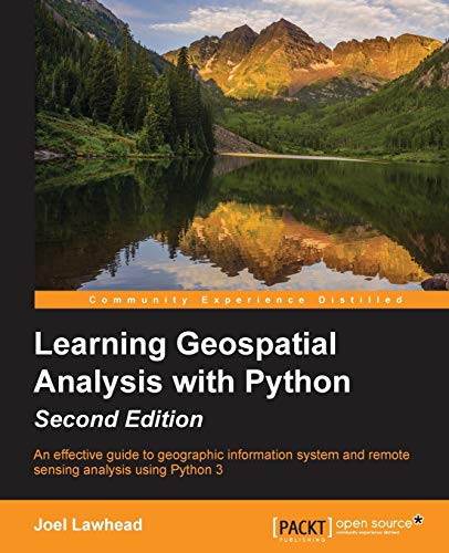
Learning GeoSpatial Analysis with Python: An effective guide to geographic information systems and remote sensing analysis using Python 3
Librería: ThriftBooks-Dallas, Dallas, TX, Estados Unidos de America
Calificación del vendedor: 5 de 5 estrellas

EUR 7,56
Gastos de envío gratis
Se envía dentro de Estados Unidos de AmericaCantidad disponible: 1 disponibles
Ańadir al carritoPaperback. Condición: Very Good. No Jacket. May have limited writing in cover pages. Pages are unmarked. ~ ThriftBooks: Read More, Spend Less.
-
Learning Geospatial Analysis with Python - Second Edition: An effective guide to geographic information systems and remote sensing analysis using Python 3
Librería: AwesomeBooks, Wallingford, Reino Unido
Calificación del vendedor: 5 de 5 estrellas
EUR 43,10
Envío por EUR 4,77
Se envía de Reino Unido a Estados Unidos de AmericaCantidad disponible: 1 disponibles
Ańadir al carritopaperback. Condición: Very Good. Learning Geospatial Analysis with Python - Second Edition: An effective guide to geographic information systems and remote sensing analysis using Python 3 This book is in very good condition and will be shipped within 24 hours of ordering. The cover may have some limited signs of wear but the pages are clean, intact and the spine remains undamaged. This book has clearly been well maintained and looked after thus far. Money back guarantee if you are not satisfied. See all our books here, order more than 1 book and get discounted shipping. .
-
Learning Geospatial Analysis with Python - Second Edition: An effective guide to geographic information systems and remote sensing analysis using Python 3
Librería: Bahamut Media, Reading, Reino Unido
Calificación del vendedor: 5 de 5 estrellas
EUR 43,10
Envío por EUR 8,09
Se envía de Reino Unido a Estados Unidos de AmericaCantidad disponible: 1 disponibles
Ańadir al carritopaperback. Condición: Very Good. Shipped within 24 hours from our UK warehouse. Clean, undamaged book with no damage to pages and minimal wear to the cover. Spine still tight, in very good condition. Remember if you are not happy, you are covered by our 100% money back guarantee.
-

Geospatial Perspectives on Satisfaction with Health Services in Malawi | Analysis Using Geographic Information Systems Technology
Idioma: Inglés
Publicado por LAP LAMBERT Academic Publishing, 2011
ISBN 10: 3845411732 ISBN 13: 9783845411736
Librería: preigu, Osnabrück, Alemania
Calificación del vendedor: 5 de 5 estrellas
EUR 51,00
Envío por EUR 70,00
Se envía de Alemania a Estados Unidos de AmericaCantidad disponible: 5 disponibles
Ańadir al carritoTaschenbuch. Condición: Neu. Geospatial Perspectives on Satisfaction with Health Services in Malawi | Analysis Using Geographic Information Systems Technology | Gideon Mazinga | Taschenbuch | 136 S. | Englisch | 2011 | LAP LAMBERT Academic Publishing | EAN 9783845411736 | Verantwortliche Person für die EU: preigu GmbH & Co. KG, Lengericher Landstr. 19, 49078 Osnabrück, mail[at]preigu[dot]de | Anbieter: preigu.
-

Geographic Information Systems In Geospatial Intelligence
Librería: GreatBookPrices, Columbia, MD, Estados Unidos de America
Calificación del vendedor: 5 de 5 estrellas
EUR 139,42
Envío por EUR 2,32
Se envía dentro de Estados Unidos de AmericaCantidad disponible: Más de 20 disponibles
Ańadir al carritoCondición: New.
-
Geographic Information Systems in Geospatial Intelligence
Librería: Ria Christie Collections, Uxbridge, Reino Unido
Calificación del vendedor: 5 de 5 estrellas
EUR 132,89
Envío por EUR 13,88
Se envía de Reino Unido a Estados Unidos de AmericaCantidad disponible: Más de 20 disponibles
Ańadir al carritoCondición: New. In.
-
Geographic Information Systems In Geospatial Intelligence
Librería: GreatBookPrices, Columbia, MD, Estados Unidos de America
Calificación del vendedor: 5 de 5 estrellas
EUR 146,26
Envío por EUR 2,32
Se envía dentro de Estados Unidos de AmericaCantidad disponible: Más de 20 disponibles
Ańadir al carritoCondición: As New. Unread book in perfect condition.
-
Geographic Information Systems In Geospatial Intelligence
Librería: GreatBookPricesUK, Woodford Green, Reino Unido
Calificación del vendedor: 5 de 5 estrellas
EUR 132,88
Envío por EUR 17,38
Se envía de Reino Unido a Estados Unidos de AmericaCantidad disponible: Más de 20 disponibles
Ańadir al carritoCondición: New.
-
Geographic Information Systems In Geospatial Intelligence
Librería: GreatBookPricesUK, Woodford Green, Reino Unido
Calificación del vendedor: 5 de 5 estrellas
EUR 147,59
Envío por EUR 17,38
Se envía de Reino Unido a Estados Unidos de AmericaCantidad disponible: Más de 20 disponibles
Ańadir al carritoCondición: As New. Unread book in perfect condition.
-

Geo-Environmental Hazards using AI-enabled Geospatial Techniques and Earth Observation Systems (Advances in Geographic Information Science)
Librería: Books Puddle, New York, NY, Estados Unidos de America
Calificación del vendedor: 4 de 5 estrellas

EUR 200,66
Envío por EUR 3,50
Se envía dentro de Estados Unidos de AmericaCantidad disponible: 4 disponibles
Ańadir al carritoCondición: New.
-

Geo-Environmental Hazards using AI-enabled Geospatial Techniques and Earth Observation Systems (Advances in Geographic Information Science)
Librería: Books Puddle, New York, NY, Estados Unidos de America
Calificación del vendedor: 4 de 5 estrellas
EUR 206,44
Envío por EUR 3,50
Se envía dentro de Estados Unidos de AmericaCantidad disponible: 4 disponibles
Ańadir al carritoCondición: New. 2024th edition NO-PA16APR2015-KAP.
-

Emerging Trends in Open Source Geographic Information Systems (Advances in Geospatial Technologies)
Idioma: Inglés
Publicado por Engineering Science Reference, 2018
ISBN 10: 1522550399 ISBN 13: 9781522550396
Librería: Ria Christie Collections, Uxbridge, Reino Unido
Calificación del vendedor: 5 de 5 estrellas
EUR 196,29
Envío por EUR 13,88
Se envía de Reino Unido a Estados Unidos de AmericaCantidad disponible: Más de 20 disponibles
Ańadir al carritoCondición: New. In.
-

Handbook of Research on Geographic Information Systems Applications and Advancements (Advances in Geospatial Technologies)
Idioma: Inglés
Publicado por Information Science Reference, 2016
ISBN 10: 1522509372 ISBN 13: 9781522509370
Librería: Ria Christie Collections, Uxbridge, Reino Unido
Calificación del vendedor: 5 de 5 estrellas
EUR 313,62
Envío por EUR 13,88
Se envía de Reino Unido a Estados Unidos de AmericaCantidad disponible: Más de 20 disponibles
Ańadir al carritoCondición: New. In.
-
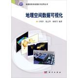
Geographic Information Systems Theory and Applications Series : Geospatial Data Visualization(Chinese Edition)
Librería: liu xing, Nanjing, JS, China
Calificación del vendedor: 5 de 5 estrellas
EUR 97,12
Envío por EUR 15,80
Se envía de China a Estados Unidos de AmericaCantidad disponible: 1 disponibles
Ańadir al carritopaperback. Condición: New. Ship out in 2 business day, And Fast shipping, Free Tracking number will be provided after the shipment.Paperback. Pub Date :2013-03-01 Pages: 308 Language: Chinese Publisher: Science Press visualization technology is an important tool in today's scientific research . it not only makes a lot of abstract data in a graphical form the image of the show. but also makes it easy to summarize data regularity. Geographic Information Systems Theory and Applications Series : Geospatial Data Visualization In explaining the broad visual concept geospatial data visualization discipline system . the type and.Four Satisfaction guaranteed,or money back.
-

Geospatial Information and Geographic Information Systems (GIS): Current Issues and Future Challenges
Librería: Revaluation Books, Exeter, Reino Unido
Calificación del vendedor: 5 de 5 estrellas
EUR 40,59
Envío por EUR 11,59
Se envía de Reino Unido a Estados Unidos de AmericaCantidad disponible: 1 disponibles
Ańadir al carritoPaperback. Condición: Brand New. 36 pages. 9.00x6.00x0.09 inches. In Stock. This item is printed on demand.
-

Geospatial Perspectives on Satisfaction with Health Services in Malawi : Analysis Using Geographic Information Systems Technology
Idioma: Inglés
Publicado por LAP LAMBERT Academic Publishing, 2011
ISBN 10: 3845411732 ISBN 13: 9783845411736
Librería: AHA-BUCH GmbH, Einbeck, Alemania
Calificación del vendedor: 5 de 5 estrellas
EUR 59,00
Envío por EUR 61,11
Se envía de Alemania a Estados Unidos de AmericaCantidad disponible: 1 disponibles
Ańadir al carritoTaschenbuch. Condición: Neu. nach der Bestellung gedruckt Neuware - Printed after ordering - This book explores the spatial pattern of user satisfaction with health services at district level in Malawi and factors, including policies that potentially explain the variation. The analysis is based on Nationwide Core Social Welfare Indicators Survey and the National Health Services Statistics data obtained from National Statistics Office of Malawi. The National Health Facilities were geo-coded to display the distribution of health care facilities in the country. Spatial autocorrelation, Ordinary Least Squares (OLS) and Spatial Lag regression modeling techniques were applied to investigate factors contributing to spatial variation of user satisfaction with health services. The book demonstrates the importance of including spatial effect in regression analysis when using geographic based data in social and public health research. In addition, policy implication on quality and equity of health services delivery system has been discussed. The book further illustrates the need to incorporate principles of social justice and distributive justice in order to provide a more equitable health care delivery system.
-
Geographic Information Systems in Geospatial Intelligence
Librería: PBShop.store UK, Fairford, GLOS, Reino Unido
Calificación del vendedor: 5 de 5 estrellas
EUR 135,08
Envío por EUR 5,82
Se envía de Reino Unido a Estados Unidos de AmericaCantidad disponible: Más de 20 disponibles
Ańadir al carritoHRD. Condición: New. New Book. Delivered from our UK warehouse in 4 to 14 business days. THIS BOOK IS PRINTED ON DEMAND. Established seller since 2000.
-
Geographic Information Systems in Geospatial Intelligence
Librería: PBShop.store US, Wood Dale, IL, Estados Unidos de America
Calificación del vendedor: 5 de 5 estrellas
EUR 141,82
Gastos de envío gratis
Se envía dentro de Estados Unidos de AmericaCantidad disponible: Más de 20 disponibles
Ańadir al carritoHRD. Condición: New. New Book. Shipped from UK. THIS BOOK IS PRINTED ON DEMAND. Established seller since 2000.
-
Learning GeoSpatial Analysis with Python | An effective guide to geographic information systems and remote sensing analysis using Python 3
Librería: preigu, Osnabrück, Alemania
Calificación del vendedor: 5 de 5 estrellas
EUR 71,55
Envío por EUR 70,00
Se envía de Alemania a Estados Unidos de AmericaCantidad disponible: 5 disponibles
Ańadir al carritoTaschenbuch. Condición: Neu. Learning GeoSpatial Analysis with Python | An effective guide to geographic information systems and remote sensing analysis using Python 3 | Joel Lawhead | Taschenbuch | Kartoniert / Broschiert | Englisch | 2015 | Packt Publishing | EAN 9781783552429 | Verantwortliche Person für die EU: Libri GmbH, Europaallee 1, 36244 Bad Hersfeld, gpsr[at]libri[dot]de | Anbieter: preigu Print on Demand.
-

Learning GeoSpatial Analysis with Python : An effective guide to geographic information systems and remote sensing analysis using Python 3
Librería: AHA-BUCH GmbH, Einbeck, Alemania
Calificación del vendedor: 5 de 5 estrellas
EUR 83,17
Envío por EUR 63,67
Se envía de Alemania a Estados Unidos de AmericaCantidad disponible: 1 disponibles
Ańadir al carritoTaschenbuch. Condición: Neu. nach der Bestellung gedruckt Neuware - Printed after ordering - An effective guide to geographic information systems and remote sensing analysis using Python 3 Key Features:Construct applications for GIS development by exploiting Python This focuses on built-in Python modules and libraries compatible with the Python Packaging Index distribution system-no compiling of C libraries necessary This practical, hands-on tutorial teaches you all about Geospatial analysis in Python Book Description: Geospatial Analysis is used in almost every field you can think of from medicine, to defense, to farming. This book will guide you gently into this exciting and complex field. It walks you through the building blocks of geospatial analysis and how to apply them to influence decision making using the latest Python software. Learning Geospatial Analysis with Python, 2nd Edition uses the expressive and powerful Python 3 programming language to guide you through geographic information systems, remote sensing, topography, and more, while providing a framework for you to approach geospatial analysis effectively, but on your own terms. We start by giving you a little background on the field, and a survey of the techniques and technology used. We then split the field into its component specialty areas: GIS, remote sensing, elevation data, advanced modeling, and real-time data. This book will teach you everything you need to know about, Geospatial Analysis from using a particular software package or API to using generic algorithms that can be applied. This book focuses on pure Python whenever possible to minimize compiling platform-dependent binaries, so that you don't become bogged down in just getting ready to do analysis. This book will round out your technical library through handy recipes that will give you a good understanding of a field that supplements many a modern day human endeavors. What You Will Learn:Automate Geospatial analysis workflows using Python Code the simplest possible GIS in 60 lines of Python Mold thematic maps with Python tools Get hold of the various forms that geospatial data comes in Produce elevation contours using Python tools Create flood inundation models Apply Geospatial analysis to find out about real-time data tracking and for storm chasing Who this book is for: If you are a Python developer, researcher, or analyst who wants to perform Geospatial, modeling, and GIS analysis with Python, then this book is for you. Familarity with digital mapping and analysis using Python or another scripting language for automation or crunching data manually is appreciated.
-

Geographic Information Systems in Geospatial Intelligence
Librería: BuchWeltWeit Ludwig Meier e.K., Bergisch Gladbach, Alemania
Calificación del vendedor: 5 de 5 estrellas
EUR 129,00
Envío por EUR 23,00
Se envía de Alemania a Estados Unidos de AmericaCantidad disponible: 2 disponibles
Ańadir al carritoBuch. Condición: Neu. This item is printed on demand - it takes 3-4 days longer - Neuware -Earth observation systems, by use of space science and technology advances, present a large-scale opportunity for applying remote sensing methods with geographical information system (GIS) developments. Integrating these two methods makes it possible to achieve high-accuracy satellite data processing. This book considers aspects of GIS technology applications with space science technology and innovation approaches. It examines the potential of Earth observation satellite systems as well as existing challenges and problems in the field. Chapters cover topics such as RGB-D sensors for autonomous pothole detection, machine learning in GIS, interferometric synthetic aperture radar (InSAR) modeling, and others. 186 pp. Englisch.
-
Geographic Information Systems in Geospatial Intelligence
Librería: THE SAINT BOOKSTORE, Southport, Reino Unido
Calificación del vendedor: 5 de 5 estrellas
EUR 157,58
Envío por EUR 14,90
Se envía de Reino Unido a Estados Unidos de AmericaCantidad disponible: Más de 20 disponibles
Ańadir al carritoHardback. Condición: New. This item is printed on demand. New copy - Usually dispatched within 5-9 working days.
-

Geographic Information Systems in Geospatial Intelligence
Librería: moluna, Greven, Alemania
Calificación del vendedor: 5 de 5 estrellas
EUR 129,00
Envío por EUR 48,99
Se envía de Alemania a Estados Unidos de AmericaCantidad disponible: Más de 20 disponibles
Ańadir al carritoGebunden. Condición: New. Dieser Artikel ist ein Print on Demand Artikel und wird nach Ihrer Bestellung fuer Sie gedruckt. KlappentextrnrnEarth observation systems, by use of space science and technology advances, present a large-scale opportunity for applying remote sensing methods with geographical information system (GIS) developments. Integrating these two metho.
-

Geographic Information Systems in Geospatial Intelligence
Librería: buchversandmimpf2000, Emtmannsberg, BAYE, Alemania
Calificación del vendedor: 5 de 5 estrellas
EUR 129,00
Envío por EUR 60,00
Se envía de Alemania a Estados Unidos de AmericaCantidad disponible: 1 disponibles
Ańadir al carritoBuch. Condición: Neu. This item is printed on demand - Print on Demand Titel. Neuware -Earth observation systems, by use of space science and technology advances, present a large-scale opportunity for applying remote sensing methods with geographical information system (GIS) developments. Integrating these two methods makes it possible to achieve high-accuracy satellite data processing. This book considers aspects of GIS technology applications with space science technology and innovation approaches. It examines the potential of Earth observation satellite systems as well as existing challenges and problems in the field. Chapters cover topics such as RGB-D sensors for autonomous pothole detection, machine learning in GIS, interferometric synthetic aperture radar (InSAR) modeling, and others.Books on Demand GmbH, Überseering 33, 22297 Hamburg 186 pp. Englisch.
-

Geographic Information Systems in Geospatial Intelligence
Librería: AHA-BUCH GmbH, Einbeck, Alemania
Calificación del vendedor: 5 de 5 estrellas
EUR 129,00
Envío por EUR 63,11
Se envía de Alemania a Estados Unidos de AmericaCantidad disponible: 1 disponibles
Ańadir al carritoBuch. Condición: Neu. nach der Bestellung gedruckt Neuware - Printed after ordering - Earth observation systems, by use of space science and technology advances, present a large-scale opportunity for applying remote sensing methods with geographical information system (GIS) developments. Integrating these two methods makes it possible to achieve high-accuracy satellite data processing. This book considers aspects of GIS technology applications with space science technology and innovation approaches. It examines the potential of Earth observation satellite systems as well as existing challenges and problems in the field. Chapters cover topics such as RGB-D sensors for autonomous pothole detection, machine learning in GIS, interferometric synthetic aperture radar (InSAR) modeling, and others.
-

Geographic Information Systems in Geospatial Intelligence
Librería: preigu, Osnabrück, Alemania
Calificación del vendedor: 5 de 5 estrellas
EUR 129,00
Envío por EUR 70,00
Se envía de Alemania a Estados Unidos de AmericaCantidad disponible: 5 disponibles
Ańadir al carritoBuch. Condición: Neu. Geographic Information Systems in Geospatial Intelligence | Rustam B. Rustamov | Buch | Gebunden | Englisch | 2020 | IntechOpen | EAN 9781838805043 | Verantwortliche Person für die EU: preigu GmbH & Co. KG, Lengericher Landstr. 19, 49078 Osnabrück, mail[at]preigu[dot]de | Anbieter: preigu Print on Demand.
-

Local Information Systems : Health observatory, Information system, Business intelligence tools, Geographic Information Systems, Geospatial, Knowledge Management
Librería: AHA-BUCH GmbH, Einbeck, Alemania
Calificación del vendedor: 5 de 5 estrellas
EUR 137,63
Envío por EUR 60,66
Se envía de Alemania a Estados Unidos de AmericaCantidad disponible: 1 disponibles
Ańadir al carritoTaschenbuch. Condición: Neu. nach der Bestellung gedruckt Neuware - Printed after ordering.
-
Geo-Environmental Hazards using AI-enabled Geospatial Techniques and Earth Observation Systems (Advances in Geographic Information Science)
Librería: Majestic Books, Hounslow, Reino Unido
Calificación del vendedor: 4 de 5 estrellas
EUR 212,26
Envío por EUR 7,53
Se envía de Reino Unido a Estados Unidos de AmericaCantidad disponible: 4 disponibles
Ańadir al carritoCondición: New. Print on Demand.
-

Geographic Information Systems in Geospatial Intelligence
Librería: buchversandmimpf2000, Emtmannsberg, BAYE, Alemania
Calificación del vendedor: 5 de 5 estrellas
EUR 156,00
Envío por EUR 60,00
Se envía de Alemania a Estados Unidos de AmericaCantidad disponible: 1 disponibles
Ańadir al carritoTaschenbuch. Condición: Neu. This item is printed on demand - Print on Demand Titel. Neuware VDM Verlag, Dudweiler Landstraße 99, 66123 Saarbrücken 104 pp. Englisch.
-
Geo-Environmental Hazards using AI-enabled Geospatial Techniques and Earth Observation Systems (Advances in Geographic Information Science)
Librería: Majestic Books, Hounslow, Reino Unido
Calificación del vendedor: 4 de 5 estrellas
EUR 218,41
Envío por EUR 7,53
Se envía de Reino Unido a Estados Unidos de AmericaCantidad disponible: 4 disponibles
Ańadir al carritoCondición: New. Print on Demand.
