Jason wiese (27 resultados)
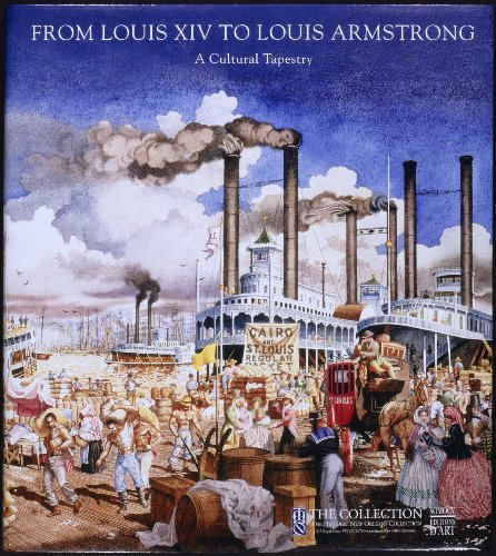
From Louis XIV to Louis Armstrong: A Cultural Tapestry
Alfred E. Lemmon; John H. Lawrence; Gilles-Antoine Langlois; John Magill; Guillaume Ambroise; Jason Wiese
- Tapa dura
Librería: ThriftBooks-Atlanta, AUSTELL, GA, Estados Unidos de AmericaThriftBooks-Atlanta
Contactar con el vendedorVendedor de 5 estrellasCondición: Usado - Aceptable
EUR 14,50
Gastos de envío gratisSe envía dentro de Estados Unidos de AmericaCantidad disponible: 1 disponibles
Hardcover. Condición: Good. No Jacket. Pages can have notes/highlighting. Spine may show signs of wear. ~ ThriftBooks: Read More, Spend Less.
- Tapa dura
Librería: Revaluation Books, Exeter, Reino UnidoRevaluation Books
Contactar con el vendedorVendedor de 5 estrellasCondición: Nuevo
EUR 29,40
Envío por EUR 14,51Se envía de Reino Unido a Estados Unidos de AmericaCantidad disponible: 2 disponibles
Hardcover. Condición: Brand New. illustrated edition edition. 103 pages. 11.00x9.75x0.25 inches. In Stock.
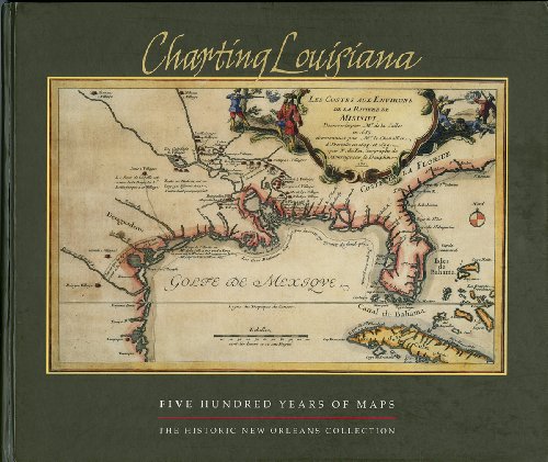
Charting Louisiana: Five Hundred Years of Maps
Lemmon, Alfred E. [Editor]; Magill, John T. [Editor]; Wiese, Jason R. [Editor];
- Tapa dura
Librería: Vintage Books and Fine Art, Oxford, MD, Estados Unidos de AmericaVintage Books and Fine Art
Contactar con el vendedorVendedor de 5 estrellasCondición: Usado - Bueno
EUR 40,59
Envío por EUR 7,44Se envía dentro de Estados Unidos de AmericaCantidad disponible: 1 disponibles
hardcover. Condición: Very Good. Illustrated boards to match the dust jacket. Square tight binding. Clean interior. Binding Fine. Dust jacket with mild to moderate edge wear including a few short closed tears.
- Tapa dura
Librería: Lakeside Books, Benton Harbor, MI, Estados Unidos de AmericaLakeside Books
Contactar con el vendedorVendedor de 5 estrellasCondición: Nuevo
EUR 66,15
Envío por EUR 3,49Se envía dentro de Estados Unidos de AmericaCantidad disponible: 12 disponibles
Condición: New. Brand New! Not Overstocks or Low Quality Book Club Editions! Direct From the Publisher! We're not a giant, faceless warehouse organization! We're a small town bookstore that loves books and loves it's customers! Buy from Lakeside Books.
Charting Louisiana: Five Hundred Years of Maps
Lemmon, Alfred E.; Magill, John T. and Wiese, Jason R. (eds.)
Idioma: Inglés
Editorial: The Historic New Orleans Collection, New Orleans, 2003
- Tapa dura
Librería: Else Fine Booksellers, Tacoma, WA, Estados Unidos de AmericaElse Fine Booksellers
Contactar con el vendedorVendedor de 5 estrellasCondición: Usado - Bueno
EUR 67,65
Envío por EUR 4,82Se envía dentro de Estados Unidos de AmericaCantidad disponible: 1 disponibles
Hardcover. Condición: Very Good. Estado de la sobrecubierta: Very Good. 383 pages, cartobibliography, selected readings, index. A few bumps and dents to the lower spine, minor moisture waver along the page fore edges of the last few signatures. Dust jacket edges rubbed, surface scratches- prevalently on the rear panel.

CHARTING LOUISIANA ( 500 YEARS OF MAPS )
ALFRED LEMMON, JOHN MAGILL, JASON WIESE, MARY LOUISE CHRISTOVICH
- Tapa dura
- Primera edición
Librería: Thomas Savage, Bookseller, Krotz Springs, LA, Estados Unidos de AmericaThomas Savage, Bookseller
Contactar con el vendedorVendedor de 5 estrellasCondición: Usado - Bueno
EUR 67,65
Envío por EUR 6,09Se envía dentro de Estados Unidos de AmericaCantidad disponible: 1 disponibles
Hardcover. Condición: Very Good. Estado de la sobrecubierta: Very Good. 1st Edition. STATED FIRST EDITION, FIRST PRINTING .OVERSIZED HARDCOVER EDITION WITH DUSTJACKET .binding is solid. NOT EX-LIBRARY COPY .text unmarked.

Charting Louisiana : Five Hundred Years of Maps
Lemmon, Alfred E. (EDT); Hebert, John R. (EDT); Wiese, Jason R. (EDT); Magill, John T. (EDT)
- Tapa dura
Librería: GreatBookPrices, Columbia, MD, Estados Unidos de AmericaGreatBookPrices
Contactar con el vendedorVendedor de 5 estrellasCondición: Nuevo
EUR 74,28
Envío por EUR 2,31Se envía dentro de Estados Unidos de AmericaCantidad disponible: 16 disponibles
Condición: New.
- Tapa dura
Librería: California Books, Miami, FL, Estados Unidos de AmericaCalifornia Books
Contactar con el vendedorVendedor de 4 estrellasCondición: Nuevo
EUR 76,67
Gastos de envío gratisSe envía dentro de Estados Unidos de AmericaCantidad disponible: Más de 20 disponibles
Condición: New.

Charting Louisiana : Five Hundred Years of Maps
Lemmon, Alfred E. (EDT); Hebert, John R. (EDT); Wiese, Jason R. (EDT); Magill, John T. (EDT)
- Tapa dura
Librería: GreatBookPrices, Columbia, MD, Estados Unidos de AmericaGreatBookPrices
Contactar con el vendedorVendedor de 5 estrellasCondición: Usado - Como Nuevo
EUR 81,56
Envío por EUR 2,31Se envía dentro de Estados Unidos de AmericaCantidad disponible: 16 disponibles
Condición: As New. Unread book in perfect condition.
- Tapa dura
- Primera edición
Librería: Wildside Books, Eastbourne, Reino UnidoWildside Books
Contactar con el vendedorVendedor de 5 estrellasMiembro de asociación: PBFA
Condición: Usado - Excelente
EUR 71,73
Envío por EUR 13,93Se envía de Reino Unido a Estados Unidos de AmericaCantidad disponible: 1 disponibles
Hardcover. Condición: Fine. No Jacket. 1st Edition. oblong folio , i-xxii, 383 pp ,193 coloured plates illustrating charts and maps dating from 1524-1985, other illustrations . Laminated boards as issued, lacks dust wrapper, light bumping to corners but generally an excellent copy of a magnificent work . Produced in an edition o…f 5000 copies to commemorate The Louisiana Purchase. As well as a beautiful record this is a work of considerable scholarship and importance. Overseas postage charges will be extra due to weight of the book.
Idioma: Inglés
Editorial: Historic New Orleans Collection, Chicago, IL, 2003
- Tapa dura
Librería: Grand Eagle Retail, Bensenville, IL, Estados Unidos de AmericaGrand Eagle Retail
Contactar con el vendedorVendedor de 5 estrellasCondición: Nuevo
EUR 87,60
Gastos de envío gratisSe envía dentro de Estados Unidos de AmericaCantidad disponible: 1 disponibles
Hardcover. Condición: new. Hardcover. To celebrate the bicentennial of the Louisiana Purchase, The Historic New Orleans Collection (THNOe has pursued the ambitious goal of publishing an atlas that depicts Louisiana's history through maps. The result of those efforts is "Charting Louisiana." This book, THNOC's… bicentennial gift to the public, offers a rich selection of historic and contemporary maps from various sources that collectively illustrate the region's diverse history, from its multinational colonial experiences to the modern American state. "Charting Louisiana" presents 104 maps from THNOC's holdings, representing the full range of the institution's cartographic treasures. The atlas also features sixty-seven important works from the Geography and Map Division of the Library of Congress—custodian of the largest cartographic collection in the world—and contributions from other United States repositories, including the Louisiana State Museum and Chicago's Newberry Library. Archives in France, Spain, Great Britain, and Mexico generously provided the balance, as befits Louisiana's international history. The product of this cooperative effort is an unprecedented compilation of 193 high-quality reproductions of important maps illustrating the development of Louisiana from the early sixteenth century to the present, along with historical essays providing a broader context for understanding the maps. Complete with a detailed cartobibliography and list of selected readings, "Charting Louisiana" is a lush, captivating, and valuable source of information for history buffs, scholars, and map lovers, providing ample opportunities for new interpretations of the state's history as well as that of the nation. To celebrate the bicentennial of the Louisiana Purchase, The Historic New Orleans Collection (THNOC) has pursued the ambitious goal of publishing an atlas that depicts Louisiana's history through maps. The result of those efforts is "Charting Louisiana," This book, THNOC's bicentennial gift to the public, offers a rich selection of historic and contemporary maps from various sources that collectively illustrate the region's diverse history, from its multinational colonial experiences to the modern American state. "Charting Louisiana" presents 104 maps from THNOC's holdings, representing the full range of the institution's cartographic treasures. The atlas also features sixty-seven important works from the Geography and Map Division of the Library of Congress—custodian of the largest cartographic collection in the world—and contributions from other United States repositories, including the Louisiana State Museum and Chicago's Newberry Library. Archives in France, Spain, Great Britain, and Mexico generously provided the balance, as befits Louisiana's international history. The product of this cooperative effort is an unprecedented compilation of 193 high-quality reproductions of important maps illustrating the development of Louisiana from the early sixteenth century to the present, along with historical essays providing a broader context for understanding the maps. Complete with a detailed cartobibliography and list of selected readings, "Charting Louisiana" is a lush, captivating, and valuable source of information for history buffs, scholars, and map lovers, providing ample opportunities for new interpretations of the state's history as well as that of the nation. Shipping may be from multiple locations in the US or from the UK, depending on stock availability.
- Tapa dura
Librería: Ria Christie Collections, Uxbridge, Reino UnidoRia Christie Collections
Contactar con el vendedorVendedor de 5 estrellasCondición: Nuevo
EUR 74,20
Envío por EUR 13,90Se envía de Reino Unido a Estados Unidos de AmericaCantidad disponible: Más de 20 disponibles
Condición: New. In.
Charting Louisiana : Five Hundred Years of Maps
Lemmon, Alfred E. (EDT); Hebert, John R. (EDT); Wiese, Jason R. (EDT); Magill, John T. (EDT)
- Tapa dura
Librería: GreatBookPricesUK, Woodford Green, Reino UnidoGreatBookPricesUK
Contactar con el vendedorVendedor de 5 estrellasCondición: Nuevo
EUR 71,85
Envío por EUR 17,41Se envía de Reino Unido a Estados Unidos de AmericaCantidad disponible: 16 disponibles
Condición: New.
- Tapa dura
Librería: PBShop.store UK, Fairford, GLOS, Reino UnidoPBShop.store UK
Contactar con el vendedorVendedor de 5 estrellasCondición: Nuevo
EUR 71,86
Envío por EUR 18,92Se envía de Reino Unido a Estados Unidos de AmericaCantidad disponible: 12 disponibles
HRD. Condición: New. New Book. Shipped from UK. Established seller since 2000.
Charting Louisiana : Five Hundred Years of Maps
Lemmon, Alfred E. (EDT); Hebert, John R. (EDT); Wiese, Jason R. (EDT); Magill, John T. (EDT)
- Tapa dura
Librería: GreatBookPricesUK, Woodford Green, Reino UnidoGreatBookPricesUK
Contactar con el vendedorVendedor de 5 estrellasCondición: Usado - Como Nuevo
EUR 73,98
Envío por EUR 17,41Se envía de Reino Unido a Estados Unidos de AmericaCantidad disponible: 16 disponibles
Condición: As New. Unread book in perfect condition.
- Tapa dura
Librería: Defunct Books, Nashville, TN, Estados Unidos de AmericaDefunct Books
Contactar con el vendedorVendedor de 5 estrellasCondición: Usado - Bueno
EUR 90,15
Envío por EUR 4,37Se envía dentro de Estados Unidos de AmericaCantidad disponible: 1 disponibles
Hardcover. Condición: Very Good. Pictorial boards have edge wear (a couple dings), scratches, minor scuffs, rubbed corners/spine. No writing.
From Louis XIV to Louis Armstrong
Alfred E. Lemmon; John H. Lawrence; Gilles-Antoine Langlois; John Magill; Guillaume Ambroise; Jason Wiese; Michaele Lienart [Editor]
- Tapa dura
Librería: BennettBooksLtd, Los Angeles, CA, Estados Unidos de AmericaBennettBooksLtd
Contactar con el vendedorVendedor de 5 estrellasCondición: Nuevo
EUR 99,22
Envío por EUR 6,09Se envía dentro de Estados Unidos de AmericaCantidad disponible: 1 disponibles
Hardcover. Condición: New. In shrink wrap. Looks like an interesting title.

Editorial: Historic New Orleans, 2003
- Tapa dura
Librería: Arader Galleries of Philadelphia, PA, Philadelphia, PA, Estados Unidos de AmericaArader Galleries of Philadelphia, PA
Contactar con el vendedorVendedor de 4 estrellasCondición: Usado - Como Nuevo
EUR 57,73
Envío por EUR 3,94Se envía dentro de Estados Unidos de AmericaCantidad disponible: 1 disponibles
Hardcover. Condición: Like New. Estado de la sobrecubierta: very Good. new still in publisher shrink wrap.
- Tapa dura
Librería: LiLi - La Liberté des Livres, CANEJAN, FranciaLiLi - La Liberté des Livres
Contactar con el vendedorVendedor de 5 estrellasCondición: Usado - Excelente
EUR 58,62
Envío por EUR 65,00Se envía de Francia a Estados Unidos de AmericaCantidad disponible: 1 disponibles
Condición: fine. l'article peut presenter de tres legers signes d'usure, petites rayures ou imperfections esthetiques. vendeur professionnel; envoi soigne en 24/48h.
- Tapa dura
Librería: Revaluation Books, Exeter, Reino UnidoRevaluation Books
Contactar con el vendedorVendedor de 5 estrellasCondición: Nuevo
EUR 103,89
Envío por EUR 34,82Se envía de Reino Unido a Estados Unidos de AmericaCantidad disponible: 2 disponibles
Hardcover. Condición: Brand New. 408 pages. 12.00x14.00x1.25 inches. In Stock.
Charting Louisiana: Five Hundred Years of Maps
Lemmon, Alfred E. [Editor]; Magill, John T. [Editor]; Wiese, Jason R. [Editor];
- Tapa dura
Librería: BennettBooksLtd, Los Angeles, CA, Estados Unidos de AmericaBennettBooksLtd
Contactar con el vendedorVendedor de 5 estrellasCondición: Nuevo
EUR 136,55
Envío por EUR 6,09Se envía dentro de Estados Unidos de AmericaCantidad disponible: 1 disponibles
hardcover. Condición: New. In shrink wrap. Looks like an interesting title.

- Tapa dura
Librería: moluna, Greven, Alemaniamoluna
Contactar con el vendedorVendedor de 5 estrellasCondición: Nuevo
EUR 102,74
Envío por EUR 48,99Se envía de Alemania a Estados Unidos de AmericaCantidad disponible: Más de 20 disponibles
Gebunden. Condición: New. Über den AutorAlfred E. Lemmon is Director of the Williams Research Center of The Historic New Orleans Collection. An authority on French and Spanish colonial cultural history, he has been published in numerous books, encyclopedi.
- Tapa dura
Librería: Revaluation Books, Exeter, Reino UnidoRevaluation Books
Contactar con el vendedorVendedor de 5 estrellasCondición: Nuevo
EUR 139,61
Envío por EUR 34,82Se envía de Reino Unido a Estados Unidos de AmericaCantidad disponible: 2 disponibles
Hardcover. Condición: Brand New. 408 pages. 12.00x14.00x1.25 inches. In Stock.

Charting Louisiana: Five Hundred Years of Maps
LEMMON, ALFRED E., JOHN T. MAGILL and JASON R. WIESE (Editors)
Idioma: Inglés
Editorial: Published by The Historic New Orleans Collection, 2003
- Tapa dura
- Primera edición
Librería: The Old Print Shop, Inc., New York, NY, Estados Unidos de AmericaThe Old Print Shop, Inc.
Contactar con el vendedorVendedor de 2 estrellasCondición: Usado - Excelente
EUR 180,39
Envío por EUR 7,88Se envía dentro de Estados Unidos de AmericaCantidad disponible: 1 disponibles
Hardcover. Condición: Fine. Estado de la sobrecubierta: Fine. 1st Edition. Foreword by Mary Louise Christovich, 408 pages, 193 maps and more than 40 chapter illustrations (all color), cartobibliography, oblong large quarto (4to) dust jacket cloth binding. Book dealer inventory #32580.

- Tapa dura
- Mapa
Librería: AHA-BUCH GmbH, Einbeck, AlemaniaAHA-BUCH GmbH
Contactar con el vendedorVendedor de 5 estrellasCondición: Nuevo
EUR 140,67
Envío por EUR 79,30Se envía de Alemania a Estados Unidos de AmericaCantidad disponible: 2 disponibles
Buch. Condición: Neu. Neuware - Winner of the Louisiana Endowment for the Humanities 2004 Humanities Book of the Year Award, the Louisiana Library Association's 2004 Louisiana Literary Award, and the Gulf South Historical Association's 2004 Best Book on the Gulf South Award. The name 'Louisiana' has always held a special allure,… calling forth images of a rich colonial past, a land filled with exotic flora and fauna, and a territory that once extended across stretches of North America. Tracing the discovery, colonization, and development of the region, Charting Louisiana: Five Hundred Years of Maps relates the epic history of Louisiana. From the earliest appearance of the Gulf Coast on a 16th-century woodcut to a color-enhanced satellite view of the state, the atlas presents an extraordinary gathering of 193 manuscripts and printed maps (all full-color plates), many of them rarely made available to the public. Six essays lead the reader across the historical panorama of Louisiana as found in its cartography. Distributed for The Historic New Orleans Collection.
- Tapa dura
Librería: BWS BKS, Ferndale, NY, Estados Unidos de AmericaBWS BKS
Contactar con el vendedorVendedor de 1 estrellasCondición: Nuevo
EUR 1782,27
Envío por EUR 2,63Se envía dentro de Estados Unidos de AmericaCantidad disponible: 2 disponibles
Hardcover. Condición: New.
Charting Louisiana: Five Hundred Years of Maps
LEMMON, Alfred E., John T. Magill and Jason R. Wiese (editors)
Editorial: The Historic New Orleans Project, New Orleans, 2003
- Tapa dura
Librería: Arader Galleries - AraderNYC, New York, NY, Estados Unidos de AmericaArader Galleries - AraderNYC
Contactar con el vendedorVendedor de 5 estrellasCondición: Nuevo
EUR 202,94
Gastos de envío gratisSe envía dentro de Estados Unidos de AmericaCantidad disponible: 1 disponibles
Hardcover. Condición: New. Dust Jacket Included. Measures 12 x 14 in. (30.4 x 35.6 cm.). Pictorial endpapers, half-title, title page, 193 maps (many in color), xxii, 383 pages including cartobibliography.CONDITION/BINDING: New. Pictorial paper-covred boards with pictorial dust-jacket. AN EXTRAORDINARY GATHERING OF HISTORICALLY I…MPORTANT MANUSCRIPT AND PRINTED MAPS from the sixteenth to the twentieth centuries, which along with six essays, provide a cartographical history of the development of Louisiana.


