Chamberlin wellman (20 resultados)

THE ROUND EARTH ON FLAT PAPER -- and -- MAP SERVICES OF THE NATIONAL GEOGRAPHIC SOCIETY
Chamberlin, Wellman (ROUND EARTH.) and Grosvenor, Gilbert (MAP SERVICES.)
Editorial: National Geographic Society (1950), Washington, DC, 1950
- Tapa blanda
Librería: Ray Boas, Bookseller - Established 1980, Walpole, NH, Estados Unidos de AmericaRay Boas, Bookseller - Established 1980
Contactar con el vendedorVendedor de 5 estrellasCondición: Usado
EUR 9,05
Envío por EUR 4,91Se envía dentro de Estados Unidos de AmericaCantidad disponible: 1 disponibles
PB. 125pp Owner's name on front cover. good, wraps (softcover) - owner's name on front cover. B&W illustrations (ilustrador).
Editorial: National Geographic Solciety, Washington, DC, 1947
- Tapa blanda
Librería: Terra Firma Books, San Diego, CA, Estados Unidos de AmericaTerra Firma Books
Contactar con el vendedorVendedor de 5 estrellasCondición: Usado - Aceptable
EUR 9,04
Envío por EUR 5,26Se envía dentro de Estados Unidos de AmericaCantidad disponible: 1 disponibles
Soft cover. Condición: Good. 126pp. Soiled covers but internally Clean.no name or writing. Charles E Riddiford (ilustrador).
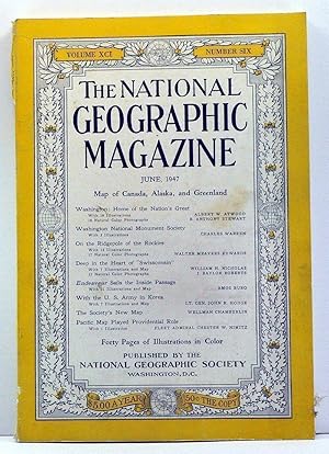
The National Geographic Magazine, Volume 91, Number 6 (June, 1947)
Grosvenor, Gilbert (ed.); Atwood, Albert W.; Stewart, B. Anthony; Warren, Charles; Edwards, Walter Meayers; Nicholas, WIlliam H.; Roberts, J. Baylor; Burg, Amos; Hodge, John R.; Chamberlin, Wellman; Nimitz, Chester W.
Editorial: National Geographic Society, Washington, 1947
- Tapa blanda
Librería: Cat's Cradle Books, Archdale, NC, Estados Unidos de AmericaCat's Cradle Books
Contactar con el vendedorVendedor de 5 estrellasCondición: Usado
EUR 21,73
Gastos de envío gratisSe envía dentro de Estados Unidos de AmericaCantidad disponible: 1 disponibles
Soft Cover. Map of Canada, Alaska, and Greenland is present, tanned and folded inside volume. Sound binding. Pages clean, off-white. Wrappers have wear at spine, overall handling wear and light soiling. Contents: Atwood and Stewart, Washington: home of the nation's great. Warren, Washington National Monument Society. Edwards, On… the ridgepole of the Rockies. Nicholas and Roberts, Deep in the heart of "Swissconsin." Burg, Edneavour sails the inside passage. Hodge, With the U.S. Army in Korea. Chamberlin, The Society's new map. Nimitz, Pacific map played providential role. Full-color Coca-Cola ad on back of wrappers. 10.0" tall. Good in No Dust Jacket dust jacket.
Editorial: National Geographic Society, 1947
- Tapa blanda
Librería: My Dead Aunt's Books, Hyattsville, MD, Estados Unidos de AmericaMy Dead Aunt's Books
Contactar con el vendedorVendedor de 5 estrellasCondición: Usado - Aceptable
EUR 18,11
Envío por EUR 4,83Se envía dentro de Estados Unidos de AmericaCantidad disponible: 1 disponibles
Paperback. Condición: Good. Unmarked glossy paperback in matte covers .

Editorial: National Geographic Magazine, Washington, 1953
- Tapa blanda
- Publicación periódica
Librería: Cosmo Books, Shropshire., Reino UnidoCosmo Books
Contactar con el vendedorVendedor de 5 estrellasCondición: Usado - Bueno
EUR 10,46
Envío por EUR 13,89Se envía de Reino Unido a Estados Unidos de AmericaCantidad disponible: 3 disponibles
Booklet - Unbound Pages. Condición: Very Good. 19 pages, with illustrated maps which some are in colour. An authentic standalone article, extracted from a larger volume. Not a reprint or reproduction, but an original work in its own right. Supplied without title page or cover. Size: 16 x 24 cms. Category: National Geographic Mag…azine; Cosmo Books : 29 years on ABE, 47 years taking care of customers. A bookseller you can rely on.

Editorial: National Geographic Magazine, Washington, 1941
- Tapa blanda
- Publicación periódica
Librería: Cosmo Books, Shropshire., Reino UnidoCosmo Books
Contactar con el vendedorVendedor de 5 estrellasCondición: Usado - Bueno
EUR 13,11
Envío por EUR 13,89Se envía de Reino Unido a Estados Unidos de AmericaCantidad disponible: 1 disponibles
Booklet - Unbound Pages. Condición: Very Good. 12 pages, illustrated in black and white. An authentic standalone article, extracted from a larger volume. Not a reprint or reproduction, but an original work in its own right. Supplied without title page or cover. Size: 16 x 24 cms. Category: National Geographic Magazine; Cosmo Boo…ks : 29 years on ABE, 47 years taking care of customers. A bookseller you can rely on.
Editorial: National Geographic Society
Librería: Wonder Book, Frederick, MD, Estados Unidos de AmericaWonder Book
Contactar con el vendedorVendedor de 5 estrellasCondición: Usado - Aceptable
EUR 23,19
Gastos de envío gratisSe envía dentro de Estados Unidos de AmericaCantidad disponible: 1 disponibles
Condición: Good. Good condition. (cartography, map projection, map drawing, maps) A copy that has been read but remains intact. May contain markings such as bookplates, stamps, limited notes and highlighting, or a few light stains.
THE ROUND EARTH ON FLAT PAPER, MAP PROJECTIONS USED BY CARTOGRAPHERS + MAP SERVICES OF THE NATIONAL GEOGRAPHIC SOCIETY [REPRINT]
National Geographic Society (Chamberlin, Wellman + Grosvenor, Gilbert)
Editorial: National Geographic Soc, 1950
- Tapa blanda
- Primera edición
Librería: Larry W Price Books, Portland, OR, Estados Unidos de AmericaLarry W Price Books
Contactar con el vendedorVendedor de 5 estrellasCondición: Usado - Bueno
EUR 26,71
Envío por EUR 4,35Se envía dentro de Estados Unidos de AmericaCantidad disponible: 1 disponibles
Paperback. Condición: Very Good. 1st Edition. 126 pp., Photos, Illus, Orig Grey Illus Paperback, VG, 1st ed. Charles E Riddiford (ilustrador).

Editorial: Washington, DC : National Geographic Society, 1947
- Tapa blanda
Librería: Klondyke, Almere, HolandaKlondyke
Contactar con el vendedorVendedor de 5 estrellasCondición: Usado - Aceptable
EUR 11,00
Envío por EUR 20,00Se envía de Holanda a Estados Unidos de AmericaCantidad disponible: 1 disponibles
Condición: Good. Paperback, numerous illustrations in b/w (including photographs), 8vo.; Front- and rear cover spotted and browned along the edges.
Editorial: National Geographic Society, 1947
- Tapa blanda
Librería: virtualrarities, san francisco, CA, Estados Unidos de Americavirtualrarities
Contactar con el vendedorVendedor de 5 estrellasCondición: Usado - Bueno
EUR 27,11
Envío por EUR 6,71Se envía dentro de Estados Unidos de AmericaCantidad disponible: 1 disponibles
Soft cover. Condición: Very Good. No Jacket. Very Good+. Printed Wraps. Signed "William P. Brosgé" at top of front cover. Brosgé was a geologist for the U.S. Geological Survey. In 2001 he received the Dibblee Medal for his achievements in geologic mapping in Alaska. This booklet contains: Map Services of the National Geographic…Society, Projections Used for National Geographic Society Maps, The Round Earth on Flat Paper - Map Projections Used by Cartographers, Eleven Typical Maps from the National Geographic Magazine, and National Geographic Society Ten-color maps. Profusely illustrated with b/w photographs, maps, drawings, charts, etc. A valuable resource for cartographers and historians. Covers show mild wear and soiling, mild edge wear. Mild bump at right center edge of first few pp.; very mild bump to upper right page corners; otherwise interior is clean, crisp, tight & bright, unmarked. 126 pp. Approx. 7" x 10". A very nice copy. Carefully shipped.
Editorial: National Geographic, Washington D. C., 1947
- Tapa blanda
- Firmado
Librería: Novel Ideas Books & Gifts, Decatur, IL, Estados Unidos de AmericaNovel Ideas Books & Gifts
Contactar con el vendedorVendedor de 5 estrellasCondición: Usado - Bueno
EUR 31,68
Envío por EUR 4,39Se envía dentro de Estados Unidos de AmericaCantidad disponible: 1 disponibles
Softcover. Condición: Very Good-. Inscribed "Thanks Katie for all the millions of typing, Wellman Chamberlin." Slight yellowing of the paper cover near and on spine. ; Small 4to 9" - 11" tall; 125 pages; Signed by Author.
Editorial: National Geographic Society, Washington, D.C., 1950
- Tapa blanda
Librería: The Book House, Inc. - St. Louis, St. Louis, MO, Estados Unidos de AmericaThe Book House, Inc. - St. Louis
Contactar con el vendedorVendedor de 5 estrellasCondición: Usado - Aceptable
EUR 31,68
Envío por EUR 6,15Se envía dentro de Estados Unidos de AmericaCantidad disponible: 1 disponibles
Paperback. Condición: Good. Good paperback, c. 1950. Some wear and dirt to covers. Black and white photographs and illustrations. Includes eight two-page maps from National Geographic magazine and catalogue of National Geographic wall maps. Riddiford, Charles E. (ilustrador).
Editorial: National Geographic Magazine, 1953
- Tapa blanda
- Publicación periódica
Librería: Hammonds Antiques & Books, St. Louis, MO, Estados Unidos de AmericaHammonds Antiques & Books
Contactar con el vendedorVendedor de 3 estrellasCondición: Usado - Bueno
EUR 38,48
Envío por EUR 5,71Se envía dentro de Estados Unidos de AmericaCantidad disponible: 1 disponibles
Magazine. Condición: Very Good. No Dust Jacket. very good condition. Vintage paper items are not returnable scarce vintage article has many illustrations in b/w & color . Pages neatly trimmed, in mylar with a stiff backing.; scarce vintage article has many illustrations in b/w & color . Pages neatly trimmed, in mylar with a stif…f backing.; NOVI009275; pages 6x9; 19 pages; These pages, neatly trimmed, are in mylar with a stiff backing board. Please not that it is not bound.
Editorial: National Geographic Society, Washington DC, 1947
- Tapa blanda
- Primera edición
Librería: Ground Zero Books, Ltd., Silver Spring, MD, Estados Unidos de AmericaGround Zero Books, Ltd.
Contactar con el vendedorVendedor de 5 estrellasCondición: Usado - Aceptable
EUR 54,32
Envío por EUR 4,39Se envía dentro de Estados Unidos de AmericaCantidad disponible: 1 disponibles
Wraps. Condición: Good. 126, [2] pages. Illustrations. 107 Illustrations from Photographs and Drawings, 18 Pages of Maps from the National Geographic Magazine. Cover has red mark, wear and soiling. Some page soiling. Mr. Chamberlin, became the National Geographic Society's chief cartographer in 1961. and retired in 1971. He inve…nted the Chamberlin trimetric projection a method of showing large areas of the earth with less distortion than conventional projections. He also designed the plastic geometer, or measuring that fits over the society's world globe, and enables the user to compute direction, distance, area, mileage, time and even the position of the sun and the orbit of satellite. Mr. Chamberlin, a graduate of Antioch College, joined the society's cartographic staff as a researcher in 1935. In 1946, he perfected the Chamberlin trimetric projection, a technique based on the surveyor's axiom that a point can he definitely located by its distance from three other points. His projection, used by cartographers throughout the world, allows the mapping of entire continents minimum distortion. Gilbert Hovey Grosvenor (October 28, 1875 - February 4, 1966), father of photojournalism, was the first full-time editor of National Geographic Magazine (1899-1954). Grosvenor is credited with having built the magazine into the iconic publication that it is today. As President of the National Geographic Society, he assisted its rise to one of the world's largest and best known science and learning organizations, aided by the chronicling in its magazine of ambitious natural and cultural explorations around the globe. Grosvenor was hired in 1899 as the first full-time employee of the National Geographic Society by Alexander Graham Bell, the Society's President at the time. He eventually was named Director, and later President of the Society, and remained Editor of the magazine until 1954. Grosvenor advocated policies of neutrality and positive, upbeat journalism through two world wars, the Great Depression, and the beginning of the Cold War. This style was seen as innovative in the opening years of the 20th century. However, by the 1950s, Grosvenor's style was criticized as being ossified and dated. He became very involved in protecting the Katmai volcanic crater and Valley of Ten Thousand Smokes from mining exploitation, and helped to establish Katmai National Monument in 1918. Presumed First Edition/First Printing Thus. Charles E. Riddiford (ilustrador).

Editorial: National Geographic Society, Washington D.C., 1950
- Tapa blanda
Librería: Q's Books Hamilton, Hamilton, NSW, AustraliaQ's Books Hamilton
Contactar con el vendedorVendedor de 5 estrellasCondición: Usado - Regular
EUR 31,18
Envío por EUR 26,37Se envía de Australia a Estados Unidos de AmericaCantidad disponible: 1 disponibles
Soft cover. Condición: Fair. No Jacket. 109 Illustrations from photographs and drawings; 16 pages of maps from the National Geographic Magazine. Map services of the National Geographic Society by Gilbert Grosvenor. This book is in mostly good condition. There is tape on the spine but the binding is sound and there are no loose p…ages. There are some marks on the cover and some fading. The previous owner has signed their name on the front cover and on the title page. Riddiford, Charles E. (ilustrador).
Editorial: National Geographic Society, Washington DC, 1969
- Primera edición
Librería: Ground Zero Books, Ltd., Silver Spring, MD, Estados Unidos de AmericaGround Zero Books, Ltd.
Contactar con el vendedorVendedor de 5 estrellasCondición: Usado - Bueno
EUR 40,74
Envío por EUR 4,39Se envía dentro de Estados Unidos de AmericaCantidad disponible: 2 disponibles
Map/Poster. Condición: Very good. Format is approximately 27.5 inches by 42.5 inches. Index. Glossary. Small tear a center fold between bottom and next lower panel fold. Item has some wear. Folded to fit inside the magazine as a supplement (25 panels, 20 approximately 5.5 inches by 9 inches, 5 panels approximately 5.5 inches by…6.5 inches as folded). Illustration and text on one side only. This poster/map was a supplement to the National Geographic, February 1969, Volume 135, No. 2, The Earth's Moon. The map/poster is dominated by two large lunar images (Near Side and Far Side). There are many other smaller images illustrating myriad aspects of lunar phases and features. There are numerous text sections, such as unmanned spacecraft, physical features and physical properties, and a long selective index running the length of the left and right sides. National Geographic Maps, founded in 1915, is a wholly owned division of the National Geographic Society. The Maps division is responsible for the creation of Society cartographic products including page maps in National Geographic Magazine, travel maps, wall maps, atlases, TOPO! mapping software, Trails Illustrated hiking maps, and globes. National Geographic Maps is responsible for illustrating the world around us through the art and science of mapmaking. National Geographic Maps continues this mission by creating the world's best wall maps, outdoor recreation maps, travel maps, atlases and globes that inspire people to care about and explore their world. Presumed First Edition, First printing thus. Wellman Chamberlin (Chief Cartographer) and Athos (ilustrador).
Librería: Libreria Piani, Monte San Pietro, BO, ItaliaLibreria Piani
Contactar con el vendedorVendedor de 5 estrellasCondición: Usado
EUR 12,00
Envío por EUR 25,00Se envía de Italia a Estados Unidos de AmericaCantidad disponible: 1 disponibles
(Washington) 1953, 8vo stralcio con copertina posticcia muta, pp. 751/770 con illustrazioni fotografiche in nero e numerose carte in nero e a colori. - !! ATTENZIONE !!: Con il termine estratto (o stralcio) intendiamo riferirci ad un fascicolo contenente un articolo, completo in se, sia che esso sia stato stampato a parte utiliz…zando la stessa composizione sia che provenga direttamente da una rivista. Le pagine sono indicate come "da/a", ad esempio: 229/231 significa che il testo è composto da tre pagine. Quando la rivista di provenienza non viene indicata é perché ci è sconosciuta. - !! ATTENTION !!: : NOT A BOOK : ?extract? or ?excerpt? means simply a few pages, original nonetheless, printed in a magazine. Pages are indicated as in "from? ?to", for example: 229/231 means the text comprises three pages (229, 230 and 231). If the magazine that contained the pages is not mentioned, it is because it is unknown to us.
The Round Earth on Flat Paper: Map Projections Used by Cartographers
Chamberlin, Wellman; Illustrated by Illustrated. [Illustrator]
Editorial: National Geographic Society, 1947
- Tapa blanda
Librería: Griffin Books, Stamford, CT, Estados Unidos de AmericaGriffin Books
Contactar con el vendedorVendedor de 5 estrellasCondición: Usado - Aceptable
EUR 72,42
Envío por EUR 5,27Se envía dentro de Estados Unidos de AmericaCantidad disponible: 1 disponibles
Paperback. Condición: Good. Tight and unmarked in lightly tone wrappers, ownership ink to front cover. Please email for photos. Larger books or sets may require additional shipping charges. Books sent via US Postal.

THE ROUND EARTH ON FLAT PAPER - Map Projections Used by Cartographers.
Grosvenor, Gilbert (Map Services of the National Geographic Society) / With Drawings by Charles E. Riddiford / Map Projections by Wellman Chamberlin
Editorial: National Geographic Society, 1950, 1950
- Tapa blanda
Librería: Handled With Care, Bocholt, BelgicaHandled With Care
Contactar con el vendedorVendedor de 3 estrellasCondición: Usado - Bueno
EUR 34,30
Envío por EUR 47,00Se envía de Belgica a Estados Unidos de AmericaCantidad disponible: 1 disponibles
Softcover/Paperback. Condición: Very Good. In zeer goede staat. Softcover. Rijkelijk geà llustreerd.
 Más imágenes
Lands of the Bible Today: With Descriptive Notes [NATIONAL GEOGRAPHIC SOCIETY] VINTAGE 1967 MAP]
Chamberlin, Wellman, Chief Cartographer; Grazzini, Athos D., Associate Chief Cartographer, National Geographic Society, Cartographic Division
Idioma: Inglés
Editorial: National Geographic Society, Washington, D.C., 1967
- Mapa
Librería: Vero Beach Books, Vero Beach, FL, Estados Unidos de AmericaVero Beach Books
Contactar con el vendedorVendedor de 5 estrellasCondición: Usado - Excelente
EUR 113,16
Gastos de envío gratisSe envía dentro de Estados Unidos de AmericaCantidad disponible: 1 disponibles
No Binding. Condición: Fine. Fine condition 40 inch by 28 1/2 inch double sided vintage 1967 National Geographic Society map which includes a map index at the left section, and smaller maps at the lower section entitled: 1) The Fertile Crescent; 2) Traditional Route of the Exodus; 3) Saint Paul's Four Great Journeys; and 4) The…Crusades. The obverse is entitled THe Holy Land and shows the "National boundaries [which] follow the armistice lines of 1949 between Israel and the neighboring Arab states. They predate the Arab-Israeli war of 1967. [Includes a] Shaded red line [which] indicate territory occupied by Israel as of June 10, 1967 and Walled City of Jerusalem.".


