
Importe total (1 artículo artículos):
Destino del pedido:

national geographic society cartographic division (42 resultados)
Ir a los resultados principales
Tipo de artículo
- Todos los tipos de productos
- Libros (34)
- Revistas y publicaciones
- Cómics
- Partituras
- Arte, grabados y pósters
- Fotografías
- Mapas (8)
- Manuscritos y coleccionismo de papel
Condición
Encuadernación
Más atributos
Gastos de envío gratis
- Gastos de Envío Gratis a EEUU
Ubicación del vendedor
Valoración de los vendedores
-

Amazonia : A World Resource at Risk (National Georgraphic Magazine, August 1992).
Publicado por National Geographic Society., 1992
Librería: Eryops Books, Stephenville, TX, Estados Unidos de America
Valoración del vendedor:

No Binding. Condición: Very Good. Large Folded Poster printed on both sides; with maps, illustrations, and summaries of endangered Amazonian species; in very good condition. Poster.
-
Portraits of Our Celestial Family (National Georgraphic Magazine, August 1990).
Publicado por National Geographic Society., 1990
Librería: Eryops Books, Stephenville, TX, Estados Unidos de America
Valoración del vendedor:
No Binding. Condición: Very Good. Large Folded Poster printed on both sides, with illustrations and information on the Solar System; in very good condition. Poster.
-
Top of the World (National Geographic Magazine Atlas Plate 3, Nov. 1965).
Publicado por National Geographic Society., 1965
Librería: Eryops Books, Stephenville, TX, Estados Unidos de America
Valoración del vendedor:
Mapa
No Binding. Condición: Very Good. Large Folded Map of the Arctic Region; in very good condition. Map.
-
British Columbia : The Making of Canada (National Georgraphic Magazine, April 1992).
Publicado por National Geographic Society., 1992
Librería: Eryops Books, Stephenville, TX, Estados Unidos de America
Valoración del vendedor:
No Binding. Condición: Very Good. Large Folded Poster printed on both sides, with maps and information on geography, history, and culture; in very good condition. Poster.
-
Ontario : Close - Up, Canada (National Georgraphic Magazine, December 1978).
Publicado por National Geographic Society., 1978
Librería: Eryops Books, Stephenville, TX, Estados Unidos de America
Valoración del vendedor:
No Binding. Condición: Very Good. Large Folded Poster printed on both sides, with maps and information on geography, history, and culture; in very good condition. Poster.
-
Whales of the World AND The Great Whales : Migration and Range (National Georgraphic Magazine, Dec. 1976).
Publicado por National Geographic Society., 1976
Librería: Eryops Books, Stephenville, TX, Estados Unidos de America
Valoración del vendedor:
No Binding. Condición: Very Good. Large Folded Poster printed on both sides; with map showing cetacean distribution and illustrations and summaries of the species; in very good condition. Poster.
-
Canada's Vacationlands (National Georgraphic Magazine, November 1985).
Publicado por National Geographic Society., 1985
Librería: Eryops Books, Stephenville, TX, Estados Unidos de America
Valoración del vendedor:
No Binding. Condición: Very Good. Large Folded Poster printed on both sides, with maps and information on geography, history, and wildlife; in very good condition. Poster.
-
Africa Threatened (National Georgraphic Magazine, December 1990).
Publicado por National Geographic Society., 1990
Librería: Eryops Books, Stephenville, TX, Estados Unidos de America
Valoración del vendedor:
No Binding. Condición: Very Good. Large Folded Poster printed on both sides; with maps, illustrations, and summaries of endangered African species; in very good condition. Poster.
-
CHINA map (National Geographic Society) 1991
Publicado por National Geographic Society, 1901
Librería: HPB-Diamond, Dallas, TX, Estados Unidos de America
Valoración del vendedor:
map. Condición: Very Good. Connecting readers with great books since 1972! Used books may not include companion materials, and may have some shelf wear or limited writing. We ship orders daily and Customer Service is our top priority!.
-
CHINA map (National Geographic Society) 1991
Publicado por National Geographic Society, 1901
Librería: Letusbegin, Ossining, NY, Estados Unidos de America
Valoración del vendedor:
Mapa
Map. Condición: As New. China Map in original bag from National Geographic, slight warehouse wear, exact artwork as listed,
-
A Traveler's Map of Mexico
Publicado por National Geographic Society / the Cartographic Division, 1994
Librería: gigabooks, Spokane, WA, Estados Unidos de America
Valoración del vendedor:
Condición: Very Good. Map -- Very Good - Showing lightes of wear.
-
CHINA map (National Geographic Society) 1991
Publicado por National Geographic Society, 1901
Librería: Foggypaws, Sonoma, CA, Estados Unidos de America
Valoración del vendedor:
map. Condición: Very Good. July 1991 China double-sided fold out map and infographic in very good condition. Overall in great shape.
-
Close Up USA
Publicado por The National Geographic Society
Librería: ThriftBooks-Dallas, Dallas, TX, Estados Unidos de America
Valoración del vendedor:
Paperback. Condición: Good. No Jacket. Pages can have notes/highlighting. Spine may show signs of wear. ~ ThriftBooks: Read More, Spend Less 1.1.
-
Spain in the Americas
Librería: JR Books, Grand Rapids, MI, Estados Unidos de America
Valoración del vendedor:
Paperback. Condición: New. Large folded map.
-
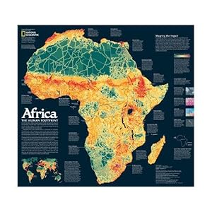
Africa: The Human Footprint (Map)
Publicado por National Geographic Society, 2005
Librería: Armadillo Books, Chapel Hill, NC, Estados Unidos de America
Valoración del vendedor:

Mapa
No Binding. Condición: Fine. Fine condition! The "Human footprint" map shows degrees of human density and generalized land use, while the "Storied landscape" map on the verso shows physico-geographic zones, forests/grasslands, and dense human concentrations. Two maps on one sheet (double-sided); color; 57 cm. x 62 cm., folded to 15 cm. x 16 cm. Ships quickly from NC to the eastern half of the USA. All maps are sealed in plastic, packaged securely, and shipped promptly via First Class US Mail with tracking information.
-
Territorial Growth of the United States
Publicado por National Geographic Society, Washington DC, 1987
Librería: BISON BOOKS - ABAC/ILAB, Winnipeg, MB, Canada
Miembro de asociación: ABAC ILAB
Valoración del vendedor:
Pamphlet. Folded glossy paper. Coloured map on one side, assorted maps with descriptions on the other. Small open tears at the folding intersections; good.
-
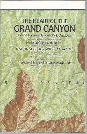
The Heart of The Grand Canyon (Map, July 1978)
Publicado por National Geographic Society, Washington, D.C., 1978
Librería: Bookfeathers, LLC, Lewisburg, PA, Estados Unidos de America
Valoración del vendedor:
Libro
Paperback. Condición: NF. Color (brown and green) map with relief shading; enhanced satellite image, sectional drawing and text on opposite side, originally accompanied magazine issue of July 1978. 16 panels, folds to roughly 5 5/8"x 9 3/4". NF. Mild toning to white borders and backgond with colors clean and strong. Mild occasional wear along edges.
-
Special places of the World: New York City
Publicado por National Geographic Society, Washington, D. C., 1990
Libro Original o primera edición
Folded Pamphlet. Condición: Very Good. First Edition. Illustrated, maps.
-
Mexico and Central America
Publicado por National Geographic Society, Washington DC, 1980
Libro Original o primera edición
Folded Map. Condición: Very Good. First Edition. Supplement to National Geographic, December 1980.
-
Archaeological Map of North America: Land of the Feathered Serpent
Publicado por National Geographic Society, Washington DC, 1968
Libro Original o primera edición
Folded Map. Condición: Very Good. First Edition. Supplement to National Geographic, October 1968.
-
South America
Publicado por National Geographic Society, Washington DC, 1960
Libro Original o primera edición
Folded Map. Condición: Very Good. First Edition. Supplement to National Geographic, February 1960.
-
Folded Map. Condición: Very Good. Revised Edition.
-
Spain in the Americas
Publicado por National Geographic Society, Washington DC, 1992
Libro Original o primera edición
Folded Map. Condición: Very Good. First Edition. Supplement to National Geographic, February 1992.
-
Coastal California
Publicado por National Geographic Magazine, Washington, 1993
Libro Original o primera edición
Pamphlet. Condición: Very Good. First Edition. Folded map, supplement to the National Geographic, July 1993.
-
Precious Resource Water
Publicado por National Geographic Society, 1993
Librería: POQUETTE'S BOOKS, DEWITT, MI, Estados Unidos de America
Valoración del vendedor:
Paperback. Condición: Good. Map.
-
Viet Nam, Cambodia, Laos and Eastern Thailand
Publicado por National Geographic Society, Washington, DC, 1965
Librería: Ground Zero Books, Ltd., Silver Spring, MD, Estados Unidos de America
Valoración del vendedor:
Condición: very good. 11.5" x 20.5", 1 map, color map, 11.5" x 20.5" (folded to 5.75" x 5.25").
-
Western Canada: Atlas Plate 21 [Map]
Publicado por National Geographic Society, Washington, DC, 1966
Librería: Ground Zero Books, Ltd., Silver Spring, MD, Estados Unidos de America
Valoración del vendedor:
Original o primera edición
1 p. 1 sheet (Approximately 19 inches by 24 inches) folded into 8 panels, image on one side only. Multi-color. Scale of 80 miles to one inch. Wellman Chamberlin was the Chief Cartographer, James M. Darley was the Assistant Chief Cartographer, and Melville Bell Grosvenor was the Editor of the National Geographic Magazine at the time this was published. Fair. No dust jacket. Map has small tears and wear and central fold. Presumed first edition thus, dated September, 1966.
-
Top of the World: Atlas Plate 3 [Map]
Publicado por National Geographic Society, Washington, DC, 1965
Librería: Ground Zero Books, Ltd., Silver Spring, MD, Estados Unidos de America
Valoración del vendedor:
Original o primera edición
Condición: Good. No dust jacket. 1 p. 1 sheet (Approximately 19 inches by 24 inches) folded into 8 panels, image on one side only. Multi-color. Scale of 316 miles to one inch. Wellman Chamberlin was the Chief Cartographer, James M. Darley was the Assistant Chief Cartographer, and Melville Bell Grosvenor was the Editor of the National Geographic Magazine at the time this was published. Presumed first edition thus, dated November, 1965.
-
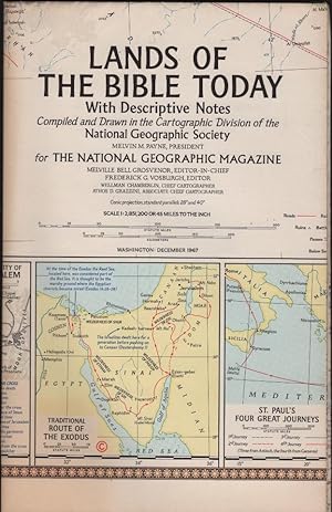
Lands of the bible today : with descriptive notes / compiled and drawn in the cartographic division of the National Geographic Society.
Publicado por Washington : National Geographic Society, 1967
Librería: Schürmann und Kiewning GbR, Naumburg, Alemania
Valoración del vendedor:
Mapa
250x160x1 Karte, gefaltet. Condición: Gut. 1 Karte : mehrfarbig ; 68 x 99 cm, gefaltet 25 x 16 cm / Kartographische mathematische Daten: 1:2 821 200; conic proj., standard parallels 28° and 40°; E 20°00'-E 51°25'/N 42°00'-N 25°20' / Mit 5 Nebenkarten: Holy Land today, Walled c Papier gebräunt Sprache: Englisch Gewicht in Gramm: 300.
-
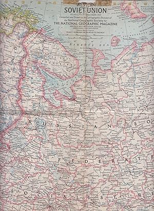
Western Soviet Union Map, Atlas Plate 45
Publicado por The National Geographic Society, 1959
Librería: Robinson Street Books, IOBA, Binghamton, NY, Estados Unidos de America
Miembro de asociación: IOBA
Valoración del vendedor:
Mapa
Map. Condición: Good. Prompt shipment, with tracking. we ship in CLEAN SECURE BOXES NEW BOXES Map of the Western Soviet Union Map [Atlas Plate 45] in Good condition, creased from folding, residue of tape marks and nicks to edges, tear in center of map, 25inches x 19.25 inches, Prompt shipping with tracking.
