
Importe total (1 artículo artículos):
Destino del pedido:

kohl collection maps relating (66 resultados)
Ir a los resultados principales
Filtros de búsqueda
Tipo de artículo
- Todos los tipos de productos
- Libros (66)
- Revistas y publicaciones (No hay ningún otro resultado que coincida con este filtro.)
- Cómics (No hay ningún otro resultado que coincida con este filtro.)
- Partituras (No hay ningún otro resultado que coincida con este filtro.)
- Arte, grabados y pósters (No hay ningún otro resultado que coincida con este filtro.)
- Fotografías (No hay ningún otro resultado que coincida con este filtro.)
- Mapas (No hay ningún otro resultado que coincida con este filtro.)
- Manuscritos y coleccionismo de papel (No hay ningún otro resultado que coincida con este filtro.)
Condición Más información
Encuadernación
Más atributos
- Primera edición (2)
- Firmado (No hay ningún otro resultado que coincida con este filtro.)
- Sobrecubierta (No hay ningún otro resultado que coincida con este filtro.)
- Con imágenes (23)
- No impresión bajo demanda (34)
Idioma (2)
Gastos de envío gratis
Ubicación del vendedor
Valoración de los vendedores
-
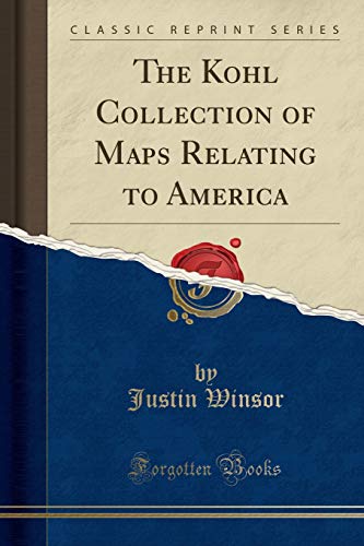
The Kohl Collection of Maps Relating to America Classic Reprint
Librería: PBShop.store US, Wood Dale, IL, Estados Unidos de America
Calificación del vendedor: 5 de 5 estrellas

EUR 22,54
Gastos de envío gratis
Se envía dentro de Estados Unidos de AmericaCantidad disponible: 15 disponibles
Ańadir al carritoPAP. Condición: New. New Book. Shipped from UK. Established seller since 2000.
-

The Kohl Collection Now in the Library of Congress Of Maps Relating to America, Vol 19 Classic Reprint
Librería: PBShop.store US, Wood Dale, IL, Estados Unidos de America
Calificación del vendedor: 5 de 5 estrellas
EUR 22,69
Gastos de envío gratis
Se envía dentro de Estados Unidos de AmericaCantidad disponible: 15 disponibles
Ańadir al carritoPAP. Condición: New. New Book. Shipped from UK. Established seller since 2000.
-

The Kohl Collection of Maps Relating to America
Librería: PBShop.store US, Wood Dale, IL, Estados Unidos de America
Calificación del vendedor: 5 de 5 estrellas
EUR 16,89
Gastos de envío gratis
Se envía dentro de Estados Unidos de AmericaCantidad disponible: 15 disponibles
Ańadir al carritoPAP. Condición: New. New Book. Shipped from UK. Established seller since 2000.
-

THE KOHL COLLECTION (Now in the Library of Congress) of MAPS RELATING TO AMERICA
Publicado por Government Printing Office
Librería: Wonder Book, Frederick, MD, Estados Unidos de America
Miembro de asociación: ABAA ILAB
Calificación del vendedor: 5 de 5 estrellas
EUR 10,04
Gastos de envío gratis
Se envía dentro de Estados Unidos de AmericaCantidad disponible: 1 disponibles
Ańadir al carritoCondición: Fair. Acceptable condition. Reading copy only. Bottom corner of page 163 torn away. Dampstained. Owner's name on front endpage. (reference, catalog).
-
![Imagen de archivo de The Kohl Collection of Maps Relating to America [microform] a la venta por California Books](https://pictures.abebooks.com/isbn/9781015205338-es-300.jpg)
The Kohl Collection of Maps Relating to America [microform]
Librería: California Books, Miami, FL, Estados Unidos de America
Calificación del vendedor: 4 de 5 estrellas

EUR 18,63
Gastos de envío gratis
Se envía dentro de Estados Unidos de AmericaCantidad disponible: Más de 20 disponibles
Ańadir al carritoCondición: New.
-

KOHL COLLECTION (NOW IN THE LIBRARY OF CONGRESS) OF MAPS RELATING TO AMERICA.|THE
Publicado por Government Printing Office, Washington, D.C., 1904
Librería: Oak Knoll Books, ABAA, ILAB, NEW CASTLE, DE, Estados Unidos de America
Miembro de asociación: ABAA ILAB MBS
Calificación del vendedor: 5 de 5 estrellas
EUR 8,87
Envío por EUR 7,32
Se envía dentro de Estados Unidos de AmericaCantidad disponible: 1 disponibles
Ańadir al carritooriginal cloth. Maps Ilustrador. 8vo. original cloth. (ii), 189+(1) pages. A reprint of Bibliographical Contribution Number 19 of the Library of Harvard University, with index and preface by Philip Lee Phillips, Chief, Division of Maps and Charts (Keyguide to Information Sources in Cartography 117). Front free endpaper loose. Staining to covers and wear to head and tail of spine. General shelfwear. Exlibrary with markings. The catalogue, compiled by Justin Winsor in 1886 and reprinted with an index by the GPO in 1904, describes 474 items now in the Library of Congress. When Johan Kohl (1808-1878) came to the United States in 1854, he brought with him an important collection of facsimile drawings of maps relating to the discovery and exploration of the New World. The product of years of research in European libraries and archives, Kohl's drawings were the most comprehensive collection of cartographic reproductions in America at that time. In 1856 Congress commissioned Kohl to duplicate his drawings for a proposed catalogue of early maps of America, which remained in the Department of State until their transfer to the Library in 1903. In all, almost 500 early maps are described, with an author list and general index.
-
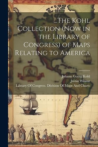
The Kohl Collection (Now in the Library of Congress) of Maps Relating to America with Index by Philip Lee Phillips
Publicado por Government Printing Office, Washington, D. C., 1904
Librería: T. W. Palmer Books, Eugene, OR, Estados Unidos de America
Calificación del vendedor: 5 de 5 estrellas
Original o primera edición
EUR 13,30
Envío por EUR 3,44
Se envía dentro de Estados Unidos de AmericaCantidad disponible: 1 disponibles
Ańadir al carritoHardcover. Condición: Good. No Jacket. 1st Edition. 25 x 17.5 cm., 189 pp., Useful prefatory note by Philip Lee Phillips (1857-1924) and Herbert Putnam (1861/09/20-1955/08/14) describing this collection of reproductions, original red cloth with gilt lettering, ex libris with label removed from spine, book plate on front free end paper and otherwise minimal markings, inside front hinge faiking.
-
The Kohl Collection of Maps Relating to America
Librería: PBShop.store UK, Fairford, GLOS, Reino Unido
Calificación del vendedor: 5 de 5 estrellas
EUR 16,27
Envío por EUR 3,80
Se envía de Reino Unido a Estados Unidos de AmericaCantidad disponible: 15 disponibles
Ańadir al carritoPAP. Condición: New. New Book. Shipped from UK. Established seller since 2000.
-
The Kohl Collection of Maps Relating to America Classic Reprint
Librería: PBShop.store UK, Fairford, GLOS, Reino Unido
Calificación del vendedor: 5 de 5 estrellas
EUR 24,63
Envío por EUR 3,80
Se envía de Reino Unido a Estados Unidos de AmericaCantidad disponible: 15 disponibles
Ańadir al carritoPAP. Condición: New. New Book. Shipped from UK. Established seller since 2000.
-
The Kohl Collection Now in the Library of Congress Of Maps Relating to America, Vol 19 Classic Reprint
Librería: PBShop.store UK, Fairford, GLOS, Reino Unido
Calificación del vendedor: 5 de 5 estrellas
EUR 24,68
Envío por EUR 3,80
Se envía de Reino Unido a Estados Unidos de AmericaCantidad disponible: 15 disponibles
Ańadir al carritoPAP. Condición: New. New Book. Shipped from UK. Established seller since 2000.
-
Library of Congress: The Kohl Collection (Now in the Library of Congress) Of Maps Relating to America
Idioma: Inglés
Publicado por Government Printing Office, Washington, 1904
Librería: Dublin Bookbrowsers, Dublin, NONE, Irlanda
Calificación del vendedor: 2 de 5 estrellas

EUR 19,21
Envío por EUR 10,40
Se envía de Irlanda a Estados Unidos de AmericaCantidad disponible: 1 disponibles
Ańadir al carritoBurgundy Cloth. Condición: Good-Very Good. pp 189, burgundy cloth, spine title in gilt. Library stamp to title page. Else Very good in slightly marked and stained cover.
-

.The Kohl Collection (Now in the Library of Congress) of Maps Relating to America
Librería: GreatBookPrices, Columbia, MD, Estados Unidos de America
Calificación del vendedor: 5 de 5 estrellas
EUR 29,23
Envío por EUR 2,27
Se envía dentro de Estados Unidos de AmericaCantidad disponible: Más de 20 disponibles
Ańadir al carritoCondición: New.
-

.The Kohl Collection (Now in the Library of Congress) of Maps Relating to America (Hardback or Cased Book)
Idioma: Inglés
Publicado por Legare Street Press 7/18/2023, 2023
ISBN 10: 1020295635 ISBN 13: 9781020295638
Librería: BargainBookStores, Grand Rapids, MI, Estados Unidos de America
Calificación del vendedor: 5 de 5 estrellas
EUR 31,58
Gastos de envío gratis
Se envía dentro de Estados Unidos de AmericaCantidad disponible: 5 disponibles
Ańadir al carritoHardback or Cased Book. Condición: New. .The Kohl Collection (Now in the Library of Congress) of Maps Relating to America. Book.
-
Library of Congress: The Kohl Collection (Now in the Library of Congress) Of Maps Relating to America
Publicado por Government Printing Office, Washington, DC, 1904
Librería: Great Expectations Rare Books, Staten Island, NYC, NY, Estados Unidos de America
Calificación del vendedor: 5 de 5 estrellas
EUR 15,04
Envío por EUR 5,60
Se envía dentro de Estados Unidos de AmericaCantidad disponible: 1 disponibles
Ańadir al carritoHardcover. Condición: Good+. First Edition Thus. Hardcover, small quarto bound in red cloth. 189 pages. Index. Ex-library copy, from Virginia Military Institute with their small round stamp, dated Feb. 9. 1905, inside front cover. No other markings or stamps. With Prefatory Note and Index by Philip Lee Phillips. First edition thus, being a reprint of Bibliographical Contribution Number 19 of the Library of Harvard University. No previous ownership marks. A clean, sound, unmarked copy. Good+.
-

The Kohl Collection of Maps Relating to America Classic Reprint
Librería: PBShop.store US, Wood Dale, IL, Estados Unidos de America
Calificación del vendedor: 5 de 5 estrellas
EUR 34,50
Gastos de envío gratis
Se envía dentro de Estados Unidos de AmericaCantidad disponible: 15 disponibles
Ańadir al carritoHRD. Condición: New. New Book. Shipped from UK. Established seller since 2000.
-
.The Kohl Collection (Now in the Library of Congress) of Maps Relating to America
Librería: GreatBookPrices, Columbia, MD, Estados Unidos de America
Calificación del vendedor: 5 de 5 estrellas
EUR 32,34
Envío por EUR 2,27
Se envía dentro de Estados Unidos de AmericaCantidad disponible: Más de 20 disponibles
Ańadir al carritoCondición: As New. Unread book in perfect condition.
-
...The Kohl Collection (Now in the Library of Congress) of Maps Relating to America
Librería: Ria Christie Collections, Uxbridge, Reino Unido
Calificación del vendedor: 5 de 5 estrellas
EUR 20,53
Envío por EUR 13,85
Se envía de Reino Unido a Estados Unidos de AmericaCantidad disponible: Más de 20 disponibles
Ańadir al carritoCondición: New. In.
-
The Kohl Collection of Maps Relating to America Classic Reprint
Librería: PBShop.store UK, Fairford, GLOS, Reino Unido
Calificación del vendedor: 5 de 5 estrellas
EUR 32,98
Envío por EUR 4,81
Se envía de Reino Unido a Estados Unidos de AmericaCantidad disponible: 15 disponibles
Ańadir al carritoHRD. Condición: New. New Book. Shipped from UK. Established seller since 2000.
-
The Kohl Collection of Maps Relating to America [microform]
Librería: Ria Christie Collections, Uxbridge, Reino Unido
Calificación del vendedor: 5 de 5 estrellas
EUR 16,64
Envío por EUR 13,85
Se envía de Reino Unido a Estados Unidos de AmericaCantidad disponible: Más de 20 disponibles
Ańadir al carritoCondición: New. In.
-
The Kohl Collection of Maps Relating to America
Librería: THE SAINT BOOKSTORE, Southport, Reino Unido
Calificación del vendedor: 5 de 5 estrellas
EUR 18,02
Envío por EUR 14,09
Se envía de Reino Unido a Estados Unidos de AmericaCantidad disponible: Más de 20 disponibles
Ańadir al carritoPaperback. Condición: New. New copy - Usually dispatched within 4 working days.
-
THE KOHL COLLECTION (NOW IN THE LIBRARY OF CONGRESS) OF MAPS RELATING TO AMERICA
Publicado por Government Printing Office, San Francisco, 1904
Librería: First Folio A.B.A.A., Paris, TN, Estados Unidos de America
Miembro de asociación: ABAA ILAB MWABA TXBA
Calificación del vendedor: 5 de 5 estrellas
EUR 22,17
Envío por EUR 8,40
Se envía dentro de Estados Unidos de AmericaCantidad disponible: 1 disponibles
Ańadir al carritoFirst separate issue. First separate issue. 8vo. 180p. Indexed. 474 entries. Bound in publisher's gilt-titled red cloth. Cracking to front inner hinge paper, rubbing to extremes, complete and sound, good.
-
Kohl Collection of Maps Relating to America
Publicado por Government Printing Office
Librería: Wonder Book, Frederick, MD, Estados Unidos de America
Miembro de asociación: ABAA ILAB
Calificación del vendedor: 5 de 5 estrellas
EUR 23,45
Gastos de envío gratis
Se envía dentro de Estados Unidos de AmericaCantidad disponible: 1 disponibles
Ańadir al carritoCondición: Fair. Acceptable condition. Former Library book. Spine torn. Endpages detached. (Early maps, bibliography).
-
...The Kohl Collection (Now in the Library of Congress) of Maps Relating to America
Librería: Ria Christie Collections, Uxbridge, Reino Unido
Calificación del vendedor: 5 de 5 estrellas
EUR 32,25
Envío por EUR 13,85
Se envía de Reino Unido a Estados Unidos de AmericaCantidad disponible: Más de 20 disponibles
Ańadir al carritoCondición: New. In.
-
The Kohl Collection of Maps Relating to America
Publicado por Government Printing Office, Washington, D. C., 1904
Librería: San Rafael Books, Pasadena, CA, Estados Unidos de America
Calificación del vendedor: 2 de 5 estrellas
Original o primera edición
EUR 23,95
Envío por EUR 8,61
Se envía dentro de Estados Unidos de AmericaCantidad disponible: 1 disponibles
Ańadir al carritoCloth. Condición: Near Fine. Estado de la sobrecubierta: None. 1st American Edition. Index by Philip Lee Phillips. Bookplate of Charles Frederick Kohl. Near Fine Maroon Cloth. Front Hinge starting. Internally Fine. Size: 4vo.
-
.The Kohl Collection (Now in the Library of Congress) of Maps Relating to America
Librería: GreatBookPricesUK, Woodford Green, Reino Unido
Calificación del vendedor: 5 de 5 estrellas
EUR 32,24
Envío por EUR 17,34
Se envía de Reino Unido a Estados Unidos de AmericaCantidad disponible: Más de 20 disponibles
Ańadir al carritoCondición: New.
-
.The Kohl Collection (Now in the Library of Congress) of Maps Relating to America
Librería: GreatBookPricesUK, Woodford Green, Reino Unido
Calificación del vendedor: 5 de 5 estrellas
EUR 34,70
Envío por EUR 17,34
Se envía de Reino Unido a Estados Unidos de AmericaCantidad disponible: Más de 20 disponibles
Ańadir al carritoCondición: As New. Unread book in perfect condition.
-

The Kohl Collection of Maps Relating to America (Classic Reprint)
Librería: Forgotten Books, London, Reino Unido
Calificación del vendedor: 4 de 5 estrellas
EUR 15,84
Gastos de envío gratis
Se envía de Reino Unido a Estados Unidos de AmericaCantidad disponible: Más de 20 disponibles
Ańadir al carritoPaperback. Condición: New. Print on Demand. This captivating book delves into the history of early maps, focusing specifically on the depiction of the Americas and the evolution of cartographic knowledge during a pivotal era of exploration and discovery. The author, a renowned scholar, presents a comprehensive collection of meticulously annotated maps that showcase the gradual refinement of geographical understanding throughout the 16th century. These maps, drawn from various archives and libraries, offer a unique window into the minds of early explorers and the changing perceptions of the New World. From the symbolic representations of the 11th century to the more accurate depictions of the 16th century, this book traces the development of cartography as a tool for understanding the world and its place within it. By examining the ways in which these maps shaped the course of history, the author sheds light on the profound impact of geographical knowledge on human exploration, trade, and global exploration. This book is a reproduction of an important historical work, digitally reconstructed using state-of-the-art technology to preserve the original format. In rare cases, an imperfection in the original, such as a blemish or missing page, may be replicated in the book. print-on-demand item.
-
The Kohl Collection (Now in the Library of Congress) Of Maps Relating to
Librería: Forgotten Books, London, Reino Unido
Calificación del vendedor: 4 de 5 estrellas
EUR 15,89
Gastos de envío gratis
Se envía de Reino Unido a Estados Unidos de AmericaCantidad disponible: Más de 20 disponibles
Ańadir al carritoPaperback. Condición: New. Print on Demand. This book captures the world's geographic understanding immediately before Christopher Columbusâs historic journey, providing a never-before-seen glimpse into the geographical knowledge of the time. The author meticulously compiles and analyzes over 150 maps from the 600-year period preceding Columbus's voyage, offering readers an unmatched resource for understanding historical cartography and the development of geographical thought. This book is an invaluable tool for historians, geographers, scholars of the Age of Exploration, and anyone interested in the history of mapmaking. Through its in-depth exploration of early maps, this book sheds light on the motivations and misconceptions that shaped the voyages of discovery and the development of geographical knowledge during one of the most pivotal eras in human history. This book is a reproduction of an important historical work, digitally reconstructed using state-of-the-art technology to preserve the original format. In rare cases, an imperfection in the original, such as a blemish or missing page, may be replicated in the book. print-on-demand item.
-

The Kohl Collection of Maps | relating to America
Librería: preigu, Osnabrück, Alemania
Calificación del vendedor: 5 de 5 estrellas
EUR 13,90
Envío por EUR 70,00
Se envía de Alemania a Estados Unidos de AmericaCantidad disponible: 5 disponibles
Ańadir al carritoTaschenbuch. Condición: Neu. The Kohl Collection of Maps | relating to America | Justin Winsor (u. a.) | Taschenbuch | 76 S. | Englisch | 2019 | hansebooks | EAN 9783337785239 | Verantwortliche Person für die EU: BoD - Books on Demand, In de Tarpen 42, 22848 Norderstedt, info[at]bod[dot]de | Anbieter: preigu.
-
![Imagen del vendedor de The Kohl Collection of Maps Relating to America [microform] a la venta por AHA-BUCH GmbH](https://pictures.abebooks.com/inventory/md/md31915330222.jpg)
The Kohl Collection of Maps Relating to America [microform]
Idioma: Inglés
Publicado por Creative Media Partners, LLC Sep 2021, 2021
ISBN 10: 101520533X ISBN 13: 9781015205338
Librería: AHA-BUCH GmbH, Einbeck, Alemania
Calificación del vendedor: 5 de 5 estrellas
EUR 27,46
Envío por EUR 60,61
Se envía de Alemania a Estados Unidos de AmericaCantidad disponible: 2 disponibles
Ańadir al carritoTaschenbuch. Condición: Neu. Neuware.


