
Importe total (1 artículo artículos):
Destino del pedido:

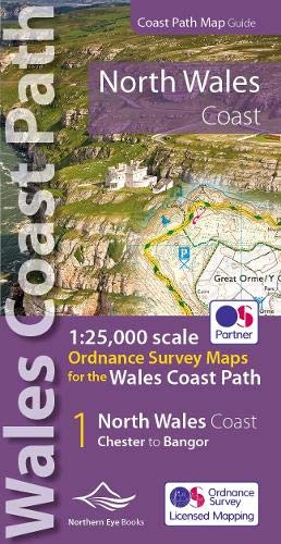
9781908632586 - North Wales Coast Path Map: 1:25,000 Ordnance Survey maps for the Wales Coast Path: 2 (OS Map Books - Wales Coast Path) de Northern Eye (20 resultados)
Ir a los resultados principales
Filtros de búsqueda
Tipo de artículo
- Todos los tipos de productos
- Libros (20)
- Revistas y publicaciones (No hay ningún otro resultado que coincida con este filtro.)
- Cómics (No hay ningún otro resultado que coincida con este filtro.)
- Partituras (No hay ningún otro resultado que coincida con este filtro.)
- Arte, grabados y pósters (No hay ningún otro resultado que coincida con este filtro.)
- Fotografías (No hay ningún otro resultado que coincida con este filtro.)
- Mapas (No hay ningún otro resultado que coincida con este filtro.)
- Manuscritos y coleccionismo de papel (No hay ningún otro resultado que coincida con este filtro.)
Condición Más información
- Nuevo (18)
- Como nuevo, Excelente o Muy bueno (2)
- Bueno o Aceptable (No hay ningún otro resultado que coincida con este filtro.)
- Regular o Pobre (No hay ningún otro resultado que coincida con este filtro.)
- Tal como se indica (No hay ningún otro resultado que coincida con este filtro.)
Encuadernación
- Todas
- Tapa dura (No hay ningún otro resultado que coincida con este filtro.)
- Tapa blanda (20)
Más atributos
- Primera edición (No hay ningún otro resultado que coincida con este filtro.)
- Firmado (No hay ningún otro resultado que coincida con este filtro.)
- Sobrecubierta (No hay ningún otro resultado que coincida con este filtro.)
- Con imágenes (5)
- No impresión bajo demanda (20)
Idioma (1)
Precio
- Cualquier precio
- Menos de EUR 20
- EUR 20 a EUR 45
- Más de EUR 45 (No hay ningún otro resultado que coincida con este filtro.)
Gastos de envío gratis
Ubicación del vendedor
Valoración de los vendedores
-

North Wales Coast Path Map
Idioma: Inglés
Publicado por Northern Eye Books, GB, 2022
ISBN 10: 1908632585 ISBN 13: 9781908632586
Librería: Rarewaves.com USA, London, LONDO, Reino Unido
Calificación del vendedor: 5 de 5 estrellas

EUR 13,90
Gastos de envío gratis
Se envía de Reino Unido a Estados Unidos de AmericaCantidad disponible: Más de 20 disponibles
Ańadir al carritoPaperback. Condición: New. One of seven handy, lightweight, pocket sized map books covering the whole of the 870 mile/1400 kilometre Wales Coast Path. This volume covers North Wales from Chester to Bangor and includes enhanced large scale (1:25,000) Ordnance Survey mapping in a handy atlas format, with extracts from large scale Explorer maps 266, 265, 264 and OL17. The official route of the Wales Coast Path is highlighted and on-map symbols show amenities at main towns and villages. There is an introduction and additional useful information.
-
North Wales Coast Path Map : 1:25,000 Scale Ordnance Survey Mapping for the Wales Coast Path
Librería: GreatBookPrices, Columbia, MD, Estados Unidos de America
Calificación del vendedor: 5 de 5 estrellas
EUR 11,56
Envío por EUR 2,27
Se envía dentro de Estados Unidos de AmericaCantidad disponible: 4 disponibles
Ańadir al carritoCondición: New.
-
North Wales Coast Path Map
Librería: PBShop.store US, Wood Dale, IL, Estados Unidos de America
Calificación del vendedor: 5 de 5 estrellas
EUR 14,46
Gastos de envío gratis
Se envía dentro de Estados Unidos de AmericaCantidad disponible: 15 disponibles
Ańadir al carritoPAP. Condición: New. New Book. Shipped from UK. Established seller since 2000.
-
North Wales Coast Path Map : 1:25,000 Scale Ordnance Survey Mapping for the Wales Coast Path
Librería: GreatBookPrices, Columbia, MD, Estados Unidos de America
Calificación del vendedor: 5 de 5 estrellas
EUR 12,24
Envío por EUR 2,27
Se envía dentro de Estados Unidos de AmericaCantidad disponible: 4 disponibles
Ańadir al carritoCondición: As New. Unread book in perfect condition.
-
North Wales Coast Path Map (Paperback)
Idioma: Inglés
Publicado por Northern Eye Books, Tattenhall, 2022
ISBN 10: 1908632585 ISBN 13: 9781908632586
Librería: Grand Eagle Retail, Bensenville, IL, Estados Unidos de America
Calificación del vendedor: 5 de 5 estrellas
EUR 16,46
Gastos de envío gratis
Se envía dentro de Estados Unidos de AmericaCantidad disponible: 1 disponibles
Ańadir al carritoPaperback. Condición: new. Paperback. One of seven handy, lightweight, pocket sized map books covering the whole of the 870 mile/1400 kilometre Wales Coast Path. This volume covers North Wales from Chester to Bangor and includes enhanced large scale (1:25,000) Ordnance Survey mapping in a handy atlas format, with extracts from large scale Explorer maps 266, 265, 264 and OL17. The official route of the Wales Coast Path is highlighted and on-map symbols show amenities at main towns and villages. There is an introduction and additional useful information. One of seven handy, lightweight, pocket sized map bookscovering the whole of the 870 mile/1400 kilometre Wales Coast Path. This volume covers North Wales from Chester to Bangor and includes enhanced large scale (1:25,000) Ordnance Survey mapping in a handy atlas format. Shipping may be from multiple locations in the US or from the UK, depending on stock availability.
-
NORTH WALES COAST PATH MAP BOOK
Librería: Speedyhen LLC, Hialeah, FL, Estados Unidos de America
Calificación del vendedor: 2 de 5 estrellas

EUR 16,67
Gastos de envío gratis
Se envía dentro de Estados Unidos de AmericaCantidad disponible: 2 disponibles
Ańadir al carritoCondición: NEW.
-
North Wales Coast Path Map
Librería: PBShop.store UK, Fairford, GLOS, Reino Unido
Calificación del vendedor: 5 de 5 estrellas
EUR 13,01
Envío por EUR 3,77
Se envía de Reino Unido a Estados Unidos de AmericaCantidad disponible: 15 disponibles
Ańadir al carritoPAP. Condición: New. New Book. Shipped from UK. Established seller since 2000.
-
North Wales Coast Path Map: 1:25,000 scale Ordnance Survey mapping for the Wales Coast Path (OS Map Books - Wales Coast Path)
Librería: Revaluation Books, Exeter, Reino Unido
Calificación del vendedor: 5 de 5 estrellas
EUR 11,15
Envío por EUR 11,46
Se envía de Reino Unido a Estados Unidos de AmericaCantidad disponible: 1 disponibles
Ańadir al carritoPaperback. Condición: Brand New. 1st, 2021 edition. 48 pages. 8.27x4.37x0.32 inches. In Stock.
-
North Wales Coast Path Map: 1:25,000 scale Ordnance Survey mapping for the Wales Coast Path (OS Map Books - Wales Coast Path)
Librería: Kennys Bookshop and Art Galleries Ltd., Galway, GY, Irlanda
Calificación del vendedor: 5 de 5 estrellas
EUR 15,83
Envío por EUR 10,50
Se envía de Irlanda a Estados Unidos de AmericaCantidad disponible: 1 disponibles
Ańadir al carritoCondición: New. 2022. 1st, 2021. Paperback. . . . . .
-
North Wales Coast Path Map
Librería: Ria Christie Collections, Uxbridge, Reino Unido
Calificación del vendedor: 5 de 5 estrellas
EUR 13,37
Envío por EUR 13,73
Se envía de Reino Unido a Estados Unidos de AmericaCantidad disponible: 1 disponibles
Ańadir al carritoCondición: New. In.
-
North Wales Coast Path Map: 1:25,000 scale Ordnance Survey mapping for the Wales Coast Path (OS Map Books - Wales Coast Path)
Librería: Kennys Bookstore, Olney, MD, Estados Unidos de America
Calificación del vendedor: 5 de 5 estrellas
EUR 18,75
Envío por EUR 9,04
Se envía dentro de Estados Unidos de AmericaCantidad disponible: 1 disponibles
Ańadir al carritoCondición: New. 2022. 1st, 2021. Paperback. . . . . . Books ship from the US and Ireland.
-
North Wales Coast Path Map: 1:25,000 scale Ordnance Survey mapping for the Wales Coast Path
Librería: THE SAINT BOOKSTORE, Southport, Reino Unido
Calificación del vendedor: 5 de 5 estrellas
EUR 15,29
Envío por EUR 13,84
Se envía de Reino Unido a Estados Unidos de AmericaCantidad disponible: 2 disponibles
Ańadir al carritoPaperback / softback. Condición: New. New copy - Usually dispatched within 3 working days.
-
North Wales Coast Path Map : 1:25,000 Scale Ordnance Survey Mapping for the Wales Coast Path
Librería: GreatBookPricesUK, Woodford Green, Reino Unido
Calificación del vendedor: 5 de 5 estrellas
EUR 13,00
Envío por EUR 17,19
Se envía de Reino Unido a Estados Unidos de AmericaCantidad disponible: 4 disponibles
Ańadir al carritoCondición: New.
-
North Wales Coast Path Map : 1:25,000 Scale Ordnance Survey Mapping for the Wales Coast Path
Librería: GreatBookPricesUK, Woodford Green, Reino Unido
Calificación del vendedor: 5 de 5 estrellas
EUR 14,82
Envío por EUR 17,19
Se envía de Reino Unido a Estados Unidos de AmericaCantidad disponible: 4 disponibles
Ańadir al carritoCondición: As New. Unread book in perfect condition.
-
North Wales Coast Path Map (Paperback)
Idioma: Inglés
Publicado por Northern Eye Books, Tattenhall, 2022
ISBN 10: 1908632585 ISBN 13: 9781908632586
Librería: AussieBookSeller, Truganina, VIC, Australia
Calificación del vendedor: 5 de 5 estrellas
EUR 26,95
Envío por EUR 31,86
Se envía de Australia a Estados Unidos de AmericaCantidad disponible: 1 disponibles
Ańadir al carritoPaperback. Condición: new. Paperback. One of seven handy, lightweight, pocket sized map books covering the whole of the 870 mile/1400 kilometre Wales Coast Path. This volume covers North Wales from Chester to Bangor and includes enhanced large scale (1:25,000) Ordnance Survey mapping in a handy atlas format, with extracts from large scale Explorer maps 266, 265, 264 and OL17. The official route of the Wales Coast Path is highlighted and on-map symbols show amenities at main towns and villages. There is an introduction and additional useful information. One of seven handy, lightweight, pocket sized map bookscovering the whole of the 870 mile/1400 kilometre Wales Coast Path. This volume covers North Wales from Chester to Bangor and includes enhanced large scale (1:25,000) Ordnance Survey mapping in a handy atlas format. Shipping may be from our Sydney, NSW warehouse or from our UK or US warehouse, depending on stock availability.
-
NORTH WALES COAST PATH MAP BOOK
Librería: Speedyhen, Hertfordshire, Reino Unido
Calificación del vendedor: 5 de 5 estrellas
EUR 11,53
Envío por EUR 46,99
Se envía de Reino Unido a Estados Unidos de AmericaCantidad disponible: 1 disponibles
Ańadir al carritoCondición: NEW.
-

North Wales Coast Path Map
Librería: moluna, Greven, Alemania
Calificación del vendedor: 5 de 5 estrellas
EUR 16,67
Envío por EUR 48,99
Se envía de Alemania a Estados Unidos de AmericaCantidad disponible: 1 disponibles
Ańadir al carritoCondición: New. One of seven handy, lightweight, pocket sized map bookscovering the whole of the 870 mile/1400 kilometre Wales Coast Path. This volume covers North Wales from Chester to Bangor and includes enhanced large scale (1:25,000) Ordnance Survey mapping in a handy.
-

North Wales Coast Path Map : 1:25,000 Ordnance Survey maps for the Wales Coast Path
Idioma: Inglés
Publicado por Northern Eye Books Mär 2022, 2022
ISBN 10: 1908632585 ISBN 13: 9781908632586
Librería: AHA-BUCH GmbH, Einbeck, Alemania
Calificación del vendedor: 5 de 5 estrellas
EUR 14,23
Envío por EUR 60,21
Se envía de Alemania a Estados Unidos de AmericaCantidad disponible: 1 disponibles
Ańadir al carritoTaschenbuch. Condición: Neu. Neuware - One of seven handy, lightweight, pocket sized map bookscovering the whole of the 870 mile/1400 kilometre Wales Coast Path. This volume covers North Wales from Chester to Bangor and includes enhanced large scale (1:25,000) Ordnance Survey mapping in a handy atlas format.
-

North Wales Coast Path Map
Idioma: Inglés
Publicado por Northern Eye Books, GB, 2022
ISBN 10: 1908632585 ISBN 13: 9781908632586
Librería: Rarewaves.com UK, London, Reino Unido
Calificación del vendedor: 5 de 5 estrellas
EUR 11,52
Envío por EUR 74,49
Se envía de Reino Unido a Estados Unidos de AmericaCantidad disponible: Más de 20 disponibles
Ańadir al carritoPaperback. Condición: New. One of seven handy, lightweight, pocket sized map books covering the whole of the 870 mile/1400 kilometre Wales Coast Path. This volume covers North Wales from Chester to Bangor and includes enhanced large scale (1:25,000) Ordnance Survey mapping in a handy atlas format, with extracts from large scale Explorer maps 266, 265, 264 and OL17. The official route of the Wales Coast Path is highlighted and on-map symbols show amenities at main towns and villages. There is an introduction and additional useful information.
-

North Wales Coast Path Map | 1:25,000 Ordnance Survey maps for the Wales Coast Path
Librería: preigu, Osnabrück, Alemania
Calificación del vendedor: 5 de 5 estrellas
EUR 16,90
Envío por EUR 70,00
Se envía de Alemania a Estados Unidos de AmericaCantidad disponible: 1 disponibles
Ańadir al carritoTaschenbuch. Condición: Neu. North Wales Coast Path Map | 1:25,000 Ordnance Survey maps for the Wales Coast Path | Taschenbuch | Kartoniert / Broschiert | Englisch | 2022 | Northern Eye Books | EAN 9781908632586 | Verantwortliche Person für die EU: Libri GmbH, Europaallee 1, 36244 Bad Hersfeld, gpsr[at]libri[dot]de | Anbieter: preigu.