L h everts (515 resultados)

History of the Connecticut Valley in Massachusetts, With Illustrations and Biographical Sketches of Some of Its Prominent Men and Pioneers; Volume 1 (Paperback or Softback)
L H Everts & Co
- Tapa blanda
Librería: BargainBookStores, Grand Rapids, MI, Estados Unidos de AmericaBargainBookStores
Contactar con el vendedorVendedor de 5 estrellasCondición: Nuevo
EUR 33,82
Gastos de envío gratisSe envía dentro de Estados Unidos de AmericaCantidad disponible: 5 disponibles
Paperback or Softback. Condición: New. History of the Connecticut Valley in Massachusetts, With Illustrations and Biographical Sketches of Some of Its Prominent Men and Pioneers; Volume 1. Book.

History of the Connecticut Valley in Massachusetts, With Illustrations and Biographical Sketches of Some of Its Prominent Men and Pioneers; Volume 2 (Paperback or Softback)
L H Everts & Co
- Tapa blanda
Librería: BargainBookStores, Grand Rapids, MI, Estados Unidos de AmericaBargainBookStores
Contactar con el vendedorVendedor de 5 estrellasCondición: Nuevo
EUR 37,68
Gastos de envío gratisSe envía dentro de Estados Unidos de AmericaCantidad disponible: 5 disponibles
Paperback or Softback. Condición: New. History of the Connecticut Valley in Massachusetts, With Illustrations and Biographical Sketches of Some of Its Prominent Men and Pioneers; Volume 2. Book.
Editorial: L.H. Everts, 1874
- Tapa blanda
Librería: Queen City Books, Lynchburg, OH, Estados Unidos de AmericaQueen City Books
Contactar con el vendedorVendedor de 4 estrellasCondición: Usado - Regular
EUR 22,56
Envío por EUR 3,46Se envía dentro de Estados Unidos de AmericaCantidad disponible: 1 disponibles
Softcover. Condición: Fair. 1874 Antique softcover with black rubbing to cover and slight tear along edge. Interior has aging to pages.Your purchase benefits literacy and summer reading programs in Cincinnati and Hamilton County, Ohio. We ship every business day. All books ship in cardboard bookfolds with delivery confirmation.

- Tapa blanda
Librería: PBShop.store US, Wood Dale, IL, Estados Unidos de AmericaPBShop.store US
Contactar con el vendedorVendedor de 5 estrellasCondición: Nuevo
EUR 39,69
Gastos de envío gratisSe envía dentro de Estados Unidos de AmericaCantidad disponible: 15 disponibles
PAP. Condición: New. New Book. Shipped from UK. Established seller since 2000.
- Tapa blanda
Librería: PBShop.store UK, Fairford, GLOS, Reino UnidoPBShop.store UK
Contactar con el vendedorVendedor de 5 estrellasCondición: Nuevo
EUR 34,03
Envío por EUR 7,85Se envía de Reino Unido a Estados Unidos de AmericaCantidad disponible: 15 disponibles
PAP. Condición: New. New Book. Shipped from UK. Established seller since 2000.

- Tapa blanda
Librería: PBShop.store US, Wood Dale, IL, Estados Unidos de AmericaPBShop.store US
Contactar con el vendedorVendedor de 5 estrellasCondición: Nuevo
EUR 43,70
Gastos de envío gratisSe envía dentro de Estados Unidos de AmericaCantidad disponible: 15 disponibles
PAP. Condición: New. New Book. Shipped from UK. Established seller since 2000.
- Tapa blanda
Librería: PBShop.store UK, Fairford, GLOS, Reino UnidoPBShop.store UK
Contactar con el vendedorVendedor de 5 estrellasCondición: Nuevo
EUR 36,27
Envío por EUR 7,85Se envía de Reino Unido a Estados Unidos de AmericaCantidad disponible: 15 disponibles
PAP. Condición: New. New Book. Shipped from UK. Established seller since 2000.

- Tapa blanda
Librería: Chiron Media, Wallingford, Reino UnidoChiron Media
Contactar con el vendedorVendedor de 5 estrellasCondición: Nuevo
EUR 31,81
Envío por EUR 17,98Se envía de Reino Unido a Estados Unidos de AmericaCantidad disponible: 10 disponibles
PF. Condición: New.

Idioma: Inglés
Editorial: The Bookmark, Knightstown, IN, 1975
- Tapa dura
- Primera edición
Librería: Kerkhoff Books DIV KSI, Warsaw, IN, Estados Unidos de AmericaKerkhoff Books DIV KSI
Contactar con el vendedorVendedor de 5 estrellasCondición: Usado - Muy bueno
EUR 45,13
Envío por EUR 7,01Se envía dentro de Estados Unidos de AmericaCantidad disponible: 1 disponibles
Hardcover. Condición: Near Fine. 1st Edition. Bound in blue cloth with white titles, 202 pp. Laid in back is an envelope with an 1875 map of Newark. This is a complete reprint of the 1875 atlas in a reduced size.

- Tapa dura
Librería: PBShop.store US, Wood Dale, IL, Estados Unidos de AmericaPBShop.store US
Contactar con el vendedorVendedor de 5 estrellasCondición: Nuevo
EUR 53,27
Gastos de envío gratisSe envía dentro de Estados Unidos de AmericaCantidad disponible: 15 disponibles
HRD. Condición: New. New Book. Shipped from UK. Established seller since 2000.
- Tapa dura
Librería: PBShop.store UK, Fairford, GLOS, Reino UnidoPBShop.store UK
Contactar con el vendedorVendedor de 5 estrellasCondición: Nuevo
EUR 44,65
Envío por EUR 8,86Se envía de Reino Unido a Estados Unidos de AmericaCantidad disponible: 15 disponibles
HRD. Condición: New. New Book. Shipped from UK. Established seller since 2000.
Idioma: Inglés
Editorial: Windmill Publications, Mt. Vernon, IN, 1992
- Tapa dura
Librería: Sandhill Books, Spring Green, WI, Estados Unidos de AmericaSandhill Books
Contactar con el vendedorVendedor de 5 estrellasCondición: Usado - Bueno
EUR 64,98
Envío por EUR 3,50Se envía dentro de Estados Unidos de AmericaCantidad disponible: 1 disponibles
Hardcover. Condición: Very Good. No Jacket. 251 and 57 pages, facsimile maps and drawings throughout, 14in tall, folio. Blue cloth and gilt title on front and spine. Township maps from 1847 and 1854 wallmaps; from the 1866 "Atlas of Licking Co., Ohio" by F. W. Beers; and from the 1875 "Combination Atlas Map of Licking County, Oh…io" by L. H. Everts. Many facsimile drawings of residences and public and commercial buildings, also a 57-page index of landowners' names. A clean and unworn copy that shows yellow highlighting on pages 4 and 33.
 Más imágenes
Editorial: The Bookmark
- Tapa dura
Librería: ThriftBooksVintage, Tukwila, WA, Estados Unidos de AmericaThriftBooksVintage
Contactar con el vendedorVendedor de 5 estrellasCondición: Usado - Bueno
EUR 54,15
Gastos de envío gratisSe envía dentro de Estados Unidos de AmericaCantidad disponible: 1 disponibles
Hardcover. Condición: Very Good. No Jacket. 1975 Bookmark reprint. Clean. Clean Collectible Condition. Gift Quality. This book shows minimal sign of wear to the cover, binding, or pages. No dust jacket included with this book. Secure packaging for safe delivery.

- Tapa blanda
Librería: AHA-BUCH GmbH, Einbeck, AlemaniaAHA-BUCH GmbH
Contactar con el vendedorVendedor de 5 estrellasCondición: Nuevo
EUR 28,86
Envío por EUR 61,00Se envía de Alemania a Estados Unidos de AmericaCantidad disponible: 2 disponibles
Taschenbuch. Condición: Neu. Neuware.
Editorial: The Bookmark, Knightstown, Ind., 1975
- Tapa dura
Librería: By Books Alone, Woodstock, NY, Estados Unidos de AmericaBy Books Alone
Contactar con el vendedorVendedor de 5 estrellasCondición: Usado
EUR 54,15
Envío por EUR 4,82Se envía dentro de Estados Unidos de AmericaCantidad disponible: 1 disponibles
Hard Cover. Condición: About Very Good. Reprint. Map loose at front. Covers lightly soiled.

- Tapa dura
Librería: AHA-BUCH GmbH, Einbeck, AlemaniaAHA-BUCH GmbH
Contactar con el vendedorVendedor de 5 estrellasCondición: Nuevo
EUR 46,55
Envío por EUR 61,86Se envía de Alemania a Estados Unidos de AmericaCantidad disponible: 2 disponibles
Buch. Condición: Neu. Neuware - This work has been selected by scholars as being culturally important and is part of the knowledge base of civilization as we know it.This work is in the public domain in the United States of America, and possibly other nations. Within the United States, you may freely copy and distribute this wor…k, as no entity (individual or corporate) has a copyright on the body of the work.Scholars believe, and we concur, that this work is important enough to be preserved, reproduced, and made generally available to the public. To ensure a quality reading experience, this work has been proofread and republished using a format that seamlessly blends the original graphical elements with text in an easy-to-read typeface.We appreciate your support of the preservation process, and thank you for being an important part of keeping this knowledge alive and relevant.

History of the Connecticut Valley in Massachusetts, With Illustrations and Biographical Sketches of Some of Its Prominent Men and Pioneers; Volume 1
L H Everts & Co
- Tapa blanda
Librería: AHA-BUCH GmbH, Einbeck, AlemaniaAHA-BUCH GmbH
Contactar con el vendedorVendedor de 5 estrellasCondición: Nuevo
EUR 53,54
Envío por EUR 64,86Se envía de Alemania a Estados Unidos de AmericaCantidad disponible: 2 disponibles
Taschenbuch. Condición: Neu. Neuware.

History of the Connecticut Valley in Massachusetts, With Illustrations and Biographical Sketches of Some of Its Prominent Men and Pioneers; Volume 2
L H Everts & Co
- Tapa blanda
Librería: AHA-BUCH GmbH, Einbeck, AlemaniaAHA-BUCH GmbH
Contactar con el vendedorVendedor de 5 estrellasCondición: Nuevo
EUR 59,20
Envío por EUR 66,13Se envía de Alemania a Estados Unidos de AmericaCantidad disponible: 2 disponibles
Taschenbuch. Condición: Neu. Neuware - Discover the rich history of the Connecticut Valley in Massachusetts with L.H. Everts & Co's comprehensive account. Filled with illustrations and biographical sketches of some of its prominent men and pioneers, this fascinating book brings the past to life and provides a valuable resource f…or researchers, students, and history buffs alike.

History of the Connecticut Valley in Massachusetts, With Illustrations and Biographical Sketches of Some of Its Prominent Men and Pioneers; Volume 1
L H Everts & Co
- Tapa dura
Librería: AHA-BUCH GmbH, Einbeck, AlemaniaAHA-BUCH GmbH
Contactar con el vendedorVendedor de 5 estrellasCondición: Nuevo
EUR 66,26
Envío por EUR 65,76Se envía de Alemania a Estados Unidos de AmericaCantidad disponible: 2 disponibles
Buch. Condición: Neu. Neuware.

History of the Connecticut Valley in Massachusetts, With Illustrations and Biographical Sketches of Some of Its Prominent Men and Pioneers; Volume 2
L H Everts & Co
- Tapa dura
Librería: AHA-BUCH GmbH, Einbeck, AlemaniaAHA-BUCH GmbH
Contactar con el vendedorVendedor de 5 estrellasCondición: Nuevo
EUR 70,51
Envío por EUR 67,08Se envía de Alemania a Estados Unidos de AmericaCantidad disponible: 2 disponibles
Buch. Condición: Neu. Neuware - Discover the rich history of the Connecticut Valley in Massachusetts with L.H. Everts & Co's comprehensive account. Filled with illustrations and biographical sketches of some of its prominent men and pioneers, this fascinating book brings the past to life and provides a valuable resource for rese…archers, students, and history buffs alike.This work has been selected by scholars as being culturally important, and is part of the knowledge base of civilization as we know it.This work is in the 'public domain in the United States of America, and possibly other nations. Within the United States, you may freely copy and distribute this work, as no entity (individual or corporate) has a copyright on the body of the work.Scholars believe, and we concur, that this work is important enough to be preserved, reproduced, and made generally available to the public. We appreciate your support of the preservation process, and thank you for being an important part of keeping this knowledge alive and relevant.
 Más imágenes
Idioma: Inglés
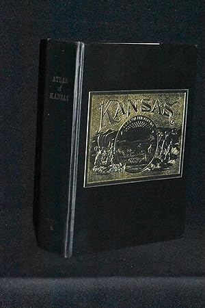
Editorial: Kansas Council of Genealogical Societies, Wellington, KS, 1982
- Tapa dura
Librería: Books by White/Walnut Valley Books, Winfield, KS, Estados Unidos de AmericaBooks by White/Walnut Valley Books
Contactar con el vendedorVendedor de 5 estrellasCondición: Usado - Muy bueno
EUR 383,55
Envío por EUR 4,16Se envía dentro de Estados Unidos de AmericaCantidad disponible: 1 disponibles
Hardcover. Condición: Near Fine. No Jacket. Reprint Edition. Kansas Council of Genealogical Societies, Wellington, KS. 1982. Hardcover. Reprint of the 1887 original. Book is tight, square, and unmarked. Book Condition: Near Fine; light bumping to three tips; light shelfwear to head. No DJ. Black cloth boards and spine with antiq…ue gold printing on the spine and large gilt Kansas emblem on the front board. Spine states Reproduction by Walsworth. 340 pp of numbered pages (plus many unnumbered pages) of maps. The introductory letter from GOV John Carlin states that is book is a step in preserving Kansas history and the maps and photographs show the state as it once looked to provide a benchmark to measure the history of Kansas. Regarding the original atlas "This massive compilation contains a vast wealth of information on Kansas at the time of publication. Many of the views depict stock ranches, which are also located on the extremely detailed maps. There are many bird's-eye views of towns and sights. Much of the accompanying text is devoted to listing the leading citizens of the state, their property, what kind of livestock they raise, and even what kind of fencing they use". This book continues these features. A clean very presentable copy. No International Shipping. No additional shipping costs for media mail. Priority shipping will require additional postage.
 Más imágenes
Idioma: Inglés
Editorial: L. H. Everts, [Philadelphia], 1875
- Tapa dura
- Primera edición
Librería: Lloyd Zimmer, Books and Maps, Chanute, KS, Estados Unidos de AmericaLloyd Zimmer, Books and Maps
Contactar con el vendedorVendedor de 5 estrellasCondición: Usado - Pobre
EUR 406,11
Envío por EUR 4,38Se envía dentro de Estados Unidos de AmericaCantidad disponible: 1 disponibles
Half Leather. Condición: Poor+. No Dust Jacket. First Edition. 200 pages, including 40 pages of 47 hand-colored lithographic maps, plus more than 100 lithographic scenes of homes, businesses, farms, etc. There are a few leaves mis-paginated, though volume has been collated and found to be complete and in proper order of pages. T…his volume appears to have been rebound at a later time, with new leather over spine and corners, as well as new marbled end leaves. However, it appears that the contents were not well bound at that time. The text block is split in two, and more than one half of the leaves are disbound. Scattered chips and wear on some leaves, as well as some scattered foxing. The folding map of Ohio shows a few small closed tears, mostly along fold lines. The map of Randolph Township (pages 129/130) shows moderate foxing, and the following leaf (pages 131/132) show a three inch tear with old tape repair. Most of the contents remain bright and very clean. Good working and/or binding copy. Graded poor because of the disbound state. Due to weight, additional charges will apply for Priority and/or International shipping.
Idioma: Inglés
Editorial: L.H. Everts, Philadelphia, 1875
- Tapa dura
Librería: Manning's Books & Prints, ABAA, Pacifica, CA, Estados Unidos de AmericaManning's Books & Prints, ABAA
Contactar con el vendedorVendedor de 3 estrellasCondición: Usado - Regular
EUR 406,11
Envío por EUR 6,13Se envía dentro de Estados Unidos de AmericaCantidad disponible: 1 disponibles
Hardcover. Condición: Fair. Collection of large very detailed maps and drawings depicting Stark County, Ohio. Many illustrations are detailed isometric scenes of individual farms teeming with activity, with shaded lines of trees, livestock , and farmers working. Also present are many bird's eye hand -colored maps showing propert…y boundaries. Center fodled partial foldout map of all of Ohio has some tears around edges, and a small 1/2 inch by 4" strip is missing from left lower margin. Hardcover boards have heavy scuffing and diffuse wear across front , and rubbing along edges. Preliminary pages and title pages have moderate age staining. Map pages have light age staining, which does impinge on but never obscures the map content. Spine reinforced with tape at exterior. L.H. Everts (ilustrador).
 Más imágenes
Idioma: Inglés
Editorial: Hunter PR, Philadelphia, 1875
- Tapa dura
- Primera edición
Librería: Brady & Co. Fine Books, Chattanooga, TN, Estados Unidos de AmericaBrady & Co. Fine Books
Contactar con el vendedorVendedor de 5 estrellasCondición: Usado - Bueno
EUR 1692,12
Envío por EUR 14,24Se envía dentro de Estados Unidos de AmericaCantidad disponible: 1 disponibles
Hardcover. Condición: Very Good. 1st Edition, Illustrated Edition. A substantial and highly detailed nineteenth century county atlas featuring extensive hand colored maps, township plans, and numerous finely executed lithographic plates depicting residences, farms, and towns throughout Warren County Ohio. Produced during the gol…den age of county atlases, this volume combines detailed cartography, local history, and subscriber based content. Large folio. All maps and plates are present and complete. Pagination and contents align with known institutional examples, and hand coloring compares favorably with preserved library copies. Example: the double-page United States map is indexed as pages 6-7 but is printed and bound as pages 3-4, consistent with known irregular pagination in institutional examples of this Everts atlas. Maps included comprise a double page map of the United States, State of Ohio, Geological and Climatological Map, Outline Map of Warren County, and detailed township maps of Franklin, Clear Creek, Wayne, Massie, Washington, Deerfield, Union, Harlan, Salem, Turtle Creek (west and east parts), and Hamilton Township, along with village and town plats of Carlisle Station, Springboro, Franklin, Lebanon, Harveysburg, Hen Peck, Blue Ball, Socialville, Corwin, Fort Ancient, Freeport, Deerfield, Butlerville, Fosters Crossing, Morrow, Waynesville, Mason, Maineville, Cozaddale, Raysville, Hammel, Mount Holly, Ridgeville, Utica, Turtle Creek village, Red Lion, West Woodville, Hopkinsville, Level Station, Osceola, Roachester, Dallasburg, New Columbia, and Middleboro. Also includes a large fold out map of Warren County measuring approximately 24.5 by 25.5 inches with original hand coloring. Numerous lithographic plates of residences and properties are present throughout, many specific to individual landowners. Impressions are strong, dark, and well preserved. 20-picture limit in Abebooks is way to few to capture the color and beauty this presents. The volume also contains extensive county history and biographical sketches. Condition: Maps retain bright original hand coloring throughout. The large Warren County fold out map has a small loss at a fold intersection approximately one half inch by one quarter inch, affecting a minor portion of Hocking County. This is a common issue for this format and does not significantly detract from overall presentation. Interior is generally clean with light, even age toning. Occasional age related foxing, marginal smudging, rare small holes and crease separation, and scattered dog ears are present, primarily confined to margins and not affecting maps or plates. Paper remains supple and not brittle. Front pastedown shows approximately 15 diagonal shallow surface scoring from utilitarian use, confined to the inside cover and not affecting maps or text. Plates are notably crisp with strong impressions. Binding shows wear to the original quarter leather with rubbing at corners and some separation along portions of the spine. Boards remain attached and the binding is sound. Fold out maps are mounted on original binders guards, supporting the structure of the text block. Condition examples highlighted in the photos. Provenance: Ownership inscription in purple ink for John P Grandin. Period blue pencil markings appear in the index and several text pages, including marks next to John P Grandin, farmer in Hamilton Township settled 1857, and Benj Buttersworth, lawyer settled 1837. These markings suggest this is likely the original subscribers copy belonging to Grandin. John P Grandin, 1825 to 1876, was a Warren County farmer and landowner whose biography appears in an 1882 county history, adding historical association to the volume. Notes: A desirable and visually striking example of a classic Ohio county atlas with strong hand coloring, complete map content, and identifiable local ownership. Presents attractively despite typical age related wear. Additional images available upon request. H.H. Lloyd and Company, NY (ilustrador).
 Más imágenes
- Tapa blanda
- Impresión bajo demanda
Librería: Forgotten Books, London, Reino UnidoForgotten Books
Contactar con el vendedorVendedor de 4 estrellasCondición: Nuevo
EUR 27,59
Gastos de envío gratisSe envía de Reino Unido a Estados Unidos de AmericaCantidad disponible: Más de 20 disponibles
Paperback. Condición: New. Print on Demand. Embark on a captivating journey through the annals of Jefferson County, New York, as this book meticulously chronicles its rich history and remarkable individuals. Delving into the county's physical attributes, the author paints a vivid picture of its geographical, geological, and topo…graphical landscape. From the glistening waters of Lake Ontario and the St. Lawrence River to the cascading rapids of Black River, the natural beauty of the region is brought to life. This historical account goes beyond mere description, exploring the intricate tapestry of human experiences that shaped the county. The narrative seamlessly weaves together accounts of early French explorers and settlers, the complexities of land titles, and the evolution of civil organization. Readers will encounter prominent figures in law, medicine, and politics, gaining insights into their contributions to the growth and prosperity of Jefferson County. Thematic depth emerges as the book delves into the impact of pivotal events such as the War of 1812 and the Civil War. The author's meticulous research sheds light on the county's role in these conflicts, showcasing the valor and resilience of its inhabitants. Through these multifaceted explorations, this book offers a profound understanding of the forces that have molded Jefferson County into the vibrant and dynamic region it is today. This book is a reproduction of an important historical work, digitally reconstructed using state-of-the-art technology to preserve the original format. In rare cases, an imperfection in the original, such as a blemish or missing page, may be replicated in the book. print-on-demand item.

- Tapa blanda
- Impresión bajo demanda
Librería: Ria Christie Collections, Uxbridge, Reino UnidoRia Christie Collections
Contactar con el vendedorVendedor de 5 estrellasCondición: Nuevo
EUR 16,30
Envío por EUR 13,91Se envía de Reino Unido a Estados Unidos de AmericaCantidad disponible: Más de 20 disponibles
Condición: New. PRINT ON DEMAND Book; New; Fast Shipping from the UK. No. book.

- Tapa dura
- Impresión bajo demanda
Librería: PBShop.store US, Wood Dale, IL, Estados Unidos de AmericaPBShop.store US
Contactar con el vendedorVendedor de 5 estrellasCondición: Nuevo
EUR 33,62
Gastos de envío gratisSe envía dentro de Estados Unidos de AmericaCantidad disponible: Más de 20 disponibles
HRD. Condición: New. New Book. Shipped from UK. THIS BOOK IS PRINTED ON DEMAND. Established seller since 2000.
Editorial: The Bookmark, 1974
- Tapa blanda
Librería: Marbus Farm Books, Winchester, VA, Estados Unidos de AmericaMarbus Farm Books
Contactar con el vendedorVendedor de 5 estrellasCondición: Usado - Bueno
EUR 103,78
Envío por EUR 4,38Se envía dentro de Estados Unidos de AmericaCantidad disponible: 1 disponibles
Paperback. Condición: Very Good. Oversize reprint. Softcover, light shelfwear to covers. Contents clean and tight. 132 pages, index, b&w illus. "This Reprint sponsored by the Trumbull County Chapter, Ohio Genealogical Society.
- Tapa blanda
- Impresión bajo demanda
Librería: THE SAINT BOOKSTORE, Southport, Reino UnidoTHE SAINT BOOKSTORE
Contactar con el vendedorVendedor de 5 estrellasCondición: Nuevo
EUR 20,89
Envío por EUR 14,29Se envía de Reino Unido a Estados Unidos de AmericaCantidad disponible: Más de 20 disponibles
Paperback / softback. Condición: New. This item is printed on demand. New copy - Usually dispatched within 5-9 working days.
Editorial: The Tuscarawas County Genealogical Society, 1980
- Tapa dura
Librería: Mark Henderson, Overland Park, KS, Estados Unidos de AmericaMark Henderson
Contactar con el vendedorVendedor de 4 estrellasCondición: Usado - Muy bueno
EUR 135,34
Envío por EUR 5,21Se envía dentro de Estados Unidos de AmericaCantidad disponible: 1 disponibles
Hardcover. Condición: Near Fine. Book.


