Descripción
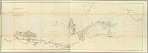
WILLIAMSON, R.S. General Map of Explorations and Surveys in California made under the direction of the Hon. Jefferson Davis, Secretary of War by Lieut. R.S. Williamson, Topogl. Engr. assisted by Lieut. J.G. Parke, Topl. Engr. and Mr. Isaac Williams Smith, Civ. Engr. 1853. Explorations and Surveys for a Rail Road Route from the Mississippi River to the Pacific Ocean. War Department. Routes in California to connect with the routes near the 32nd and 35th parallels. Engr. by Selmar Siebert. Washington: A.O.P. Nicholson, 1861. Fine folding lithographed map (25 4/8 x 76 4/8 inches) of a north/south view of California from the San Francisco Bay to San Diego, the railway line is shown extending as far east as Fort Yuma (some browning at old folds). Published in volume XI of "Reports of Explorations and Surveys, to Ascertain the Most Practicable and Economical Route for a Railroad From the Mississippi River to the Pacific Ocean, 36th Congress, 2d Session, Senate, Ex. Doc" With the peace treaty with Mexico recently signed, northern and southern borders established, and the discovery of gold in California, the United States Congress saw the need for exploration of their interior lands. There was much discussion of a super highway for travelers to safely navigate from the Mississippi River to the Pacific coastline. By an act of Congress, Secretary of War Jefferson Davis was charged to conduct surveys for the first transcontinental railroad route to the Pacific Ocean, near the 35th parallel. Five teams were sent, the Northern, Central, and coastal Pacific surveys were commissioned along with two Southern Pacific survey teams. The reports of these teams represent the first attempt at a comprehensive, systematic geographical exploration of the Western regions of America, and made possible the first reasonably accurate topographical maps of the West. Four major routes were surveyed, from a northern route terminating at the mouth of the Columbia River to a southern route running through Texas to San Diego. Graff 4435; Hill, pp. 301-302; Howes P3; Sabin 69946; Taft, pp. 4-9; Wagner-Camp 262-266a, 267:1; Wheat, Mapping the Transmississippi West IV, pp. 67-91.
N° de ref. del artículo 72map408
Contactar al vendedor
Denunciar este artículo
