
Western hemisphere eastern maps (9 resultados)

Editorial: Contentum Ltd., Larnaca, Cyprus
- Arte / Grabado / Póster
Librería: Contentum, Nicosia, ChipreContentum
Contactar con el vendedorVendedor de 5 estrellasCondición: Nuevo
EUR 17,99
Gastos de envío gratisSe envía de Chipre a Estados Unidos de AmericaCantidad disponible: Más de 20 disponibles
Loose Leaf. Condición: New. Reproduction. Original title: World map, divided into maps of the eastern and western hemisphere German: Weltkarte, unterteilt in Karten der östlichen und westlichen Hemisphäre French: Carte du monde, divisée en cartes de l'hémisphère Est et de l'hémisphère Ouest Spanish: Mapa del mundo, dividido en m…apas del hemisferio oriental y occidental High-quality fine-art reproduction based on an original work from the Rijksmuseum. Creation period: 18th century (1721). Professionally printed on premium fine-art paper (Photo Matt Fibre) in size A5. The motif is printed with a white border (museum-style presentation). No.
 Más imágenes
Editorial: Reclus
- Arte / Grabado / Póster
Librería: Artisans-lane Maps & Prints, Sidney, BC, CanadaArtisans-lane Maps & Prints
Contactar con el vendedorVendedor de 4 estrellasCondición: Usado - Bueno
EUR 12,82
Envío por EUR 16,60Se envía de Canada a Estados Unidos de AmericaCantidad disponible: 1 disponibles
no binding. Condición: very good. 2 Seperate Maps. Actual Map Image Sizes: 4 1/2 x 4 1/2 ins. Overall Size including text and borders : 10 1/2 x 7 Ins . CONDITION: This is a Intext maps with text on the back. Clear and sharp with beautiful detail. As scanned. NOTE THE FOLLOWING BEFORE YOU PURCHASE: This is a GENUINE ANTIQUE VINT…AGE 1890 MAP. It is NOT a modern reproduction, ie. a laser scan, photocopy etc. It is the original from the antique or vintage atlas or book publication. This intext map was published on the date mentioned, or circa of the date mentioned at the top of the page. The map I have for sale, like many antique vintage prints and maps that you see online, originate from an antique vintage book or atlas publication. The publication may not always be known. If you have any questions, emails are welcome.
 Más imágenes
- Mapa
Librería: RareMapsandBooks, Dover, NH, Estados Unidos de AmericaRareMapsandBooks
Contactar con el vendedorVendedor de 4 estrellasCondición: Usado - Aceptable
EUR 29,25
Envío por EUR 6,07Se envía dentro de Estados Unidos de AmericaCantidad disponible: 1 disponibles
Condición: good. Western Hemisphere - Eastern Hemisphere.(Old Maps, 19th Century Maps, World Maps, Eastern Hemisphere, Western Hemisphere, Mountains of the Moon, New Zealand, Hawaii). Issued Boston, 1853. Engraved by G. W. Boynton. Charming lot x 2 mid-19th century antique miniature hemisphere maps, engraved with original hand c…olor. Note the mythical chain across the interior of Africa called Mts. of the Moon is shown. Light uniform paper age toning otherwise clean, nice looking examples. Small miniature format. Sheets measure c. 7" x 5". Printed areas measure c. 5" x 4 1/4". Ristow, American Maps and Mapmakers, p. 271. Tooley's Dictionary of Mapmakers, vol. 1, pg. 180.[B12612].

Editorial: Samuel Augustus Mitchell - M. Bradley, Philadelphia, 1887
Librería: Certain Books, ABAA, Las Cruces, NM, Estados Unidos de AmericaCertain Books, ABAA
Contactar con el vendedorVendedor de 3 estrellasCondición: Usado - Aceptable
EUR 76,50
Envío por EUR 9,61Se envía dentro de Estados Unidos de AmericaCantidad disponible: 1 disponibles
Condición: Good. Single-sided printed map; engraved; hand-colored; depicts Highest Mountains for Each Hemisphere,Comparative Lenghths of World's Rivers, Smaller Hemispheres for the Northern Southern Hemispheres, Masses of Land and Water; 15" x 24" approximate size; adequate margins; shrink-wrapped to archival foam core for prote…ction and shipping; good condition.
 Más imágenes
Editorial: London ca. 1885, 1885
- Mapa
Librería: Garwood & Voigt, Sevenoaks, Reino UnidoGarwood & Voigt
Contactar con el vendedorVendedor de 5 estrellasCondición: Usado - Excelente
EUR 109,16
Envío por EUR 23,55Se envía de Reino Unido a Estados Unidos de AmericaCantidad disponible: 1 disponibles
Condición: Fine. 35 x 32 cm (each map). Printed in colour.
 Más imágenes
Editorial: John Thomson & Company, Edinburgh, UK, 1814
Librería: Hornseys, Ripon, Reino UnidoHornseys
Contactar con el vendedorVendedor de 5 estrellasMiembro de asociación: PBFA
Condición: Usado - Bueno
EUR 1206,85
Envío por EUR 29,44Se envía de Reino Unido a Estados Unidos de AmericaCantidad disponible: 1 disponibles
No Binding. Condición: Very Good. Four maps. Sheet sizes: 68cm x 53.8cm. From 'A New General Atlas, consisting of A Series of Geographical Designs, on Various Projections, Exhibiting the Form and Component Parts of the Globe; and A Collection of Maps and Charts, Delineating the Natural and Political Divisions of the Empires, Kin…gdoms and States of the World'. Date 1815, 1815, 1814, 1814. Crease to central fold line. Blank to the reverse. Age-toning, minor off-setting and slight foxing as usual. Original hand-colouring nice and bright. In very good, bright, clean condition. Full matching sets of these maps are rare. This is one of a number of these maps that we are currently posting. Please see our other listings or use the keyword: hornseysthomson.
 Más imágenes
Editorial: Vienna 1800, 1786
- Mapa
Librería: Robert Frew Ltd. ABA ILAB, London, Reino UnidoRobert Frew Ltd. ABA ILAB
Contactar con el vendedorVendedor de 5 estrellasCondición: Usado
EUR 727,75
Envío por EUR 11,78Se envía de Reino Unido a Estados Unidos de AmericaCantidad disponible: 1 disponibles
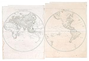
2 sheets. Overall sheet sizes 79 x 61 cm and 82 x 62 cm, both diameters 60.5 cm. Original outline colour. Twin large hemisphere maps of the world. Right margin of eastern hemisphere sheet shaved to border of map, left margin of western hemisphere sheet shaved with slight loss to border. Marginal nicks and tears to both sheets, p…aper evenly soiled. Some light staining to both sheets.
 Más imágenes
- Mapa
Librería: Antique Paper Company, ASHFORD, KENT, Reino UnidoAntique Paper Company
Contactar con el vendedorVendedor de 2 estrellasCondición: Usado
EUR 454,84
Envío por EUR 7,07Se envía de Reino Unido a Estados Unidos de AmericaCantidad disponible: 1 disponibles
1850 A pair of original antique maps EASTERN HEMISPHERE - WESTERN HEMISPHERE Drawn engraved by John Rapkin for The Illustrated Atlas and Modern History of the World by Martin Montgomery. An attractive and decorative pair of maps with stunning vignette engravings in the borders. Each map size approx 35.5cm x 28cm. Condition is ex…cellent and each with central fold as issued.
 Más imágenes
Librería: Bartele Gallery - The Netherlands, Langweer, FRL, HolandaBartele Gallery - The Netherlands
Contactar con el vendedorVendedor de 5 estrellasCondición: Usado
EUR 480,00
Envío por EUR 17,00Se envía de Holanda a Estados Unidos de AmericaCantidad disponible: 1 disponibles
Western & Eastern Hemisphere Maps ? World Double Hemisphere Engravings 1857 These beautiful antique prints show two complementary hemispheric maps titled "Westliche Halbkugel" (Western Hemisphere) and "Oestliche Halbkugel" (Eastern Hemisphere). The Western Hemisphere map presents North and South America in fine detail, including… the United States, Mexico, Central America, the Caribbean islands, and South America down to Tierra del Fuego. It also includes Polynesia across the Pacific, with labelled island groups reflecting mid-19th-century geographical knowledge. The Eastern Hemisphere map depicts Europe, Asia, Africa, and Australia with clarity, showing political boundaries as they were recognised in 1857. Notable features include detailed coastlines, major rivers and mountain ranges, the delineation of colonial territories in Africa, and the extent of Russia across Siberia. Australia is labelled with its colonial divisions, and Southeast Asia is clearly defined, reflecting European perspectives of the time. Both maps were engraved and published in 1857 in Gotha by Justus Perthes as part of Adolf Stieler's famous Hand-Atlas. Stieler's atlases were renowned for their accuracy, clarity, and elegance, used widely by scholars and travellers throughout the 19th century. Technique: Copperplate engraving with original outline hand colouring used to differentiate national boundaries and enhance readability. The engraving is finely executed with German titles and notations, and each hemisphere is presented in a clean circular projection. These maps are significant as they represent mid-19th-century cartography at its finest, capturing geopolitical realities before major events such as German unification or the Scramble for Africa reshaped borders. Condition summary: Both maps are in excellent condition with minimal age toning, no tears or repairs, and strong, crisp impressions. Colours remain fresh and paper is firm throughout. Framing tips: Frame these maps as a matching pair in identical dark wood or ebonised frames to create a powerful decorative display. Use wide ivory or cream mounts to provide a clean margin around each hemisphere. UV-protective glass is recommended to preserve colours and fine engraved detail for long-term enjoyment.


