
Hemisphere map (43 resultados)

Idioma: Inglés
Editorial: MACKENZIE & DENT, 1830
Librería: K Books Ltd ABA ILAB, York, YORKS, Reino UnidoK Books Ltd ABA ILAB
Contactar con el vendedorVendedor de 5 estrellasCondición: Usado - Bueno
EUR 24,26
Envío por EUR 22,96Se envía de Reino Unido a Estados Unidos de AmericaCantidad disponible: 1 disponibles
No Binding. Condición: Very Good. engraved map. A vg copy of an attractive decorative antique map. Scarce. A splendid circular map, showing South America and North America, with Pacific Islands and New Zealand. T Clerk (ilustrador).
WESTEN HEMISPHERE MAP, ANTIQUE MAP - an Original Antique MAP
WESTERN HEMISPHERE MAP OR THE NEW WORLD , ANIQUE MAP PRINTED IN COLOUR IN 1866
Idioma: Inglés
Librería: K Books Ltd ABA ILAB, York, YORKS, Reino UnidoK Books Ltd ABA ILAB
Contactar con el vendedorVendedor de 5 estrellasCondición: Usado - Bueno
EUR 14,55
Envío por EUR 22,96Se envía de Reino Unido a Estados Unidos de AmericaCantidad disponible: 1 disponibles
No Binding. Condición: Very Good. An original antique coloured map printed in 1866. Mounted (matted) and ready to frame. Very good condition. AN EARLY MAP , IN GOOD CONDITION, MOUNT SIZE 12 X 14 INCHES, 34 X 38 CMS THE MAP SHOWS NORTH AND SOUTH AMERICA , PACIFIC ISLANDS AND NEW ZEALAND .
Idioma: Inglés
Editorial: H.G. COLLINS, London, 1840
- Primera edición
Librería: K Books Ltd ABA ILAB, York, YORKS, Reino UnidoK Books Ltd ABA ILAB
Contactar con el vendedorVendedor de 5 estrellasCondición: Usado - Bueno
EUR 48,40
Envío por EUR 22,96Se envía de Reino Unido a Estados Unidos de AmericaCantidad disponible: 1 disponibles
Single Sheet. Condición: Very Good. No Jacket. First Edition. HEMISPHERE MAP, DOUBLE HEMISPHERE MAP OF THE WORLD SHOWING THE WESTERN AND EASTERN HEMISPHERES, CIRCA 1840 MEASURES 23 X 11 INCHES, DISPATCHED IN A STRONG TUBE, WELL PACKED, REASONABLY PRICED .
Idioma: Inglés
Librería: K Books Ltd ABA ILAB, York, YORKS, Reino UnidoK Books Ltd ABA ILAB
Contactar con el vendedorVendedor de 5 estrellasCondición: Usado - Aceptable
EUR 48,52
Envío por EUR 22,96Se envía de Reino Unido a Estados Unidos de AmericaCantidad disponible: 1 disponibles
No Binding. Condición: Slight Damage. A fine antique map - printed in 1844. Mounted (matted) and ready to frame. Engraved size approx 16 x 13 Ins, 41 x 33 Cms. Mounted size approx 19 x 16 in, 49 x 41cm. Coloured in outline, hand colouring contemporary. A fine opportunity to purchase an attractive and decorative engraved antique…map of the Western Hemisphere. Engraved By Walker (ilustrador).
Editorial: Harper & Brothers., 1875
Librería: Asia Bookroom ANZAAB/ILAB, Canberra, ACT, AustraliaAsia Bookroom ANZAAB/ILAB
Contactar con el vendedorVendedor de 5 estrellasCondición: Usado
EUR 47,25
Envío por EUR 18,57Se envía de Australia a Estados Unidos de AmericaCantidad disponible: 1 disponibles
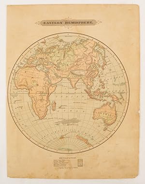
Spherical map printed in colour, 21.3 x 21.2 cm with shaded key to elevation and ocean currents, unrelated text on the verso, paper toned and margins soiled, bottom edge ragged, small sealed to to the inner margin, but in sound condition. Map showing the five continents of Asia, Africa, Antarctica, Europe, and Australia. Publish…ed by Harper & Brothers for inclusion in their "School Geography". Plateau of Tibet very prominently marked. Gobi Desert and Plateau of Mongolia also marked, India described as Hindostan, Indo-China includes Thailand.
Map Of the Eastern Hemisphere - Spherical Map - Fine Detailed Map - an Original Engraving
MAP OF THE EASTERN HEMISPHERE - an Antique Original Hand Coloured Engraving
Idioma: Inglés
Librería: K Books Ltd ABA ILAB, York, YORKS, Reino UnidoK Books Ltd ABA ILAB
Contactar con el vendedorVendedor de 5 estrellasCondición: Usado - Bueno
EUR 54,58
Envío por EUR 22,96Se envía de Reino Unido a Estados Unidos de AmericaCantidad disponible: 1 disponibles
No Binding. Condición: Very Good. A fine engraving - printed circa 1860. Mounted and ready to frame. Hand colouring not contemporary, but delicately and expertly executed. A fine opportunity to purchase an attractive and decorative engraving - Map Of the Eastern Hemisphere - Spherical Map.
Double Hemisphere Map - Antique Hand Coloured .
Double Hemisphere Map. An Original Antique Hand Cioloured Map.
Idioma: Inglés
Librería: K Books Ltd ABA ILAB, York, YORKS, Reino UnidoK Books Ltd ABA ILAB
Contactar con el vendedorVendedor de 5 estrellasCondición: Usado - Bueno
EUR 54,58
Envío por EUR 22,96Se envía de Reino Unido a Estados Unidos de AmericaCantidad disponible: 1 disponibles
No Binding. Condición: Very Good. A splendid original antique hand coloured map . Mounted (matted) and ready to frame . Very good condition . Hand colouring - not contemporary but delicately and expertly executed . Shows a double hemisphere world map - attractive.
Idioma: Inglés
Librería: K Books Ltd ABA ILAB, York, YORKS, Reino UnidoK Books Ltd ABA ILAB
Contactar con el vendedorVendedor de 5 estrellasCondición: Usado - Bueno
EUR 60,65
Envío por EUR 22,96Se envía de Reino Unido a Estados Unidos de AmericaCantidad disponible: 1 disponibles
No Binding. Condición: Very Good. A fine antique map - printed in 1844. Mounted (matted) and ready to frame. Engraved size approx 16 x 13 Ins, 41 x 33 Cms. Mounted size approx 19 x 16 in, 49 x 41cm. Coloured in outline, hand colouring contemporary. A fine opportunity to purchase an attractive and decorative engraved antique map…of the Eastern Hemisphere. Engraved By Walker (ilustrador).

Editorial: Samuel Augustus Mitchell - M. Bradley, Philadelphia, 1887
Librería: Certain Books, ABAA, Las Cruces, NM, Estados Unidos de AmericaCertain Books, ABAA
Contactar con el vendedorVendedor de 3 estrellasCondición: Usado - Aceptable
EUR 76,50
Envío por EUR 9,61Se envía dentro de Estados Unidos de AmericaCantidad disponible: 1 disponibles
Condición: Good. Single-sided printed map; engraved; hand-colored; depicts Highest Mountains for Each Hemisphere,Comparative Lenghths of World's Rivers, Smaller Hemispheres for the Northern Southern Hemispheres, Masses of Land and Water; 15" x 24" approximate size; adequate margins; shrink-wrapped to archival foam core for prote…ction and shipping; good condition.
Editorial: Mitchell
- Mapa
Librería: Main Street Fine Books & Mss, ABAA, Galena, IL, Estados Unidos de AmericaMain Street Fine Books & Mss, ABAA
Contactar con el vendedorVendedor de 5 estrellasCondición: Usado
EUR 112,50
Envío por EUR 5,24Se envía dentro de Estados Unidos de AmericaCantidad disponible: 1 disponibles
Two maps published by Mitchell, 1880. Both measuring 12" X 15" (images 10" X 14"). Hand colored. Decorative borders. Near fine.

- Tapa blanda
- Mapa
Librería: Geographicus Rare Antique Maps, Brooklyn, NY, Estados Unidos de AmericaGeographicus Rare Antique Maps
Contactar con el vendedorVendedor de 4 estrellasCondición: Usado
EUR 251,99
Envío por EUR 14,85Se envía dentro de Estados Unidos de AmericaCantidad disponible: 1 disponibles
Soft cover. Very good. Exhibits light wear along original fold lines. Size 31.25 x 31.5 Inches. This is a 1945 LIFE Magazine map of the Eastern Hemisphere highlighting Russian naval history and Soviet naval capability. This map was published only months after the end of World War II (1939 - 1945) as relations between the Western… Allies and the Soviet Union were rapidly deteriorating. Red stars with anchors mark Soviet naval bases, each of which is labeled. Two potential Soviet naval bases in Libya and Eritrea, are labeled as well. A dashed line along the coast of Siberia traces the Northeast Passage, a key transportation route during World War II. Russian Naval History Text boxes reference four historic naval battles: The Battle of Hango in 1714, the Battle of Chesme in 1770, the Battle of Sinope in 1853, and the Battle of Tsushima Strait in 1905. The Battle of Hango was the first major naval victory in the history of the Russian navy. The Battle of Chesme was a major Russian victory during the Russo-Tukish War (1768 - 1774) and was the greatest naval defeat of the Ottomans since the 1571 Battle of Lepanto. The Battle of Sinope was a precursor to the Crimean War (1854 - 1856) and was another major naval victory for the Russians over the Ottomans. The last of these four battles, the 1905 Battle of Tsushima Strait, has been deemed one of the most important naval engagements in world history, where a major power, the Imperial Russian Navy, was defeated by the 'upstart' Japanese. Publication History and Census This map is an enlargement of a map that was created for LIFE Magazine. A smaller version of the map was published in the December 17, 1945 issue of LIFE Magazine .

Mappemonde dressee et grave specialement pour le Petit Journal d'apres les documents le plus recents.
1897 Le Petit Journal Double Hemisphere Wall Map w/ World's Ethnicities
- Tapa blanda
- Mapa
Librería: Geographicus Rare Antique Maps, Brooklyn, NY, Estados Unidos de AmericaGeographicus Rare Antique Maps
Contactar con el vendedorVendedor de 4 estrellasCondición: Usado
EUR 1411,15
Envío por EUR 14,85Se envía dentro de Estados Unidos de AmericaCantidad disponible: 1 disponibles
Soft cover. Good. Laid down on fresh linen. Some soiling and cracking. Size 37 x 43 Inches. A superb c. 1897 wall map of the world in two hemispheres printed by Emil Charaire for Le Petit Journal , the largest newspaper in the world at the time. Among other interesting features, the map is surrounded by figures in ethnic dress r…epresenting the peoples of the world. A Closer Look The world is displayed in a double hemispheric projection, with countries and colonies color-shaded. Cities, major waterways, railways, shipping routes (and times) between major ports, and other features are noted throughout. Vignettes surround the map, depicting views ( paysages ) of the Saint Lawrence River, the Lake of Geneva, a scene involving an elephant and stupa in Indochina, a village in New Caledonia, the Sphinx and pyramids in Egypt, and the Pampas in South America. At the top and bottom, 84 figures represent the peoples of the world, with distinctive ethnic dress. Publication History and Census This sheet was prepared as a supplement to Le Petit Journal . The double hemisphere map was drawn and designed by the Imprimerie de F. Menetrier, while the entire sheet was printed by the Imprimerie Emile Charaire. It is undated, but the map is referenced in a November 1897 issue of Le Petit Journal , meant to be an enlargement and embellishment of a map that had appeared in the paper earlier that year. Other features, such as the configuration of European colonies in Africa and Asia, a reference to the 1895 North Polar Explorations of Nansen, and the completion of the Trans-Siberian Railway (including the planned though not yet constructed Circum-Baikal Railway), support a date in the late 1890s. Despite the wide circulation of Le Petit Journal at the time, this wall map is now quite scarce, with examples noted in the OCLC at the National Library of Australia and Biblioteca Nacional de Chile, while an example is also held by the David Rumsey Historical Map Collection, which dates it to 1880. References: OCLC 222149509, 662516247. Rumsey 10477.000.

- Tapa dura
- Mapa
Librería: Geographicus Rare Antique Maps, Brooklyn, NY, Estados Unidos de AmericaGeographicus Rare Antique Maps
Contactar con el vendedorVendedor de 4 estrellasCondición: Usado
EUR 1511,94
Envío por EUR 14,85Se envía dentro de Estados Unidos de AmericaCantidad disponible: 1 disponibles
Hardcover. Good. Folds into original yellow paper boards. Some wear on old fold lines. Size 19.75 x 22.25 Inches. This is a rare 1879 or Meiji 12 Japanese map of the Western Hemisphere. It reflects the growing familiarity of Japanese cartographers with the geography of distant lands and the influence of foreign cartography in Ja…pan in the early Meiji period. A Detailed Look at the Map The map's title indicates that it was based on a foreign-language map (or maps) of the Americas, most likely in German or English, given the countries with the strongest influence in Japan at the time. It depicts both North and South America on a hemispherical projection and includes parts of Antarctica, New Zealand, Greenland, and Siberia. Most of the individual U.S. states and territories are labeled and color-coded based upon a configuration prevalent in the early 1860s - giving us some clues as to the source map. The large Nebraska Territory extends north as far as Canada and dominates the central plains. The unincorporated Dacotah territory also appears west of Minnesota. Colorado is present, and Oregon and Washington extend eastward as far as the Rocky Mountains. However, the creators must have had access to more recent maps because most of the subsequent territories are named within the boundaries of the territories as shaded here (such as Montana ???, Wyoming ???, and Nevada ???, though not Idaho). The Rocky Mountains, the Andes, and other mountain ranges are shaded green. An inset of the New England states appears in the upper left. Some anachronisms are included, such as the Yucatan Republic and the naming of the Hawaiian Islands as the Sandwich Islands. On the other hand, the mapping of Antarctica is quite up-to-date. Historical Context - An Explanation of Rarity Commodore Matthew C. Perry arrived in Edo Harbor on July 8, 1853, intimidating the struggling Tokugawa Shogunate to open Japan to foreign trade after 214 years of self-imposed isolation. Fifteen years later, the Tokugawa were toppled by revolutionary forces loyal to the Emperor in Kyoto. Though initially promising to expel foreigners and foreign influences, the revolutionaries understood that Japan's best hope was to learn from and imitate foreign powers, and vastly expanded modernization projects were undertaken in the last years of the Tokugawa. One priority was the importation of foreign knowledge, including cartographic practices and geographic knowledge. This piece represents Japan's growing interest in foreign geography and the availability of foreign knowledge in translation in the early Meiji period. Publication History and Census This map was drawn in Aichi Prefecture by Kito? Do?kyo? (????) and published on June 15, 1879 (Meiji 12) by Ozawa Kichisaburo (?????). The original foreign map it is based on was translated by Asano Meid? (????), and the final product was reviewed (??) by Yoshikawa Takaharu (????). Interestingly, the map's creators are divided into gentlemen (??) and commoners (??); although the formal social classes of the Tokugawa era had been abolished, this distinction reveals the remnants of social hierarchy and uncertainty around the new social landscape of the Meiji era. We are aware of a partner map, illustrating the Eastern Hemisphere, held at the East Asian Library, University of California. Of this Western Hemisphere map, only three other examples are known in institutional collections: one at the National Diet Library, one at the Huntington Library, and a third at the East Asian Library, U.C. Berkeley. Rare. References: OCLC 1280533894, UC-Berkeley Japanese Historical Maps Collection from the C. V. Starr East Asian Library Record No. 56105.

- Mapa
Librería: Geographicus Rare Antique Maps, Brooklyn, NY, Estados Unidos de AmericaGeographicus Rare Antique Maps
Contactar con el vendedorVendedor de 4 estrellasCondición: Usado
EUR 151,19
Envío por EUR 14,85Se envía dentro de Estados Unidos de AmericaCantidad disponible: 1 disponibles
Very good. Blank on verso. Minor stains. Size 12 x 10 Inches. A rare example of Colton's 1858 map of the eastern Hemisphere. Depicts Asia, europe, Africa and Australia. Although major cities are labeled, political distinctions are not. Shows major cities, rivers, mountains, capes, oceans and ocean currents. Offers a fascinating…snapshot of the world during a period of rapid globalization and discovery. This beautiful hand colored map is a copper plate engraving, featuring a delicate floral style border only used by Colton in this particular atlas. Dated and copyrighted to J. H. Colton, 1859, this map is by G. Woolworth Colton and the text is by Richard Swainson Fisher. Published from Colton's 172 William Street Office in New York City an issued as part of the1859 edition of Colton's Illustrated Cabinet Atlas and Descriptive Geography . References: Rumsey 1690.010.

- Mapa
Librería: Geographicus Rare Antique Maps, Brooklyn, NY, Estados Unidos de AmericaGeographicus Rare Antique Maps
Contactar con el vendedorVendedor de 4 estrellasCondición: Usado
EUR 151,19
Envío por EUR 14,85Se envía dentro de Estados Unidos de AmericaCantidad disponible: 1 disponibles
Very good condition. Size 11 x 11 Inches. This attractive hand colored map depicts the Eastern Hemisphere including Africa, Europe, Asia and Australia. Printed in 1844 by well known map publisher C. Flemming.

- Mapa
Librería: Geographicus Rare Antique Maps, Brooklyn, NY, Estados Unidos de AmericaGeographicus Rare Antique Maps
Contactar con el vendedorVendedor de 4 estrellasCondición: Usado
EUR 191,51
Envío por EUR 14,85Se envía dentro de Estados Unidos de AmericaCantidad disponible: 1 disponibles
Very good condition. Blank on verso. Size 11 x 11 Inches. This attractive hand colored map depicts the Western Hemisphere including North America and South America. Printed in 1844 by well known map publisher C. Flemming. Fine or perfect condition. All text in German.

- Mapa
Librería: Geographicus Rare Antique Maps, Brooklyn, NY, Estados Unidos de AmericaGeographicus Rare Antique Maps
Contactar con el vendedorVendedor de 4 estrellasCondición: Usado
EUR 191,51
Envío por EUR 14,85Se envía dentro de Estados Unidos de AmericaCantidad disponible: 1 disponibles
Very good. Light foxing here and there. Scratch that does not penetrate paper in South America - not easily seen. Size 11 x 10 Inches. This rare hand colored map is a copper plate engraving, dating to 1858 by the well known 19th century American Mapmaker Colton. It is a representation of the Western Hemisphere, including North a…nd South America. Oceanic features such as the Sargasso Sea This map is from the rare transitional Colton's Cabinet Atlas. This rare map indicates products by region, temperature, and general elevation. The California Gold region is clearly noted. Map is dated 1858.

- Mapa
Librería: Geographicus Rare Antique Maps, Brooklyn, NY, Estados Unidos de AmericaGeographicus Rare Antique Maps
Contactar con el vendedorVendedor de 4 estrellasCondición: Usado
EUR 201,59
Envío por EUR 14,85Se envía dentro de Estados Unidos de AmericaCantidad disponible: 1 disponibles
Very good. Even overall toning. Light foxing. Blank on verso. Size 15.5 x 14 Inches. This is an 1857 J. H. Colton map of the Western Hemisphere. Offering a fascinating snapshot of the world during a period of rapid globalization and discovery, this map depicts North America, South America and most of Polynesia. Antarctica is onl…y tenuously illustrated, reflecting the primitive state of exploration in the region. This map also identifies various cities, towns, rivers, rapids, mountain passes and an assortment of additional topographical details. Map is hand colored in pink, green, yellow and blue pastels to define national and regional boundaries. The whole is surrounded by Colton's typical spiral motif border. Dated and copyrighted to J. H. Colton, 1855. Published from Colton's 172 William Street Office in New York City. Issued as page no. X in volume 2 of Colton's 1857 Atlas of the World. References: Rumsey 0149.007 (1856 edition). Phillips (Atlases) 816.

- Primera edición
- Mapa
Librería: Geographicus Rare Antique Maps, Brooklyn, NY, Estados Unidos de AmericaGeographicus Rare Antique Maps
Contactar con el vendedorVendedor de 4 estrellasCondición: Usado
EUR 201,59
Envío por EUR 14,85Se envía dentro de Estados Unidos de AmericaCantidad disponible: 1 disponibles
1st Edition. Very good. Original platemark visible. Minor spotting at places. Blank on verso. Size 9.5 x 8.5 Inches. This is a fine 1835 map of the western hemisphere by the important American mapmaker T. G. Bradford. It covers North America, South America, West Indies and most of Polynesia including New Zealand and offers a fas…cinating snapshot of the world during a period of rapid globalization and discovery. Important cities, rivers, islands and mountains, along with other topographical features are noted throughout. The Antarctic continent, first sighted in 1820, but neglected during the first half of the 19th century, does not appear on the map. The map was published as plate no. 140 in Thomas G. Bradford's 1835 Comprehensive Atlas Geographical, Historical and Commercial . Bradford's atlas, published in 1835 was an important work on many levels. First, it was one of the first American atlases to follow an encyclopedic format, offering readers extensive geographical and statistical tables to supplement the maps themselves. Second, it was published in Boston and influenced the city's rise as a publishing center later in the 19th century (at the time most publishing in the United States was restricted to New York and Philadelphia). Third, this atlas was the first to contain a separate and specific map showing the Republic of Texas. Fourth and finally, Bradford's atlas in some instances broke the Euro-centric mold regarding atlas production. Among other things, Bradford focused his atlas on the Americas and abandoned the classical decoration common in European atlases in favor of a more informational and inherently American approach. Bradford published this atlas in several editions and with various partners. The first edition was published by William D. Ticktor and did not contain the iconic Republic of Texas map (although we have in fact seen Ticktor examples with a Texas map, suggesting, against conventional wisdom, that there may have been two Ticktor editions). The second official edition, published in the same year by the American Stationers Company, was the first to contain the Republic of Texas map, which is based on Austin's map, with two pages of descriptive text. A third edition was issued in 1836, also by American Stationers (though still dated 1835), and contained an unaltered Republic of Texas map with only a single page of descriptive text. A fourth edition appeared later, possibly 1837, and included an updated and revised map of Texas that replaces the old Mexican land grants with new inchoate counties. The maps from this atlas are an important addition to any collection focusing on early American cartography and Republic of Texas cartography. All maps in this atlas, though not specifically noted as such, were most likely engraved by G. W. Boynton of Boston, who also engraved most of the maps for Bradford's later publication. References: Rumsey 2643.150 (1838 edition).

- Mapa
Librería: Geographicus Rare Antique Maps, Brooklyn, NY, Estados Unidos de AmericaGeographicus Rare Antique Maps
Contactar con el vendedorVendedor de 4 estrellasCondición: Usado
EUR 201,59
Envío por EUR 14,85Se envía dentro de Estados Unidos de AmericaCantidad disponible: 1 disponibles
Very good. Some minor discoloration in lower left quadrant, near Falklands. Erased pencil marks to margins. Size 10 x 9 Inches. This is Finley's desirable 1827 map of the Western Hemisphere. Includes North America, South America and most of Polynesia. Identifies rivers, mountain rangers, lakes, and major cities. Color coded acco…rding to continent. Includes New Zealand and parts of Siberia. Engraved by Young and Delleker for the 1827 edition of Anthony Finley's General Atlas . References: Rumsey 0285.001 (1831 edition). Phillips (Atlases) 4314, 760, 752, 6045.

- Mapa
Librería: Geographicus Rare Antique Maps, Brooklyn, NY, Estados Unidos de AmericaGeographicus Rare Antique Maps
Contactar con el vendedorVendedor de 4 estrellasCondición: Usado
EUR 251,99
Envío por EUR 14,85Se envía dentro de Estados Unidos de AmericaCantidad disponible: 1 disponibles
Good. Wear along original centerfold. Verso repairs to centerfold separations. Size 14.25 x 13.75 Inches. This is a beautifully colored 1831 Henry Teesdale / John Dower map of the Western Hemisphere published in their A New General Atlas of the World . The map predates the Mexican-American War, thus the United States does not in…clude the modern-day American Southwest or Texas. A Closer Look North, Central, and South America immediately draw the viewer's attention. Cities are identified, including Quebec, Montreal, New York, Boston, Charleston, New Orleans, Veracruz, Havana, Caracas, Montevideo, Buenos Aires, Rio de Janeiro, and Valparaiso. Bays, capes, and other coastal features are labeled throughout. Islands are illustrated across the Pacific, such as Christmas Island and Owhyhee (Hawaii). Karakakooa Bay is marked as the site of Captain Cook's death on February 14, 1779. Lines trace Cook's voyages in the Atlantic and Pacific, with specific dates noted at a handful of positions. Publication History and Census Although not indicated on the sheet, this map was engraved by John Dower as the second plate in the 1831 edition of A New General Atlas of the World , published by Henry Teesdale. This appears to be a rare presentation of this map, as most examples from any edition of the atlas do not show such vivid and full color, only hand-colored outlines of territories. The 1831 edition of this map is independently cataloged in OCLC as being part of the holdings at the University of Chicago, the University of Texas at Arlington, the University of California Los Angeles, the Anchorage Museum, the University of Oxford, the National Library of New Zealand, and the National Library of Australia. The entire atlas is held by roughly one dozen institutions. References: OCLC 43222767.

- Mapa
Librería: Geographicus Rare Antique Maps, Brooklyn, NY, Estados Unidos de AmericaGeographicus Rare Antique Maps
Contactar con el vendedorVendedor de 4 estrellasCondición: Usado
EUR 251,99
Envío por EUR 14,85Se envía dentro de Estados Unidos de AmericaCantidad disponible: 1 disponibles
Very good. Light foxing. Blank on verso. Size 11.5 x 11 Inches. This is a c. 1782 map of the Western Hemisphere by an unknown cartographer. Based on the geography, our best guess is that this map was published in 1782, just prior to the publication of Cook's maps. The entirety of the Western Hemisphere, including North and South… America, Greenland, and numerous islands in the South Pacific, as well as New Zealand, the extreme western tip of Siberia, and the Cape Verde and Azores Island, are illustrated. Included are several locations in the United States, including Boston, New York, Long Island, and Philadelphia. It also depicts the fabled 'River of the West' flowing toward the Pacific Ocean from Lake Winnipeg (L. Winipeg). Explorers hoped that this river existed, which would make the journey across the North American continent by river possible. Such a route would be invaluable in transporting goods across the continent and, ultimately, to the rich markets of Asia. Unfortunately, mother nature put several mountain rangers in the way. Other rivers are depicted on the map, including the Mississippi and Amazon. Based on the geography, our best guess is that this map was published in 1782, just prior to the publication of Cook's maps.

Amerique Historique, Physique et Politique Actuelle.
1835 Las Cases (Lesage) and Renouard Map of the Western Hemisphere
- Mapa
Librería: Geographicus Rare Antique Maps, Brooklyn, NY, Estados Unidos de AmericaGeographicus Rare Antique Maps
Contactar con el vendedorVendedor de 4 estrellasCondición: Usado
EUR 302,39
Envío por EUR 14,85Se envía dentro de Estados Unidos de AmericaCantidad disponible: 1 disponibles
Very good. Even overall toning. Verso repair to centerfold separation. Minor closed margin tears professionally repaired on verso. Blank on verso. Size 19.75 x 26 Inches. This is a c. 1835 Emmanuel, Comte de Las Cases and Paul Renouard map of the Western Hemisphere. The map depicts the entirety of North, Central, and South Ameri…ca, along with the Caribbean Sea and part of the Pacific and Atlantic Oceans. The discovery, conquest, and exploration of the Americas is highlighted , beginning with Christopher Columbus's transatlantic voyage in 1492 when he landed on Hispaniola. Fernando Cortez's march through Mexico and subsequent conquest of the Aztecs is also illustrated and highlighted in yellow, traveling from Cuba to Mexico City. Pizarro's conquest of the Inca Empire in Peru is also traced. One expedition after the Age of Conquest is illustrated as well, Lewis and Clark's harrowing expedition through the Louisiana Territory to Washington, where the settlement at Astoria is labeled. Each country is labeled and includes the number of inhabitants and the number of square miles of territory it controls in most cases. Cities and towns are labeled as well throughout the hemisphere. Captions inform the viewer of facts throughout the hemisphere as well, such as the fact that the Amazon was still pretty much unknown territory and that the Mississippi is the second longest river in the world. Text frames the map on nearly three sides, containing information about the hemisphere in general and about the expeditions of Columbus, Cortez, and Pizarro, along with a paragraph concerning the American Revolutionary War. A table of information about most of the countries in the hemisphere is also included and situated on the lower left. This map was drawn by Emmanuel, Comte de Las Cases, engraved by Alexandre Moisy and the lettering was engraved by Bénard. It was published by Paul Renouard in Las Cases' Atlas historique c. 1835. References: OCLC 733693992.

- Mapa
Librería: Geographicus Rare Antique Maps, Brooklyn, NY, Estados Unidos de AmericaGeographicus Rare Antique Maps
Contactar con el vendedorVendedor de 4 estrellasCondición: Usado
EUR 352,79
Envío por EUR 14,85Se envía dentro de Estados Unidos de AmericaCantidad disponible: 1 disponibles
Very good. Light offsetting. Size 20.75 x 20 Inches. A hand-colored 1815 map of the Western Hemisphere by John Thomson, which appeared in his New General Atlas . It is notable for tracing the routes of late 18th century explorers, including Cook, Vancouver, and La Perouse, that first gave shape, however inchoate, to the shores o…f northwestern America, Hawaii, New Zealand, and other Pacific coasts on European maps. A Closer Look Coverage includes North America and South America, or the Western Hemisphere, with cities, administrative divisions (including most U.S. states), rivers, mountains, and other features indicated. The approximate locations of some indigenous groups are labeled in the Americas. Significant attention is devoted to the Pacific Ocean to highlight the great voyages of exploration of the late 18th century, with the routes of Cook, Vancouver, La Perouse, and others traced, including the overland exploration of Mackenzie. The names of many islands in the Pacific here later took on different spellings (Oahu instead of 'Woahoo,' Tahiti instead of 'Otaheite') or different names altogether in Western languages. Publication History and Census This map was prepared by John Thomson and engraved by Samuel Neele for Thomson's New General Atlas , 1817. Examples of the map display different pagination (or none at all) and other details depending on the printing. Thomson's maps are known for their stunning color, awe-inspiring size, and magnificent detail, resulting here in one of the finest maps of the Western Hemisphere to appear in the 19th century. References: Rumsey 1007.006.

Chart of Knowledge United States / Chart of Knowledge Western Hemisphere
1931 Bocholtz Chart of Knowledge Map of North America and Western Hemisphere
- Mapa
Librería: Geographicus Rare Antique Maps, Brooklyn, NY, Estados Unidos de AmericaGeographicus Rare Antique Maps
Contactar con el vendedorVendedor de 4 estrellasCondición: Usado
EUR 403,18
Envío por EUR 14,85Se envía dentro de Estados Unidos de AmericaCantidad disponible: 1 disponibles
Very good. Light wear. Western Hemisphere map on verso. Size 10.25 x 10.25 Inches. This is a rare 1931 double-sided S. G. Bocholtz and Chart of Knowledge spinning wheel map of the United States and the Western Hemisphere. The map of the United States depicts from Alaska and the Arctic Ocean to northern South America and from the… Pacific Ocean to the Atlantic Ocean. All 48 states in the continental United States are labeled, some of which are abbreviated. Each state is shaded a different color, allowing for easy identification. The names of the states are also present along the edge of the disk. As the central disk spins, information about each of the states appears in the windows cut into the disk. The information provided about each state includes the state's rank in population, when it became a state, the population of the state, the state capital and its population as well as the state's principal city and its population, the principal mining and manufacturing products produced in the state, the population per square mile and the principal agricultural products produced in the state. A blimp in the upper portion of the map bears the title Chart of Knowledge . A plane and a ship are also illustrated. On the verso, a map depicting the Western Hemisphere is present. This map depicts from North and South America across the Atlantic Ocean to Europe and Africa, although no locations in either Europe or Africa are labeled. In the Western Hemisphere, nearly all of the countries are labeled, although most of the Lesser Antilles are not illustrated, as their location is take up by one of the informational windows. In the larger countries (which appears to be the majority, with the exception of some of the Caribbean islands and Central American nations), capitals and other major cities are labeled, including Ottawa, New York, Los Angeles, San Francisco, Seattle, Quito, Mexico City, Santiago, Lima, and Bogota. Here, the countries of North America, South America, Central America, and the West Indies ring the central disk. Information provided by the windows includes the year discovered or settled, the principal agricultural, mining, and manufacturing products, who discovered the country, its population, capital, area in square miles, and principal sea port. The countries of the Lesser Antilles which are not illustrated to appear in the outer ring. The blimp, plane, and ship illustrated on the United States map appear here as well and are accompanied by a sailing ship, the Santa Maria, possibly the one used by Christopher Columbus when he discovered the New World. This map was produced by The Chart of Knowledge Company and S. G. Bocholtz in 1931.

- Primera edición
- Mapa
Librería: Geographicus Rare Antique Maps, Brooklyn, NY, Estados Unidos de AmericaGeographicus Rare Antique Maps
Contactar con el vendedorVendedor de 4 estrellasCondición: Usado
EUR 403,18
Envío por EUR 14,85Se envía dentro de Estados Unidos de AmericaCantidad disponible: 1 disponibles
1st Edition. Very good. Minor foxing. Original platemark visible. Size 13 x 12 Inches. This is a beautiful first edition 1834 David Burr map of the Eastern Hemisphere. It covers the entirety of Asia, Africa and Europe as well as Australia and the East Indies and much of the Pacific. Important cities, rivers, islands and mountain…s, along with other topographical features are noted. Although 'New Holland' officially changed its name to Australia in 1824, it is here referred to by its older Dutch name, a term that would fall out of favor shortly after this map was printed. The interior however, is entirely unexplored. In Africa, the source of the White Nile is set in the speculative Mountains of the Moon. The interiors of Africa and Asia here follow archaic geographical conventions - giving evidence to the general lack of knowledge about these regions in the early 19th century. The Great Wall of China is noted, but not identified. According to Ristow, although Burr is credited on the title page, he left this atlas incomplete. He was appointed as topographer to the U.S. Post Office, and of the sixty-three maps finally included in this atlas, only completed eight. The rest of the maps were then completed by Illman and Pilbrow in Burr's style. The map was 'Entered according to act of Congress in the year 1834 by Illman & Pilbrow in the Clerk's office of the District Court for the Southern District of New York', but not published until the atlas was released in 1835. Engraved and Printed by Illman & Pilbrow and published by D. S. Stone in Burr's New Universal Atlas . References: Rumsey 4628.001. Philips (Atlases) 771.

- Primera edición
- Mapa
Librería: Geographicus Rare Antique Maps, Brooklyn, NY, Estados Unidos de AmericaGeographicus Rare Antique Maps
Contactar con el vendedorVendedor de 4 estrellasCondición: Usado
EUR 453,58
Envío por EUR 14,85Se envía dentro de Estados Unidos de AmericaCantidad disponible: 1 disponibles
1st Edition. Very good. Minor foxing. Original platemark visible. Size 12.5 x 11 Inches. This is an attractive first edition 1835 David Burr map of the Western Hemisphere By David Burr. It covers North America, South America, West Indies and most of Polynesia including New Zealand and offers a fascinating snapshot of the world d…uring a period of rapid globalization and discovery. Important cities, rivers, islands and mountains, along with other topographical features are noted throughout. The Antarctic continent, first sighted in 1820, but neglected during the first half of the 19th century, does not appear on the map. According to Ristow, although Burr is credited on the title page, he left this atlas incomplete. He was appointed as topographer to the U.S. Post Office, and of the sixty-three maps finally included in this atlas, only completed eight. The rest of the maps were then completed by Illman and Pilbrow in Burr's style. The map was 'Entered according to act of Congress in the year 1833 by Illman & Pilbrow in the Clerk's office of the District Court for the Southern District of New York'. Published by D. S. Stone in Burr's New Universal Atlas . References: Rumsey 4628.002. Philips (Atlases) 771.

- Mapa
Librería: Geographicus Rare Antique Maps, Brooklyn, NY, Estados Unidos de AmericaGeographicus Rare Antique Maps
Contactar con el vendedorVendedor de 4 estrellasCondición: Usado
EUR 503,98
Envío por EUR 14,85Se envía dentro de Estados Unidos de AmericaCantidad disponible: 1 disponibles
Good. Offsetting. Light soiling. Size 25 x 21 Inches. A lovely 1816 offset polar projection map of the Northern Hemisphere that appeared in Edinburgh cartographer John Thomson's New General Atlas . A Closer Look Focusing on the Northern Hemisphere but extending southwards past the Tropic of Capricorn, coverage includes all of No…rth America, Europe, and Asia as well as much of Africa and South America. The perspective adopted is distinctive, being centered on 'the horizon of the plane of London' rather than the North Pole or the Equator. Impressive detail encompasses both political and geographic features. International borders are not illustrated, while paths trace divisions between geographic areas, the course of caravan routes through the Sahara Desert, the voyages of Captain James Cook, and the supposed course of unexplored rivers. In Africa, the mythical Mountains of Kong extend eastward to join with the Mountains of the Moon - the semi-apocryphal source of the Nile. The geography exhibits a general lack of information regarding the Arctic and connects Greenland with the mainland of North America, seemingly leaving open the possibility of a Northeast, though not a Northwest, Passage. Publication History and Census This map was prepared by George Buchanan and engraved by John and George Menzies in 1816 for inclusion in John Thomson's New General Atlas , which went through multiple printings in Edinburgh, London, and Dublin between 1815 and 1817. Examples of the map display different pagination (or none at all, as here) and other details depending on the printing. References: Rumsey 1007.007.

- Mapa
Librería: Geographicus Rare Antique Maps, Brooklyn, NY, Estados Unidos de AmericaGeographicus Rare Antique Maps
Contactar con el vendedorVendedor de 4 estrellasCondición: Usado
EUR 503,98
Envío por EUR 14,85Se envía dentro de Estados Unidos de AmericaCantidad disponible: 1 disponibles
Very good. Verso repairs to fold separations an at fold intersections. Exhibits some wear and toning along original fold lines. Closed margin tear professionally repaired on verso. Blank on verso. Size 40.5 x 34.5 Inches. This is a 1943 Robert M. Chapin, Jr. map of the Northern Hemisphere and its great circle aviation routes. Re…d lines highlight eleven great circle routes from New York to points across the hemisphere, including London, Rome, Tokyo, Moscow, Calcutta, Fairbanks, and Honolulu. Each route's distance from New York appears in miles and silhouettes of the iconic DC-3 / C-47 mark each city. What are Great Circle Routes? Great circle routes are the shortest distance between two points on the surface of a sphere. On this map, Chapin illustrates how these routes all 'go over the top of the world' and may include flying over several different countries depending on the destination. Why Talk About This Now? Aren't We Fighting a World War? Considering when this map was published, in mid-February 1943, this discussion of air routes comes from two different perspectives The first is directly related to the war effort, when the United States was undertaking the logistical marvel of sending supplies around the world by air. Never before had worldwide air routes been pioneered as quickly as air supply routes during 1942 and into 1943. Both military and civilian transport aircraft flew these routes and provided essential supplies and personnel to military bases worldwide. The second reason was foresight. The U.S. spent billions of dollars building air bases and the supporting infrastructure (hangers, weather reporting stations, radio stations, etc.) worldwide. Six months after the war ended (and everyone knew the war would end eventually) those bases would all revert to the nation where they had been built. Pilots, and others involved in aviation, began pushing global aviation standards in 1943. Publication History and Census This map is a separately issued enlargement of a map drawn by Robert M. Chapin, Jr. for publication in the February 15, 1943 issue of TIME . An example is cataloged in OCLC and is part of the institutional collection at Franklin and Marshall College. References: OCLC 947055114.

- Mapa
Librería: Geographicus Rare Antique Maps, Brooklyn, NY, Estados Unidos de AmericaGeographicus Rare Antique Maps
Contactar con el vendedorVendedor de 4 estrellasCondición: Usado
EUR 503,98
Envío por EUR 14,85Se envía dentro de Estados Unidos de AmericaCantidad disponible: 1 disponibles
Very good condition. Minor discoloration along original centerfold. Minor dampstaining in lower margins. Blank on verso. Size 22 x 20 Inches. A rare and important 1818 map of the Eastern Hemisphere by John Pinkerton. Depicts Asia, Europe, Africa and Australia. This map offers fairly accurate shorelines throughout. In Africa, the… interior remains unexplored except for the Congo, the Cape Colony, the gold mining regions of Monomotapa, and Abyssinia. The speculative Mountains of Kong, supposed source of the Niger, cross the western part of the continent. The apocryphal Mountains of the Moon, just south of Abyssinia, are mapped but not labeled. The coasts of Australia are accurate but the interior is vague and unknown. In Asia there are several notations regarding unexplored territories in southwestern China and Central Asia. Far to the north, in the high Arctic, there is a partial land mass with the note 'Coast discovered by the Hunters employed by m. Liakhov.' This land refers to the Lyakhov Islands, discovered in the 1770s by Russian Fur trader Ivan Lyakhov. These islands, part of New Siberia, were said to have such an abundance of fossilized mammoth ivory that many of the smaller islands were formed from it in their entirety. Lyakhov himself brought back 10,000 tons of Ivory on his first trip and subsequent traders are said to have brought back as much as 100,000 tons in the following 20 years. Drawn by L. Herbert and engraved by Samuel Neele under the direction of John Pinkerton. The map comes from the scarce American edition of Pinkerton's Modern Atlas, published by Thomas Dobson & Co. of Philadelphia in 1818. References: Rumsey 0732.002. Phillips (Atlases) 724. National Maritime Museum, 409.


