
Importe total (1 artículo artículos):
Destino del pedido:

royal scotland map (71 resultados)
Ir a los resultados principales
Filtros de búsqueda
Tipo de artículo
- Todos los tipos de productos
- Libros (59)
- Revistas y publicaciones (No hay ningún otro resultado que coincida con este filtro.)
- Cómics (No hay ningún otro resultado que coincida con este filtro.)
- Partituras (No hay ningún otro resultado que coincida con este filtro.)
- Arte, grabados y pósters (No hay ningún otro resultado que coincida con este filtro.)
- Fotografías (No hay ningún otro resultado que coincida con este filtro.)
- Mapas (12)
- Manuscritos y coleccionismo de papel (No hay ningún otro resultado que coincida con este filtro.)
Condición Más información
Encuadernación
Más atributos
- Primera edición (6)
- Firmado (No hay ningún otro resultado que coincida con este filtro.)
- Sobrecubierta (No hay ningún otro resultado que coincida con este filtro.)
- Con imágenes (51)
- No impresión bajo demanda (36)
Idioma (2)
Gastos de envío gratis
Ubicación del vendedor
Valoración de los vendedores
-

Walk Edinburgh Map | Water of Leith & Royal Mile | Ordnance Survey | OS Urban Series | Scotland | City Walks | Edinburgh | Maps | Adventure (OS Urban Map)
Idioma: Inglés
Publicado por Ordnance Survey, United Kingdom, Hants, 2020
ISBN 10: 0319091902 ISBN 13: 9780319091906
Librería: WorldofBooks, Goring-By-Sea, WS, Reino Unido
Calificación del vendedor: 5 de 5 estrellas

EUR 2,22
Envío por EUR 6,48
Se envía de Reino Unido a Estados Unidos de AmericaCantidad disponible: 1 disponibles
Ańadir al carritoPaperback. Condición: Very Good. Printed as a strip map over 11 panels Walk Edinburgh incorporates a unique concertina fold design so it can be read like a book or unfolded to reveal a section of the Water of Leith on one side and Edinburgh's spectacular Castle and Royal mile on the reverse. It also includes Holyrood park, Calton hill and the Botanical gardens. These colourful 3D artworks of the Parks and the Water of Leith also contain recommended authored routes to take the walker through the points of interest and history of the city's river and green space. Walk Edinburgh is a new urban map designed for people wanting to get into local green spaces and improve their health but also for the tourist audience wanting to discover the rich history and open spaces of this magnificent city. And, with accessible routes it is a map for the whole family. The book has been read, but is in excellent condition. Pages are intact and not marred by notes or highlighting. The spine remains undamaged.
-

Walk Edinburgh Map | Water of Leith & Royal Mile | Ordnance Survey | OS Urban Series | Scotland | City Walks | Edinburgh | Maps | Adventure (OS Urban Map)
Librería: WeBuyBooks, Rossendale, LANCS, Reino Unido
Calificación del vendedor: 5 de 5 estrellas
EUR 1,65
Envío por EUR 5,18
Se envía de Reino Unido a Estados Unidos de AmericaCantidad disponible: 2 disponibles
Ańadir al carritoCondición: Like New. Most items will be dispatched the same or the next working day. An apparently unread copy in perfect condition. Dust cover is intact with no nicks or tears. Spine has no signs of creasing. Pages are clean and not marred by notes or folds of any kind.
-
Walk Edinburgh Map | Water of Leith & Royal Mile | Ordnance Survey | OS Urban Series | Scotland | City Walks | Edinburgh | Maps | Adventure (OS Urban Map)
Librería: AwesomeBooks, Wallingford, Reino Unido
Calificación del vendedor: 5 de 5 estrellas
EUR 3,74
Envío por EUR 5,77
Se envía de Reino Unido a Estados Unidos de AmericaCantidad disponible: 2 disponibles
Ańadir al carritoWall Chart. Condición: Very Good. Walk Edinburgh Map | Water of Leith & Royal Mile | Ordnance Survey | OS Urban Series | Scotland | City Walks | Edinburgh | Maps | Adventure (OS Urban Map) This book is in very good condition and will be shipped within 24 hours of ordering. The cover may have some limited signs of wear but the pages are clean, intact and the spine remains undamaged. This book has clearly been well maintained and looked after thus far. Money back guarantee if you are not satisfied. See all our books here, order more than 1 book and get discounted shipping.
-

Royal Deeside and North East Scotland: Official Tourist Map
Librería: WorldofBooks, Goring-By-Sea, WS, Reino Unido
Calificación del vendedor: 5 de 5 estrellas
EUR 3,33
Envío por EUR 6,48
Se envía de Reino Unido a Estados Unidos de AmericaCantidad disponible: 1 disponibles
Ańadir al carritoPaperback. Condición: Very Good. The book has been read, but is in excellent condition. Pages are intact and not marred by notes or highlighting. The spine remains undamaged.
-
Walk Edinburgh Map | Water of Leith & Royal Mile | Ordnance Survey | OS Urban Series | Scotland | City Walks | Edinburgh | Maps | Adventure (OS Urban Map)
Idioma: Inglés
Publicado por Ordnance Survey 02/n /01 J, 2020
ISBN 10: 0319091902 ISBN 13: 9780319091906
Librería: Bahamut Media, Reading, Reino Unido
Calificación del vendedor: 5 de 5 estrellas
EUR 7,27
Envío por EUR 8,07
Se envía de Reino Unido a Estados Unidos de AmericaCantidad disponible: 1 disponibles
Ańadir al carritoWall Chart. Condición: Very Good. Shipped within 24 hours from our UK warehouse. Clean, undamaged book with no damage to pages and minimal wear to the cover. Spine still tight, in very good condition. Remember if you are not happy, you are covered by our 100% money back guarantee.
-

Guide Book to Cape Breton: Royal Province of Nova Scotia or New Scotland, Dominion of Canada: With an Original map, and a Plan of Louisburg
Librería: Ria Christie Collections, Uxbridge, Reino Unido
Calificación del vendedor: 5 de 5 estrellas
EUR 16,65
Envío por EUR 13,86
Se envía de Reino Unido a Estados Unidos de AmericaCantidad disponible: Más de 20 disponibles
Ańadir al carritoCondición: New. In.
-
Royal Deeside and North East Scotland: Official Tourist Map
Librería: Reuseabook, Gloucester, GLOS, Reino Unido
Calificación del vendedor: 5 de 5 estrellas
EUR 6,10
Envío por EUR 11,57
Se envía de Reino Unido a Estados Unidos de AmericaCantidad disponible: 1 disponibles
Ańadir al carritomap. Condición: Used; Good. Dispatched, from the UK, within 48 hours of ordering. This book is in good condition but will show signs of previous ownership. Please expect some creasing to the spine and/or minor damage to the cover. Damaged cover. The cover of is slightly damaged for instance a torn or bent corner.
-

Royal Scotland Map
Publicado por John Bartholomew & Son, Edinburgh, Scotland, 1976
Librería: Between the Covers-Rare Books, Inc. ABAA, Gloucester City, NJ, Estados Unidos de America
Miembro de asociación: ABAA ESA ILAB IOBA
Calificación del vendedor: 5 de 5 estrellas
Original o primera edición
EUR 17,87
Envío por EUR 4,77
Se envía dentro de Estados Unidos de AmericaCantidad disponible: 1 disponibles
Ańadir al carritoSoftcover. Condición: Fine. Folding Map and Royalty chart opens to 30"x39". Color. Illustrated by Fred Vaughn. Fine.
-

ROYAL SCOTLAND MAP
Idioma: Inglés
Publicado por BARTHOLOMEW, EDINGBURGH UK
Librería: Happyfish Books, Meopham, KENT, Reino Unido
Calificación del vendedor: 4 de 5 estrellas

EUR 11,90
Envío por EUR 23,13
Se envía de Reino Unido a Estados Unidos de AmericaCantidad disponible: 1 disponibles
Ańadir al carritoSoft cover. Condición: Very Good. FRED VAUGHAN Ilustrador. THIS MAP IS IN VERY GOOD CONDITION WITH BRIGHT AND COLOURFULL PICTURES. ALL IN ALL A NICE EXAMPLE OF THIS MAP.
-

Guide Book to Cape Breton: Royal Province of Nova Scotia or New Scotland, Dominion of Canada: With an Original map, and a Plan of Louisburg
Librería: Ria Christie Collections, Uxbridge, Reino Unido
Calificación del vendedor: 5 de 5 estrellas
EUR 31,22
Envío por EUR 13,86
Se envía de Reino Unido a Estados Unidos de AmericaCantidad disponible: Más de 20 disponibles
Ańadir al carritoCondición: New. In.
-
![Imagen del vendedor de The Royal Automobile Club Quarter-Inch Map of Scotland | Sheet 12: North and West Highlands [Ordnance Survey by John Bartholomew 4 Miles to an Inch] a la venta por Little Stour Books PBFA Member](https://pictures.abebooks.com/inventory/md/md31045257096.jpg)
The Royal Automobile Club Quarter-Inch Map of Scotland | Sheet 12: North and West Highlands [Ordnance Survey by John Bartholomew 4 Miles to an Inch]
Publicado por Published by John Bartholomew & Son Ltd., Duncan Street, Edinburgh circa . 1938., 1938
Librería: Little Stour Books PBFA Member, Canterbury, Reino Unido
Miembro de asociación: PBFA
Calificación del vendedor: 5 de 5 estrellas
EUR 7,15
Envío por EUR 34,70
Se envía de Reino Unido a Estados Unidos de AmericaCantidad disponible: 1 disponibles
Ańadir al carritoPublisher's original brown card covers. 9˝'' x 4˝''. 20 section colour map opening to 40'' x 22''. Colour paper map mounted on cloth. Priced 6/- to the front cover. Rubbing to the cover edges. Member of the P.B.F.A. SCOTLAND (Gaelic: Alba).
-
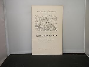
Royal Scottish Geographical Society (Glasgow Centre) Scotland on the Map An Exhibition of Maps held in the Kielvingrove Museum, Glasgow, from March 24th to April 22nd, 1956 to mark the seventieth session of the Society in Glasgow
Publicado por Royal Scottish Geographical Society (Glasgow Centre), Glasgow, 1956
Librería: Provan Books, Glasgow, Reino Unido
Calificación del vendedor: 5 de 5 estrellas
EUR 3,57
Envío por EUR 28,91
Se envía de Reino Unido a Estados Unidos de AmericaCantidad disponible: 1 disponibles
Ańadir al carritoSoft cover. Condición: Fair. 23 pages, fair condition in slightly dust marked paper covers, staples removed to prevent rust damage, annotations and marks throughout the catalogue and extensive notes in ink on the rear cover.
-

Royal Automobile Club. Scotland, Northern England and Wales. (Road map)
Idioma: Inglés
Publicado por RAC/Royal Automobile Club
Librería: Frans Books, Solva, Pembs, Reino Unido
Calificación del vendedor: 4 de 5 estrellas
EUR 7,15
Envío por EUR 31,23
Se envía de Reino Unido a Estados Unidos de AmericaCantidad disponible: 1 disponibles
Ańadir al carritoUnbound. Condición: Good. No Jacket. Unbound road map. Size given is folded. Scale 1:1,000,000 or 16 English miles to an inch. Scotland and Northern England one side, England and Wales the other. Slightly spotted and discoloured but in good condition. Undated but indicates motorways under construction. Map is divided into 20 mile squares. Inset map of exits from London. (B20).
-

Guide Book to Cape Breton: Royal Province of Nova Scotia or New Scotland, Dominion of Canada: With an Original map, and a Plan of Louisburg
Librería: moluna, Greven, Alemania
Calificación del vendedor: 5 de 5 estrellas
EUR 23,26
Envío por EUR 48,99
Se envía de Alemania a Estados Unidos de AmericaCantidad disponible: Más de 20 disponibles
Ańadir al carritoCondición: New.
-

Copy of a Manuscript Tract addressed to Lord Burghley, illustrative of the Border Topography of Scotland, A.D. 1590; with a Platt or Map of the Borders taken in the same Year, both preserved in one of the Royal MSS. in the British Museum. An article printed in 1829, written by Henry Ellis : 11 pages + 1 large plate.
Publicado por Archaeologia, or Miscellaneous Tracts relating to Antiquity., London, 1829
Librería: Cosmo Books, Shropshire., Reino Unido
Calificación del vendedor: 5 de 5 estrellas
EUR 23,24
Envío por EUR 13,76
Se envía de Reino Unido a Estados Unidos de AmericaCantidad disponible: 1 disponibles
Ańadir al carritoBooklet - Unbound Pages. Condición: Very Good. 11 pages + 1 large plate. An authentic standalone article, extracted from a larger volume of Archaeologia, Miscellaneous Tracts relating to Antiquity. Not a reprint or reproduction, but an original work in its own right. Preserved in a modern card cover, prepared for practicality - an unassuming but serviceable presentation that favours function over finery. Size: 25 x 30 cms. Category: Archaeologia; Cosmo Books : 29 years on ABE, 47 years taking care of customers. A bookseller you can rely on.
-
Guide Book to Cape Breton: Royal Province of Nova Scotia or New Scotland, Dominion of Canada: With an Original map, and a Plan of Louisburg
Idioma: Inglés
Publicado por Creative Media Partners, LLC, 2022
ISBN 10: 1016013523 ISBN 13: 9781016013529
Librería: PBShop.store US, Wood Dale, IL, Estados Unidos de America
Calificación del vendedor: 5 de 5 estrellas
EUR 18,73
Gastos de envío gratis
Se envía dentro de Estados Unidos de AmericaCantidad disponible: Más de 20 disponibles
Ańadir al carritoPAP. Condición: New. New Book. Shipped from UK. THIS BOOK IS PRINTED ON DEMAND. Established seller since 2000.
-

Guide Book to Cape Breton: Royal Province of Nova Scotia or New Scotland, Dominion of Canada: With an Original map, and a Plan of Louisburg
Librería: moluna, Greven, Alemania
Calificación del vendedor: 5 de 5 estrellas
EUR 37,07
Envío por EUR 48,99
Se envía de Alemania a Estados Unidos de AmericaCantidad disponible: Más de 20 disponibles
Ańadir al carritoGebunden. Condición: New.
-

Guide Book to Cape Breton: Royal Province of Nova Scotia or New Scotland, Dominion of Canada: With an Original map, and a Plan of Louisburg
Idioma: Inglés
Publicado por Creative Media Partners, LLC Okt 2022, 2022
ISBN 10: 1016013523 ISBN 13: 9781016013529
Librería: AHA-BUCH GmbH, Einbeck, Alemania
Calificación del vendedor: 5 de 5 estrellas
EUR 27,46
Envío por EUR 60,48
Se envía de Alemania a Estados Unidos de AmericaCantidad disponible: 2 disponibles
Ańadir al carritoTaschenbuch. Condición: Neu. Neuware.
-
The Islands of Colonsay and Oransay, Argyll, Scotland, 1975 Sutherland & Savills property estate sale catalogue brochure with map. By direction of Lord Strathcona and Mount Royal.
Idioma: Inglés
Publicado por J T Sutherland & Co., and Savills, Angus & London., 1975
Librería: Tony Hutchinson, Seale, Reino Unido
Calificación del vendedor: 5 de 5 estrellas
Original o primera edición
EUR 71,48
Envío por EUR 21,40
Se envía de Reino Unido a Estados Unidos de AmericaCantidad disponible: 1 disponibles
Ańadir al carritoSoft cover. Condición: Good. 1st Edition. 16pp. Original glossy sale folder, with large fold-out map still in original folds.
-
Guide Book to Cape Breton: Royal Province of Nova Scotia or New Scotland, Dominion of Canada: With an Original map, and a Plan of Louisburg
Idioma: Inglés
Publicado por Creative Media Partners, LLC, 2022
ISBN 10: 1016013523 ISBN 13: 9781016013529
Librería: PBShop.store UK, Fairford, GLOS, Reino Unido
Calificación del vendedor: 5 de 5 estrellas
EUR 18,23
Envío por EUR 3,81
Se envía de Reino Unido a Estados Unidos de AmericaCantidad disponible: Más de 20 disponibles
Ańadir al carritoPAP. Condición: New. New Book. Delivered from our UK warehouse in 4 to 14 business days. THIS BOOK IS PRINTED ON DEMAND. Established seller since 2000.
-

Guide Book to Cape Breton: Royal Province of Nova Scotia or New Scotland, Dominion of Canada: With an Original map, and a Plan of Louisburg
Idioma: Inglés
Publicado por Creative Media Partners, LLC Okt 2022, 2022
ISBN 10: 1016008619 ISBN 13: 9781016008617
Librería: AHA-BUCH GmbH, Einbeck, Alemania
Calificación del vendedor: 5 de 5 estrellas
EUR 44,46
Envío por EUR 61,32
Se envía de Alemania a Estados Unidos de AmericaCantidad disponible: 2 disponibles
Ańadir al carritoBuch. Condición: Neu. Neuware.
-
Slater's Royal National And Commercial Directory and Topography of the Counties of Derbyshire, Herefordshire, Leicestershire, Lincolnshire, Monmouthshire, Northamptonshire, Nottinghamshire, Rutlandshaire, Shropshire, Staffordshire, Warwickshire, Worcestershire. With Classified Lists of the Merchants, Bankers, Profesional Gentlemen, Manufacturers and Traders, etc, etc, etc. With a Large folding Map of England & Wales and Part of Lowland Scotland+
Idioma: Inglés
Publicado por Isaac Slater (Late Pigot & Co), Fountain & Portland Streets, Manchester, 1850
Librería: Colophon Books (UK), Leek, STAFF, Reino Unido
Calificación del vendedor: 5 de 5 estrellas
EUR 1.131,73
Envío por EUR 30,36
Se envía de Reino Unido a Estados Unidos de AmericaCantidad disponible: 1 disponibles
Ańadir al carritoCalf. Condición: Very Good. Special Edition. 8pp + 1019 pages + 200 pages of engraved billhead adverts at rear and a 22 page classified index WITH 10 folding coloured County maps and a large folding map of the country before title page. All maps by Slater & Co. Full diced calf boards all original with the smooth calf spine being later, Approx 10 x 6 x 4 inches (25 x 15 x 10 cm) Condition is excellent with a little edge dust lines to the very extreme edges or a couple of the maps, colouring all bright and maps are stain one small split in the centre fold line of the large country map all maps tipped in, all foxing free (care needed when opening as they are tightly bound, boards rubbed and original diced calf re-laid over smooth calf. *VERY SCARCE as a single volume with all the counties in this compendium of county directories and maps. Usually sold as separate counties, however this is as intended with the details of all the counties mention on the title pages, the only county NOT to have its own map is Rutland, which is made part of another county, so 11 counties with the correct 10 maps. Complete.
-
Guide Book to Cape Breton: Royal Province of Nova Scotia or New Scotland, Dominion of Canada: With an Original map, and a Plan of Louisburg
Librería: Majestic Books, Hounslow, Reino Unido
Calificación del vendedor: 4 de 5 estrellas
EUR 21,37
Envío por EUR 7,52
Se envía de Reino Unido a Estados Unidos de AmericaCantidad disponible: 4 disponibles
Ańadir al carritoCondición: New. Print on Demand.
-
Guide Book to Cape Breton: Royal Province of Nova Scotia or New Scotland, Dominion of Canada: With an Original map, and a Plan of Louisburg
Librería: Books Puddle, New York, NY, Estados Unidos de America
Calificación del vendedor: 4 de 5 estrellas
EUR 25,74
Envío por EUR 3,46
Se envía dentro de Estados Unidos de AmericaCantidad disponible: 4 disponibles
Ańadir al carritoCondición: New. Print on Demand.
-
MAP - Bathymetrical Survey of the Fresh-Water Lochs of Scotland under the directions of Sir John Murray and Laurence Pullar Loch Affric (Beauly Basin) Surveyed in 1903 by E R Watson and R C Marshall, Height of Surface of Water above Sea Level 747 feet The Land Contours are from the Ordnance Survey [From the Geographical Journal - Printed by The Royal Geographical Society]
Publicado por London: The Royal Geographical Society, 1906
Librería: Louis88Books (Members of the PBFA), Andover, Reino Unido
Miembro de asociación: PBFA
Calificación del vendedor: 5 de 5 estrellas
Mapa Original o primera edición
EUR 23,83
Envío por EUR 33,54
Se envía de Reino Unido a Estados Unidos de AmericaCantidad disponible: 1 disponibles
Ańadir al carritoNo Binding. Condición: Good. 1st Edition. MAP. London: The Royal Geographical Society, 1906, First Edition. Bathymetrical Survey of the Fresh-Water Lochs of Scotland, under the directions of Sir John Murray and Laurence Pullar. Loch Affric, (Beauly Basin), Surveyed in 1903 by E R Watson and R C Marshall, Height of Surface of Water above Sea Level - 747 Feet, The Land Contours are from the Ordnance Survey. Scale 1:21,120 or 3 Inches to 1 Mile. Ex library stamp to the top right for Huddersfield Technical College. Backed in linen. Folded with a wide inner margin where removed from a volume of work. See photos for the layout. A scarce map in good condition. Size: approximately 12 and a half inches wide by 9 and a quarter inches tall (32 x 23.5cm). Publisher: See above. Publication Date: 1906.
-
MAP - Bathymetrical Survey of the Fresh-Water Lochs of Scotland under the directions of Sir John Murray and Laurence Pullar Lochs Beinn A'Mheadhoin and An Laghair (Beauly Basin) Surveyed in 1903 by James Murray The Land Contours are from the Ordnance Survey [From the Geographical Journal - Printed by The Royal Geographical Society]
Publicado por London: The Royal Geographical Society, 1906
Librería: Louis88Books (Members of the PBFA), Andover, Reino Unido
Miembro de asociación: PBFA
Calificación del vendedor: 5 de 5 estrellas
Mapa Original o primera edición
EUR 23,83
Envío por EUR 33,54
Se envía de Reino Unido a Estados Unidos de AmericaCantidad disponible: 1 disponibles
Ańadir al carritoNo Binding. Condición: Good. 1st Edition. MAP. London: The Royal Geographical Society, 1906, First Edition. Bathymetrical Survey of the Fresh-Water Lochs of Scotland, under the directions of Sir John Murray and Laurence Pullar. Lochs Beinn A'Mheadhoin and An Laghair, (Beauly Basin), Surveyed in 1903 by James Murray, The Land Contours are from the Ordnance Survey. Scale 1:21,120 or 3 Inches to 1 Mile. Ex library stamp to the top right for Huddersfield Technical College. Backed in linen. Folded with a wide inner margin where removed from a volume of work. See photos for the layout. A scarce map in good condition. Size: approximately 13 and a quarter inches wide by 9 and a quarter inches tall (34 x 23.5cm). Publisher: See above. Publication Date: 1906 Binding: Hardback.
-
The Royal Autombile Club Quarter-inch Map of Scotland 9 The Borders
Publicado por John Bartholomew and Son, Edinburgh, 1111
Librería: PEND BOOKS, Newton Stewart, Reino Unido
Calificación del vendedor: 4 de 5 estrellas
Original o primera edición
EUR 5,96
Envío por EUR 75,18
Se envía de Reino Unido a Estados Unidos de AmericaCantidad disponible: 1 disponibles
Ańadir al carritoSoftcover. Condición: Very Good. No Jacket. First Edition. Folding paper map in buff card covers, slight curling to corners of covers. Full colour map.
-
Guide Book to Cape Breton: Royal Province of Nova Scotia or New Scotland, Dominion of Canada: With an Original map, and a Plan of Louisburg
Librería: Biblios, Frankfurt am main, HESSE, Alemania
Calificación del vendedor: 4 de 5 estrellas
EUR 22,44
Envío por EUR 9,95
Se envía de Alemania a Estados Unidos de AmericaCantidad disponible: 4 disponibles
Ańadir al carritoCondición: New. PRINT ON DEMAND.
-
Guide Book to Cape Breton: Royal Province of Nova Scotia or New Scotland, Dominion of Canada: With an Original map, and a Plan of Louisburg
Librería: THE SAINT BOOKSTORE, Southport, Reino Unido
Calificación del vendedor: 5 de 5 estrellas
EUR 19,62
Envío por EUR 14,24
Se envía de Reino Unido a Estados Unidos de AmericaCantidad disponible: Más de 20 disponibles
Ańadir al carritoPaperback / softback. Condición: New. This item is printed on demand. New copy - Usually dispatched within 5-9 working days.
-
![Imagen del vendedor de Ports & Harbours on the East Coast of Scotland. Ports shown are Edinburgh, Peterhead, Aberdeen, Dundee and a general map of the lower Estuary of the Forth, [ taken from The Royal Illustrated Atlas of Modern Geography ] a la venta por Keoghs Books](https://pictures.abebooks.com/inventory/md/md571891096.jpg)
Ports & Harbours on the East Coast of Scotland. Ports shown are Edinburgh, Peterhead, Aberdeen, Dundee and a general map of the lower Estuary of the Forth, [ taken from The Royal Illustrated Atlas of Modern Geography ]
Publicado por Published by A. Fullarton & Co. no date givenapproximately 1862, London, 1862
Librería: Keoghs Books, Skipton, Reino Unido
Miembro de asociación: PBFA
Calificación del vendedor: 5 de 5 estrellas
Mapa Original o primera edición
EUR 41,70
Envío por EUR 32,38
Se envía de Reino Unido a Estados Unidos de AmericaCantidad disponible: 1 disponibles
Ańadir al carrito, 46 x 32.5 cm map, a single page plate from an atlas numbered XXXIII - engraved town plans with original colour First Edition thus , bottom edge cropped with slight loss at lower margin, otherwise map in very good condition 46 x 32.5 cm map ISBN:


![Imagen del vendedor de MAP - Bathymetrical Survey of the Fresh-Water Lochs of Scotland under the directions of Sir John Murray and Laurence Pullar Loch Affric (Beauly Basin) Surveyed in 1903 by E R Watson and R C Marshall, Height of Surface of Water above Sea Level 747 feet The Land Contours are from the Ordnance Survey [From the Geographical Journal - Printed by The Royal Geographical Society] a la venta por Louis88Books (Members of the PBFA)](https://pictures.abebooks.com/inventory/md/md30862989026.jpg)
![Imagen del vendedor de MAP - Bathymetrical Survey of the Fresh-Water Lochs of Scotland under the directions of Sir John Murray and Laurence Pullar Lochs Beinn A'Mheadhoin and An Laghair (Beauly Basin) Surveyed in 1903 by James Murray The Land Contours are from the Ordnance Survey [From the Geographical Journal - Printed by The Royal Geographical Society] a la venta por Louis88Books (Members of the PBFA)](https://pictures.abebooks.com/inventory/md/md30862983591.jpg)