

Importe total (1 artículo artículos):
Destino del pedido:

physical map europe (26 resultados)
Ir a los resultados principales
Filtros de búsqueda
Tipo de artículo
- Todos los tipos de productos
- Libros (18)
- Revistas y publicaciones (No hay ningún otro resultado que coincida con este filtro.)
- Cómics (No hay ningún otro resultado que coincida con este filtro.)
- Partituras (No hay ningún otro resultado que coincida con este filtro.)
- Arte, grabados y pósters (No hay ningún otro resultado que coincida con este filtro.)
- Fotografías (No hay ningún otro resultado que coincida con este filtro.)
- Mapas (8)
- Manuscritos y coleccionismo de papel (No hay ningún otro resultado que coincida con este filtro.)
Condición Más información
- Nuevo (3)
- Como nuevo, Excelente o Muy bueno (No hay ningún otro resultado que coincida con este filtro.)
- Bueno o Aceptable (10)
- Regular o Pobre (1)
- Tal como se indica (12)
Encuadernación
Más atributos
- Primera edición (No hay ningún otro resultado que coincida con este filtro.)
- Firmado (No hay ningún otro resultado que coincida con este filtro.)
- Sobrecubierta (No hay ningún otro resultado que coincida con este filtro.)
- Con imágenes (19)
- No impresión bajo demanda (24)
Idioma (2)
Gastos de envío gratis
Ubicación del vendedor
Valoración de los vendedores
-

Europe Physical GeoCenter Map (GeoCenter Maps)
Idioma: Inglés
Publicado por Mairs Geographischer Verlag,Kurt Mair, 2007
ISBN 10: 382976426X ISBN 13: 9783829764261
Librería: WeBuyBooks, Rossendale, LANCS, Reino Unido
Calificación del vendedor: 5 de 5 estrellas

EUR 11,59
Envío por EUR 7,41
Se envía de Reino Unido a Estados Unidos de AmericaCantidad disponible: 1 disponibles
Añadir al carritoCondición: Very Good. Most items will be dispatched the same or the next working day. A copy that has been read, but is in excellent condition. Pages are intact and not marred by notes or highlighting. The spine remains undamaged.
-

Europe Physical Road Map 1:3 500 000
Librería: PBShop.store US, Wood Dale, IL, Estados Unidos de America
Calificación del vendedor: 5 de 5 estrellas
EUR 25,48
Gastos de envío gratis
Se envía dentro de Estados Unidos de AmericaCantidad disponible: 1 disponibles
Añadir al carritoUNK. Condición: New. New Book. Shipped from UK. Established seller since 2000.
-

Europe Physical GeoCenter Map (GeoCenter Maps)
Idioma: Inglés
Publicado por Mairs Geographischer Verlag,Kurt Mair, 2007
ISBN 10: 382976426X ISBN 13: 9783829764261
Librería: Reuseabook, Gloucester, GLOS, Reino Unido
Calificación del vendedor: 5 de 5 estrellas
EUR 14,47
Envío por EUR 11,58
Se envía de Reino Unido a Estados Unidos de AmericaCantidad disponible: 1 disponibles
Añadir al carritoMap. Condición: Used; Very Good. Dispatched, from the UK, within 48 hours of ordering. Though second-hand, the book is still in very good shape. Minimal signs of usage may include very minor creasing on the cover or on the spine.
-

Europe Physical Map (1862)
Idioma: Inglés
Publicado por London, 1862
Librería: Thorne Books & Prints, Kortrijk, Belgica
Calificación del vendedor: 5 de 5 estrellas
Mapa
EUR 35,00
Envío por EUR 14,50
Se envía de Belgica a Estados Unidos de AmericaCantidad disponible: 1 disponibles
Añadir al carritoNo Binding. Condición: Very Good. Physical Map of Europe by John Dower. Taken from 'A School Atlas' by James Cornwell, published in London in 1862. Image size 85 x 138 mm approx, good margins. Very Good - light handling wear and marks.
-

1903 Original Antique Colour Map - EUROPE Physical Map (5)
Librería: Antique Paper Company, ASHFORD, KENT, Reino Unido
Calificación del vendedor: 3 de 5 estrellas

EUR 17,89
Envío por EUR 6,95
Se envía de Reino Unido a Estados Unidos de AmericaCantidad disponible: 1 disponibles
Añadir al carritoListing Template 2018 Home About Us View Feedback Contact Us 1903 Original Antique Colour Map - EUROPE Physical Map (5)Click image to enlargeDescriptionEUROPEA lovely original antique Map titledPHYSICAL MAP EUROPEPublished by George Philip Son in 1903and taken from the PHILIPS' STUDENATLAS OF PHYSICAL,POLITICAL AND CLASSICALGEOGRAPHY.Size overall approx27cm x34cm including large margins and perfect for mounting and framing.Condition is excellent with vibrant colours.ALL OUR PRINTS MAPS ARE GENUINE ANTIQUES OF AT LEAST 100 YEARS OLD AND ARE DATED AS STATED IN THE DESCRIPTION.WE WILL HAPPILY COMBINE LOTS INTO SINGLE POSTAL CHARGE. If you purchase multiple lots, please wait for our invoice to confirm the postage cost.PaymentWe prefer payment via PAYPAL. In some circumstances, we are able to accept a Cheque from UK Buyers, drawn on a UK Bank. Buyers will need to wait for 7 working days for the cheque to clear before any items are sent out. We can also accept Cash Payment in UK Pounds Stirling, Euros or US Dollars, but payment by cash methods are sent at the risk of the buyer. If you want to pay in any way apart from PAYPAL, please contact us PRIOR to making any bid or outright purchase.ShippingWe always try to ship items within 3 working days of any order. We are very happy to combine many items for a single postal charge. All our items are sent in either Board Backed envelopes or Art Tubes and are in the case of sending to tropical areas of the world, additionally provded with sealed plastic envelopes.We ship to almost anywhere in the world but there are just a few territories we are unable to ship to.About UsAntique Paper Company are established dealers in Antique Maps, Prints, Stamps, Postal History, Antiquarian Books and in fact all forms of Antique Paper also including Post Cards, Old Posters, Archives, Manuscripts, Ephemera etc.We are keen buyers and are prepared to travel throughout the UK, Europe and most of the world in search of opportunites to buy. Cash funds of up to and#163;250,000 are available immediately for the right opportunities. We work closely with Libraries Solicitors/probate situations where they are looking for disposal options and seek better single items to large quantities and also Specialised Collections of almost any genre.Please do not hesitate to contact us with details of any items you might have for sale.Contact Us View Our Categories Decorative Prints World Wide Maps Scotland Maps Architecture Design England Maps Royalty About UsWe specialise in selling all items that can be considered to be Antique Paper. * PRINTS * MAPS * HISTORICAL DOCUMENTS * POSTAL HISTORY * BOOKS * POSTERS * STAMPS * POSTCARDS * EPHEMERA And anything else that is considered Antique and made of Paper. ALL OF OUR ITEMS ARE ORIGINAL ANTIQUES - NOT MODERN COPIES. We are also very keen buyers of anything similar and especially after better collections, original archives, whole libraries and better single items and have and#163;250,000 in cash funds at anyone time to buy the right items. Contact UsIf you have any questions then please do not hesitate to contact us through the eBay messaging system. Feedback We will always help you to have a 100% positive happy buying experience. Contact us if you are unhappy about any aspect of your purchase from us. We only want five star feedback from you so buy with confidence.
-

1900 Antique Colour PHYSICAL MAP OF EUROPE (02)
Librería: Antique Paper Company, ASHFORD, KENT, Reino Unido
Calificación del vendedor: 3 de 5 estrellas
EUR 17,89
Envío por EUR 6,95
Se envía de Reino Unido a Estados Unidos de AmericaCantidad disponible: 1 disponibles
Añadir al carritoListing Template 2018 Home About Us View Feedback Contact Us 1900 Antique Colour PHYSICAL MAP OF EUROPE (02)Click image to enlargeDescriptionA lovely original antique Map titledPHYSICAL MAP OF EUROPEPublished by George Philip Son in 1900 and taken from the PHILIPS' SELECT ATLAS OF PHYSICAL AND POLITICAL GEOGRAPHY.Size overall approx27cm x34cm including large margins and perfect for mounting and framing.Condition is excellent with vibrant colours.ALL OUR PRINTS MAPS ARE GENUINE ANTIQUES OF AT LEAST 100 YEARS OLD AND ARE DATED AS STATED IN THE DESCRIPTION.WE WILL HAPPILY COMBINE LOTS INTO SINGLE POSTAL CHARGE. If you purchase multiple lots, please wait for our invoice to confirm the postage cost.PaymentWe accept a variety of payment methods. For UK customers, we can accept Paypal, Personal/Company Cheques (please allow 5 working days for clearance) and Postal Orders.For non-UK customers, Paypal is prefered. We are also able to accept Cash Payments in US Dollars or Euros, but by prior arrangement only and sent entirely at the risk of the buyer. Payment is asked for within 7 days of the end of the listing. For bulk buys/multiple/single purchases over and#163;500, payment terms can be agreed over a period of 3 - 12 months on the basis that the item(s) will not be released until full payment is received.ShippingOur shipping charges are clearly displayed on our our listings. Please read carefully to make sure you understand and accept our shipping costs. All of our shipping charges are taken up by mainly the actual postal costs, but we have built in a nominal amount to cover appropriate packaging for each lot. For any items sent via Recorded/Special Delivery within the UK and International Signed for (overseas), are covered under the Royal Mail insurance scheme as published in their website. If you are particularly concerned about obtaining the correct amount of insurance, please contact us and we will provide you with a firm quote for the insurance you require, if it is over the basicamounts advertised by Royal Mail.Terms of SaleOur terms of sale are clearly displayed with every listing. If you have any query on this or any other matter, please do not hesitate to contact us via the Ebay messaging serviceAbout UsWe have been buying and selling all forms of ANTIQUE PAPER items for over 30 years with the main emphasis on sourcing original archives, estates, collections and highly prized individual items. We are prepared to travel to almost any point on the globe for the opportunity of purchasing an exciting collection or archive and can have funds of up to and#163;250,000 available immediately for the right purchase opportunity. We are always looking for Prints (mainly 1500 - 1800's), Maps, Atlases, Old Documents, Letters, Postal History,Correspondences, Archives, Posters, Ephemera, Stamps, Antiquarian Illustrated Books (up to late 1800's especially the Illustrated London News, The Graphic etc), runs of Periodicals, Postcards - in fact anything that can be considered to be antique, as long as it is in some kind of paper form!We have alsoworked closely with Libraries, Solicitors, Estates etc to advise on the most appropriate method of disposal for Archives and Private Collections and have provided a Private Treaty Service for many clients in order to maximise the best possible return, with complete discretion.All items we well are guaranteed to be as described and original antiques.If you have anything that you wish to sell or dispose of, please can you initially contact us via the Ebay messaging service.Contact UsFor any contact, please can you initially contact us via the Ebay messaging service View Our Categories Decorative Prints World Wide Maps Scotland Maps Architecture Design England Maps Royalty About UsWe specialise in selling all items that can be considered to be Antique Paper. * PRINTS * MAPS * HISTORICAL DOCUMENTS * POSTAL HISTORY * BOOKS * POSTERS * STAMPS * POSTCARDS * EPHEMERA And anything else that is considered Antique and made of Paper. ALL OF OUR ITEMS ARE ORIGINAL ANTIQUES - NOT MODERN COPIES. We are also very keen buyers of anything similar and especially after better collections, original archives, whole libraries and better single items and have and#163;250,000 in cash funds at anyone time to buy the right items. Contact UsIf you have any questions then please do not hesitate to contact us through the eBay messaging system. Feedback We will always help you to have a 100% positive happy buying experience. Contact us if you are unhappy about any aspect of your purchase from us. We only want five star feedback from you so buy with confidence.
-

Physical Map of Asia with Europe
Año de publicación: 1887
Librería: Art Source International Inc., Boulder, CO, Estados Unidos de America
Calificación del vendedor: 5 de 5 estrellas
EUR 22,12
Envío por EUR 13,74
Se envía dentro de Estados Unidos de AmericaCantidad disponible: 1 disponibles
Añadir al carritoThis chromolithographic map is from Warrens Common-School Geography, printed in 1887. The natural geographical properties of Asia with Europe are given on this map. Details include ocean depths, equatorial currents, products and agriculture, native species of animals, and minerals used for mining. This map measures 11 inches by 9.25 inches.
-

Physical Map of Europe
Año de publicación: 1887
Librería: Art Source International Inc., Boulder, CO, Estados Unidos de America
Calificación del vendedor: 5 de 5 estrellas
EUR 26,54
Envío por EUR 13,74
Se envía dentro de Estados Unidos de AmericaCantidad disponible: 1 disponibles
Añadir al carritoThis chromolithographic map is from Warrens Common-School Geography, printed in 1887. The natural geographical properties of Europe are given on this map with details including equatorial currents, products and agriculture, native species of animals, and minerals used for mining. This map measures 11.25 inches by 9.25 inches.
-
MAP OF EUROPE, 1856 [From Colton's Atlas of the World Illustrating Physical and Political Geography Volume II]
Publicado por Colton, 1856
Librería: Larry W Price Books, Portland, OR, Estados Unidos de America
Calificación del vendedor: 5 de 5 estrellas
EUR 84,05
Envío por EUR 4,25
Se envía dentro de Estados Unidos de AmericaCantidad disponible: 1 disponibles
Añadir al carritoPamphlet. Condición: Good. Map is 18.5 x 16 inches, Elaborate Border, Hand-WaterColored in Pastels, light brn waterstain affects top center margin (but does not extend into map, thus Suitable for Framing (Map is dated 1855) (Extends from the Urals & Caspian Sea to Iceland).
-
MAP OF TURKEY IN EUROPE, 1856 [From Colton's Atlas of the World Illustrating Physical and Political Geography Volume II]
Publicado por Colton, 1856
Librería: Larry W Price Books, Portland, OR, Estados Unidos de America
Calificación del vendedor: 5 de 5 estrellas
EUR 84,05
Envío por EUR 4,25
Se envía dentro de Estados Unidos de AmericaCantidad disponible: 1 disponibles
Añadir al carritoPamphlet. Condición: Good. Map is 18.5 x 16 inches, Elaborate border, Hand-WaterColored in Pastels, light brn waterstain visible for 2 inches on lower left of map but not greatly objectionable, else VG & Extremely Attractive & Could be Beautifully Framed (Map is dated 1855) (Inset Maps at bottom show the Bosphorus & Candia or Crete).
-
Europe Physical GeoCenter Map (GeoCenter Maps)
Idioma: Inglés
Publicado por Mairs Geographischer Verlag,Kurt Mair, 2007
ISBN 10: 382976426X ISBN 13: 9783829764261
Librería: Buchpark, Trebbin, Alemania
Calificación del vendedor: 5 de 5 estrellas
EUR 12,23
Envío por EUR 105,00
Se envía de Alemania a Estados Unidos de AmericaCantidad disponible: 1 disponibles
Añadir al carritoCondición: Gut. Zustand: Gut | Sprache: Englisch | Produktart: Bücher | Keine Beschreibung verfügbar.
-

Carte Physique de LEurope (Physical Map of Europe)'
Año de publicación: 1848
Librería: Art Source International Inc., Boulder, CO, Estados Unidos de America
Calificación del vendedor: 5 de 5 estrellas
EUR 44,24
Envío por EUR 13,74
Se envía dentro de Estados Unidos de AmericaCantidad disponible: 1 disponibles
Añadir al carritoThis map is from the "Atlas General," published by Louis Etienne Dussieux in 1848. Details include names of lakes and rivers, cities and towns, regions, and topography. These steel engraved maps show fine detail and would make an excellent addition to any collection. This map measures 15.5 inches by 11 inches.
-
Europe; physical-political (Large Pull Down Map)
Publicado por Denoyer-Geppert Company,, 1941
Librería: Sequitur Books, Boonsboro, MD, Estados Unidos de America
Miembro de asociación: IOBA
Calificación del vendedor: 5 de 5 estrellas
EUR 265,41
Envío por EUR 4,27
Se envía dentro de Estados Unidos de AmericaCantidad disponible: 1 disponibles
Añadir al carritoHardcover. Condición: Fair. [Pre-WWII Europe] 160 x 185 cm. Color map, mounted on muslin, rods top and bottom. Heavy metal rolling rod at top. Scale 50 miles to the inch. S2 Europe map. Bottom rod partial separated / torn from map. Note: This is a large, heavy map. Additional postage will apply depending on delivery location.
-

Map of Europe, Exhibiting its Principal States, and Physical Features.
Publicado por LondonPublished by James Wyld Geographer to the Queen and H.R.H. Prince Albert c., 1860
Librería: Robert Frew Ltd. ABA ILAB, London, Reino Unido
Miembro de asociación: ABA ILAB PBFA
Calificación del vendedor: 5 de 5 estrellas
Mapa
EUR 357,82
Envío por EUR 11,58
Se envía de Reino Unido a Estados Unidos de AmericaCantidad disponible: 1 disponibles
Añadir al carritoEngraved decorative map of Europe with original hand-colouring (56 x 71 cm), dissected into 18 sections and backed onto linen, folding between original purple cloth covers into matching slipcase with publisher's label affixed to front, publisher's advertisement to verso. Generally an excellent example with vivid outline colour.
-

Carte Physique et Politique de la Turquie DEurope (Physical and Political Map of Turkey in Europe)'
Año de publicación: 1848
Librería: Art Source International Inc., Boulder, CO, Estados Unidos de America
Calificación del vendedor: 5 de 5 estrellas
EUR 48,66
Envío por EUR 13,74
Se envía dentro de Estados Unidos de AmericaCantidad disponible: 1 disponibles
Añadir al carritoThis map is from the "Atlas General," published by Louis Etienne Dussieux in 1848. Details include names of lakes and rivers, cities and towns, regions, and topography. Accentuated with hand outline color these steel engraved maps show fine detail and would make an excellent addition to any collection. This map measures 11 inches by 15 inches.
-
Physical Features of Europe & Asia 1856 A.K. Johnston map
Año de publicación: 1856
Librería: RareMapsandBooks, Dover, NH, Estados Unidos de America
Miembro de asociación: ESA IOBA
Calificación del vendedor: 5 de 5 estrellas
Mapa
EUR 42,03
Envío por EUR 5,97
Se envía dentro de Estados Unidos de AmericaCantidad disponible: 1 disponibles
Añadir al carritoCondición: good. The Physical Features of Europe & Asia.(Europe, Asia, Arabian Peninsula, Mediterranean Sea, India, China, Japan, Korea, Russia, Persia, Ottoman Empire, Germany, Italy, France, Spain, British Isles, Scandinavia). Issued 1856, Edinburgh by William Blackwood and Sons. Engraved by W & A. K. Johnston. Detailed and lovely large mid 19th century color lithographed folio map with piano key border. Numerous cross sectional views of land elevations, including the Dead Sea, Carpathian Mts., Himalayas, etc. Well preserved, nice looking example with pleasing age patina. Original center fold as issued. Sheet Measures c. 21 3/4" H x 27" W. Engraved Area Measures c. 20" H x 24" W. Cartographic Reference (s):Tooley's Dictionary of Mapmakers, vol. 1.[R25240].
-
Europe India Asia thematic Physical Features 1856 A.K. Johnston large old map
Año de publicación: 1856
Librería: RareMapsandBooks, Dover, NH, Estados Unidos de America
Miembro de asociación: ESA IOBA
Calificación del vendedor: 5 de 5 estrellas
Mapa
EUR 45,12
Envío por EUR 5,97
Se envía dentro de Estados Unidos de AmericaCantidad disponible: 1 disponibles
Añadir al carritoCondición: good. The Physical Features of Europe & Asia.(Europe, Asia, Arabian Peninsula, Mediterranean Sea, India, China, Japan, Korea, Russia, Persia, Ottoman Empire, Germany, Italy, France, Spain, British Isles, Scandinavia). Issued 1856, Edinburgh by William Blackwood and Sons. Engraved by W & A. K. Johnston. Detailed, uncommon and lovely large (oversized) mid-19th century color lithographed map with piano key border. The bottom is filled with numerous cross-sectional views of land height elevations, including the Dead Sea, Carpathian Mts., Himalayas, etc. Also includes a small and early hand colored (orig.) geological map of the Indonesian island of Java plus a small volcanic kingdom of Luzon Philippines islands map inset. Great scientific thematic map which comes from a scarce and once very expensive elephant folio sheet atlas printed in relatively small numbers for a limited distribution. Well preserved, nice looking example with pleasing age patina. Original center fold as issued. Sheet Measures c. 21 3/4" H x 27" W. Engraved Area Measures c. 20" H x 24" W. Cartographic Reference (s):Tooley's Dictionary of Mapmakers, vol. 1.[R25240-BR125].
-
![Imagen del vendedor de The mineral waters and health resorts of Europe: treatment of chronic diseases by spas and climates, with hints as to the simultaneous employment of various physical and dietetic methods, being a rev. and enl. ed. of "The spas and mineral waters of Europe' by Hermann Weber . and F. Parkes Weber . With a map. 1898 [LeatherBound] a la venta por S N Books World](https://pictures.abebooks.com/inventory/md/md31376471706.jpg)
The mineral waters and health resorts of Europe: treatment of chronic diseases by spas and climates, with hints as to the simultaneous employment of various physical and dietetic methods, being a rev. and enl. ed. of "The spas and mineral waters of Europe' by Hermann Weber . and F. Parkes Weber . With a map. 1898 [LeatherBound]
Idioma: Inglés
Año de publicación: 2025
Librería: S N Books World, Delhi, India
Calificación del vendedor: 5 de 5 estrellas
EUR 34,49
Gastos de envío gratis
Se envía de India a Estados Unidos de AmericaCantidad disponible: 18 disponibles
Añadir al carritoLeatherBound. Condición: New. BOOKS ARE EXEMPT FROM IMPORT DUTIES AND TARIFFS; NO EXTRA CHARGES APPLY. Leatherbound edition. Condition: New. Leather Binding on Spine and Corners with Golden leaf printing on spine. Bound in genuine leather with Satin ribbon page markers and Spine with raised gilt bands. Pages: 550. A perfect gift for your loved ones. Reprinted from 1898 edition. NO changes have been made to the original text. This is NOT a retyped or an ocr'd reprint. Illustrations, Index, if any, are included in black and white. Each page is checked manually before printing. As this print on demand book is reprinted from a very old book, there could be some missing or flawed pages, but we always try to make the book as complete as possible. Fold-outs, if any, are not part of the book. If the original book was published in multiple volumes then this reprint is of only one volume, not the whole set. IF YOU WISH TO ORDER PARTICULAR VOLUME OR ALL THE VOLUMES YOU CAN CONTACT US. Resized as per current standards. Sewing binding for longer life, where the book block is actually sewn (smythe sewn/section sewn) with thread before binding which results in a more durable type of binding. Language: English Pages: 550.
-
![Imagen del vendedor de The mineral waters and health resorts of Europe: treatment of chronic diseases by spas and climates, with hints as to the simultaneous employment of various physical and dietetic methods, being a rev. and enl. ed. of "The spas and mineral waters of Europe' by Hermann Weber . and F. Parkes Weber . With a map. Volume 1898 1898 [LeatherBound] a la venta por S N Books World](https://pictures.abebooks.com/inventory/md/md30639806454.jpg)
The mineral waters and health resorts of Europe: treatment of chronic diseases by spas and climates, with hints as to the simultaneous employment of various physical and dietetic methods, being a rev. and enl. ed. of "The spas and mineral waters of Europe' by Hermann Weber . and F. Parkes Weber . With a map. Volume 1898 1898 [LeatherBound]
Idioma: Inglés
Año de publicación: 2025
Librería: S N Books World, Delhi, India
Calificación del vendedor: 5 de 5 estrellas
EUR 34,49
Gastos de envío gratis
Se envía de India a Estados Unidos de AmericaCantidad disponible: 18 disponibles
Añadir al carritoLeatherbound. Condición: NEW. BOOKS ARE EXEMPT FROM IMPORT DUTIES AND TARIFFS; NO EXTRA CHARGES APPLY. Leatherbound edition. Condition: New. Leather Binding on Spine and Corners with Golden leaf printing on spine. Bound in genuine leather with Satin ribbon page markers and Spine with raised gilt bands. Pages: 550. A perfect gift for your loved ones. Reprinted from 1898 edition. NO changes have been made to the original text. This is NOT a retyped or an ocr'd reprint. Illustrations, Index, if any, are included in black and white. Each page is checked manually before printing. As this print on demand book is reprinted from a very old book, there could be some missing or flawed pages, but we always try to make the book as complete as possible. Fold-outs, if any, are not part of the book. If the original book was published in multiple volumes then this reprint is of only one volume, not the whole set. IF YOU WISH TO ORDER PARTICULAR VOLUME OR ALL THE VOLUMES YOU CAN CONTACT US. Resized as per current standards. Sewing binding for longer life, where the book block is actually sewn (smythe sewn/section sewn) with thread before binding which results in a more durable type of binding. Volume 1898 Language: English Pages: 550 Volume 1898.
-

Physical Map of Europe
Año de publicación: 1843
Librería: Art Source International Inc., Boulder, CO, Estados Unidos de America
Calificación del vendedor: 5 de 5 estrellas
EUR 39,81
Envío por EUR 13,74
Se envía dentro de Estados Unidos de AmericaCantidad disponible: 1 disponibles
Añadir al carritoAn excellent example of a pre-Civil War school atlas. Fine engraving and bold, vibrant hand coloring. Great size for framing. A perfect gift idea! This map measures 11 inches by 8.5 inches.
-
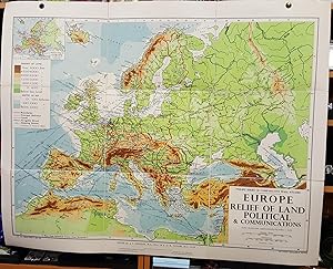
Philips' Small School-Room Map of Europe - Physical
Publicado por George Philip & Son, Ltd., 1961
Librería: Deeside Books, Ballater, Reino Unido
Calificación del vendedor: 5 de 5 estrellas
Mapa
EUR 178,91
Envío por EUR 23,16
Se envía de Reino Unido a Estados Unidos de AmericaCantidad disponible: 1 disponibles
Añadir al carritoSoft cover. Condición: Very Good. Very Large Canvas backed map with 16 segments, slightly tarnished copper eyelets and some light wear to outside covers but otherwise in Very Good condition.
-
Europe; Physical-Political (Large Pull Down Map)
Publicado por Denoyer-Geppert Company, 1965
Librería: Sequitur Books, Boonsboro, MD, Estados Unidos de America
Miembro de asociación: IOBA
Calificación del vendedor: 5 de 5 estrellas
Mapa
EUR 353,88
Envío por EUR 4,27
Se envía dentro de Estados Unidos de AmericaCantidad disponible: 1 disponibles
Añadir al carritoMaps. Condición: Very Good. 201 x 155 cm. Color map, muslin, mounted on wood rods top and bottom. Simple conic projection with true parallels at 40 and 60 degrees. Note: This is a large, heavy map. Additional postage will apply depending on delivery location.
-

Map of Europe exhibiting its principal states and physical features.
Publicado por LondonJames Wyld. Geographer to the Queen 457 Strand & 11 & 12 Charing Cross London., 1870
Librería: Robert Frew Ltd. ABA ILAB, London, Reino Unido
Miembro de asociación: ABA ILAB PBFA
Calificación del vendedor: 5 de 5 estrellas
Mapa
EUR 357,82
Envío por EUR 11,58
Se envía de Reino Unido a Estados Unidos de AmericaCantidad disponible: 1 disponibles
Añadir al carritoDouble page engraved map (52 x 65 cm, overall sheet size 58 x 86 cm.) Original outline colour. Trivial browning to outer margins not affecting map, generally very good.
-

NOUVELLE CARTE Illustrée de L'EUROPE A new illustrated map of Europe presenting the substantial physical divisions, the geographic distribution of vegetables and minerals. The industrial towns the ports of commerce fortifications, the railways etc.
Publicado por Paris. 1857, 1857
Librería: Peter Harrington. ABA/ ILAB., London, Reino Unido
Miembro de asociación: ABA ILAB PBFA
Calificación del vendedor: 5 de 5 estrellas
EUR 536,73
Envío por EUR 25,48
Se envía de Reino Unido a Estados Unidos de AmericaCantidad disponible: 1 disponibles
Añadir al carritoAn interesting view of Europe from a commercial and industrial perspective with numerous decorative embellishments. There is statistical information about the countries on either side of the map with 22 attractive vignettes depicting industry native to each area. These include Great Britain, Denmark and Norway, France, Belgium, Holland, Prussia, German states, Switzerland, Italian states, Portugal, Greece, European Russia and Turkey. There are also images of a few European plants and fruits, which could be of commercial interest, in down corner inserts. The actual map has towns, ports, and railways marked on it. GÉOGRAPHIE COMMERCIALE ET INDUSTRIELLE. Alexandre Vuillemin (1812-1880) was a cartographer and a book editor based in Paris. Despite a prolific cartographic career, much of Vuillemin's life is shrouded in mystery. What is known is that his studied under the prominent French Auguste Henri Dufour (1798-1865). Vuillemin's most important work is his detailed, highly decorative large format Atlas de Géographie Commerciale et Industrielle, which this map is a part of. Steel engraving. Very good condition; a slight tear in the bottom of centrefold, not affecting the image. Original outline colour with later additions. Size: 84.5 x 59.5 cm.
-

NOUVELLE CARTE Illustrée DES ÉTATS DU NORD DE L'EUROPE. RUSSIE D'EUROPE. LA SUÉDE ET LE DANEMARK INDIQUANT LES DIVISIONS PHYSIQUES ET POLITIQUES DE CES DIFFÉRENTS É TATS; LA DISTRIBUTION GEOGRAPHIQUE DES PLANTES CULTIVÉES. ainsi que les villes industrielles les ports commerciaux, les chemins de fer et les canaux. A new illustrated map of the states of Northern Europe. European Russia, Sweden and Denmark indicating physical and political divisions of the different states; the Geographic distribution of cultivated plants. Industrial towns, commercial ports, railways and canals.
Publicado por GÉOGRAPHIE COMMERCIALE ET INDUSTRIELLE. 1857, 1857
Librería: Peter Harrington. ABA/ ILAB., London, Reino Unido
Miembro de asociación: ABA ILAB PBFA
Calificación del vendedor: 5 de 5 estrellas
EUR 715,64
Envío por EUR 25,48
Se envía de Reino Unido a Estados Unidos de AmericaCantidad disponible: 1 disponibles
Añadir al carritoAn interesting view of the northern Europe, including European part of Russia, Norway, Sweden, and Denmark, from a commercial and industrial perspective. There is statistical information about the countries and their regions on either side of the map with 20 attractive vignettes depicting industry native to each area, its landscape, fauna, and flora, as well as architecture and inhabitants of the regions. These include northern regions of Norway and Sweden, Sweden proper, Gothland, Faroe Islands, Jutland, Schleswig, Holstein, Baltic Russia, Finland, Poland, and Caucasus region among others. There is also an insert showing the whole Russian Empire in the bottom. The actual map has towns, ports and railways marked on it. Alexandre Vuillemin (1812-1880) was a cartographer and a book editor based in Paris. Despite a prolific cartographic career, much of Vuillemin's life is shrouded in mystery. What is known is that his studied under the prominent French Auguste Henri Dufour (1798-1865). Vuillemin's most important work is his detailed, highly decorative large format Atlas de Géographie Commerciale et Industrielle, which this map is a part of. Steel engraving. Very good condition; a slight tear in the bottom of centrefold, not affecting the image. Original outline colour with later additions. Size: 84.5 x 59.5 cm. (33½ x 23½ inches).
-
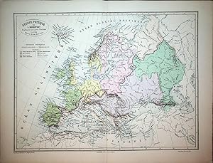
EUROPE, PHYSICAL MAP / EUROPA PHYSISCHE KARTE, BONNEFONT / VUILLEMIN 1885 Titel: Europe Physique.; par L. Bonnefont; Gravé par Erhard; dressé par A. Vuillemin
Publicado por Lanée Editeur ca. 1885, Paris, 1885
Librería: ANTIQUARIAT.WIEN Fine Books & Prints, Wien, Austria
Miembro de asociación: ILAB VDAO
Calificación del vendedor: 5 de 5 estrellas
Mapa
EUR 66,00
Envío por EUR 72,00
Se envía de Austria a Estados Unidos de AmericaCantidad disponible: 1 disponibles
Añadir al carritooriginal map, original Landkarte, mehrfärbig, Blatt ca. 32,5 x 42 cm ORIGINAL MAP /ORIGINALE LANDKARTE // Louis Bonnefont, Alexandre Aime? Vuillemin (1812-); Bonacker 232 de 500 Landkarte.


