Importe total (1 artículo artículos):
Destino del pedido:

thomas barron introduction (8 resultados)
Ir a los resultados principales
Filtros de búsqueda
Tipo de artículo
- Todos los tipos de productos
- Libros (8)
- Revistas y publicaciones (No hay ningún otro resultado que coincida con este filtro.)
- Cómics (No hay ningún otro resultado que coincida con este filtro.)
- Partituras (No hay ningún otro resultado que coincida con este filtro.)
- Arte, grabados y pósters (No hay ningún otro resultado que coincida con este filtro.)
- Fotografías (No hay ningún otro resultado que coincida con este filtro.)
- Mapas (No hay ningún otro resultado que coincida con este filtro.)
- Manuscritos y coleccionismo de papel (No hay ningún otro resultado que coincida con este filtro.)
Condición Más información
- Nuevo (1)
- Como nuevo, Excelente o Muy bueno (3)
- Bueno o Aceptable (3)
- Regular o Pobre (1)
- Tal como se indica (No hay ningún otro resultado que coincida con este filtro.)
Encuadernación
Más atributos
- Primera edición (4)
- Firmado (No hay ningún otro resultado que coincida con este filtro.)
- Sobrecubierta (5)
- Con imágenes (2)
- No impresión bajo demanda (8)
Idioma (2)
Precio
- Cualquier precio
- Menos de EUR 20
- EUR 20 a EUR 45
- Más de EUR 45 (No hay ningún otro resultado que coincida con este filtro.)
Gastos de envío gratis
- Envío gratis a Estados Unidos de America (No hay ningún otro resultado que coincida con este filtro.)
Ubicación del vendedor
Valoración de los vendedores
-
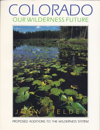
COLORADO : OUR WILDERNESS FUTURE : Proposed Additions to the Wilderness System
Idioma: Inglés
Publicado por Westcliffe Publishers, Englewood, CO, 1990
ISBN 10: 0929969383 ISBN 13: 9780929969381
Librería: 100POCKETS, Berkeley, CA, Estados Unidos de America
Calificación del vendedor: 4 de 5 estrellas

Original o primera edición
EUR 20,42
Envío por EUR 6,54
Se envía dentro de Estados Unidos de AmericaCantidad disponible: 1 disponibles
Ańadir al carritoSoft cover. Condición: Near Fine. John Fielder (Editor-Photographer) Ilustrador. First Edition, First Thus. BRAND NEW Copy w/a whisper of wear to corner tips. Map of Proposed Wilderness Areas in Colorado the front endpapers. Monograph. A socio-political and philosophical treatise on conservation in contemporary Colorado. Raising issues on: How much do we protect?; What about water rights?; How should timber & mining industries should fit in?; and, What about motorized traffic? An essential and basic discourse within the specifics of Colorado with raminifactions to the world at large.
-
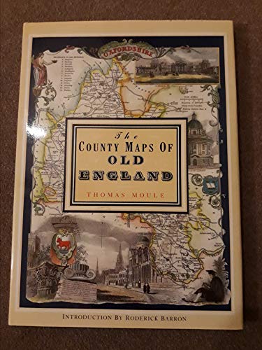
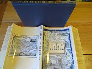
The County Maps of Old England
Idioma: Inglés
Publicado por Studio Editions, London, 1990
ISBN 10: 1851704035 ISBN 13: 9781851704033
Librería: Babushka Books & Framers, Isle of Wight, Reino Unido
Calificación del vendedor: 4 de 5 estrellas
Original o primera edición
EUR 7,13
Envío por EUR 19,72
Se envía de Reino Unido a Estados Unidos de AmericaCantidad disponible: 1 disponibles
Ańadir al carritoHardcover. Condición: Very Good. Estado de la sobrecubierta: Very Good. 1st Edition.
-

The First And Second Parts Of King Edward IV Histories
Publicado por The Shakespeare Society, London, 1842
Librería: Willis Monie-Books, ABAA, Cooperstown, NY, Estados Unidos de America
Miembro de asociación: ABAA ESA ILAB
Calificación del vendedor: 5 de 5 estrellas

EUR 17,95
Envío por EUR 6,97
Se envía dentro de Estados Unidos de AmericaCantidad disponible: 1 disponibles
Ańadir al carritoHardcover. Condición: Fair. Ex-library. Ex-library copy with label remnants on the spine and the front cover. Bookplate on front endpaper, bar code in the rear. Binding thoroughly split following the title page and at the rear inner hinge. Title page is loosely attached. Covers have slight wear corner and edge wear. ; "Reprinted from the unique black letter first edition of 1600, collated with one other in black letter, and with those of 1619 and 1626.".
-
The County Maps of Old England.
Idioma: Inglés
Publicado por London; Studio Editions. 1991., 1991
ISBN 10: 1851704035 ISBN 13: 9781851704033
Librería: Elaine Beardsell, HOLMFIRTH, Reino Unido
Miembro de asociación: PBFA
Calificación del vendedor: 4 de 5 estrellas
EUR 17,82
Envío por EUR 23,06
Se envía de Reino Unido a Estados Unidos de AmericaCantidad disponible: 1 disponibles
Ańadir al carritoHardcover. Condición: Fine. Dust Jacket Included. Reprint. 14" x 10". 126[1]pp, illustrated with 56 full plate cold maps. Fine hardback in price clipped, else, fine protected dustwrapper.
-
The County Maps of Old England
Idioma: Inglés
Publicado por Studio Editions Ltd., London, 1990
ISBN 10: 1851704035 ISBN 13: 9781851704033
Librería: Polar Books, Llandudno, CONWY, Reino Unido
Calificación del vendedor: 5 de 5 estrellas
Original o primera edición
EUR 17,82
Envío por EUR 28,83
Se envía de Reino Unido a Estados Unidos de AmericaCantidad disponible: 1 disponibles
Ańadir al carritoHardcover (Original Cloth). Condición: Very Good. Estado de la sobrecubierta: Good. First Edition. 1st Edition in this format: 127 pages, illustrated with colour maps throughout. Publishers Note: The maps and text from the Counties for this Edition of Thomas Moule's County Maps are taken from James Barclay's Complete and Universal English Dictionary published in 1842 and have been coloured. Original covers in unclipped dust jacket. A lovely book. Shelf wear, crease to dust jacket (probably form publishers when it was initially placed on book), dust jacket spine sunned with small closed repair to tail of spine, contents clean. First edition of the work in this format and binding, and/or set or series. Quantity Available: 1. Shipped Weight: Under 2 kilogram. Category: Geography & Maps; History. ISBN: 1851704035. ISBN/EAN: 9781851704033. Pictures of this item not already displayed here available upon request. Inventory No: 4091. This book weighs over 1Kg and may involve extra shipping charges to some countries.
-
COUNTY MAPS OF OLD ENGLAND
Idioma: Inglés
Publicado por Studio Editions, London, 1990
ISBN 10: 1851704035 ISBN 13: 9781851704033
Librería: Amazing Book Company, Liphook, Reino Unido
Calificación del vendedor: 5 de 5 estrellas
EUR 17,82
Envío por EUR 35,11
Se envía de Reino Unido a Estados Unidos de AmericaCantidad disponible: 1 disponibles
Ańadir al carritoHardcover. Condición: New. Estado de la sobrecubierta: As New. Thomas Moule Ilustrador. First Thgus. This copy is in new, unmarked condition bound in blue cloth covered boards with bright gilt titling to the spine. This copy is bright, tight, white and square. The unclipped dust wrapper is in as new condition. International postal rates are calculated on a book weighing 1 Kilo, in cases where the book weighs more than 1 Kilo increased postal rates will be quoted, where the book weighs less then postage will be reduced accordingly. Thomas Moule is one of the most distinctive and beloved of early Victorian mapmakers. His charming series of English county maps, first published in 1830 as the 'English Counties,' are as popular and collectible today as when they first appeared. Their elaborate and decorative style, a synthesis of art and cartography, sets them apart from most other maps of the period, whose plain unembellished style owed much to the pioneering work of the Ordinance Survey. Moule's maps convey a picture of an England where 'ancientness' could still be found in abundance. This was an England where history was still alive in ancient country houses, parish churches with their escutcheoned Gothic memorials and tombs, in market towns and market place and in a landscape that still offered 'scenes, situations, and prospects remarkable fro extent and beauty." Moule is often compared to his distinguished 17th century predecessors, John Speed and Joan Bleau. This new edition of 'Moule's Maps' combines 56 coloured maps with the original text taken from 'Barclays Complete and Universal English Dictionary' in which they appeared in the editions published between 1842 and 1852. Ref DDD 1.
-
The County Maps of Old England (First edition, Hardcover)
Librería: Libros Angulo, Madrid, M, Espańa
Calificación del vendedor: 5 de 5 estrellas
Original o primera edición
EUR 15,00
Envío por EUR 50,00
Se envía de Espańa a Estados Unidos de AmericaCantidad disponible: 1 disponibles
Ańadir al carritoEncuadernación de tapa dura. Condición: Bien. 1? Edición. Studio Editions, London, 1990. Texto en inglés. Cartografía. Profusamente ilustrado. 128 pp. 36 x 26. Tela editorial tapa dura con dorados en lomo y sobrecubierta de editorial ilustrada. Sin subrayados ni anotaciones. PEQUEŃO ROCE EN PARTE INFERIOR DE LOMO, por lo demás: Buen estado de conservación. ISBN: 9781851704033.
-
![Imagen del vendedor de The County Maps of Old England [2] a la venta por Little Stour Books PBFA Member](https://pictures.abebooks.com/inventory/md/md5402207172.jpg)
The County Maps of Old England [2]
Publicado por Published by Studio Editions Ltd., 50 Eastcastle Street, London . London 1990., 1990
Librería: Little Stour Books PBFA Member, Canterbury, Reino Unido
Miembro de asociación: PBFA
Calificación del vendedor: 5 de 5 estrellas
EUR 17,82
Envío por EUR 34,59
Se envía de Reino Unido a Estados Unidos de AmericaCantidad disponible: 1 disponibles
Ańadir al carritoCondición: Fine. Hard back binding in publisher's original navy paper covers, gilt lettering to the spine, navy end papers. Folio 14˝'' x 10Ľ''. ISBN 1851704035. Contains 128 printed pages of text with 56 full-page colour maps. Fine condition book, in Fine condition dust wrapper, unused new book. Member of the P.B.F.A. ISBN 1851704035 ENGLAND EXPLORATION.