
Importe total (1 artículo artículos):
Destino del pedido:

renshawe (39 resultados)
Ir a los resultados principales
Filtros de búsqueda
Tipo de artículo
- Todos los tipos de productos
- Libros (17)
- Revistas y publicaciones (No hay ningún otro resultado que coincida con este filtro.)
- Cómics (No hay ningún otro resultado que coincida con este filtro.)
- Partituras (No hay ningún otro resultado que coincida con este filtro.)
- Arte, grabados y pósters (22)
- Fotografías (No hay ningún otro resultado que coincida con este filtro.)
- Mapas (No hay ningún otro resultado que coincida con este filtro.)
- Manuscritos y coleccionismo de papel (No hay ningún otro resultado que coincida con este filtro.)
Condición Más información
- Nuevo (12)
- Como nuevo, Excelente o Muy bueno (1)
- Bueno o Aceptable (26)
- Regular o Pobre (No hay ningún otro resultado que coincida con este filtro.)
- Tal como se indica (No hay ningún otro resultado que coincida con este filtro.)
Encuadernación
Más atributos
- Primera edición (22)
- Firmado (No hay ningún otro resultado que coincida con este filtro.)
- Sobrecubierta (No hay ningún otro resultado que coincida con este filtro.)
- Con imágenes (33)
- No impresión bajo demanda (28)
Idioma (3)
Gastos de envío gratis
Ubicación del vendedor
Valoración de los vendedores
-

Results of Primary Triangulation and Primary Traverse, Fiscal Year 1900 - '01 (United States Geological Survey Bulletiin 181 )
Publicado por United States Government Printing Office, 1901
Librería: Eryops Books, Stephenville, TX, Estados Unidos de America
Calificación del vendedor: 5 de 5 estrellas

EUR 2,57
Envío por EUR 5,25
Se envía dentro de Estados Unidos de AmericaCantidad disponible: 1 disponibles
Ańadir al carritoNo Binding. Condición: Good. ORIGINAL 1901 PUBLICATION; includes one folded map (COMPLETE for this publication); missing covers; spine reinforced with tape; light browning of leaves; otherwise in good condition. Book.
-
Results of Primary Triangulation and Primary Traverse, Fiscal Year 1901 - 02 (United States Geological Survey Bulletin 201).
Publicado por United States Government Printing Office., 1902
Librería: Eryops Books, Stephenville, TX, Estados Unidos de America
Calificación del vendedor: 5 de 5 estrellas
EUR 13,46
Envío por EUR 5,25
Se envía dentro de Estados Unidos de AmericaCantidad disponible: 1 disponibles
Ańadir al carritoSoft cover, missing wraps. Condición: Good. ORIGINAL 1902 PUBLICATION; missing covers; spine reinforced with tape; light creasing of corners of leaves; light smudging of title page; o/w in good condition. Book.
-
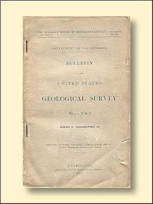
Bulletin of the United States Geological Survey No. 185 Series F Geography, 26 Results of Spirit Leveling Fiscal Year 1900-'01
Publicado por U.S. Government Printing Office, 1901
Librería: Catron Grant Books, Rio Rancho, NM, Estados Unidos de America
Calificación del vendedor: 1 de 5 estrellas

EUR 14,41
Envío por EUR 9,62
Se envía dentro de Estados Unidos de AmericaCantidad disponible: 1 disponibles
Ańadir al carritoStapled Softcover. Condición: Good. No Jacket. 219 pp. Text is clean, tight and unmarked. No board covers. paper front cover has a short closed tear.
-
Results of primary triangulation and primary traverse fiscal year 1900-'01.Bulletin of the United States geological survey 181.
Publicado por Washington : Gov. Print. Off. , 1901, 1901
Librería: Wissenschaftliches Antiquariat Köln Dr. Sebastian Peters UG, Köln, Alemania
Calificación del vendedor: 5 de 5 estrellas
EUR 15,00
Envío por EUR 10,00
Se envía de Alemania a Estados Unidos de AmericaCantidad disponible: 1 disponibles
Ańadir al carritoBroschur. Condición: gut. 240 S. : Kt., 23 cm, Bibliotheksexemplar, Rücken leicht beschädigt, Inhalt gut erhalten. Sprache: eng.
-

Carte - Crater Lake - Géographie nostalgique
Librería: Gallix, Gif sur Yvette, Francia
Calificación del vendedor: 4 de 5 estrellas

EUR 19,00
Envío por EUR 14,67
Se envía de Francia a Estados Unidos de AmericaCantidad disponible: 1 disponibles
Ańadir al carritoCondición: Neuf.
-
Results of Primary Triangulation and Primary Traverse: Fiscal Year 1901-02
Librería: Forgotten Books, London, Reino Unido
Calificación del vendedor: 4 de 5 estrellas
EUR 17,56
Gastos de envío gratis
Se envía de Reino Unido a Estados Unidos de AmericaCantidad disponible: Más de 20 disponibles
Ańadir al carritoPaperback. Condición: New. Print on Demand. This book presents triangulation observations and primary traverse data collected by the United States Geological Survey during the fiscal year 1901-2. The data was meticulously compiled and computed by a team of experts, and covers numerous triangulation and traverse star stations across the United States. These stations served as crucial reference points for mapping and surveying efforts, providing a solid foundation for accurate geographic positioning and land boundary definition. The results of this extensive survey contribute to the ongoing development of a comprehensive national geodetic network. This book is a reproduction of an important historical work, digitally reconstructed using state-of-the-art technology to preserve the original format. In rare cases, an imperfection in the original, such as a blemish or missing page, may be replicated in the book. print-on-demand item.
-
Results of Spirit Leveling: Fiscal Year 1900-'01 (Classic Reprint)
Librería: Forgotten Books, London, Reino Unido
Calificación del vendedor: 4 de 5 estrellas
EUR 18,64
Gastos de envío gratis
Se envía de Reino Unido a Estados Unidos de AmericaCantidad disponible: Más de 20 disponibles
Ańadir al carritoPaperback. Condición: New. Print on Demand. This book documents the spirit leveling operations performed by the United States Geological Survey in various regions of the country during fiscal year 1900 to 1901. Published in 1902, these results contribute to the overall geodetic vertical control network of the United States. Spirit leveling is a method of surveying that precisely determines the height of a place relative to a known point. The book contains a compilation of the adjusted and checked elevations of benchmarks established throughout the country, including Maine, New York, Pennsylvania, West Virginia, Ohio, Kentucky, North Carolina, South Carolina, Tennessee, and Georgia. These benchmarks serve as permanent references for future surveys. The author meticulously presents the data in tables, making it easily accessible to surveyors, engineers, and other professionals working in the United States. Overall, the book is an invaluable resource for those seeking accurate elevation information for various locations across the United States, promoting scientific and infrastructural development in the region. This book is a reproduction of an important historical work, digitally reconstructed using state-of-the-art technology to preserve the original format. In rare cases, an imperfection in the original, such as a blemish or missing page, may be replicated in the book. print-on-demand item.
-
Results of Primary Triangulation and Primary Traverse, Fiscal Year 1901-02
Librería: Forgotten Books, London, Reino Unido
Calificación del vendedor: 4 de 5 estrellas
EUR 19,93
Gastos de envío gratis
Se envía de Reino Unido a Estados Unidos de AmericaCantidad disponible: Más de 20 disponibles
Ańadir al carritoPaperback. Condición: New. Print on Demand. This book details a detailed report of triangulation stations in New York, Pennsylvania, Ohio, North Carolina, Wyoming, Colorado, Michigan, and Iowa. The author established and marked the positions of 35 stations, which control 9l -minute quadrangles, covering portions of Fulton, Hamilton, St. Lawrence, Franklin, Sar atoga, and Warren counties. He also established a meridian line at Johns town. The primary traverse in North Carolina controlled ten 15-minute quadrangles in the east-central portion of the State and was based upon triangulation stations of the United States lake survey and on points near Millbrook and Burbank. This book provides new geographical information on a wide area of the United States. This book is a reproduction of an important historical work, digitally reconstructed using state-of-the-art technology to preserve the original format. In rare cases, an imperfection in the original, such as a blemish or missing page, may be replicated in the book. print-on-demand item.
-

MAP: "Detailed Geological Map Showing Actual Exposures in the NE Sec T63 N.R. 12 W., Minnesota, Geology Sheet XXVI. from The Atlas to accompany Monograph XLV on the Vermillion Iron-Bearing District of Minnesota.
Publicado por U.S. Geological Survey, Washingtion, D.C, 1898
Librería: Dorley House Books, Inc., Hagerstown, MD, Estados Unidos de America
Calificación del vendedor: 4 de 5 estrellas
Arte / Grabado / Póster Original o primera edición
EUR 45,02
Envío por EUR 7,56
Se envía dentro de Estados Unidos de AmericaCantidad disponible: 1 disponibles
Ańadir al carritoUnbound. Condición: Very Good. Colored Map Ilustrador. 1st. 18" x 24" colored mining map showing observed rock exposures Size: 18'' x 24". Map.
-

MAP: Ely Sheet (Topography Sheet VI)
Publicado por Julius Bien & Company, NY, 1893
Librería: Dorley House Books, Inc., Hagerstown, MD, Estados Unidos de America
Calificación del vendedor: 4 de 5 estrellas
Arte / Grabado / Póster Original o primera edición
EUR 58,53
Envío por EUR 7,56
Se envía dentro de Estados Unidos de AmericaCantidad disponible: 1 disponibles
Ańadir al carritoUnbound. Condición: Very Good. color Topographical Map Ilustrador. 1st. 21 3/4" x 17/5" colored map, topography of the area of Burntside, Shagwa White iron Lake & Ely, Minnesota area; topography by H.L. baldwin, Robert Muldrow & E.C. Bebb; has large margins which may have small repairs or lite ruffling Size: 21 3/4" x 17/5".
-

MAP: Soudan Sheet (Topography Sheet IV)
Publicado por Julius Bien & Company, NY, 1893
Librería: Dorley House Books, Inc., Hagerstown, MD, Estados Unidos de America
Calificación del vendedor: 4 de 5 estrellas
Arte / Grabado / Póster Original o primera edición
EUR 58,53
Envío por EUR 7,56
Se envía dentro de Estados Unidos de AmericaCantidad disponible: 1 disponibles
Ańadir al carritoUnbound. Condición: Very Good. color Topographical Map Ilustrador. 1st. 21 3/4" x 17/5" colored map, topography of the area of Lake Vermilion and Eagle Nest Lake & Soudan, Minnesota; topography by H.L. baldwin, Robert Muldrow & E.C. Bebb; has large margins which may have small repairs or lite ruffling Size: 21 3/4" x 17/5".
-

MAP: Tower Sheet (Topography Sheet IV)
Publicado por Julius Bien & Company, NY, 1893
Librería: Dorley House Books, Inc., Hagerstown, MD, Estados Unidos de America
Calificación del vendedor: 4 de 5 estrellas
Arte / Grabado / Póster Original o primera edición
EUR 58,53
Envío por EUR 7,56
Se envía dentro de Estados Unidos de AmericaCantidad disponible: 1 disponibles
Ańadir al carritoUnbound. Condición: Very Good. color Topographica Map Ilustrador. 1st. 21 3/4" x 17/5" colored map, topography of the area of Lake Vermilion, & Pike River, Minnesota and the Chippewa Indian Reservation. ; topography by H.L. baldwin, Robert Muldrow & E.C. Bebb; has large margins which may have small repairs or lite ruffling Size: 21 3/4" x 17/5".
-

MAP: Basswood and Fall Lakes Sheet (Topography Sheet VII)
Publicado por Julius Bien & Company, NY, 1893
Librería: Dorley House Books, Inc., Hagerstown, MD, Estados Unidos de America
Calificación del vendedor: 4 de 5 estrellas
Arte / Grabado / Póster Original o primera edición
EUR 58,53
Envío por EUR 7,56
Se envía dentro de Estados Unidos de AmericaCantidad disponible: 1 disponibles
Ańadir al carritoUnbound. Condición: Very Good. color Topographical Map Ilustrador. 1st. 21 3/4" x 17/5" colored map, topography of the area of Basswood and Fall Lakes , Minnesota area; topography by H.L. Baldwin, Robert Muldrow & E.C. Bebb; has large margins which may have small repairs or lite ruffling Size: 21 3/4" x 17/5".
-

Results of Spirit Leveling: Fiscal Year 1900-'01 (Classic Reprint)
Librería: Forgotten Books, London, Reino Unido
Calificación del vendedor: 4 de 5 estrellas
EUR 27,43
Gastos de envío gratis
Se envía de Reino Unido a Estados Unidos de AmericaCantidad disponible: Más de 20 disponibles
Ańadir al carritoPaperback. Condición: New. Print on Demand. This book explores the oil and gas fields found within the Upper Cretaceous and Tertiary formations of the Western Gulf Coast. The author delves into the geology of the region to provide an understanding of the conditions that led to the formation of these valuable resources. The book discusses the various formations present in the area, their characteristics, and their distribution. It also examines the structure of the Upper Cretaceous and Tertiary formations to shed light on how this has influenced the occurrence of oil and gas. Furthermore, the book explores the history of oil and gas development in the region and provides insights into the association of petroleum, sulfur, gypsum, and rock salt. Through a detailed analysis of the geology and history of the region, this book offers valuable information for those interested in the exploration and development of oil and gas resources in the Western Gulf Coast. This book is a reproduction of an important historical work, digitally reconstructed using state-of-the-art technology to preserve the original format. In rare cases, an imperfection in the original, such as a blemish or missing page, may be replicated in the book. print-on-demand item.
-
EUR 37,31
Envío por EUR 53,50
Se envía de Suiza a Estados Unidos de AmericaCantidad disponible: 1 disponibles
Ańadir al carritoCondición: Used: Like New. LIVRE A L?ETAT DE NEUF. EXPEDIE SOUS 3 JOURS OUVRES. NUMERO DE SUIVI COMMUNIQUE AVANT ENVOI, EMBALLAGE RENFORCE. EAN:9791096554515.
-

MAP: "Detail Map of a Portion ofTS.61 and 62 N.R. 11 W. Minnesota, Geology Sheet XXII. from The Atlas to accompany Monograph XLV on the Vermillion Iron-Bearing District of Minnesota.
Publicado por U.S. Geological Survey, Washingtion, D.C, 1898
Librería: Dorley House Books, Inc., Hagerstown, MD, Estados Unidos de America
Calificación del vendedor: 4 de 5 estrellas
Arte / Grabado / Póster Original o primera edición
EUR 135,07
Envío por EUR 7,56
Se envía dentro de Estados Unidos de AmericaCantidad disponible: 1 disponibles
Ańadir al carritoUnbound. Condición: Very Good. Colored Map Ilustrador. 1st. 36" x 24" colored mining map showing observed rock exposures Size: 36" x 24". Map.
-
MAP: "Detail Map of a Portion ofTS.61 and 62 N.R. 14 W. Minnesota, Geology Sheet XIX. from The Atlas to accompany Monograph XLV on the Vermillion Iron-Bearing District of Minnesota.
Publicado por U.S. Geological Survey, Washingtion, D.C, 1898
Librería: Dorley House Books, Inc., Hagerstown, MD, Estados Unidos de America
Calificación del vendedor: 4 de 5 estrellas
Arte / Grabado / Póster Original o primera edición
EUR 135,07
Envío por EUR 7,56
Se envía dentro de Estados Unidos de AmericaCantidad disponible: 1 disponibles
Ańadir al carritoUnbound. Condición: Very Good. Colored Map Ilustrador. 1st. 36" x 24" colored mining map showing observed rock exposures Size: 36" x 24". Map.
-

MAP: "Detail Map of Soudan Hill, North of Soudan, Minnesota, Geology Sheet XXIV. from The Atlas to accompany Monograph XLV on the Vermillion Iron-Bearing District of Minnesota.
Publicado por U.S. Geological Survey, Washingtion, D.C, 1898
Librería: Dorley House Books, Inc., Hagerstown, MD, Estados Unidos de America
Calificación del vendedor: 4 de 5 estrellas
Arte / Grabado / Póster Original o primera edición
EUR 135,07
Envío por EUR 7,56
Se envía dentro de Estados Unidos de AmericaCantidad disponible: 1 disponibles
Ańadir al carritoUnbound. Condición: Very Good. Colored Map Ilustrador. 1st. 36" x 24" colored mining map showing observed rock exposures Size: 36" x 24". Map.
-

MAP: "Detail Map of Point South of Mud Creek Bay, Vermillion Lake, Minnesota, Geology Sheet XXV. from The Atlas to accompany Monograph XLV on the Vermillion Iron-Bearing District of Minnesota.
Publicado por U.S. Geological Survey, Washingtion, D.C, 1898
Librería: Dorley House Books, Inc., Hagerstown, MD, Estados Unidos de America
Calificación del vendedor: 4 de 5 estrellas
Arte / Grabado / Póster Original o primera edición
EUR 135,07
Envío por EUR 7,56
Se envía dentro de Estados Unidos de AmericaCantidad disponible: 1 disponibles
Ańadir al carritoUnbound. Condición: Very Good. Colored Map Ilustrador. 1st. 18" x 24" colored mining map showing observed rock exposures Size: 18'' x 24". Map.
-

MAP: "Detail Map of a Portion ofTS.61 and 62 N.R. 13 W. Minnesota, Geology Sheet XX. from The Atlas to accompany Monograph XLV on the Vermillion Iron-Bearing District of Minnesota.
Publicado por U.S. Geological Survey, Washingtion, D.C, 1898
Librería: Dorley House Books, Inc., Hagerstown, MD, Estados Unidos de America
Calificación del vendedor: 4 de 5 estrellas
Arte / Grabado / Póster Original o primera edición
EUR 135,07
Envío por EUR 7,56
Se envía dentro de Estados Unidos de AmericaCantidad disponible: 1 disponibles
Ańadir al carritoUnbound. Condición: Very Good. Colored Map Ilustrador. 1st. 36" x 24" colored mining map showing observed rock exposures Size: 36" x 24". Map.
-

MAP: "Detail Map of a Portoon ofTS.61 and 62 N.R. 15 W. Minnesota, Geology Sheet XII. from The Atlas to Accompany Monograph XLV on the Vermillion Iron-Bearing District of Minnesota.
Publicado por U.S. Geological Survey, Washingtion, D.C, 1898
Librería: Dorley House Books, Inc., Hagerstown, MD, Estados Unidos de America
Calificación del vendedor: 4 de 5 estrellas
Arte / Grabado / Póster Original o primera edición
EUR 135,07
Envío por EUR 7,56
Se envía dentro de Estados Unidos de AmericaCantidad disponible: 1 disponibles
Ańadir al carritoUnbound. Condición: Very Good. Colored Map Ilustrador. 1st. 36" x 24" colored mining map showing observed rock exposures Size: 36" x 24". Map.
-

MAP: "Detail Map of Tower and Lee Hills North of Tower, Minnesota, Geology Sheet XXIII. from The Atlas to accompany Monograph XLV on the Vermillion Iron-Bearing District of Minnesota.
Publicado por U.S. Geological Survey, Washingtion, D.C, 1898
Librería: Dorley House Books, Inc., Hagerstown, MD, Estados Unidos de America
Calificación del vendedor: 4 de 5 estrellas
Arte / Grabado / Póster Original o primera edición
EUR 135,07
Envío por EUR 7,56
Se envía dentro de Estados Unidos de AmericaCantidad disponible: 1 disponibles
Ańadir al carritoUnbound. Condición: Very Good. Colored Map Ilustrador. 1st. 36" x 24" colored mining map showing observed rock exposures Size: 36" x 24". Map.
-

MAP: "Ensign and Snowbank Lakes Sheet, Topography Sheet VIII) from MAP: "Ensign and Snowbank Lakes Sheet, Topography Sheeyt VIII." From The Atlas to accompany monograph XLV on the Vermillion Iron-Bearing District of Minnesota.
Publicado por U.S. Geological Survey, Washingtion, D.C, 1898
Librería: Dorley House Books, Inc., Hagerstown, MD, Estados Unidos de America
Calificación del vendedor: 4 de 5 estrellas
Arte / Grabado / Póster Original o primera edición
EUR 135,07
Envío por EUR 7,56
Se envía dentro de Estados Unidos de AmericaCantidad disponible: 1 disponibles
Ańadir al carritoUnbound. Condición: Very Good. Colored Map Ilustrador. 1st. 18" x 24" colored mining map Size: 18" x 24". Map.
-

MAP: "Ensign and Snowbank Lakes Sheet, Geology Sheet XV. from MAP: "Ensign and Snowbank Lakes Sheet, Topography Sheeyt VIII." From The Atlas to accompany monograph XLV on the Vermillion Iron-Bearing District of Minnesota.
Publicado por U.S. Geological Survey, Washingtion, D.C, 1898
Librería: Dorley House Books, Inc., Hagerstown, MD, Estados Unidos de America
Calificación del vendedor: 4 de 5 estrellas
Arte / Grabado / Póster Original o primera edición
EUR 135,07
Envío por EUR 7,56
Se envía dentro de Estados Unidos de AmericaCantidad disponible: 1 disponibles
Ańadir al carritoUnbound. Condición: Very Good. Colored Map Ilustrador. 1st. 18" x 24" colored mining map Size: 18" x 24". Map.
-

MAP: "Soudan Sheet, Geology Sheet XII. from MAP: "Ensign and Snowbank Lakes Sheet, Topography Sheeyt VIII." From The Atlas to accompany monograph XLV on the Vermillion Iron-Bearing District of Minnesota.
Publicado por U.S. Geological Survey, Washingtion, D.C, 1898
Librería: Dorley House Books, Inc., Hagerstown, MD, Estados Unidos de America
Calificación del vendedor: 4 de 5 estrellas
Arte / Grabado / Póster Original o primera edición
EUR 135,07
Envío por EUR 7,56
Se envía dentro de Estados Unidos de AmericaCantidad disponible: 1 disponibles
Ańadir al carritoUnbound. Condición: Very Good. Colored Map Ilustrador. 1st. 18" x 24" colored mining map Size: 18" x 24" Sheet Size. Map.
-

MAP: "Knife Lake Sheet, Topography Sheet IX) from MAP: "Ensign and Snowbank Lakes Sheet, Topography Sheeyt VIII." From The Atlas to accompany monograph XLV on the Vermillion Iron-Bearing District of Minnesota.
Publicado por U.S. Geological Survey, Washingtion, D.C, 1898
Librería: Dorley House Books, Inc., Hagerstown, MD, Estados Unidos de America
Calificación del vendedor: 4 de 5 estrellas
Arte / Grabado / Póster Original o primera edición
EUR 135,07
Envío por EUR 7,56
Se envía dentro de Estados Unidos de AmericaCantidad disponible: 1 disponibles
Ańadir al carritoUnbound. Condición: Very Good. Colored Map Ilustrador. 1st. 18" x 24" colored mining map Size: 18" x 24". Map.
-

MAP: "Gunflint Lake Sheet, Geology Sheet XII. from MAP: "Ensign and Snowbank Lakes Sheet, Topography Sheeyt VIII." From The Atlas to accompany monograph XLV on the Vermillion Iron-Bearing District of Minnesota.
Publicado por U.S. Geological Survey, Washingtion, D.C, 1898
Librería: Dorley House Books, Inc., Hagerstown, MD, Estados Unidos de America
Calificación del vendedor: 4 de 5 estrellas
Arte / Grabado / Póster Original o primera edición
EUR 135,07
Envío por EUR 7,56
Se envía dentro de Estados Unidos de AmericaCantidad disponible: 1 disponibles
Ańadir al carritoUnbound. Condición: Very Good. Colored Map Ilustrador. 1st. 18" x 24" colored mining map Size: 18" x 24" Sheet Size. Map.
-

MAP: "Tower Sheet, Geology Sheet XI. from MAP: "Ensign and Snowbank Lakes Sheet, Topography Sheeyt VIII." From The Atlas to accompany monograph XLV on the Vermillion Iron-Bearing District of Minnesota.
Publicado por U.S. Geological Survey, Washingtion, D.C, 1898
Librería: Dorley House Books, Inc., Hagerstown, MD, Estados Unidos de America
Calificación del vendedor: 4 de 5 estrellas
Arte / Grabado / Póster Original o primera edición
EUR 135,07
Envío por EUR 7,56
Se envía dentro de Estados Unidos de AmericaCantidad disponible: 1 disponibles
Ańadir al carritoUnbound. Condición: Very Good. Colored Map Ilustrador. 1st. 18" x 24" colored mining map Size: 18" x 24" Sheet Size. Map.
-

MAP: "Gunflint Lake Sheet, Topography Sheet X from MAP: "Ensign and Snowbank Lakes Sheet, Topography Sheeyt VIII." From The Atlas to accompany monograph XLV on the Vermillion Iron-Bearing District of Minnesota.
Publicado por U.S. Geological Survey, Washingtion, D.C, 1898
Librería: Dorley House Books, Inc., Hagerstown, MD, Estados Unidos de America
Calificación del vendedor: 4 de 5 estrellas
Arte / Grabado / Póster Original o primera edición
EUR 135,07
Envío por EUR 7,56
Se envía dentro de Estados Unidos de AmericaCantidad disponible: 1 disponibles
Ańadir al carritoUnbound. Condición: Very Good. Colored Map Ilustrador. 1st. 18" x 24" colored mining map Size: 18" x 24" Sheet Size. Map.
-

MAP: "Basswood and Fall Lakes Sheet, Geology Sheet XIV. from MAP: "Ensign and Snowbank Lakes Sheet, Topography Sheeyt VIII." From The Atlas to accompany monograph XLV on the Vermillion Iron-Bearing District of Minnesota.
Publicado por U.S. Geological Survey, Washingtion, D.C, 1898
Librería: Dorley House Books, Inc., Hagerstown, MD, Estados Unidos de America
Calificación del vendedor: 4 de 5 estrellas
Arte / Grabado / Póster Original o primera edición
EUR 135,07
Envío por EUR 7,56
Se envía dentro de Estados Unidos de AmericaCantidad disponible: 1 disponibles
Ańadir al carritoUnbound. Condición: Very Good. Colored Map Ilustrador. 1st. 18" x 24" colored mining map Size: 18" x 24" Sheet Size. Map.


