
Importe total (1 artículo artículos):
Destino del pedido:

oliphant tom (4 resultados)
Ir a los resultados principales
Filtros de búsqueda
Tipo de artículo
- Todos los tipos de productos
- Libros (2)
- Revistas y publicaciones (No hay ningún otro resultado que coincida con este filtro.)
- Cómics (No hay ningún otro resultado que coincida con este filtro.)
- Partituras (No hay ningún otro resultado que coincida con este filtro.)
- Arte, grabados y pósters (No hay ningún otro resultado que coincida con este filtro.)
- Fotografías (No hay ningún otro resultado que coincida con este filtro.)
- Mapas (2)
- Manuscritos y coleccionismo de papel (No hay ningún otro resultado que coincida con este filtro.)
Condición Más información
- Nuevo (3)
- Como nuevo, Excelente o Muy bueno (No hay ningún otro resultado que coincida con este filtro.)
- Bueno o Aceptable (1)
- Regular o Pobre (No hay ningún otro resultado que coincida con este filtro.)
- Tal como se indica (No hay ningún otro resultado que coincida con este filtro.)
Encuadernación
- Todas
- Tapa dura (No hay ningún otro resultado que coincida con este filtro.)
- Tapa blanda (2)
Más atributos
- Primera edición (1)
- Firmado (1)
- Sobrecubierta (No hay ningún otro resultado que coincida con este filtro.)
- Con imágenes (1)
- No impresión bajo demanda (4)
Idioma (2)
Gastos de envío gratis
- Envío gratis a Estados Unidos de America (No hay ningún otro resultado que coincida con este filtro.)
Ubicación del vendedor
Valoración de los vendedores
-

Hobson and Tantobie 1895: Durham Sheet 12.01 (Old Ordnance Survey Maps of County Durham)
Librería: GENERATIONS GONE BY, Manchester, Reino Unido
Calificación del vendedor: 5 de 5 estrellas

EUR 4,17
Envío por EUR 35,15
Se envía de Reino Unido a Estados Unidos de AmericaCantidad disponible: 1 disponibles
Ańadir al carritoSoft cover. Condición: New. No Jacket. Here are the details of maps for Tantobie & the Hobson: Co Durham Sheet 12.01 Hobson & Tantobie 1895 - published 2004; intro by Tom Oliphant. ISBN.978-1-84151-718-6 This very detailed map covers the villages of Tantobie and Hobson, a few miles NE of Consett. Coverage stretches from Tantobie northward to Hobson, and eastward to part of Tanfield. The coke ovens are shown at Hobson, although the colliery is on the Burnopfield map. The Pontop & Jarrow Railway runs through the map and other features include a short stretch of the Linz Colliery Railway, Mountsett Quarries, Mountsett Fell, the routes of old wagonways, Wagonhill Farm, Clough Dene, Tanfield Leith Hall. The portion of Tanfield shown includes Packhorse Inn and Peacock Inn. On the reverse, as well as a short directory of Tantobie, we include information on Durham coalmining from Whelan's Directory 1894. The map links up with Sheets 6.13 Burnopfield to the north, and 12.02 East Tanfield to the east.
-

Burnhope 1895: Durham Sheet 19.02 (Old Ordnance Survey Maps of County Durham)
Librería: GENERATIONS GONE BY, Manchester, Reino Unido
Calificación del vendedor: 5 de 5 estrellas
Mapa
EUR 3,27
Envío por EUR 35,15
Se envía de Reino Unido a Estados Unidos de AmericaCantidad disponible: 1 disponibles
Ańadir al carritoNo Binding. Condición: New. No Jacket. Here are the details of maps for Burnhope: Co Durham Sheet 19.02 Burnhope 1895 - published 2001; intro by Tom Oliphant. ISBN.978-1-84151-248-8 This very detailed map covers the colliery village of Burnhope, just SW of Stanley. The map is double-sided to give maximum coverage. The main map covers the village itself, (really the eastern part of today's village) and includes St John's church, Burnhope Wagonway, and Burnhope Colliery - Fortune and Annie Pits. Fell Pit with its own wagonway is also included, as is Ibbetson's Sike Quarry. The map extends north to Burnhope Engine, east to what is now the hamlet of Peartree. Also included are Holmside Hall, noted for its remarkable effigy of a woman "either drinking from a bottle or.playing the bagpipes" on a barn wall (though this is not visible to the public). The map also includes Holmside New Hall and the area now known as Little Holmside. On the reverse we include a large section of adjacent sheet 12.14 which extends coverage north to Morrowedge Quarry, South Moor and (at the top of the map) South Moor Colliery - Hedley Pit. The map links up with Sheets 12.06 Stanley to the north, 12.15 Craghead to the NE and 19.03 Edmondsley to the east.
-
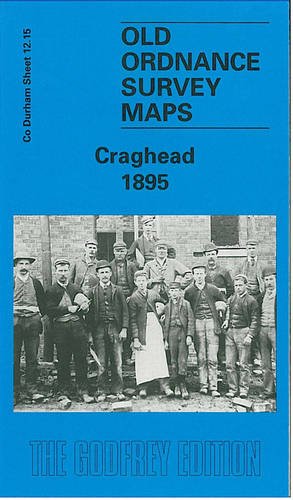
Craghead 1895: Durham Sheet 12.15
Librería: GENERATIONS GONE BY, Manchester, Reino Unido
Calificación del vendedor: 5 de 5 estrellas
Mapa
EUR 3,27
Envío por EUR 35,15
Se envía de Reino Unido a Estados Unidos de AmericaCantidad disponible: 1 disponibles
Ańadir al carritoNo Binding. Condición: New. No Jacket. Here are the details of maps for Craghead: Co Durham Sheet 12.15 Craghead 1895 - published 2000; intro by Tom Oliphant. ISBN.978-1-84151-158-0 This very detailed map covers the colliery village of Craghead, just SE of Stanley. The map is double-sided to give maximum coverage. The main map covers the village itself, including Craghead Colliery - George Pit and William Pit - and Holmside Colliery - Oswald Pit and Thomas Pit. The Craghead Wagonway is included. The map then extends a mile east into countryside as far as Broomy Holm and includes the Black House pub (today the Charlaw Inn). On the reverse a section of adjacent sheet 12.14 extends coverage west to Windmill Hill, today the setting for 2 massive wind turbines. There is a short directory of Holmside Parish, and Tom Oliphant's notes remind us of the village's links with the engineer William Hedley, and tells us that Hilary Clinton's grandfather, Jonathan Rodham, was born here in Wagtail Cottages. The map links up with Sheet 19.03 Holmside & Edmondsley to the south.
-

Broken Dirge Over Atlantis and Other Poems (Harvey Taylor's chapbooks)
Publicado por Harvey Taylor, Alameda, CA, U.S.A., 1940
Librería: Vashon Island Books, Vashon, WA, Estados Unidos de America
Calificación del vendedor: 5 de 5 estrellas
Original o primera edición Ejemplar firmado
EUR 66,11
Envío por EUR 4,71
Se envía dentro de Estados Unidos de AmericaCantidad disponible: 1 disponibles
Ańadir al carritoPaperback. Condición: Very Good. Cover Design By Tom Oliphant Ilustrador. First Edition. Vg in printed wraps (minimal wear to wraps) one of 265 copies; signed by author; pages uncut. Size: 8vo - over 7ľ" - 9ľ" tall. Signed by Author(s). Book.