
Importe total (1 artículo artículos):
Destino del pedido:

map bartholomew (27 resultados)
Ir a los resultados principales
Filtros de búsqueda
Tipo de artículo
- Todos los tipos de productos
- Libros (21)
- Revistas y publicaciones (No hay ningún otro resultado que coincida con este filtro.)
- Cómics (No hay ningún otro resultado que coincida con este filtro.)
- Partituras (No hay ningún otro resultado que coincida con este filtro.)
- Arte, grabados y pósters (No hay ningún otro resultado que coincida con este filtro.)
- Fotografías (No hay ningún otro resultado que coincida con este filtro.)
- Mapas (6)
- Manuscritos y coleccionismo de papel (No hay ningún otro resultado que coincida con este filtro.)
Condición Más información
- Nuevo (No hay ningún otro resultado que coincida con este filtro.)
- Como nuevo, Excelente o Muy bueno (3)
- Bueno o Aceptable (10)
- Regular o Pobre (No hay ningún otro resultado que coincida con este filtro.)
- Tal como se indica (14)
Encuadernación
Más atributos
- Primera edición (9)
- Firmado (No hay ningún otro resultado que coincida con este filtro.)
- Sobrecubierta (No hay ningún otro resultado que coincida con este filtro.)
- Con imágenes (16)
- No impresión bajo demanda (27)
Idioma (2)
Gastos de envío gratis
Ubicación del vendedor
Valoración de los vendedores
-
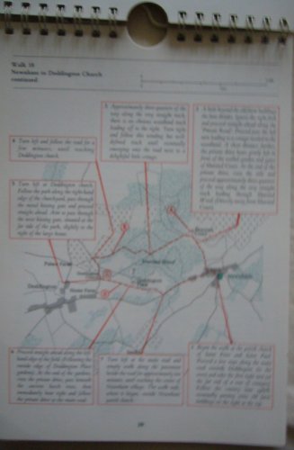
Walk the North Downs
Librería: MusicMagpie, Stockport, Reino Unido
Calificación del vendedor: 5 de 5 estrellas

EUR 3,00
Envío por EUR 6,36
Se envía de Reino Unido a Estados Unidos de AmericaCantidad disponible: 1 disponibles
Ańadir al carritoCondición: Very Good. 1753696296. 7/28/2025 9:51:36 AM.
-

Bartholomew World Travel Map: China: scale : 1 : 4, 500, 000
Publicado por Edinburgh: John Bartholomew & Son Ltd., 1977
ISBN 10: 0851526403 ISBN 13: 9780851526409
Librería: MW Books, New York, NY, Estados Unidos de America
Calificación del vendedor: 5 de 5 estrellas
Original o primera edición
EUR 22,70
Gastos de envío gratis
Se envía dentro de Estados Unidos de AmericaCantidad disponible: 1 disponibles
Ańadir al carritoFirst Edition. Near fine folding map. Remains well preserved overall; tight, bright, clean and sharp-cornered. Physical description; 1 folded map : text, col. map ; 25 cm. Subjects; China ; Maps. E0732900 E1344600 N0533300 N0175700. Scale 1:4,500,000. (E 73°29'00"--E 134°46'00"/N 53°33'00"--N 17°57'00"). Genre; Map. 3 Kg.
-

Bartholomew's Revised "Half-inch" Contoured Maps Sussex
Idioma: Inglés
Publicado por Edinburgh Geographical Institute, Edinburgh
Librería: J J Basset Books, bassettbooks, bookfarm.co.uk, Peter Tavy, Reino Unido
Calificación del vendedor: 3 de 5 estrellas

EUR 11,93
Envío por EUR 23,17
Se envía de Reino Unido a Estados Unidos de AmericaCantidad disponible: 1 disponibles
Ańadir al carritoColour Paperback. Condición: VERY GOOD ( AVERAGE). No Jacket. Colour Map Ilustrador. Revised Edition. Map is MOUNTED ON CLOTH.The name H. Elliott is signed on back cover.please e-mail for further details. Size: 12mo - over 6ľ" - 7ľ". Name Inscribed.
-
Bartholomew's Revised "Half-inch" Contoured Maps, Oxfordshire
Idioma: Inglés
Publicado por Edinburgh Geographical Institute, Edinburgh
Librería: J J Basset Books, bassettbooks, bookfarm.co.uk, Peter Tavy, Reino Unido
Calificación del vendedor: 3 de 5 estrellas
EUR 11,93
Envío por EUR 23,17
Se envía de Reino Unido a Estados Unidos de AmericaCantidad disponible: 1 disponibles
Ańadir al carritoColour Paperback. Condición: VERY GOOD ( AVERAGE). No Jacket. Colour Map Ilustrador. Revised Edition. Map is mounted on cloth. The name H. Elliott is signed on back cover.please e-mail for further details. Size: 12mo - over 6ľ" - 7ľ". Name Inscribed.
-
Bartholomew's Revised "Half-inch" Contoured Maps Essex
Idioma: Inglés
Publicado por Edinburgh Geographical Institute, Edinburgh
Librería: J J Basset Books, bassettbooks, bookfarm.co.uk, Peter Tavy, Reino Unido
Calificación del vendedor: 3 de 5 estrellas
EUR 11,93
Envío por EUR 23,17
Se envía de Reino Unido a Estados Unidos de AmericaCantidad disponible: 1 disponibles
Ańadir al carritoColour Paperback. Condición: VERY GOOD ( AVERAGE). No Jacket. Colour Map Ilustrador. Revised Edition. Map is mounted on cloth.please e-mail for further details. Size: 12mo - over 6ľ" - 7ľ". Not Signed or Inscribed.
-
Bartholomew's Revised "Half-inch" Contoured Maps Warwickshire
Idioma: Inglés
Publicado por Edinburgh Geographical Institute, Edinburgh
Librería: J J Basset Books, bassettbooks, bookfarm.co.uk, Peter Tavy, Reino Unido
Calificación del vendedor: 3 de 5 estrellas
EUR 11,93
Envío por EUR 23,17
Se envía de Reino Unido a Estados Unidos de AmericaCantidad disponible: 1 disponibles
Ańadir al carritoColour Paperback. Condición: VERY GOOD ( AVERAGE). No Jacket. Colour Map Ilustrador. Revised Edition. Map is mounted on cloth.The name H. Elliott is signed on front cover.please e-mail for further details. Size: 12mo - over 6ľ" - 7ľ". Name Inscribed.
-
Bartholomews clan map: Sotland of old. The lands, the arms, the crests.
Idioma: Inglés
Publicado por John Bartholomew & son Ltd., Edinburgh, without date (about 1970), 1970
Librería: Antiquariat Carl Wegner, Berlin, B, Alemania
Miembro de asociación: GIAQ
Calificación del vendedor: 5 de 5 estrellas
Original o primera edición
EUR 27,00
Envío por EUR 9,00
Se envía de Alemania a Estados Unidos de AmericaCantidad disponible: 1 disponibles
Ańadir al carritoSoftcover. 101 x 76 cm. Original color map, folded several times to a large octavo. The margins are printed with numerous colored coats of arms. Clean, good condition. -- Farbige originale Karte, mehrfach auf gr.-8° gefaltet. Die Ränder sind mit zahlreichen farbigen Wappenabbildungen bedruckt. Sauberer, guter Zustand. contains: the arms of the realm and ancient local principalities of Scotland / ancient territories of scottish clans or considerable families, with arms of their chiefs or heads -- Bitte Portokosten außerhalb EU erfragen! / Please ask for postage costs outside EU! / S ' il vous plait demander des frais de port en dehors de l ' UE! // Bitte beachten Sie auch unsere Fotos! / Please also note our photos! / Veuillez noter nos photos -- Ob Sonnenschein oder warmer Regen: mit einem interessanten Buch kommen Sie immer gut durch den Tag. -- Wir kaufen Ihre werthaltigen Bücher! K25399-436598.
-

Bartholomew World Travel Map: China: scale : 1 : 4, 500, 000
Publicado por Edinburgh: John Bartholomew & Son Ltd., 1977
ISBN 10: 0851526403 ISBN 13: 9780851526409
Librería: MW Books Ltd., Galway, Irlanda
Calificación del vendedor: 5 de 5 estrellas
Original o primera edición
EUR 12,95
Envío por EUR 13,95
Se envía de Irlanda a Estados Unidos de AmericaCantidad disponible: 1 disponibles
Ańadir al carritoFirst Edition. Near fine folding map. Remains well preserved overall; tight, bright, clean and sharp-cornered. Physical description; 1 folded map : text, col. map ; 25 cm. Subjects; China ; Maps. E0732900 E1344600 N0533300 N0175700. Scale 1:4,500,000. (E 73°29'00"--E 134°46'00"/N 53°33'00"--N 17°57'00"). Genre; Map. 1 Kg.
-
ARABIAN PENINSULA, Travel Map, Scale 1: 3000000. *
Publicado por John BARTHOLOMEW & SON Ltd., * * * * *, 1982
Librería: L. Michael, North Hollywood, CA, Estados Unidos de America
Calificación del vendedor: 4 de 5 estrellas

Mapa
EUR 16,09
Envío por EUR 13,40
Se envía dentro de Estados Unidos de AmericaCantidad disponible: 1 disponibles
Ańadir al carritoSoft cover. Condición: Fine. 1982 Map, In Fine/ Condition Ilustrador. Map, In Fine/ Condition $35.14 ARABIAN PENINSULA, Travel Map, Scale 1: 3000000. John BARTHOLOMEW & SON Ltd. John BARTHOLOMEW & SON Ltd. 1982 Green Colored Front Cover Folder With Title In Black And White Letters, Soft Cover Folder: Near Fine/, Containing One Soft Folding Map, In Fine/, Condition. Were Lightly Viewed, Clean And Tight To The Spine, Printed On Off White Paper, In Fine/ Condition. Had Light Use. No Book Plate Or Prior Owner's Name Inside. D/j: None. Description Applies To This B0K, Only, Which Is Hard To Find, And Will Be = Packaged And Shipped Carefully, To Avoid Shipping Damage And Will Make It, An Excellent Addition To Your Own Personal Library Collection, Or As A Gift For The Collector / Reader. WORLD WIDE SHIPPING, AVAILABLE.
-
Bartholomew's World Layered Series Map of France And The Low Countries Northern Section In Layer Colouring With Roads And Distances Scale 1:1,000,000
Idioma: Inglés
Publicado por John Bartholomew & Son Ltd, Edinburgh
Librería: K Books Ltd ABA ILAB, York, YORKS, Reino Unido
Miembro de asociación: ABA ILAB PBFA
Calificación del vendedor: 5 de 5 estrellas
EUR 11,93
Envío por EUR 22,59
Se envía de Reino Unido a Estados Unidos de AmericaCantidad disponible: 1 disponibles
Ańadir al carritoNo Binding. Condición: Very Good. One folding linen backed colour map, with khaki card covers, scale of 1 : 1,000,000, some pen markings where places have been circled and small tears but o/w good condition, John Bartholomew & Son Ltd, Edinburgh, circa.
-
Crimea - Antiquarian Coloured Map
Idioma: Inglés
Publicado por A Fullarton & Co., London & Edinburgh
Librería: K Books Ltd ABA ILAB, York, YORKS, Reino Unido
Miembro de asociación: ABA ILAB PBFA
Calificación del vendedor: 5 de 5 estrellas
EUR 17,90
Envío por EUR 22,59
Se envía de Reino Unido a Estados Unidos de AmericaCantidad disponible: 1 disponibles
Ańadir al carritoNo Binding. Condición: Very Good. Drawn By J.Bartholomew Ilustrador. An original antique map of Crimea, according to Huot & Demidoff, ca. 1860. Mounted and ready to frame. Partly coloured on outline. In excellent condition, decorative and impressive.
-

Map of South Africa and Madagascar in Contour Colouring Showing Roads, Boundaries, etc. Scale 1: 4,000,000
Publicado por John Bartholomew & Son Ltd. [ca.1900], Edinburgh, 1900
Librería: Vashon Island Books, Vashon, WA, Estados Unidos de America
Calificación del vendedor: 5 de 5 estrellas
EUR 31,65
Envío por EUR 4,83
Se envía dentro de Estados Unidos de AmericaCantidad disponible: 1 disponibles
Ańadir al carritoPaperback. Condición: Very Good-. Illustrated by Color map. Ilustrador. VG- in wraps (some wear; minor foxing) 8vo Large folding color map, linen-backed, with pamphlet covers. Size: 8vo - over 7ľ" - 9ľ" tall. Book.
-
EGYPT, Between Cairo and the Suez Canal - An Antique Coloured Map Printed Circa 1882
Idioma: Inglés
Publicado por William Mackenzie, Edinburgh, 1882
Librería: K Books Ltd ABA ILAB, York, YORKS, Reino Unido
Miembro de asociación: ABA ILAB PBFA
Calificación del vendedor: 5 de 5 estrellas
EUR 23,87
Envío por EUR 22,59
Se envía de Reino Unido a Estados Unidos de AmericaCantidad disponible: 1 disponibles
Ańadir al carritoNo Binding. Condición: Very Good. J Bartholomew Ilustrador. An attractive original antique coloured map . Mounted - matted - and ready to frame . Very good condition . Somewhat uncommon . Shows the area of Egypt between Cairo and the Suez Canal to illustrate military operations of 1882. Unobtrusive central fold.
-
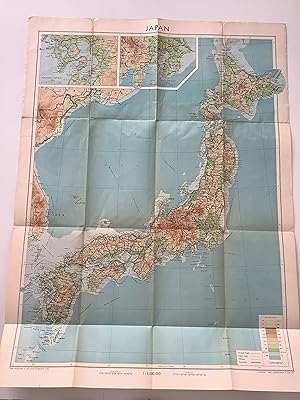
Japan. With Boundaries, Roads and Railways.
Publicado por Edinburgh, Bartholomew., 1954
Librería: Michael Steinbach Rare Books, Wien, Austria
Miembro de asociación: ILAB VDA VDAO
Calificación del vendedor: 5 de 5 estrellas
EUR 25,00
Envío por EUR 19,50
Se envía de Austria a Estados Unidos de AmericaCantidad disponible: 1 disponibles
Ańadir al carrito53 : 71 cm., resp. 22 : 13 cm. One many-folded map. Original wrappers. Bartholomew's Worl Series. - Scale 1 : 3,000,000.
-

Birmingham
Publicado por Published by A. Fullarton & Co. [1860], London & Edinburgh, 1860
Librería: Keoghs Books, Skipton, Reino Unido
Miembro de asociación: PBFA
Calificación del vendedor: 5 de 5 estrellas
Mapa Original o primera edición
EUR 23,87
Envío por EUR 32,44
Se envía de Reino Unido a Estados Unidos de AmericaCantidad disponible: 1 disponibles
Ańadir al carrito, paper map folded at centre, hand-coloured in outline, scale of half a mile to an inch, upper left Smethwick, upper right Aston, lower left Harbourne, lower right Bordesley First Edition thus , lightly foxed around margins and a few patches to map, in good condition 35 x 26.5 cm Paperback ISBN:
-

Canada (North West Provinces).
Publicado por Bartholomew. [1886]., 1886
Librería: Asia Bookroom ANZAAB/ILAB, Canberra, ACT, Australia
Miembro de asociación: ANZAAB ILAB
Calificación del vendedor: 5 de 5 estrellas
EUR 24,93
Envío por EUR 18,65
Se envía de Australia a Estados Unidos de AmericaCantidad disponible: 1 disponibles
Ańadir al carritoSmall map of the north west provinces of Canada from the British Colonial Pocket Atlas. Printed colour, tiny barely visible hole in one place along the centrefold. 16 x 12 cm. A map of the Canadian prairies and British Columbia, showing the defunct districts of Assiniboia, Athabasca, and Keewatin.
-

The Channel Islands; General Map of the Islands, Alderney & The Casquets, Guernsey and Sercq, Jersey
Publicado por Published by A. Fullarton & Co [1860], London, 1860
Librería: Keoghs Books, Skipton, Reino Unido
Miembro de asociación: PBFA
Calificación del vendedor: 5 de 5 estrellas
Mapa Original o primera edición
EUR 29,84
Envío por EUR 32,44
Se envía de Reino Unido a Estados Unidos de AmericaCantidad disponible: 1 disponibles
Ańadir al carrito, 4 maps on one sheet, folded at centre, hand-coloured in outline, diferent scales for each of the 4 maps First Edition , some light spots at margins, maps clean, neat edge repair, in good+ condition 35 x 26.5 cm Paperback ISBN:
-
Philips' Series of Travelling Maps. South Australia [cover title on the cloth case of a linen-backed folding map]
Publicado por George Philip, London, 1861
Librería: Michael Treloar Booksellers ANZAAB/ILAB, Adelaide, SA, Australia
Miembro de asociación: ANZAAB ILAB
Calificación del vendedor: 5 de 5 estrellas
Mapa Original o primera edición
EUR 467,53
Envío por EUR 21,07
Se envía de Australia a Estados Unidos de AmericaCantidad disponible: 1 disponibles
Ańadir al carritoHardcover. Condición: Fine. First Edition. London, George Philip, [late 1861]. A full-colour map, printed surface 610 × 510 mm, cut into 20 panels mounted on linen (as issued), folded, and mounted in the publisher's gilt-decorated cloth case (external dimensions 190 × 118 mm). Slight wear to the corners of the case, with minimal restoration to the spine; light erasures to the pastedown and paper-lined verso of the exposed panel of the folded map; the map is lightly marked in one spot, but is essentially in fine condition. There are two interesting rubber-stamps on one cloth panel, that of 'W.C. Rigby, Newsagent, Adelaide' and 'Archiv. Provinciae Austriae S. J.'; the erasures mentioned above appear to have removed a couple of examples of the Jesuit Archive stamp. Philips' Authentic Maps of the Australian Colonies, Number 6 (according to the information printed on the front pastedown). Tooley 974 (basic details of the map only, not noting the Travelling Maps series). Pertinent details printed on the map that provide evidence of the date of publication include 'Burke & Wills 1860-61', and the locations where King, and the bodies of Gray, Burke and Wills, were found (King was found in September 1861). The latest reference to Stuart is 'Stuart's Route 1860' (presumably his fifth expedition, from November 1860 to September 1861). The entire region of South Australia west of about 133 degrees east longitude and north of the coastline is described as 'Unexplored Country added to South Australia in 1861'; the Act to annex this land was passed in Great Britain in August 1861. Historians of Australian bookselling will know that William Charles Rigby commenced trading as a bookseller and newsagent in Adelaide in late 1859.
-
China In Provinces; Independent Seng Maio Si
Publicado por John Bartholomew, Edinburgh, 1862
Librería: The First Edition Rare Books, LLC, Cincinnati, OH, Estados Unidos de America
Miembro de asociación: ABAA ILAB IOBA MWABA
Calificación del vendedor: 5 de 5 estrellas
EUR 678,14
Envío por EUR 5,27
Se envía dentro de Estados Unidos de AmericaCantidad disponible: 1 disponibles
Ańadir al carritoFramed Map. Condición: Fine. Colored Map of the Provinces of China: Independent Seng Maio Si by John Bartholomew of Edinburgh, published in 1862. Ilustrador. Atlas Map. Previously folded along centerline. Framed by DuPage Framing Center of Wheaton, Illinois. Museum glass, decorative antique wood frame. Includes beige cloth matte, full piece measures 32" x 26.5". A beautiful piece. This map was taken from Black's General Atlas of the World: A Series in Fifty-Six Maps, published by Adam and Charles Black of Edinburgh.
-
![Imagen del vendedor de The Polar Book [complete with two colour maps, 1930] a la venta por Muir Books [Robert Muir Old & Rare Books]](https://pictures.abebooks.com/inventory/md/md31172273622.jpg)
The Polar Book [complete with two colour maps, 1930]
Publicado por E. Allom & Co. Ltd n.d. ( 1930), London, 1930
Librería: Muir Books [Robert Muir Old & Rare Books], PERTH, WA, Australia
Miembro de asociación: ANZAAB ILAB
Calificación del vendedor: 5 de 5 estrellas
Original o primera edición
EUR 1.090,89
Envío por EUR 24,58
Se envía de Australia a Estados Unidos de AmericaCantidad disponible: 1 disponibles
Ańadir al carritoWraps. John Bartholomew (map-maker) Ilustrador. 1st edition. 1st ed., pp.115, two col. maps by John Bartholomew on large fold plate showing 'South Polar Regions' and 'North Polar Regions', the map tipped onto rear endpaper, repair to lower title page with paper adhered over what appears to have been a sticker, evidence of small sticker to lower rear wrap and discolouring to front paste-down, light repairs to spine, some foxing to edges, orig pictorial paper wraps. Very good clean condition of this scarce title. Published in 1930 for the British Polar Exhibition, Louis Bernacchi was one of the main organisers of the event and founded the Antarctic Club. He was also the first Australian to work and winter in the Antarctica. Contributors include Frank Debenham, Dr G. Murray-Levick and J.M. Wordie.
-
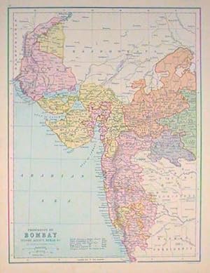
Presidency of Bombay Indore Agency Berar &c.
Publicado por J. Bartholomew [circa1880s]., Edinburgh., 1880
Librería: Asia Bookroom ANZAAB/ILAB, Canberra, ACT, Australia
Miembro de asociación: ANZAAB ILAB
Calificación del vendedor: 5 de 5 estrellas
EUR 77,92
Envío por EUR 18,65
Se envía de Australia a Estados Unidos de AmericaCantidad disponible: 1 disponibles
Ańadir al carritoMap 40.2 x 30.4 cms with printed colour and outline hand colour, in very good condition. Handsome map with colonial interests attractively coloured.
-
Bartholomew's General War Map of Europe and the Mediterranean
Publicado por Edinburgh. John Bartholomew & Co. c.[1915], 1915
Librería: J. Patrick McGahern Books Inc. (ABAC), Ottawa, ON, Canada
Miembro de asociación: ABAC ILAB
Calificación del vendedor: 4 de 5 estrellas
EUR 95,59
Envío por EUR 8,78
Se envía de Canada a Estados Unidos de AmericaCantidad disponible: 1 disponibles
Ańadir al carritoLarge colour map: 67x 82cm, (26" x 32"), with 8 insets, linen-backed, folded in thirds & sixths, in illustrated wrappers with publishers ads, printed on map "With compliments of Dailuaine-Tasker Distilleries Ltd.", on verso of one panel of map are 4 photos of Glenlivet distilleries, upper wrapper detached, spine chipped, a fine bright copy (Pol). ~ John Bartholomew, Edinburgh was one of the finest cartographers in Great Britain. The detail in this map showing Europe and environs at the start if World War One is impressive. Insets include Copenhagen, Gibraltar, Hamburg, Berlin, Petrograd, Dardenelles and Gallipoli. The interest in the latter indicates that the map could be dated to at least 1915 or 1916.
-
Bartholomew's general map of North America. . . .
Publicado por John Bartholomew & Son, Ltd., The Geographical Institute & American Map Company, [1924]., Edinburgh & New York:, 1924
Librería: Zephyr Used & Rare Books, Vancouver, WA, Estados Unidos de America
Miembro de asociación: ABAA CBA ESA ILAB
Calificación del vendedor: 5 de 5 estrellas
Original o primera edición
EUR 135,63
Envío por EUR 7,02
Se envía dentro de Estados Unidos de AmericaCantidad disponible: 1 disponibles
Ańadir al carrito8vo. 5 x 8.5 in. which folds out into very large Elephant Folio linen-backed folding map sized 28.75 x 36.5 in. (slight age toning at fore-edges, minor rubbing, 1 fold crease w/ minor closed tear). Original printed soft covers mounted on exterior when folded, w/ American Map Co. label affixed on front cover, ads on rear (minor shelfwear, rubbing), still VG copy. First edition, thus, of this general map of North America issued as a folding pocket map by Bartholomew in 1924 during the Roaring 20's. The map encompasses most of Alaska (w/o the Aelutian Islands, and the Bering Sea, but does include all of Canada, Greenland, upper part of Iceland, as well as most of the Caribbean Islands and tip of South America with Colombia and Venezuela in White. Map is dated by the newly released "Fourth Edition" of Bartholomew's Citizen's Atlas published in 1924.
-
Motor roads through the British Isles. . . [Bartholomew's contour motoring map of the British Isles: showing the best touring roads with heights and distances. . . .]
Publicado por Hire Department of The Daimler Motor Co. (1904), Ltd., [1910]., Coventry & London, England:, 1910
Librería: Zephyr Used & Rare Books, Vancouver, WA, Estados Unidos de America
Miembro de asociación: ABAA CBA ESA ILAB
Calificación del vendedor: 5 de 5 estrellas
Original o primera edición
EUR 497,30
Envío por EUR 7,02
Se envía dentro de Estados Unidos de AmericaCantidad disponible: 1 disponibles
Ańadir al carritoOne large folding linen-backed dissected colour travel map, sized 36 x 32 in., consisting of 40 map panels, 14 leaves of Daimler Motor Co. for hire vehicles advertised & mounted on verso w/ photo illustrations, self-printed mounted red linen covers when folded, black lettering on covers, NF copy. First edition, thus, of this exceedingly scarce promotional automobile travel map issued by the storied Daimler Motor Co. after the company had been purchased in 1910 by BSA (Birmingham Small Arms Co.) under the efforts of Dudley Docker. Featuring garages in various locations, the Daimler Motor Co. Hire Dept. rented every type of automobile, including Landaulettes, Limousines, Touring Cars, Ambulances, and even provided automobiles and chauffeurs for Continental Tours. In addition, they maintained an entire stable of automobiles in Liverpool near the Cunard Line docks to receive American customers who could rent by the hour, day, and up to a month, 42 and 48 horsepower cars seating up to 5-6 passengers and the driver. The Bartholomew Touring Map tends to be rather uncommon, but we could find no holdings or records of this specially issued Daimler Motor Co. version in Worldcat, or other references.
-
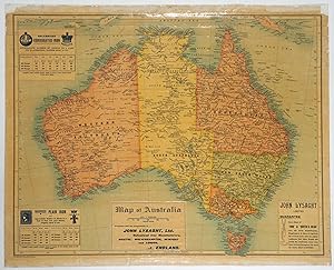
Map of Australia
Publicado por John Bartholomew and Co, Edinburgh, 1901
Librería: Antipodean Books, Maps & Prints, ABAA, Garrison, NY, Estados Unidos de America
Miembro de asociación: ABAA ANZAAB ESA ILAB
Calificación del vendedor: 4 de 5 estrellas
EUR 646,49
Envío por EUR 8,78
Se envía dentro de Estados Unidos de AmericaCantidad disponible: 1 disponibles
Ańadir al carritoMaps. Condición: Very good condition. A rolling wall map advertising a British steel firm with connections to Australia. Printed "With Compliments John Lysaght Ltd." of Bristol, England and features three insets advertising their products. In the 1880s, Lysaght's produce 40,000 tons of rolled iron sheet each year, much of which was exported to Australia. John Lysaght himself traveled to Australia in 1879, and formed a subsidiary company there, Lysaght (Australia), the Victoria Galvanised Iron and Wire Co. Published around 1901 after the discovery of Kalgoorlie; while the Northern Territory was still a South Australian protectorate (it was made a state in 1911). The map was most likely published to commemorate Federation. 18x24", originally published as a rolling map on small metal rollers, which are not present. The map has its original lamination and has been deacidified and flattened with the borders restored by Green Dragon Bindery.
-

China.
Ańo de publicación: 1922
Librería: Geographicus Rare Antique Maps, Brooklyn, NY, Estados Unidos de America
Miembro de asociación: ABAA ESA ILAB
Calificación del vendedor: 4 de 5 estrellas
Mapa
EUR 101,27
Envío por EUR 14,92
Se envía dentro de Estados Unidos de AmericaCantidad disponible: 1 disponibles
Ańadir al carritoVery good. Exhibits light wear along original centerfold. Size 22.5 x 17.25 Inches. This is a 1922 J.G. Bartholomew terrain map of China. Depicting eastern China from Mongolia to Hainan, Bartholomew employs color to differentiate between six ranges in elevation from sea level to 12,000 feet and above. He also uses color to illustrate ocean depth. Chinese provinces are illustrated and labeled, and cities, town, and villages are identified. An inset map in the upper left corner details Beijing (Peking) and its environs. Publication History This map was created by J.G. Bartholomew for publication by The Times as Plate 63 in 1922 The Times Survey Atlas of the World . A complete example of the atlas is part of the David Rumsey Map Collection. The atlas is well represented institutionally. References: Rumsey 2113.072.
-

Ritter's Map of Arabia (1852).
Ańo de publicación: 1904
Librería: Geographicus Rare Antique Maps, Brooklyn, NY, Estados Unidos de America
Miembro de asociación: ABAA ESA ILAB
Calificación del vendedor: 4 de 5 estrellas
Mapa
EUR 253,17
Envío por EUR 14,92
Se envía dentro de Estados Unidos de AmericaCantidad disponible: 1 disponibles
Ańadir al carritoVery good. Light wear and toning along original fold lines. Blank on verso. Size 10.25 x 12.5 Inches. This is a 1904 John Bartholomew map of the Arabian Peninsula. A reduction of Heinrich Kiepert's Ubersichts-Karte von Arabien , the map centers on the Arabian Peninsula and depicts from Egypt to the Gulf of Oman and from Jerusalem to the Bab-el-Mandeb, the strait between Yemen and Djibouti and Eritrea. Cities, towns, and villages throughout the region are labeled, including Jerusalem, Basra, Kuwait City, and Mecca. The route of the Hajj is noted, as are other trade routes and the routes of two German explorers. The Penetration of Arabia Bartholomew created this map for publication in The Penetration of Arabia: A Record of the Development of Western Knowledge Concerning the Arabian Peninsula by David George Hogarth (1862 - 1927). In this work, first published in 1904, Hogarth attempted to recount the history of Western knowledge of the Arabian Peninsula, beginning with the historical geography of Claudius Ptolemy and continuing through the explorations of the early 20th century. As an intriguing aside, Hogarth was an associate of Thomas Edward (T.E.) Lawrence, known to history as Lawrence of Arabia, and helped plan the early stages of the 1916 Arab Revolt against the Ottoman Turks. Publication History and Census This map was created by John Bartholomew from an 1852 map created by Heinrich Kiepert and publisher by Carl Ritter for publication in David George Hogarth's The Penetration of Arabia in 1904. The separate map is quite rare, both institutionally and on the private market. The Penetration of Arabia is well represented institutionally, but is scarce on the private market.


![Imagen del vendedor de Philips' Series of Travelling Maps. South Australia [cover title on the cloth case of a linen-backed folding map] a la venta por Michael Treloar Booksellers ANZAAB/ILAB](https://pictures.abebooks.com/inventory/md/md14916534518.jpg)
