

Importe total (1 artículo artículos):
Destino del pedido:

leslie kettlewell (29 resultados)
Ir a los resultados principales
Filtros de búsqueda
Tipo de artículo
- Todos los tipos de productos
- Libros (29)
- Revistas y publicaciones (No hay ningún otro resultado que coincida con este filtro.)
- Cómics (No hay ningún otro resultado que coincida con este filtro.)
- Partituras (No hay ningún otro resultado que coincida con este filtro.)
- Arte, grabados y pósters (No hay ningún otro resultado que coincida con este filtro.)
- Fotografías (No hay ningún otro resultado que coincida con este filtro.)
- Mapas (No hay ningún otro resultado que coincida con este filtro.)
- Manuscritos y coleccionismo de papel (No hay ningún otro resultado que coincida con este filtro.)
Condición Más información
- Nuevo (11)
- Como nuevo, Excelente o Muy bueno (2)
- Bueno o Aceptable (12)
- Regular o Pobre (4)
- Tal como se indica (No hay ningún otro resultado que coincida con este filtro.)
Encuadernación
- Todas
- Tapa dura (No hay ningún otro resultado que coincida con este filtro.)
- Tapa blanda (29)
Más atributos
- Primera edición (1)
- Firmado (No hay ningún otro resultado que coincida con este filtro.)
- Sobrecubierta (1)
- Con imágenes (12)
- No impresión bajo demanda (29)
Idioma (2)
Gastos de envío gratis
Ubicación del vendedor
Valoración de los vendedores
-

Reed's Nautical Almanac: Caribbean 1994
Idioma: Inglés
Publicado por Thomas Reed Publications, 1994
ISBN 10: 1884666019 ISBN 13: 9781884666018
Librería: Top Notch Books, Tolar, TX, Estados Unidos de America
Calificación del vendedor: 5 de 5 estrellas

EUR 7,20
Envío por EUR 5,03
Se envía dentro de Estados Unidos de AmericaCantidad disponible: 1 disponibles
Añadir al carritoSoft Cover. Condición: Very Good. Wraps have only light wear, spine is unbent. Pages are clean with no markings in text. Size: 8vo - 7¾" - 9¾" Tall.
-
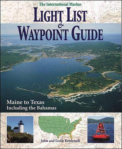
International Marine Light List and Waypoint Guide (The): Maine to Texas Including the Bahamas
Idioma: Inglés
Publicado por International Marine/Ragged Mountain Press, 1996
ISBN 10: 0070343012 ISBN 13: 9780070343016
Librería: ThriftBooks-Atlanta, AUSTELL, GA, Estados Unidos de America
Calificación del vendedor: 5 de 5 estrellas
EUR 17,97
Gastos de envío gratis
Se envía dentro de Estados Unidos de AmericaCantidad disponible: 1 disponibles
Añadir al carritoPaperback. Condición: Fair. No Jacket. Readable copy. Pages may have considerable notes/highlighting. ~ ThriftBooks: Read More, Spend Less.
-

The Intracoastal Waterway Chartbook: Norfolk to Miami
Librería: BookDepart, Shepherdstown, WV, Estados Unidos de America
Calificación del vendedor: 5 de 5 estrellas
EUR 15,54
Envío por EUR 7,38
Se envía dentro de Estados Unidos de AmericaCantidad disponible: 1 disponibles
Añadir al carritoPaperback. Condición: Good. Paperback with spiral binding; scuffing, light soiling, and edge wear to ex terior; a few small tears at top edge near binding; fade spots to page edge s; in good condition with clean text.
-
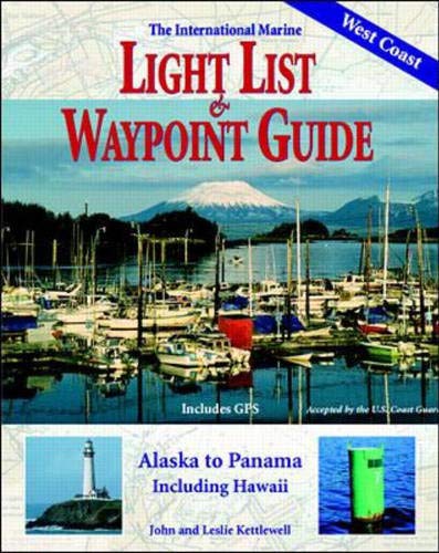
International Marine Light List and Waypoint Guide (The): Alaska to Panama, Including Hawaii
Idioma: Inglés
Publicado por International Marine/Ragged Mountain Press (edition 1), 1997
ISBN 10: 007034390X ISBN 13: 9780070343900
Librería: BooksRun, Philadelphia, PA, Estados Unidos de America
Calificación del vendedor: 5 de 5 estrellas
EUR 25,20
Gastos de envío gratis
Se envía dentro de Estados Unidos de AmericaCantidad disponible: 1 disponibles
Añadir al carritoPaperback. Condición: Very Good. 1. It's a well-cared-for item that has seen limited use. The item may show minor signs of wear. All the text is legible, with all pages included. It may have slight markings and/or highlighting.
-

The International Marine Light List & Waypoint Guide, From Maine to Texas, Including the Bahamas
Publicado por International Marine, 1997
Librería: Library House Internet Sales, Grand Rapids, OH, Estados Unidos de America
Calificación del vendedor: 5 de 5 estrellas
EUR 9,91
Envío por EUR 6,11
Se envía dentro de Estados Unidos de AmericaCantidad disponible: 1 disponibles
Añadir al carritoSoftcover. Condición: Good. No Jacket. Piece(s) of the spine missing. Due to age and/or environmental conditions, the pages of this book have darkened. Please note the image in this listing is a stock photo and may not match the covers of the actual item. Book.
-
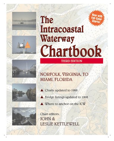
Intracoastal Waterway Chartbook: Norfolk to Miami
Idioma: Inglés
Publicado por Mcgraw-Hill (edition 3rd), 1998
ISBN 10: 0070344558 ISBN 13: 9780070344556
Librería: BooksRun, Philadelphia, PA, Estados Unidos de America
Calificación del vendedor: 5 de 5 estrellas
EUR 27,15
Gastos de envío gratis
Se envía dentro de Estados Unidos de AmericaCantidad disponible: 1 disponibles
Añadir al carritoPaperback. Condición: Fair. 3rd. The item might be beaten up but readable. May contain markings or highlighting, as well as stains, bent corners, or any other major defect, but the text is not obscured in any way.
-
Intracoastal Waterway Chartbook: Norfolk, Virginia to Miami, Florida
Librería: Nelsons Books, Chazy, NY, Estados Unidos de America
Calificación del vendedor: 4 de 5 estrellas

EUR 28,82
Envío por EUR 5,85
Se envía dentro de Estados Unidos de AmericaCantidad disponible: 1 disponibles
Añadir al carritoSpiralbound. Condición: Very good. 3rd ed. Trade paperback (US). Glued binding. 267 p. Norfolk, Virginia, to Miami, Florida. Audience: General/trade. book is very good plus, some light edge wear. no markings.
-
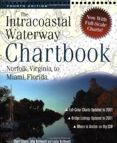
Intracoastal Waterway Chartbook : Norfolk, Virginia, to Miami, Florida
Idioma: Inglés
Publicado por International Marine/Ragged Mountain Press, 2002
ISBN 10: 0071387994 ISBN 13: 9780071387996
Librería: Patrico Books, Apollo Beach, FL, Estados Unidos de America
Calificación del vendedor: 5 de 5 estrellas
EUR 36,01
Envío por EUR 3,49
Se envía dentro de Estados Unidos de AmericaCantidad disponible: 1 disponibles
Añadir al carritospiral_bound. Condición: Very Good. Ships Out Tomorrow!
-

Intracoastal Waterway Chartbook : Norfolk, Virginia, to Miami, Florida
Idioma: Inglés
Publicado por International Marine/Ragged Mountain Press, 2002
ISBN 10: 0071387994 ISBN 13: 9780071387996
Librería: MERS Goodwill, Saint Louis, MO, Estados Unidos de America
Calificación del vendedor: 5 de 5 estrellas
EUR 39,59
Envío por EUR 3,50
Se envía dentro de Estados Unidos de AmericaCantidad disponible: 1 disponibles
Añadir al carritoCondición: acceptable. Used - Acceptable: All pages and the cover are intact, but shrink wrap, dust covers, or boxed set case may be missing. Pages may include limited notes, highlighting, or minor water damage but the text is readable. Pages may include limited notes and highlighting, but the text cannot be obscured or unreadable. Any access codes or passwords originally included with the book may be expired, used or no longer valid. Image is stock photo and cover art edition may be different than pictured.
-

Intracoastal Waterway Chartbook Norfolk to Miami, 6th Edition (Intracoastal Waterway Chartbook: Norfolk, Virginia to Miami, Florida)
Idioma: Inglés
Publicado por International Marine/Ragged Mountain Press, 2012
ISBN 10: 0071803904 ISBN 13: 9780071803908
Librería: Goodwill of Central and Coastal Virginia, Richmond, VA, Estados Unidos de America
Calificación del vendedor: 4 de 5 estrellas
EUR 39,11
Envío por EUR 5,02
Se envía dentro de Estados Unidos de AmericaCantidad disponible: 1 disponibles
Añadir al carritoCondición: acceptable.
-
Intracoastal Waterway Chartbook : Norfolk, Virginia, to Miami, Florida
Idioma: Inglés
Publicado por International Marine/Ragged Mountain Press, 2012
ISBN 10: 0071803904 ISBN 13: 9780071803908
Librería: GreatBookPrices, Columbia, MD, Estados Unidos de America
Calificación del vendedor: 5 de 5 estrellas
EUR 64,69
Envío por EUR 2,31
Se envía dentro de Estados Unidos de AmericaCantidad disponible: 2 disponibles
Añadir al carritoCondición: New.
-

Intracoastal Waterway Chartbook Norfolk to Miami (Spiral)
Idioma: Inglés
Publicado por International Marine Publishing Co, Rockport, ME, 2012
ISBN 10: 0071803904 ISBN 13: 9780071803908
Librería: Grand Eagle Retail, Bensenville, IL, Estados Unidos de America
Calificación del vendedor: 5 de 5 estrellas
EUR 67,07
Gastos de envío gratis
Se envía dentro de Estados Unidos de AmericaCantidad disponible: 1 disponibles
Añadir al carritoSpiral. Condición: new. Spiral. $500 WORTH OF GOVERNMENT CHART AND COAST PILOT COVERAGE--MARKED WITH WAYPOINTS, BRIDGES, AND THE ROUTE!The Intracoastal Waterway Chartbook is a complete set of navigation charts for the 1,090-mile Intracoastal Waterway from Norfolk to Miami, as well as charts for all major Atlantic inlets. The chartbook also includes a complete listing of waterway bridge and lock characteristics; anchorage listings; mileage charts; charts for a picturesque alternate route; andnew to thiseditionmarina listingsall in a compact, easy-to-use format. The preferred route is marked in magenta on the charts to guide you all the way down (or up) the entire length of the Intracoastal Waterway. Safe anchorage locations are also shown to keep you and your vessel safe--and rested--as you cruise. Waypoints are also given for critical locations along the entire route, allowingyou to pre-plot your course in your GPS. Use this all-in-one chartbook alone or as a backup to your electronic navigation.Statute miles are noted in fi ve-mile increments in the chart margins, along with bridge, lock, marina, and anchorage locations. A handy place-name index makes it even easier to go right to the chart showing your destination."All the charts you need for the 1,000-mile 'Ditch'cruise for a fraction of the price." -- Cruising World"An outstanding example of economical, complete,no-nonsense chart compilation." -- Practical Sailor"An excellent compendium." -- The Capital (Annapolis, MD)"Your destination can be followed page by page in the proper order." -- Trailer Boats Presents a complete set of navigation that charts for the 1,090-mile Intracoastal Waterway from Norfolk to Miami, as well as charts for all major Atlantic inlets. This book includes a complete listing of waterway bridge and lock characteristics; anchorage listings; mileage charts; and charts for a picturesque alternate route. Shipping may be from multiple locations in the US or from the UK, depending on stock availability.
-
Intracoastal Waterway Chartbook : Norfolk, Virginia, to Miami, Florida
Idioma: Inglés
Publicado por International Marine/Ragged Mountain Press, 2012
ISBN 10: 0071803904 ISBN 13: 9780071803908
Librería: GreatBookPrices, Columbia, MD, Estados Unidos de America
Calificación del vendedor: 5 de 5 estrellas
EUR 66,38
Envío por EUR 2,31
Se envía dentro de Estados Unidos de AmericaCantidad disponible: 2 disponibles
Añadir al carritoCondición: As New. Unread book in perfect condition.
-

The Intracoastal Waterway Chartbook: 2nd edition, Norfolk, Va to Miami, Fl
Idioma: Inglés
Publicado por International Marine, Camden, Maine, 1995
ISBN 10: 0070343004 ISBN 13: 9780070343009
Librería: James Lasseter, Jr, Brooksville, FL, Estados Unidos de America
Calificación del vendedor: 5 de 5 estrellas
EUR 63,02
Envío por EUR 6,95
Se envía dentro de Estados Unidos de AmericaCantidad disponible: 1 disponibles
Añadir al carritoSoft cover. Condición: Very Good. A 265 page book "The Intracoastal Waterway Chartbook" is a complete set of Navigation Charts for the 1,090 mile Waterway from Norfolk to Miami. It also includes charts for the major inlets between the Waterway and the Atlantic Ocean. It would have cost more than $350.00 in 1995 dollars to purchase the same coverage in government charts and publications. A previous owner has highlighted many bridges in yellow; statute miles in blue; green markers in green, red markers in red and anchorage in orange. Some text is highlighted in light yellow. The work is held together by 21 wire binders at the page tops. Apparently the last name of the prior owner was Kokomo and this is etched (but does not go through to the other side) at the upper right hand corner of the front cover. You must hold it to light at the correct angle to see the name. The back cover has an area in the middle where a sticker of some sort has apparently been removed. Condition is better than it sounds. All in all, this is a highly useful copy; available for immediate shipment, carefully packed in a sturdy box! bx109.
-

Intracoastal Waterway Chartbook Norfolk to Miami
Idioma: Inglés
Publicado por International Marine Publishing Co, US, 2012
ISBN 10: 0071803904 ISBN 13: 9780071803908
Librería: Rarewaves USA, OSWEGO, IL, Estados Unidos de America
Calificación del vendedor: 5 de 5 estrellas
EUR 71,60
Gastos de envío gratis
Se envía dentro de Estados Unidos de AmericaCantidad disponible: Más de 20 disponibles
Añadir al carritoSpiral Bound. Condición: New. $500 WORTH OF GOVERNMENT CHART AND COAST PILOT COVERAGE--MARKED WITH WAYPOINTS, BRIDGES, AND THE ROUTE!The Intracoastal Waterway Chartbook is a complete set of navigation charts for the 1,090-mile Intracoastal Waterway from Norfolk to Miami, as well as charts for all major Atlantic inlets. The chartbook also includes a complete listing of waterway bridge and lock characteristics; anchorage listings; mileage charts; charts for a picturesque alternate route; and-new to thisedition-marina listings-all in a compact, easy-to-use format. The preferred route is marked in magenta on the charts to guide you all the way down (or up) the entire length of the Intracoastal Waterway. Safe anchorage locations are also shown to keep you and your vessel safe--and rested--as you cruise. Waypoints are also given for critical locations along the entire route, allowingyou to pre-plot your course in your GPS. Use this all-in-one chartbook alone or as a backup to your electronic navigation.Statute miles are noted in fi ve-mile increments in the chart margins, along with bridge, lock, marina, and anchorage locations. A handy place-name index makes it even easier to go right to the chart showing your destination."All the charts you need for the 1,000-mile 'Ditch'cruise for a fraction of the price." -- Cruising World"An outstanding example of economical, complete,no-nonsense chart compilation." -- Practical Sailor"An excellent compendium." -- The Capital (Annapolis, MD)"Your destination can be followed page by page in the proper order." -- Trailer Boats.
-

Intracoastal Waterway Chartbook : Norfolk, Virginia, to Miami, Florida
Idioma: Inglés
Publicado por International Marine/Ragged Mountain Press, 2012
ISBN 10: 0071803904 ISBN 13: 9780071803908
Librería: GreatBookPricesUK, Woodford Green, Reino Unido
Calificación del vendedor: 5 de 5 estrellas
EUR 60,62
Envío por EUR 17,64
Se envía de Reino Unido a Estados Unidos de AmericaCantidad disponible: Más de 20 disponibles
Añadir al carritoCondición: As New. Unread book in perfect condition.
-

Intracoastal Waterway Chartbook Norfolk to Miami
Idioma: Inglés
Publicado por International Marine Publishing Co, US, 2012
ISBN 10: 0071803904 ISBN 13: 9780071803908
Librería: Rarewaves.com USA, London, LONDO, Reino Unido
Calificación del vendedor: 5 de 5 estrellas
EUR 80,89
Gastos de envío gratis
Se envía de Reino Unido a Estados Unidos de AmericaCantidad disponible: Más de 20 disponibles
Añadir al carritoSpiral Bound. Condición: New. $500 WORTH OF GOVERNMENT CHART AND COAST PILOT COVERAGE--MARKED WITH WAYPOINTS, BRIDGES, AND THE ROUTE!The Intracoastal Waterway Chartbook is a complete set of navigation charts for the 1,090-mile Intracoastal Waterway from Norfolk to Miami, as well as charts for all major Atlantic inlets. The chartbook also includes a complete listing of waterway bridge and lock characteristics; anchorage listings; mileage charts; charts for a picturesque alternate route; and-new to thisedition-marina listings-all in a compact, easy-to-use format. The preferred route is marked in magenta on the charts to guide you all the way down (or up) the entire length of the Intracoastal Waterway. Safe anchorage locations are also shown to keep you and your vessel safe--and rested--as you cruise. Waypoints are also given for critical locations along the entire route, allowingyou to pre-plot your course in your GPS. Use this all-in-one chartbook alone or as a backup to your electronic navigation.Statute miles are noted in fi ve-mile increments in the chart margins, along with bridge, lock, marina, and anchorage locations. A handy place-name index makes it even easier to go right to the chart showing your destination."All the charts you need for the 1,000-mile 'Ditch'cruise for a fraction of the price." -- Cruising World"An outstanding example of economical, complete,no-nonsense chart compilation." -- Practical Sailor"An excellent compendium." -- The Capital (Annapolis, MD)"Your destination can be followed page by page in the proper order." -- Trailer Boats.
-

Intracoastal Waterway Chartbook Norfolk to Miami
Idioma: Inglés
Publicado por International Marine Publishing Co, 2012
ISBN 10: 0071803904 ISBN 13: 9780071803908
Librería: Kennys Bookshop and Art Galleries Ltd., Galway, GY, Irlanda
Calificación del vendedor: 5 de 5 estrellas
EUR 74,66
Envío por EUR 10,50
Se envía de Irlanda a Estados Unidos de AmericaCantidad disponible: Más de 20 disponibles
Añadir al carritoCondición: New. Presents a complete set of navigation that charts for the 1,090-mile Intracoastal Waterway from Norfolk to Miami, as well as charts for all major Atlantic inlets. This book includes a complete listing of waterway bridge and lock characteristics; anchorage listings; mileage charts; and charts for a picturesque alternate route. Num Pages: 304 pages, Illustrations, map. BIC Classification: 1KBBF; TRLN; WSSN. Category: (G) General (US: Trade). Dimension: 233 x 302 x 15. Weight in Grams: 844. . 2012. 6th Edition. . . . .
-
Intracoastal Waterway Chartbook : Norfolk, Virginia, to Miami, Florida
Idioma: Inglés
Publicado por International Marine/Ragged Mountain Press, 2012
ISBN 10: 0071803904 ISBN 13: 9780071803908
Librería: GreatBookPricesUK, Woodford Green, Reino Unido
Calificación del vendedor: 5 de 5 estrellas
EUR 74,55
Envío por EUR 17,64
Se envía de Reino Unido a Estados Unidos de AmericaCantidad disponible: Más de 20 disponibles
Añadir al carritoCondición: New.
-
Intracoastal Waterway Chartbook Norfolk to Miami
Idioma: Inglés
Publicado por International Marine Publishing Co, 2012
ISBN 10: 0071803904 ISBN 13: 9780071803908
Librería: Kennys Bookstore, Olney, MD, Estados Unidos de America
Calificación del vendedor: 5 de 5 estrellas
EUR 94,27
Envío por EUR 9,18
Se envía dentro de Estados Unidos de AmericaCantidad disponible: Más de 20 disponibles
Añadir al carritoCondición: New. Presents a complete set of navigation that charts for the 1,090-mile Intracoastal Waterway from Norfolk to Miami, as well as charts for all major Atlantic inlets. This book includes a complete listing of waterway bridge and lock characteristics; anchorage listings; mileage charts; and charts for a picturesque alternate route. Num Pages: 304 pages, Illustrations, map. BIC Classification: 1KBBF; TRLN; WSSN. Category: (G) General (US: Trade). Dimension: 233 x 302 x 15. Weight in Grams: 844. . 2012. 6th Edition. . . . . Books ship from the US and Ireland.
-

Intracoastal Waterway Chartbook Norfolk to Miami
Idioma: Inglés
Publicado por International Marine Publishing Co, US, 2012
ISBN 10: 0071803904 ISBN 13: 9780071803908
Librería: Rarewaves USA United, OSWEGO, IL, Estados Unidos de America
Calificación del vendedor: 5 de 5 estrellas
EUR 74,54
Envío por EUR 43,71
Se envía dentro de Estados Unidos de AmericaCantidad disponible: Más de 20 disponibles
Añadir al carritoSpiral Bound. Condición: New. $500 WORTH OF GOVERNMENT CHART AND COAST PILOT COVERAGE--MARKED WITH WAYPOINTS, BRIDGES, AND THE ROUTE!The Intracoastal Waterway Chartbook is a complete set of navigation charts for the 1,090-mile Intracoastal Waterway from Norfolk to Miami, as well as charts for all major Atlantic inlets. The chartbook also includes a complete listing of waterway bridge and lock characteristics; anchorage listings; mileage charts; charts for a picturesque alternate route; and-new to thisedition-marina listings-all in a compact, easy-to-use format. The preferred route is marked in magenta on the charts to guide you all the way down (or up) the entire length of the Intracoastal Waterway. Safe anchorage locations are also shown to keep you and your vessel safe--and rested--as you cruise. Waypoints are also given for critical locations along the entire route, allowingyou to pre-plot your course in your GPS. Use this all-in-one chartbook alone or as a backup to your electronic navigation.Statute miles are noted in fi ve-mile increments in the chart margins, along with bridge, lock, marina, and anchorage locations. A handy place-name index makes it even easier to go right to the chart showing your destination."All the charts you need for the 1,000-mile 'Ditch'cruise for a fraction of the price." -- Cruising World"An outstanding example of economical, complete,no-nonsense chart compilation." -- Practical Sailor"An excellent compendium." -- The Capital (Annapolis, MD)"Your destination can be followed page by page in the proper order." -- Trailer Boats.
-

The Intracoastal Waterway Chartbook: Norfolk, Virginia to Miami, Florida
Librería: moluna, Greven, Alemania
Calificación del vendedor: 5 de 5 estrellas
EUR 67,97
Envío por EUR 48,99
Se envía de Alemania a Estados Unidos de AmericaCantidad disponible: 1 disponibles
Añadir al carritoKartoniert / Broschiert. Condición: New. Presents a complete set of navigation that charts for the 1,090-mile Intracoastal Waterway from Norfolk to Miami, as well as charts for all major Atlantic inlets. This book includes a complete listing of waterway bridge and lock characteristics anchorage l.
-
Intracoastal Waterway Chartbook Norfolk to Miami (Spiral)
Idioma: Inglés
Publicado por International Marine Publishing Co, Rockport, ME, 2012
ISBN 10: 0071803904 ISBN 13: 9780071803908
Librería: AussieBookSeller, Truganina, VIC, Australia
Calificación del vendedor: 5 de 5 estrellas
EUR 96,00
Envío por EUR 32,35
Se envía de Australia a Estados Unidos de AmericaCantidad disponible: 1 disponibles
Añadir al carritoSpiral. Condición: new. Spiral. $500 WORTH OF GOVERNMENT CHART AND COAST PILOT COVERAGE--MARKED WITH WAYPOINTS, BRIDGES, AND THE ROUTE!The Intracoastal Waterway Chartbook is a complete set of navigation charts for the 1,090-mile Intracoastal Waterway from Norfolk to Miami, as well as charts for all major Atlantic inlets. The chartbook also includes a complete listing of waterway bridge and lock characteristics; anchorage listings; mileage charts; charts for a picturesque alternate route; andnew to thiseditionmarina listingsall in a compact, easy-to-use format. The preferred route is marked in magenta on the charts to guide you all the way down (or up) the entire length of the Intracoastal Waterway. Safe anchorage locations are also shown to keep you and your vessel safe--and rested--as you cruise. Waypoints are also given for critical locations along the entire route, allowingyou to pre-plot your course in your GPS. Use this all-in-one chartbook alone or as a backup to your electronic navigation.Statute miles are noted in fi ve-mile increments in the chart margins, along with bridge, lock, marina, and anchorage locations. A handy place-name index makes it even easier to go right to the chart showing your destination."All the charts you need for the 1,000-mile 'Ditch'cruise for a fraction of the price." -- Cruising World"An outstanding example of economical, complete,no-nonsense chart compilation." -- Practical Sailor"An excellent compendium." -- The Capital (Annapolis, MD)"Your destination can be followed page by page in the proper order." -- Trailer Boats Presents a complete set of navigation that charts for the 1,090-mile Intracoastal Waterway from Norfolk to Miami, as well as charts for all major Atlantic inlets. This book includes a complete listing of waterway bridge and lock characteristics; anchorage listings; mileage charts; and charts for a picturesque alternate route. Shipping may be from our Sydney, NSW warehouse or from our UK or US warehouse, depending on stock availability.
-

Reed's Nautical Almanac: North American - East Coast
Idioma: Inglés
Publicado por Thomas Reed Publications, 1992
ISBN 10: 0947637877 ISBN 13: 9780947637873
Librería: AwesomeBooks, Wallingford, Reino Unido
Calificación del vendedor: 5 de 5 estrellas
EUR 127,26
Envío por EUR 4,84
Se envía de Reino Unido a Estados Unidos de AmericaCantidad disponible: 1 disponibles
Añadir al carritoPaperback. Condición: Very Good. Reed's Nautical Almanac: North American - East Coast This book is in very good condition and will be shipped within 24 hours of ordering. The cover may have some limited signs of wear but the pages are clean, intact and the spine remains undamaged. This book has clearly been well maintained and looked after thus far. Money back guarantee if you are not satisfied. See all our books here, order more than 1 book and get discounted shipping. .
-
Reed's Nautical Almanac: North American - East Coast
Idioma: Inglés
Publicado por Thomas Reed Publications 01/10/1992, 1992
ISBN 10: 0947637877 ISBN 13: 9780947637873
Librería: Bahamut Media, Reading, Reino Unido
Calificación del vendedor: 5 de 5 estrellas
EUR 125,06
Envío por EUR 8,21
Se envía de Reino Unido a Estados Unidos de AmericaCantidad disponible: 1 disponibles
Añadir al carritoPaperback. Condición: Very Good. Shipped within 24 hours from our UK warehouse. Clean, undamaged book with no damage to pages and minimal wear to the cover. Spine still tight, in very good condition. Remember if you are not happy, you are covered by our 100% money back guarantee.
-

Intracoastal Waterway Chartbook Norfolk to Miami
Idioma: Inglés
Publicado por International Marine Publishing Co, US, 2012
ISBN 10: 0071803904 ISBN 13: 9780071803908
Librería: Rarewaves.com UK, London, Reino Unido
Calificación del vendedor: 5 de 5 estrellas
EUR 75,40
Envío por EUR 76,43
Se envía de Reino Unido a Estados Unidos de AmericaCantidad disponible: Más de 20 disponibles
Añadir al carritoSpiral Bound. Condición: New. $500 WORTH OF GOVERNMENT CHART AND COAST PILOT COVERAGE--MARKED WITH WAYPOINTS, BRIDGES, AND THE ROUTE!The Intracoastal Waterway Chartbook is a complete set of navigation charts for the 1,090-mile Intracoastal Waterway from Norfolk to Miami, as well as charts for all major Atlantic inlets. The chartbook also includes a complete listing of waterway bridge and lock characteristics; anchorage listings; mileage charts; charts for a picturesque alternate route; and-new to thisedition-marina listings-all in a compact, easy-to-use format. The preferred route is marked in magenta on the charts to guide you all the way down (or up) the entire length of the Intracoastal Waterway. Safe anchorage locations are also shown to keep you and your vessel safe--and rested--as you cruise. Waypoints are also given for critical locations along the entire route, allowingyou to pre-plot your course in your GPS. Use this all-in-one chartbook alone or as a backup to your electronic navigation.Statute miles are noted in fi ve-mile increments in the chart margins, along with bridge, lock, marina, and anchorage locations. A handy place-name index makes it even easier to go right to the chart showing your destination."All the charts you need for the 1,000-mile 'Ditch'cruise for a fraction of the price." -- Cruising World"An outstanding example of economical, complete,no-nonsense chart compilation." -- Practical Sailor"An excellent compendium." -- The Capital (Annapolis, MD)"Your destination can be followed page by page in the proper order." -- Trailer Boats.
-

The Intracoastal Waterway Chartbook: Miami, Florida to Mobile, Alabama
Idioma: Inglés
Publicado por International Marine/Ragged Mountain Press, 2003
ISBN 10: 0071422102 ISBN 13: 9780071422109
Librería: ThriftBooks-Atlanta, AUSTELL, GA, Estados Unidos de America
Calificación del vendedor: 5 de 5 estrellas
EUR 180,09
Gastos de envío gratis
Se envía dentro de Estados Unidos de AmericaCantidad disponible: 1 disponibles
Añadir al carritoUnknown. Condición: Good. No Jacket. Pages can have notes/highlighting. Spine may show signs of wear. ~ ThriftBooks: Read More, Spend Less.
-
The Intracoastal Waterway Chartbook: Miami, Florida to Mobile, Alabama
Idioma: Inglés
Publicado por International Marine/Ragged Mountain Press, 2003
ISBN 10: 0071422102 ISBN 13: 9780071422109
Librería: George Kent, Bookseller, Silverhill, AL, Estados Unidos de America
Calificación del vendedor: 5 de 5 estrellas
Original o primera edición
EUR 265,64
Envío por EUR 6,43
Se envía dentro de Estados Unidos de AmericaCantidad disponible: 1 disponibles
Añadir al carritoSoft cover. Condición: Very Good. No Jacket. 1st Edition. This spiral bound soft cover first edition of 262 pages is tight, bright, and clean, free of names and markings. There is a bit of a crinkle at the bottom corner, front to back, that does not affect the printed page or illustrations.
-
The Intracoastal Waterway Chartbook: Miami, Florida to Mobile, Alabama
Idioma: Inglés
Publicado por International Marine/Ragged Mountain Press, 2003
ISBN 10: 0071422102 ISBN 13: 9780071422109
Librería: Mispah books, Redhill, SURRE, Reino Unido
Calificación del vendedor: 4 de 5 estrellas
EUR 333,07
Envío por EUR 29,40
Se envía de Reino Unido a Estados Unidos de AmericaCantidad disponible: 1 disponibles
Añadir al carritospiral_bound. Condición: Good. Good. Dust Jacket NOT present. CD WILL BE MISSING. . SHIPS FROM MULTIPLE LOCATIONS. book.


