Importe total (1 artĒculo artĒculos):
Destino del pedido:

johnston alex keith (99 resultados)
Ir a los resultados principales
Filtros de b·squeda
Tipo de artĒculo
- Todos los tipos de productos
- Libros (99)
- Revistas y publicaciones (No hay ning·n otro resultado que coincida con este filtro.)
- C¾mics (No hay ning·n otro resultado que coincida con este filtro.)
- Partituras (No hay ning·n otro resultado que coincida con este filtro.)
- Arte, grabados y p¾sters (No hay ning·n otro resultado que coincida con este filtro.)
- FotografĒas (No hay ning·n otro resultado que coincida con este filtro.)
- Mapas (No hay ning·n otro resultado que coincida con este filtro.)
- Manuscritos y coleccionismo de papel (No hay ning·n otro resultado que coincida con este filtro.)
Condici¾n Mßs informaci¾n
Encuadernaci¾n
Mßs atributos
- Primera edici¾n (3)
- Firmado (No hay ning·n otro resultado que coincida con este filtro.)
- Sobrecubierta (No hay ning·n otro resultado que coincida con este filtro.)
- Con imßgenes (40)
- No impresi¾n bajo demanda (87)
Idioma (2)
Gastos de envĒo gratis
Ubicaci¾n del vendedor
Valoraci¾n de los vendedores
-

The school atlas of physical geography illustrated in a series
Librería: GreatBookPrices, Columbia, MD, Estados Unidos de America
Calificaci¾n del vendedor: 5 de 5 estrellas

EUR 21,25
EnvĒo por EUR 2,31
Se envĒa dentro de Estados Unidos de AmericaCantidad disponible: Mßs de 20 disponibles
A±adir al carritoCondici¾n: New.
-

The school atlas of physical geography illustrated in a series: The elementary facts of geology, hydrography, meteorology and natural history (Paperback or Softback)
Librería: BargainBookStores, Grand Rapids, MI, Estados Unidos de America
Calificaci¾n del vendedor: 5 de 5 estrellas
EUR 23,64
Gastos de envĒo gratis
Se envĒa dentro de Estados Unidos de AmericaCantidad disponible: 5 disponibles
A±adir al carritoPaperback or Softback. Condici¾n: New. The school atlas of physical geography illustrated in a series: The elementary facts of geology, hydrography, meteorology and natural history. Book.
-

School Atlas of Physical Geography
Librería: GreatBookPrices, Columbia, MD, Estados Unidos de America
Calificaci¾n del vendedor: 5 de 5 estrellas
EUR 21,74
EnvĒo por EUR 2,31
Se envĒa dentro de Estados Unidos de AmericaCantidad disponible: Mßs de 20 disponibles
A±adir al carritoCondici¾n: As New. Unread book in perfect condition.
-

The school atlas of physical geography illustrated in a series: The elementary facts of geology, hydrography, meteorology and natural history
Librería: Lucky's Textbooks, Dallas, TX, Estados Unidos de America
Calificaci¾n del vendedor: 5 de 5 estrellas
EUR 20,64
EnvĒo por EUR 3,49
Se envĒa dentro de Estados Unidos de AmericaCantidad disponible: Mßs de 20 disponibles
A±adir al carritoCondici¾n: New.
-
School Atlas of Physical Geography
Librería: GreatBookPrices, Columbia, MD, Estados Unidos de America
Calificaci¾n del vendedor: 5 de 5 estrellas
EUR 21,96
EnvĒo por EUR 2,31
Se envĒa dentro de Estados Unidos de AmericaCantidad disponible: Mßs de 20 disponibles
A±adir al carritoCondici¾n: New.
-
School Atlas of Physical Geography
Librería: California Books, Miami, FL, Estados Unidos de America
Calificaci¾n del vendedor: 4 de 5 estrellas

EUR 24,35
Gastos de envĒo gratis
Se envĒa dentro de Estados Unidos de AmericaCantidad disponible: Mßs de 20 disponibles
A±adir al carritoCondici¾n: New.
-

The school atlas of physical geography illustrated in a series
Librería: GreatBookPrices, Columbia, MD, Estados Unidos de America
Calificaci¾n del vendedor: 5 de 5 estrellas
EUR 22,34
EnvĒo por EUR 2,31
Se envĒa dentro de Estados Unidos de AmericaCantidad disponible: Mßs de 20 disponibles
A±adir al carritoCondici¾n: As New. Unread book in perfect condition.
-
The school atlas of physical geography illustrated in a series: The elementary facts of geology, hydrography, meteorology and natural history
Librería: Ria Christie Collections, Uxbridge, Reino Unido
Calificaci¾n del vendedor: 5 de 5 estrellas
EUR 24,79
EnvĒo por EUR 13,90
Se envĒa de Reino Unido a Estados Unidos de AmericaCantidad disponible: Mßs de 20 disponibles
A±adir al carritoCondici¾n: New. In.
-
School Atlas of Physical Geography
Librería: Ria Christie Collections, Uxbridge, Reino Unido
Calificaci¾n del vendedor: 5 de 5 estrellas
EUR 25,22
EnvĒo por EUR 13,90
Se envĒa de Reino Unido a Estados Unidos de AmericaCantidad disponible: Mßs de 20 disponibles
A±adir al carritoCondici¾n: New. In.
-
The school atlas of physical geography illustrated in a series: The elementary facts of geology, hydrography, meteorology and natural history
Librería: Chiron Media, Wallingford, Reino Unido
Calificaci¾n del vendedor: 5 de 5 estrellas
EUR 21,61
EnvĒo por EUR 17,98
Se envĒa de Reino Unido a Estados Unidos de AmericaCantidad disponible: 10 disponibles
A±adir al carritoPaperback. Condici¾n: New.
-
School Atlas of Physical Geography
Librería: Chiron Media, Wallingford, Reino Unido
Calificaci¾n del vendedor: 5 de 5 estrellas
EUR 22,04
EnvĒo por EUR 17,98
Se envĒa de Reino Unido a Estados Unidos de AmericaCantidad disponible: Mßs de 20 disponibles
A±adir al carritoPF. Condici¾n: New.
-

The school atlas of physical geography illustrated in a series
Librería: GreatBookPricesUK, Woodford Green, Reino Unido
Calificaci¾n del vendedor: 5 de 5 estrellas
EUR 24,58
EnvĒo por EUR 17,41
Se envĒa de Reino Unido a Estados Unidos de AmericaCantidad disponible: Mßs de 20 disponibles
A±adir al carritoCondici¾n: New.
-
School Atlas of Physical Geography
Librería: GreatBookPricesUK, Woodford Green, Reino Unido
Calificaci¾n del vendedor: 5 de 5 estrellas
EUR 25,01
EnvĒo por EUR 17,41
Se envĒa de Reino Unido a Estados Unidos de AmericaCantidad disponible: Mßs de 20 disponibles
A±adir al carritoCondici¾n: New.
-
School Atlas of Physical Geography
Librería: GreatBookPricesUK, Woodford Green, Reino Unido
Calificaci¾n del vendedor: 5 de 5 estrellas
EUR 27,31
EnvĒo por EUR 17,41
Se envĒa de Reino Unido a Estados Unidos de AmericaCantidad disponible: Mßs de 20 disponibles
A±adir al carritoCondici¾n: As New. Unread book in perfect condition.
-

The school atlas of physical geography illustrated in a series
Librería: GreatBookPricesUK, Woodford Green, Reino Unido
Calificaci¾n del vendedor: 5 de 5 estrellas
EUR 28,06
EnvĒo por EUR 17,41
Se envĒa de Reino Unido a Estados Unidos de AmericaCantidad disponible: Mßs de 20 disponibles
A±adir al carritoCondici¾n: As New. Unread book in perfect condition.
-

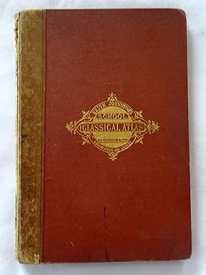
School Atlas of Classical Geography Comprising in Twenty Plates Maps and Plans of All the Important Countries and Localities Referred to by Classical Authors, Constructed From the Best Materials, and Embodying the Results of the Most Recent Investigations - New and ENlarged Edition
Idioma: Inglķs
Publicado por Johnston, 1876
Librería: Hampstead Books, Haverfordwest, Reino Unido
Calificaci¾n del vendedor: 4 de 5 estrellas
EUR 17,92
EnvĒo por EUR 32,50
Se envĒa de Reino Unido a Estados Unidos de AmericaCantidad disponible: 1 disponibles
A±adir al carritoHardcover. Condici¾n: Good/Very Good. Lovely brown Moroccan(?) boards with bright gilt titles and border, also black border, corners & spine ends rubbed, 6cm tear along top of spine, publisher's adverts on end papers, edges tanned, pages clean, all colour map plates present, pages clean save for the odd spot, mostly on the blank backs of the maps, binding tight. Dispatched from the UK same or next working day.
-
School Atlas of Classical Geography Comprising in Twenty Plates Maps and Plans of All the Important Countries and Localities Referred to by Classical Authors,
Idioma: Inglķs
Publicado por William Blackwood & Sons, London, England,, 1874
Librería: Tony Hutchinson, Seale, Reino Unido
Calificaci¾n del vendedor: 5 de 5 estrellas
EUR 52,60
EnvĒo por EUR 23,79
Se envĒa de Reino Unido a Estados Unidos de AmericaCantidad disponible: 1 disponibles
A±adir al carritoHardcover. Condici¾n: Good. New & Enlarged Edition. 23 hinged in double page maps +36pp index. Still well bound but missing leather of spine, foxing to end pages but not maps, interior in nice clean condition. Owner's name and 1876 date at top of title page.
-

Dictionary of geography, descriptive, physical, statistical, and historical; forming a complete general gazetteer of the world, vol I: Aa - Le
Publicado por Longman, Brown, Green & Longmans, London, 1855
Librería: Cotswold Internet Books, Cheltenham, Reino Unido
Calificaci¾n del vendedor: 5 de 5 estrellas
EUR 23,66
EnvĒo por EUR 16,25
Se envĒa de Reino Unido a Estados Unidos de AmericaCantidad disponible: 1 disponibles
A±adir al carrito2nd ed. Bound in half-leather with marbled boards. Pages clean; front board detached; leather on spine badly deteriorated, & worn at board corners; paper on boards scuffed; would benefit from rebinding. Last page end mid-sentence Used - Acceptable. Poor hardback.
-

School Atlas of Physical Geography
Librería: preigu, Osnabr³ck, Alemania
Calificaci¾n del vendedor: 5 de 5 estrellas
EUR 16,90
EnvĒo por EUR 70,00
Se envĒa de Alemania a Estados Unidos de AmericaCantidad disponible: 5 disponibles
A±adir al carritoTaschenbuch. Condici¾n: Neu. School Atlas of Physical Geography | Alex Keith Johnston | Taschenbuch | Kartoniert / Broschiert | Englisch | 2022 | hansebooks | EAN 9783348072380 | Verantwortliche Person f³r die EU: Hansebooks GmbH, Trakehner Weg 52, 22844 Norderstedt, gb[at]hansebooks[dot]com | Anbieter: preigu.
-
The school atlas of physical geography illustrated in a series | The elementary facts of geology, hydrography, meteorology and natural history
Librería: preigu, Osnabr³ck, Alemania
Calificaci¾n del vendedor: 5 de 5 estrellas
EUR 16,90
EnvĒo por EUR 70,00
Se envĒa de Alemania a Estados Unidos de AmericaCantidad disponible: 5 disponibles
A±adir al carritoTaschenbuch. Condici¾n: Neu. The school atlas of physical geography illustrated in a series | The elementary facts of geology, hydrography, meteorology and natural history | Alex. Keith Johnston | Taschenbuch | 132 S. | Englisch | 2016 | hansebooks | EAN 9783742846181 | Verantwortliche Person f³r die EU: Hansebooks GmbH, Trakehner Weg 52, 22844 Norderstedt, gb[at]hansebooks[dot]com | Anbieter: preigu.
-
School Atlas of Classical Geography Comprising in Twenty Plates Maps and Plans of All the Important Countries and Localities Referred to by Classical Authors,
Publicado por Edinburgh ; London : W. & A. K. Johnston,, 1881
Librería: G. & J. CHESTERS, TAMWORTH, Reino Unido
Calificaci¾n del vendedor: 5 de 5 estrellas
EUR 49,13
EnvĒo por EUR 8,12
Se envĒa de Reino Unido a Estados Unidos de AmericaCantidad disponible: 1 disponibles
A±adir al carritoHardcover. Condici¾n: Very Good. A very good large hbk (approx A4), 36 pages, 22 double + 1 single page colour maps supported at centre, publisher's black covered boards with wear to the extremities (no dustwrapper).
-
Keith Johnston's Classical School Atlas
Publicado por William Blackwood and Sons, 1853
Librería: just books, SCUNTHORPE, Reino Unido
Calificaci¾n del vendedor: 3 de 5 estrellas

EUR 35,86
EnvĒo por EUR 21,41
Se envĒa de Reino Unido a Estados Unidos de AmericaCantidad disponible: 1 disponibles
A±adir al carritoHardcover. Condici¾n: Good. Photos of this old book. original binding and sound.on one blank page is a signature and date 1854 see photo. inside all pages clean. see photos for spine and front cover. good condition for a book of this age. selling for a local charity.accept pay pal.any questions please ask.
-
The Battle of Fleurus, Antique Battle Map from Alison's History of Europe Atlas 1789 -1815
Publicado por William Blackwood & Sons, Edin. & London, 1875
Librería: Jacques Gander, Fairford, Reino Unido
Calificaci¾n del vendedor: 5 de 5 estrellas
EUR 21,52
EnvĒo por EUR 22,05
Se envĒa de Reino Unido a Estados Unidos de AmericaCantidad disponible: 1 disponibles
A±adir al carritoThis map shows The Battle of Fleurus on 26th June 1794. Depicted are the positions of the French and Austrians; their cavalry, infantry and artillery; coloured blue and yellow, according to nationality. The positions before the battle are shown in light colouring.The hand colouring is original , that is to say it dates to the publication of the atlas in 1875. The sheet measures 11 X 8.75 inches, the actual map from its borders measures approx. 6 X 8 inches. The map is by W. & A.K. Johnston, Edin. and the scale is about .75 inches to the mile.The map is in very good condition, and is mostly quite clean with the just the odd spot here or there.
-
The Battle of Trebbia, Antique Battle Map from Alison's History of Europe Atlas 1789 -1815
Publicado por William Blackwood & Sons, Edin. & London, 1875
Librería: Jacques Gander, Fairford, Reino Unido
Calificaci¾n del vendedor: 5 de 5 estrellas
EUR 21,52
EnvĒo por EUR 22,05
Se envĒa de Reino Unido a Estados Unidos de AmericaCantidad disponible: 1 disponibles
A±adir al carritoThis map shows The Battle of Trebbia on 18th, 19th & 20th June 1799. Depicted are the positions of the French and the Allied Russians & Austrians; their cavalry, infantry and artillery; coloured blue and yellow, according to nationality. positions before and after the battle are coloured light The hand colouring is original , that is to say it dates to the publication of the atlas in 1875. The sheet measures 11 X 8.75 inches, the actual map from its borders measures approx. 6 X 8 inches. The map is by W. & A.K. Johnston, Edin. and the scale is about .5 inches to the mile.The map is in very good condition, and is mostly quite clean with the just the odd spot here or there.
-
Map of the Operations Which Led to the Capitulation of Ulm , Antique Battle Map from Alison's History of Europe Atlas 1789 -1815
Publicado por William Blackwood & Sons, Edin. & London, 1875
Librería: Jacques Gander, Fairford, Reino Unido
Calificaci¾n del vendedor: 5 de 5 estrellas
EUR 21,52
EnvĒo por EUR 22,05
Se envĒa de Reino Unido a Estados Unidos de AmericaCantidad disponible: 1 disponibles
A±adir al carritoMap of the Operations Which Led to the Capitulation of Ulm in October 1805. Depicted are the positions of the French and Austrians; their cavalry, infantry and artillery; coloured blue and yellow, according to nationality. The hand colouring is original , that is to say it dates to the publication of the atlas in 1875. The sheet measures 11 X 8.75 inches, the actual map from its borders measures approx. 6 X 8 inches. The map is by W. & A.K. Johnston, Edin. and the scale is about 4 miles to the inch.The map is in very good condition, and is mostly quite clean with the just the odd spot here or there.
-
The Battle of Culm , Antique Battle Map from Alison's History of Europe Atlas 1789 -1815
Publicado por William Blackwood & Sons, Edin. & London, 1875
Librería: Jacques Gander, Fairford, Reino Unido
Calificaci¾n del vendedor: 5 de 5 estrellas
EUR 21,52
EnvĒo por EUR 22,05
Se envĒa de Reino Unido a Estados Unidos de AmericaCantidad disponible: 1 disponibles
A±adir al carritoThis map shows The Battle of Culm 29th August 1813. Depicted are the positions of the French and Allies; their cavalry, infantry and artillery; coloured blue and mauve, according to nationality. The hand colouring is original , that is to say it dates to the publication of the atlas in 1875. Half the map shows the battle and the area around Culm, the other half of the map shows Saxony, part of Prussia with Lutzen, Lepzig, Dresden , Culm etc. marked. The sheet measures 11 X 8.75 inches, the actual map from its borders measures approx. 6 X 8 inches. The map is by W. & A.K. Johnston, Edin. and the scale of the battle map is about 1.25inches to the mile.The map is in very good condition, and is mostly quite clean with the just the odd spot here or there.
-
The Battle of Neerwinden 1793, Antique Battle Map from Alison's History of Europe Atlas 1789 -1815
Publicado por William Blackwood & Sons, Edin. & London, 1875
Librería: Jacques Gander, Fairford, Reino Unido
Calificaci¾n del vendedor: 5 de 5 estrellas
EUR 21,52
EnvĒo por EUR 22,05
Se envĒa de Reino Unido a Estados Unidos de AmericaCantidad disponible: 1 disponibles
A±adir al carritoThis map shows The Battle of Neerwinden on 18th March 1793. Depicted are the positions of the French and Austrians; their cavalry, infantry and artillery; coloured blue and yellow, according to nationality. the positions of the forces before the battle are shown in lighter colouring. The hand colouring is original , that is to say it dates to the publication of the atlas in 1875. The sheet measures 11 X 8.75 inches, the actual map from its borders measures approx. 6 X 8 inches. The map is by W. & A.K. Johnston, Edin. and the scale is about 1 inch to the mile.The map is in very good condition, and is mostly quite clean with the just the odd spot here or there.
-
The Battle of the Katzbach, Antique Battle Map from Alison's History of Europe Atlas 1789 -1815
Publicado por William Blackwood & Sons, Edin. & London, 1875
Librería: Jacques Gander, Fairford, Reino Unido
Calificaci¾n del vendedor: 5 de 5 estrellas
EUR 21,52
EnvĒo por EUR 22,05
Se envĒa de Reino Unido a Estados Unidos de AmericaCantidad disponible: 1 disponibles
A±adir al carritoThis map shows The Battle of the Katzbach on 26th August 1813. Depicted are the positions of the the French and the Russians & Prussians; their cavalry, infantry and artillery; coloured blue, green or mauve, according to nationality. The hand colouring is original , that is to say it dates to the publication of the atlas in 1875. The sheet measures 11 X 8.75 inches, the actual map from its borders measures approx. 6 X 8 inches. The map is by W. & A.K. Johnston, Edin. and the scale is about .8 inches to the mile.The map is in very good condition, and the sheet is very clean with perhaps the just the odd spot here or there.
-
The Battle of Dresden, Antique Battle Map from Alison's History of Europe Atlas 1789 -1815
Publicado por William Blackwood & Sons, Edin. & London, 1875
Librería: Jacques Gander, Fairford, Reino Unido
Calificaci¾n del vendedor: 5 de 5 estrellas
EUR 21,52
EnvĒo por EUR 22,05
Se envĒa de Reino Unido a Estados Unidos de AmericaCantidad disponible: 1 disponibles
A±adir al carritoThis map shows The Battle of Dresden on 26th & 27th August 1813. Depicted are the positions of the the Austrians, Russians, Prussians and French; their cavalry, infantry and artillery; coloured yellow, mauve, green and blue, according to nationality. The hand colouring is original , that is to say it dates to the publication of the atlas in 1875. The sheet measures 11 X 8.75 inches, the actual map from its borders measures approx. 6 X 8 inches. The map is by W. & A.K. Johnston, Edin. and the scale is about .9 inches to the mile.The map is in very good condition, and the sheet is very clean with perhaps the just the odd spot here or there.
-
The Battle of Vimeira, Antique Battle Map from Alison's History of Europe Atlas 1789 -1815
Publicado por William Blackwood & Sons, Edin. & London, 1875
Librería: Jacques Gander, Fairford, Reino Unido
Calificaci¾n del vendedor: 5 de 5 estrellas
EUR 21,52
EnvĒo por EUR 22,05
Se envĒa de Reino Unido a Estados Unidos de AmericaCantidad disponible: 1 disponibles
A±adir al carritoThis map shows The Battle of Vimeira on 21st August 1808. Depicted are the positions of the Allies and the French; their cavalry, infantry and artillery; coloured red and blue, according to nationality. The hand colouring is original , that is to say it dates to the publication of the atlas in 1875. The sheet measures 11 X 8.75 inches, the actual map from its borders measures approx. 6 X 8 inches. The map is by W. & A.K. Johnston, Edin. and the scale is about 1.5 inches to the mile.The map is in very good condition, there is some adhesive remaining along the extreme left of the sheet where it was removed from its binding, this is well away from the actual map and would easily disappear when mounted. Otherwise the sheet is mostly quite clean with perhaps the just the odd spot here or there.