James e maps (27 resultados)
 Más imágenes
- Tapa blanda
Librería: Pennywhistle Books, Greensboro, NC, Estados Unidos de AmericaPennywhistle Books
Contactar con el vendedorVendedor de 5 estrellasCondición: Usado - Excelente
EUR 4,96
Envío por EUR 3,95Se envía dentro de Estados Unidos de AmericaCantidad disponible: 1 disponibles
Soft cover. Condición: Fine. Pages clean and unmarked; soft cover in very good condition with no creases or tears. B&W photos and nine maps. The soldier's eye view of D-Day in 1944. Maps by Anita Karl and James Kemp (ilustrador).

- Tapa blanda
- Primera edición
Librería: Clausen Books, RMABA, Colorado Springs, CO, Estados Unidos de AmericaClausen Books, RMABA
Contactar con el vendedorVendedor de 5 estrellasCondición: Usado - Bueno
EUR 10,41
Envío por EUR 5,23Se envía dentro de Estados Unidos de AmericaCantidad disponible: 1 disponibles
Glossy Illustrated Boards. Condición: Very Good. Second Edition/7th Printing. Textblock is exceptionally bright and tight. No remainder marks, all page edges are crisp. Covers are slightly shelf scuffed. 508pp., including bibliographical references and indeces. Size: 8vo - over 7¾" - 9¾" tall. Eileen W. James (maps & Illustratio…ns by) (ilustrador). Hardcover.

- Tapa blanda
- Primera edición
Librería: Anthology Booksellers, Portland, OR, Estados Unidos de AmericaAnthology Booksellers
Contactar con el vendedorVendedor de 1 estrellasMiembro de asociación: CBA
Condición: Usado - Bueno
EUR 12,94
Envío por EUR 3,95Se envía dentro de Estados Unidos de AmericaCantidad disponible: 1 disponibles
Wraps. Condición: Very Good. First edition. 4to, 270 pp., illus. Spine slightly creased, wrappers sunned and a bit edgeworn with small spot on front, date in ink on halftitle.
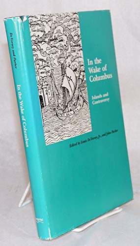
In the Wake of Columbus: Islands and Controversy (TERRAE INCOGNITAE)
De Vorsey Jr., Louis [Editor]; Parker, John [Editor]; Molander, Arne B. [Contributor]; Kelley Jr., James E. [Contributor]; Parker, John [Contributor]; De Vorsey Jr., Louis [Contributor]; Dunn, Oliver [Contributor]; Verhoog, Pieter [Contributor]; Fuson, Robert H. [Contributor]; Power, Robert [Contributor];
- Tapa dura
Librería: Affordable Collectibles, Columbia, MO, Estados Unidos de AmericaAffordable Collectibles
Contactar con el vendedorVendedor de 5 estrellasCondición: Usado - Aceptable
EUR 16,25
Envío por EUR 3,51Se envía dentro de Estados Unidos de AmericaCantidad disponible: 1 disponibles
Hardcover. Condición: Good. NO DJ. Otherwise very good with no marks. Minimal wear present. Maps (ilustrador).
- Tapa blanda
- Primera edición
Librería: Fahrenheit's Books, Denver, CO, Estados Unidos de AmericaFahrenheit's Books
Contactar con el vendedorVendedor de 5 estrellasMiembro de asociación: RMABA
Condición: Usado - Bueno
EUR 13,58
Envío por EUR 6,15Se envía dentro de Estados Unidos de AmericaCantidad disponible: 1 disponibles
Trade Paperback. Condición: Very Good. 1st Edition. First trade paperback edition, has faint lean to binding, hint of bowing to book, very slight bumps to spine ends and corners with a touch of creasing to corners of covers and first/last couple pages, and a slight reading crease to spine, otherwise a solid VG copy with clean in…terior.

Idioma: Inglés
Editorial: Vintage Books/ A Division of Random House, New York 2006
- Tapa blanda
Librería: gearbooks, The Bronx, NY, Estados Unidos de Americagearbooks
Contactar con el vendedorVendedor de 5 estrellasCondición: Usado - Como Nuevo
EUR 15,64
Envío por EUR 5,26Se envía dentro de Estados Unidos de AmericaCantidad disponible: 1 disponibles
Trade Paperback. Condición: Like New. 1st Vintage Bks Ed Dec 2006. 142 pp. Clean, fresh copy with very minor shelf wear on front and back cover, crisp pages and clean text. Joyce Pendola (Maps) (ilustrador).

Military Operations France And Belgium, 1916
Edmonds, James E. (Maps & Skstches Compiled By Becke, A. F.)
- Tapa dura
Librería: Montreal Books, Westmount, QC, CanadaMontreal Books
Contactar con el vendedorVendedor de 5 estrellasCondición: Usado - Muy bueno
EUR 18,10
Envío por EUR 4,35Se envía de Canada a Estados Unidos de AmericaCantidad disponible: 1 disponibles
Hardcover. Condición: Near Fine. No Jacket. A very nice copy. Front cover board slightly warped. Book.
Military Operations France And Belgium, 1916
Edmonds, James E. (Maps & Skstches Compiled By Becke, A. F.)
- Tapa dura
Librería: RPBooks, Champlain, NY, Estados Unidos de AmericaRPBooks
Contactar con el vendedorVendedor de 3 estrellasCondición: Usado - Muy bueno
EUR 18,10
Envío por EUR 6,11Se envía dentro de Estados Unidos de AmericaCantidad disponible: 1 disponibles
Hardcover. Condición: Near Fine. No Jacket. A very nice copy. Front cover board slightly warped. Book.

- Tapa blanda
- Primera edición
Librería: 100POCKETS, Berkeley, CA, Estados Unidos de America100POCKETS
Contactar con el vendedorVendedor de 4 estrellasCondición: Nuevo
EUR 20,59
Envío por EUR 6,59Se envía dentro de Estados Unidos de AmericaCantidad disponible: 1 disponibles
Soft cover. Condición: New. Estado de la sobrecubierta: None as Issued. First Edition, 13th Printing. BRAND NEW Copy. Travel/tour guide to some 130 one-time mining, milling, and Colorado River towns in Arizona. The volume includes many specially drawn maps since many an old road and landmark to ghost town have virtually disappea…red making reliance on moders highway maps often fruitless. Text augmented with local tales and legends. Fine copy. Don Percious (Maps) (ilustrador).
 Más imágenes
FOUR NEOTROPICAL RAINFORESTS
Gentry, Alwyn H.; Guzman-Teare, Myra; Karr, James R.; Duellman, William E.
- Tapa dura
- Primera edición
Librería: Riverow Bookshop, Owego, NY, Estados Unidos de AmericaRiverow Bookshop
Contactar con el vendedorVendedor de 5 estrellasCondición: Usado
EUR 22,63
Envío por EUR 5,71Se envía dentro de Estados Unidos de AmericaCantidad disponible: 1 disponibles
Hardcover w/DJ. Condición: Good +/Good +. First Edition. New Haven, CT: Yale University Press. Good +/Good +. 1990. First Edition. Hardcover w/DJ. Sm 4to., 627pp., dust jacket shelf wear to edges and corners, front spine edge lightly creased, spine tips lightly creased and bumped, otherwise quite good; cover spine tips lightly b…umped, crease at front spine edge, otherwise quite good; Former owner's name on front free-endpaper, light foxing to top edge of text block, otherwise pages clean and unmarked. . Black & White Maps & Charts (ilustrador).

Editorial: The John C Winston Company 1957
- Tapa dura
Librería: Bargain Finders of Colorado, Simla, CO, Estados Unidos de AmericaBargain Finders of Colorado
Contactar con el vendedorVendedor de 4 estrellasCondición: Usado - Aceptable
EUR 15,34
Envío por EUR 4,39Se envía dentro de Estados Unidos de AmericaCantidad disponible: 1 disponibles
Hardcover. Condición: Good. No Jacket. Revised Edition. Privately owned copy. Interior is tight, clean and unmarked. Hardcover has grey cloth boards, with black lettering, but no DJ. Young person almanac of post WWII globe illustrated with maps, graphs and B&W photos. Of particular interest are land/sea/air routes w/ travel time… estimates between points on the globe. 392 pages plus 16 full color plate political & elevation maps of the planet. Copyrights 1954 & 1950. Printline H-1157. Printed before ISBNs, there is none. No LoC #, nor publisher's catalog. Brammell, James A. (Cartography) ;Tschirky, L. Robert (Picture Graphs) ;Pearcy, G. Etzel (Air Route Maps) (ilustrador).
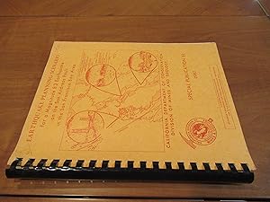
Earthquake Planning Scenario For A Magnitude 8.3 Earthquake On The San Andreas Fault In The San Francisco Bay Area [Special Publication 61 1982]
James F. Davis, John H. Bennett, Glenn A. Borchardt, James E. Kahle, Salem J. Rice, Michael A Silva
Idioma: Inglés
Editorial: California Department Of Conservation, Division Of Mines And Geology 1982
- Tapa blanda
- Primera edición
Librería: Arroyo Seco Books, Pasadena, Member IOBA, Pasadena, CA, Estados Unidos de AmericaArroyo Seco Books, Pasadena, Member IOBA
Contactar con el vendedorVendedor de 4 estrellasMiembro de asociación: IOBA
Condición: Usado - Muy bueno
EUR 24,89
Envío por EUR 7,03Se envía dentro de Estados Unidos de AmericaCantidad disponible: 1 disponibles
Soft cover. Condición: Near Fine. 1st Edition. Ix, 160 Pp. Card Covers. Plastic Comb Binding, As Issued. First Edition, Complete Report, Near Fine. Photographs, Maps, Charts (ilustrador).

- Tapa dura
Librería: Lawrence Jones Books, Ashmore, QLD, AustraliaLawrence Jones Books
Contactar con el vendedorVendedor de 5 estrellasCondición: Usado - Bueno
EUR 9,39
Envío por EUR 21,97Se envía de Australia a Estados Unidos de AmericaCantidad disponible: 1 disponibles
Hard Cover. Condición: Very Good. Estado de la sobrecubierta: Very Good. Second Printing. x, 208pp, b/w ills throughout, maps, bibliography, index. Prev owner's bookplate laid down on the front flyleaf. Or black cloth boards in jacket.The authors have included many specially drawn maps; and accurate township, range and section c…o-ordinates place the towns at their correct locations. Using this information, the sites can be located from standard base maps. Size: 4to15. Maps by Don Percious (ilustrador).
Military Operations France And Belgium, 1916
Edmonds, James E. (Maps & Skstches Compiled By Becke, A. F.)
- Tapa dura
Librería: Broad Street Books, Branchville, NJ, Estados Unidos de AmericaBroad Street Books
Contactar con el vendedorVendedor de 5 estrellasCondición: Nuevo
EUR 31,63
Envío por EUR 4,35Se envía dentro de Estados Unidos de AmericaCantidad disponible: 1 disponibles
Hardcover. Condición: New. Brand New Book.

- Tapa dura
Librería: Xochi's Bookstore & Gallery, truth or consequences, NM, Estados Unidos de AmericaXochi's Bookstore & Gallery
Contactar con el vendedorVendedor de 2 estrellasCondición: Usado - Bueno
EUR 34,39
Envío por EUR 4,39Se envía dentro de Estados Unidos de AmericaCantidad disponible: 1 disponibles
Hardcover. Condición: Very Good. Estado de la sobrecubierta: Very Good. First Edition. 270pp.incl.index; HB yellow w/orange; slight rub w/dent,tp.edge; clean,tight pgs. DJ white w/orange&yellow; some rub w/wear on edges&corners; some sun on spine. More than 130 defunct mining, farming, railroad, & lumbering communities. more tha…n 450 photos. Cooper, Jim (maps) (ilustrador).
Editorial: Edward Arnold & Co., London 1926
- Tapa dura
Librería: Dick's Book Barn, Trumansburg, NY, Estados Unidos de AmericaDick's Book Barn
Contactar con el vendedorVendedor de 5 estrellasCondición: Usado
EUR 22,63
Envío por EUR 4,83Se envía dentro de Estados Unidos de AmericaCantidad disponible: 1 disponibles
Hardcover. Condición: G-VG/no dj; clean copy, some w. 215. maps (ilustrador).
- Tapa dura
Librería: The Secret Bookshop, Tararua, Nueva ZelandaThe Secret Bookshop
Contactar con el vendedorVendedor de 5 estrellasCondición: Usado - Como Nuevo
EUR 18,10
Envío por EUR 25,48Se envía de Nueva Zelanda a Estados Unidos de AmericaCantidad disponible: 1 disponibles
Hardcover. Condición: As New. A very clean copy of the 1993 reprint. British narrative of the Western Front in 1916, focusing on the period leading up to and including the opening of the Battle of the Somme. It is part of a multi‑volume series documenting the war in meticulous operational detail.

Editorial: Free Press/ Macmillan, N.Y. 1975
- Tapa dura
- Primera edición
Librería: Dave Shoots, Bookseller, Saint John, NB, CanadaDave Shoots, Bookseller
Contactar con el vendedorVendedor de 5 estrellasCondición: Usado - Bueno
EUR 13,58
Envío por EUR 17,57Se envía de Canada a Estados Unidos de AmericaCantidad disponible: 1 disponibles
Hardcover. Condición: Very Good. Good Plus. First Printing. Original black cloth on boards. DJ lightly worn head and foot. ISBN 0-02-928610-7. "The turbulent years from fall of the imperial monarchy to the founding of the People's Republic." - DJ. No writing or damage to book. 338 pp. Size: 8vo - over 7¾" - 9¾" tall. Maps (ilust…rador). Book.

- Tapa dura
Librería: Dogs of War Booksellers, Utica, NY, Estados Unidos de AmericaDogs of War Booksellers
Contactar con el vendedorVendedor de 5 estrellasCondición: Nuevo
EUR 45,26
Envío por EUR 7,03Se envía dentro de Estados Unidos de AmericaCantidad disponible: 1 disponibles
Hardcover. Condición: New.
Editorial: SHORE & DISTRICT H.S.,UK 2005
- Tapa dura
- Primera edición
Librería: S.Carter, NEWPORT, Reino UnidoS.Carter
Contactar con el vendedorVendedor de 4 estrellasCondición: Usado - Excelente
EUR 14,34
Envío por EUR 23,31Se envía de Reino Unido a Estados Unidos de AmericaCantidad disponible: 1 disponibles
Hardcover. Condición: Fine. Estado de la sobrecubierta: Fine. 1st Edition. UK1ST.EDIITON.1ST.PRINTING.NO DATE BUT I THINK 2005. FINE HARDBACK IN FINE DUSTWRAPPER.BEAUTIFULLY PRODUCED BOOK.69 Language: eng Language: eng 0.0 Language: eng 0.0 Language: eng 0.0 Language: eng 0.0 Language: eng Language: eng.
- Tapa dura
- Primera edición
Librería: Arroyo Seco Books, Pasadena, Member IOBA, Pasadena, CA, Estados Unidos de AmericaArroyo Seco Books, Pasadena, Member IOBA
Contactar con el vendedorVendedor de 4 estrellasMiembro de asociación: IOBA
Condición: Usado - Excelente
EUR 76,93
Envío por EUR 7,03Se envía dentro de Estados Unidos de AmericaCantidad disponible: 1 disponibles
Hardcover. Condición: Fine. Estado de la sobrecubierta: Fine. 1st Edition. Xiv, 306 Pp. Red Boards, Gilt. First Printing. Fine In Fine Dust Jacket. Photographs, Maps (ilustrador).

Editorial: Macmillan and Co., Limited, London 1929
- Tapa dura
Librería: Alkahest Books, Deerfield, IL, Estados Unidos de AmericaAlkahest Books
Contactar con el vendedorVendedor de 5 estrellasCondición: Usado - Bueno
EUR 58,83
Envío por EUR 5,71Se envía dentro de Estados Unidos de AmericaCantidad disponible: 1 disponibles
hardcover. Condición: Very Good. 1929 reprint. Octavo, red cloth covers, xxvii [9] 548 + 4 pages of ads for the series. Maps on endpapers, and maps in the text. Corrections tipped in on several pages, some red ink cross-outs (text still readable). A few spots on covers, and minor color bleeding into top margin of front map--does… not affect image. Does not include separate map case. Part of the series: History of the Great War, Based on Official Documents, by Direction of the Historical Section of the Committee of Imperial Defense. 040414A.
- Tapa dura
- Primera edición
- Firmado
Librería: Lower Beverley Better Books, Lyndhurst, ON, CanadaLower Beverley Better Books
Contactar con el vendedorVendedor de 5 estrellasCondición: Usado - Excelente
EUR 111,47
Envío por EUR 19,33Se envía de Canada a Estados Unidos de AmericaCantidad disponible: 1 disponibles
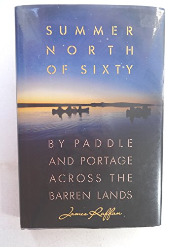
Hardcover. Condición: Fine. Estado de la sobrecubierta: Fine. True First CDN Edition 1st Printing. Number line: 90 91 92 93 94 95 6 5 4 3 2 1. Preface by author dated November, 1989 at Seeley's Bay, Ontario. Black cloth covered boards have as-new gilt text on spine only, decorative map ep's. Book has fo's birthday dedication dat…ed, Aug/91 verso full title page. Book is otherwise as new. Unclipped ($24.95) DJ has very slight edge wear at spine ends, ow as new. Book is becoming increasingly rare - never went to soft cover. Book recounts tale of a six week, 700 km canoe trip. 229 pp. INSCRIPTION: Keep paddlin' James Raffan. SIGNED by author in black sharpie. Bookseller's Inventory # 154579. Kaathryn Adams (maps EP'S) (ilustrador). Inscribed by Author(s).
 Más imágenes
Idioma: Inglés
- Tapa dura
Librería: Captain John Smith's Books, MABLETHORPE, Reino UnidoCaptain John Smith's Books
Contactar con el vendedorVendedor de 5 estrellasCondición: Usado - Regular
EUR 53,75
Envío por EUR 42,92Se envía de Reino Unido a Estados Unidos de AmericaCantidad disponible: 1 disponibles
Hardcover. Condición: Fair. These are a collection of First World War maps from the 1920s and 30s detailing battles and tactics.They are associated with similar volumes of text, but would befit anyone who has an appetite for old war maps, war history or those seeking original research.Some are unopened from their original paper…clasps and are in almost pristine condition save a bit of fading and the odd library sticker mark.A very rare find.Ex private library stock so expect some library markings and sparse annotations in the text. Binder in good to very good condition with only a few signs of wear considering age. All maps present. Some yellowing of pages and some bleaching on spine. Foxing on some maps and boxes. Please note that the image above is a stock photo and may differ somewhat to that of the item delivered. 1918 variant includes both text AND maps.Many thanks for looking.
 Más imágenes
Idioma: Inglés
- Tapa dura
Librería: Captain John Smith's Books, MABLETHORPE, Reino UnidoCaptain John Smith's Books
Contactar con el vendedorVendedor de 5 estrellasCondición: Usado - Regular
EUR 56,14
Envío por EUR 42,92Se envía de Reino Unido a Estados Unidos de AmericaCantidad disponible: 2 disponibles
Hardcover. Condición: Fair. These are a collection of First World War maps from the 1920s and 30s detailing battles and tactics.They are associated with similar volumes of text, but would befit anyone who has an appetite for old war maps, war history or those seeking original research.Some are unopened from their original paper…clasps and are in almost pristine condition save a bit of fading and the odd library sticker mark.A very rare find.Ex private library stock so expect some library markings and sparse annotations in the text. Binder in good to very good condition with only a few signs of wear considering age. All maps present. Some yellowing of pages and some bleaching on spine. Foxing on some maps and boxes. Please note that the image above is a stock photo and may differ somewhat to that of the item delivered. 1918 variant includes both text AND maps.Many thanks for looking.

The Enchanted Island Of Oz
Thompson, Ruth Plumly, illustrated by Dick Martin and maps by James E. Haff
Editorial: The International WIzard of Oz Club, Inc., 1976 1976
- Tapa blanda
Librería: WellRead Books, Shamong, NJ, Estados Unidos de AmericaWellRead Books
Contactar con el vendedorVendedor de 5 estrellasMiembro de asociación: IOBA
Condición: Usado
EUR 90,51
Envío por EUR 7,03Se envía dentro de Estados Unidos de AmericaCantidad disponible: 1 disponibles
Small 4to.; illustrated stiff wraps, softcover; 77 pages; black and white illustrations and maps; from the title page "founded on & continuing the famous OZ stories by L. Frank Baum"; a sunned errata slip laid in; bottom corner is bumped else very good.
Editorial: Macmillan, London 1933
- Tapa dura
- Primera edición
Librería: VANESSA PARKER RARE BOOKS, Westport, MAYO, IrlandaVANESSA PARKER RARE BOOKS
Contactar con el vendedorVendedor de 4 estrellasMiembro de asociación: IOBA
Condición: Usado - Bueno
EUR 211,74
Envío por EUR 25,00Se envía de Irlanda a Estados Unidos de AmericaCantidad disponible: 1 disponibles
Hard Back Red Buckrum. Condición: Very Good. First Edition. Two scarce books on the first world war Vol 1 only 591 pages of text and maps with some notations and lining in pencil , Lacking vol two, but does have a boxed set third edition bound matching the book full of folding maps of the battles etc. A very useful set for milit…ary historians, all very clean and in very good tight condition. From the library of THE MACDERMOT Prince of Connaught , Coolavin , Co Sligo. Maps & Sketches Compiled By Major a f Beck (ilustrador).


