
Henn williams (8 resultados)

- Tapa blanda
Librería: Rarewaves.com USA, London, LONDO, Reino UnidoRarewaves.com USA
Contactar con el vendedorVendedor de 5 estrellasCondición: Nuevo
EUR 19,01
Gastos de envío gratisSe envía de Reino Unido a Estados Unidos de AmericaCantidad disponible: 11 disponibles
Paperback. Condición: New.

- Tapa blanda
Librería: Rarewaves.com UK, London, Reino UnidoRarewaves.com UK
Contactar con el vendedorVendedor de 5 estrellasCondición: Nuevo
EUR 16,64
Envío por EUR 76,27Se envía de Reino Unido a Estados Unidos de AmericaCantidad disponible: 11 disponibles
Paperback. Condición: New.
Editorial: Philadelphia, Philadelphia, 1855
- Tapa dura
Librería: High Ridge Books, Inc. - ABAA, South Deerfield, MA, Estados Unidos de AmericaHigh Ridge Books, Inc. - ABAA
Contactar con el vendedorVendedor de 5 estrellasCondición: Usado
EUR 406,50
Envío por EUR 7,98Se envía dentro de Estados Unidos de AmericaCantidad disponible: 1 disponibles
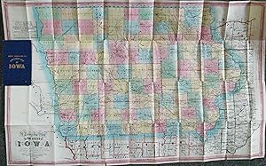
Añadir al carritoOriginal blue cloth folder. fine condition, with only very short tears along two folds. Full color by county in Iowa, outline color outside of the state. Henn, Williams were land dealers in Fairfield, Iowa, with offices also in Chariton, Sioux City and Fort Dodge. This edition was co-published by R. L. Barnes of Philadelphia, wh…ose copyright notice, dated 1854, appears at the bottom. Graff 1857.
 Más imágenes
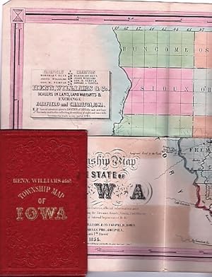
A TOWNSHIP MAP OF THE STATE OF IOWA . Dealers in Land, Land Warrants & Exchange. Fairfield & Charlton, Iowa.Investments made in any part of Iowa. Compiled from the United States Surveys, official information and personal reconnaissance, showing the Streams, Roads, Towns, County Seats, Works of Internal Improvement, &c. &c
Iowa / Henn, Williams & Co
Editorial: Henn, Williams & Co. / R.L. Barnes, Fairfield, Iowa / Philadelphia, 1855
- Tapa dura
- Primera edición
Librería: R & A Petrilla, Booksellers & Appraisers, Roosevelt, NJ, Estados Unidos de AmericaR & A Petrilla, Booksellers & Appraisers
Contactar con el vendedorVendedor de 4 estrellasCondición: Usado - Bueno
EUR 531,16
Envío por EUR 4,39Se envía dentro de Estados Unidos de AmericaCantidad disponible: 1 disponibles
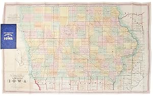
Añadir al carritoHardcover. Condición: Very Good. First Edition. Full-color folding map, 22" x 35". Folds into embossed red-cloth covers, gilt lettering on cover, 5.75" x 3.75". Near fine condition. Drawn in 1854 and issued early in 1855, this map shows a "Great Western Mail & Emigrant Route to the Pacific" extending from Omaha. The first Americ…an settlers arrived in Iowa from the East in 1833. By 1855, the new state had become a magnet for homesteaders and settlers to work the rich land.
 Más imágenes
Editorial: Henn, Williams & Co. and R. Barnes, Fairfield, Iowa and Philadelphia, 1855
- Tapa dura
- Primera edición
- Mapa
Librería: Donald A. Heald Rare Books (ABAA), New York, NY, Estados Unidos de AmericaDonald A. Heald Rare Books (ABAA)
Contactar con el vendedorVendedor de 5 estrellasCondición: Usado
EUR 542,00
Envío por EUR 21,93Se envía dentro de Estados Unidos de AmericaCantidad disponible: 1 disponibles
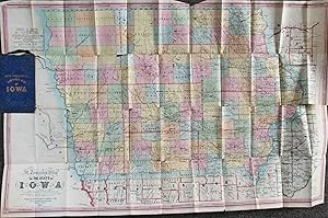
Añadir al carritoFolding pocket map lithographed by Friend & Aub of Philadelphia, full original period hand colouring. Folds into original blue cloth covers, blocked in blind, the upper cover with publisher and title in gilt. A fine copy of this attractive map of Iowa from the early years of its settlement, this second edition shows the rapid de…velopment within the state and is the first edition to include Sioux City and many proposed railroad routes. This large and colourful map of Iowa shows the state divided into numerous counties, all within nine land districts, with the sites of the land offices identified in each. Issued to promote settlement in the state, the map includes an advertisement in the upper left corner for Henn, Williams and Co.: "dealers in land, land warrants & exchange . special attention given to Location of Land, the sale and loan of Warrants and to the collecting & remitting of sight and time bills. Investments made in any part of Iowa." Besides locating numerous towns and river systems, the state's burgeoning railroad system is shown, with many proposed routes depicted across the state by means of dotted lines. This is the second edition of the map, after the first of 1854, but apparently printed from a new plate to incorporate the rapid growth. A third edition followed in 1856. Phillips A List of Maps of America, p. 337; Rumsey 1739; Graff 1857; Streeter sale 3898.
Editorial: Philadelphia, Philadelphia, 1855
- Tapa dura
Librería: High Ridge Books, Inc. - ABAA, South Deerfield, MA, Estados Unidos de AmericaHigh Ridge Books, Inc. - ABAA
Contactar con el vendedorVendedor de 5 estrellasCondición: Usado
EUR 677,50
Envío por EUR 7,98Se envía dentro de Estados Unidos de AmericaCantidad disponible: 1 disponibles
Añadir al carritoOriginal blue cloth. 2 tears into surface, at left in Nebraska and in 3 counties in the northwestern part of the state. Minor separations at fold junctions. Full color by county. The entire state has been organized at this time, though the northern and westernmost counties are at best minimally mapped. Graff 1857.
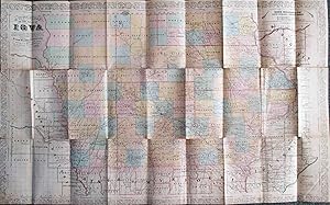
Editorial: Chicago, Chicago, 1856
Librería: High Ridge Books, Inc. - ABAA, South Deerfield, MA, Estados Unidos de AmericaHigh Ridge Books, Inc. - ABAA
Contactar con el vendedorVendedor de 5 estrellasCondición: Usado
EUR 496,83
Envío por EUR 7,98Se envía dentro de Estados Unidos de AmericaCantidad disponible: 1 disponibles
Añadir al carritoLacks folder. Generally very condition, with one repaired tear near the previous folder attachment and small separations at some fold junctions. Full color by county in Iowa, outline color outside of the state. This issue is entirely reengraved from the 1855 edition, including a new decorative border and many changes in towns an…d geographical features. The co-publishers of this edition were Keen and Lee of Chicago and Charles DeSilver of Philadelphia. The copyright notice is from Illinois.
 Más imágenes
Editorial: Fairfield, [IA] & Philadelphia: Published by Henn, Williams & Co. and by R. L. Barnes, 1854., 1854
Librería: William Reese Company, New York, NY, Estados Unidos de AmericaWilliam Reese Company
Contactar con el vendedorVendedor de 5 estrellasCondición: Usado
EUR 1580,83
Envío por EUR 12,28Se envía dentro de Estados Unidos de AmericaCantidad disponible: 1 disponibles
Añadir al carritoFirst edition of this township map of Iowa published by Henn, Williams Company and R.L. Barnes. Subsequent editions were issued in 1855 and 1856. Commenting on the first three editions of this map, Thomas Streeter wrote: "These three maps show clearly the rapid growth of the settlement in Iowa over just a three-year period. In 1…854 [the present first edition] there was practically no settlement in the three tiers of northwestern counties. By 1855 [the second edition] Kossuth County had absorbed Bancroft and Humboldt, and.had a county seat.The northwestern counties are further developed by 1856 [the third edition], with Nebraska counties.being shown for the first time." When this map was printed in 1854, Nebraska had just become an organized incorporated territory of the United States created by the Kansas-Nebraska Act of 1854, and as development of Nebraska had yet to really begin, the Nebraska portion of the map includes only Omaha city, Nebraska City, Old Fort Kearney, the Great Western Mail & Emigrant route to the Pacific, Belleview Mission, and the location of the Omaha and Pawnee reservations. A large and important early map of Iowa. STREETER SALE 3893, 3901 (note). GRAFF 1856. PHILLIPS, MAPS, p.337. Folding into original 16mo green cloth boards, stamped in gilt and blind. Cloth rubbed and stained, worn at extremities. A few old stains on the map, small splits at a few cross-folds, closed two-inch tear along one fold (where affixed to boards). Very good.


