Hassenstein bruno (58 resultados)

- Tapa blanda
Librería: GreatBookPrices, Columbia, MD, Estados Unidos de AmericaGreatBookPrices
Contactar con el vendedorVendedor de 5 estrellasCondición: Nuevo
EUR 13,59
Envío por EUR 2,28Se envía dentro de Estados Unidos de AmericaCantidad disponible: Más de 20 disponibles
Condición: New.

- Tapa blanda
Librería: BargainBookStores, Grand Rapids, MI, Estados Unidos de AmericaBargainBookStores
Contactar con el vendedorVendedor de 5 estrellasCondición: Nuevo
EUR 15,95
Gastos de envío gratisSe envía dentro de Estados Unidos de AmericaCantidad disponible: 5 disponibles
Paperback or Softback. Condición: New. Ost-Afrika zwischen Chartum und dem Rothen Meere bis Suakin und Massaua. Book.
- Tapa blanda
Librería: GreatBookPrices, Columbia, MD, Estados Unidos de AmericaGreatBookPrices
Contactar con el vendedorVendedor de 5 estrellasCondición: Usado - Como Nuevo
EUR 15,28
Envío por EUR 2,28Se envía dentro de Estados Unidos de AmericaCantidad disponible: Más de 20 disponibles
Condición: As New. Unread book in perfect condition.
- Tapa blanda
Librería: Ria Christie Collections, Uxbridge, Reino UnidoRia Christie Collections
Contactar con el vendedorVendedor de 5 estrellasCondición: Nuevo
EUR 15,62
Envío por EUR 13,88Se envía de Reino Unido a Estados Unidos de AmericaCantidad disponible: Más de 20 disponibles
Condición: New. In.

Editorial: Gotha : Perthes 1861
- Primera edición
Librería: Wissenschaftliches Antiquariat Köln Dr. Sebastian Peters UG, Köln, , AlemaniaWissenschaftliches Antiquariat Köln Dr. Sebastian Peters UG
Contactar con el vendedorVendedor de 5 estrellasCondición: Usado - Bueno
EUR 16,00
Envío por EUR 10,00Se envía de Alemania a Estados Unidos de AmericaCantidad disponible: 1 disponibles
Condición: gut. 16 S., 1 Faltkarte, 30 cm, gebräunt, leicht fleckig, letzte Seite an der Bindung mit kleiner Fehlstelle. Sprache: Deutsch Erstausgabe.
- Tapa blanda
Librería: GreatBookPricesUK, Woodford Green, Reino UnidoGreatBookPricesUK
Contactar con el vendedorVendedor de 5 estrellasCondición: Nuevo
EUR 15,61
Envío por EUR 17,38Se envía de Reino Unido a Estados Unidos de AmericaCantidad disponible: Más de 20 disponibles
Condición: New.
- Tapa blanda
Librería: GreatBookPricesUK, Woodford Green, Reino UnidoGreatBookPricesUK
Contactar con el vendedorVendedor de 5 estrellasCondición: Usado - Como Nuevo
EUR 18,00
Envío por EUR 17,38Se envía de Reino Unido a Estados Unidos de AmericaCantidad disponible: Más de 20 disponibles
Condición: As New. Unread book in perfect condition.
Editorial: Justus Perthes, Gotha 2020
Librería: Antiquariat Fines Mundi, Saarbruecken, , AlemaniaAntiquariat Fines Mundi
Contactar con el vendedorVendedor de 5 estrellasCondición: Usado
EUR 15,00
Envío por EUR 18,00Se envía de Alemania a Estados Unidos de AmericaCantidad disponible: 12 disponibles
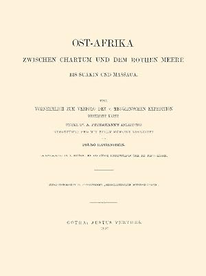
-16 Seiten -Mit 1 Karte --- Bruno Hassenstein:Mittheilungen aus Justus Perthes' geographischer Anstalt über wichtige neue Erforschungen auf dem Gesammtgebiet der Geographie von Dr. A. PetermannErgänzungsheft 6: Ost-Afrika zwischen Chartum und dem rothen Meere bis Suakin und MassauaAnhang: Th. v. Heuglin: Ein arabischer Schriftst…eller über die Bedja-LänderEine vornehmlich zum Verfolg der v. Heuglin'schen Expedition bestimmte KarteVerlagsfrischer, bibliophil ausgestatteter Faksimile-Reprint:Gedruckt auf einem schönen alterungsbeständigen und säurefreien Werkdruckpapier,das den Originaleindruck am besten wiedergibt.Gebunden in Interimsbroschur.Erschienen im Verlag Fines Mundi, Saarbrücken. --- 28,5 x 22,4 cm.
- Tapa dura
Librería: Ria Christie Collections, Uxbridge, Reino UnidoRia Christie Collections
Contactar con el vendedorVendedor de 5 estrellasCondición: Nuevo
EUR 28,46
Envío por EUR 13,88Se envía de Reino Unido a Estados Unidos de AmericaCantidad disponible: Más de 20 disponibles
Condición: New. In.
Editorial: Justus Perthes, Gotha 2020
Librería: Antiquariat Fines Mundi, Saarbruecken, , AlemaniaAntiquariat Fines Mundi
Contactar con el vendedorVendedor de 5 estrellasCondición: Usado
EUR 19,00
Envío por EUR 18,00Se envía de Alemania a Estados Unidos de AmericaCantidad disponible: 11 disponibles
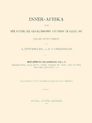
-II, 30 Seiten -Mit 2 Kartenblättern -Tafel 4 und 6 --- August Petermann & Bruno Hassenstein:Mittheilungen aus Justus Perthes' geographischer Anstalt über wichtige neue Erforschungen auf dem Gesammtgebiet der Geographie von Dr. A. PetermannErgänzungsheft 7: Inner-Afrika nach dem Stande der geographischen Kenntniss im Jahre 1861E…rste Abtheilung: Nubische Wüste, Bajuda-Steppe, Darfur, Kordofan und Takale, Land der Dinka und Nuehr, Dar Fertit usw. Verlagsfrischer, bibliophil ausgestatteter Faksimile-Reprint:Gedruckt auf einem schönen alterungsbeständigen und säurefreien Werkdruckpapier,das den Originaleindruck am besten wiedergibt.Gebunden in Interimsbroschur.Erschienen im Verlag Fines Mundi, Saarbrücken. --- 28,5 x 22,4 cm.

Editorial: Justus Perthes, Gotha 2020
Librería: Antiquariat Fines Mundi, Saarbruecken, , AlemaniaAntiquariat Fines Mundi
Contactar con el vendedorVendedor de 5 estrellasCondición: Usado
EUR 21,00
Envío por EUR 18,00Se envía de Alemania a Estados Unidos de AmericaCantidad disponible: 12 disponibles
-XIV, 116 Seiten --- Bruno Hassenstein & August Petermann:Mittheilungen aus Justus Perthes' geographischer Anstalt über wichtige neue Erforschungen auf dem Gesammtgebiet der Geographie von Dr. A. PetermannErgänzungsheft 11: Inner-Afrika nach dem Stande der geographischen Kenntniss in den Jahren 1861 bis 1863Nebst Original-Berich…ten von M. von Beurmann, Kotschy, Brun-Rollet, Behm, Antinori, Th. von Heuglin, Morlang und von Harnier Verlagsfrischer, bibliophil ausgestatteter Faksimile-Reprint:Gedruckt auf einem schönen alterungsbeständigen und säurefreien Werkdruckpapier,das den Originaleindruck am besten wiedergibt.Gebunden in Interimsbroschur.Erschienen im Verlag Fines Mundi, Saarbrücken. --- 28,5 x 22,4 cm.
Editorial: Justus Perthes, Gotha 2020
Librería: Antiquariat Fines Mundi, Saarbruecken, , AlemaniaAntiquariat Fines Mundi
Contactar con el vendedorVendedor de 5 estrellasCondición: Usado
EUR 25,00
Envío por EUR 18,00Se envía de Alemania a Estados Unidos de AmericaCantidad disponible: 12 disponibles
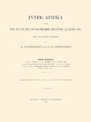
-II, 50 Seiten -3 Tafeln --- August Petermann & Bruno Hassenstein:Mittheilungen aus Justus Perthes' geographischer Anstalt über wichtige neue Erforschungen auf dem Gesammtgebiet der Geographie von Dr. A. PetermannErgänzungsheft 8: Inner-Afrika nach dem Stande der geographischen Kenntniss im Jahre 1861Zweite AbtheilungAufsatz IV:… Das Land und Volk der Tebu, von Dr. E. BehmAufsatz V: M. v. Beurmann's Reise von Bengasi nach Mursuk, Februar - April 1862 Verlagsfrischer, bibliophil ausgestatteter Faksimile-Reprint:Gedruckt auf einem schönen alterungsbeständigen und säurefreien Werkdruckpapier,das den Originaleindruck am besten wiedergibt.Gebunden in Interimsbroschur.Erschienen im Verlag Fines Mundi, Saarbrücken. --- 28,5 x 22,4 cm.
Editorial: Justus Perthes, Gotha 2020
Librería: Antiquariat Fines Mundi, Saarbruecken, , AlemaniaAntiquariat Fines Mundi
Contactar con el vendedorVendedor de 5 estrellasCondición: Usado
EUR 27,00
Envío por EUR 18,00Se envía de Alemania a Estados Unidos de AmericaCantidad disponible: 12 disponibles
-II, 18 Seiten -Mit 1 Originalkarte -3 Tafeln --- Bruno Hassenstein & August Petermann:Mittheilungen aus Justus Perthes' geographischer Anstalt über wichtige neue Erforschungen auf dem Gesammtgebiet der Geographie von Dr. A. PetermannErgänzungsheft 10: Inner-Afrika nach dem Stande der geographischen Kenntniss in den Jahren 1861…u. 1862Dritte Abtheilung:Originalbericht VI: Antinoris's Reise zum Lande der Djur, 1860 u. 1861Originalbericht VII: M.v. Beurmann's Aufenthalt in Mursuk und Reise nach Wau, 28. April bis 21. Juni 1862Originalkarte: v. Beurmann's Reise von Bengasi nach Mursuk und WauVerlagsfrischer, bibliophil ausgestatteter Faksimile-Reprint:Gedruckt auf einem schönen alterungsbeständigen und säurefreien Werkdruckpapier,das den Originaleindruck am besten wiedergibt.Gebunden in Interimsbroschur.Erschienen im Verlag Fines Mundi, Saarbrücken. --- 28,5 x 22,4 cm.
Idioma: Alemán
Editorial: Justus Perthes, Gotha 1881
- Mapa
Librería: Independent Books, Long Beach, WA, Estados Unidos de AmericaIndependent Books
Contactar con el vendedorVendedor de 2 estrellasCondición: Usado - Bueno
EUR 47,43
Envío por EUR 4,97Se envía dentro de Estados Unidos de AmericaCantidad disponible: 1 disponibles
No Binding. Condición: Very Good. In German: Ost-Griqua und Pondo-Land nach C. Henkel's Karte und Anderen Quellen. Inset: Mundung des Umzimvubu.Cream and brown base map with geopolitical boundaries tinted pink. From "Mittheilungen aus Justus Perthes' Geographischer Anstalt uber Wichtige Neue Erforschungen auf dem Gessammtgebiete… der Geographie von Dr. A. Petermann, 1881." Roughly: "Communications from Justus Perthes' Geographical Institute Concerning Important New Studies in the Whole Field of Geography by Dr. Augustus Petermann, 1881." Condition notes: 8.5" wide X 10.8" high, mildly toned, mild page waviness, soft fold (not creased) down the middle. Bruno Hassenstein (ilustrador).
Idioma: Alemán
Editorial: Justus Perthes, Gotha 1881
- Mapa
Librería: Independent Books, Long Beach, WA, Estados Unidos de AmericaIndependent Books
Contactar con el vendedorVendedor de 2 estrellasCondición: Usado - Bueno
EUR 47,43
Envío por EUR 4,97Se envía dentro de Estados Unidos de AmericaCantidad disponible: 1 disponibles
No Binding. Condición: Very Good. In German: W.S. & A. Blunt's Reisen in Nord-Arabien. Mit Benutzung Forschungen vom Said Pascha, Burton, Doughty u. A. gez. v. B. Hassenstein. Black and white base map with the sea tinted blue, and travel routes marked in deep pink. From "Mittheilungen aus Justus Perthes' Geographischer Anstalt u…ber Wichtige Neue Erforschungen auf dem Gessammtgebiete der Geographie von Dr. A. Petermann, 1881." Roughly: "Communications from Justus Perthes' Geographical Institute Concerning Important New Studies in the Whole Field of Geography by Dr. Augustus Petermann, 1881." Condition notes: 8.5" wide X 10.8" high, mildly toned, mild page waviness, soft fold (not creased) down the middle. Bruno Hassenstein (ilustrador).
Idioma: Alemán
Editorial: Justus Perthes, Gotha 1881
- Mapa
Librería: Independent Books, Long Beach, WA, Estados Unidos de AmericaIndependent Books
Contactar con el vendedorVendedor de 2 estrellasCondición: Usado - Bueno
EUR 47,43
Envío por EUR 4,97Se envía dentro de Estados Unidos de AmericaCantidad disponible: 1 disponibles
No Binding. Condición: Very Good. In German: Nordwest-Australien und Timor Meer nach Alex Forrest's Forschungen 1879 und den Neuesten Nautischen Vermessungen. Black and white base map with sea tinted shades of blue by depth, and travel routes in several colors. From "Mittheilungen aus Justus Perthes' Geographischer Anstalt uber…Wichtige Neue Erforschungen auf dem Gessammtgebiete der Geographie von Dr. A. Petermann, 1881." Roughly: "Communications from Justus Perthes' Geographical Institute Concerning Important New Studies in the Whole Field of Geography by Dr. Augustus Petermann, 1881." Condition notes: 10.8" wide X 8.6" high, mildly toned, mild page waviness. Bruno Hassenstein (ilustrador).
Idioma: Alemán
Editorial: Justus Perthes, Gotha 1881
- Mapa
Librería: Independent Books, Long Beach, WA, Estados Unidos de AmericaIndependent Books
Contactar con el vendedorVendedor de 2 estrellasCondición: Usado - Bueno
EUR 47,43
Envío por EUR 4,97Se envía dentro de Estados Unidos de AmericaCantidad disponible: 1 disponibles
No Binding. Condición: Very Good. In German: Reiseroute des Indischen Punditen A-a im Gebiet des Oberen Irawaddy 1879/80. Nach dem Feldbuch des Erforschers Zusammengestellt von Captn. J.E. Sandeman. Black and white base map with lands in rice cultivation tinted green, formerly cultivated lands tinted peach, and travel routes mar…ked in red. From "Mittheilungen aus Justus Perthes' Geographischer Anstalt uber Wichtige Neue Erforschungen auf dem Gessammtgebiete der Geographie von Dr. A. Petermann, 1881." Roughly: "Communications from Justus Perthes' Geographical Institute Concerning Important New Studies in the Whole Field of Geography by Dr. Augustus Petermann, 1881." Condition notes: 8.4" wide X 10.8" high, mildly toned, mild page waviness, soft fold (not creased) down the middle, chip to right margin. Bruno Hassenstein (ilustrador).
- Tapa blanda
- Impresión bajo demanda
Librería: PBShop.store US, Wood Dale, IL, Estados Unidos de AmericaPBShop.store US
Contactar con el vendedorVendedor de 5 estrellasCondición: Nuevo
EUR 17,29
Gastos de envío gratisSe envía dentro de Estados Unidos de AmericaCantidad disponible: Más de 20 disponibles
PAP. Condición: New. New Book. Shipped from UK. THIS BOOK IS PRINTED ON DEMAND. Established seller since 2000.
- Tapa blanda
- Impresión bajo demanda
Librería: PBShop.store UK, Fairford, GLOS, Reino UnidoPBShop.store UK
Contactar con el vendedorVendedor de 5 estrellasCondición: Nuevo
EUR 17,17
Envío por EUR 3,81Se envía de Reino Unido a Estados Unidos de AmericaCantidad disponible: Más de 20 disponibles
PAP. Condición: New. New Book. Delivered from our UK warehouse in 4 to 14 business days. THIS BOOK IS PRINTED ON DEMAND. Established seller since 2000.
Idioma: Alemán
Editorial: Justus Perthes, Gotha 1881
- Mapa
Librería: Independent Books, Long Beach, WA, Estados Unidos de AmericaIndependent Books
Contactar con el vendedorVendedor de 2 estrellasCondición: Usado - Bueno
EUR 59,31
Envío por EUR 4,97Se envía dentro de Estados Unidos de AmericaCantidad disponible: 1 disponibles
No Binding. Condición: Very Good. In German: Originalkarte Einer Reiseroute von Lado bis Dara, Nach der Itinerar-Aufnahme von R.W. Felkin & Revd. C. Wilson, M.A. Sept. bis Dec. 1879, Construirt und Gezeichnet von B. Hassenstein. From "Mittheilungen aus Justus Perthes' Geographischer Anstalt uber Wichtige Neue Erforschungen auf d…em Gessammtgebiete der Geographie von Dr. A. Petermann, 1881." Roughly: "Communications from Justus Perthes' Geographical Institute Concerning Important New Studies in the Whole Field of Geography by Dr. Augustus Petermann, 1881." Condition notes: 8.4" wide X 22.0" high in 3 panels (folded twice in the same direction), several closed tears at folds, top left corner has long, narrow crease. Bruno Hassenstein (ilustrador).
Idioma: Alemán
Editorial: Justus Perthes, Gotha 1881
- Mapa
Librería: Independent Books, Long Beach, WA, Estados Unidos de AmericaIndependent Books
Contactar con el vendedorVendedor de 2 estrellasCondición: Usado - Bueno
EUR 59,31
Envío por EUR 4,97Se envía dentro de Estados Unidos de AmericaCantidad disponible: 1 disponibles
No Binding. Condición: Very Good. In German: Ubersicht der Neuen Franzosischen Landesbefestigung Zusammengestellt auf C. Vogel's Karte Frankreich in 4 Bl. This map does not identify which of the four sheets it is. This sheet covers the area from Paris on the west to Strassburg on the east, and from Koln on the north to Chalon on… the south. Geopolitical boundaries tinted in pastels, cities shown in pink, and fortifications shown as red dots. From "Mittheilungen aus Justus Perthes' Geographischer Anstalt uber Wichtige Neue Erforschungen auf dem Gessammtgebiete der Geographie von Dr. A. Petermann, 1881." Roughly: "Communications from Justus Perthes' Geographical Institute Concerning Important New Studies in the Whole Field of Geography by Dr. Augustus Petermann, 1881." Condition notes: 15.4" wide X 14.6" in 4 panels (folded once in each direction) high, mildly toned, mild page waviness. Bruno Hassenstein (ilustrador).
Idioma: Alemán
Editorial: Justus Perthes, Gotha 1881
- Mapa
Librería: Independent Books, Long Beach, WA, Estados Unidos de AmericaIndependent Books
Contactar con el vendedorVendedor de 2 estrellasCondición: Usado - Bueno
EUR 59,31
Envío por EUR 4,97Se envía dentro de Estados Unidos de AmericaCantidad disponible: 1 disponibles
No Binding. Condición: Very Good. In German: Tiefen un See-Temperturen der Bering-Strasse Gemessen von W.H. Dahll im U.S.C. Srvey Schr. "Yukon" 5 Sept. 1880. For the inset: Ansicht des Ost-Caps und der Diomedes Inseln. Map and temperature profile tinted blue by 2-degree isotherms. Physical profile tinted peach and blue. From "Mi…ttheilungen aus Justus Perthes' Geographischer Anstalt uber Wichtige Neue Erforschungen auf dem Gessammtgebiete der Geographie von Dr. A. Petermann, 1881." Roughly: "Communications from Justus Perthes' Geographical Institute Concerning Important New Studies in the Whole Field of Geography by Dr. Augustus Petermann, 1881." Condition notes: 10.8" wide X 8.5" high, mildly toned, mild page waviness, soft fold (not creased) down the middle. Bruno Hassenstein (ilustrador).
Idioma: Alemán
Editorial: Justus Perthes, Gotha 1881
- Mapa
Librería: Independent Books, Long Beach, WA, Estados Unidos de AmericaIndependent Books
Contactar con el vendedorVendedor de 2 estrellasCondición: Usado - Bueno
EUR 59,31
Envío por EUR 4,97Se envía dentro de Estados Unidos de AmericaCantidad disponible: 1 disponibles
No Binding. Condición: Very Good. In German: Die Argentinischen Territorien der Pampa, des Rio-Negro &c. Nach dem Aufnahmen der Expeditionscorps gegen Indianer, unter General D.J.A. Roca. Cream and brown base map with water bodies tinted blue, geopolitical boundaries tinted pink, and certain areas along rivers tinted green. From… "Mittheilungen aus Justus Perthes' Geographischer Anstalt uber Wichtige Neue Erforschungen auf dem Gessammtgebiete der Geographie von Dr. A. Petermann, 1881." Roughly: "Communications from Justus Perthes' Geographical Institute Concerning Important New Studies in the Whole Field of Geography by Dr. Augustus Petermann, 1881." Condition notes: 10.8" wide X 8.5" high, mildly toned, slight page waviness. Bruno Hassenstein (ilustrador).
Idioma: Alemán
Editorial: Justus Perthes, Gotha 1881
- Mapa
Librería: Independent Books, Long Beach, WA, Estados Unidos de AmericaIndependent Books
Contactar con el vendedorVendedor de 2 estrellasCondición: Usado - Bueno
EUR 59,31
Envío por EUR 4,97Se envía dentro de Estados Unidos de AmericaCantidad disponible: 1 disponibles
No Binding. Condición: Very Good. In German: Die Wasserstrassen Frakreich's nachh der Carte de la Navigatiom Interieure de la France Heraugegeben von Ministerium der Offentlichen Arbeiten 1878. For insets: Paris und Umgegend; Flandern. Black and white base map with rivers marked in various colors. From "Mittheilungen aus Justus…Perthes' Geographischer Anstalt uber Wichtige Neue Erforschungen auf dem Gessammtgebiete der Geographie von Dr. A. Petermann, 1881." Roughly: "Communications from Justus Perthes' Geographical Institute Concerning Important New Studies in the Whole Field of Geography by Dr. Augustus Petermann, 1881." Condition notes: 13.5" wide X 10.8" high in 2 panels (folded once), mildly toned, mild page waviness. Bruno Hassenstein (ilustrador).
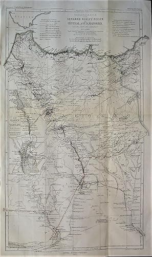
Idioma: Alemán
Editorial: Justus Perthes, Gotha 1865
- Mapa
Librería: Independent Books, Long Beach, WA, Estados Unidos de AmericaIndependent Books
Contactar con el vendedorVendedor de 2 estrellasCondición: Usado - Bueno
EUR 65,23
Envío por EUR 4,97Se envía dentro de Estados Unidos de AmericaCantidad disponible: 1 disponibles
No Binding. Condición: Very Good. In German: Originalkarte von Gerhard Rohlfs' Reisen Central und Sud Marokko (Atlas, Tafilet, Draa, &c.) 1862 und 1864. Nach Rohlfs' Tagebuch und personlichen Angaben mit Benutzung Anderer Quellen. Gezeichnet von B. Hassenstein. Generally in black and white, with routes in red and orange, and cou…ntry borders tinted green. From "Mittheilungen aus Justus Perthes' Geographischer Anstalt uber Wichtige Neue Erforschungen auf dem Gessammtgebiete der Geographie von Dr. A. Petermann, 1865." Roughly: "Communications from Justus Perthes' Geographical Institute Concerning Important New Studies in the Whole Field of Geography by Dr. Augustus Petermann, 1865." Condition notes: 10.8" wide X 18.0" high in 4 panels (2 folds), modestly toned, mild page waviness, top left edge crinkled outside of the border. Bruno Hassenstein (ilustrador).
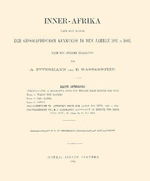
Editorial: Justus Perthes, Gotha 1861
- Tapa dura
Librería: Antiquariat "Der Büchergärtner", St. Ingbert, , AlemaniaAntiquariat "Der Büchergärtner"
Contactar con el vendedorVendedor de 5 estrellasCondición: Usado
EUR 350,00
Envío por EUR 35,00Se envía de Alemania a Estados Unidos de AmericaCantidad disponible: 1 disponibles
27,5 x 23 cm. 164 S. Inner-Afrika BL.4 und 6. Goldgeprägtes Leinen. Rückenschildchen. 10 gefalt. farbig lithogr. Karten. Buchblock vom Einband gelöst. Papier gebräunt. Sonst altersbedingt gut. Hinweis: Versandkosten müssen bei Auslandsversand evtl. angehoben werden.
Idioma: Alemán
Editorial: Justus Perthes, Gotha 1881
- Mapa
Librería: Independent Books, Long Beach, WA, Estados Unidos de AmericaIndependent Books
Contactar con el vendedorVendedor de 2 estrellasCondición: Usado - Bueno
EUR 71,19
Envío por EUR 4,97Se envía dentro de Estados Unidos de AmericaCantidad disponible: 1 disponibles
No Binding. Condición: Very Good. In German: Karte der Nordwestlichen Mongolei nach den Aufnahmen und Ortsbestimmungen von Potanin und Rafailow 1876 & 1877. Cream and brown base map with water bodies tinted blue and travel routes in red. From "Mittheilungen aus Justus Perthes' Geographischer Anstalt uber Wichtige Neue Erforschun…gen auf dem Gessammtgebiete der Geographie von Dr. A. Petermann, 1881." Roughly: "Communications from Justus Perthes' Geographical Institute Concerning Important New Studies in the Whole Field of Geography by Dr. Augustus Petermann, 1881." Condition notes: 13.2" wide X 10.8" high in 2 panels (folded once), mildly toned, mild page waviness. Bruno Hassenstein (ilustrador).
Idioma: Alemán
Editorial: Justus Perthes, Gotha 1881
- Mapa
Librería: Independent Books, Long Beach, WA, Estados Unidos de AmericaIndependent Books
Contactar con el vendedorVendedor de 2 estrellasCondición: Usado - Bueno
EUR 71,19
Envío por EUR 4,97Se envía dentro de Estados Unidos de AmericaCantidad disponible: 1 disponibles
No Binding. Condición: Very Good. In German: Die Tiefsee-Temperaturen des Europaischen Nordmeeres Zusammengestelt von H. Mohn. Land masses tinted peach, isotherms tinted pink and blue. From "Mittheilungen aus Justus Perthes' Geographischer Anstalt. Herausgegeben von Dr. E. Behm. Erganzungsband XIV, 1880-1881." Roughly: "Communic…ations from Justus Perthes' Geographical Institute. Edited by Dr. E. Behm. Supplement 14, 1880-1881." Condition notes: 21.7" wide X 10.8" high in 3 panels (folded twice in one direction), mildly toned, mild page waviness. Bruno Hassenstein (ilustrador).
Idioma: Alemán
Editorial: Justus Perthes, Gotha 1881
- Mapa
Librería: Independent Books, Long Beach, WA, Estados Unidos de AmericaIndependent Books
Contactar con el vendedorVendedor de 2 estrellasCondición: Usado - Bueno
EUR 71,19
Envío por EUR 4,97Se envía dentro de Estados Unidos de AmericaCantidad disponible: 1 disponibles
No Binding. Condición: Very Good. In German: Geologische Karte der Queen Charlotte Islands nach George M. Dawson's Aufnahmen 1878. Color map and inset of geologic types. Also shown are small black and white drawings of game pieces, a ceremonial spoon, fish hooks, a fishing club, a castanet made from Puffin beaks, and a rattle sh…aped like a raven as well as other figures. This is a beautiful and interesting map. From "Mittheilungen aus Justus Perthes' Geographischer Anstalt uber Wichtige Neue Erforschungen auf dem Gessammtgebiete der Geographie von Dr. A. Petermann, 1881." Roughly: "Communications from Justus Perthes' Geographical Institute Concerning Important New Studies in the Whole Field of Geography by Dr. Augustus Petermann, 1881." Condition notes: 8.4" wide X 10.8" high, mildly toned, mild page waviness, soft fold (not creased) down the middle, lt sm stain to bottom margin. Bruno Hassenstein (ilustrador).
Idioma: Alemán
Editorial: Justus Perthes, Gotha 1881
- Mapa
Librería: Independent Books, Long Beach, WA, Estados Unidos de AmericaIndependent Books
Contactar con el vendedorVendedor de 2 estrellasCondición: Usado - Bueno
EUR 71,19
Envío por EUR 4,97Se envía dentro de Estados Unidos de AmericaCantidad disponible: 1 disponibles
No Binding. Condición: Very Good. In German: E. Marino's Aufnahme des Mittleren Bahr El Abiad und des Bahr El Seraf Sept. 1879 bis Marz 1880. Nach dem Original-Tagebuch u. Handerschrift Skizzen Construirt & Autographirt von Chr. Peip. For insets: Kizze der barre im Bahr el Abiad v 7-15 Dec. 1880 durchbrochen von E. Marno; Skizze… des Projectirten Kanal's Verlegung fer Mundung des Bahr el Gebel, Black and white base map, with some areas shaded blue. From "Mittheilungen aus Justus Perthes' Geographischer Anstalt uber Wichtige Neue Erforschungen auf dem Gessammtgebiete der Geographie von Dr. A. Petermann, 1881." Roughly: "Communications from Justus Perthes' Geographical Institute Concerning Important New Studies in the Whole Field of Geography by Dr. Augustus Petermann, 1881." Condition notes: 13.0" wide X 17.7" high in 4 panels (folded once in each direction), mildly toned, mild page waviness, crescent-shaped closed tear to left margin and map area. Bruno Hassenstein (ilustrador).


