
Geo h walker co (35 resultados)

Editorial: EP NOLL, 1899
Librería: Princeton Antiques Bookshop / Ruffolo Enterprises, Atlantic City, NJ, Estados Unidos de AmericaPrinceton Antiques Bookshop / Ruffolo Enterprises
Contactar con el vendedorVendedor de 4 estrellasCondición: Usado
EUR 23,41
Envío por EUR 5,46Se envía dentro de Estados Unidos de AmericaCantidad disponible: 1 disponible
Añadir al carritoFOLDED BROWN. General wear, foxing on cover, soiling on rear top edge, unfolds to a size 4x vertically 8x horizontally, stickers of E.P. Noll covering original publisher DATE PUBLISHED: 1899 EDITION: 2.
Editorial: Walker Lith. & Pub. Co., Boston, 1907
- Tapa dura
Librería: Daedalus Books, Portland, OR, Estados Unidos de AmericaDaedalus Books
Contactar con el vendedorVendedor de 5 estrellasMiembro de asociación: CBA
Condición: Usado - Bueno
EUR 42,11
Envío por EUR 5,91Se envía dentro de Estados Unidos de AmericaCantidad disponible: 1 disponible
Añadir al carritoCloth. Condición: Very Good. Folding map. Paper map is attached to a cloth backing. Bookstore label affixed to front of map. Wear to edges and browned with age. ; 42" x 32".

Editorial: Boston, Boston, 1895
- Tapa blanda
Librería: High Ridge Books, Inc. - ABAA, South Deerfield, MA, Estados Unidos de AmericaHigh Ridge Books, Inc. - ABAA
Contactar con el vendedorVendedor de 5 estrellasCondición: Usado
EUR 187,30
Envío por EUR 8,27Se envía dentro de Estados Unidos de AmericaCantidad disponible: 1 disponible
Añadir al carritoFolding map in original illustrated stiff wrappers. Very good condition, with separations at some fold junctions and mended splits at three folds. Parks, water and town lines colored. This is a street-level map showing all of the City of Boston, with parts of Milton, Quincy and Dedham in the south and extending to show most of Malden and Revere in the north. Extends west to show all of Brighton and most of Watertown.…
 Más imágenes
Editorial: Boston, Boston, 1898
- Tapa blanda
Librería: High Ridge Books, Inc. - ABAA, South Deerfield, MA, Estados Unidos de AmericaHigh Ridge Books, Inc. - ABAA
Contactar con el vendedorVendedor de 5 estrellasCondición: Usado
EUR 210,71
Envío por EUR 8,27Se envía dentro de Estados Unidos de AmericaCantidad disponible: 1 disponible
Añadir al carritoOriginal stiff wrappers. Generally very good, many separations at fold junctions. Some splits along folds repaired. Outline color by town with parks showin fully colored in green. Shows from Westford and Acton in the northwest to Beverly in the northeast, Holliston in the southwest, Scituate in the southeast. The title on the cover is "Cyclists' Road Map of the Boston District, Showing All the Roads and Points of Interest, with the Cycling Routes Distinguished by Red Lines." Comparison of this edition with an earlier issue reveals the addition of quite a few bicycle routes, particularly in the less densely areas towards the edges of the map. Also the cover of this issue has a small map on the cover showing the location in Boston of Walker's premises, not the ad for the League of American Wheelmen which was on the earlier issue.…
 Más imágenes
Editorial: Geo. H. Walker & Co., Boston
- Tapa blanda
Librería: Complete Traveller Antiquarian Bookstore, Westport, CT, Estados Unidos de AmericaComplete Traveller Antiquarian Bookstore
Contactar con el vendedorVendedor de 5 estrellasCondición: Usado - Bueno
EUR 280,94
Envío por EUR 4,54Se envía dentro de Estados Unidos de AmericaCantidad disponible: 1 disponible
Añadir al carritoSoftcover. Condición: Very Good+. A beautiful view of the Boston Harbor measuring about 20" x 14" and printed in blue tones. Nd. [late 1800s]. In stiff wraps.; 16mo 6" - 7" tall.
 Más imágenes
Editorial: Geo. H. Walker & Co., 1880
- Tapa dura
Librería: Barry Lawrence Ruderman, La Jolla, CA, Estados Unidos de AmericaBarry Lawrence Ruderman
Contactar con el vendedorVendedor de 3 estrellasCondición: Usado - Aceptable
EUR 702,36
Envío por EUR 31,37Se envía dentro de Estados Unidos de AmericaCantidad disponible: 1 disponible
Añadir al carritoHardcover. Condición: good. Gilded Age Attleboro, Massachusetts Atlas: Maps and Lithograph Views of Homes and FactoriesPublished by George H. Walker & Company, this detailed atlas and viewbook of Attleboro, Massachusetts, records the area at a. Folio. Original gilt cloth binding, spine repaired with black tape. Light toning. Previous owner's bookplate. Pencil ownership name dated 1895 to front free endpaper. 80 pages, including 16 hand-colored maps (on 13 sheets, mostly double-sheets) and 18 lithograph views (on 10 leaves). Some dampstaining lower margins of last 10 leaves or so. Title page upper fore edge corner clipped (printing unaffected), with some staining to lower corner. Gilded Age Attleboro, Massachusetts Atlas: Maps and Lithograph Views of Homes and FactoriesPublished by George H. Walker & Company, this detailed atlas and viewbook of Attleboro, Massachusetts, records the area at a moment of intense industrial and infrastructural expansion. The atlas comprises a double-sheet map of Massachusetts and numerous hand-colored cadastral maps of Attleboro as well as 18 lithograph views of prominent homes and buildings in Attleboro. The views include residences of J. H. Sturdy, B. J. Angell, J. M. Bates, Blackinton, J. D. Richards, and H. N Daggett, H. M. Richards, and others. Other views show the factories of J. M. Bates, A. Bushee, and E. A. Robinson, as well as the tannery of Wm. Coupe & Co.The text component contains an "Historical sketch of the town of Attleborough," and a 2-page directory of manufacturers, merchants, etc.Geo. H. Walker & Co. was founded by George Hiram Walker in 1878. The Boston-based firm quickly established itself as a premier publisher of real estate and county atlases, providing essential geographic data for local municipalities.RarityRare in the market. No examples in RBH. Book.…

- Tapa dura
- Impresión bajo demanda
Librería: True World of Books, Delhi, IndiaTrue World of Books
Contactar con el vendedorVendedor de 5 estrellasCondición: Nuevo
EUR 22,47
Gastos de envío gratisSe envía de India a Estados Unidos de AmericaCantidad disponible: 18 disponibles
Añadir al carritoLeatherBound. Condición: New. BOOKS ARE EXEMPT FROM IMPORT DUTIES AND TARIFFS; NO EXTRA CHARGES APPLY. LeatherBound edition. Condition: New. Reprinted from 1892 edition. Leather Binding on Spine and Corners with Golden leaf printing on spine. Bound in genuine leather with Satin ribbon page markers and Spine with raised gilt bands. A perfect gift for your loved ones. Pages: 11 NO changes have been made to the original text. This is NOT a retyped or an ocr'd reprint. Illustrations, Index, if any, are included in black and white. Each page is checked manually before printing. As this print on demand book is reprinted from a very old book, there could be some missing or flawed pages, but we always try to make the book as complete as possible. Fold-outs, if any, are not part of the book. If the original book was published in multiple volumes then this reprint is of only one volume, not the whole set. Sewing binding for longer life, where the book block is actually sewn (smythe sewn/section sewn) with thread before binding which results in a more durable type of binding. Pages: 11.…

- Tapa dura
- Impresión bajo demanda
Librería: True World of Books, Delhi, IndiaTrue World of Books
Contactar con el vendedorVendedor de 5 estrellasCondición: Nuevo
EUR 22,47
Gastos de envío gratisSe envía de India a Estados Unidos de AmericaCantidad disponible: 18 disponibles
Añadir al carritoLeatherBound. Condición: New. BOOKS ARE EXEMPT FROM IMPORT DUTIES AND TARIFFS; NO EXTRA CHARGES APPLY. LeatherBound edition. Condition: New. Reprinted from 1916 edition. Leather Binding on Spine and Corners with Golden leaf printing on spine. NO changes have been made to the original text. This is NOT a retyped or an ocr'd reprint. Illustrations, Index, if any, are included in black and white. Each page is checked manually before printing. Pages: 51 As this print on demand book is reprinted from a very old book, there could be some missing or flawed pages, but we always try to make the book as complete as possible. Fold-outs, if any, are not part of the book. If the original book was published in multiple volumes then this reprint is of only one volume, not the whole set. Sewing binding for longer life, where the book block is actually sewn (smythe sewn/section sewn) with thread before binding which results in a more durable type of binding. Pages: 51 Volume 1916 Language: English.…
 Más imágenes
Editorial: Geo. H. Walker & Co., Boston, 1893
- Mapa
Librería: Complete Traveller Antiquarian Bookstore, Westport, CT, Estados Unidos de AmericaComplete Traveller Antiquarian Bookstore
Contactar con el vendedorVendedor de 5 estrellasCondición: Usado - Bueno
EUR 163,88
Envío por EUR 4,54Se envía dentro de Estados Unidos de AmericaCantidad disponible: 1 disponible
Añadir al carritoMap. Condición: Very Good. Large detailed fold-out map in color.; 12mo 7" - 7½" tall.
Editorial: Boston, Boston, 1897
Librería: High Ridge Books, Inc. - ABAA, South Deerfield, MA, Estados Unidos de AmericaHigh Ridge Books, Inc. - ABAA
Contactar con el vendedorVendedor de 5 estrellasCondición: Usado
EUR 163,88
Envío por EUR 8,27Se envía dentro de Estados Unidos de AmericaCantidad disponible: 1 disponible
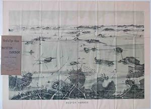
Añadir al carritoTinted bird's-eye view of Boston Harbor looking east with South Boston in the foreground. Identifies all major islands in the harbor, with Nahant, Calf Island, Hull and Nantasket Beach at the top. fine condition. Very good detail, showing all buildings, including forts on Castle Island and George's Island. Steamer routes are also shown. The front wrapper indicates that this was published by John F. Murphy of Boston. Reps 1388.…

- Tapa dura
- Impresión bajo demanda
Librería: True World of Books, Delhi, IndiaTrue World of Books
Contactar con el vendedorVendedor de 5 estrellasCondición: Nuevo
EUR 28,09
Gastos de envío gratisSe envía de India a Estados Unidos de AmericaCantidad disponible: 18 disponibles
Añadir al carritoLeatherBound. Condición: New. BOOKS ARE EXEMPT FROM IMPORT DUTIES AND TARIFFS; NO EXTRA CHARGES APPLY. LeatherBound edition. Condition: New. Reprinted from 1881 edition. Leather Binding on Spine and Corners with Golden leaf printing on spine. Bound in genuine leather with Satin ribbon page markers and Spine with raised gilt bands. A perfect gift for your loved ones. Pages: 88 NO changes have been made to the original text. This is NOT a retyped or an ocr'd reprint. Illustrations, Index, if any, are included in black and white. Each page is checked manually before printing. As this print on demand book is reprinted from a very old book, there could be some missing or flawed pages, but we always try to make the book as complete as possible. Fold-outs, if any, are not part of the book. If the original book was published in multiple volumes then this reprint is of only one volume, not the whole set. Sewing binding for longer life, where the book block is actually sewn (smythe sewn/section sewn) with thread before binding which results in a more durable type of binding. Pages: 88.…

Librería: Art Source International Inc., Boulder, CO, Estados Unidos de AmericaArt Source International Inc.
Contactar con el vendedorVendedor de 4 estrellasCondición: Usado
EUR 187,30
Envío por EUR 14,55Se envía dentro de Estados Unidos de AmericaCantidad disponible: 3 disponibles
Añadir al carritoWe are proud to offer maps from the atlas of Barnstable County, Massachusetts by George H. Walker & Co., 1880. As you probably know maps of Cape Cod towns are few and far between. Walkers atlas of Barnstable County is a great example of county atlases of this time period. The maps show landowners, streets, railroads, depots, wharfs, lighthouses, and much more. All maps have beautiful, original water coloring. Each one would make a perfect Cape Cod gift.This map measures 17 inches by 12.5 inches. …

Librería: Art Source International Inc., Boulder, CO, Estados Unidos de AmericaArt Source International Inc.
Contactar con el vendedorVendedor de 4 estrellasCondición: Usado
EUR 210,71
Envío por EUR 14,55Se envía dentro de Estados Unidos de AmericaCantidad disponible: 1 disponible
Añadir al carritoWe are proud to offer maps from the atlas of Barnstable County, Massachusetts by George H. Walker & Co., 1880. As you probably know maps of Cape Cod towns are few and far between. Walkers atlas of Barnstable County is a great example of county atlases of this time period. The maps show landowners, streets, railroads, depots, wharfs, lighthouses, and much more. All maps have beautiful, original water coloring. Each one would make a perfect Cape Cod gift.This map measures 26 inches by 16 inches. …

Librería: Art Source International Inc., Boulder, CO, Estados Unidos de AmericaArt Source International Inc.
Contactar con el vendedorVendedor de 4 estrellasCondición: Usado
EUR 210,71
Envío por EUR 14,55Se envía dentro de Estados Unidos de AmericaCantidad disponible: 1 disponible
Añadir al carritoWe are proud to offer maps from the atlas of Barnstable County, Massachusetts by George H. Walker & Co., 1880. As you probably know maps of Cape Cod towns are few and far between. Walkers atlas of Barnstable County is a great example of county atlases of this time period. The maps show landowners, streets, railroads, depots, wharfs, lighthouses, and much more. All maps have beautiful, original water coloring. Each one would make a perfect Cape Cod gift.This map measures 16 inches by 12 inches. …
Librería: Art Source International Inc., Boulder, CO, Estados Unidos de AmericaArt Source International Inc.
Contactar con el vendedorVendedor de 4 estrellasCondición: Usado
EUR 234,12
Envío por EUR 14,55Se envía dentro de Estados Unidos de AmericaCantidad disponible: 1 disponible
Añadir al carrito"We are proud to offer maps from the atlas of Barnstable County, Massachusetts by George H. Walker & Co., 1880. As you probably know maps of Cape Cod towns are few and far between. Walkers atlas of Barnstable County is a great example of county atlases of this time period. The maps show landowners, streets, railroads, depots, wharfs, lighthouses, and much more. All maps have beautiful, original water coloring. Each one would make a perfect Cape Cod gift.We are proud to offer maps from the atlas of Barnstable County, Massachusetts by George H. Walker & Co., 1880. As you probably know maps of Cape Cod towns are few and far between. Walkers atlas of Barnstable County is a great example of county atlases of this time period. The maps show landowners, streets, railroads, depots, wharfs, lighthouses, and much more. All maps have beautiful, original water coloring. Each one would make a perfect Cape Cod gift. …

Librería: Art Source International Inc., Boulder, CO, Estados Unidos de AmericaArt Source International Inc.
Contactar con el vendedorVendedor de 4 estrellasCondición: Usado
EUR 234,12
Envío por EUR 14,55Se envía dentro de Estados Unidos de AmericaCantidad disponible: 1 disponible
Añadir al carritoWe are proud to offer maps from the atlas of Barnstable County, Massachusetts by George H. Walker & Co., 1880. As you probably know maps of Cape Cod towns are few and far between. Walkers atlas of Barnstable County is a great example of county atlases of this time period. The maps show landowners, streets, railroads, depots, wharfs, lighthouses, and much more. This map of Dennis also illustrates the village of East Dennis. All maps have beautiful, original water coloring. Each one would make a perfect Cape Cod gift.This map measures 17 inches by 12.5 inches. …

Librería: Art Source International Inc., Boulder, CO, Estados Unidos de AmericaArt Source International Inc.
Contactar con el vendedorVendedor de 4 estrellasCondición: Usado
EUR 234,12
Envío por EUR 14,55Se envía dentro de Estados Unidos de AmericaCantidad disponible: 2 disponibles
Añadir al carritoWe are proud to offer maps from the atlas of Barnstable County, Massachusetts by George H. Walker & Co., 1880. As you probably know maps of Cape Cod towns are few and far between. Walkers atlas of Barnstable County is a great example of county atlases of this time period. The maps show landowners, streets, railroads, depots, wharfs, lighthouses, and much more. This map of South Yarmouth also illustrates part of the Village of West Yarmouth. All maps have beautiful, original water coloring. Each one would make a perfect Cape Cod gift.This map measures 25.5 inches by 16 inches. …

Librería: Art Source International Inc., Boulder, CO, Estados Unidos de AmericaArt Source International Inc.
Contactar con el vendedorVendedor de 4 estrellasCondición: Usado
EUR 234,12
Envío por EUR 14,55Se envía dentro de Estados Unidos de AmericaCantidad disponible: 2 disponibles
Añadir al carritoWe are proud to offer maps from the atlas of Barnstable County, Massachusetts by George H. Walker & Co., 1880. As you probably know maps of Cape Cod towns are few and far between. Walkers atlas of Barnstable County is a great example of county atlases of this time period. The maps show landowners, streets, railroads, depots, wharfs, lighthouses, and much more. All maps have beautiful, original water coloring. Each one would make a perfect Cape Cod gift.This map measures 12 inches by 17.5 inches. …

Librería: Art Source International Inc., Boulder, CO, Estados Unidos de AmericaArt Source International Inc.
Contactar con el vendedorVendedor de 4 estrellasCondición: Usado
EUR 234,12
Envío por EUR 14,55Se envía dentro de Estados Unidos de AmericaCantidad disponible: 1 disponible
Añadir al carritoWe are proud to offer maps from the atlas of Barnstable County, Massachusetts by George H. Walker & Co., 1880. As you probably know maps of Cape Cod towns are few and far between. Walkers atlas of Barnstable County is a great example of county atlases of this time period. The maps show landowners, streets, railroads, depots, wharfs, lighthouses, and much more. All maps have beautiful, original water coloring. Each one would make a perfect Cape Cod gift.This map measures 16 inches by 12 inches. …

Librería: Art Source International Inc., Boulder, CO, Estados Unidos de AmericaArt Source International Inc.
Contactar con el vendedorVendedor de 4 estrellasCondición: Usado
EUR 234,12
Envío por EUR 14,55Se envía dentro de Estados Unidos de AmericaCantidad disponible: 2 disponibles
Añadir al carritoWe are proud to offer maps from the atlas of Barnstable County, Massachusetts by George H. Walker & Co., 1880. As you probably know maps of Cape Cod towns are few and far between. Walkers atlas of Barnstable County is a great example of county atlases of this time period. The maps show landowners, streets, railroads, depots, wharfs, lighthouses, and much more. This map of the Village of North Sandwich also illustrates the Village of Pocasset. All maps have beautiful, original water coloring. Each one would make a perfect Cape Cod gift.This map measures 16 inches by 13 inches. …

Librería: Art Source International Inc., Boulder, CO, Estados Unidos de AmericaArt Source International Inc.
Contactar con el vendedorVendedor de 4 estrellasCondición: Usado
EUR 234,12
Envío por EUR 14,55Se envía dentro de Estados Unidos de AmericaCantidad disponible: 2 disponibles
Añadir al carritoWe are proud to offer maps from the atlas of Barnstable County, Massachusetts by George H. Walker & Co., 1880. As you probably know maps of Cape Cod towns are few and far between. Walkers atlas of Barnstable County is a great example of county atlases of this time period. The maps show landowners, streets, railroads, depots, wharfs, lighthouses, and much more. This map of the Village of Sandwich also illustrates the Village of Spring Hill. All maps have beautiful, original water coloring. Each one would make a perfect Cape Cod gift.This map measures 26 inches by 13 inches. …

Librería: Art Source International Inc., Boulder, CO, Estados Unidos de AmericaArt Source International Inc.
Contactar con el vendedorVendedor de 4 estrellasCondición: Usado
EUR 234,12
Envío por EUR 14,55Se envía dentro de Estados Unidos de AmericaCantidad disponible: 2 disponibles
Añadir al carritoWe are proud to offer maps from the atlas of Barnstable County, Massachusetts by George H. Walker & Co., 1880. As you probably know maps of Cape Cod towns are few and far between. Walkers atlas of Barnstable County is a great example of county atlases of this time period. The maps show landowners, streets, railroads, depots, wharfs, lighthouses, and much more. All maps have beautiful, original water coloring. Each one would make a perfect Cape Cod gift.This map measures 16 inches by 12 inches. …
 Más imágenes
- Tapa dura
- Impresión bajo demanda
Librería: Gyan Books Pvt. Ltd., Delhi, IndiaGyan Books Pvt. Ltd.
Contactar con el vendedorVendedor de 5 estrellasCondición: Nuevo
EUR 36,70
Gastos de envío gratisSe envía de India a Estados Unidos de AmericaCantidad disponible: Más de 20 disponibles
Añadir al carritoLeather Bound. Condición: New. Language: English. Language: English. Presenting an Exquisite Leather-Bound Edition, expertly crafted with Original Natural Leather that gracefully adorns the spine and corners. The allure continues with Golden Leaf Printing that adds a touch of elegance, while Hand Embossing on the rounded spine lends an artistic flair. This masterpiece has been meticulously reprinted in 2024, utilizing the invaluable guidance of the original edition published many years ago in 1901. The contents of this book are presented in classic black and white. Its durability is ensured through a meticulous sewing binding technique, enhancing its longevity. Imprinted on top-tier quality paper. A team of professionals has expertly processed each page, delicately preserving its content without alteration. Due to the vintage nature of these books, every page has been manually restored for legibility. However, in certain instances, occasional blurriness, missing segments, or faint black spots might persist. We sincerely hope for your understanding of the challenges we faced with these books. Recognizing their significance for readers seeking insight into our historical treasure, we've diligently restored and reissued them. Our intention is to offer this valuable resource once again. We eagerly await your feedback, hoping that you'll find it appealing and will generously share your thoughts and recommendations. Lang: - English, Vol: - , Pages: - 264, Print on Demand. If it is a multi-volume set, then it is only a single volume. We are specialised in Customisation of books, if you wish to opt different color leather binding, you may contact us. This service is chargeable. Product Disclaimer: Kindly be informed that, owing to the inherent nature of leather as a natural material, minor discolorations or textural variations may be perceptible. Explore the FOLIO EDITION (12x19 Inches): Available Upon Request. 264 264.…

Librería: Art Source International Inc., Boulder, CO, Estados Unidos de AmericaArt Source International Inc.
Contactar con el vendedorVendedor de 4 estrellasCondición: Usado
EUR 257,53
Envío por EUR 14,55Se envía dentro de Estados Unidos de AmericaCantidad disponible: 2 disponibles
Añadir al carritoWe are proud to offer maps from the atlas of Barnstable County, Massachusetts by George H. Walker & Co., 1880. As you probably know maps of Cape Cod towns are few and far between. Walkers atlas of Barnstable County is a great example of county atlases of this time period. The maps show landowners, streets, railroads, depots, wharfs, lighthouses, and much more. All maps have beautiful, original water coloring. Each one would make a perfect Cape Cod gift.This map measures 27 inches by 16.5 inches. …

Librería: Art Source International Inc., Boulder, CO, Estados Unidos de AmericaArt Source International Inc.
Contactar con el vendedorVendedor de 4 estrellasCondición: Usado
EUR 280,94
Envío por EUR 14,55Se envía dentro de Estados Unidos de AmericaCantidad disponible: 2 disponibles
Añadir al carritoWe are proud to offer maps from the atlas of Barnstable County, Massachusetts by George H. Walker & Co., 1880. As you probably know maps of Cape Cod towns are few and far between. Walkers atlas of Barnstable County is a great example of county atlases of this time period. The maps show landowners, streets, railroads, depots, wharfs, lighthouses, and much more. This map of Harwich also illustrates the Village of Harwich Port. All maps have beautiful, original water coloring. Each one would make a perfect Cape Cod gift.This map measures 25.5 inches by 16 inches. …

Librería: Art Source International Inc., Boulder, CO, Estados Unidos de AmericaArt Source International Inc.
Contactar con el vendedorVendedor de 4 estrellasCondición: Usado
EUR 280,94
Envío por EUR 14,55Se envía dentro de Estados Unidos de AmericaCantidad disponible: 1 disponible
Añadir al carritoWe are proud to offer maps from the atlas of Barnstable County, Massachusetts by George H. Walker & Co., 1880. As you probably know maps of Cape Cod towns are few and far between. Walkers atlas of Barnstable County is a great example of county atlases of this time period. The maps show landowners, streets, railroads, depots, wharfs, lighthouses, and much more. All maps have beautiful, original water coloring. Each one would make a perfect Cape Cod gift.This map measures 25.5 inches by 16 inches. …

Librería: Art Source International Inc., Boulder, CO, Estados Unidos de AmericaArt Source International Inc.
Contactar con el vendedorVendedor de 4 estrellasCondición: Usado
EUR 280,94
Envío por EUR 14,55Se envía dentro de Estados Unidos de AmericaCantidad disponible: 2 disponibles
Añadir al carritoWe are proud to offer maps from the atlas of Barnstable County, Massachusetts by George H. Walker & Co., 1880. As you probably know maps of Cape Cod towns are few and far between. Walkers atlas of Barnstable County is a great example of county atlases of this time period. The maps show landowners, streets, railroads, depots, wharfs, lighthouses, and much more. This map of Falmouth also illustrates the villages of North and West Falmouth. All maps have beautiful, original water coloring. Each one would make a perfect Cape Cod gift.This map measures 12 inches by 16 inches. …

Librería: Art Source International Inc., Boulder, CO, Estados Unidos de AmericaArt Source International Inc.
Contactar con el vendedorVendedor de 4 estrellasCondición: Usado
EUR 304,35
Envío por EUR 14,55Se envía dentro de Estados Unidos de AmericaCantidad disponible: 1 disponible
Añadir al carritoWe are proud to offer maps from the atlas of Barnstable County, Massachusetts by George H. Walker & Co., 1880. As you probably know maps of Cape Cod towns are few and far between. Walkers atlas of Barnstable County is a great example of county atlases of this time period. The maps show landowners, streets, railroads, depots, wharfs, lighthouses, and much more. This map of Harwich also illustrates the Villages of Harwich Port. All maps have beautiful, original water coloring. Each one would make a perfect Cape Cod gift.This map measures 27 inches by 16 inches. …

Librería: Art Source International Inc., Boulder, CO, Estados Unidos de AmericaArt Source International Inc.
Contactar con el vendedorVendedor de 4 estrellasCondición: Usado
EUR 304,35
Envío por EUR 14,55Se envía dentro de Estados Unidos de AmericaCantidad disponible: 1 disponible
Añadir al carritoWe are proud to offer maps from the atlas of Barnstable County, Massachusetts by George H. Walker & Co., 1880. As you probably know maps of Cape Cod towns are few and far between. Walkers atlas of Barnstable County is a great example of county atlases of this time period. The maps show landowners, streets, railroads, depots, wharfs, lighthouses, and much more. All maps have beautiful, original water coloring. Each one would make a perfect Cape Cod gift.This map measures 12 inches by 17 inches. …

Librería: Art Source International Inc., Boulder, CO, Estados Unidos de AmericaArt Source International Inc.
Contactar con el vendedorVendedor de 4 estrellasCondición: Usado
EUR 304,35
Envío por EUR 14,55Se envía dentro de Estados Unidos de AmericaCantidad disponible: 2 disponibles
Añadir al carritoWe are proud to offer maps from the atlas of Barnstable County, Massachusetts by George H. Walker & Co., 1880. As you probably know maps of Cape Cod towns are few and far between. Walkers atlas of Barnstable County is a great example of county atlases of this time period. The maps show landowners, streets, railroads, depots, wharfs, lighthouses, and much more. All maps have beautiful, original water coloring. Each one would make a perfect Cape Cod gift.This map measures 12 inches by 16 inches. …


