
Importe total (1 artículo artículos):
Destino del pedido:

cycle maps (85 resultados)
Ir a los resultados principales
Filtros de búsqueda
Tipo de artículo
- Todos los tipos de productos
- Libros (70)
- Revistas y publicaciones (No hay ningún otro resultado que coincida con este filtro.)
- Cómics (No hay ningún otro resultado que coincida con este filtro.)
- Partituras (No hay ningún otro resultado que coincida con este filtro.)
- Arte, grabados y pósters (No hay ningún otro resultado que coincida con este filtro.)
- Fotografías (No hay ningún otro resultado que coincida con este filtro.)
- Mapas (15)
- Manuscritos y coleccionismo de papel (No hay ningún otro resultado que coincida con este filtro.)
Condición Más información
- Nuevo (81)
- Como nuevo, Excelente o Muy bueno (4)
- Bueno o Aceptable (No hay ningún otro resultado que coincida con este filtro.)
- Regular o Pobre (No hay ningún otro resultado que coincida con este filtro.)
- Tal como se indica (No hay ningún otro resultado que coincida con este filtro.)
Encuadernación
- Todas
- Tapa dura (No hay ningún otro resultado que coincida con este filtro.)
- Tapa blanda (1)
Más atributos
- Primera edición (No hay ningún otro resultado que coincida con este filtro.)
- Firmado (No hay ningún otro resultado que coincida con este filtro.)
- Sobrecubierta (No hay ningún otro resultado que coincida con este filtro.)
- Con imágenes (16)
- No impresión bajo demanda (85)
Idioma (1)
Gastos de envío gratis
Ubicación del vendedor
Valoración de los vendedores
-

London And Essex Cycle Map 6
Librería: GreatBookPrices, Columbia, MD, Estados Unidos de America
Calificación del vendedor: 5 de 5 estrellas

EUR 8,05
Envío por EUR 2,29
Se envía dentro de Estados Unidos de AmericaCantidad disponible: 3 disponibles
Ańadir al carritoCondición: As New. Unread book in perfect condition.
-

Cornwall & South Devon Cycle Map 1
Librería: GreatBookPrices, Columbia, MD, Estados Unidos de America
Calificación del vendedor: 5 de 5 estrellas
EUR 8,51
Envío por EUR 2,29
Se envía dentro de Estados Unidos de AmericaCantidad disponible: 4 disponibles
Ańadir al carritoCondición: As New. Unread book in perfect condition.
-
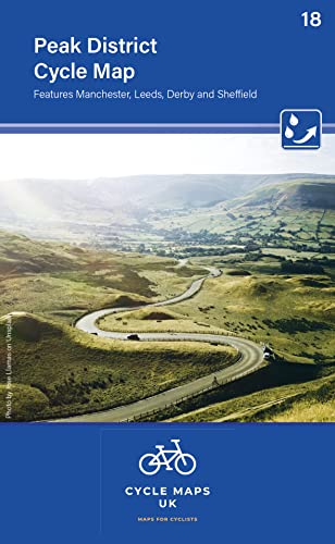
Peak District Cycle Map 18 (Folded)
Librería: Grand Eagle Retail, Bensenville, IL, Estados Unidos de America
Calificación del vendedor: 5 de 5 estrellas
EUR 12,91
Gastos de envío gratis
Se envía dentro de Estados Unidos de AmericaCantidad disponible: 1 disponibles
Ańadir al carritoFolded. Condición: new. Folded. The next map in the Cycle Maps UK series covers the Peak District and the surrounding cities of Manchester, Leeds, Derby and Sheffield. The maps are all produced at a scale of 1:100 000 showing important features including the National cycle Network. Sections on road, off road and traffic free are all shown in differing colours along with their route number. Other roads and their classification are shown enabling you to link rides or explore sections and discover new routes at home or further afield. Facilities such as toilets, pubs, accommodation, bike shops, repair stations and railway stations are all shown. The mapping also has relief shading giving you a clear picture of the terrain (and steepness of any hills) you will encounter. Scale: 100 000 (10mm = 1 Km, 16mm = 1 Mile) Folded size: 163mm x 105mm Unfolded: 650mm x 800mm Tear and water-resistant paper Double sided The maps are all produced at a scale of 1:100 000 showing important features including the National cycle Network. Sections on road, off road and traffic free are all shown in differing colours along with their route number. Shipping may be from multiple locations in the US or from the UK, depending on stock availability.
-
Cornwall and West Devon Cycle Map 1 (Folded)
Librería: Grand Eagle Retail, Bensenville, IL, Estados Unidos de America
Calificación del vendedor: 5 de 5 estrellas
EUR 13,53
Gastos de envío gratis
Se envía dentro de Estados Unidos de AmericaCantidad disponible: 1 disponibles
Ańadir al carritoFolded. Condición: new. Folded. First in a new series of cycle maps covering the whole country. The first map covers from Lands End in Cornwall to Plymouth. The maps are all produced at a scale of 1:100 000 showing important features including the National cycle Network. Sections on road, off road and traffic free are all shown in differing colours along with their route number. Other roads and their classification are shown enabling you to link rides or explore sections and discover new routes at home or further afield. Facilities such as toilets, pubs, accommodation, bike shops, repair stations and railway stations are all shown. The mapping also has relief shading giving you a clear picture of the terrain (and steepness of any hills) you will encounter. Scale: 100 000 (10mm = 1 Km, 16mm = 1 Mile) Folded size: 163mm x 105mm Unfolded: 650mm x 800mm Tear and water-resistant paper Double sided First in a new series of cycle maps covering the whole country. The first map covers from Lands End in Cornwall to Plymouth. Shipping may be from multiple locations in the US or from the UK, depending on stock availability.
-
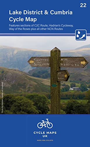
Lake District & Cumbria Cycle Map 22 (Folded)
Librería: Grand Eagle Retail, Bensenville, IL, Estados Unidos de America
Calificación del vendedor: 5 de 5 estrellas
EUR 13,53
Gastos de envío gratis
Se envía dentro de Estados Unidos de AmericaCantidad disponible: 1 disponibles
Ańadir al carritoFolded. Condición: new. Folded. The next map in the all-new Cycle Maps UK series. This covers The Lake District, Cumbria and all the way down to Lancaster. The maps are all produced at a scale of 1:100 000 showing important features including the National cycle Network. Sections on road, off road and traffic free are all shown in differing colours along with their route number. Other roads and their classification are shown enabling you to link rides or explore sections and discover new routes at home or further afield. Facilities such as toilets, pubs, accommodation, bike shops, repair stations and railway stations are all shown. The mapping also has relief shading giving you a clear picture of the terrain (and steepness of any hills) you will encounter. Scale: 100 000 (10mm = 1 Km, 16mm = 1 Mile) Folded size: 163mm x 105mm Unfolded: 650mm x 800mm Tear and water-resistant paper Double sided The maps are all produced at a scale of 1:100 000 showing important features including the National cycle Network. Sections on road, off road and traffic free are all shown in differing colours along with their route number. Shipping may be from multiple locations in the US or from the UK, depending on stock availability.
-
Cornwall & South Devon Cycle Map 1
Librería: GreatBookPrices, Columbia, MD, Estados Unidos de America
Calificación del vendedor: 5 de 5 estrellas
EUR 11,19
Envío por EUR 2,29
Se envía dentro de Estados Unidos de AmericaCantidad disponible: 4 disponibles
Ańadir al carritoCondición: New.
-
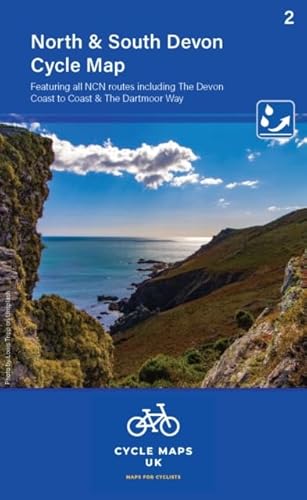
North and South Devon Cycle Map (2) (Folded)
Librería: Grand Eagle Retail, Bensenville, IL, Estados Unidos de America
Calificación del vendedor: 5 de 5 estrellas
EUR 13,60
Gastos de envío gratis
Se envía dentro de Estados Unidos de AmericaCantidad disponible: 1 disponibles
Ańadir al carritoFolded. Condición: new. Folded. Map 2 covers North and South Devon, including Dartmoor and the western part of Exmoor National Parks. The Devon coast to Coast route from Ilfracombe to Plymouth is fully covered. The maps are all produced at a scale of 1:100 000 showing important features including the National cycle Network. Sections on road, off road and traffic free are all shown in differing colours along with their route number. Other roads and their classification are shown enabling you to link rides or explore sections and discover new routes at home or further afield. Facilities such as toilets, pubs, accommodation, bike shops, repair stations and railway stations are all shown. The mapping also has relief shading giving you a clear picture of the terrain (and steepness of any hills) you will encounter. Scale: 1:100 000 (10mm = 1 Km, 16mm = 1 Mile) Folded size: 163mm x 105mm Unfolded: 650mm x 800mm Tear and water-resistant paper Double sided The maps are all produced at a scale of 1:100 000 showing important features including the National cycle Network. Sections on road, off road and traffic free are all shown in differing colours along with their route number. Shipping may be from multiple locations in the US or from the UK, depending on stock availability.
-
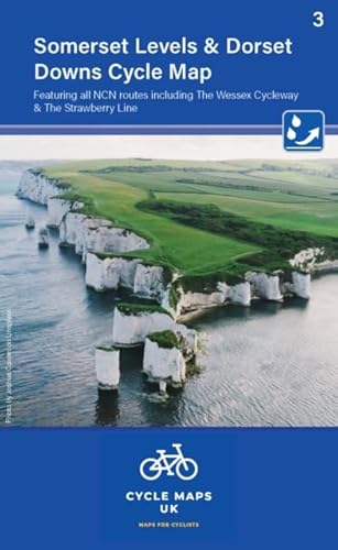
Somerset Levels and Dorset Downs (Folded)
Librería: Grand Eagle Retail, Bensenville, IL, Estados Unidos de America
Calificación del vendedor: 5 de 5 estrellas
EUR 13,67
Gastos de envío gratis
Se envía dentro de Estados Unidos de AmericaCantidad disponible: 1 disponibles
Ańadir al carritoFolded. Condición: new. Folded. Map 3 in the series covers the Somerset level and the Dorset Downs, from Minehead and Exeter in the West to Poole and Salisbury in the East. The maps are all produced at a scale of 1:100 000 showing important features including the National cycle Network. Sections on road, off road and traffic free are all shown in differing colours along with their route number. Other roads and their classification are shown enabling you to link rides or explore sections and discover new routes at home or further afield. Facilities such as toilets, pubs, accommodation, bike shops, repair stations and railway stations are all shown. The mapping also has relief shading giving you a clear picture of the terrain (and steepness of any hills) you will encounter. Scale: 1:100 000 (10mm = 1 Km, 16mm = 1 Mile) Folded size: 163mm x 105mm Unfolded: 650mm x 800mm Tear and water-resistant paper Double sided The maps are all produced at a scale of 1:100 000 showing important features including the National cycle Network. Sections on road, off road and traffic free are all shown in differing colours along with their route number. Shipping may be from multiple locations in the US or from the UK, depending on stock availability.
-
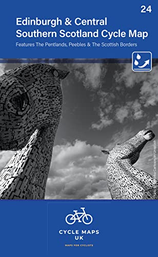
Edinburgh & Central Southern Scotland Cycle Map 24 (Folded)
Librería: Grand Eagle Retail, Bensenville, IL, Estados Unidos de America
Calificación del vendedor: 5 de 5 estrellas
EUR 13,71
Gastos de envío gratis
Se envía dentro de Estados Unidos de AmericaCantidad disponible: 1 disponibles
Ańadir al carritoFolded. Condición: new. Folded. The next map in the Cycle Maps UK series covers the city of Edinburgh and the area to the south. The maps are all produced at a scale of 1:100 000 showing important features including the National cycle Network. Sections on road, off road and traffic free are all shown in differing colours along with their route number. Other roads and their classification are shown enabling you to link rides or explore sections and discover new routes at home or further afield. Facilities such as toilets, pubs, accommodation, bike shops, repair stations and railway stations are all shown. The mapping also has relief shading giving you a clear picture of the terrain (and steepness of any hills) you will encounter. Scale: 100 000 (10mm = 1 Km, 16mm = 1 Mile) Folded size: 163mm x 105mm Unfolded: 650mm x 800mm Tear and water-resistant paper Double sided The next map in the Cycle Maps UK series covers the city of Edinburgh and the area to the south. Shipping may be from multiple locations in the US or from the UK, depending on stock availability.
-
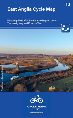
East Anglia Cycle Map featuring The Norfolk Broads (Folded)
Librería: Grand Eagle Retail, Bensenville, IL, Estados Unidos de America
Calificación del vendedor: 5 de 5 estrellas
EUR 13,72
Gastos de envío gratis
Se envía dentro de Estados Unidos de AmericaCantidad disponible: 1 disponibles
Ańadir al carritoFolded. Condición: new. Folded. First in a new series of cycle maps covering the whole country. The maps are all produced at a scale of 1:100 000 showing important features including the National cycle Network. Sections on road, off road and traffic free are all shown in differing colours along with their route number. Other roads and their classification are shown enabling you to link rides or explore sections and discover new routes at home or further afield. Facilities such as toilets, pubs, accommodation, bike shops, repair stations and railway stations are all shown. The mapping also has relief shading giving you a clear picture of the terrain (and steepness of any hills) you will encounter. Scale: 100 000 (10mm = 1 Km, 16mm = 1 Mile) Folded size: 163mm x 105mm Unfolded: 650mm x 800mm Tear and water-resistant paper Double sided The maps are all produced at a scale of 1:100 000 showing important features including the National cycle Network. Sections on road, off road and traffic free are all shown in differing colours along with their route number. Shipping may be from multiple locations in the US or from the UK, depending on stock availability.
-
London and Essex Cycle Map 6 (Folded)
Librería: Grand Eagle Retail, Bensenville, IL, Estados Unidos de America
Calificación del vendedor: 5 de 5 estrellas
EUR 13,96
Gastos de envío gratis
Se envía dentro de Estados Unidos de AmericaCantidad disponible: 1 disponibles
Ańadir al carritoFolded. Condición: new. Folded. Second in a new series of cycle maps covering the whole country. The London and Essex map covers from Uxbridge in the west to Harwich in the east. As far north as Luton and Halstead and as far south as Canterbury and Leatherhead. The maps are all produced at a scale of 1:100 000 showing important features including the National cycle Network. Sections on road, off road and traffic free are all shown in differing colours along with their route number. Other roads and their classification are shown enabling you to link rides or explore sections and discover new routes at home or further afield. Facilities such as toilets, pubs, accommodation, bike shops, repair stations and railway stations are all shown. The mapping also has relief shading giving you a clear picture of the terrain you are likely to encounter. Scale: 100 000 (10mm = 1 Km, 16mm = 1 Mile) Folded size: 163mm x 105mm Unfolded: 650mm x 800mm Tear and water-resistant paper Double sided Second in a new series of cycle maps covering the whole country. The London and Essex map covers from Uxbridge in the west to Harwich in the east. As far north as Luton and Halstead and as far south as Canterbury and Leatherhead. Shipping may be from multiple locations in the US or from the UK, depending on stock availability.
-
London And Essex Cycle Map 6
Librería: GreatBookPrices, Columbia, MD, Estados Unidos de America
Calificación del vendedor: 5 de 5 estrellas
EUR 11,61
Envío por EUR 2,29
Se envía dentro de Estados Unidos de AmericaCantidad disponible: 3 disponibles
Ańadir al carritoCondición: New.
-
EDINBURGH & CENTRAL SOUTHERN SCOTLAND 24
Librería: Speedyhen LLC, Hialeah, FL, Estados Unidos de America
Calificación del vendedor: 2 de 5 estrellas

EUR 14,03
Gastos de envío gratis
Se envía dentro de Estados Unidos de AmericaCantidad disponible: 3 disponibles
Ańadir al carritoCondición: NEW.
-
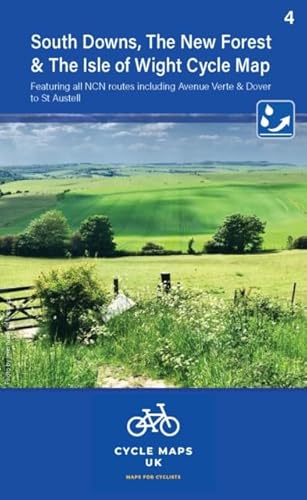
South Downs and The New Forest (Folded)
Librería: Grand Eagle Retail, Bensenville, IL, Estados Unidos de America
Calificación del vendedor: 5 de 5 estrellas
EUR 14,13
Gastos de envío gratis
Se envía dentro de Estados Unidos de AmericaCantidad disponible: 1 disponibles
Ańadir al carritoFolded. Condición: new. Folded. Map 4 covers the South Downs, The New Forest and the Isle of Wight. The coverage stretches as far north as Reigate Aldershot and Andover. The maps are all produced at a scale of 1:100 000 showing important features including the National cycle Network. Sections on road, off road and traffic free are all shown in differing colours along with their route number. Other roads and their classification are shown enabling you to link rides or explore sections and discover new routes at home or further afield. Facilities such as toilets, pubs, accommodation, bike shops, repair stations and railway stations are all shown. The mapping also has relief shading giving you a clear picture of the terrain (and steepness of any hills) you will encounter. Scale: 1:100 000 (10mm = 1 Km, 16mm = 1 Mile) Folded size: 163mm x 105mm Unfolded: 650mm x 800mm Tear and water-resistant paper Double sided The maps are all produced at a scale of 1:100 000 showing important features including the National cycle Network. Sections on road, off road and traffic free are all shown in differing colours along with their route number. Shipping may be from multiple locations in the US or from the UK, depending on stock availability.
-
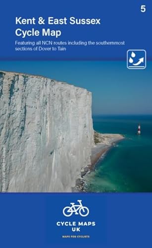
Kent Cycle Map featuring The High Weald and Kent Downs (Folded)
Librería: Grand Eagle Retail, Bensenville, IL, Estados Unidos de America
Calificación del vendedor: 5 de 5 estrellas
EUR 14,13
Gastos de envío gratis
Se envía dentro de Estados Unidos de AmericaCantidad disponible: 1 disponibles
Ańadir al carritoFolded. Condición: new. Folded. Map 5 covers Kent and East Sussex. Featuring all NCN routes including the southernmost sections of Dover to Tain. The maps are all produced at a scale of 1:100 000 showing important features including the National cycle Network. Sections on road, off road and traffic free are all shown in differing colours along with their route number. Other roads and their classification are shown enabling you to link rides or explore sections and discover new routes at home or further afield. Facilities such as toilets, pubs, accommodation, bike shops, repair stations and railway stations are all shown. The mapping also has relief shading giving you a clear picture of the terrain (and steepness of any hills) you will encounter. Scale: 1:100 000 (10mm = 1 Km, 16mm = 1 Mile) Folded size: 163mm x 105mm Unfolded: 650mm x 800mm Tear and water-resistant paper Double sided The maps are all produced at a scale of 1:100 000 showing important features including the National cycle Network. Sections on road, off road and traffic free are all shown in differing colours along with their route number. Shipping may be from multiple locations in the US or from the UK, depending on stock availability.
-
Edinburgh and Central Southern Scotland Cycle Map 24
Librería: PBShop.store US, Wood Dale, IL, Estados Unidos de America
Calificación del vendedor: 5 de 5 estrellas
EUR 14,98
Gastos de envío gratis
Se envía dentro de Estados Unidos de AmericaCantidad disponible: 15 disponibles
Ańadir al carritoUNK. Condición: New. New Book. Shipped from UK. Established seller since 2000.
-
Peak District Cycle Map 18
Librería: PBShop.store US, Wood Dale, IL, Estados Unidos de America
Calificación del vendedor: 5 de 5 estrellas
EUR 14,98
Gastos de envío gratis
Se envía dentro de Estados Unidos de AmericaCantidad disponible: 15 disponibles
Ańadir al carritoUNK. Condición: New. New Book. Shipped from UK. Established seller since 2000.
-
London and Essex Cycle Map 6
Librería: PBShop.store US, Wood Dale, IL, Estados Unidos de America
Calificación del vendedor: 5 de 5 estrellas
EUR 14,98
Gastos de envío gratis
Se envía dentro de Estados Unidos de AmericaCantidad disponible: 15 disponibles
Ańadir al carritoUNK. Condición: New. New Book. Shipped from UK. Established seller since 2000.
-
Lake District and Cumbria Cycle Map 22
Librería: PBShop.store US, Wood Dale, IL, Estados Unidos de America
Calificación del vendedor: 5 de 5 estrellas
EUR 14,99
Gastos de envío gratis
Se envía dentro de Estados Unidos de AmericaCantidad disponible: 15 disponibles
Ańadir al carritoUNK. Condición: New. New Book. Shipped from UK. Established seller since 2000.
-
Cornwall and West Devon Cycle Map 1
Librería: PBShop.store US, Wood Dale, IL, Estados Unidos de America
Calificación del vendedor: 5 de 5 estrellas
EUR 14,99
Gastos de envío gratis
Se envía dentro de Estados Unidos de AmericaCantidad disponible: 15 disponibles
Ańadir al carritoUNK. Condición: New. New Book. Shipped from UK. Established seller since 2000.
-
Lake District and Cumbria Cycle Map 22
Librería: PBShop.store UK, Fairford, GLOS, Reino Unido
Calificación del vendedor: 5 de 5 estrellas
EUR 11,18
Envío por EUR 3,81
Se envía de Reino Unido a Estados Unidos de AmericaCantidad disponible: 15 disponibles
Ańadir al carritoUNK. Condición: New. New Book. Shipped from UK. Established seller since 2000.
-
Cornwall and West Devon Cycle Map 1
Librería: PBShop.store UK, Fairford, GLOS, Reino Unido
Calificación del vendedor: 5 de 5 estrellas
EUR 11,18
Envío por EUR 3,81
Se envía de Reino Unido a Estados Unidos de AmericaCantidad disponible: 15 disponibles
Ańadir al carritoUNK. Condición: New. New Book. Shipped from UK. Established seller since 2000.
-
Edinburgh and Central Southern Scotland Cycle Map 24
Librería: PBShop.store UK, Fairford, GLOS, Reino Unido
Calificación del vendedor: 5 de 5 estrellas
EUR 11,18
Envío por EUR 3,81
Se envía de Reino Unido a Estados Unidos de AmericaCantidad disponible: 15 disponibles
Ańadir al carritoUNK. Condición: New. New Book. Shipped from UK. Established seller since 2000.
-
Peak District Cycle Map 18
Librería: PBShop.store UK, Fairford, GLOS, Reino Unido
Calificación del vendedor: 5 de 5 estrellas
EUR 11,18
Envío por EUR 3,81
Se envía de Reino Unido a Estados Unidos de AmericaCantidad disponible: 15 disponibles
Ańadir al carritoUNK. Condición: New. New Book. Shipped from UK. Established seller since 2000.
-
London and Essex Cycle Map 6
Librería: PBShop.store UK, Fairford, GLOS, Reino Unido
Calificación del vendedor: 5 de 5 estrellas
EUR 11,18
Envío por EUR 3,81
Se envía de Reino Unido a Estados Unidos de AmericaCantidad disponible: 15 disponibles
Ańadir al carritoUNK. Condición: New. New Book. Shipped from UK. Established seller since 2000.
-
North and South Devon Cycle Map 2: Including the Devon Coast to coast and The Dartmoor Way: 2023
Librería: Brook Bookstore On Demand, Napoli, NA, Italia
Calificación del vendedor: 3 de 5 estrellas

EUR 13,07
Envío por EUR 4,00
Se envía de Italia a Estados Unidos de AmericaCantidad disponible: 4 disponibles
Ańadir al carritoCondición: new.
-
Somerset Levels and Dorset Downs
Librería: Brook Bookstore On Demand, Napoli, NA, Italia
Calificación del vendedor: 3 de 5 estrellas
EUR 13,07
Envío por EUR 4,00
Se envía de Italia a Estados Unidos de AmericaCantidad disponible: 3 disponibles
Ańadir al carritoCondición: new.
-
Cornwall & West Devon Cycle Map 1
Librería: Majestic Books, Hounslow, Reino Unido
Calificación del vendedor: 4 de 5 estrellas

EUR 11,03
Envío por EUR 7,52
Se envía de Reino Unido a Estados Unidos de AmericaCantidad disponible: 1 disponibles
Ańadir al carritoCondición: New.
-
North and South Devon Cycle Map 2
Librería: Revaluation Books, Exeter, Reino Unido
Calificación del vendedor: 5 de 5 estrellas
EUR 7,70
Envío por EUR 11,57
Se envía de Reino Unido a Estados Unidos de AmericaCantidad disponible: 2 disponibles
Ańadir al carritoUnknown Binding. Condición: Brand New. 2 pages. 8.27x5.91x0.79 inches. In Stock.
-
Cornwall & West Devon Cycle Map 1 (Cycle Maps UK)
Librería: Revaluation Books, Exeter, Reino Unido
Calificación del vendedor: 5 de 5 estrellas
Mapa
EUR 7,70
Envío por EUR 11,57
Se envía de Reino Unido a Estados Unidos de AmericaCantidad disponible: 2 disponibles
Ańadir al carritoMap. Condición: Brand New. 1 pages. 6.34x3.98x0.51 inches. In Stock.