
Importe total (1 artículo artículos):
Destino del pedido:

bedinger sargent (11 resultados)
Ir a los resultados principales
Filtros de búsqueda
Tipo de artículo
- Todos los tipos de productos
- Libros (11)
- Revistas y publicaciones (No hay ningún otro resultado que coincida con este filtro.)
- Cómics (No hay ningún otro resultado que coincida con este filtro.)
- Partituras (No hay ningún otro resultado que coincida con este filtro.)
- Arte, grabados y pósters (No hay ningún otro resultado que coincida con este filtro.)
- Fotografías (No hay ningún otro resultado que coincida con este filtro.)
- Mapas (No hay ningún otro resultado que coincida con este filtro.)
- Manuscritos y coleccionismo de papel (No hay ningún otro resultado que coincida con este filtro.)
Condición Más información
- Nuevo (No hay ningún otro resultado que coincida con este filtro.)
- Como nuevo, Excelente o Muy bueno (2)
- Bueno o Aceptable (9)
- Regular o Pobre (No hay ningún otro resultado que coincida con este filtro.)
- Tal como se indica (No hay ningún otro resultado que coincida con este filtro.)
Encuadernación
- Todas
- Tapa dura (No hay ningún otro resultado que coincida con este filtro.)
- Tapa blanda (11)
Más atributos
- Primera edición (No hay ningún otro resultado que coincida con este filtro.)
- Firmado (No hay ningún otro resultado que coincida con este filtro.)
- Sobrecubierta (No hay ningún otro resultado que coincida con este filtro.)
- Con imágenes (11)
- No impresión bajo demanda (11)
Idioma (1)
Precio
- Cualquier precio
- Menos de EUR 20
- EUR 20 a EUR 45
- Más de EUR 45 (No hay ningún otro resultado que coincida con este filtro.)
Gastos de envío gratis
- Envío gratis a Estados Unidos de America (No hay ningún otro resultado que coincida con este filtro.)
Ubicación del vendedor
Valoración de los vendedores
-

STUDIES OF GEOLOGY AND HYDROLOGY IN THE BASIN AND RANGE PROVINCE, SOUTHWESTERN UNITED STATES FOR ISOLATION OF HIGH-LEVEL RADIOACTIVE WASTE - CHARACTERIZATION OF THE SONORAN REGION, ARIZONA: GEOLOGICAL SURVEY PROFESSIONAL PAPER 1370-D
Publicado por United States Government Printing Office, Washington, D. C., 1990
Librería: Crossroads Books, Reno, NV, Estados Unidos de America
Miembro de asociación: IOBA
Calificación del vendedor: 5 de 5 estrellas

EUR 18,95
Envío por EUR 4,42
Se envía dentro de Estados Unidos de AmericaCantidad disponible: 1 disponibles
Ańadir al carritoCondición: very good. The Sonoran region, southwestern Arizona, of the Basin and Range province, is south and east of the Colorado River. The structural basins typically are filled with 200 to 1,500 meters of clastic material with thick evaporite sections present locally. DH5. softcover, 6 foldout maps inside rear cover, 40 pages, binding very good, pages clean.
-

Geologic and Hydrologic Characterization and Evaluation of the Basin and Range Province Relative to the Disposal of High-level Radioactive Waste; Part II Geologic and Hydrologic Characterization
Publicado por United States Government Printing Office, Washington, 1985
Librería: Crossroads Books, Reno, NV, Estados Unidos de America
Miembro de asociación: IOBA
Calificación del vendedor: 5 de 5 estrellas
EUR 23,46
Envío por EUR 4,42
Se envía dentro de Estados Unidos de AmericaCantidad disponible: 5 disponibles
Ańadir al carritoCondición: very good. Geological Survey Circular 904B. The geology and hydrology of the basin and Range Province of the western conterminous United States are characterized in a series of data sets depicted in maps compiled for evaluation of prospective areas for further study of geohydrologic environments for isolation of high-level radioactive waste. DO3. softcover, stapled binding, 30 pages.
-

Geologic and Hydrologic Characterization and Evaluation of the Basin and Range Province Relative to the Disposal of High-level Radioactive Waste; Part III Geologic and Hydrologic Evaluation
Publicado por United States Government Printing Office, Washington, 1985
Librería: Crossroads Books, Reno, NV, Estados Unidos de America
Miembro de asociación: IOBA
Calificación del vendedor: 5 de 5 estrellas
EUR 23,46
Envío por EUR 4,42
Se envía dentro de Estados Unidos de AmericaCantidad disponible: 5 disponibles
Ańadir al carritoCondición: very good. Geological Survey Circular 904C. This report describes the first phase in evaluating the geology and hydrology of the Basin and Range Province for potential suitability of geohydrologic environments for isolation of high-level radioactive waste. DO3. softcover, stapled binding, 27 pages.
-
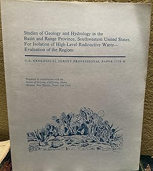
Studies of Geology and Hydrology in the Basin and Range Province, Southwestern United States, For Isolation of High-Level Radioactive Waste--Evaluation of the Regions; U. S. Geological Survey Professional Paper 1370H
Publicado por United States Government Printing Office, Washington, D. C., 1990
Librería: Crossroads Books, Reno, NV, Estados Unidos de America
Miembro de asociación: IOBA
Calificación del vendedor: 5 de 5 estrellas
EUR 23,46
Envío por EUR 4,42
Se envía dentro de Estados Unidos de AmericaCantidad disponible: 2 disponibles
Ańadir al carritoCondición: very good. Six regions in the Basin and Range province, ranging in size from 21,000 to 80,000 square kilometers, were evaluated to identify prospective hydrogeologic environments for isolation of high-level radioactive waste. DK1. 7 foldout maps inside rear cover, softcover, 61 pages.
-

Studies of Geology and Hydrology in the Basin and Range Province, Southwestern United States, For Isolation of High-Level Radioactive Waste--Characterization of the Bonneville Region, Utah and Nevada; U. S. Geological Survey Professional Paper 1370G
Publicado por United States Government Printing Office, Washington, D. C., 1990
Librería: Crossroads Books, Reno, NV, Estados Unidos de America
Miembro de asociación: IOBA
Calificación del vendedor: 5 de 5 estrellas
EUR 23,46
Envío por EUR 4,42
Se envía dentro de Estados Unidos de AmericaCantidad disponible: 2 disponibles
Ańadir al carritoCondición: very good. The Bonneville region of the Basin and range province in west-central Utah and adjacent Nevada includes several basins lying south of the Great Sale Lake Desert. DK2. 7 foldout maps inside rear cover, softcover, 38 pages.
-

Studies of Geology and Hydrology in the Basin and Range Province, Southwestern United States, For Isolation of High-Level Radioactive Waste -- Characterization of the Sonoran Region, California; U.S. Geological Survey Professional Paper 1370E
Publicado por United States Government Printing Office, Washington, D. C., 1989
Librería: Crossroads Books, Reno, NV, Estados Unidos de America
Miembro de asociación: IOBA
Calificación del vendedor: 5 de 5 estrellas
EUR 23,46
Envío por EUR 4,42
Se envía dentro de Estados Unidos de AmericaCantidad disponible: 1 disponibles
Ańadir al carritoCondición: very good. The Sonoran region of California lies west of the Colorado River and adjoins the Mojave Desert on the west, Death Valley on the northwest, and the Salton trough on the south. DH5. softcover, 7 foldout maps, 30 pages.
-

Studies of Geology and Hydrology in the Basin and Range Province, Southwestern United States, For Isolation of High-Level Radioactive Waste -- Characterization of the Trans-Pecos Region, Texas; U.S. Geological Survey Professional Paper 1370B
Publicado por United States Government Printing Office, Washington, D. C., 1989
Librería: Crossroads Books, Reno, NV, Estados Unidos de America
Miembro de asociación: IOBA
Calificación del vendedor: 5 de 5 estrellas
EUR 23,46
Envío por EUR 4,42
Se envía dentro de Estados Unidos de AmericaCantidad disponible: 1 disponibles
Ańadir al carritoCondición: very good. The Trans-Pecos region of Texas, in the southeasternmost part of the Basin and Range province, is semiarid: precipitation ranges from less than 250 to 450 millimeters and potential evapotransipiration is as great as 2.5 meters annually. DH5. softcover, 7 foldout maps, 43 pages.
-

STUDIES OF GEOLOGY AND HYDROLOGY IN THE BASIN AND RANGE PROVINCE, SOUTHWESTERN UNITED STATES FOR ISOLATION OF HIGH-LEVEL RADIOACTIVE WASTE - CHARACTERIZATION OF THE SONORAN REGION, ARIZONA: GEOLOGICAL SURVEY PROFESSIONAL PAPER 1370-D
Publicado por United States Geological Survey/USGS/Government Printing Office/GPO, Washington, DC, 1990
Librería: Robert Gavora, Fine & Rare Books, ABAA, Talent, OR, Estados Unidos de America
Miembro de asociación: ABAA CBA ILAB
Calificación del vendedor: 5 de 5 estrellas
EUR 22,56
Envío por EUR 6,13
Se envía dentro de Estados Unidos de AmericaCantidad disponible: 1 disponibles
Ańadir al carritoSoft cover. Condición: Near Fine. 40 pages with maps, tables and references, plus all six folded map plates in the rear pocket. Bound in original light blue stiff paper covers printed and illustrated in dark blue. A near fine copy. Book.
-

Studies of Geology and Hydrology in the Basin And Range Providence, Southwestern United States, For Isolation of High-Level Radioactive Waste-Characterization of the Sonoran Region, California
Publicado por U.S Government Printing Office, Washington, 1989
Librería: Eastburn Books, Albany, OR, Estados Unidos de America
Calificación del vendedor: 5 de 5 estrellas
EUR 27,07
Envío por EUR 5,24
Se envía dentro de Estados Unidos de AmericaCantidad disponible: 1 disponibles
Ańadir al carritoSoft cover. Condición: Good +. No Jacket. Good + Blue wraps w/blue lettering. U.S. Geological Survey Professional paper 1370-E. Two seperate pockets in back complete w/all seven plates/maps. Text unmarked/clean. Covers w/edgewear & very short tear to back. Cornerbumps. Binding solid. Covers clean/solid. 4to - over 9ľ" - 12" tall.
-
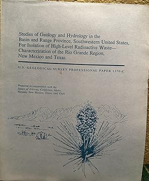
Studies of Geology and Hydrology in the Basin and Range Province, Southwestern United States, For Isolation of High Level Radioactive Waste--Characterization of the Rio Grande Region, New Mexico and Texas; U.S. Geological Survey Professional Paper 1370C
Publicado por United States Government Printing Office, Washington, D. C., 1989
Librería: Crossroads Books, Reno, NV, Estados Unidos de America
Miembro de asociación: IOBA
Calificación del vendedor: 5 de 5 estrellas
EUR 32,49
Envío por EUR 4,42
Se envía dentro de Estados Unidos de AmericaCantidad disponible: 1 disponibles
Ańadir al carritoCondición: very good. The Rio Grande region, New Mexico and Texas, includes most of the area east of the Rio Grande to the Sacramento Mountains. The region encompasses two large basins, the Jornada del Muerto and Tularosa basins, and the intervening San Andres Mountains. The valley surfaces generally have altitudes from 600 to 1,500 meters, and the mountain ranges generally have altitudes from 1,500 to 2,400 meters. About one-half the area is underlain by basin fill. DO3. softcover, 7 foldout maps inside rear cover, 42 pages.
-
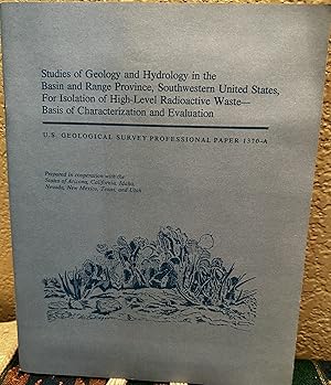
Studies of Geology and Hydrology in the Basin and Range Province, Southwestern United States, For Isolation of High-Level Radioactive Waste-- Basis of Characterization and Evaluation; U.S. Geological Survey Professional Paper 1370A
Publicado por United States Government Printing Office, Washington, 1989
Librería: Crossroads Books, Reno, NV, Estados Unidos de America
Miembro de asociación: IOBA
Calificación del vendedor: 5 de 5 estrellas
EUR 32,49
Envío por EUR 4,42
Se envía dentro de Estados Unidos de AmericaCantidad disponible: 1 disponibles
Ańadir al carritoCondición: near fine. Studies of Geology and Hydrology for Isolation of High-Level Radioactive Waste DM4. softcover, foldout map inside rear cover, 41 pages.