Importe total (1 artículo artículos):
Destino del pedido:

bartholomew j w (64 resultados)
Ir a los resultados principales
Filtros de búsqueda
Tipo de artículo
- Todos los tipos de productos
- Libros (48)
- Revistas y publicaciones (No hay ningún otro resultado que coincida con este filtro.)
- Cómics (No hay ningún otro resultado que coincida con este filtro.)
- Partituras (No hay ningún otro resultado que coincida con este filtro.)
- Arte, grabados y pósters (No hay ningún otro resultado que coincida con este filtro.)
- Fotografías (No hay ningún otro resultado que coincida con este filtro.)
- Mapas (16)
- Manuscritos y coleccionismo de papel (No hay ningún otro resultado que coincida con este filtro.)
Condición Más información
Encuadernación
Más atributos
- Primera edición (12)
- Firmado (No hay ningún otro resultado que coincida con este filtro.)
- Sobrecubierta (11)
- Con imágenes (35)
- No impresión bajo demanda (47)
Idioma (2)
Gastos de envío gratis
Ubicación del vendedor
Valoración de los vendedores
-

Abstracts : American Association of Stratigraphic Palynologists, Proceedings of the First Annual Meeting AND Photograph of Founding Members AASP/A.A.S.P.; Abstracts include: Megaspores as Indicators of Habitat; Middle & Upper Devonian Palynomorph Assemblages.; Chitinozoa . Devonian Callaway Fm.; Archaeological Pollen Analysis; Palynomorphs .Horizon Beta Outcrop; Densospore Variability.Sporangiostrobus; Classification.Azolla Megaspore species; Palynology, Paleoecology and a Computer; Microstructure .Orgueil Carbonaceous Meteorie and in Early Precambrian Sedimentary Rocks from South Africa (Geoscience and Man, Vol. 1, pp. 133-136).
Publicado por School of Geoscience, Louisiana State University., 1970
Librería: Eryops Books, Stephenville, TX, Estados Unidos de America
Calificación del vendedor: 5 de 5 estrellas

EUR 0,90
Envío por EUR 5,24
Se envía dentro de Estados Unidos de AmericaCantidad disponible: 1 disponibles
Añadir al carritoNo Binding. Condición: Very Good. ORIGINAL Articles, disbound from journal; no covers; in very good condition. Journal.
-
British Isles Pocket Atlas
Idioma: Inglés
Publicado por John Bartholomew & Son LTD., Edinburgh, 1935
Librería: M & M Books, ATHENS, GA, Estados Unidos de America
Calificación del vendedor: 3 de 5 estrellas

EUR 18,00
Envío por EUR 4,37
Se envía dentro de Estados Unidos de AmericaCantidad disponible: 1 disponibles
Añadir al carritoHardcover. Condición: Very Good. No Jacket. 9th Edition.
-
Richard Bentley, D. D. A Bibliography of his works and of all the literature called forth by his acts or his writings (1908)
Idioma: Inglés
Publicado por Bowes and Bowes, 1908
Librería: MB Books, Derbyshire, Reino Unido
Calificación del vendedor: 5 de 5 estrellas
EUR 9,70
Envío por EUR 23,55
Se envía de Reino Unido a Estados Unidos de AmericaCantidad disponible: 1 disponibles
Añadir al carritoHardcover. Condición: Good. No Jacket. Condition : Good. Ex-university library copy with associated library stamps etc. Hard cover, no jacket. 115pp. Rough cut pages. No highlighting or annotations to text. Small ink stain to edge of a few pages. This does not affect the text.
-

Mineral nutrient immobilization under forest and grass fallow in the Yangambi (Belgian Congo) Region with some preliminary results on the decomposition of plant material on the forest floor
Publicado por Ed. INEAC - 1953, 1953
Librería: Sylvain Paré, Montolieu, Francia
Calificación del vendedor: 5 de 5 estrellas
EUR 7,00
Envío por EUR 15,20
Se envía de Francia a Estados Unidos de AmericaCantidad disponible: 1 disponibles
Añadir al carritoEd. INEAC - 1953, série scientifique N° 57, in-8, broché, 27 pages Bon état, non coupé - Pour les envois hors de France, la tafication «livre & brochure» pour les frais de port a disparue.Les frais de port annoncés correspondent à une moyenne. Ils seront calculés au plus juste en fonction du poids de votre article.
-
The Oxford Economic Atlas
Idioma: Inglés
Publicado por Oxford University Press, 1925
Librería: Sandhill Books, Spring Green, WI, Estados Unidos de America
Calificación del vendedor: 5 de 5 estrellas
EUR 32,40
Envío por EUR 3,50
Se envía dentro de Estados Unidos de AmericaCantidad disponible: 1 disponibles
Añadir al carritoHardcover. Condición: Good. No Jacket. sixth edition. Red cloth, xii and 64 pages, 11 in tall. World and continental maps throughout showing climate, population, commerce, religion, race, etc. Climate maps show air pressure, temperature, rainfall, and ocean surface temperature. In introductory comments concerning the Negro: "because of climate influences the development of the brain is arrested, and the adult is essentially unintellectual.He is of great use as a manual laborer in a steamy climate, e. g. on a cane-sugar plantation." Front cover with 2 small dampstain spots at edge. Ownership ink-stamp on endpaper, possible glue repair to gutter at title page.
-
Soil Survey Of Monroe County, Wisconsin, Bulletin No. 60B, Soil Series No. 35
Publicado por State of Wisconsin, 1931
Librería: Crossroad Books, Eau Claire, WI, Estados Unidos de America
Calificación del vendedor: 5 de 5 estrellas
EUR 19,44
Envío por EUR 4,81
Se envía dentro de Estados Unidos de AmericaCantidad disponible: 1 disponibles
Añadir al carritoSoftcover. Condición: Very Good. Estado de la sobrecubierta: No Dust Jacket. Softcover. Spine tail is bumped with 1" tear. Rear lower corner is bumped. Previous owner's name on front cover. Fold-out map at rear of book; clean. ; ART20C; 93 pages.
-

Covenantal Biomedical Ethics for Contemporary Medicine : An Alternative to Principles-Based Ethics
Librería: GreatBookPrices, Columbia, MD, Estados Unidos de America
Calificación del vendedor: 5 de 5 estrellas
EUR 35,70
Envío por EUR 2,31
Se envía dentro de Estados Unidos de AmericaCantidad disponible: Más de 20 disponibles
Añadir al carritoCondición: New.
-

Covenantal Biomedical Ethics for Contemporary Medicine : An Alternative to Principles-Based Ethics
Librería: GreatBookPrices, Columbia, MD, Estados Unidos de America
Calificación del vendedor: 5 de 5 estrellas
EUR 38,24
Envío por EUR 2,31
Se envía dentro de Estados Unidos de AmericaCantidad disponible: Más de 20 disponibles
Añadir al carritoCondición: As New. Unread book in perfect condition.
-

England & Wales
Año de publicación: 1868
Librería: theoldmapman, Clevedon, SOMER, Reino Unido
Calificación del vendedor: 5 de 5 estrellas
Mapa
EUR 9,70
Envío por EUR 7,65
Se envía de Reino Unido a Estados Unidos de AmericaCantidad disponible: 1 disponibles
Añadir al carritoSingle sheet. Original antique printed map in colours showing principal features. Centrefold as issued. 21 x 26 cm.
-
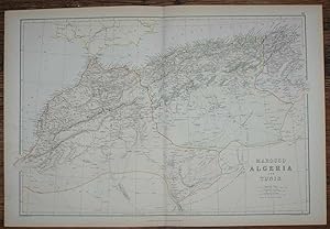
1884 Blackie's Map of Marocco, Algeria and Tunis
Publicado por Blackie & Son, London, Glasgow, Edinburgh and Dublin, 1884
Librería: Bailgate Books Ltd, Doncaster, Reino Unido
Calificación del vendedor: 5 de 5 estrellas
Mapa
EUR 15,52
Envío por EUR 17,07
Se envía de Reino Unido a Estados Unidos de AmericaCantidad disponible: 1 disponibles
Añadir al carritoSoftcover. Condición: Very Good. Estado de la sobrecubierta: No Dust Jacket. Drawn and Engraved by J. Bartholomew Ilustrador. Early Edition. Disbound map from the 1884 "Comprehensive Atlas & Geography of the World: Comprising an Extensive Series of Maps, a Description, Physical and Political, of all the Countries of the Earth; a Pronouncing Vocabulary of Geographical Names, and a Copious Index of Geographical Positions. Compiled and Engraved from the Most Authentic Sources, Under the Supervision of W. G. Blackie, PhD., F.S.A.Scot." Sheet number covers Single sheet with horizontal centre fold. Sheet is clean but slightly darkened at the edges. Map is drawn to a given scale with latitude and longitude lines, map is extensively labeled. Pastel shades have been used to denote countries and slightly darker shades have been used to denote boarders. Black and white engraved hatching shows landscape features. Size: 38x56cm. Item Type: Map. No dust jacket, as published. Single sheet map/chart which is suitable for framing. Illustrator: Drawn and Engraved by J. Bartholomew. Quantity Available: 1. Shipped Weight: under 1 kg. Pictures of this item not already displayed here available upon request. Inventory No: 45117104041. All our books are sent by tracked mail.
-
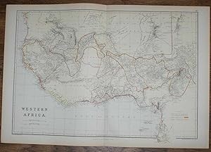
1884 Blackie's Map of Western Africa
Publicado por Blackie & Son, London, Glasgow, Edinburgh and Dublin, 1884
Librería: Bailgate Books Ltd, Doncaster, Reino Unido
Calificación del vendedor: 5 de 5 estrellas
Mapa
EUR 15,52
Envío por EUR 17,07
Se envía de Reino Unido a Estados Unidos de AmericaCantidad disponible: 1 disponibles
Añadir al carritoSoftcover. Condición: Very Good. Estado de la sobrecubierta: No Dust Jacket. Drawn and Engraved by J. Bartholomew Ilustrador. Early Edition. Disbound map from the 1884 "Comprehensive Atlas & Geography of the World: Comprising an Extensive Series of Maps, a Description, Physical and Political, of all the Countries of the Earth; a Pronouncing Vocabulary of Geographical Names, and a Copious Index of Geographical Positions. Compiled and Engraved from the Most Authentic Sources, Under the Supervision of W. G. Blackie, PhD., F.S.A.Scot." Sheet number covers Single sheet with horizontal centre fold. Sheet is clean but slightly darkened at the edges. Map is drawn to a given scale with latitude and longitude lines, map is extensively labeled. Pastel shades have been used to denote countries and slightly darker shades have been used to denote boarders. Black and white engraved hatching shows landscape features. Size: 38x56cm. Item Type: Map. No dust jacket, as published. Single sheet map/chart which is suitable for framing. Illustrator: Drawn and Engraved by J. Bartholomew. Quantity Available: 1. Shipped Weight: under 1 kg. Pictures of this item not already displayed here available upon request. Inventory No: 45117104040. All our books are sent by tracked mail.
-
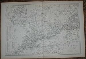
1884 Blackie's Map of Canada - The Province of Ontario and part of Quebec
Publicado por Blackie & Son, London, Glasgow, Edinburgh and Dublin, 1884
Librería: Bailgate Books Ltd, Doncaster, Reino Unido
Calificación del vendedor: 5 de 5 estrellas
Mapa
EUR 16,50
Envío por EUR 17,07
Se envía de Reino Unido a Estados Unidos de AmericaCantidad disponible: 1 disponibles
Añadir al carritoSoftcover. Condición: Very Good. Estado de la sobrecubierta: No Dust Jacket. Drawn and Engraved by J. Bartholomew Ilustrador. Early Edition. Disbound map from the 1884 "Comprehensive Atlas & Geography of the World: Comprising an Extensive Series of Maps, a Description, Physical and Political, of all the Countries of the Earth; a Pronouncing Vocabulary of Geographical Names, and a Copious Index of Geographical Positions. Compiled and Engraved from the Most Authentic Sources, Under the Supervision of W. G. Blackie, PhD., F.S.A.Scot." Sheet number covers Single sheet with horizontal centre fold. Sheet is clean but slightly darkened at the edges. Map is drawn to a given scale with latitude and longitude lines, map is extensively labeled. Pastel shades have been used to denote countries and slightly darker shades have been used to denote boarders. Black and white engraved hatching shows landscape features. Size: 38x56cm. Item Type: Map. No dust jacket, as published. Single sheet map/chart which is suitable for framing. Illustrator: Drawn and Engraved by J. Bartholomew. Quantity Available: 1. Shipped Weight: under 1 kg. Pictures of this item not already displayed here available upon request. Inventory No: 45117104036. All our books are sent by tracked mail.
-
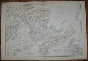
1884 Blackie's Map of Canada - The Provinces of Quebec, Nova Scotia, New Brunswick, Prince Edward Island and Newfoundland
Publicado por Blackie & Son, London, Glasgow, Edinburgh and Dublin, 1884
Librería: Bailgate Books Ltd, Doncaster, Reino Unido
Calificación del vendedor: 5 de 5 estrellas
Mapa
EUR 16,50
Envío por EUR 17,07
Se envía de Reino Unido a Estados Unidos de AmericaCantidad disponible: 1 disponibles
Añadir al carritoSoftcover. Condición: Very Good. Estado de la sobrecubierta: No Dust Jacket. Drawn and Engraved by J. Bartholomew Ilustrador. Early Edition. Disbound map from the 1884 "Comprehensive Atlas & Geography of the World: Comprising an Extensive Series of Maps, a Description, Physical and Political, of all the Countries of the Earth; a Pronouncing Vocabulary of Geographical Names, and a Copious Index of Geographical Positions. Compiled and Engraved from the Most Authentic Sources, Under the Supervision of W. G. Blackie, PhD., F.S.A.Scot." Single sheet with vertical centre fold. Sheet is clean but slightly darkened at the edges. Map is drawn to a given scale with latitude and longitude lines, map is extensively labeled. Pastel shades have been used to denote countries and slightly darker shades have been used to denote boarders. Black and white engraved hatching shows landscape features. Size: 38x56cm. Item Type: Map. No dust jacket, as published. Single sheet map/chart which is suitable for framing. Illustrator: Drawn and Engraved by J. Bartholomew. Quantity Available: 1. Shipped Weight: under 1 kg. Pictures of this item not already displayed here available upon request. Inventory No: 45117104037. All our books are sent by tracked mail.
-
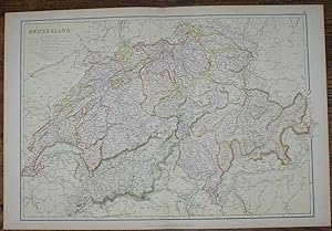
1884 Blackie's Map of Switzerland
Publicado por Blackie & Son, London, Glasgow, Edinburgh and Dublin, 1884
Librería: Bailgate Books Ltd, Doncaster, Reino Unido
Calificación del vendedor: 5 de 5 estrellas
Mapa
EUR 17,46
Envío por EUR 17,07
Se envía de Reino Unido a Estados Unidos de AmericaCantidad disponible: 1 disponibles
Añadir al carritoSoftcover. Condición: Very Good. Estado de la sobrecubierta: No Dust Jacket. Drawn and Engraved by J. Bartholomew Ilustrador. Early Edition. Disbound map from the 1884 "Comprehensive Atlas & Geography of the World: Comprising an Extensive Series of Maps, a Description, Physical and Political, of all the Countries of the Earth; a Pronouncing Vocabulary of Geographical Names, and a Copious Index of Geographical Positions. Compiled and Engraved from the Most Authentic Sources, Under the Supervision of W. G. Blackie, PhD., F.S.A.Scot." Sheet number covers Single sheet with horizontal centre fold. Sheet is clean but slightly darkened at the edges. Map is drawn to a given scale with latitude and longitude lines, map is extensively labeled. Pastel shades have been used to denote countries and slightly darker shades have been used to denote boarders. Black and white engraved hatching shows landscape features. Size: 38x56cm. Item Type: Map. No dust jacket, as published. Single sheet map/chart which is suitable for framing. Illustrator: Drawn and Engraved by J. Bartholomew. Quantity Available: 1. Shipped Weight: under 1 kg. Pictures of this item not already displayed here available upon request. Inventory No: 45117104018. All our books are sent by tracked mail.
-

South America
Año de publicación: 1868
Librería: theoldmapman, Clevedon, SOMER, Reino Unido
Calificación del vendedor: 5 de 5 estrellas
Mapa
EUR 12,13
Envío por EUR 7,65
Se envía de Reino Unido a Estados Unidos de AmericaCantidad disponible: 1 disponibles
Añadir al carritoSingle sheet. Original antique coloured map. Centrefold as issued. Especially nice colouring. 26 x 22.5 cm.
-
1884 Blackie's Map of Central Europe, showing the Principal Railways and the Political Boundaries
Publicado por Blackie & Son, London, Glasgow, Edinburgh and Dublin, 1884
Librería: Bailgate Books Ltd, Doncaster, Reino Unido
Calificación del vendedor: 5 de 5 estrellas
Mapa
EUR 17,46
Envío por EUR 17,07
Se envía de Reino Unido a Estados Unidos de AmericaCantidad disponible: 1 disponibles
Añadir al carritoSoftcover. Condición: Very Good. Estado de la sobrecubierta: No Dust Jacket. Drawn and Engraved by J. Bartholomew Ilustrador. Early Edition. Disbound map from the 1884 "Comprehensive Atlas & Geography of the World: Comprising an Extensive Series of Maps, a Description, Physical and Political, of all the Countries of the Earth; a Pronouncing Vocabulary of Geographical Names, and a Copious Index of Geographical Positions. Compiled and Engraved from the Most Authentic Sources, Under the Supervision of W. G. Blackie, PhD., F.S.A.Scot." Sheet number covers Single sheet with horizontal centre fold. Sheet is clean but slightly darkened at the edges. Map is drawn to a given scale with latitude and longitude lines, map is extensively labeled. Pastel shades have been used to denote countries and slightly darker shades have been used to denote boarders. Black and white engraved hatching shows landscape features. Size: 38x56cm. Item Type: Map. No dust jacket, as published. Single sheet map/chart which is suitable for framing. Illustrator: Drawn and Engraved by J. Bartholomew. Quantity Available: 1. Shipped Weight: under 1 kg. Pictures of this item not already displayed here available upon request. Inventory No: 45117104021. All our books are sent by tracked mail.
-
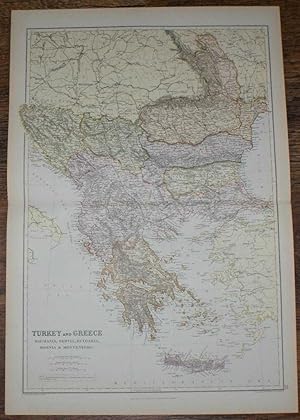
1884 Blackie's Map of Turkey, Greece, Roumania, Servia, Bulgaria, Bosnia & Montenegro
Publicado por Blackie & Son, London, Glasgow, Edinburgh and Dublin, 1884
Librería: Bailgate Books Ltd, Doncaster, Reino Unido
Calificación del vendedor: 5 de 5 estrellas
Mapa
EUR 17,46
Envío por EUR 17,07
Se envía de Reino Unido a Estados Unidos de AmericaCantidad disponible: 1 disponibles
Añadir al carritoSoftcover. Condición: Very Good. Estado de la sobrecubierta: No Dust Jacket. Drawn and Engraved by J. Bartholomew Ilustrador. Early Edition. Disbound map from the 1884 "Comprehensive Atlas & Geography of the World: Comprising an Extensive Series of Maps, a Description, Physical and Political, of all the Countries of the Earth; a Pronouncing Vocabulary of Geographical Names, and a Copious Index of Geographical Positions. Compiled and Engraved from the Most Authentic Sources, Under the Supervision of W. G. Blackie, PhD., F.S.A.Scot." Sheet number covers Single sheet with horizontal centre fold. Sheet is clean but slightly darkened at the edges. Map is drawn to a given scale with latitude and longitude lines, map is extensively labeled. Pastel shades have been used to denote countries and slightly darker shades have been used to denote boarders. Black and white engraved hatching shows landscape features. Size: 56x38cm. Item Type: Map. No dust jacket, as published. Single sheet map/chart which is suitable for framing. Illustrator: Drawn and Engraved by J. Bartholomew. Quantity Available: 1. Shipped Weight: under 1 kg. Pictures of this item not already displayed here available upon request. Inventory No: 45117104007. All our books are sent by tracked mail.
-

Covenantal Biomedical Ethics for Contemporary Medicine : An Alternative to Principles-Based Ethics
Librería: GreatBookPricesUK, Woodford Green, Reino Unido
Calificación del vendedor: 5 de 5 estrellas
EUR 35,99
Envío por EUR 17,66
Se envía de Reino Unido a Estados Unidos de AmericaCantidad disponible: Más de 20 disponibles
Añadir al carritoCondición: New.
-
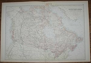
1884 Blackie's Map of British North America - The Dominion of Canada
Publicado por Blackie & Son, London, Glasgow, Edinburgh and Dublin, 1884
Librería: Bailgate Books Ltd, Doncaster, Reino Unido
Calificación del vendedor: 5 de 5 estrellas
Mapa
EUR 19,41
Envío por EUR 17,07
Se envía de Reino Unido a Estados Unidos de AmericaCantidad disponible: 1 disponibles
Añadir al carritoSoftcover. Condición: Very Good. Estado de la sobrecubierta: No Dust Jacket. Drawn and Engraved by J. Bartholomew Ilustrador. Early Edition. Disbound map from the 1884 "Comprehensive Atlas & Geography of the World: Comprising an Extensive Series of Maps, a Description, Physical and Political, of all the Countries of the Earth; a Pronouncing Vocabulary of Geographical Names, and a Copious Index of Geographical Positions. Compiled and Engraved from the Most Authentic Sources, Under the Supervision of W. G. Blackie, PhD., F.S.A.Scot." Sheet number covers Single sheet with horizontal centre fold. Sheet is clean but slightly darkened at the edges. Map is drawn to a given scale with latitude and longitude lines, map is extensively labeled. Pastel shades have been used to denote countries and slightly darker shades have been used to denote boarders. Black and white engraved hatching shows landscape features. Size: 38x56cm. Item Type: Map. No dust jacket, as published. Single sheet map/chart which is suitable for framing. Illustrator: Drawn and Engraved by J. Bartholomew. Quantity Available: 1. Shipped Weight: under 1 kg. Pictures of this item not already displayed here available upon request. Inventory No: 45117104038. All our books are sent by tracked mail.
-
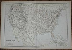
1884 Blackie's Map of The United States of North America
Publicado por Blackie & Son, London, Glasgow, Edinburgh and Dublin, 1884
Librería: Bailgate Books Ltd, Doncaster, Reino Unido
Calificación del vendedor: 5 de 5 estrellas
Mapa
EUR 19,41
Envío por EUR 17,07
Se envía de Reino Unido a Estados Unidos de AmericaCantidad disponible: 1 disponibles
Añadir al carritoSoftcover. Condición: Very Good. Estado de la sobrecubierta: No Dust Jacket. Drawn and Engraved by J. Bartholomew Ilustrador. Early Edition. Disbound map from the 1884 "Comprehensive Atlas & Geography of the World: Comprising an Extensive Series of Maps, a Description, Physical and Political, of all the Countries of the Earth; a Pronouncing Vocabulary of Geographical Names, and a Copious Index of Geographical Positions. Compiled and Engraved from the Most Authentic Sources, Under the Supervision of W. G. Blackie, PhD., F.S.A.Scot." Sheet number covers Single sheet with horizontal centre fold. Sheet is clean but slightly darkened at the edges. Map is drawn to a given scale with latitude and longitude lines, map is extensively labeled. Pastel shades have been used to denote countries and slightly darker shades have been used to denote boarders. Black and white engraved hatching shows landscape features. Size: 38x56cm. Item Type: Map. No dust jacket, as published. Single sheet map/chart which is suitable for framing. Illustrator: Drawn and Engraved by J. Bartholomew. Quantity Available: 1. Shipped Weight: under 1 kg. Pictures of this item not already displayed here available upon request. Inventory No: 45117104035. All our books are sent by tracked mail.
-
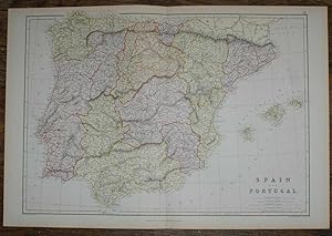
1884 Blackie's Map of Spain and Portugal
Publicado por Blackie & Son, London, Glasgow, Edinburgh and Dublin, 1884
Librería: Bailgate Books Ltd, Doncaster, Reino Unido
Calificación del vendedor: 5 de 5 estrellas
Mapa
EUR 19,41
Envío por EUR 17,07
Se envía de Reino Unido a Estados Unidos de AmericaCantidad disponible: 1 disponibles
Añadir al carritoSoftcover. Condición: Very Good. Estado de la sobrecubierta: No Dust Jacket. Drawn and Engraved by J. Bartholomew Ilustrador. Early Edition. Disbound map from the 1884 "Comprehensive Atlas & Geography of the World: Comprising an Extensive Series of Maps, a Description, Physical and Political, of all the Countries of the Earth; a Pronouncing Vocabulary of Geographical Names, and a Copious Index of Geographical Positions. Compiled and Engraved from the Most Authentic Sources, Under the Supervision of W. G. Blackie, PhD., F.S.A.Scot." Sheet number covers Single sheet with horizontal centre fold. Sheet is clean but slightly darkened at the edges. Map is drawn to a given scale with latitude and longitude lines, map is extensively labeled. Pastel shades have been used to denote countries and slightly darker shades have been used to denote boarders. Black and white engraved hatching shows landscape features. Size: 38x56cm. Item Type: Map. No dust jacket, as published. Single sheet map/chart which is suitable for framing. Illustrator: Drawn and Engraved by J. Bartholomew. Quantity Available: 1. Shipped Weight: under 1 kg. Pictures of this item not already displayed here available upon request. Inventory No: 45117104016. All our books are sent by tracked mail.
-

Covenantal Biomedical Ethics for Contemporary Medicine : An Alternative to Principles-Based Ethics
Librería: GreatBookPricesUK, Woodford Green, Reino Unido
Calificación del vendedor: 5 de 5 estrellas
EUR 40,34
Envío por EUR 17,66
Se envía de Reino Unido a Estados Unidos de AmericaCantidad disponible: Más de 20 disponibles
Añadir al carritoCondición: As New. Unread book in perfect condition.
-
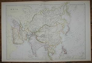
1884 Blackie's Map of Asia
Publicado por Blackie & Son, London, Glasgow, Edinburgh and Dublin, 1884
Librería: Bailgate Books Ltd, Doncaster, Reino Unido
Calificación del vendedor: 5 de 5 estrellas
Mapa
EUR 21,35
Envío por EUR 17,07
Se envía de Reino Unido a Estados Unidos de AmericaCantidad disponible: 1 disponibles
Añadir al carritoSoftcover. Condición: Very Good. Estado de la sobrecubierta: No Dust Jacket. Drawn and Engraved by J. Bartholomew Ilustrador. Early Edition. Disbound map from the 1884 "Comprehensive Atlas & Geography of the World: Comprising an Extensive Series of Maps, a Description, Physical and Political, of all the Countries of the Earth; a Pronouncing Vocabulary of Geographical Names, and a Copious Index of Geographical Positions. Compiled and Engraved from the Most Authentic Sources, Under the Supervision of W. G. Blackie, PhD., F.S.A.Scot." Sheet number covers Single sheet with horizontal centre fold. Sheet is clean but slightly darkened at the edges. Map is drawn to a given scale with latitude and longitude lines, map is extensively labeled. Pastel shades have been used to denote countries and slightly darker shades have been used to denote boarders. Black and white engraved hatching shows landscape features. Size: 38x56cm. Item Type: Map. No dust jacket, as published. Single sheet map/chart which is suitable for framing. Illustrator: Drawn and Engraved by J. Bartholomew. Quantity Available: 1. Shipped Weight: under 1 kg. Pictures of this item not already displayed here available upon request. Inventory No: 45117104015. All our books are sent by tracked mail.
-
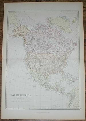
1884 Blackie's Map of North America
Publicado por Blackie & Son, London, Glasgow, Edinburgh and Dublin, 1884
Librería: Bailgate Books Ltd, Doncaster, Reino Unido
Calificación del vendedor: 5 de 5 estrellas
Mapa
EUR 21,35
Envío por EUR 17,07
Se envía de Reino Unido a Estados Unidos de AmericaCantidad disponible: 1 disponibles
Añadir al carritoSoftcover. Condición: Very Good. Estado de la sobrecubierta: No Dust Jacket. Drawn and Engraved by J. Bartholomew Ilustrador. Early Edition. Disbound map from the 1884 "Comprehensive Atlas & Geography of the World: Comprising an Extensive Series of Maps, a Description, Physical and Political, of all the Countries of the Earth; a Pronouncing Vocabulary of Geographical Names, and a Copious Index of Geographical Positions. Compiled and Engraved from the Most Authentic Sources, Under the Supervision of W. G. Blackie, PhD., F.S.A.Scot." Sheet number covers Single sheet with horizontal centre fold. Sheet is clean but slightly darkened at the edges. Map is drawn to a given scale with latitude and longitude lines, map is extensively labeled. Pastel shades have been used to denote countries and slightly darker shades have been used to denote boarders. Black and white engraved hatching shows landscape features. Size: 56x38cm. Item Type: Map. No dust jacket, as published. Single sheet map/chart which is suitable for framing. Illustrator: Drawn and Engraved by J. Bartholomew. Quantity Available: 1. Shipped Weight: under 1 kg. Pictures of this item not already displayed here available upon request. Inventory No: 45117104005. All our books are sent by tracked mail.
-
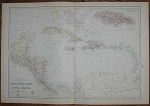
1884 Blackie's Map of The West India Islands and Central America
Publicado por Blackie & Son, London, Glasgow, Edinburgh and Dublin, 1884
Librería: Bailgate Books Ltd, Doncaster, Reino Unido
Calificación del vendedor: 5 de 5 estrellas
Mapa
EUR 21,35
Envío por EUR 17,07
Se envía de Reino Unido a Estados Unidos de AmericaCantidad disponible: 1 disponibles
Añadir al carritoSoftcover. Condición: Very Good. Estado de la sobrecubierta: No Dust Jacket. Drawn and Engraved by J. Bartholomew Ilustrador. Early Edition. Disbound map from the 1884 "Comprehensive Atlas & Geography of the World: Comprising an Extensive Series of Maps, a Description, Physical and Political, of all the Countries of the Earth; a Pronouncing Vocabulary of Geographical Names, and a Copious Index of Geographical Positions. Compiled and Engraved from the Most Authentic Sources, Under the Supervision of W. G. Blackie, PhD., F.S.A.Scot." Sheet number covers Single sheet with horizontal centre fold. Sheet is clean but slightly darkened at the edges. Map is drawn to a given scale with latitude and longitude lines, map is extensively labeled. Pastel shades have been used to denote countries and slightly darker shades have been used to denote boarders. Black and white engraved hatching shows landscape features. Size: 38x56cm. Item Type: Map. No dust jacket, as published. Single sheet map/chart which is suitable for framing. Illustrator: Drawn and Engraved by J. Bartholomew. Quantity Available: 1. Shipped Weight: under 1 kg. Pictures of this item not already displayed here available upon request. Inventory No: 45117104033. All our books are sent by tracked mail.
-
1884 Blackie's Map of The British Islands and the North Sea
Publicado por Blackie & Son, London, Glasgow, Edinburgh and Dublin, 1884
Librería: Bailgate Books Ltd, Doncaster, Reino Unido
Calificación del vendedor: 5 de 5 estrellas
Mapa
EUR 22,32
Envío por EUR 17,07
Se envía de Reino Unido a Estados Unidos de AmericaCantidad disponible: 1 disponibles
Añadir al carritoSoftcover. Condición: Very Good. Estado de la sobrecubierta: No Dust Jacket. Drawn and Engraved by J. Bartholomew Ilustrador. Early Edition. Disbound map from the 1884 "Comprehensive Atlas & Geography of the World: Comprising an Extensive Series of Maps, a Description, Physical and Political, of all the Countries of the Earth; a Pronouncing Vocabulary of Geographical Names, and a Copious Index of Geographical Positions. Compiled and Engraved from the Most Authentic Sources, Under the Supervision of W. G. Blackie, PhD., F.S.A.Scot." Sheet number covers Single sheet with horizontal centre fold. Sheet is clean but slightly darkened at the edges. Map is drawn to a given scale with latitude and longitude lines, map is extensively labeled. Pastel shades have been used to denote countries and slightly darker shades have been used to denote boarders. Black and white engraved hatching shows landscape features. Size: 38x56cm. Item Type: Map. No dust jacket, as published. Single sheet map/chart which is suitable for framing. Illustrator: Drawn and Engraved by J. Bartholomew. Quantity Available: 1. Shipped Weight: under 1 kg. Pictures of this item not already displayed here available upon request. Inventory No: 45117104024. All our books are sent by tracked mail.
-
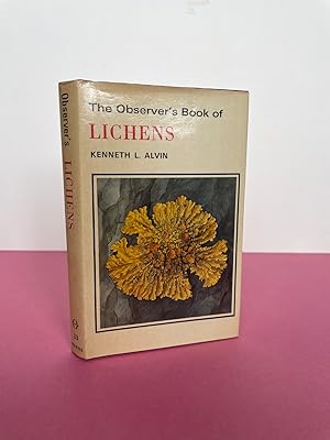
THE OBSERVER'S BOOK OF LICHENS
Idioma: Inglés
Publicado por Frederick Warne, London, 1977
ISBN 10: 0723215669 ISBN 13: 9780723215660
Librería: LOE BOOKS, Bathpool, CORNW, Reino Unido
Calificación del vendedor: 5 de 5 estrellas
Original o primera edición
EUR 48,52
Envío por EUR 14,72
Se envía de Reino Unido a Estados Unidos de AmericaCantidad disponible: 1 disponibles
Añadir al carritoHardcover. Condición: Very Good. Estado de la sobrecubierta: Very Good. Color & B/w Illustration Ilustrador. First Edition. dDust jacke very good, some uniform toning, no loss. binding clean. Contents clean and tight, bright, no inscriptions. A good clean copy. Size: 16mo. Book.
-
Allentown 1762-1987: A 225-Year History [Volume I]
Publicado por Lehigh County Historical Society, Allentown, PA, 1987
Librería: Saucony Book Shop, Kutztown, PA, Estados Unidos de America
Calificación del vendedor: 5 de 5 estrellas
Original o primera edición
EUR 45,00
Envío por EUR 5,24
Se envía dentro de Estados Unidos de AmericaCantidad disponible: 1 disponibles
Añadir al carritoHardcover. Condición: Fine. Estado de la sobrecubierta: Very Good. 1st Edition. Dark blue cloth-effect paper covered boards, lettered in gold foil. As issued. Pictorial dust jacket is rubbed at corners and shows several mild creases and rubs, now in mylar. [x],584 pp., illus. w/ vintage b&w photographs, endpaper maps. Size: 4to - over 9¾" - 12" tall. Book.
-
W.H. Smith & Son's Reduced Ordnance Map of Lincoln and environs. Scale 4 Miles to an Inch.
Publicado por W.H. Smith & Son, [ca. 1880]., 1880
Librería: Charles Cox Rare Books , Bude, Reino Unido
Calificación del vendedor: 5 de 5 estrellas
EUR 26,08
Envío por EUR 26,50
Se envía de Reino Unido a Estados Unidos de AmericaCantidad disponible: 1 disponibles
Añadir al carritoHardcover. Condición: Very Good. 19" by 14" linen-backed coloured map folded in dull red cloth boards with yellow paper label. In very nice state.
-
Allentown 1762-1987: A 225-Year History [Volume II]
Publicado por Lehigh County Historical Society, Allentown, PA, 1987
Librería: Saucony Book Shop, Kutztown, PA, Estados Unidos de America
Calificación del vendedor: 5 de 5 estrellas
Original o primera edición
EUR 49,50
Envío por EUR 5,24
Se envía dentro de Estados Unidos de AmericaCantidad disponible: 1 disponibles
Añadir al carritoHardcover. Condición: Fine. Estado de la sobrecubierta: Fine. 1st Edition. Dark blue cloth-effect paper covered boards, lettered in gold foil. As issued. Pictorial dust jacket shows very slight edge rubbing, essentially as issued, now in mylar. [viii],663pp., illus. w/ vintage b&w photographs, endpaper maps. Size: 4to - over 9¾" - 12" tall. Book.