Barron roderick (60 resultados)

- Tapa blanda
Librería: BooksRun, Philadelphia, PA, Estados Unidos de AmericaBooksRun
Contactar con el vendedorVendedor de 5 estrellasCondición: Usado - Regular
EUR 8,22
Gastos de envío gratisSe envía dentro de Estados Unidos de AmericaCantidad disponible: 1 disponibles
Paperback. Condición: Fair. The item might be beaten up but readable. May contain markings or highlighting, as well as stains, bent corners, or any other major defect, but the text is not obscured in any way.
- Tapa blanda
Librería: HPB-Emerald, Dallas, TX, Estados Unidos de AmericaHPB-Emerald
Contactar con el vendedorVendedor de 5 estrellasCondición: Usado - Bueno
EUR 6,63
Envío por EUR 3,30Se envía dentro de Estados Unidos de AmericaCantidad disponible: 1 disponibles
paperback. Condición: Very Good. Connecting readers with great books since 1972! Used books may not include companion materials, and may have some shelf wear or limited writing. We ship orders daily and Customer Service is our top priority.

- Tapa blanda
Librería: WeBuyBooks, Rossendale, LANCS, Reino UnidoWeBuyBooks
Contactar con el vendedorVendedor de 5 estrellasCondición: Usado - Bueno
EUR 5,25
Envío por EUR 9,01Se envía de Reino Unido a Estados Unidos de AmericaCantidad disponible: 1 disponibles
Condición: Very Good. Most items will be dispatched the same or the next working day. A copy that has been read, but is in excellent condition. Pages are intact and not marred by notes or highlighting. The spine remains undamaged.

- Tapa blanda
Librería: WeBuyBooks, Rossendale, LANCS, Reino UnidoWeBuyBooks
Contactar con el vendedorVendedor de 5 estrellasCondición: Usado - Aceptable
EUR 5,25
Envío por EUR 9,01Se envía de Reino Unido a Estados Unidos de AmericaCantidad disponible: 1 disponibles
Condición: Good. Most items will be dispatched the same or the next working day. A copy that has been read but remains in clean condition. All of the pages are intact and the cover is intact and the spine may show signs of wear. The book may have minor markings which are not specifically mentioned. Small Tears to the Dust Jacket…, Slipcase, or cover.
- Tapa blanda
Librería: WorldofBooks, Goring-By-Sea, WS, Reino UnidoWorldofBooks
Contactar con el vendedorVendedor de 5 estrellasCondición: Usado - Bueno
EUR 8,32
Envío por EUR 6,54Se envía de Reino Unido a Estados Unidos de AmericaCantidad disponible: 5 disponibles
Paperback. Condición: Very Good. The book has been read, but is in excellent condition. Pages are intact and not marred by notes or highlighting. The spine remains undamaged.
- Tapa blanda
Librería: Oddball Books, Burbank, CA, Estados Unidos de AmericaOddball Books
Contactar con el vendedorVendedor de 5 estrellasCondición: Usado - Bueno
EUR 9,05
Envío por EUR 6,14Se envía dentro de Estados Unidos de AmericaCantidad disponible: 1 disponibles
Paperback. Condición: Very Good. Not Stated. The book has some minor wear along the top side edges. Due to the size of this book it cannot be shipped priority mail or outside the United States.
- Tapa dura
Librería: Terra Firma Books, San Diego, CA, Estados Unidos de AmericaTerra Firma Books
Contactar con el vendedorVendedor de 5 estrellasCondición: Usado - Excelente
EUR 13,57
Envío por EUR 5,26Se envía dentro de Estados Unidos de AmericaCantidad disponible: 2 disponibles
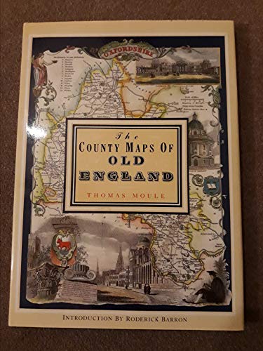
Hardcover. Condición: Fine. Estado de la sobrecubierta: Fine. Fine copies of Moule's 56 maps in color from1830; 127pp. No name or writing. CLEAN.
- Tapa blanda
Librería: Hilton Books, Sandbach, Reino UnidoHilton Books
Contactar con el vendedorVendedor de 5 estrellasCondición: Usado - Excelente
EUR 9,62
Envío por EUR 11,09Se envía de Reino Unido a Estados Unidos de AmericaCantidad disponible: 1 disponibles
Soft cover. Condición: Fine.
- Tapa dura
Librería: Daedalus Books, Portland, OR, Estados Unidos de AmericaDaedalus Books
Contactar con el vendedorVendedor de 5 estrellasMiembro de asociación: CBA
Condición: Usado - Bueno
EUR 16,26
Envío por EUR 5,71Se envía dentro de Estados Unidos de AmericaCantidad disponible: 1 disponibles
Cloth. Condición: Very Good. Estado de la sobrecubierta: Very Good. Clean and solid. ; Color Illustrations; Folio; 128 pages.

- Tapa blanda
- Primera edición
Librería: MW Books, New York, NY, Estados Unidos de AmericaMW Books
Contactar con el vendedorVendedor de 5 estrellasCondición: Usado
EUR 22,73
Gastos de envío gratisSe envía dentro de Estados Unidos de AmericaCantidad disponible: 1 disponibles
First Edition. Near fine paperback copy; wrapper edges very slightly dulled. Remains particularly well-preserved overall; tight, bright, clean and especially sharp-cornered. Physical description: 1 atlas (8 pages, 40 leaves of plates) : color maps ; 38 cm. Notes: Reproduces some plates and originals held by the British Museum an…d Jonathan Potter Ltd., London. Subjects: Great Britain Maps. Railroads Great Britain Maps. England. History - ; atlases. Genre: Atlas. Language: English. 3 Kg.

- Tapa blanda
- Primera edición
Librería: MW Books, New York, NY, Estados Unidos de AmericaMW Books
Contactar con el vendedorVendedor de 5 estrellasCondición: Usado
EUR 24,57
Gastos de envío gratisSe envía dentro de Estados Unidos de AmericaCantidad disponible: 1 disponibles
First Edition. Very good paperback copy; edges somewhat slightly dust-dulled and nicked. Remains particularly well-preserved overall; tight, bright, clean and strong. Physical description; 8 pages, 40 leaves of plates : color maps ; 39 cm. Subjects; Pictorial maps -- History. Cartography -- History. 3 Kg.

- Tapa blanda
Librería: Hamelyn, Madrid, M, EspañaHamelyn
Contactar con el vendedorVendedor de 5 estrellasCondición: Usado - Bueno
EUR 8,96
Envío por EUR 12,99Se envía de España a Estados Unidos de AmericaCantidad disponible: 1 disponibles
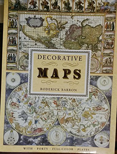
Condición: Bueno. : Descubre la fascinante historia de la cartografía con 'Mapas del Mundo' de Roderick Barron. Este libro te lleva en un viaje a través de diferentes periodos, desde el mapa de Hereford hasta los mapas del siglo XIX de John Tallis y Thomas Moule. Con cuarenta láminas a todo color, este volumen ofrece una visión…detallada y rica de la evolución de los mapas a lo largo del tiempo. Ideal para amantes de la geografía y la historia. EAN: 9788476300244 Tipo: Libros Categoría: Historia Título: Mapas del mundo Autor: Roderick Barron Editorial: Editorial LIBSA Idioma: es-ES Formato: tapa blanda.
- Tapa dura
- Primera edición
Librería: Babushka Books & Framers, Isle of Wight, Reino UnidoBabushka Books & Framers
Contactar con el vendedorVendedor de 4 estrellasCondición: Usado - Bueno
EUR 7,21
Envío por EUR 19,96Se envía de Reino Unido a Estados Unidos de AmericaCantidad disponible: 1 disponibles
Hardcover. Condición: Very Good. Estado de la sobrecubierta: Very Good. 1st Edition.

- Tapa blanda
- Primera edición
Librería: MW Books Ltd., Galway, IrlandaMW Books Ltd.
Contactar con el vendedorVendedor de 5 estrellasCondición: Usado
EUR 12,95
Envío por EUR 13,95Se envía de Irlanda a Estados Unidos de AmericaCantidad disponible: 1 disponibles
First Edition. Near fine paperback copy; wrapper edges very slightly dulled. Remains particularly well-preserved overall; tight, bright, clean and especially sharp-cornered. Physical description: 1 atlas (8 pages, 40 leaves of plates) : color maps ; 38 cm. Notes: Reproduces some plates and originals held by the British Museum an…d Jonathan Potter Ltd., London. Subjects: Great Britain Maps. Railroads Great Britain Maps. England. History - ; atlases. Genre: Atlas. Language: English. 1 Kg.
 Más imágenes
- Tapa blanda
Librería: Nugget Box (PBFA), Stafford, Reino UnidoNugget Box (PBFA)
Contactar con el vendedorVendedor de 5 estrellasMiembro de asociación: PBFA
Condición: Usado - Regular
EUR 12,02
Envío por EUR 16,34Se envía de Reino Unido a Estados Unidos de AmericaCantidad disponible: 1 disponibles
Paperback. Condición: Fair. General wear to the book, cover, edges and corners. Slight age discolouration to page edges, small tear/rough edge to bottom corner of 2 pages done in production. Internally Good - clean and tidy copy in tight binding. A Good reference copy. **776g ** All orders are sent with a tracking /signature ser…vice for your peace of mind, so that you can keep tabs on your parcel. For overseas customers - on some sites we use, parcels weighing over the standard rate may incur an additional charge and we will then contact you with the additional shipping fee required. This is for the postage only we do not charge you for our time or our excellent packaging, which we are noted for. Dispatched in cardboard mailers within 24/48 Hours Mon - Friday 2pm, except bank holidays, otherwise next business day - excellent service guaranteed.; 88 pages.

Idioma: Inglés
Editorial: Orsa Maggiore, 1989
- Tapa blanda
Librería: Small World Books, Rochester, NY, Estados Unidos de AmericaSmall World Books
Contactar con el vendedorVendedor de 2 estrellasCondición: Usado - Bueno
EUR 23,77
Envío por EUR 5,27Se envía dentro de Estados Unidos de AmericaCantidad disponible: 1 disponibles
Soft cover. Condición: Very Good. Oversize. Mild Shelfwear And Edgewear, Light Tanning Around Pages' Edges, Otherwise An Unmarkd, Clean, And Solid Copy. No Priority or International Shipping. Antique Color Maps (ilustrador).

- Tapa blanda
- Primera edición
Librería: MW Books Ltd., Galway, IrlandaMW Books Ltd.
Contactar con el vendedorVendedor de 5 estrellasCondición: Usado
EUR 14,95
Envío por EUR 13,95Se envía de Irlanda a Estados Unidos de AmericaCantidad disponible: 1 disponibles
First Edition. Very good paperback copy; edges somewhat slightly dust-dulled and nicked. Remains particularly well-preserved overall; tight, bright, clean and strong. Physical description; 8 pages, 40 leaves of plates : color maps ; 39 cm. Subjects; Pictorial maps -- History. Cartography -- History. 1 Kg.

- Tapa blanda
Librería: Barksdale Books, Almere, HolandaBarksdale Books
Contactar con el vendedorVendedor de 5 estrellasCondición: Usado - Aceptable
EUR 10,00
Envío por EUR 20,00Se envía de Holanda a Estados Unidos de AmericaCantidad disponible: 1 disponibles
Condición: Good. Paperback, 40 full colour plates, unpaged, folio.; Slightly foxed on cut; some foxing inside.

- Tapa blanda
Librería: Neo Books, Sidcup, KENT, Reino UnidoNeo Books
Contactar con el vendedorVendedor de 5 estrellasCondición: Usado - Bueno
EUR 9,56
Envío por EUR 21,04Se envía de Reino Unido a Estados Unidos de AmericaCantidad disponible: 1 disponibles
Soft cover. Condición: Very Good. No Jacket. Some light wear to covers and spine, mainly edges and corners, top right corner of cover lightly creased, internally in good condition, pages crisp and clear.
- Tapa blanda
Librería: Ryde Bookshop Ltd, Isle of Wight, Reino UnidoRyde Bookshop Ltd
Contactar con el vendedorVendedor de 5 estrellasCondición: Usado - Bueno
EUR 7,21
Envío por EUR 23,30Se envía de Reino Unido a Estados Unidos de AmericaCantidad disponible: 1 disponibles
Soft cover. Condición: Very Good. with forty full color plates (ilustrador).

- Tapa blanda
Librería: Washburn Books, Pateley Bridge, Reino UnidoWashburn Books
Contactar con el vendedorVendedor de 5 estrellasCondición: Usado - Aceptable
EUR 6,62
Envío por EUR 24,16Se envía de Reino Unido a Estados Unidos de AmericaCantidad disponible: 1 disponibles
Soft cover. Condición: Good. No Jacket. Reprint. Volume in the Poster Art Series. Collection of 40 decorative historical maps dated from the middle ages to the 19th century, with introduction and 40 full colour plates, each accompanied by a description. Slight peeling to the laminate cover and minor fading to spine, otherwise go…od copy with no inscriptions. Size: Folio - over 12 - 15" tall. Book.

- Tapa blanda
Librería: Klondyke, Almere, HolandaKlondyke
Contactar con el vendedorVendedor de 5 estrellasCondición: Usado - Aceptable
EUR 11,00
Envío por EUR 20,00Se envía de Holanda a Estados Unidos de AmericaCantidad disponible: 1 disponibles
Condición: Good. Paperback, 40 full colour plates, unpaged, folio.; Edges slightly browned.

- Tapa blanda
- Primera edición
Librería: Kilrimund Books, Gateside, FIFE, Reino UnidoKilrimund Books
Contactar con el vendedorVendedor de 5 estrellasCondición: Usado - Muy bueno
EUR 8,41
Envío por EUR 25,68Se envía de Reino Unido a Estados Unidos de AmericaCantidad disponible: 1 disponibles
Soft cover. Condición: Near Fine. Estado de la sobrecubierta: not specified>. 1st Edition. Soft cover. Forty full colour plates. No inscriptions, Clean, bright, crisp and tight.
- Tapa dura
Librería: Elaine Beardsell, HOLMFIRTH, Reino UnidoElaine Beardsell
Contactar con el vendedorVendedor de 4 estrellasMiembro de asociación: PBFA
Condición: Usado - Excelente
EUR 18,03
Envío por EUR 23,34Se envía de Reino Unido a Estados Unidos de AmericaCantidad disponible: 1 disponibles
Hardcover. Condición: Fine. Dust Jacket Included. Reprint. 14" x 10". 126[1]pp, illustrated with 56 full plate cold maps. Fine hardback in price clipped, else, fine protected dustwrapper.
- Tapa blanda
Librería: Mooney's bookstore, Den Helder, HolandaMooney's bookstore
Contactar con el vendedorVendedor de 4 estrellasCondición: Usado - Bueno
EUR 28,14
Envío por EUR 14,95Se envía de Holanda a Estados Unidos de AmericaCantidad disponible: 1 disponibles
Condición: Very good.
Idioma: Español
Editorial: Libsa, Madrid, 1989
- Tapa blanda
Librería: Librería Raíces, Alicante, EspañaLibrería Raíces
Contactar con el vendedorVendedor de 3 estrellasCondición: Usado
EUR 15,00
Envío por EUR 22,85Se envía de España a Estados Unidos de AmericaCantidad disponible: 1 disponibles
Rústica. Condición: Normal. 28 x 38. Cuarenta láminas a todo color. Rústica edit. impresa con mapas y dibujos a color, plastificada.
- Tapa blanda
Librería: Richard Sylvanus Williams (Est 1976), WINTERTON, Reino UnidoRichard Sylvanus Williams (Est 1976)
Contactar con el vendedorVendedor de 5 estrellasCondición: Usado - Bueno
EUR 7,06
Envío por EUR 37,35Se envía de Reino Unido a Estados Unidos de AmericaCantidad disponible: 1 disponibles
Paperback. Condición: VG. Reprint. Book is in very good condition with minor signs of wear and/or age. Large format.
Idioma: Español
Editorial: Madrid, Libsa, 1989
- Tapa blanda
Librería: LLIBRES del SENDERI, Barcelona, B, EspañaLLIBRES del SENDERI
Contactar con el vendedorVendedor de 5 estrellasCondición: Usado - Muy bueno
EUR 16,00
Envío por EUR 27,00Se envía de España a Estados Unidos de AmericaCantidad disponible: 1 disponibles
Encuadernación de tapa blanda. Condición: Muy bueno. (Cartografía. Mapas antiguos). Madrid, Libsa, 1989. Col. Poster Art. Cubiertas originales en rústica ilustrada. 8 p. + láminas en color. Folio mayor (38 x 28 cm). Muy buen ejemplar. JL7047.

- Tapa blanda
Librería: Alcaná Libros, Madrid, M, EspañaAlcaná Libros
Contactar con el vendedorVendedor de 5 estrellasCondición: Usado - Bueno
EUR 4,89
Envío por EUR 40,00Se envía de España a Estados Unidos de AmericaCantidad disponible: 1 disponibles
tapa blanda. Condición: Bien. null ((100)) Editorial Libsa. Madrid. 1989. 38 x 28 cm. 7 páginas, 40 hojas principalmente mapas. Encuadernación en tapa blanda de editorial. Escala indeterminada. Los 40 mapas, que recoge este volumen, recorren diferentes periodos de la cartografía desde el mapa de Hereford hasta los mapas del sigl…o XIX de John Tallis y Thomas Moule. LIBSA. editor . Firma del anterior propietario. ISBN: 8476300247, 9788476300244 (=3643593=) PB152.
 Más imágenes
- Tapa dura
Librería: Rodney Rogers, Shrewsbury, Reino UnidoRodney Rogers
Contactar con el vendedorVendedor de 5 estrellasCondición: Usado - Excelente
EUR 14,43
Envío por EUR 37,53Se envía de Reino Unido a Estados Unidos de AmericaCantidad disponible: 1 disponibles
Hardcover. Condición: Fine. Estado de la sobrecubierta: Fine. Dark-blue hardcover with gilt lettering to spine, in glossy pictorial dust-jacket. 265 x 362 x 20mm. 127pp. High-quality colour reproductions with text on facing pages. A pristine copy - as new. NB: An extra shipping charge may be requested for heavier or more valuabl…e items. All our 'Seller Images' show the actual item you will receive.


