Descripción
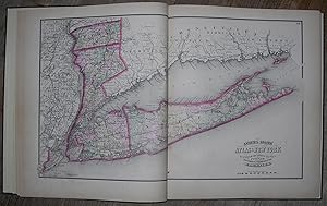
4to., (14 ¾ x 12 ½ inches). 16-page Classified Business Directory of New York City (somewhat toned). 16 color-printed lithographed maps finished by hand (slightly browned). Green cloth, spine lettered in gilt (extremities bumped). First edition. Includes beautifully colored maps of all New York counties, City of Brooklyn, Long Island City, City of New York, and Rail Road, Geological, and Meteorological maps of New York, with New York City Business Directory at the end. Asher & Adams was a New York-based mapmaking firm active in the 1860s and 1870s, known for their exceptionally detailed state and county atlases, the most important of which is "Asher & Adams Commercial and Statistical Gazetteer of the United States (1874). This atlas is notable because it is one of the first 19th-century atlases to remove topographical information in favor of detailed depictions of railroads. This book of maps of New York was published 1869, just on the heels of the Civil War, and the entire nation faced the daunting task of reconstruction. It was also an opportunity: old infrastructure was replaced with new technology, and the United States were connected in ways they never were before. By 1866, Western Union's network included about 100,000 miles of wire, and the first transcontinental railroad was completed in 1869. In New York City, the 1860s meant the advent of the skyscraper era, beginning with the construction of the Equitable Building, which broke ground in 1868 and was finished in 1870. New York was emerging as the nation's center of industry and finance, growing rapidly with the influx of European immigrants. Much of the island of Manhattan was still largely undeveloped, particularly from Central Park northward, and the growing population and demand for housing spurred development and expansion of the city. These maps portray a very exciting and dynamic period in New York history, which is evident in their level of detail. N° de ref. del artículo 72MMS155
Contactar al vendedor
Denunciar este artículo
![]()

