World Mini Guide: Hongkong Macau

  • Tapa blanda
  • Mapa
  • Usado
Ver todos los detalles
Imagen del artículo 1 de 4.

Librería: Geographicus Rare Antique Maps, Brooklyn, NY, Estados Unidos de AmericaGeographicus Rare Antique Maps

Vendedor de 5 estrellas

Vendedor de AbeBooks desde 21 de noviembre de 2024

Miembro de asociación: ABAAESAILAB

Ver los artículos de este vendedor
Tapa blanda

Condición: Usado

EUR 198,67

Envío por EUR 14,64 
Se envía dentro de Estados Unidos de America

Cantidad disponible: 1 disponibles

Añadir al carrito
Devoluciones gratuitas de 30 días

Descripción del artículo del vendedor

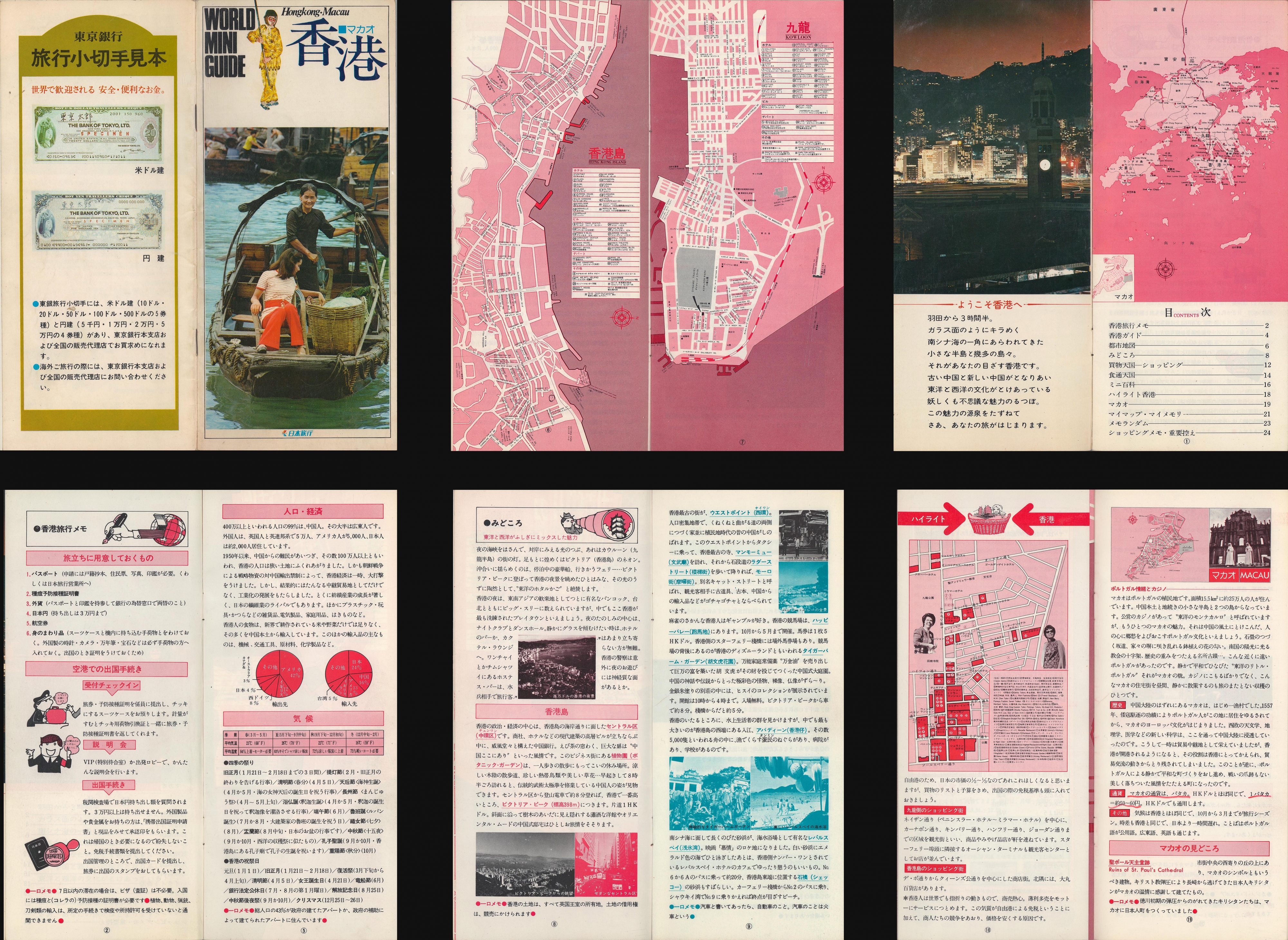
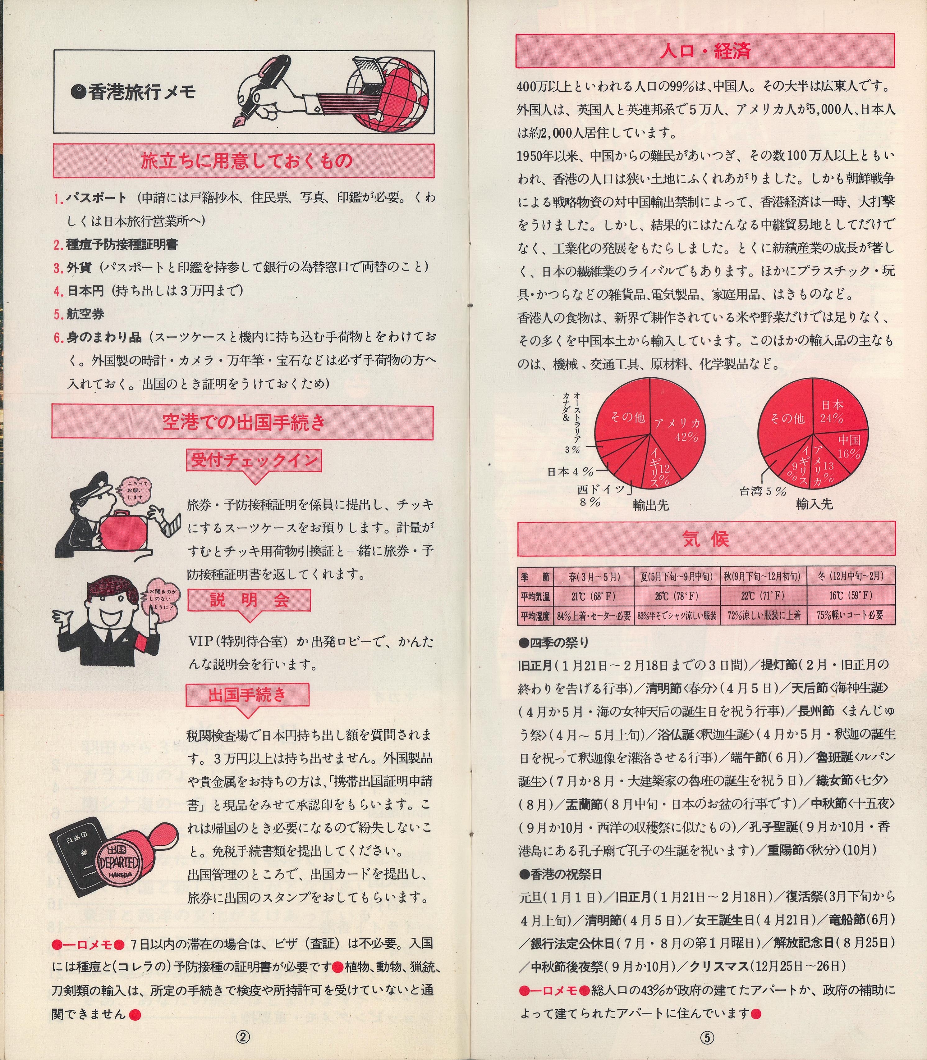
Very good. Folding brochure secured by two staples. Size 8.5 x 7.5 Inches. An instructive c. 1975 Japanese-language tourist brochure for Hong Kong and Macao. The maps and information therein reflect the growing cultural and economic ties between Hong Kong and Japan at the time. A Closer Look Following the composite image, the first image above consists of two maps. At left is a map of the most developed part of Hong Kong Island, oriented towards the west with north at right, while the map at right focuses on the southern part of Kowloon, including the neighborhoods of Tsim Sha Tsui, Yu Ma Tei, and Mong Kok. Throughout, the locations of hotels (including the Excelsior, which the original owner has circled), notable buildings (city hall, the post office, etc.), department stores, and other important sites such as the Japanese Consulate and Hong Kong Tourism Association (??????), are highlighted. Additional sites are noted, such as police stations, parks, religious sites, the Happy Valley Race Course, hospitals, and the Poorman's Nightclub, which was a night market with stalls selling food, inexpensive goods, and clothing. Transportation lines and stations are marked, including the Peak Tram towards top-left, the Star Ferry, just above the title of the Hong Kong Island map, and the Hong Kong Tramway. Kowloon railway station, the terminus of the Kowloon-Canton Railway, here at the southern tip of Kowloon, was relocated in 1975 to Hung Hom, just east of the entrance to the Cross-Harbour Tunnel. This map also predates the opening of Hong Kong's world-renowned Mass Transit Railway (MTR) system, combining subway, bus, and rail services akin to the MTA system in New York City, only more seamlessly integrated. The back cover includes an advertisement for the Bank of Tokyo (????), which was especially known for its international business, including developing an early system for settling payments between Japanese yen and Chinese renminbi. The table of contents page has a broader scope map of Hong Kong including outlying islands, an inset map of Macao, and connections with Mainland China (at Bao'an County ???, later to become the Shenzhen Special Economic Zone). Subsequent pages include helpful reminders for travelers, information on customs and immigration procedures, statistics about Hong Kong's population, economy, climate, history, and famous sites, a map and information on shopping districts of Hong Kong Island and Kowloon, and information on Macao. Historical Context As Japan's postwar economic recovery gained steam in the 1960s, the country's businesses sought new outlets for investment and Hong Kong became one of their primary destinations. Despite bad memories of the Japanese invasion and occupation of Hong Kong during World War II, business and cultural links blossomed by the 1970s, and increased further in the 1980s, in part because of the opening of mainland China to foreign tourism and investment. Foreign investment from Japan and elsewhere helped to boost Hong Kong's economy, while the city's population grew substantially from both domestic growth and migrants from mainland China. Therefore, by the 1970s, the most developed parts of the city had become among the most densely populated on Earth and its streets were clogged with cars and pedestrians, the impetus for instituting the MTR system mentioned above. Publication History and Census This brochure was distributed by an unknown publisher; the bottom of cover includes the text 'Travel Japan' (????), but it is unclear if this was an organization or simply a tagline. The brochure is undated, but the location of the railway station suggests a date no later than 1975, while the presence of the Cross-Harbour Tunnel indicates a date no earlier than 1972. We are unaware of any other examples of this brochure in institutional collections or on the market.

N° de ref. del artículo HKMacaoMiniGuide-unknown-1975

Detalles bibliográficos

Título
World Mini Guide: Hongkong Macau
Autor
1980 Japanese Hong Kong Macao Tourism Brochure
Año de publicación
1975
Encuadernación
Encuadernación de tapa blanda
Catálogos de vendedores
JAPAN-CHINA-KOREA

Geographicus Rare Antique Maps

Brooklyn, NY, Estados Unidos de America

Vendedor de 5 estrellas

Vendedor de AbeBooks desde 21 de noviembre de 2024

Miembro de asociación:

Tarifas de envío en Estados Unidos de America

ArtículoDe 7 a 14 días hábilesDe 2 a 8 días hábiles
Primer artículoEUR 14,64EUR 38,75
Los plazos de entrega los establecen los vendedores y varían según el transportista y la ubicación. Los pedidos que pasan por la aduana pueden sufrir retrasos y los compradores son responsables de los aranceles o tarifas asociadas. Los vendedores pueden ponerse en contacto con usted en relación con cargos adicionales para cubrir cualquier aumento en los costes de envío de los artículos.

Métodos de pago

  • Visa
  • Mastercard
  • American Express
  • Carte Bleue
  • Apple Pay
  • Google Pay

Descripción de la tienda

Geographicus Rare Antique Maps was founded in New York, New York, by Kevin James Brown in 1999. We are specialist antiquarians dealing in historic maps from all over the world and in all price ranges. Our enthusiasm, passion, and devotion to scholarship is expressed in our meticulously researched descriptions, among the most detailed and comprehensive available anywhere, for each and every rare map that passes over our desk. This same devotion guides the relationships of honesty and trust we have fostered with our clients, whether through purchasing or selling a rare map, getting an appraisal, or simply calling to discuss antique maps in general. We are happy to assist you no matter whether you are an interior decorator, an institution, an experienced collector, or are just looking for a single antique map. Geographicus is a member of the ABAA (Antiquarian Booksellers' Association of America), the ILAB (International League of Antiquarian Booksellers), the New York Map Society, the Washington Map Society, the IMCOS, and the Society for the History of Discoveries. While primarily an internet-based company, we are happy to meet with clients to show our antique maps by appointment at our New York City location.

Especialidad

MAPS

Miembro de asociación

  • Antiquarian Booksellers' Association of America
  • The Ephemera Society of America
  • International League of Antiquarian Booksellers
Los miembros de estas asociaciones se comprometen a mantener los estándares más altos. Garantizan la autenticidad de todos los artículos puestos a la venta. Proporcionan descripciones detalladas y expertas, informan de todos los defectos o restauraciones importantes, incluyen precios claros y precisos y actúan de manera justa y honesta durante la experiencia de compra.