
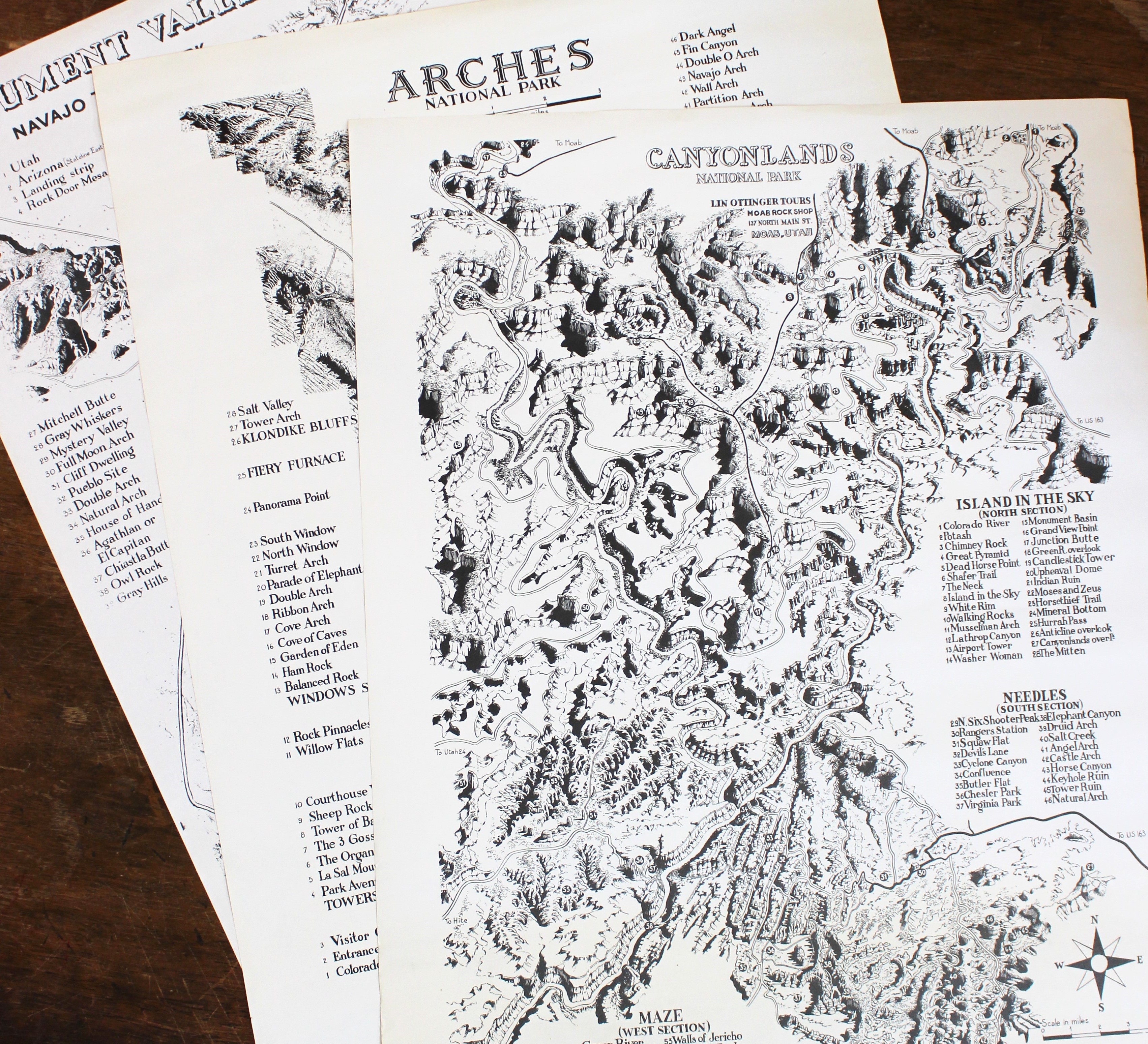
Set of 3 1970s Lin Ottinger Maps
Gal, Jean-Claude
Editorial: Lin Ottinger Tours, Moab, UT
Usado
Maps
Librería:
Back of Beyond Books, Moab, UT, Estados Unidos de America
Calificación del vendedor: 4 de 5 estrellas

Vendedor de AbeBooks desde 2 de febrero de 2007
Miembro de asociación:
Este libro ya no está disponible. Sin embargo, AbeBooks ofrece millones de libros. Escriba otros términos de búsqueda a continuación para encontrar ejemplares similares.
Descripción
Descripción:
Set of three maps produced by Lin Ottinger in Moab, Utah during the 1970s. Set includes maps of Arches National Park (1973) , Canyonlands National Park (1972) , and Monument Valley Navajo Tribal Park (1975). Each map is printed in black-and-white and measures approximately 22 x 17 inches. All are in very good condition with minor creasing to edges. Canyonlands map has light toning to bottom 5 inches. Versos are blank. All were drawn by French comic artist Jean-Claude Gal. Set was previously owned by W. L. "Bud" Rusho (1928-2011) , a western historian, author, and photographer who is best known for his work about Everett Ruess. Includes a TLS that is signed by Ottinger granting Rusho permission to use the maps in any of his publications. These maps show the topography of three iconic parks and mark all the major landmarks. A great Southeastern Utah piece with interesting provenance. ; B&W Illustrations. N° de ref. del artículo 024932
Detalles bibliográficos
Título: Set of 3 1970s Lin Ottinger Maps
Editorial: Lin Ottinger Tours, Moab, UT
Encuadernación: Maps
Condición: Very Good
IberLibro.com es un mercado online donde puede comprar millones de libros antiguos, nuevos, usados, raros y agotados. Le ponemos en contacto con miles de librerías de todo el mundo. Comprar en IberLibro es fácil y 100% seguro. Busque un libro, realice el pedido a través de nuestra página con toda confianza y recíbalo directamente de la librería.
Busque entre millones de libros de miles de librerías
Libros usados
Bestsellers rebajados, autores destacados y una gran variedad de libros por menos de 5 €. Si su pasatiempo es leer, éste es su espacio.
Libros antiguos y de colección
Compendio vital para el amante del libro antiguo: libros firmados, primeras ediciones, facsímiles, librerías anticuarias o destacados.
Libros con envío gratis

Gastos de envío gratuitos para miles de libros nuevos, antiguos y de ocasión. Sin compra mínima.