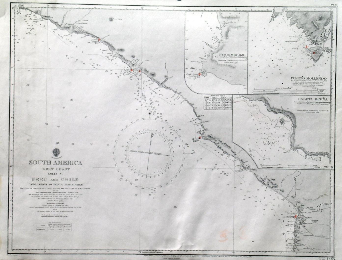
'SOUTH AMERICA WEST COAST SHEET XII / PERU AND CHILE / CABO LOBOS TO PUNTA PESCADORES'. Sea chart of the south Peruvian coastline to the Chilean border at Arica, with 3 inset harbour plans of Puerto de Ilo, Puerto Mollendo and Caleta Ocona. First published at the Admiralty 1840, and now with a few corrections by the
Admiralty Charts.
Editorial: Admiralty 1940
Mapa
Condici�n: Fine
Librer�a: Garwood & Voigt, Sevenoaks, Reino Unido
Calificaci�n del vendedor: 5 de 5 estrellas
![]()
Vendedor de AbeBooks desde 25 de noviembre de 2013
Usado -
Precio:
EUR 110,31
Convertir moneda
EUR 26,18
gastos de env�o desde Reino Unido a Espa�a
Destinos, gastos y plazos de env�o
Cantidad disponible: 1 disponibles
A�adir al carrito