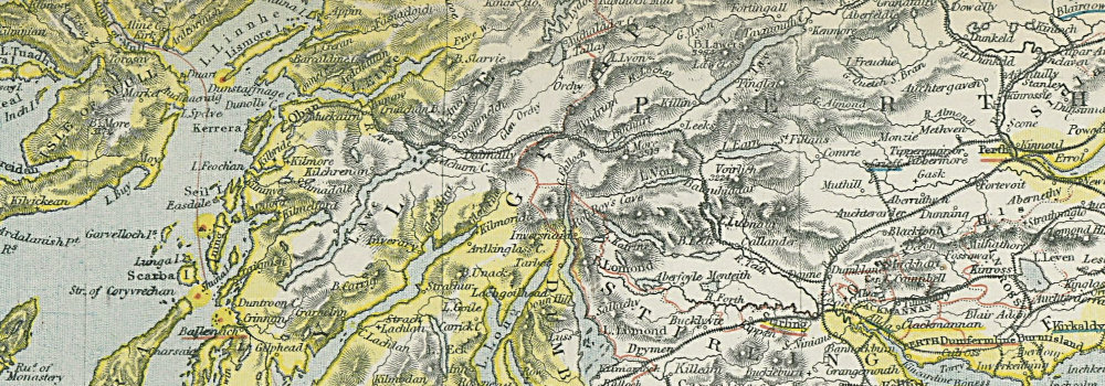
Railway and Statistical map of Scotland
Letts, Thomas
Vendido por Antiqua Print Gallery, London, Reino Unido
Vendedor de AbeBooks desde 14 de enero de 2022
Usado
Condición: Good
Cantidad disponible: 1 disponibles
Añadir al carritoVendido por Antiqua Print Gallery, London, Reino Unido
Vendedor de AbeBooks desde 14 de enero de 2022
Condición: Good
Cantidad disponible: 1 disponibles
Añadir al carritoSCOTLAND. General map showing counties railways lighthouses. LETTS 1883. Antique colour atlas map; Published by Letts & Co. Most of the plates used for this atlas were original engraved for the SDUK atlas in the mid nineteenth century. The plates were later sold to Thomas Letts, and subsequently to Mason & Payne (1883). 43.0 x 36.0cm, 17 x 14 inches; this is a folding map. Condition: Good. The image shown may have been taken from a different example of this map than that which is offered for sale. The map you will receive is in good condition but there may be minor variations in the condition from that shown in the image. There is nothing printed on the reverse side, which is plain.
N° de ref. del artículo P-8-010758
Ver la página web de la librería
Terms:
All items are offered subject to prior sale and remain our property until full payment has been received. Goods will be sent within 2 business days of receipt of cleared payment, except during holidays.
Returns:
We accept returns for any reason initiated within 30 days of the estimated delivery date according to Abebooks standard conditions of return.
Authenticity:
All items are genuine antique or vintage and printed at the date stated unless specifically stated to be later reproductions....
Más informaciónSmaller items (up to A4 in size) are packed flat in a board-backed envelope. Larger items are rolled into a strong postal tube. Items are sent insured.