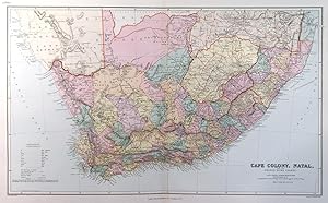
'CAPE COLONY, NATAL, AND THE ORANGE RIVER COLONY'. A superb detailed map of the Cape Colony at the very beginning of the 20th century. Railways, Military Posts and Missionary Stations are indicated. Fiscal Districts in Cape Colony and the Counties in Natal are coloured in separate tints. Districts in the Orange River Colony and then Transvaal are bounded by red lines. Scale: 46 English Miles to one inch
Edward Stanford.
Vendido por Garwood & Voigt, Sevenoaks, Reino Unido
Vendedor de AbeBooks desde 25 de noviembre de 2013
Usado
Condición: Usado - Excelente
Cantidad disponible: 1 disponibles
Añadir al carrito