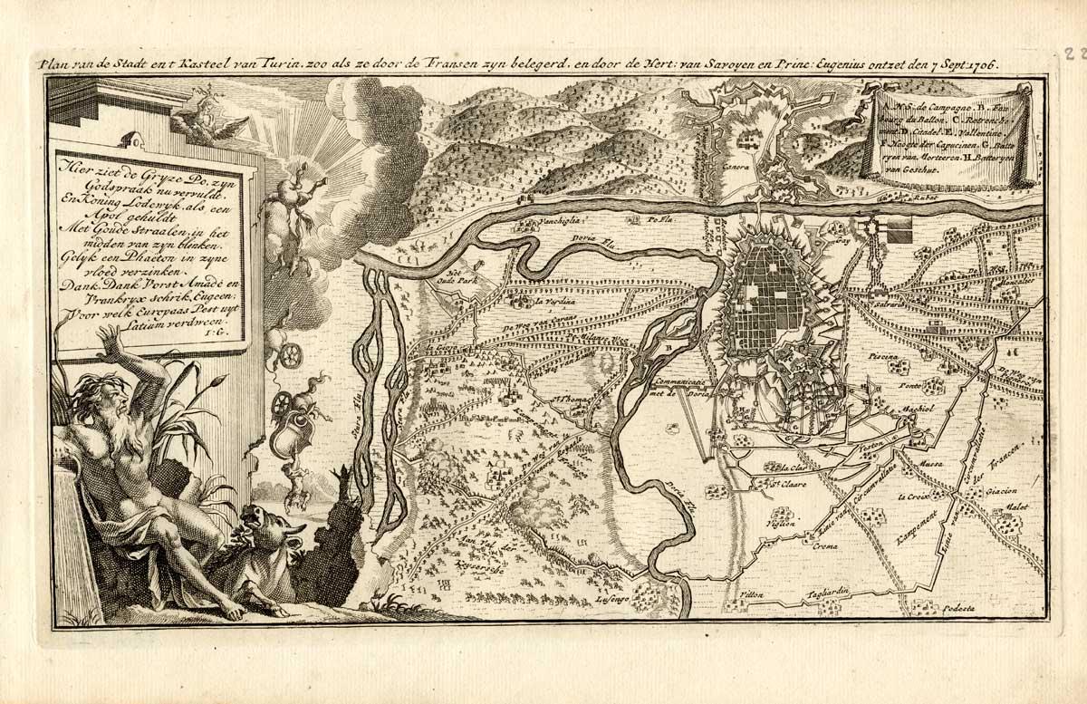
Antique Map-TURIN-TORINO-ITALY-FORTRESS-WAR-Weege-1753
Vendido por ThePrintsCollector, Zeeland, Holanda
Vendedor de AbeBooks desde 3 de abril de 2017
Usado
Cantidad disponible: 1 disponibles
Añadir al carritoVendido por ThePrintsCollector, Zeeland, Holanda
Vendedor de AbeBooks desde 3 de abril de 2017
Cantidad disponible: 1 disponibles
Añadir al carritoMap 223: 'Plan van de Stadt en 't Kasteel van Turin .' (Plan of the Castle and City of Turin as it was besieged by the French and liberated by the Duke of Savoy and Prince Eugenius on 7 september 1706.) Map / plan of Turin and surroundings, Italy. Allegorical cartouche and legend. Copperplate etchings and/or engravings on a verge type hand laid paper. Watermark with the Amsterdam coat of arms. Age: 1753. Authenticity guaranteed. Description: This very rare old antique copperplate engraved print originates from: 'Kleyne en Beknopte Atlas, of Tooneel des Oorlogs in Europa, .', published in Amsterdam by David Weege, 1753. First and only very rare edition. This work is a reissue of an atlas published by Erven J. Ratelband en Compagnie, Amsterdam, 1735, enlarged with 25 maps / views. Include maps and views from earlier sources like Jacob Aertsz. Colom (c. 1635) and Daniel de La Feuille (c. 1706). Ref: Koeman Wee 1. Artists and Engravers: The publisher of this work is David Weege (active Amsterdam 1748-1787). Condition: Excellent. General age related toning and minimal staining. Left margin with 4 small holes from binding not affecting the image. Storage location: C89-45 The overall size is ca. 12.2 x 7.7 inch. The image size is ca. 10.8 x 6.1 inch. The overall size is ca. 31 x 19.5 cm. The image size is ca. 27.5 x 15.5 cm.
N° de ref. del artículo 18157
Ver la página web de la librería