Importe total (1 artículo artículos):
Destino del pedido:

roma map (77 resultados)
Título :
roma map
Refinar con la Búsqueda avanzada
Ir a los resultados principales
Filtros de búsqueda
Tipo de artículo
- Todos los tipos de productos
- Libros (44)
- Revistas y publicaciones (No hay ningún otro resultado que coincida con este filtro.)
- Cómics (No hay ningún otro resultado que coincida con este filtro.)
- Partituras (No hay ningún otro resultado que coincida con este filtro.)
- Arte, grabados y pósters (9)
- Fotografías (No hay ningún otro resultado que coincida con este filtro.)
- Mapas (22)
- Manuscritos y coleccionismo de papel (2)
Condición Más información
- Nuevo (4)
- Como nuevo, Excelente o Muy bueno (9)
- Bueno o Aceptable (32)
- Regular o Pobre (No hay ningún otro resultado que coincida con este filtro.)
- Tal como se indica (32)
Encuadernación
Más atributos
- Primera edición (5)
- Firmado (No hay ningún otro resultado que coincida con este filtro.)
- Sobrecubierta (No hay ningún otro resultado que coincida con este filtro.)
- Con imágenes (55)
- No impresión bajo demanda (77)
Idioma (7)
Gastos de envío gratis
Ubicación del vendedor
Valoración de los vendedores
-

CITTA DI ROMA, NUOVA GUIDA TOPONOMASTIC MONUMENTALE (MAP - "THIS IS THE MOST PRACTICAL GUIDE OF THE CITY")
Idioma: Inglés
Publicado por Autore Editore, Milan, 1951
Librería: Larry W Price Books, Portland, OR, Estados Unidos de America
Calificación del vendedor: 5 de 5 estrellas

EUR 8,78
Envío por EUR 4,26
Se envía dentro de Estados Unidos de AmericaCantidad disponible: 1 disponibles
Ańadir al carritoHardcover. Condición: Very Good. Lge Color FoldOut Map, 20 x 28 Inches, Folded to 4.25 x 7 Inches, Orange Illus Paperback Cover, 1 taped repair on map, else VG.
-

ROMA TOUR Pianta Guida-Map Guide-Plan Guide Plan Fuhrer-Plano Guia
Librería: Better World Books: West, Reno, NV, Estados Unidos de America
Calificación del vendedor: 5 de 5 estrellas
EUR 10,22
Gastos de envío gratis
Se envía dentro de Estados Unidos de AmericaCantidad disponible: 1 disponibles
Ańadir al carritoCondición: Good. Pages intact with minimal writing/highlighting. The binding may be loose and creased. Dust jackets/supplements are not included. Stock photo provided. Product includes identifying sticker. Better World Books: Buy Books. Do Good.
-
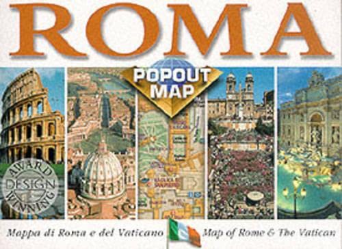
Roma Popout Map: Double Map
Librería: HPB-Ruby, Dallas, TX, Estados Unidos de America
Calificación del vendedor: 5 de 5 estrellas
EUR 6,97
Envío por EUR 3,23
Se envía dentro de Estados Unidos de AmericaCantidad disponible: 1 disponibles
Ańadir al carritomap. Condición: Very Good. Connecting readers with great books since 1972! Used books may not include companion materials, and may have some shelf wear or limited writing. We ship orders daily and Customer Service is our top priority!
-

Laminated Map of Rome (Roma Plasticized Map) (English, Spanish, F
Idioma: Inglés
Publicado por Edizioni Cartografiche Lozzi, 2009
ISBN 10: 8896620090 ISBN 13: 9788896620090
Librería: Hawking Books, Edgewood, TX, Estados Unidos de America
Calificación del vendedor: 4 de 5 estrellas

EUR 17,25
Gastos de envío gratis
Se envía dentro de Estados Unidos de AmericaCantidad disponible: 1 disponibles
Ańadir al carritoCondición: Very Good. Lozzi Ilustrador. Very Good Condition. Five star seller - Buy with confidence!
-

Roma Metro-Bus Map
Librería: HPB Inc., Dallas, TX, Estados Unidos de America
Calificación del vendedor: 5 de 5 estrellas
EUR 4,54
Envío por EUR 3,23
Se envía dentro de Estados Unidos de AmericaCantidad disponible: 1 disponibles
Ańadir al carritomap. Condición: Very Good. Connecting readers with great books since 1972! Used books may not include companion materials, and may have some shelf wear or limited writing. We ship orders daily and Customer Service is our top priority!
-
Roma Popout Map: Double Map
Librería: World of Books (was SecondSale), Montgomery, IL, Estados Unidos de America
Calificación del vendedor: 5 de 5 estrellas
EUR 13,55
Gastos de envío gratis
Se envía dentro de Estados Unidos de AmericaCantidad disponible: 1 disponibles
Ańadir al carritoCondición: Good. Item in good condition. Textbooks may not include supplemental items i.e. CDs, access codes etc.
-
Roma: A New Map 1/12000, Booklet with 40x30 Inch Map, 1959
Idioma: Inglés
Publicado por Enrico Verdesi, Roma, 1959
Librería: West With The Night, Tucson, AZ, Estados Unidos de America
Calificación del vendedor: 5 de 5 estrellas
EUR 16,80
Envío por EUR 3,23
Se envía dentro de Estados Unidos de AmericaCantidad disponible: 1 disponibles
Ańadir al carritoIncludes maps. Very good. Light shelfwear, No ownership marks.
-

ROMA TOUR Pianta Guida-Map Guide-Plan Guide Plan Fuhrer-Plano Guia (Italien, Anglais, Allemand, Franais, Espagnol)
Librería: WeBuyBooks, Rossendale, LANCS, Reino Unido
Calificación del vendedor: 5 de 5 estrellas
EUR 8,67
Envío por EUR 6,04
Se envía de Reino Unido a Estados Unidos de AmericaCantidad disponible: 1 disponibles
Ańadir al carritoCondición: Good. Most items will be dispatched the same or the next working day. A copy that has been read but remains in clean condition. All of the pages are intact and the cover is intact and the spine may show signs of wear. The book may have minor markings which are not specifically mentioned.
-

Amore e Psiche a Roma Storyboard del mito e City Map
Idioma: Italiano
Publicado por L'Erma di Bretschneider, 2012
ISBN 10: 888265723X ISBN 13: 9788882657239
Librería: ISD LLC, Bristol, CT, Estados Unidos de America
Calificación del vendedor: 5 de 5 estrellas
Original o primera edición
EUR 12,41
Envío por EUR 4,30
Se envía dentro de Estados Unidos de AmericaCantidad disponible: 1 disponibles
Ańadir al carritopaperback. Condición: New. 1st.
-

Pianta di Roma mini map. Ediz. francese
Idioma: Francés
ISBN 10: 8896620589 ISBN 13: 9788896620588
Librería: medimops, Berlin, Alemania
Calificación del vendedor: 5 de 5 estrellas
EUR 3,20
Envío por EUR 10,00
Se envía de Alemania a Estados Unidos de AmericaCantidad disponible: 1 disponibles
Ańadir al carritoCondición: very good. Gut/Very good: Buch bzw. Schutzumschlag mit wenigen Gebrauchsspuren an Einband, Schutzumschlag oder Seiten. / Describes a book or dust jacket that does show some signs of wear on either the binding, dust jacket or pages.
-
Rome Roma Rom City Centre Map
Publicado por Berndtson & Berndtson, 1996
Librería: mountain, GEORGETOWN, CO, Estados Unidos de America
Calificación del vendedor: 5 de 5 estrellas
EUR 6,77
Envío por EUR 4,30
Se envía dentro de Estados Unidos de AmericaCantidad disponible: 1 disponibles
Ańadir al carritomap. Condición: Good. Map shows some wear but is in good over all shape.
-

EUR 3,37
Envío por EUR 10,00
Se envía de Alemania a Estados Unidos de AmericaCantidad disponible: 1 disponibles
Ańadir al carritoCondición: good. Befriedigend/Good: Durchschnittlich erhaltenes Buch bzw. Schutzumschlag mit Gebrauchsspuren, aber vollständigen Seiten. / Describes the average WORN book or dust jacket that has all the pages present.
-
Rome in Colour: Vatican & Sistine Chapel Guide with Fold-Out Roma Map (Lozzi, c.1980s)
Idioma: Inglés
Publicado por Editrice Lozzi
Librería: The Archives, Manassas, VA, Estados Unidos de America
Miembro de asociación: ESA
Calificación del vendedor: 5 de 5 estrellas
EUR 22,12
Envío por EUR 5,16
Se envía dentro de Estados Unidos de AmericaCantidad disponible: 1 disponibles
Ańadir al carritoSoft cover. Condición: Very Good. Attractive mid-to-late 20th-century Rome guide from Editrice Lozzi, featuring full-color plates, bilingual text, and structured itineraries spanning major monuments, archaeological sites, and ecclesiastical landmarks. The guide includes dedicated sections on the Vatican, St. Peter's Basilica, and the Sistine Chapel, along with concise historical notes and descriptive commentary organized into eight walking itineraries. High-quality color photography and a clean typographic layout make this a representative example of Rome's long-running Lozzi tourist series. This copy includes the original fold-out Roma map, issued by Ente Provinciale per il Turismo, with detailed street grids, monuments, transit routes, and hotel/amenity indexes. The reverse side features railway promotional material for the ETR 450 'Pendolino' and demonstrates the period travel context. Softcover shows modest rubbing, a small corner crease, and light edgewear; interior clean, bright, and unmarked. The included map booklet is complete, with typical handling folds but no tears. A nicely preserved vintage tourist set, ideal for collectors of travel ephemera, Rome/Vatican history, or mid-century guidebooks. Edition/printing: Not stated, as is standard for Editrice Lozzi; likely an early-mid 1980s issue based on typography, photographic stock, and ETR 450 advertising. Condition: Very Good. Minor exterior wear; clean interior; complete map. Sound and appealing example of the period.
-
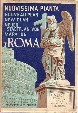
Nuovissima pianta roma. New map. Nouveau plan. Neuer Stadtplan.
Idioma: Italiano
Publicado por Editore Enrico Verdesi, Roma s.d. [ ca. 1930 / 1935]., 1935
Librería: Antiquariat Carl Wegner, Berlin, B, Alemania
Miembro de asociación: GIAQ
Calificación del vendedor: 5 de 5 estrellas
Original o primera edición
EUR 13,50
Envío por EUR 9,00
Se envía de Alemania a Estados Unidos de AmericaCantidad disponible: 1 disponibles
Ańadir al carritoSoftcover. In - picc.8 °. Cartonnagio ill., la legatura usato. 52 p. con carta piegata in colore.La carta strappata. Con informazioni turistiche. Scala 1:12.000. Esemplare moderato. -- 52 p. Il testo in pt.8 con pianta colorata. Cartone in ottavo, colorato ed un poco usato. La pianta e sporco separata ed anche usata (Scala 1:12.000). Il Testo e destinato per informazioni turistichi. -- Kl.-8°. 52 Seiten Text und ein farbiger Faltplan. Farbig illustrierte Originalkartonage. Der Umschlag etwas abgegriffen. Der Plan ebenfalls gebraucht und ungeschickt ausgetrennt (Abriß einer Ecke im Innendeckel verblieben). Insgesamt noch guter Zustand. Scala 1/12.000. - Hauptinhalt: Verkehrsinformationen für Touristen. -- Bitte Portokosten außerhalb EU erfragen! / Please ask for postage costs outside EU! / S ' il vous plait demander des frais de port en dehors de l ' UE! // Bitte beachten Sie auch unsere Fotos! / Please also note our photos! / Veuillez noter nos photos -- Lesen Sie etwas Schönes auf einer Bank in der Frühlingssonne! Wir haben die passende Lektüre. -- Wir kaufen Ihre werthaltigen Bücher! K00062-401063.
-
MAP "ROMA URBS & FOUM ROMANUM" [COLOR MAP WITH HAND WATERCOLORED BORDERS & PRINCIPAL FEATURES
Idioma: Griego Moderno
Publicado por From: Kiepert, Henry, Atlas Antiquus, Twelve Maps of the Ancient World, Boston, MA, 1892
Librería: Larry W Price Books, Portland, OR, Estados Unidos de America
Calificación del vendedor: 5 de 5 estrellas
EUR 20,30
Envío por EUR 4,26
Se envía dentro de Estados Unidos de AmericaCantidad disponible: 1 disponibles
Ańadir al carritoPaperback. Condición: Very Good. Lge Color Map (14.5 x 18 Inches, with fold to 9 x 14.5 Inches, Borders & Principal Features are Hand Watercolpred, Scale 1:20.000, The center-fold of Map has orig linen clth backing, Shows Rome along with 2 related Insert Maps. Map is beautifully fresh & attractive.
-

ROMA PIANTA - GUIDA MAP - GUIDE PLAN - FUHRER - PLAN - GUIDE Con la rete autofilotramviaria della cittŕ
Publicado por Casa Editrice Lozzi, Roma, 1965
Librería: Historia, Regnum et Nobilia, BATTIPAGLIA, SA, Italia
Calificación del vendedor: 4 de 5 estrellas
Original o primera edición
EUR 10,00
Envío por EUR 20,00
Se envía de Italia a Estados Unidos de AmericaCantidad disponible: 1 disponibles
Ańadir al carritoBrossura. Condición: ottimo. senza sovraccoperta. prima edizione. Formato in 16°; 42 pagine. Brossura editoriale figurata.Con tavole a colori. Con una grande mappa di Roma a colori allegata.
-
Roma city map plan de la ville échelle 1:13 000
Librería: Galerie des Deux Siciles, Cannes, Francia
Calificación del vendedor: 5 de 5 estrellas
EUR 9,00
Envío por EUR 9,00
Se envía de Francia a Estados Unidos de AmericaCantidad disponible: 1 disponibles
Ańadir al carritocomme neuf plan de la ville.
-

Pianta di Roma -New map of Rome
Publicado por Italy
Librería: Book Express (NZ), Shannon, Nueva Zelanda
Calificación del vendedor: 4 de 5 estrellas
EUR 6,25
Envío por EUR 26,68
Se envía de Nueva Zelanda a Estados Unidos de AmericaCantidad disponible: 1 disponibles
Ańadir al carritoPaperback. Condición: Good. 'Editrice lozzi -Roma' one fold worn.
-

MAP: "Roma Imperatoria".from Orbis Terrarum Antiquus I Scholarum Usum Descriptus
Publicado por Herman Haack.Sumptibus Institutionis Geographicae Atque Cartographicae, Germany, 1888
Librería: Dorley House Books, Inc., Hagerstown, MD, Estados Unidos de America
Calificación del vendedor: 4 de 5 estrellas
Arte / Grabado / Póster Original o primera edición
EUR 26,60
Envío por EUR 7,45
Se envía dentro de Estados Unidos de AmericaCantidad disponible: 1 disponibles
Ańadir al carritoUnbound. Condición: Very Good. Handcolored Ilustrador. 1st. lovely and frameable map of ancient Roman empire with insets of Fora Imperatoria & roma Liberae Reipublicae Tempore, sm foxing marks in margins (only) Size: 10" x 11.5".
-
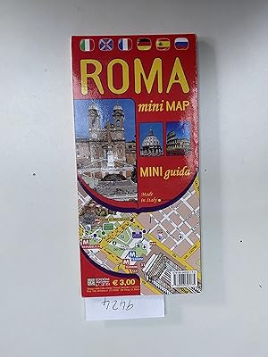
Roma. Mini guida. Mini map. Ediz. italiana e inglese. Mini Map.
Idioma: Inglés
Publicado por Edizioni Cartografiche Lozzi, 2012
ISBN 10: 8896620171 ISBN 13: 9788896620175
Librería: Book Souk, Porstoy, Reino Unido
Calificación del vendedor: 5 de 5 estrellas
EUR 4,76
Envío por EUR 33,53
Se envía de Reino Unido a Estados Unidos de AmericaCantidad disponible: 1 disponibles
Ańadir al carritoSoft cover. Condición: Good. 30 grams.
-

NuovaPianta Di Roma - New Map of Rome - Neur Stadtplan von Rom .
Librería: Gwyn Tudur Davies, Aberystwyth, Reino Unido
Calificación del vendedor: 5 de 5 estrellas
Mapa
EUR 4,76
Envío por EUR 14,45
Se envía de Reino Unido a Estados Unidos de AmericaCantidad disponible: 1 disponibles
Ańadir al carritoSoft cover. Condición: Good. No Jacket. Published c.1960s? 1 folded map / street plan with some minor tears along folds and scuffing around edges o/w a clean unmarked copy in good condition. [Rome - Italy - Map - Street plan] p719 / m8257.
-
ROMA - NUOVISSIMA PIANTA - NEW MAP - NOUVEAU PLAN - 1950
Publicado por EDITORE ENRICO VERDESI - ROMA, 1950
Librería: Jenhams Books, Dundee, Reino Unido
Calificación del vendedor: 5 de 5 estrellas
EUR 8,04
Envío por EUR 28,90
Se envía de Reino Unido a Estados Unidos de AmericaCantidad disponible: 1 disponibles
Ańadir al carritopaperback. Condición: Good. Updated with more langauges ! ROMA - Nuovissima Pianta - Nouveau Plan - New Plan - Neuer Stadtplan von - Mapa de Roma. A large folding map - undated as far as we can see, possibly 1960s - in Good to condition. This book is in stock now, in our UK premises. Photos of our books are available on request (dustjacket and cover illustrations vary, and unless the image accompanying the listing is marked 'Bookseller Image', it is an Abebooks Stock Image, NOT our own). BUYERS OUTSIDE UK please also note the following: 1. shipping rates apply to packets of 750g and under, and should the packed weight of an item exceed this we reserve the right to ship via 'Economy', or request extra postage prior to fulfilling the order, or cancel 2. many countries apply import or other taxes - these are the buyers responsibility; we may ask for extra payment to cover any taxes which we have to pay 'up front' on the buyer's behalf.
-

Roma Centrocittŕ Pocket = Rome City Center Pocket Map
Idioma: Italiano
Publicado por Touring Club Italino, 2025
ISBN 10: 8836583288 ISBN 13: 9788836583287
Librería: libreriauniversitaria.it, Occhiobello, RO, Italia
Calificación del vendedor: 4 de 5 estrellas
EUR 6,90
Envío por EUR 17,95
Se envía de Italia a Estados Unidos de AmericaCantidad disponible: 3 disponibles
Ańadir al carritoCondición: NEW.
-

Pianta Di Roma Mini Map. Ediz. Tedesca
Idioma: Alemán
ISBN 10: 8896620597 ISBN 13: 9788896620595
Librería: medimops, Berlin, Alemania
Calificación del vendedor: 5 de 5 estrellas
EUR 3,37
Envío por EUR 10,00
Se envía de Alemania a Estados Unidos de AmericaCantidad disponible: 1 disponibles
Ańadir al carritoCondición: very good. Gut/Very good: Buch bzw. Schutzumschlag mit wenigen Gebrauchsspuren an Einband, Schutzumschlag oder Seiten. / Describes a book or dust jacket that does show some signs of wear on either the binding, dust jacket or pages.
-

Roma Map Stadtplan
Idioma: Alemán
Publicado por Editrice Lozzi o.J.
Librería: Wimbauer Buchversand, Hagen, NRW, Alemania
Calificación del vendedor: 5 de 5 estrellas
EUR 4,99
Envío por EUR 15,00
Se envía de Alemania a Estados Unidos de AmericaCantidad disponible: 1 disponibles
Ańadir al carritoFaltplan. Condición: Befriedigend. Plan lose in Mappe, Kanten gering berieben / bestossen /// Standort Wimregal HAA-61734 Sprache: Deutsch Gewicht in Gramm: 48.
-
Carta Archeologica Di Roma: Tavola II (Book and Map)
Publicado por Istituto Greografico Militare/Litografia Artistica Cartografica, 1964
Librería: Dunaway Books, St. Louis, MO, Estados Unidos de America
Calificación del vendedor: 4 de 5 estrellas
EUR 39,90
Envío por EUR 3,44
Se envía dentro de Estados Unidos de AmericaCantidad disponible: 1 disponibles
Ańadir al carritoSoft cover. Condición: Very Good. Text in Italian. Book of tables/info and a seperate corresponding fold out map in a like slipcase.
-

MAP: "Roma Vetus, Athenae, Urbs, Hierosolyma".from Orbis Terrarum Antiquus Schul-Atlas De Alten Welt
Publicado por Justus Perthes Gotha, Germany, 1841
Librería: Dorley House Books, Inc., Hagerstown, MD, Estados Unidos de America
Calificación del vendedor: 4 de 5 estrellas
Arte / Grabado / Póster Original o primera edición
EUR 39,90
Envío por EUR 7,45
Se envía dentro de Estados Unidos de AmericaCantidad disponible: 1 disponibles
Ańadir al carritoUnbound. Condición: Very Good. Map Ilustrador. 1st. lovely and frameable map with four small b/w maps of the ancient cities of Roma, Athenae, Urbs, Hierosolyma Size: 10.5" x 8".
-

"Rome Ancienne." - Rome Roma Rom Italia Italy Karte map
Idioma: Francés
Publicado por Paris, 1787
Librería: Antiquariat Steffen Völkel GmbH, Seubersdorf, Alemania
Miembro de asociación: ILAB VDA
Calificación del vendedor: 5 de 5 estrellas
Mapa
EUR 9,99
Envío por EUR 30,00
Se envía de Alemania a Estados Unidos de AmericaCantidad disponible: 1 disponibles
Ańadir al carritoSehr seltene Kupferstich-Karte von Philippe de Pretot aus seinem Atlas Universelle aus dem Jahre 1787. -- Blatt-Maße: ca. 27 x 20 cm. -- gut erhalten. || Very rare copper engraved map by Philippe de Pretot from his Atlas Universelle from 1787. -- in good condition. || Dies ist ein Original! - Kein Nachdruck! - Keine Kopie! | This is an original! - No reprint! - No copy! // Wir, das Antiquariat Steffen Völkel, kaufen und verkaufen alte Bücher, Handschriften, Zeichnungen, Autographen, Grafiken und Fotografien. Wir sind stets am Ankauf von kompletten Bibliotheken, Sammlungen und Nachlässen interessiert. Sprache: Französisch Gewicht in Gramm: 1550.
-
Pianta Die Roma. 500 monumenti. Nouveau Paln. New Map. Neuester Stadt Plan. Nueva Planta.
Librería: antiquariat RABENSCHWARZ, Braunschweig, Alemania
Miembro de asociación: GIAQ
Calificación del vendedor: 4 de 5 estrellas
EUR 13,44
Envío por EUR 25,00
Se envía de Alemania a Estados Unidos de AmericaCantidad disponible: 1 disponibles
Ańadir al carritoGefalteter Plan. Mehrfach gefalteter , farbiger Plan, 100 x 70 cm, keine Massstabsangabe, mit geteichneten Monumenten in Aufrissperspektive. Eine Liste der Sehenswürdigkeiten ist mit eine Nummern und Planzuordnung auf die Rückseite gedruckt. Der Plan ist nicht datiert, vermutlich Ende der 50er Jahre. Zustand: Der Paln liegt lose in einer kartonierten Mappe, im Plan Anstreichungen mit blauen Filzstift (Wege und einzelne Monumente).
-

ROMA, PIANTA, MAP
Librería: Le-Livre, SABLONS, Francia
Miembro de asociación: ILAB
Calificación del vendedor: 5 de 5 estrellas
EUR 16,95
Envío por EUR 42,00
Se envía de Francia a Estados Unidos de AmericaCantidad disponible: 1 disponibles
Ańadir al carritoPas de couverture. Condición: bon. RO60120999: 2010. In-8. En feuillets. Etat d'usage, Couv. convenable, Dos satisfaisant, Intérieur acceptable. Carte dépliable en couleur, d'env. 80/60 cm, dans sa pochette d'origine. Illustré de photos en couleur dans le texte au verso. Quelques petites déchirures aux pliures. . . . Classification Dewey : 450-Italien, roumain, rhéto-romain.