

Importe total (1 artículo artículos):
Destino del pedido:

railroad map mexico (18 resultados)
Ir a los resultados principales
Filtros de búsqueda
Tipo de artículo
- Todos los tipos de productos
- Libros (16)
- Revistas y publicaciones (No hay ningún otro resultado que coincida con este filtro.)
- Cómics (No hay ningún otro resultado que coincida con este filtro.)
- Partituras (No hay ningún otro resultado que coincida con este filtro.)
- Arte, grabados y pósters (No hay ningún otro resultado que coincida con este filtro.)
- Fotografías (No hay ningún otro resultado que coincida con este filtro.)
- Mapas (2)
- Manuscritos y coleccionismo de papel (No hay ningún otro resultado que coincida con este filtro.)
Condición Más información
- Nuevo (1)
- Como nuevo, Excelente o Muy bueno (2)
- Bueno o Aceptable (3)
- Regular o Pobre (No hay ningún otro resultado que coincida con este filtro.)
- Tal como se indica (12)
Encuadernación
Más atributos
- Primera edición (1)
- Firmado (No hay ningún otro resultado que coincida con este filtro.)
- Sobrecubierta (No hay ningún otro resultado que coincida con este filtro.)
- Con imágenes (17)
- No impresión bajo demanda (17)
Idioma (2)
Precio
- Cualquier precio
- Menos de EUR 20 (No hay ningún otro resultado que coincida con este filtro.)
- EUR 20 a EUR 45
- Más de EUR 45
Gastos de envío gratis
Ubicación del vendedor
Valoración de los vendedores
-

MAP SHOWING LINES OF TRANSPORTATION BETWEEN ANTONITO, COLORADO AND CHAMA, NEW MEXICO, INCLUDING THE CUMBRES & TOLTEC SENIC RAILROAD, STATE HIGHWAY 17, AND THE ABANDONED PARK VIEW AND FT. GARLAND TOLL ROAD.
Idioma: Inglés
Publicado por Western Guideways, Lakewood, CO, 1975
Librería: Robert Gavora, Fine & Rare Books, ABAA, Talent, OR, Estados Unidos de America
Miembro de asociación: ABAA CBA ILAB
Calificación del vendedor: 5 de 5 estrellas

Mapa
EUR 22,13
Envío por EUR 6,02
Se envía dentro de Estados Unidos de AmericaCantidad disponible: 1 disponibles
Añadir al carritoFolded map. Condición: Fine. Map measures 34 x 21.5 inches. A fine and bright, as new map.
-

Original Map - Automobile & Railroad Distances in United States Canada . Mexico Given in Figures
Publicado por Trinity Press, Washington, D. C., 1919
Librería: Barry Cassidy Rare Books, Sacramento, CA, Estados Unidos de America
Calificación del vendedor: 5 de 5 estrellas
EUR 22,13
Envío por EUR 5,16
Se envía dentro de Estados Unidos de AmericaCantidad disponible: 1 disponibles
Añadir al carritoNo Binding. Condición: Collectible-Very Good. Folded map in brown paper cover with black lettering. Chipping and bending at edges and corners of cover, small tears on folds of map. Dimensions 3 1/2 x 7 1/2 inches folded, 24 x 13 inches unfolded. Map of the continental United States and portions of Canada and Mexico, showing the railroad distances between cities and approximate distances by water.
-
![Imagen del vendedor de Rand McNally & Co.'s indexed pocket map and shippers' guide of Mexico : accompanied by a new and original compilation and ready reference index, showing in detail the entire railroad system, the express company doing business over each road, and accurately locating all states and territories, cities, towns, post offices, railroad stations, villages, islands, lakes, rivers, etc. Volume TEXT 1914 [LeatherBound] a la venta por S N Books World](https://pictures.abebooks.com/inventory/md/md30639188164.jpg)
Rand McNally & Co.'s indexed pocket map and shippers' guide of Mexico : accompanied by a new and original compilation and ready reference index, showing in detail the entire railroad system, the express company doing business over each road, and accurately locating all states and territories, cities, towns, post offices, railroad stations, villages, islands, lakes, rivers, etc. Volume TEXT 1914 [LeatherBound]
Idioma: Inglés
Año de publicación: 2025
Librería: S N Books World, Delhi, India
Calificación del vendedor: 5 de 5 estrellas
EUR 26,55
Gastos de envío gratis
Se envía de India a Estados Unidos de AmericaCantidad disponible: 18 disponibles
Añadir al carritoLeatherbound. Condición: NEW. BOOKS ARE EXEMPT FROM IMPORT DUTIES AND TARIFFS; NO EXTRA CHARGES APPLY. Leatherbound edition. Condition: New. Leather Binding on Spine and Corners with Golden leaf printing on spine. Bound in genuine leather with Satin ribbon page markers and Spine with raised gilt bands. Pages: 84. A perfect gift for your loved ones. Reprinted from 1914 edition. NO changes have been made to the original text. This is NOT a retyped or an ocr'd reprint. Illustrations, Index, if any, are included in black and white. Each page is checked manually before printing. As this print on demand book is reprinted from a very old book, there could be some missing or flawed pages, but we always try to make the book as complete as possible. Fold-outs, if any, are not part of the book. If the original book was published in multiple volumes then this reprint is of only one volume, not the whole set. IF YOU WISH TO ORDER PARTICULAR VOLUME OR ALL THE VOLUMES YOU CAN CONTACT US. Resized as per current standards. Sewing binding for longer life, where the book block is actually sewn (smythe sewn/section sewn) with thread before binding which results in a more durable type of binding. Volume TEXT Language: English Pages: 84 Volume TEXT.
-
1875 New Railroad Map of the United States, the Dominion of Canada, Mexico and the West Indies
Publicado por The Lakeside Press, 1875
Librería: rareviewbooks, Kensington, MD, Estados Unidos de America
Calificación del vendedor: 5 de 5 estrellas
Mapa
EUR 75,24
Envío por EUR 6,87
Se envía dentro de Estados Unidos de AmericaCantidad disponible: 1 disponibles
Añadir al carritoNo Binding. Condición: Good. Original double panel color map from the 1875 edition of the Historical Atlas of the State of Iowa. Measures W28 x H17 1/4 inches including border.Creased dow the center at fold with some foxing/soiling/creases on border. Bookseller since 1995 (LL-15Drw#22) rareviewbooks.
-
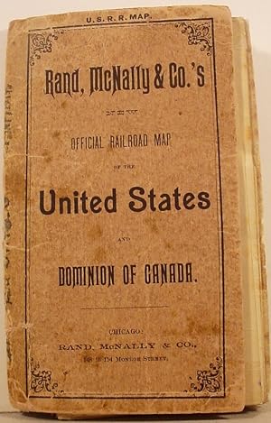
Rand, McNally & Co.'s / New / Official / Railroad Map / Of The / United States / Canada / And / Mexico
Publicado por Rand McNally; Chicago; pp.; Wraps; VG; 1885/1886, 1886
Librería: Watermark West Rare Books, Wichita, KS, Estados Unidos de America
Calificación del vendedor: 4 de 5 estrellas

EUR 398,31
Envío por EUR 6,87
Se envía dentro de Estados Unidos de AmericaCantidad disponible: 1 disponibles
Añadir al carritoSoft cover. Condición: Very Good. Large sheet of light-weight paper (32 x 43.75"), folded and mounted into covers (6 x 3.5"). _____ The full color map shows the entire US, with railroads shown and labeled in the map._____ Mexico is depicted south to Mexico City, only the southernmost section of Canada is shown._____ New England is also shown in an inset (13 x 10") on an enlarged scale._____ There are smaller (2.5 x 1.75) insets of: Boston, Cincinnati, Philadelphia, NY, St Louis, Chicago, Buffalo and Washington DC._____ The covers are titled "Rand, McNally & Co.'s / New / Official Railroad Map / of the / United States / and / Dominion of Canada."____ They are free and the spine has been repaired on the inside, partially obscuring the list of other maps on the inside front cover._____ Most of the map's folds have been neatly reinforced on the blank rear.
-

New Railroad Map of the United States, the Dominion of Canada, Mexico, and the West Indies
Año de publicación: 1875
Librería: Art Source International Inc., Boulder, CO, Estados Unidos de America
Calificación del vendedor: 5 de 5 estrellas
EUR 66,39
Envío por EUR 13,75
Se envía dentro de Estados Unidos de AmericaCantidad disponible: 1 disponibles
Añadir al carritoThis map is from A.T. Andreas" Illustrated Historical Atlas of the State of Iowa, printed in 1875. This is a railroad map of the United States, the Dominion of Canada, Mexico, and the West Indies. The names of Countries, states and important cities, lakes, rivers, and mountain ranges are identified. This map measures 25 inches by 16.5 inches.
-
Rand, McNally & Co. New Official Railroad Map of the United States, Canada and Mexico.
Publicado por Rand, McNally & Co., Chicago, 1885
Librería: HALEWOOD : ABA:ILAB : Booksellers :1867, PRESTON, Reino Unido
Miembro de asociación: ABA ILAB PBFA
Calificación del vendedor: 5 de 5 estrellas
EUR 297,74
Envío por EUR 10,23
Se envía de Reino Unido a Estados Unidos de AmericaCantidad disponible: 1 disponibles
Añadir al carritoLarge folding outline coloured map of the United States, Canada and Mexico. Railways marked with black lines. overall dimensions 110 x 81cm. folding on linen [dust mark to lower fold] into original maroon cloth titled boards [top spine worn]. Large inset of the World's Industrial and Cotton Centennial Exposition, New Orleans. Insets: Boston; Philadelphia; New York; Cincinnati; St. Louis; Chicago; Buffalo & Niagara Falls; Washington. No listing with Copac for this early edition. Good example.
-
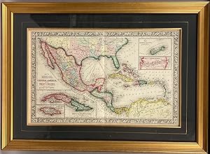
Map of Mexico, Central America, and the West Indies. (with four insets) 49. Map of the Island of Cuba. 50. Map of the Island of Jamaica. 51. Map of the Bermuda Islands. 52. Map of the Panama Railroad.
Publicado por S.A. Mitchell Jr., Philadelphia, 1865
Librería: DuBois Rare Books, New York, NY, Estados Unidos de America
Calificación del vendedor: 5 de 5 estrellas
EUR 305,37
Envío por EUR 4,30
Se envía dentro de Estados Unidos de AmericaCantidad disponible: 1 disponibles
Añadir al carritoSteel Engraving, hand colored. Condición: Near Fine. Single leaf, with center fold. 34cm x 54cm measurements to outer edge of decorative border. Steel engraving with elaborate hand coloring. Professionally framed, with frame measurements of 54cm x 73cm, gilt frame, glazed with optically correct glass. A very handsome package; Mitchell's "Map of Mexico, Central America, and the West Indies." professionally framed. Map condition is near fine with brilliant color, and only superficial wear. Source: Mitchell's New General Atlas, Philadelphia: Published By S. Augustus Mitchell, Jr. No. 31 South Sixth Street. 1865. Second state. [pg #48 in upper right corner].
-
SANTA FE MAP FOLDER SHOWING PRINCIPAL RAILROAD LINES OF THE UNITED STATES, WITH PORTIONS OF CANADA AND MEXICO. ALSO CONTOUR AND ALTITUDE MAPS OF TERRITORY TRAVERSED BY SANTA FE SYSTEM LINES . AND MAPS OF BUSINESS DISTRICTS OF CHICAGO, KANSAS CITY, LOS ANGELES AND SAN FRANCISCO. Issued by the Atchison, Topeka, and the Santa Fe Railway System [cover title]
Publicado por W. J. Black, Chicago, 1920
Librería: Currey, L.W. Inc. ABAA/ILAB, Elizabethtown, NY, Estados Unidos de America
Miembro de asociación: ILAB
Calificación del vendedor: 4 de 5 estrellas
EUR 486,83
Envío por EUR 6,02
Se envía dentro de Estados Unidos de AmericaCantidad disponible: 1 disponibles
Añadir al carritoSingle sheet, 56x120 cm (22 x 49 1/2 inches), folded to make 48 panels, printed in color. 23 illustrations, 6 maps, 1 profile. The main map, "Map of the Atchison, Topeka, and the Santa Fe Railway System," measures 52.7x99.5 cm (20 3/4 x 39 1/4 inches). It is a detailed map of the United States and adjacent regions of Canada and Mexico, showing the Santa Fe railway system and the principal railroads in the eastern United States, southern Canada, and northern Mexico. On the recto are smaller maps of San Francisco, Los Angeles, Kansas City, and Chicago, and a birdseye map/view of the United States from Chicago to the coast of California with an accompanying "Profile of the Santa Fe Between Chicago and California." The maps are copyright by the Rand McNally & Company. Includes "Index to Stations on the Santa Fe." Many of the illustrations promote the Santa Fe Station Hotels and the famous Fred Harvey Meal Service. Some wear and a few short splits at fold intersections, some darkening to outer panels, very good. OCLC reports seven copies, two of them in California, at the Autry and UCLA. (#166683).
-
New Commercial Railroad Map of the United States. With portions of the Dominion of Canada, the Republic of Mexico, and the West Indies. Approximate scale: 60 Miles to 1 inch.
Publicado por Chicago: Rand, McNally & Co., 1899, 1899
Librería: Peter Harrington. ABA/ ILAB., London, Reino Unido
Miembro de asociación: ABA ILAB PBFA
Calificación del vendedor: 5 de 5 estrellas
Original o primera edición
EUR 684,79
Envío por EUR 25,44
Se envía de Reino Unido a Estados Unidos de AmericaCantidad disponible: 1 disponibles
Añadir al carritoFirst edition of this colour map of the continental United States. It shows all 49 states and territories at the time (excluding Alaska and Hawaii, including the Indian Territory in modern-day Oklahoma), and the network of railways connecting them. We have traced only one institutional copy in the Bibliothèque nationale de France. Rand McNally started in 1856 as a printing shop in Chicago, with their main client being the Tribune (later the Chicago Tribune). Over time they expanded into tickets and timetables for the railroad industry, then dictionaries and newspapers, and finally maps. Their first map appeared in December 1872 and they continued to regularly update and publish new editions. This present map dates from 1899, in the aftermath of the panic of 1893 and the subsequent railroad consolidation by the likes of J. P. Morgan. This copy was sold in the United Kingdom by Edward Stanford, Geographer to the Queen and a renowned map dealer. His ticket can be found on the lower right corner of the map and his yellow label on the slipcase. He also added yellow covers lettered with his prospectus to the map verso. Large colour lithograph map (1,028 x 1,463 mm, folding to 204 x 133 mm), dissected into 55 panels, linen-backed, yellow card covers. Housed in the publisher's brown card slipcase, yellow label to front lettered in black. Some cities circled in contemporary blue crayon. Map lightly creased; case rubbed at edges, a few small white splotches and scratches: a very good copy.
-

Map of Mexico, Central America, and The West Indies, with Insets of Sandwich Islands, Jamaica, Bermuda, and the Panama Railroad
Año de publicación: 1875
Librería: Art Source International Inc., Boulder, CO, Estados Unidos de America
Calificación del vendedor: 5 de 5 estrellas
EUR 97,37
Envío por EUR 13,75
Se envía dentro de Estados Unidos de AmericaCantidad disponible: 1 disponibles
Añadir al carritoThis map was produced by S. Augustus Mitchell in 1875 for his New General Atlas. This map shows Mitchells traditional grape vine border, characteristic pastel coloring and abundant details of geographical features. Counties are distinguished by different colors. Wagon trails and major routes of transport are also shown. These 1875 maps offer a fascinating perspective of areas that have since undergone significant growth and change, in addition to their value as great examples of Mitchell's work. This map measures 21.5 inches by 13.5 inches.
-

Railroad Map of Mexico
Año de publicación: 1890
Librería: Art Source International Inc., Boulder, CO, Estados Unidos de America
Calificación del vendedor: 5 de 5 estrellas
EUR 128,34
Envío por EUR 13,75
Se envía dentro de Estados Unidos de AmericaCantidad disponible: 1 disponibles
Añadir al carritoThis map is from the extremely rare and well maintained 1890 edition of the county and railroad atlas made by George F. Cram. Each map is mostly black and white with bright coloring used to highlight county and state borders. The names of regions, important towns, rivers, creeks, lakes and mountain ranges are identified, as well as railroads and the names of station stops. This map illustrates Mexico with insets of Cuba and the areas surrounding Puebla. Crams distinctive title plates, coloring, and topographical details found on the maps in this hard to find 1890 atlas make them outstanding collectible pieces. This map measures 22.5 inches by 16.5 inches.
-

Mexico (Railroad Map)
Año de publicación: 1899
Librería: Art Source International Inc., Boulder, CO, Estados Unidos de America
Calificación del vendedor: 5 de 5 estrellas
EUR 132,77
Envío por EUR 13,75
Se envía dentro de Estados Unidos de AmericaCantidad disponible: 1 disponibles
Añadir al carritoArt Source International is proud to offer the maps from George F. Crams 1899 Standard American Railway Atlas. This is the first time we have seen this atlas in over 20 years. It is perhaps the finest atlas Cram ever produced. The maps are in excellent condition with exceptionally bright colors. Their most notable feature is certainly the precise depiction of the railroad routes. Every rail line is named, numbered and color coded. Cities, towns, lakes, rivers, creeks and mountain ranges are shown. This map would be a fine addition to any collection or make a unforgettable gift. This map measures 22 inches by 16 inches.
-

Railroad and County Map of New Mexico
Año de publicación: 1887
Librería: Art Source International Inc., Boulder, CO, Estados Unidos de America
Calificación del vendedor: 5 de 5 estrellas
EUR 150,47
Envío por EUR 13,75
Se envía dentro de Estados Unidos de AmericaCantidad disponible: 1 disponibles
Añadir al carritoThis map of New Mexico was produced by the George F. Cram Company for his Standard American Atlas of the World in 1887. This atlas was a precursor to his impressive railroad atlases. In 1869 the George F. Cram Company was born and the Cram name became synonymous with accuracy and innovation. This map shows all railroads, unfinished railroads, county seats, post offices, money order post offices, and large and small towns. This map is an early example of Crams large format maps and is impressive in its level of detail. This map measures 16 inches by 22 inches.
-
North America Antique Railroad Map c.1888 ? U.S., Canada & Mexico
Librería: Bartele Gallery - The Netherlands, Langweer, FRL, Holanda
Miembro de asociación: ILAB NVVA
Calificación del vendedor: 5 de 5 estrellas
EUR 540,00
Envío por EUR 17,00
Se envía de Holanda a Estados Unidos de AmericaCantidad disponible: 1 disponibles
Añadir al carritoAntique Map of North America ? Rand McNally, circa 1888 This antique map of North America, published by Rand, McNally & Co. circa 1888, offers a comprehensive view of the continent during a period of rapid political, territorial, and economic change. The map extends from the Arctic regions and Greenland in the north to Central America and the Caribbean in the south, with detailed coverage of the United States, Mexico, and British America (Canada). The United States is shown with clear state boundaries, towns, and transport connections, reflecting the country's expansion westward. Mexico is delineated by states and provinces, while Central America and the Caribbean islands are neatly engraved. Canada, labeled "British America," covers vast territories with relatively fewer details, emphasizing the great expanse of land that was only sparsely mapped at the time. Greenland is included in the northeast, while the far north is intriguingly labeled "Unknown Region." Soft pastel hand-coloring distinguishes political divisions, with yellow, pink, and green shading highlighting individual states and territories. The map also features engraved coastlines, rivers, mountain ranges, and important ports. An inset map of the Aleutian Islands is included at lower left. This sheet exemplifies Rand McNally's late 19th-century cartography, combining precision, clarity, and attractive presentation. It reflects both the geopolitical landscape of the period and the publisher's role in making affordable atlases widely available in America. Condition report: Very good condition with even toning and original hand coloring well preserved. Center fold as issued. Minor edge toning and light handling marks in the margins, not affecting the printed area. Framing tips: A light cream mat with a thin gilt inner border and a classic black or dark wood frame will highlight the delicate coloring and engraved detail. For a continental statement piece, consider framing alongside the companion maps of the United States, Canada, Mexico, and Cuba. Technique: Lithograph with original hand coloring Maker: Rand, McNally & Co., Chicago, circa 1888.
-

Railroad Map of Mexico prepared in the War College Division, General Staff
Año de publicación: 1916
Librería: Art Source International Inc., Boulder, CO, Estados Unidos de America
Calificación del vendedor: 5 de 5 estrellas
EUR 177,03
Envío por EUR 13,75
Se envía dentro de Estados Unidos de AmericaCantidad disponible: 1 disponibles
Añadir al carritoWe have not seen this map before. All the rairoad train stops throughout Mexico are shown. A must for a Mexico map collector. This map measures 45 inches by 31.5 inches.
-

Railroad Map of Mexico
Año de publicación: 1916
Librería: Art Source International Inc., Boulder, CO, Estados Unidos de America
Calificación del vendedor: 5 de 5 estrellas
EUR 208,01
Envío por EUR 13,75
Se envía dentro de Estados Unidos de AmericaCantidad disponible: 1 disponibles
Añadir al carritoThis outstanding railroad map of Mexico was produced in 1916 by the War College Division, General Staff, War Department in Washington, D.C. Includes an inset map of "Enlarged Map - State of Mexico and Surrounding Country". A sensational wall-sized map of Mexico and its Railroads in 1916' This map measures 41.5 inches by 31.5 inches.
-
Mexico Antique Railroad Map c.1888 ? Cities, States & Land of the Aztecs
Librería: Bartele Gallery - The Netherlands, Langweer, FRL, Holanda
Miembro de asociación: ILAB NVVA
Calificación del vendedor: 5 de 5 estrellas
EUR 460,00
Envío por EUR 17,00
Se envía de Holanda a Estados Unidos de AmericaCantidad disponible: 1 disponibles
Añadir al carritoAntique Map of Mexico ? Rand McNally, circa 1888 This antique map titled *"Rand, McNally & Co.'s Mexico"* was published around 1888 and depicts Mexico in the late 19th century, a period of modernization and national consolidation under the Porfirio Díaz regime. Covering the entire country from the U.S. border in the north to the Yucatán Peninsula in the south, the map includes Baja California, the Gulf of Mexico, and adjacent regions of Texas, New Mexico, and Central America. The map is rich in geographical and political detail, showing state boundaries, cities, towns, rivers, and mountain ranges. A particularly important feature is the extensive railroad network, printed in red and blue, which highlights the rapid development of Mexico's transportation infrastructure during the late 19th century. Mexico City, Guadalajara, Monterrey, Veracruz, Mérida, and many smaller towns are precisely engraved, along with ports on both the Pacific and Gulf coasts. The Gulf of Mexico and Pacific coastlines are carefully delineated with shading to indicate relief and coastal waters. Insets are not present, as the focus remains on the full national extent. This map offers both an attractive visual presentation and a historical record of Mexico during a transformative era, just prior to the political upheavals of the Mexican Revolution in the early 20th century. Condition report: Very good condition with mild toning and a faint vertical center fold as issued. Marginal handling wear present but not affecting the printed image. Plate mark visible. Framing tips: A dark oak or walnut frame with a neutral cream or ivory mat provides an elegant display for this map. For a stronger visual statement, a double mat in ivory with a thin red inner line can echo the railroad markings, enhancing its historical character. Technique: Lithograph with original color Maker: Rand, McNally & Co., Chicago, circa 1888.




![Imagen del vendedor de SANTA FE MAP FOLDER SHOWING PRINCIPAL RAILROAD LINES OF THE UNITED STATES, WITH PORTIONS OF CANADA AND MEXICO. ALSO CONTOUR AND ALTITUDE MAPS OF TERRITORY TRAVERSED BY SANTA FE SYSTEM LINES . AND MAPS OF BUSINESS DISTRICTS OF CHICAGO, KANSAS CITY, LOS ANGELES AND SAN FRANCISCO. Issued by the Atchison, Topeka, and the Santa Fe Railway System [cover title] a la venta por Currey, L.W. Inc. ABAA/ILAB](https://pictures.abebooks.com/inventory/md/md31363109024.jpg)


