Importe total (1 artículo artículos):
Destino del pedido:

part metropolitan district (9 resultados)
Ir a los resultados principales
Filtros de búsqueda
Tipo de artículo
- Todos los tipos de productos
- Libros (9)
- Revistas y publicaciones (No hay ningún otro resultado que coincida con este filtro.)
- Cómics (No hay ningún otro resultado que coincida con este filtro.)
- Partituras (No hay ningún otro resultado que coincida con este filtro.)
- Arte, grabados y pósters (No hay ningún otro resultado que coincida con este filtro.)
- Fotografías (No hay ningún otro resultado que coincida con este filtro.)
- Mapas (No hay ningún otro resultado que coincida con este filtro.)
- Manuscritos y coleccionismo de papel (No hay ningún otro resultado que coincida con este filtro.)
Condición Más información
- Nuevo (1)
- Como nuevo, Excelente o Muy bueno (No hay ningún otro resultado que coincida con este filtro.)
- Bueno o Aceptable (2)
- Regular o Pobre (No hay ningún otro resultado que coincida con este filtro.)
- Tal como se indica (6)
Encuadernación
Más atributos
- Primera edición (1)
- Firmado (No hay ningún otro resultado que coincida con este filtro.)
- Sobrecubierta (No hay ningún otro resultado que coincida con este filtro.)
- Con imágenes (7)
- No impresión bajo demanda (8)
Idioma (2)
Gastos de envío gratis
Ubicación del vendedor
Valoración de los vendedores
-

Locomotive and Train working in the latter part of the nineteenth century- Vol. 5- SER,LC&DR,LBSCR,LSWR,S&D,Metropolitan and Metropolitan District Railways
Idioma: Inglés
Publicado por Heffer & Sons, 1953
Librería: NIGEL BIRD BOOKS, Tregaron, Reino Unido
Calificación del vendedor: 5 de 5 estrellas

Original o primera edición
EUR 5,95
Envío por EUR 34,68
Se envía de Reino Unido a Estados Unidos de AmericaCantidad disponible: 1 disponibles
Ańadir al carritoHardcover. Condición: Very Good. No Jacket. 1st Edition. 131pp, ills.companies covered incl. SER,LC&DR,LBSCR,LSWR,S&D,Metropolitan and Metropolitan District Railways, hardback, vg,no dustwrapper.
-
The Annual Local Taxation Returns. Year 1913-14. Part V. Accounts of - Councils of Boroughs (Other Than Metropolitan Boroughs), Urban District Councils
Publicado por Wyman and Sons (under Authority of HMSO), London, 1916
Librería: Victoria Bookshop, BERE ALSTON, DEVON, Reino Unido
Calificación del vendedor: 4 de 5 estrellas

EUR 20,88
Envío por EUR 11,39
Se envía de Reino Unido a Estados Unidos de AmericaCantidad disponible: 1 disponibles
Ańadir al carritoPaperback. Condición: Good-. First. 4to. pages edges discoloured with some creasing heavily worn discoloured covers with chipping , tears and creasing. Book.
-

Locomotive and Train working in the Latter Part of the nineteenth Century. Vol. five: South Eastern Railway, London, Chatham and Dover Railway - London, Brighton and South Coast Railway - London and South Western Railway - Somerset and Dorset Joint Railway - Metropolitan and Metropolitan District Railways.
Publicado por Cambridge. W. Heffer Sons., 1953
Librería: Antiquariat Löwenstein, Göllersdorf, NÖ, Austria
Calificación del vendedor: 5 de 5 estrellas
EUR 28,00
Envío por EUR 18,50
Se envía de Austria a Estados Unidos de AmericaCantidad disponible: 1 disponibles
Ańadir al carrito131 Seiten, 48 Fotos. Leinen. Unfortunately, deliveries to the USA are not possible at this time.
-
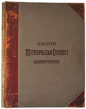
Atlas of the Metropolitan District and Adjacent Country Comprising the Counties of New York, Kings, Richmond, Westchester and part of Queens in the State of New York, the County of Hudson and parts of Counties of Bergen, Passaic, Essex and Union in the State of New Jersey. Lacks map XIII Bedford to State line
Publicado por Julius Bien & Co., New York, 1891
Librería: Antipodean Books, Maps & Prints, ABAA, Garrison, NY, Estados Unidos de America
Miembro de asociación: ABAA ANZAAB ESA ILAB
Calificación del vendedor: 4 de 5 estrellas
EUR 1.219,02
Envío por EUR 8,61
Se envía dentro de Estados Unidos de AmericaCantidad disponible: 1 disponibles
Ańadir al carritoHardcover. Condición: Otherwise very good condition. Fabulous chromolithographed double page maps of Manhattan, Southern New York and parts of New Jersey, lacks map XIII Bedford to State line. Maps consist of: Index map; City, County New York; Brooklyn, Jersey City, Hoboken, Bayonne and Newark Bay; Narrows to Jamaica Bay, Coney Island; Richmond County; Newark, Elizabeth, The Narrows & Vicinity; Newark to Paterson coast; Long Island Sound, Westchester north to Mt. Vernon, Queens south to Jamaica; Westchester County, Yonkers to Dobbs Ferry; Westchester County, Irvington, Tarrytown to Sing Sing; Westchester County Scarborough to Putnam County; Westchester County Vicinity of Croton Lake. Elephant folio, original front board present, stamped title in black, lacks back cover, leather perished, OCLC: 1872461; Le Gear, C.E. L2557.
-
![Imagen del vendedor de REPORT ON A STUDY OF DISTRICT 8 BEING THE CENTRAL PART OF THE BOROUGH OF ETOBICOKE FROM THE QUEEN ELIZABETH WAY TO HIGHWAY 401 AND DEFINED BY THE METROPOLITAN PLAN 1968 [LeatherBound] a la venta por True World of Books](https://pictures.abebooks.com/inventory/md/md31618648763.jpg)
REPORT ON A STUDY OF DISTRICT 8 BEING THE CENTRAL PART OF THE BOROUGH OF ETOBICOKE FROM THE QUEEN ELIZABETH WAY TO HIGHWAY 401 AND DEFINED BY THE METROPOLITAN PLAN 1968 [LeatherBound]
Ańo de publicación: 2025
Librería: True World of Books, Delhi, India
Calificación del vendedor: 5 de 5 estrellas
EUR 26,59
Gastos de envío gratis
Se envía de India a Estados Unidos de AmericaCantidad disponible: 18 disponibles
Ańadir al carritoLeatherBound. Condición: New. BOOKS ARE EXEMPT FROM IMPORT DUTIES AND TARIFFS; NO EXTRA CHARGES APPLY. LeatherBound edition. Condition: New. Reprinted from 1968 edition. Leather Binding on Spine and Corners with Golden leaf printing on spine. Bound in genuine leather with Satin ribbon page markers and Spine with raised gilt bands. A perfect gift for your loved ones. Pages: 138 NO changes have been made to the original text. This is NOT a retyped or an ocr'd reprint. Illustrations, Index, if any, are included in black and white. Each page is checked manually before printing. As this print on demand book is reprinted from a very old book, there could be some missing or flawed pages, but we always try to make the book as complete as possible. Fold-outs, if any, are not part of the book. If the original book was published in multiple volumes then this reprint is of only one volume, not the whole set. Sewing binding for longer life, where the book block is actually sewn (smythe sewn/section sewn) with thread before binding which results in a more durable type of binding. Pages: 138.
-

Part of the Metropolitan District
Ańo de publicación: 1891
Librería: Art Source International Inc., Boulder, CO, Estados Unidos de America
Calificación del vendedor: 5 de 5 estrellas
EUR 66,49
Envío por EUR 13,77
Se envía dentro de Estados Unidos de AmericaCantidad disponible: 1 disponibles
Ańadir al carritoThis detailed 1891 map shows part of Newton, Boston, and Brookline. It names streets, rivers, railroad lines, and cemeteries. City boundaries are denoted through colored borders. This map measures 25.5 inches by 17.5 inches.
-

Part of the Metropolitan District
Ańo de publicación: 1891
Librería: Art Source International Inc., Boulder, CO, Estados Unidos de America
Calificación del vendedor: 5 de 5 estrellas
EUR 75,36
Envío por EUR 13,77
Se envía dentro de Estados Unidos de AmericaCantidad disponible: 1 disponibles
Ańadir al carritoThis interesting 1891 map shows Lexington, Medford, Belmont, Somervile, Chelsea, Cambridge, Watertown, Brookline, Boston, Quincy, Needham, Dedham, Hyde Park,Milton, and parts of Waltham, Watertown, Belmont, and Cambridge. It names streets, government buildings, schools, churches, hospitals, cemeteries, parks, reservoirs, a pumping station, and more. Ward and city boundaries are indicated by colored borders. This map measures 26 inches by 17.5 inches.
-

Part of the Metropolitan District
Ańo de publicación: 1891
Librería: Art Source International Inc., Boulder, CO, Estados Unidos de America
Calificación del vendedor: 5 de 5 estrellas
EUR 88,66
Envío por EUR 13,77
Se envía dentro de Estados Unidos de AmericaCantidad disponible: 1 disponibles
Ańadir al carritoThis 1891 Boston map shows Brookline, Roxbury, Hyde Park, and Milton. This map names streets, churches, cemeteries, alms houses, country clubs, parks, schools, and railroad lines. This map measures 26.5 inches by 17.5 inches.
-

Part of the Metropolitan District
Ańo de publicación: 1891
Librería: Art Source International Inc., Boulder, CO, Estados Unidos de America
Calificación del vendedor: 5 de 5 estrellas
EUR 137,42
Envío por EUR 13,77
Se envía dentro de Estados Unidos de AmericaCantidad disponible: 1 disponibles
Ańadir al carritoThis 1891 map of Boston details streets, railroad lines, numerous bays, parks, government buildings, baseball grounds, schools, hospitals, churches, a police station, and reservoirs. City and ward boundaries are denoted through colored borders. This map measures 26 inches by 17.5 inches.