
Ordnance survey large scale map (38 resultados)

Editorial: Map Collector 1991
- Publicación periódica
Librería: Cosmo Books, Shropshire., Reino UnidoCosmo Books
Contactar con el vendedorVendedor de 5 estrellasCondición: Usado - Bueno
EUR 10,34
Envío por EUR 13,73Se envía de Reino Unido a Estados Unidos de AmericaCantidad disponible: 1 disponibles
Añadir al carritoBooklet - Unbound Pages. Condición: Very Good. 5 pages, illustrated. An authentic standalone article, extracted from a larger volume. Not a reprint or reproduction, but an original work in its own right. Supplied without title page or cover. Size: 21 x 30 cms. Category: Map Collector; Cosmo Books : 29 years on ABE, 47 years taki…ng care of customers. A bookseller you can rely on.

Editorial: Ordnance Survey 1908
- Mapa
Librería: Bailgate Books Ltd, Doncaster, Reino UnidoBailgate Books Ltd
Contactar con el vendedorVendedor de 5 estrellasCondición: Usado - Bueno
EUR 9,03
Envío por EUR 16,73Se envía de Reino Unido a Estados Unidos de AmericaCantidad disponible: 1 disponibles
Añadir al carritoSingle sheet. Condición: Very Good. No Dust Jacket. Revised Edition. Large-scale plan of the area between the villages of Wheldrake, Thorganby and Escrick, SE of York. Map shows; part Leonard Scales Lane, South Plantation, South Close, Keld Carrs, Keld Carrs Drain, Simpson's Wood, Crinklety's Wood, Common Drain, Common Lane, Com…mon Bottoms Wood, Westhow Field, Westhow Closes, Sandhole Lane, Common Farm, Southmoor Drain, South moor, Poor's Close, Pallion Dike, Gray Reins, Acorn Plantation, West Cottingwith Common, Keldcarrs Plantation, Gilbertson's Wood, Gilbertson's Farm, Wheldrake Wrays and Grange Farm. Includes parts of Thorganby with West Cottingwith, Escrick and Wheldrake Parish and York Union & Escrick RD along with Howdenshire Division. Information included is buildings, property/field boundaries, acreage, parish and other boundaries, footpaths, tracks, roads, railways, watercourses, orchards and forestation, levels, earthworks, antiquities etc. The map has a small area of faint 'ink spots', and an ID number in the bottom RH margin. Minor closed tears to margins with slight creasing to map. Item Type: Map. Quantity Available: 1. Shipped Weight: under 1 kg. Pictures of this item not already displayed here available upon request. Inventory No: 45110120066. All our books are sent by tracked mail.

Editorial: Ordnance Survey 1904
- Mapa
Librería: Bailgate Books Ltd, Doncaster, Reino UnidoBailgate Books Ltd
Contactar con el vendedorVendedor de 5 estrellasCondición: Usado - Bueno
EUR 9,03
Envío por EUR 16,73Se envía de Reino Unido a Estados Unidos de AmericaCantidad disponible: 1 disponibles
Añadir al carritoSingle sheet. Condición: Very Good. No Dust Jacket. Revised Edition. Includes: Saltby Lodge, farm (Swallow Hole Farm), farm (Barn Lodge Farm) , farm (Heath Farm), Swallowhole Covert, Swallow Hole (geological feature), Bescaby Oaks and Croxton Park (Old Wood). Parts of parishes included are: Saltby, Bescaby and Croxton Kerrial. T…he area is in the Melton Mowbray Union & RD and Grantham Union and Bevoir RD. Information included is buildings, property/field boundaries, acreage, parish and other boundaries, footpaths, tracks, roads, railways, watercourses, orchards and forestation, levels, earthworks, antiquities etc. The map has an inked stamp in the bottom margin and reference number in the bottom right corner (margin). Item Type: Map. Quantity Available: 1. Shipped Weight: under 1 kg. Pictures of this item not already displayed here available upon request. Inventory No: 45110120060. All our books are sent by tracked mail.

Editorial: Ordnance Survey Office / Edward Stanford 1914
- Tapa blanda
- Mapa
Librería: Gwyn Tudur Davies, Aberystwyth, Reino UnidoGwyn Tudur Davies
Contactar con el vendedorVendedor de 5 estrellasCondición: Usado - Aceptable
EUR 11,88
Envío por EUR 14,42Se envía de Reino Unido a Estados Unidos de AmericaCantidad disponible: 1 disponibles
Añadir al carritoSoft cover. Condición: Good. Estado de la sobrecubierta: Good. 3rd Edition. 1 folded folded cloth map. Some annotations and small stain on on covers o/w the map itself is clean unmarked and in very good condition. Railways revised in 1914. e1030 / m11766.

Editorial: The Ordnance Survey 1912
- Tapa blanda
- Mapa
Librería: Paul Hughes - PBFA, Bishop Auckland, Reino UnidoPaul Hughes - PBFA
Contactar con el vendedorVendedor de 5 estrellasCondición: Usado - Bueno
EUR 14,26
Envío por EUR 27,69Se envía de Reino Unido a Estados Unidos de AmericaCantidad disponible: 1 disponibles
Añadir al carritoSoft cover. Condición: Very Good. Linen-backed folding map. Some foxing to linen. Name of a Corporal of the London Rifle Brigade inscribed on front cover (1915).
Editorial: Edward Stanford Ltd
Librería: Chapter 1, Johannesburg, Sur AfricaChapter 1
Contactar con el vendedorVendedor de 5 estrellasCondición: Usado - Aceptable
EUR 10,60
Envío por EUR 25,00Se envía de Sur Africa a Estados Unidos de AmericaCantidad disponible: 1 disponibles
Añadir al carritoCondición: Good. 1912. Wraps are worn and marked.Internally clean.Well bound.Map.[RK]. Our orders are shipped using tracked courier delivery services.

Editorial: ORDNANCE SURVEY 1934 1934
Librería: PROCTOR / THE ANTIQUE MAP & BOOKSHOP, DORCHESTER, Reino UnidoPROCTOR / THE ANTIQUE MAP & BOOKSHOP
Contactar con el vendedorVendedor de 5 estrellasCondición: Usado
EUR 23,77
Envío por EUR 23,08Se envía de Reino Unido a Estados Unidos de AmericaCantidad disponible: 1 disponibles
Añadir al carritoOriginal Folded flat map. Approximate size is 100cm x 74cm. Shows areas of Knighton & Canford Magna, Bear Wood In good condition. Some light rubbing on edges, with a few small creases lightly tanned. With vertical and horizontal folds. County Borders Changed in 1974 From Hampshire to Dorset It will be rolled up and posted in a p…oster tube.
 Más imágenes
Editorial: Geological Survey of England & Wales Colonel Colby 1860 Revised 1885 1885
Librería: PROCTOR / THE ANTIQUE MAP & BOOKSHOP, DORCHESTER, Reino UnidoPROCTOR / THE ANTIQUE MAP & BOOKSHOP
Contactar con el vendedorVendedor de 5 estrellasCondición: Usado
EUR 23,77
Envío por EUR 23,08Se envía de Reino Unido a Estados Unidos de AmericaCantidad disponible: 1 disponibles
Añadir al carritoOriginal rolled flat map. Hand-coloured engraving With ORDNANCE SURVEY Blind Stamp top margin. Size 33.5 inches X 26.5 inches. 84cm x 66cm Ordnance survey map showing Basingstoke, Whitchurch, Andover & surrounding areas. In good condition. Some foxing & a little dusty on margins & tear on right hand side of map. A few small nick…s top edge. Unfolded. It will be rolled up and posted in a poster tube.

Editorial: ORDNANCE SURVEY 1937 1937
Librería: PROCTOR / THE ANTIQUE MAP & BOOKSHOP, DORCHESTER, Reino UnidoPROCTOR / THE ANTIQUE MAP & BOOKSHOP
Contactar con el vendedorVendedor de 5 estrellasCondición: Usado
EUR 23,77
Envío por EUR 23,08Se envía de Reino Unido a Estados Unidos de AmericaCantidad disponible: 1 disponibles
Añadir al carritoOriginal Folded flat map. Approximate size is 100cm x 74cm. Shows areas of Newtown, Trinidad Estate Branksome - Bourne Valley Wallisdown Poole. In good condition. Some light rubbing on edges. Small pin holes in corners. Small nick top & bottom edge. A little creased on corners. With vertical and horizontal folds. It will be roll…ed up and posted in a poster tube.

Editorial: Geological Survey of England & Wales 1884 1884
Librería: PROCTOR / THE ANTIQUE MAP & BOOKSHOP, DORCHESTER, Reino UnidoPROCTOR / THE ANTIQUE MAP & BOOKSHOP
Contactar con el vendedorVendedor de 5 estrellasCondición: Usado
EUR 26,15
Envío por EUR 23,08Se envía de Reino Unido a Estados Unidos de AmericaCantidad disponible: 1 disponibles
Añadir al carritoOriginal rolled flat map. Hand-coloured engraving With ORDNANCE SURVEY Blind Stamp top margin. Size 40 inches X 26.5 inches. 100cm x 68cm Ordnance survey map showing Saffron Walden, Whitham, Royston & surrounding areas. In generally good condition. Some foxing & a little dusty on margins & right hand side. A few small nicks on e…dges, a little tatty top left corner. Unfolded. It will be rolled up and posted in a poster tube.
Editorial: Edward Stanford / Ordnance Survey, London
- Tapa dura
Librería: CHARLES BOSSOM, Ely, Reino UnidoCHARLES BOSSOM
Contactar con el vendedorVendedor de 5 estrellasCondición: Usado - Bueno
EUR 17,83
Envío por EUR 34,62Se envía de Reino Unido a Estados Unidos de AmericaCantidad disponible: 1 disponibles
Añadir al carritoCloth. Condición: Very Good. Pre 1909, Cloth. Beige card cover, with black titles and sketch map of area covered to front. Neat name and address on front cover, Colour map mounted on cloth - fine condition, no tearing or marking, folds neatly. Price on front cover (2/6).
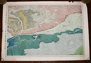
Editorial: Geological Survey of England & Wales Colonel Colby 1816 Revised 1891 1891
Librería: PROCTOR / THE ANTIQUE MAP & BOOKSHOP, DORCHESTER, Reino UnidoPROCTOR / THE ANTIQUE MAP & BOOKSHOP
Contactar con el vendedorVendedor de 5 estrellasCondición: Usado
EUR 33,28
Envío por EUR 23,08Se envía de Reino Unido a Estados Unidos de AmericaCantidad disponible: 1 disponibles
Añadir al carritoOriginal rolled flat map. Hand-coloured engraving With ORDNANCE SURVEY Blind Stamp top margin. Size 33.5 inches X 26 inches. 85cm x 66cm Ordnance survey map showing Guildford & surrounding areas. In good condition. Some foxing & a little dusty on margins. Margin has small tear on left, crease down right hand margin, Top edge a l…ittle nicked with one tear. MAP not affected by edge nicks etc. Unfolded. It will be rolled up and posted in a poster tube.

Editorial: Geological Survey of England & Wales Colonel Colby 1860 Revised 1885 1885
Librería: PROCTOR / THE ANTIQUE MAP & BOOKSHOP, DORCHESTER, Reino UnidoPROCTOR / THE ANTIQUE MAP & BOOKSHOP
Contactar con el vendedorVendedor de 5 estrellasCondición: Usado
EUR 39,22
Envío por EUR 23,08Se envía de Reino Unido a Estados Unidos de AmericaCantidad disponible: 1 disponibles
Añadir al carritoOriginal rolled flat map. Hand-coloured engraving With ORDNANCE SURVEY Blind Stamp top margin. Size 32.5 inches X 27.5 inches. 82cm x 70cm Ordnance survey map showing Basingstoke, Whitchurch, Andover & surrounding areas. In good condition. Some foxing & a little dusty on margins & slightly on right hand side of map. A few small…nicks lower edge. Unfolded. It will be rolled up and posted in a poster tube.
 Más imágenes
Idioma: Inglés
Editorial: James Wyld 1843
- Mapa
Librería: Morning Mist Books and Maps, Cirencester, Reino UnidoMorning Mist Books and Maps
Contactar con el vendedorVendedor de 5 estrellasCondición: Usado - Bueno
EUR 237,70
Envío por EUR 51,92Se envía de Reino Unido a Estados Unidos de AmericaCantidad disponible: 1 disponibles
Añadir al carritoNo Binding. Condición: Very Good. An excellent copy of Wyld's map, close to being 'fine'. Rigid slipcase with Wyld's label to front, a little worn. Map mounted in sections on linen: slight spotting and toning to verso, consistent with age. Folds tight with minimal wear. Light toning and dust-marking to map face. Outline colourin…g, along with colour for parks, roads etc. Basic adjustment to the original map with blue line showing the rail route to Folkestone. Tiny print detail to the title: new edition, 1843. Clear, sharp printing. Title explanation: Mudge's 4 sheet map of Kent for the OS was recognised as being of exceptional quality but the OS did not choose to 'protect' their rights, so the OS maps were copied and used by others for many years. Wyld took the Mudge one inch map and reduced the detail to half-inch, enabling this map to be a single sheet that also included the Thames up to London, with part of Essex. Sheet size 93cm by 64cm approx. Further details available on request (Uc3).
Editorial: T. Fisher Unwin, Ltd 1914
- Mapa
Librería: Deeside Books, Ballater, Reino UnidoDeeside Books
Contactar con el vendedorVendedor de 5 estrellasCondición: Usado - Excelente
EUR 35,65
Envío por EUR 23,08Se envía de Reino Unido a Estados Unidos de AmericaCantidad disponible: 1 disponibles
Añadir al carritoNo Binding. Condición: Fine. Large cloth mounted folding map with card covers, some very slight shelfwear to covers but map is in excellent condition with no tears, marks or holes. 1914 edition.
Editorial: Ordnance Survey, Southampton 1898
- Lámina artística
Librería: LOE BOOKS, Bathpool, Reino UnidoLOE BOOKS
Contactar con el vendedorVendedor de 4 estrellasCondición: Usado - Bueno
EUR 35,65
Envío por EUR 23,65Se envía de Reino Unido a Estados Unidos de AmericaCantidad disponible: 1 disponibles
Añadir al carritoUnframed. Condición: Very Good. Second Edition. A very large original map measuring 104 x 136cm, 64 sections dissected onto a linen backing; folding into original brown covers, the upper with a label of Edward Stanford, Ltd, London. A very good copy in very good condition. Map/Print.
 Más imágenes
Editorial: S. Lewis & Co., London 1841
- Tapa dura
- Mapa
Librería: Andrew Cox PBFA, Shropshire, Reino UnidoAndrew Cox PBFA
Contactar con el vendedorVendedor de 5 estrellasCondición: Usado - Aceptable
EUR 297,12
Envío por EUR 22,50Se envía de Reino Unido a Estados Unidos de AmericaCantidad disponible: 1 disponibles
Añadir al carritoHardcover. Condición: Good. Published in 1841, this is a very large linen backed folding Hand Coloured map of England & Wales, in four parts folding down into leather covers, opened each individual part measures 41.5 inches by 35 inches approx. Put together the whole map measures 83 inches by 70 inches approx. which is nearly 7…feet by 6 feet The leather covers are rubbed and worn at edges, there has been crude strengthening repairs to the spines The map itself has a few creases at edges, mild marking and foxing, else in overall good condition A GENERALLY NICE EXAMPLE OF THIS VERY LARGE EARLY VICTORIAN HAND COLOURED MAP OF ENGLAND AND WALES Maps are heavy, nearly three kilos packed, overseas shipping costs will be significantly higher than the basic standard quote. Drawn by R. Creighton, Engraved by J. Dower (ilustrador).

Editorial: Geological Survey of England & Wales Colonel Colby 1822 Revised 1885 1885
Librería: PROCTOR / THE ANTIQUE MAP & BOOKSHOP, DORCHESTER, Reino UnidoPROCTOR / THE ANTIQUE MAP & BOOKSHOP
Contactar con el vendedorVendedor de 5 estrellasCondición: Usado
EUR 65,37
Envío por EUR 23,08Se envía de Reino Unido a Estados Unidos de AmericaCantidad disponible: 1 disponibles
Añadir al carritoOriginal rolled flat map. Hand-coloured engraving With ORDNANCE SURVEY Blind Stamp top margin. Size 39.5 inches X 27 inches. 100cm x 69cm Ordnance survey map showing Uxbridge, Windsor, Watford Chelsea & surrounding areas. In generally good condition. Some foxing & a little dusty on margins & 2 tears together on top edge of map.…A few small nicks on edges. Unfolded. It will be rolled up and posted in a poster tube.

Editorial: ORDNANCE SURVEY 1933 1933
Librería: PROCTOR / THE ANTIQUE MAP & BOOKSHOP, DORCHESTER, Reino UnidoPROCTOR / THE ANTIQUE MAP & BOOKSHOP
Contactar con el vendedorVendedor de 5 estrellasCondición: Usado
EUR 65,37
Envío por EUR 23,08Se envía de Reino Unido a Estados Unidos de AmericaCantidad disponible: 1 disponibles
Añadir al carritoOriginal Folded flat map. Approximate size is 100cm x 74cm. Shows areas of Brownsea Island (Ferry Side) Sandbanks, Studland Heath, Poole Bay. In good condition. Some light rubbing on edges, with a few small corner creases & lightly tanned. With a few vertical and horizontal folds. It will be rolled up and posted in a poster tube….
 Más imágenes
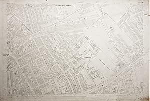
Editorial: The Ordnance Survey 1873
- Mapa
Librería: Morning Mist Books and Maps, Cirencester, Reino UnidoMorning Mist Books and Maps
Contactar con el vendedorVendedor de 5 estrellasCondición: Usado - Regular
EUR 23,77
Envío por EUR 51,92Se envía de Reino Unido a Estados Unidos de AmericaCantidad disponible: 1 disponibles
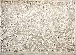
Añadir al carritoNo Binding. Condición: Fair. Please note: the colour of the map is pale cream, and the printing is uniform, this has proved difficult to accurately reproduce in the accompanying photos. Mapped to a scale of 1:1056 or 88 feet to 1 inch. Surveyed 1870, engraved in 1871. Published 1873. OS blind-stamp to upper margin for 1880. The…sheet is in indifferent condition but shows the workhouse in detail and the layout of the surrounding area. All margins dust-marked and discoloured. Several tears to margins, with one large tear in the upper right corner going beyond the margin and penetrating into the map detail by about 5cm. Some pencil notes and a large pencil cross left of Carlton Square. Spotting and marking to reverse. Full sheet measurements 102cm by 69 cm approx. Features include: workhouse with room divisions (now Mile End Hospital); Bancrofts Hospital; part of Regent's Canal with Mile End lock; railways; burial grounds etc. Area covered: Willow Street (SW); George Street (NW); part of Lichfield Road (NE); part of Canal Road (SE). The map will be posted, rolled in a rigid tube. More details available on request. This is an original map, not a modern reproduction. (319fl50).
 Más imágenes
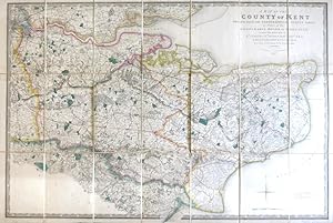
A Map of the County of Kent Drawn from the Topographical Survey Taken, by Order of the Honourable Board of Ordnance, . Reduced from the Large Map in Four Sheets by a Scale of One Inch to Two Statute Miles
(ORDNANCE SURVEY) [under the direction of] MUDGE, Wm., Lt. Colonel
Editorial: London: Jas. Wyld 1841
- Mapa
Librería: Bow Windows Bookshop (ABA, ILAB), Lewes, Reino UnidoBow Windows Bookshop (ABA, ILAB)
Contactar con el vendedorVendedor de 5 estrellasCondición: Usado
EUR 350,60
Envío por EUR 25,39Se envía de Reino Unido a Estados Unidos de AmericaCantidad disponible: 1 disponibles
Añadir al carritoMap dimensions 59.5 x 89 cm, overall 63.5 x 94.5 cm. Finely engraved folding map of the county, dissected into twenty-four sections and mounted on linen, green silk trim to the edges, marbled paper to the folded end sections, folds into original green embossed cloth slipcase with Wyld's printed label to upper board and brief tit…le label to one spine. Some mild wear to the corners of the case, a lovely example overall. Kent was the first of the Ordnance Survey maps to be published, appearing in 1801. This version, reduced in format and scale, was first published by Faden in 1807 and then by his successors, the Wylds, at intervals through to the mid-19th century.
 Más imágenes
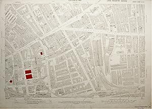
Editorial: The Ordnance Survey 1913
- Mapa
Librería: Morning Mist Books and Maps, Cirencester, Reino UnidoMorning Mist Books and Maps
Contactar con el vendedorVendedor de 5 estrellasCondición: Usado - Aceptable
EUR 35,65
Envío por EUR 51,92Se envía de Reino Unido a Estados Unidos de AmericaCantidad disponible: 1 disponibles
Añadir al carritoNo Binding. Condición: Good. Please note: the colour of the map is pale cream, and the printing is uniformly sharp, this has proved difficult to accurately reproduce in the accompanying photos. Mapped to a scale of 1:1056 or 88 feet to 1 inch. Revised 1894, published 1913. General marking and discolouring to margins. Map face sl…ightly marked. Reverse with general marking and discolouring. Stamps, in ink, to margin. Some buildings coloured red at a later stage and numbered (Land Registry?). Some creasing from handling. Full sheet measurements 104cm by 74 cm approx. Features include: goods depot at Lambeth Street (now redeveloped); Leman Street Station; goods depot off Haydon Square; Aldgate Station; numerous named warehouses. Area covered: America Square (SW); part of Stoney Lane(NW); part of Nottingham Place (NE); part of Cable Street (SE). The map will be posted, rolled in a rigid tube. More details available on request. This is an original map, not a modern reproduction. (319fl46).
 Más imágenes
Editorial: The Ordnance Survey
- Mapa
Librería: Morning Mist Books and Maps, Cirencester, Reino UnidoMorning Mist Books and Maps
Contactar con el vendedorVendedor de 5 estrellasCondición: Usado - Bueno
EUR 35,65
Envío por EUR 51,92Se envía de Reino Unido a Estados Unidos de AmericaCantidad disponible: 1 disponibles
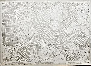
Añadir al carritoNo Binding. Condición: Very Good. Please note: the colour of the map is pale cream, and the printing is uniformly sharp, this has proved difficult to accurately reproduce in the accompanying photos. Mapped to a scale of 1:2,500 or 208 feet to 1 inch. Surveyed 1866-70. Revised 1913-4. Boundaries revised to 1919. Published 1916. L…ater printing code for 25/43/P. This means that the map was printed in 1945 but does not mean that the map was fully revised/updated at that time. Price stamps, in ink, to margin. Some light spotting and discolouring to margins. A couple of small nicks and scuffing. Light marking to reverse. Very slight marking to map face. Full sheet measurements 104cm by 74 cm approx. Features include: Peckham Rye and Denmark Hill Stations; tramway and depot; Peckham House lunatic asylum; part of Surrey Canal. Area covered: part of Denmark Hill (SW); part of Brisbane Street (NW); Studholme Street (NE); Nunhead Green (SE). The map will be posted, rolled in a rigid tube. More details available on request. This is an original map, not a modern reproduction. (319fl48).
 Más imágenes
Editorial: The Ordnance Survey 1938
- Mapa
Librería: Morning Mist Books and Maps, Cirencester, Reino UnidoMorning Mist Books and Maps
Contactar con el vendedorVendedor de 5 estrellasCondición: Usado - Bueno
EUR 35,65
Envío por EUR 51,92Se envía de Reino Unido a Estados Unidos de AmericaCantidad disponible: 1 disponibles
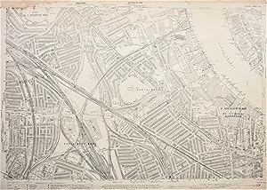
Añadir al carritoNo Binding. Condición: Very Good. Please note: the colour of the map is pale cream, and the printing is uniformly sharp, this has proved difficult to accurately reproduce in the accompanying photos. Mapped to a scale of 1:2,500 or 208 feet to 1 inch. Surveyed 1867-9. Revised 1913, published 1916, boundaries partly revised in 191…9. Reprinted 150/23, 200/28, 150/38. Final printing being 1938, but with no text mentioning actual updates. Upper margin stained with slight staining on the map itself to the upper centre. Other margins dust-marked and slightly discoloured. Stamps, in ink, to margin. Map face bright with only slight toning. Sharp, clear printing. Full sheet measurements 104cm by 74 cm approx. Features include: Herne Hill station, tramlines, parks, schools, Brixton and East Brixton stations. Area covered: part of Dumbarton Road (SW); part of Andalus Road (NW); Ruskin Park (NE); part of Burbage Road(SE). The map will be posted, rolled in a rigid tube. More details available on request. This is an original map, not a modern reproduction. (319fl23).
 Más imágenes
Editorial: The Ordnance Survey 1916
- Mapa
Librería: Morning Mist Books and Maps, Cirencester, Reino UnidoMorning Mist Books and Maps
Contactar con el vendedorVendedor de 5 estrellasCondición: Usado - Aceptable
EUR 35,65
Envío por EUR 51,92Se envía de Reino Unido a Estados Unidos de AmericaCantidad disponible: 1 disponibles
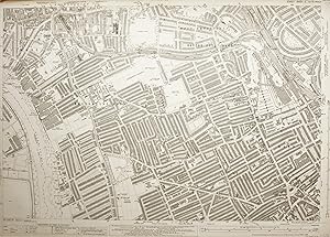
Añadir al carritoNo Binding. Condición: Good. Please note: the colour of the map is pale cream, and the printing is uniformly sharp, this has proved difficult to accurately reproduce in the accompanying photos. Mapped to a scale of 1:2,500 or 208 feet to 1 inch. Surveyed 1866-70. Revised 1914, published 1916, boundaries partly revised in 1919. U…pper margin stained with slight staining on the map itself to the upper left corner. Other margins dust-marked. Price stamps, in ink, to margin. Map face bright with only slight toning. Sharp, clear printing. Full sheet measurements 104cm by 74 cm approx. Features include: Millwall Football Ground, Surrey Canal, industrial units, railway routes, part of the river with wharves on both sides. Area covered: Wagner Street (SW); Abbeyfield Road (NW); part of West Ferry Road (NE); Albury Street (SE). The map will be posted, rolled in a rigid tube. More details available on request. This is an original map, not a modern reproduction. (319fl19).
 Más imágenes
Editorial: The Ordnance Survey 1935
- Mapa
Librería: Morning Mist Books and Maps, Cirencester, Reino UnidoMorning Mist Books and Maps
Contactar con el vendedorVendedor de 5 estrellasCondición: Usado - Bueno
EUR 41,60
Envío por EUR 51,92Se envía de Reino Unido a Estados Unidos de AmericaCantidad disponible: 1 disponibles
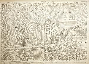
Añadir al carritoNo Binding. Condición: Very Good. Please note: the colour of the map is pale cream, and the printing is uniformly sharp, this has proved difficult to accurately reproduce in the accompanying photos. Mapped to a scale of 1:2,500 or 208 feet to 1 inch. Surveyed 1862-5. Revised 1913, boundaries partly revised in 1919, re-levelled 1…931-2, printed and published 1935. Left margin stained and crease to the upper corner, along with small tear. Other margins dust-marked. Small tear to upper margin. Small stain to lower margin. Price stamps, in ink, to margin. Map face bright with only slight toning. Sharp, clear printing. Full sheet measurements 104cm by 74 cm approx. Features include: Queen?s Club; Hammersmith, Baron?s Court and West Kensington Stations; Lillie Bridge depot; part of the Thames. Area covered: Thames(SW); Bridge Avenue (NW); part of Longridge Road (NE); Jerdan Place (SE). The map will be posted, rolled in a rigid tube. More details available on request. This is an original map, not a modern reproduction. (319fl42).
 Más imágenes
Editorial: The Ordnance Survey
- Mapa
Librería: Morning Mist Books and Maps, Cirencester, Reino UnidoMorning Mist Books and Maps
Contactar con el vendedorVendedor de 5 estrellasCondición: Usado - Bueno
EUR 41,60
Envío por EUR 51,92Se envía de Reino Unido a Estados Unidos de AmericaCantidad disponible: 1 disponibles
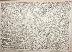
Añadir al carritoNo Binding. Condición: Very Good. Please note: the colour of the map is pale cream, and the printing is uniformly sharp, this has proved difficult to accurately reproduce in the accompanying photos. Mapped to a scale of 1:2,500 or 208 feet to 1 inch. Surveyed 1866-70. Revised 1914, originally published 1916, boundaries partly re…vised in 1919. Reprint codes: 25/44 and 50/46. So although the map was reprinted in 1946 the vast majority of the map shows the area from before the Second World War. Margins slightly discoloured and dust-marked. Price stamps, in ink, to margin. Map face bright with only slight toning. Sharp, clear printing. Full sheet measurements 104cm by 74 cm approx. Features include: the network of rails and yards making up this section of the Bricklayers Arms Branch Railway; part of the Surrey Canal with associated wharves; the area around Cobourg Road which has now been totally transformed. Area covered: northern part of New Church Road (SW); Henshaw Street (NW); part of Aspinden Road (NE); Gervase Street (SE). The map will be posted, rolled in a rigid tube. More details available on request. This is an original map, not a modern reproduction. (319fl41).
 Más imágenes
Editorial: The Ordnance Survey 1916
- Mapa
Librería: Morning Mist Books and Maps, Cirencester, Reino UnidoMorning Mist Books and Maps
Contactar con el vendedorVendedor de 5 estrellasCondición: Usado - Bueno
EUR 41,60
Envío por EUR 51,92Se envía de Reino Unido a Estados Unidos de AmericaCantidad disponible: 1 disponibles
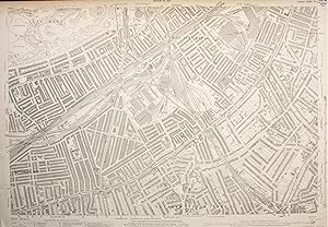
Añadir al carritoNo Binding. Condición: Very Good. Please note: the colour of the map is pale cream, and the printing is uniformly sharp, this has proved difficult to accurately reproduce in the accompanying photos. Mapped to a scale of 1:2,500 or 208 feet to 1 inch. Surveyed 1866-9. Revised 1913, published 1916, boundaries partly revised in 191…9. Margins slightly discoloured and dust-marked. Price stamps, in ink, to margin. Map face bright with only slight toning. Sharp, clear printing. Full sheet measurements 104cm by 74 cm approx. Features include: Camberwell New Road Station, King?s College Hospital, tramlines, railways. Area covered: northern part of Tasman Road (SW); part of Kenchester Street (NW); part of Lomond Grove (NE); north-eastern corner of Ruskin Park (SE). The map will be posted, rolled in a rigid tube. More details available on request. This is an original map, not a modern reproduction. (319fl40).
 Más imágenes
Editorial: The Ordnance Survey 1916
- Mapa
Librería: Morning Mist Books and Maps, Cirencester, Reino UnidoMorning Mist Books and Maps
Contactar con el vendedorVendedor de 5 estrellasCondición: Usado - Bueno
EUR 41,60
Envío por EUR 51,92Se envía de Reino Unido a Estados Unidos de AmericaCantidad disponible: 1 disponibles
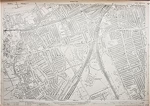
Añadir al carritoNo Binding. Condición: Very Good. Please note: the colour of the map is pale cream, and the printing is uniformly sharp, this has proved difficult to accurately reproduce in the accompanying photos. Mapped to a scale of 1:2,500 or 208 feet to 1 inch. Surveyed 1864-9. Revised 1913, published 1916, boundaries partly revised in 191…9. Margins slightly dust-marked and with the odd small tear to the upper margin. Price stamps, in ink, to margin. Map face bright with only slight toning. Sharp, clear printing. Full sheet measurements 104cm by 74 cm approx. Features include: the network of railways and associated works; Clapham Station; tram routes; boating lake in Battersea Park. Area covered: Eland Road (SW); Boating Lake(NW); Thorncroft Street(NE); Clapham Road Station (SE). The map will be posted, rolled in a rigid tube. More details available on request. This is an original map, not a modern reproduction. (319fl32).
 Más imágenes
Editorial: The Ordnance Survey 1934
- Mapa
Librería: Morning Mist Books and Maps, Cirencester, Reino UnidoMorning Mist Books and Maps
Contactar con el vendedorVendedor de 5 estrellasCondición: Usado - Bueno
EUR 47,54
Envío por EUR 51,92Se envía de Reino Unido a Estados Unidos de AmericaCantidad disponible: 1 disponibles
Añadir al carritoNo Binding. Condición: Very Good. Please note: the colour of the map is pale cream, and the printing is uniformly sharp, this has proved difficult to accurately reproduce in the accompanying photos. Mapped to a scale of 1:2,500 or 208 feet to 1 inch. Surveyed 1865-7. Revised 1913, published 1916, boundaries partly revised in 191…9. Later printing, published 1934 (with no stated later revision). Margins slightly dust-marked and slightly discoloured, along with a small tear and creasing to the lower left corner. Price stamps, in ink, to margin. Map face bright with only slight toning. Sharp, clear printing. Full sheet measurements 104cm by 74 cm approx. Features include: part of Clapham Junction, Royal Victoria Patriotic School, tramways, public buildings, riverside features east of the Wandle. Area covered: Garrett Lane (SW); mouth of River Wandle (NW); Lavender Gardens (NE); Blenkarne Road (SE). The map will be posted, rolled in a rigid tube. More details available on request. This is an original map, not a modern reproduction. (319fl21).


