mapping first world great de chasseaud peter (24 resultados)
Filtros de búsqueda
Tipo de artículo
- Todos los tipos de productos
- Libros (24)
- Revistas y publicaciones (No hay ningún otro resultado que coincida con este filtro.)
- Cómics (No hay ningún otro resultado que coincida con este filtro.)
- Partituras (No hay ningún otro resultado que coincida con este filtro.)
- Arte, grabados y pósters (No hay ningún otro resultado que coincida con este filtro.)
- Fotografías (No hay ningún otro resultado que coincida con este filtro.)
- Mapas (No hay ningún otro resultado que coincida con este filtro.)
- Manuscritos y coleccionismo de papel (No hay ningún otro resultado que coincida con este filtro.)
Condición Más información
- Nuevo (4)
- Como nuevo, Excelente o Muy bueno (5)
- Bueno o Aceptable (12)
- Regular o Pobre (No hay ningún otro resultado que coincida con este filtro.)
- Tal como se indica (3)
Encuadernación
Más atributos
- Primera edición (10)
- Firmado (No hay ningún otro resultado que coincida con este filtro.)
- Sobrecubierta (10)
- Con imágenes (5)
- No impresión bajo demanda (24)
Idioma (2)
Gastos de envío gratis
Ubicación del vendedor
Valoración de los vendedores
-
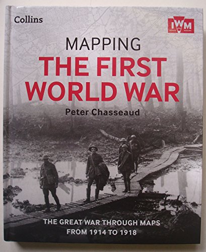
Mapping The First World War: The Great War Through Maps From 1914 - 1918
Librería: AwesomeBooks, Wallingford, Reino Unido
EUR 3,88
EUR 5,71 gastos de envío desde Reino Unido a Estados Unidos de AmericaCantidad disponible: 1 disponibles
Añadir al carritoHardcover. Condición: Very Good. Mapping The First World War: The Great War Through Maps From 1914 - 1918 This book is in very good condition and will be shipped within 24 hours of ordering. The cover may have some limited signs of wear but the pages are clean, intact and the spine remains undamaged. This book has clearly been well maintained and looked after thus far. Money back guarantee if you are not satisfied. See all our books here, order more than 1 book and get discounted shipping. .
-
Mapping The First World War: The Great War Through Maps From 1914 - 1918
Librería: MusicMagpie, Stockport, Reino Unido
EUR 5,20
EUR 6,29 gastos de envío desde Reino Unido a Estados Unidos de AmericaCantidad disponible: 1 disponibles
Añadir al carritoCondición: Very Good. 1750433612. 6/20/2025 3:33:32 PM.
-
Mapping The First World War: The Great War Through Maps From 1914-1918
Librería: Better World Books Ltd, Dunfermline, Reino Unido
EUR 6,38
EUR 9,16 gastos de envío desde Reino Unido a Estados Unidos de AmericaCantidad disponible: 1 disponibles
Añadir al carritoCondición: Very Good. Ships from the UK. Former library book; may include library markings. Used book that is in excellent condition. May show signs of wear or have minor defects.
-
Mapping the First World War : The Great War Through Maps From 1914-1918
Publicado por HarperCollins Publishers Limited, 2014
ISBN 10: 0007522207 ISBN 13: 9780007522200
Idioma: Inglés
Librería: Better World Books Ltd, Dunfermline, Reino Unido
Original o primera edición
EUR 6,38
EUR 9,16 gastos de envío desde Reino Unido a Estados Unidos de AmericaCantidad disponible: 1 disponibles
Añadir al carritoCondición: Very Good. First Edition. Ships from the UK. Former library book; may include library markings. Used book that is in excellent condition. May show signs of wear or have minor defects.
-
Mapping the First World War: The Great War Through Maps from 1914 to 1918
Librería: Greenworld Books, Arlington, TX, Estados Unidos de America
EUR 16,89
Gratis gastos de envío en Estados Unidos de AmericaCantidad disponible: 1 disponibles
Añadir al carritoCondición: good. Fast Free Shipping â" Good condition book with a firm cover and clean, readable pages. Shows normal use, including some light wear or limited notes highlighting, yet remains a dependable copy overall. Supplemental items like CDs or access codes may not be included.
-
Mapping the First World War: The Great War Through Maps from 1914 to 1918
Librería: Read'em, Reedley, CA, Estados Unidos de America
EUR 18,84
Gratis gastos de envío en Estados Unidos de AmericaCantidad disponible: 1 disponibles
Añadir al carritohardcover. Condición: Very Good. Included Map ~ Clean Unmarked Copy with Strong Binding that has been carefully read & shows Minimal Signs of Use ~ Page edges are clean with sharp corners ~ Cover is excellent having been protected by jacket ~ Jacket has good color with light rubbing wear.
-
Mapping the First World War - the Great War Through Maps from 1914 to 1918
Librería: Brit Books, Milton Keynes, Reino Unido
EUR 4,23
EUR 18,31 gastos de envío desde Reino Unido a Estados Unidos de AmericaCantidad disponible: 2 disponibles
Añadir al carritoHardcover. Condición: Used; Very Good. ***Simply Brit*** Welcome to our online used book store, where affordability meets great quality. Dive into a world of captivating reads without breaking the bank. We take pride in offering a wide selection of used books, from classics to hidden gems, ensuring there is something for every literary palate. All orders are shipped within 24 hours and our lightning fast-delivery within 48 hours coupled with our prompt customer service ensures a smooth journey from ordering to delivery. Discover the joy of reading with us, your trusted source for affordable books that do not compromise on quality.
-
Mapping the First World War. The Great War Through Maps From 1914 to 1918.
Publicado por Collins. Glasgow./Imperial War Museum. London., 2013
ISBN 10: 0007522207 ISBN 13: 9780007522200
Idioma: Inglés
Librería: Richard Peterson-Bookseller, Kingston, ON, Canada
Original o primera edición
EUR 19,45
EUR 11,64 gastos de envío desde Canada a Estados Unidos de AmericaCantidad disponible: 1 disponibles
Añadir al carritoHardcover. Condición: Fine. Estado de la sobrecubierta: Fine. 1st Edition. The book is bound in bright pictorial boards and both the book & the dust jacket are clean, bright & unmarked. Like new. States: "First edition 2013". This book weighs over 1 kilo so extra postage may be required.
-
Mapping The First World War: The Great War Through Maps From 1914 - 1918
Librería: WorldofBooks, Goring-By-Sea, WS, Reino Unido
EUR 25,24
EUR 6,41 gastos de envío desde Reino Unido a Estados Unidos de AmericaCantidad disponible: 1 disponibles
Añadir al carritoPaperback. Condición: Very Good. The book has been read, but is in excellent condition. Pages are intact and not marred by notes or highlighting. The spine remains undamaged.
-
Mapping the First World War - The Great War Through Maps from 1914 to 1918
Publicado por Collins in association with Imperial War Museums, London, 2013
ISBN 10: 000793596X ISBN 13: 9780007935963
Idioma: Inglés
Librería: Washburn Books, Pateley Bridge, Reino Unido
Original o primera edición
EUR 8,85
EUR 23,70 gastos de envío desde Reino Unido a Estados Unidos de AmericaCantidad disponible: 1 disponibles
Añadir al carritoIllustrated Boards/Green Spine. Condición: Near Fine. Estado de la sobrecubierta: Near Fine. 1st Edition. History of World War I shown through a collection of historical maps, commentary and photographs. 304pp with index, illustrated throughout in colour and black and white. Near fine copy with no inscriptions. Unclipped DJ near fine in clear protective cover. HEAVY BOOK, extra postage may be required for Air Mail shipping. Size: 4to - over 9¾ - 12" tall. Book.
-
Mapping the First World War: The Great War through maps from 1914-1918 (Imperial War Museum)
Librería: Greener Books, London, Reino Unido
EUR 15,64
EUR 18,31 gastos de envío desde Reino Unido a Estados Unidos de AmericaCantidad disponible: 1 disponibles
Añadir al carritoHardcover. Condición: Used; Very Good. **SHIPPED FROM UK** We believe you will be completely satisfied with our quick and reliable service. All orders are dispatched as swiftly as possible! Buy with confidence! Greener Books.
-
Mapping the First World War: The Great War Through Maps from 1914 to 1918
Librería: Toscana Books, AUSTIN, TX, Estados Unidos de America
EUR 36,13
EUR 3,69 gastos de envío en Estados Unidos de AmericaCantidad disponible: 1 disponibles
Añadir al carritoHardcover. Condición: new. Excellent Condition.Excels in customer satisfaction, prompt replies, and quality checks.
-
MAPPING THE FIRST WORLD WAR: The Great War through maps from 1914-1918 (Imperial War Museum)
Librería: Amazing Book Company, Liphook, Reino Unido
Original o primera edición
EUR 17,69
EUR 25,36 gastos de envío desde Reino Unido a Estados Unidos de AmericaCantidad disponible: 1 disponibles
Añadir al carritoHardcover. Condición: New. Estado de la sobrecubierta: New. 1st Edition. This copy is in new, unmarked condition bound in illustrated, laminated boards. This copy is bright, tight, white and square. The unclipped dust wrapper is in new condition. International postal rates are calculated on a book weighing 1 Kilo, in cases where the book weighs more than 1 Kilo increased postal rates will be quoted, where the book weighs less then postage will be reduced accordingly. Follow the conflict of World War I from 1914-1918 through a unique collection of historical maps, expert commentary, and photographs More than 150 maps, some previously unpublished, are used here to demonstrate how World War I was fought around the world. Small scale maps show country boundaries and occupied territories, large-scale maps cover the key battles and offensives on all fronts of the war, and trench maps show detailed positions of the front line. Maps from newspapers are also included, as well as battle planning maps and propaganda. Key offensives covered include the Battles of the Marne and Ypres; Tannenberg and the Eastern Front; Verdun and the Somme; the Gallipoli Campaign; Battle of Jutland; the Advances to Jerusalem, Damascus, and Baghdad; Vimy Ridge and Passchendaele; and German 1918 offensives and Allied counter-offensives. Along with the maps, key historical events are described, giving an illustrated history of the war from an expert historian. Ref DFC 3.
-
Mapping the First World War: The Great war through maps from 1914 to 1918
Librería: WeBuyBooks, Rossendale, LANCS, Reino Unido
EUR 21,94
EUR 21,41 gastos de envío desde Reino Unido a Estados Unidos de AmericaCantidad disponible: 1 disponibles
Añadir al carritoCondición: Good. Most items will be dispatched the same or the next working day. A copy that has been read but remains in clean condition. All of the pages are intact and the cover is intact and the spine may show signs of wear. The book may have minor markings which are not specifically mentioned.
-
Mapping the First World War: The Great War through maps from 1914-1918 (Imperial War Museum)
Librería: Dandy Lion Editions, Beare Green, Dorking, Reino Unido
Original o primera edición
EUR 23,59
EUR 22,90 gastos de envío desde Reino Unido a Estados Unidos de AmericaCantidad disponible: 1 disponibles
Añadir al carritoHardcover. Condición: Near Fine. Estado de la sobrecubierta: Near Fine. 1st Edition. Firmly bound and very carefully read. Both book & unclipped jacket are in excellent clean condition with some very minor bumping at the edges. No inscription or ownership markings. No tears or loss. Illustrated in b/w & colour with maps & photos etc. A heavy book.
-
Mapping the First World War. The Great War Through Maps from 1914 to 1918.
Publicado por Collins in Association with Imperial War Museums, London, 2013
ISBN 10: 0007522207 ISBN 13: 9780007522200
Idioma: Inglés
Librería: Lawrence Jones Books, Ashmore, QLD, Australia
Original o primera edición
EUR 26,09
EUR 21,46 gastos de envío desde Australia a Estados Unidos de AmericaCantidad disponible: 1 disponibles
Añadir al carritoHard Cover. Condición: Very Good. Estado de la sobrecubierta: Very Good. First Edition. HEAVY. 304pp, index, bw ills, maps, glossary, endpaper maps. Pictorial glossy boards in jacket. Very light edge wear to jacket. Follow the First World War through a fascinating collection of historical maps, expert commentary and photographs. Includes unique mapping from the archives of the Imperial War Museums. Size: 4to.
-
Mapping the First World War: The Great War Through Maps from 1914 to 1918
Publicado por HarperCollins UK/Imperial War Museum, London, 2014
ISBN 10: 0007522207 ISBN 13: 9780007522200
Idioma: Inglés
Librería: A Small Bookshop, ELMHURST, VIC, Australia
Original o primera edición
EUR 28,99
EUR 25,75 gastos de envío desde Australia a Estados Unidos de AmericaCantidad disponible: 1 disponibles
Añadir al carritoHardcover. Condición: Near Fine. Estado de la sobrecubierta: Near Fine. 1st Edition. DW: Minor creasing to head of spine only. 150 maps (small scale, large scale, trench and maps from newspapers, battle planning and programming) plus B&W photographs throughout. 27 x 23 cm. 304 pp. Heavy book may require extra postage.
-
Mapping the First World War: The Great War through maps from 1914-1918 (Imperial War Museum)
Librería: Anytime Books, London, Reino Unido
EUR 35,38
EUR 32,06 gastos de envío desde Reino Unido a Estados Unidos de AmericaCantidad disponible: 1 disponibles
Añadir al carritoLaminated Boards. Condición: Fine. Estado de la sobrecubierta: Fine. Magnificently illus. account. And well reviewed. pp.v.304. DW in archival sleeve.
-
Mapping the First World War: The Great War through maps from 1914-1918 (Imperial War Museum)
Librería: Revaluation Books, Exeter, Reino Unido
EUR 70,49
EUR 17,18 gastos de envío desde Reino Unido a Estados Unidos de AmericaCantidad disponible: 1 disponibles
Añadir al carritoHardcover. Condición: Brand New. 304 pages. 10.50x9.00x1.00 inches. In Stock.
-
Mapping The First World War: The Great War Through Maps From 1914 - 1918
Librería: Toscana Books, AUSTIN, TX, Estados Unidos de America
EUR 1.124,14
EUR 3,69 gastos de envío en Estados Unidos de AmericaCantidad disponible: 1 disponibles
Añadir al carritoHardcover. Condición: new. Excellent Condition.Excels in customer satisfaction, prompt replies, and quality checks.
-
Mapping The First World War - The Great War Through Maps From 1914 to 1918.
Año de publicación: 2003
Librería: Antikvariat Röde Orm, Göteborg, Suecia
EUR 18,85
EUR 22,00 gastos de envío desde Suecia a Estados Unidos de AmericaCantidad disponible: 1 disponibles
Añadir al carritoCollins & Imperial War Museums, Bishopbriggs & London 2003. First edition. Hardcover in publisher's decorated boards, with a matching dust jacket. 304 pgs. Richly illustrated with photographs and with over 150 maps. Text in English. The book is in very good condition.
-
Mapping the First World War : The Great War Through Maps from 1914 to 1918
Publicado por Collins / IWM Glasgow / London 2013, 2013
Librería: Andrew Barnes Books / Military Melbourne, Melbourne, VIC, Australia
Original o primera edición
EUR 41,02
EUR 17,17 gastos de envío desde Australia a Estados Unidos de AmericaCantidad disponible: 1 disponibles
Añadir al carrito1st edition dust jacket As New quarto 303pp., colour & b/w plates maps, bibliog., index, Follow the conflict of the World War 1 from 1914-1918 through a unique collection of historical maps, expert commentary and photographs. Published in association and including mapping from the archives of the Imperial War Museums. Over 150 maps demonstrating how the Great War was fought around the world. Types of maps featured: Small scale maps showing country boundaries and occupied territories, Large-scale maps covering the key battles and offensives on all fronts of the war, Trench maps showing detailed positions of the front line, Maps from newspapers, battle planning and propaganda Key offensives covered include: The Battles of the Marne and Ypres, Tannenberg and the Eastern Front, Verdun and the Somme, The Gallipoli Campaign, Battle of Jutland, The Advances to Jerusalem, Damascus and Baghdad, Vimy Ridge and Passchendaele, German 1918 offensives and Allied counter-offensives.
-
MAPPING THE FIRST WORLD WAR: THE GREAT WAR THROUGH MAPS FROM 1914 TO 1918
Publicado por Imperial War Museum, London, 2013
Librería: Camilla's Bookshop, Eastbourne, SX, Reino Unido
Original o primera edición
EUR 53,07
EUR 33,21 gastos de envío desde Reino Unido a Estados Unidos de AmericaCantidad disponible: 1 disponibles
Añadir al carritoHardcover. Condición: Very Good. Estado de la sobrecubierta: Very Good. First Edition. Bound in perfect pictorial cloth, with clear black and red titles to front board and spine, this 2013 hardcover First Edition, FirstImpression is VG in VG dustjacket (unclipped). 304pp with Introduction, 10 Chapters, Glossary, Further Reading. List of Maps & Aerial Photos (300+), and Index. Serious work of scholarship in VG condition. Size: 4to - over 9¾" - 12" tall.
-
Mapping the First World War: The Great War Through Maps from 1914 to 1918
Publicado por Collins / IWM Glasgow / London 2013, 2013
Librería: Andrew Barnes Books / Military Melbourne, Melbourne, VIC, Australia
Original o primera edición
EUR 45,97
EUR 17,17 gastos de envío desde Australia a Estados Unidos de AmericaCantidad disponible: 1 disponibles
Añadir al carrito1st edition dust jacket New Book quarto 303pp., colour & b/w plates maps, bibliog., index, Follow the conflict of the World War 1 from 1914-1918 through a unique collection of historical maps, expert commentary and photographs. Published in association and including mapping from the archives of the Imperial War Museums. Over 150 maps demonstrating how the Great War was fought around the world. Types of maps featured: Small scale maps showing country boundaries and occupied territories, Large-scale maps covering the key battles and offensives on all fronts of the war, Trench maps showing detailed positions of the front line, Maps from newspapers, battle planning and propaganda Key offensives covered include: The Battles of the Marne and Ypres, Tannenberg and the Eastern Front, Verdun and the Somme, The Gallipoli Campaign, Battle of Jutland, The Advances to Jerusalem, Damascus and Baghdad, Vimy Ridge and Passchendaele, German 1918 offensives and Allied counter-offensives.


