Importe total (1 artículo artículos):
Destino del pedido:

map de clark william (10 resultados)
Ir a los resultados principales
Filtros de búsqueda
Tipo de artículo
- Todos los tipos de productos
- Libros (9)
- Revistas y publicaciones (1)
- Cómics (No hay ningún otro resultado que coincida con este filtro.)
- Partituras (No hay ningún otro resultado que coincida con este filtro.)
- Arte, grabados y pósters (No hay ningún otro resultado que coincida con este filtro.)
- Fotografías (No hay ningún otro resultado que coincida con este filtro.)
- Mapas (No hay ningún otro resultado que coincida con este filtro.)
- Manuscritos y coleccionismo de papel (No hay ningún otro resultado que coincida con este filtro.)
Condición Más información
- Nuevo (No hay ningún otro resultado que coincida con este filtro.)
- Como nuevo, Excelente o Muy bueno (1)
- Bueno o Aceptable (7)
- Regular o Pobre (No hay ningún otro resultado que coincida con este filtro.)
- Tal como se indica (2)
Encuadernación
Más atributos
- Primera edición (2)
- Firmado (No hay ningún otro resultado que coincida con este filtro.)
- Sobrecubierta (No hay ningún otro resultado que coincida con este filtro.)
- Con imágenes (7)
- No impresión bajo demanda (10)
Idioma (2)
Gastos de envío gratis
Ubicación del vendedor
Valoración de los vendedores
-
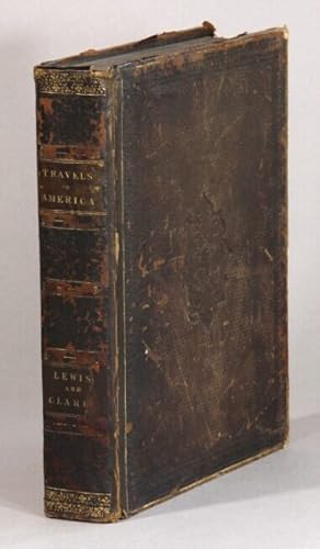
Off the Map: The Journals of Lewis and Clark
Librería: ThriftBooks-Atlanta, AUSTELL, GA, Estados Unidos de America
Calificación del vendedor: 5 de 5 estrellas

EUR 17,90
Gastos de envío gratis
Se envía dentro de Estados Unidos de AmericaCantidad disponible: 1 disponibles
Ańadir al carritoHardcover. Condición: Good. No Jacket. Tanner, Tim Ilustrador. Pages can have notes/highlighting. Spine may show signs of wear. ~ ThriftBooks: Read More, Spend Less.
-
![Imagen del vendedor de Canadian Gardening's Great Ideas For the Garden: Over 100 Easy and Creative Ways to give your garden the look you want. [ Fences and gates -- Garden structures -- Front yards -- Paths and steps -- Using plants for effect -- Container gardening -- Canada's hardiness zones map -- Resource material] a la venta por Joseph Valles - Books](https://pictures.abebooks.com/inventory/md/md31969869022.jpg)
Canadian Gardening's Great Ideas For the Garden: Over 100 Easy and Creative Ways to give your garden the look you want. [ Fences and gates -- Garden structures -- Front yards -- Paths and steps -- Using plants for effect -- Container gardening -- Canada's hardiness zones map -- Resource material]
Idioma: Inglés
Publicado por Penguin Studio, Toronto, c1996, 1996
ISBN 10: 014025708X ISBN 13: 9780140257083
Librería: Joseph Valles - Books, Stockbridge, GA, Estados Unidos de America
Calificación del vendedor: 5 de 5 estrellas
EUR 18,94
Envío por EUR 14,84
Se envía dentro de Estados Unidos de AmericaCantidad disponible: 1 disponibles
Ańadir al carritoSoft cover. Condición: Fine. 95 p. : col. ill. ; 28 cm. ; ISBN 9780140257083, 014025708X ; OCLC 35875848 ; LOC No SB453.3.C2P75 1996color photographic stiff paper wrapper ; "A Madison Press book." ; 'A graceful archway laden with climbing roses.a rustic twig gate that's easy to make.a fragrant thyme-covered walkway. Wonderful garden ideas highlight every page of this lavishly illustrated book created especially for the Canadian gardener. Evocative full-colour photographs and informative hand-on features invite you to transform or simply enhance your outdoor space with innovative plantings, stylish fences and pathways, romantic arbors and pergolas, versatile container gardens and much, much more. With dozens of practical tips on everything from pruning clematis and growing hardy roses to aging new clay pots, this book is an invaluable resource for every gardener in every region of Canada." ; Liz Primeau is renowned for her garden writing and regularly lectures on garden design at horticultural society meetings and garden shows. ; Contents: Fences and gates -- Garden structures -- Front yards -- Paths and steps -- Using plants for effect -- Container gardening -- Canada's hardiness zones map -- Resource material ; FINE. Book.
-

MAP OF BALTIMORE AND VICINITY
Publicado por Maryland Geological Survey, Maryland, 1904
Librería: Terra Firma Books, San Diego, CA, Estados Unidos de America
Calificación del vendedor: 5 de 5 estrellas
EUR 44,18
Envío por EUR 5,24
Se envía dentro de Estados Unidos de AmericaCantidad disponible: 1 disponibles
Ańadir al carritoHardcover. Condición: Good. This is a 110 year old map approx. 24x24" printed in color on paper, mounted on canvas, folds to 5.5 x 7." in green hardcover.Done in cooperation of US Geo. Survey. No name or writing. CLEAN! 115 Years Old!
-
GOLD DISTRICTS OF CALIFORNIA. [with Map in Rear Pocket]
Publicado por California Division of Mines and Geology, San Francisco, CA, 1970
Librería: Cornerstone Books, Santa Ana, CA, Estados Unidos de America
Calificación del vendedor: 5 de 5 estrellas
EUR 76,64
Envío por EUR 4,81
Se envía dentro de Estados Unidos de AmericaCantidad disponible: 1 disponibles
Ańadir al carritoCloth. Condición: Very Good. This work is Bulletin number 193 published by the California Division of Mines and Geology, and is an overall guide to the gold deposits in California including all of the known gold-bearing districts in the state. The book contains photographs, illustrations, maps, a general bibliography, a list of districts by counties, and an index of alternate district names; with large MAP IN REAR POCKET. The name of the former owner of the book is on the front pastedown and the FFEP; otherwise, this HARDCOVER copy is clean and solid. This is NOT an "on demand" printed book.
-
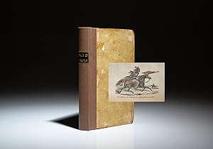
Tales Of Travels West Of The Mississippi; With A Map, And Numerous Engravings
Publicado por Gray and Bowen, Boston, 1830
Librería: The First Edition Rare Books, LLC, Cincinnati, OH, Estados Unidos de America
Miembro de asociación: ABAA ILAB IOBA MWABA
Calificación del vendedor: 5 de 5 estrellas
Original o primera edición
EUR 586,11
Envío por EUR 5,25
Se envía dentro de Estados Unidos de AmericaCantidad disponible: 1 disponibles
Ańadir al carritoBoards. Condición: Very good. First edition of Tales Of Travels West Of The Mississippi by Solomon Bell, published in 1830, the first juvenile book about the region west of the Mississippi and specifically, the Lewis and Clark Expedition. This copy is lacking the map. Ilustrador. First Edition. Twelvemo, xvi, 162pp. Publisher's original boards, modern brown cloth spine, title in gilt. Contemporary endpapers. Frontispiece portrait plus 42 individual illustrations, some colored. Prior ownership inscription on front free endpaper. Occasional toning and spotting throughout. Authored by Solomon Bell, the pseudonym for William Joseph Snelling. (Sabin 85429) (Howes S-739) (Graff 3875) (Literature Lewis & Clark, 6b, 225) All illustrations called for in The Literature of the Lewis and Clark Expedition are present. A nice example.
-
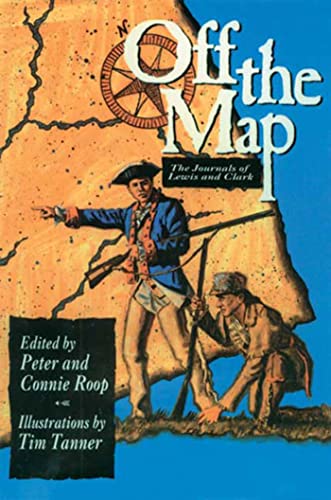
[Lewis & Clark's Official Account] A Map of Lewis and Clark's Track Across the Western Portion of North America, from the Mississippi to the Pacific Ocean. By Order of the Executive of the United States in 1804, 5 & 6. . . . [Complete with 3 volumes of Text:] Travels to the Source of the Missouri River and Across the American Continent to the Pacific Ocean. Performed by Order of the Government of the United States, in the Years 1804, 1805, and 1806].
Publicado por William Clark / Meriwether Lewis, 1815
Librería: Barry Lawrence Ruderman, La Jolla, CA, Estados Unidos de America
Miembro de asociación: ABAA ILAB
Calificación del vendedor: 5 de 5 estrellas
EUR 13.074,73
Envío por EUR 12,69
Se envía dentro de Estados Unidos de AmericaCantidad disponible: 1 disponibles
Ańadir al carritoHardcover. Condición: vg. The Single Most Important American Exploration and Discovery Map of the 19th Century.A very nice clean example of the 1815 London octavo edition of Lewis & Clark's official account, with the important foldi. Octavo. Three volumes. Contemporary speckled calf, expertly and uniformly rebacked in antique-style calf, raised bands, contrasting leather spine labels. Some edge rubbing, neatly restored corners. xxvi,[2],411; xii,434; xii,394 pages. Half title in vol. 2. Plus a total of 6 engraved maps (including the large folding map and 5 single-page maps). The large map is quite nice and clean (some splits at folds, with neat repairs to verso of sheet, no losses). The pages clean and free of foxing. Overall a very nice clean set in handsome matching 19th-century bindings. Armorial bookplate of Sir William Curtis, in each volume. In a single custom dark green felt-lined clamshell case, leather spine label. The Single Most Important American Exploration and Discovery Map of the 19th Century.A very nice clean example of the 1815 London octavo edition of Lewis & Clark's official account, with the important folding map of the Northwestern US, based upon William Clark's original manuscript map of the expedition. This is a mixed set, with volume 1 bearing the 1815 dated title page, while volumes 2 and 3 are dated 1817 (3rd edition). As the set is bound in matching contemporary bindings (speckled calf boards, with 19th-century armorial bookplate to each volume), it is very likely the three volumes have been together since they were issued. It should be noted that besides the date on the title page there is no difference between the 1815 and 1817 versions.Lewis & Clark's official account of the expedition is a cornerstone of any collection of Western Americana. The map, which is intended to illustrate the sum total of the expedition, is perhaps the single most important American exploration and discovery map of the 19th Century. It changed American mapping of the northwest by giving the first accurate depiction of the relationship of the sources of the Missouri, the sources of the Columbia, and the Rocky Mountains.This book is without question the most famous of all western travel narratives, describing the expedition to explore the newly acquired Louisiana Purchase, undertaken from 1804 to 1806 by ascending the Missouri River to its source, crossing the Rocky Mountains, and reaching the Pacific Ocean. In total, the expedition covered some eight thousand miles in slightly more than twenty-eight months. The expedition resulted in the first reliable information about much of the area which Lewis & Clark traversed, made contact with the Indian inhabitants as a prelude to the expansion of the fur trade, and advanced by a quantum leap the geographical knowledge of the continent.The present example of the map is dated April 28th, 1814, which Wagner identifies as being the date of printing on all 3 of the English editions. This is the English re-engraving and publication of the map originally issued in 1814 to accompany the first American edition of Lewis & Clark's History Of The Expedition Under The Command Of Captains Lewis And Clark, To The Sources Of The Missouri . . . , published in Philadelphia by Bradford & Inskeep. The Philadelphia edition of the map was copied by Samuel Lewis from William Clark's original drawing and was engraved by Samuel Harrison.While intended as an exact duplicate, there are some minor differences between the London and Philadelphia editions of the map. The London edition is a bit larger than the Philadelphia edition (per measurements in Wagner-Camp 13:1, 13:2 and 13:3). The London edition omits the inverted "V" symbols showing Indian settlements in the western portion of the map. Also, the old Route eastward from the Mahar Village area on the Missouri River toward Spirit Lake and the Portage to the Lake are omitted from the E. Book.
-
History of the expedition under the command of Captains Lewis and Clark, to the Sources of the Missouri Thence across the Rocky Mountains and Down the River Columbia to the Pacific Ocean, Performed During the Years 1804-5-6 [with map:] Map of Lewis and Clark's Track, Across the Western Portion of North America from the Mississippi to the Pacific Ocean
Publicado por Philadelphia,, 1814
Librería: Antiquariaat FORUM BV, Houten, Holanda
Miembro de asociación: ILAB NVVA
Calificación del vendedor: 5 de 5 estrellas
EUR 70.000,00
Envío por EUR 25,00
Se envía de Holanda a Estados Unidos de AmericaCantidad disponible: 1 disponibles
Ańadir al carrito2 volumes. First official edition of the account of the famous Lewis and Clarke expedition (1804-1806), complete with the very rare folding map, which "is gone from many if not most of the copies now extant" (Grolier). The importance of the work can hardly be overestimated. It is lauded as the most influential work concerning the exploration of the American West ever printed. The map, which was the first accurate map of the newly acquired Louisiana and filled in many of the areas that were left blank on earlier maps, is a cartographic landmark.The objective of the expedition undertaken by Meriwether Lewis (1774-1809) and William Clarke (1770-1838) was to explore the Rocky Mountains, find a way to the Pacific, discover the source of the Missouri River, and establish trading ties with the Natives. They were prompted by Thomas Jefferson, who had realised the importance of exploring the area. Lewis and Clark were the first to travel overland to the Pacific Ocean and back. They brought back a wealth of new information about the geography, natural history, and the many Native tribes of the American West. Numerous species of birds and plants hitherto unknown to science were discovered (e.g. Lewis' Woodpecker, Lewis's Syringa etc.). The explorers traversed, moreover, through Louisiana, a territory annexed to the United States just prior to the start of the expedition (1803), and then still as little known as the interior of Africa.The work is an account of the expedition, based on the journals of Lewis and Clark themselves. The map and plates show the tracks of the expedition, the ancient fortification and the Great Falls of the Missouri River, the Great and Lower Falls, as well as the Mouth of Colombia River. The account was only published eight years after the expedition. Lewis had intended to edit his journals for publication as soon as possible, but his other duties as well as his untimely death in 1809 prevented this. Clark then asked for help and the journals were edited by Nicholas Biddle and Paul Allen. The work was finally printed in an edition of 2000 copies in Philadelphia in 1814, but after deduction of defective and missing copies, only 1417 went on sale. Many of them lacked the map, as it was more expensive to include it. The work was initially not very successful, as interest in the expedition had already waned. Lewis and Clark were even mostly forgotten later in the 19th century. This changed when their journals were rediscovered and published in 1901. Their work was then more thoroughly researched and has since been recognised as the most important exploration of the North American continent.The edges and corners of the boards are somewhat scuffed, the joints are slightly weakened. Foxed throughout as usual, the folding map has been reinforced with Japanese paper on the verso, wich has also restored a diagonal tear, a small triangular loss at the top of the map has been resotred in facsimile, the first quire of volume 1 has been restored in the gutter, a small loss at the head of the title page in volume two has been restored, small tears in the margins of a few other leaves throughout have also been restored. Otherwise in good condition.l Church 1309; Hill 1017; Howes L317; Grolier, One hundred influential American books, 30; Printing and the Mind of Man 272; Sabin 855 and 40828; Streeter, Americana Beginnings 52; Streeter Sale, 1777; cf. Thorp, D., An American journey: Lewis & Clark. Modern gold-tooled half calf over cloth-covered boards, faux raised bands to spine, with a red morocco title-label lettered in gold on either spine, further with the volume numbers and place and date of publication lettered in gold on the spine. With a large folding engraved map, and 5 full-page engraved charts. Pages: XXVIII, 470, [2 blank]; IX, [1], 522 pp.
-
Travels to the source of the Missouri River and across the American continent to the Pacific Ocean : performed by order of the Government of the United States, in the years 1804, 1805, and 1806. By Capitains Lewis and Clarke. Published from the official report, and illustrated by a map of the route, and other maps. First edition.
Publicado por London: Printed For Longman, Hurst , Rees, Orme and Brown., Paternoster-Row, 1814, 1814
Librería: Wittenborn Art Books, San Francisco, CA, Estados Unidos de America
Calificación del vendedor: 5 de 5 estrellas
Original o primera edición
EUR 11.045,89
Envío por EUR 8,75
Se envía dentro de Estados Unidos de AmericaCantidad disponible: 1 disponibles
Ańadir al carritoCondición: Good. 4to. 22.5 x 29cm. xxiv, 663 , [1] pages; 4 map plates hors texte (one large folding). Page [664} is the publisher's catalogue .Contemporary boards with later linen spine and label; endpapers renewed, some offsetting present on map and plates, 2 leaves with closed tear.OCLC Number / Unique Identifier:4910831; Wright Howes, 317; Field 929; Howes L-317; Literature of Lewis & Clark 5A.2; Streeter 3128;.The controversial Louisiana Purchase in 1803 - whereby the United States purchased the territory of Louisiana (comprising a stretch of land from today's Montana to Louisiana with Colorado to the West and Missouri to the East) from the French - nearly doubled the size of the country. The cost of the transaction was $15,000,000, around $18 per square mile. Control of the entire area was taken over by the United States, including large areas of the country which was inhabited - and managed - by Native Americans, who had never themselves ceded the land. Following the Purchase, President Thomas Jefferson commissioned an expedition to explore the territory and report back in as much detail as possible. A primary aim was to find a new travel route across the country, ensuring an American presence in the area before other colonial powers took advantage of the area and tried to establish their own footholds. The Lewis and Clark Expedition - alternatively known as the Corps of Discovery Expedition - set out from Camp Dubois on the 14th May 1804, crossing the Continental Divide, eventually reaching St. Louis, Missouri, in 1806. They were famously assisted in interpretation and interactions with local tribes by Sacagawea, a Lemni Shoshone woman who accompanied the expedition.The Lewis and Clark Expedition introduced the United States government to various Native American tribes and how trade with them could be promoted, alongside advising on the viability of the path they followed. Various botanical and zoological specimens were returned to the East Coast, including corn, or maize, grown by Thomas Jefferson at Monticello. It took nearly 10 years for Lewis and Clark to publish their journals, first in Philadelphia in octavo format in 1814 as History of the Expedition under the Command of Captain Lewis and Clark, to the Sources of the Missouri, thence across the Rocky Mountains and down the River Colombia to the Pacific Ocean. Here we find the first British edition, including Neele's highly important folding map, showing the expedition route.
-

Gold Districts of California, Bulletin 193, Map Included, 5th Printing
Publicado por California Division of Mines and Geology, 1980
Librería: MIR, Henderson, NV, Estados Unidos de America
Calificación del vendedor: 5 de 5 estrellas
Revista / Publicación
EUR 180,34
Envío por EUR 5,21
Se envía dentro de Estados Unidos de AmericaCantidad disponible: 1 disponibles
Ańadir al carritoCondición: Good. Minor wear to the corners/edges. Stains, smudges, and scratches to the cover. Old price written on the first page. Stok image shown.
-
Travels to the source of the Missouri River and across the American continent to the Pacific Ocean. Performed by order of the government of the United States, in the years 1804, 1805, and 1806. By Captains Lewis and Clarke (sic). Published from the official report, and illustrated by a map of the route, and other maps
Publicado por printed for Longman, Hurst, Rees, Orme, and Brown, London, 1814
Librería: Rulon-Miller Books (ABAA / ILAB), St. Paul, MN, Estados Unidos de America
Miembro de asociación: ABAA ILAB RMABA
Calificación del vendedor: 5 de 5 estrellas
EUR 16.906,98
Envío por EUR 10,51
Se envía dentro de Estados Unidos de AmericaCantidad disponible: 1 disponibles
Ańadir al carritoFirst English edition and first quarto edition of Lewis and Clark's famous account, 4to, pp. xxiv, 663, [1] ads; large folding frontispiece map (one or two short splits at folds), 5 engraved maps on 3 sheets, small, elongated hole (? paper flaw) in lower outer corner of the half title, slightly later full diced russia with an early rebacking, neatly preserving the remains of an earlier spine which is laid down, spine darkened, extremities worn and peeling, the whole somewhat scuffed and rubbed, otherwise a good, sound copy. The "definitive account of the most important exploration of the North American continent" (Wagner-Camp). Field 929; Howes L-317; Literature of Lewis & Clark 5A.2; Streeter 3128; Wagner-Camp 13:2.

![Imagen del vendedor de [Lewis & Clark's Official Account] A Map of Lewis and Clark's Track Across the Western Portion of North America, from the Mississippi to the Pacific Ocean. By Order of the Executive of the United States in 1804, 5 & 6. . . . [Complete with 3 volumes of Text:] Travels to the Source of the Missouri River and Across the American Continent to the Pacific Ocean. Performed by Order of the Government of the United States, in the Years 1804, 1805, and 1806]. a la venta por Barry Lawrence Ruderman](https://pictures.abebooks.com/inventory/md/md32458084494.jpg)
![Imagen del vendedor de History of the expedition under the command of Captains Lewis and Clark, to the Sources of the Missouri Thence across the Rocky Mountains and Down the River Columbia to the Pacific Ocean, Performed During the Years 1804-5-6 [with map:] Map of Lewis and Clark's Track, Across the Western Portion of North America from the Mississippi to the Pacific Ocean a la venta por Antiquariaat FORUM BV](https://pictures.abebooks.com/inventory/md/md32429732568.jpg)