
Importe total (1 artículo artículos):
Destino del pedido:

map quebec counties de augustus mitchell (17 resultados)
Ir a los resultados principales
Filtros de búsqueda
Tipo de artículo
- Todos los tipos de productos
- Libros (14)
- Revistas y publicaciones (No hay ningún otro resultado que coincida con este filtro.)
- Cómics (No hay ningún otro resultado que coincida con este filtro.)
- Partituras (No hay ningún otro resultado que coincida con este filtro.)
- Arte, grabados y pósters (1)
- Fotografías (No hay ningún otro resultado que coincida con este filtro.)
- Mapas (2)
- Manuscritos y coleccionismo de papel (No hay ningún otro resultado que coincida con este filtro.)
Condición Más información
- Nuevo (No hay ningún otro resultado que coincida con este filtro.)
- Como nuevo, Excelente o Muy bueno (No hay ningún otro resultado que coincida con este filtro.)
- Bueno o Aceptable (3)
- Regular o Pobre (No hay ningún otro resultado que coincida con este filtro.)
- Tal como se indica (14)
Encuadernación
- Todas
- Tapa dura (No hay ningún otro resultado que coincida con este filtro.)
- Tapa blanda (1)
Más atributos
- Primera edición (No hay ningún otro resultado que coincida con este filtro.)
- Firmado (No hay ningún otro resultado que coincida con este filtro.)
- Sobrecubierta (No hay ningún otro resultado que coincida con este filtro.)
- Con imágenes (15)
- No impresión bajo demanda (17)
Idioma (1)
Precio
- Cualquier precio
- Menos de EUR 20 (No hay ningún otro resultado que coincida con este filtro.)
- EUR 20 a EUR 45
- Más de EUR 45
Gastos de envío gratis
Ubicación del vendedor
Valoración de los vendedores
-
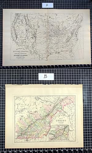
1894 Original Map: RAILROAD MAP OF THE UNTITED STATES / MAP OF QUEBEC IN COUNTIES
Publicado por Chicago : John E. Potter & Company, 1894
Librería: CorgiPack, Fulton, NY, Estados Unidos de America
Calificación del vendedor: 4 de 5 estrellas

Mapa
EUR 24,32
Gastos de envío gratis
Se envía dentro de Estados Unidos de AmericaCantidad disponible: 1 disponibles
Ańadir al carritoMap. Condición: Very Good. Original lithograph leaf from John E. Potter and Company's, "The New Family Atlas." The Quebec map is hand-colored. Please refer to photo for condition. PLEASE NOTE: If two images are shown they represent the obverse and reverse of the same leaf--not two separate leaves. Overall dimensions approx. 26" x 15.25". This item will be shipped flat.
-

Map of Quebec in Counties (1867)
Publicado por District Court East Pennsylvania, USA, 1867
Librería: Maynard & Bradley, Leicester, Reino Unido
Calificación del vendedor: 5 de 5 estrellas

EUR 46,04
Envío por EUR 25,48
Se envía de Reino Unido a Estados Unidos de AmericaCantidad disponible: 1 disponibles
Ańadir al carritoSoftcover. Condición: Very Good. c.1867. A well-preserved map, lightly toned commensurate with age, but bearing only a few minor nicks and tears to margins, with no significant damage to the print itself, and colouring remaining clear and attractive. Some marginal thumb marks and nicks, but no major marks to the print itself. Why on Amazon do most sellers not describe their actual book? Buy with confidence and support a genuine Independent Bricks & Mortar Real Bookshop. We are Maynard & Bradley CAMBO & PBFA(now lapsed) members here in Leicester City Centre. Size: 360 x 300 mm. 1 pages. Item Type: Book. Quantity Available: 1. Shipped Weight: Under 500 grams. Category: Geography & Maps; Britain/UK; 19th century; Pictures of this item not already displayed here available upon request. Inventory No: 18658.
-

Map of Quebec in Counties
Ańo de publicación: 1885
Librería: Art Source International Inc., Boulder, CO, Estados Unidos de America
Calificación del vendedor: 5 de 5 estrellas
EUR 40,61
Envío por EUR 14,02
Se envía dentro de Estados Unidos de AmericaCantidad disponible: 3 disponibles
Ańadir al carritoThis map was made by S. Augustus Mitchell for "Mitchells New General Atlas" published in 1885, by WM. M. Bradley & Co. The well maintained maps in this atlas feature Mitchell's characteristic pastel coloring and abundant details of geographical features. Quebec in counties, with an inset map of the environs of Montreal is illustrated. Details include the names of counties, cities, towns, transportation routes, mountain ranges, rivers and lakes. These 1885 maps offer a fascinating perspective of areas that have since undergone significant growth and change, in addition to their value as great examples of Mitchell's work. This map measures 12 inches by 9 inches.
-

Map of Quebec in Counties
Ańo de publicación: 1887
Librería: Art Source International Inc., Boulder, CO, Estados Unidos de America
Calificación del vendedor: 5 de 5 estrellas
EUR 40,61
Envío por EUR 14,02
Se envía dentro de Estados Unidos de AmericaCantidad disponible: 2 disponibles
Ańadir al carritoThis map was made by S. Augustus Mitchell for "Mitchell's New General Atlas" published in 1887. The well maintained maps in this atlas feature Mitchell's characteristic pastel coloring and abundant details of geographical features. Quebec is illustrated on this map with an inset showing the environs of Montreal at a greater scale than the main map. Details include the names of counties, important towns, rivers, lakes, and railroads. Counties are distinguished by color. These 1887 maps offer a fascinating perspective of areas that have since undergone significant growth and change, in addition to their value as great examples of Mitchell's work. This map measures 13.25 inches by 10.5 inches.
-

Map of Quebec in Counties
Ańo de publicación: 1872
Librería: Art Source International Inc., Boulder, CO, Estados Unidos de America
Calificación del vendedor: 5 de 5 estrellas
EUR 45,12
Envío por EUR 14,02
Se envía dentro de Estados Unidos de AmericaCantidad disponible: 3 disponibles
Ańadir al carritoThis map was made my S. Augustus Mitchell in 1872. The traditional ivy border, and hand coloring make this map beautiful. This map illustrates Quebec in counties distinguised by pastel coloring. An inset map of the environs of Montreal. Topographical features, cities, towns and transportation routes are dipicted in detail as well. This map measures 11 inches by 9 inches.
-

Map of Quebec in Counties (with an inset map of the Environs of Montreal)
Ańo de publicación: 1888
Librería: Art Source International Inc., Boulder, CO, Estados Unidos de America
Calificación del vendedor: 5 de 5 estrellas
EUR 45,12
Envío por EUR 14,02
Se envía dentro de Estados Unidos de AmericaCantidad disponible: 2 disponibles
Ańadir al carritoThis map of Quebec (with an inset map of the Environs of Montreal) was made by S. Augustus Mitchell for "Mitchells New General Atlas" published in 1888, by WM. M. Bradley & Co. The well maintained maps in this atlas feature Mitchell's characteristic pastel coloring and abundant details of geographical features. Details include the names of counties, cities, towns, transportation routes, mountain ranges, rivers and lakes. These 1888 maps offer a fascinating perspective of areas that have since undergone significant growth and change, in addition to their value as great examples of Mitchell's work. This map measures 13.5 inches by 10.75 inches.
-

Map of Quebec in Counties
Ańo de publicación: 1877
Librería: Art Source International Inc., Boulder, CO, Estados Unidos de America
Calificación del vendedor: 5 de 5 estrellas
EUR 49,64
Envío por EUR 14,02
Se envía dentro de Estados Unidos de AmericaCantidad disponible: 2 disponibles
Ańadir al carritoThis hand colored map was made for "Mitchells New General Atlas" published in 1877 by S. Augustus Mitchell. Quebec is illustrated on this map. The environs of Montreal are shown in an inset. Counties are highlighted by color. Other details include the names of counties and important cities, major roads, rivers, and lakes. This map measures 13.5 inches by 10.5 inches.
-

Map of Quebec in Counties
Ańo de publicación: 1883
Librería: Art Source International Inc., Boulder, CO, Estados Unidos de America
Calificación del vendedor: 5 de 5 estrellas
EUR 49,64
Envío por EUR 14,02
Se envía dentro de Estados Unidos de AmericaCantidad disponible: 1 disponibles
Ańadir al carritoThis map came from Mitchells New General Atlas, 1883.The traditional ivy border, and hand coloring make this map beautiful.Very Frameable. Has inset map of Montreal. This map measures 13.5 inches by 10.5 inches.
-

Map of Quebec in Counties; Environs of Montreal
Ańo de publicación: 1879
Librería: Art Source International Inc., Boulder, CO, Estados Unidos de America
Calificación del vendedor: 5 de 5 estrellas
EUR 49,64
Envío por EUR 14,02
Se envía dentro de Estados Unidos de AmericaCantidad disponible: 1 disponibles
Ańadir al carritoThis map of Quebec was produced by Augustus Mitchell in 1879 for his New General Atlas. Highlights of this map are Mitchells traditional grapevine border, characteristic pastel coloring and abundant details of geographical features. This 1879 map offers a fascinating perspective of areas that have since undergone significant growth and change, in addition to the value as great examples of Mitchell's classic map-making style. This map measures 13.5 inches by 11 inches.
-

Map of Quebec in Counties
Ańo de publicación: 1884
Librería: Art Source International Inc., Boulder, CO, Estados Unidos de America
Calificación del vendedor: 5 de 5 estrellas
EUR 54,15
Envío por EUR 14,02
Se envía dentro de Estados Unidos de AmericaCantidad disponible: 2 disponibles
Ańadir al carritoThis map was made by S. Augustus Mitchell for "Mitchells New General Atlas" published in 1884, by WM. M. Bradley & Co. The well maintained maps in this atlas feature Mitchell's characteristic pastel coloring and abundant geographical features. Details include the names of countries, regions, cities, towns, transportation routes, rivers, lakes, and mountain ranges. Regions are distinguished by color. These 1884 maps offer a fascinating perspective of areas that have since undergone significant growth and change, in addition to their value as great examples of Mitchell's work. This map measures 13.25 inches by 10.5 inches.
-

Map of Quebec in Counties
Ańo de publicación: 1878
Librería: Art Source International Inc., Boulder, CO, Estados Unidos de America
Calificación del vendedor: 5 de 5 estrellas
EUR 58,66
Envío por EUR 14,02
Se envía dentro de Estados Unidos de AmericaCantidad disponible: 3 disponibles
Ańadir al carritoThis map was produced by Augustus Mitchell in 1878 for his New General Atlas. Highlights of this map are Mitchells traditional grapevine border, characteristic pastel coloring and abundant details of geographical features. Quebec is beautifully illustrated on this map with nice inset map of "Environs of Montreal". Towns and surrounding neighborhoods are distinguished by color. This 1878 map offers a fascinating perspective of areas that have since undergone significant growth and change, in addition to the value as great examples of Mitchell's classic mapmaking style. This map measures 13.33 inches by 10.5 inches.
-

Map of Quebec in Counties
Ańo de publicación: 1881
Librería: Art Source International Inc., Boulder, CO, Estados Unidos de America
Calificación del vendedor: 5 de 5 estrellas
EUR 58,66
Envío por EUR 14,02
Se envía dentro de Estados Unidos de AmericaCantidad disponible: 3 disponibles
Ańadir al carritoThis map came from Mitchells New General Atlas, 1881.This map shows major railroads, water bodies, and towns.Decorative ivy border, and nice colorful detail. Would looknice framed! Has detailed inset map of Montreal. This map measures 10.5 inches by 13.5 inches.
-

Map of Quebec in Counties
Ańo de publicación: 1870
Librería: Art Source International Inc., Boulder, CO, Estados Unidos de America
Calificación del vendedor: 5 de 5 estrellas
EUR 58,66
Envío por EUR 14,02
Se envía dentro de Estados Unidos de AmericaCantidad disponible: 2 disponibles
Ańadir al carritoS. Augustus Mitchell Jr. made this hand colored map for Mitchells New General Atlas in 1870. Quebec is illustrated on this map. Regions are distinguished by bright pastel colors. Lakes, mountains, rivers, important cities and countries are identified. An inset shows the environs of Quebec. This map measures 13.25 inches by 10.75 inches.
-

Map of the Quebec in Counties
Ańo de publicación: 1874
Librería: Art Source International Inc., Boulder, CO, Estados Unidos de America
Calificación del vendedor: 5 de 5 estrellas
EUR 58,66
Envío por EUR 14,02
Se envía dentro de Estados Unidos de AmericaCantidad disponible: 2 disponibles
Ańadir al carritoThis map was produced by S. Augustus Mitchell in 1874 for his New General Atlas. This map shows Mitchell's traditional grape vine border, characteristic pastel coloring and abundant details of geographical features. The Provenance of Quebec is illustrated on this map. Counties are distinguished by color. These 1874 maps offer a fascinating perspective of areas that have since undergone significant growth and change, in addition to their value as great examples of Mitchell's work This map measures 14 inches by 11 inches.
-

Map of Quebec in Counties. Environs of Montreal.
Publicado por S. Augustus Mitchell, Philadelphia, 1877
Librería: Alexandre Antique Prints, Maps & Books, Toronto, ON, Canada
Miembro de asociación: ABAC ILAB
Calificación del vendedor: 4 de 5 estrellas
Mapa
EUR 112,81
Envío por EUR 5,26
Se envía de Canada a Estados Unidos de AmericaCantidad disponible: 1 disponibles
Ańadir al carritoCondición: Very Good. An attractive Map of Quebec, showing its counties and the St. Lawrence River. With an inset map showing the Environs of Montreal., Size : 270x339 (mm), 10.63x13.35 (Inches), Printed in Color with Some Hand Coloring.
-
Map of Quebec in Counties.
Publicado por Philadelphia,, 1867
Librería: libreria antiquaria perini Sas di Perini, Verona, VR, Italia
Miembro de asociación: ALAI ILAB
Calificación del vendedor: 5 de 5 estrellas
Arte / Grabado / Póster
EUR 100,00
Envío por EUR 40,00
Se envía de Italia a Estados Unidos de AmericaCantidad disponible: 1 disponibles
Ańadir al carritoIncisione in acciaio, dipinta d'epoca a tutto campo, 290x355. Carta del territorio tutto inquadrato entro bordura decorativa con vitigno intrecciato. Buon esemplare ben conservato, minime macchie marginali e numero 10 con lievi aloni agli angoli inferiori e antica numerazione a inchiostro all' angolo inferiore di destra.
-

Map of Quebec in Counties
Ańo de publicación: 1868
Librería: Art Source International Inc., Boulder, CO, Estados Unidos de America
Calificación del vendedor: 5 de 5 estrellas
EUR 67,68
Envío por EUR 14,02
Se envía dentro de Estados Unidos de AmericaCantidad disponible: 2 disponibles
Ańadir al carritoThis hand colored map was made for "Mitchells New General Atlas" published in 1868 by S. Augustus Mitchell, Jr. Quebec is illustrated on this map. An inset shows Montreal at a greater scale than the main map. Counties are distinguished by color. Other details include the names of counties, and important cities, railroads, major roads,and rivers. The pastel coloring in this atlas is very beautiful and more muted than typical. This map measures 13.5 inches by 10.75 inches.
