
Importe total (1 artículo artículos):
Destino del pedido:

map germany best authorities (5 resultados)
Ir a los resultados principales
Filtros de búsqueda
Tipo de artículo
- Todos los tipos de productos
- Libros (3)
- Revistas y publicaciones (No hay ningún otro resultado que coincida con este filtro.)
- Cómics (No hay ningún otro resultado que coincida con este filtro.)
- Partituras (No hay ningún otro resultado que coincida con este filtro.)
- Arte, grabados y pósters (No hay ningún otro resultado que coincida con este filtro.)
- Fotografías (No hay ningún otro resultado que coincida con este filtro.)
- Mapas (2)
- Manuscritos y coleccionismo de papel (No hay ningún otro resultado que coincida con este filtro.)
Condición Más información
- Nuevo (No hay ningún otro resultado que coincida con este filtro.)
- Como nuevo, Excelente o Muy bueno (No hay ningún otro resultado que coincida con este filtro.)
- Bueno o Aceptable (1)
- Regular o Pobre (No hay ningún otro resultado que coincida con este filtro.)
- Tal como se indica (4)
Encuadernación
- Todas
- Tapa dura (No hay ningún otro resultado que coincida con este filtro.)
- Tapa blanda (No hay ningún otro resultado que coincida con este filtro.)
Más atributos
- Primera edición (1)
- Firmado (No hay ningún otro resultado que coincida con este filtro.)
- Sobrecubierta (No hay ningún otro resultado que coincida con este filtro.)
- Con imágenes (5)
- No impresión bajo demanda (5)
Idioma (2)
Precio
- Cualquier precio
- Menos de EUR 20 (No hay ningún otro resultado que coincida con este filtro.)
- EUR 20 a EUR 45 (No hay ningún otro resultado que coincida con este filtro.)
- Más de EUR 45
Gastos de envío gratis
- Envío gratis a Estados Unidos de America (No hay ningún otro resultado que coincida con este filtro.)
Ubicación del vendedor
Valoración de los vendedores
-

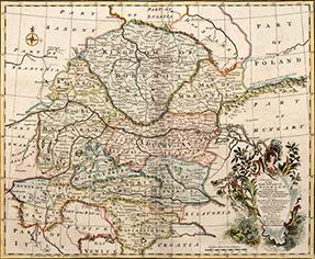
Map of Germany from the Best Authorities
Idioma: Inglés
Ańo de publicación: 1803
Librería: Old Paper Old Ink, Murray, KY, Estados Unidos de America
Calificación del vendedor: 5 de 5 estrellas

Mapa
EUR 48,72
Envío por EUR 3,87
Se envía dentro de Estados Unidos de AmericaCantidad disponible: 1 disponibles
Ańadir al carritoNo Binding. Condición: Very Good. Neele. Map of Germany from the Best Authorities. 1803. *** A copper plate engraved map with outline hand coloring. Depicted are cities and towns along with natural features such as mountains, rivers, and lakes. With a nice decorative cartouche in the lower left corner. *** Clear, clean impression with bright colors, blank verso. Two vertical folds, as issued. *** The sheet is approx. 8.25 inches high by 10 inches. The image is 7.5 inches high by 9.5 inches.
-

A New and Accurate Map of Germany divided into circles from the best authorities.
Publicado por Edinburgh: 1801, 1801
Librería: Peter Harrington. ABA/ ILAB., London, Reino Unido
Miembro de asociación: ABA ILAB PBFA
Calificación del vendedor: 5 de 5 estrellas
EUR 89,31
Envío por EUR 25,44
Se envía de Reino Unido a Estados Unidos de AmericaCantidad disponible: 1 disponibles
Ańadir al carritoA clear map of Germany, Austria, the Central States, the Netherlands and the United Provinces. Thomas Brown was an Edinburgh Bookseller and Publisher of the late 18th and early 19th century. The maps from his General Atlas are on the cusp between the decorative maps of the eighteenth century and the more accurate maps of the nineteenth century Size: 322 x 407 mm. Copper engraving. Later colour. Fine condition.
-
A CORRECT MAP of the South East part of GERMANY. Including the Electorate of Bavaria, Arch.Bishopk. of Salzburg & Kingdom of Bohemia. ALSO, the QUEEN of HUNGARY'S Hereditary Dominions in the Empire; vizt. Austria, Moravia, Styria, Carinthia, Carniola, Trent, Tirol & c. Drawn from the best Authorities, and adjusted by Astronl. Observatns. By Emanl. Bowen
Publicado por London. c.1745, 1745
Librería: Peter Harrington. ABA/ ILAB., London, Reino Unido
Miembro de asociación: ABA ILAB PBFA
Calificación del vendedor: 5 de 5 estrellas
EUR 142,90
Envío por EUR 25,44
Se envía de Reino Unido a Estados Unidos de AmericaCantidad disponible: 1 disponibles
Ańadir al carritoMap of Bavaria, Bohemia and Austria. Ornamental cartouche at lower right. Emmanuel Bowen was one of the leading English mapmakers of the eighteenth-century, and was cartographer to both the French and English Royal Courts. From Mr Tindal's Continuation of Rapin's History. Copper engraving. Very good condition; good margins; light stain along the centrefold; some offsetting. Hand coloured. Size: 43 x 36 cm.
-

An Accurate Map of Great Britain, France & Ireland, with Part of Spain, Germany, Denmark &c. Showing at One View the True Bearing and Horizontal Distance, of any Place within 700 Miles of London; Drawn from the Best Authorities
Publicado por Laurie & Whittle, London, 1794
Librería: Argosy Book Store, ABAA, ILAB, New York, NY, Estados Unidos de America
Miembro de asociación: ABAA ILAB
Calificación del vendedor: 5 de 5 estrellas
EUR 709,25
Envío por EUR 5,16
Se envía dentro de Estados Unidos de AmericaCantidad disponible: 1 disponibles
Ańadir al carritounbound. Map. Engraving with hand coloring. Image measures 20 1/8" x 20 1/8". This unusual yet beautiful hemispherical projection of Western Europe is centered on London, such that the compass bearings are drawn as straight lines. The map has a 700 mile radius that encompasses the Faroe Islands, Bergen in Norway, Munich in Germany, Parma in Italy, the northern and eastern coasts Spain, including parts of Majorca and Minorca. Countries, counties, and cities are all labeled. The map also features lovely pastel hand-coloring, with England colored a vibrant pink that stands out markedly against pale green France. In fact, the latter country seems almost to fade into the water, another possible element of the map's colonial-era image of British supremacy. An annotation in the lower left corner attests to the map's accuracy. The map is in good condition with very minor tears and wear to the edges of the sheet, not affecting the image. Small stain on the bottom border and very minor foxing. Robert Laurie (c. 1755 - 1836) and James Whittle (1757-1818) were London-based map and atlas publishers active in the late 18th and early 19th century. Their firm combined Laurie's engraving skills with Whittle's social contacts and print sales experience. Together, they published numerous maps and atlases, often enlisting prominent cartographers such as Kitchin, Faden, Jefferys and others to update and modify their plates. This unusual map is a fascinating example of their work.
-

A New Map of Germany, divided into Circles, from the Best Authorities.
Ańo de publicación: 1794
Librería: Geographicus Rare Antique Maps, Brooklyn, NY, Estados Unidos de America
Miembro de asociación: ABAA ESA ILAB
Calificación del vendedor: 3 de 5 estrellas

Mapa Original o primera edición
EUR 148,94
Envío por EUR 14,63
Se envía dentro de Estados Unidos de AmericaCantidad disponible: 1 disponibles
Ańadir al carritoVery good. Minor marginal soiling. Original platemark visible. Blank on verso. Size 8.25 x 10.75 Inches. A finely detailed first edition 1794 map of Germany by Robert Wilkinson. The map covers all of modern day Germany and Austria, and divides the area into the imperial circles devised by the Holy Roman empire to administer, tax, and defend the empire (covering most of what is now Central europe). engraved by Thomas Conder for the 1794 first edition of Robert Wilkinson's General Atlas .