
Map adirondack forest adjoining territory (7 resultados)

Editorial: Wynkoop, Hallenbeck, Crawford, Albany, NY, 1898
- Tapa dura
- Mapa
Librería: Northflow Books, Canton, NY, Estados Unidos de AmericaNorthflow Books
Contactar con el vendedorVendedor de 5 estrellasCondición: Usado - Aceptable
EUR 135,20
Envío por EUR 4,38Se envía dentro de Estados Unidos de AmericaCantidad disponible: 1 disponibles
Añadir al carritoHardcover. Condición: Good. Map of the Adirondack Forest and adjoining territory : compiled from the official maps and field notes on file in the state departments at Albany, N.Y. Inset is a map of counties and railroads in Northern New York. The map shows state ownership of lands and also boundaries of the Adirondack Park. This… is one of the few years where rather than four maps, they printed everything on two sheets a northern and a southern one. Dimensions are 178 x 142 cm. on sheets 91 x 149 cm. folded to 24 x 14 cm. in portfolio 23 x 14 cm. The maps are quite fragile with separation at folds as usual. The portfolio is in above average condition with string ties present. There are library stamps on the outside of the maps and inside the portfolio. Because of the fragility of the paper this edition is quite hard to find. It also will require great care in handling.

Editorial: Fisheries, Game and Forest Commission, Albany, NY, 1896
- Tapa dura
Librería: Inside the Covers, Frost, TX, Estados Unidos de AmericaInside the Covers
Contactar con el vendedorVendedor de 5 estrellasCondición: Usado - Aceptable
EUR 360,54
Gastos de envío gratisSe envía dentro de Estados Unidos de AmericaCantidad disponible: 1 disponibles
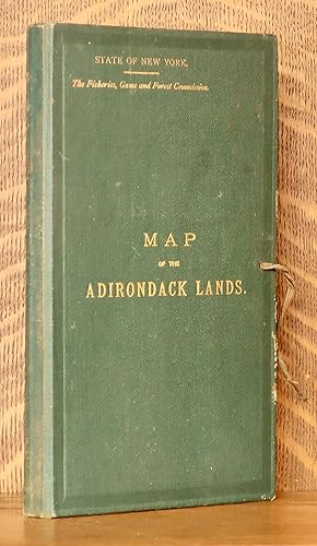
Añadir al carritoHardcover. Condición: Good. Folding map, 28 x 36, published by Fisheries, Game and Forest Commission in 1896. Comes in the green map case, with gilt lettering on front. Map has some tears along some of the top fold, and does have some toning. Map is in good condition. ; 8vo 8" - 9" tall.
 Más imágenes
Editorial: Fisheries, Game and Forest Commission of New York, Albany, New York, 1895
- Tapa dura
Librería: Andre Strong Bookseller, Blue Hill, ME, Estados Unidos de AmericaAndre Strong Bookseller
Contactar con el vendedorVendedor de 5 estrellasMiembro de asociación: MABA
Condición: Usado - Muy bueno
EUR 450,68
Envío por EUR 6,13Se envía dentro de Estados Unidos de AmericaCantidad disponible: 1 disponibles
Añadir al carritomaps and portfolio. Condición: Near fine. 4 maps in green publisher's portfolio with gilt titles. Maps in color with topographical details in brown. Unbacked and unjoined. The 4 together measure 70" x 56". Each map is 34" x 28". There is a spare Northwest map in a bit less great condition - it has some toning and a few slight te…ars along the lower fold, but is perfectly frameable on its own. Condition of the main 4 is NEAR FINE ; paper clean and colors bright, one tiny flaw at one of the folds, otherwise no flaws. Original publisher's portfolio is VERY GOOD ; very clean, titles bright, front side has some small tears to the cloth just at edge. One of the string ties is short. A paper label inside explains the colors.
 Más imágenes
Editorial: Albany, Albany, 1905
- Tapa dura
Librería: High Ridge Books, Inc. - ABAA, South Deerfield, MA, Estados Unidos de AmericaHigh Ridge Books, Inc. - ABAA
Contactar con el vendedorVendedor de 5 estrellasCondición: Usado
EUR 450,68
Envío por EUR 7,96Se envía dentro de Estados Unidos de AmericaCantidad disponible: 1 disponibles
Añadir al carrito4-sheet map, unbacked and unjoined, of Northeastern New York State, with Lake Champlain and Lake George in the east, extending west to the town of Canton in St. Lawrence County. Original red cloth folder with cloth ties. Near mint condition, with small separations at some fold junctions. Some areas in full printed color, others…in outline color. This is a fine example of the official New York State map of the Adirondack Region which was updated several times between 1898 and 1920.
 Más imágenes
Editorial: Albany, Albany, 1909
- Tapa dura
Librería: High Ridge Books, Inc. - ABAA, South Deerfield, MA, Estados Unidos de AmericaHigh Ridge Books, Inc. - ABAA
Contactar con el vendedorVendedor de 5 estrellasCondición: Usado
EUR 450,68
Envío por EUR 7,96Se envía dentro de Estados Unidos de AmericaCantidad disponible: 1 disponibles
Añadir al carrito4-sheet map, unbacked and unjoined, of Northeastern New York State, with Lake Champlain and Lake George in the east, extending west to the town of Canton in St. Lawrence County. Original red cloth folder with cloth ties. Near mint condition, with small separations at some fold junctions. Some areas in full printed color, others…in outline color. This is a fine example of the official New York State map of the Adirondack Region which was updated several times between 1898 and 1920.

Editorial: [Albany: State Forest Commission, 1893]., 1893
Librería: William Reese Company, New York, NY, Estados Unidos de AmericaWilliam Reese Company
Contactar con el vendedorVendedor de 5 estrellasCondición: Usado
EUR 856,29
Envío por EUR 12,25Se envía dentro de Estados Unidos de AmericaCantidad disponible: 1 disponibles
Añadir al carritoA highly detailed oversized map of northeastern upstate New York, focusing on the Adirondack forest preserve and divided by county. Provided in relief is a railroad and county map of northern New York. Quite rare, OCLC locating only four copies. OCLC 13031646. Folding map, 56 x 69 inches, partially colored. Original quarto green… cloth folder, gilt-stamped cover. Some small tears and perforations along folds. Overall very good.
 Más imágenes
- Mapa
Librería: Geographicus Rare Antique Maps, Brooklyn, NY, Estados Unidos de AmericaGeographicus Rare Antique Maps
Contactar con el vendedorVendedor de 4 estrellasCondición: Usado
EUR 959,05
Envío por EUR 14,88Se envía dentro de Estados Unidos de AmericaCantidad disponible: 1 disponibles
Añadir al carritoGood. Four sheets each approximately 36.5 x 28 inches. Exhibits wear along original fold lines. Some toning. Verso repairs to fold separations and at fold intersections. Some small areas on infill on all four sheets. Closed small tears on two of the sheets. Size 73 x 56 Inches. An uncommon large scale 1909 Millins O. Wood and Gl…enn S. Smith map of the Adirondack mountains of New York. The map depicts the entire Adirondack Mountain region, extending from the St. Lawrence River and Canada to Groversville and Broadalbin, and from Lewis and St. Lawrence counties to Lake George and Lake Champlain. Created by authority of the Forest, Fish and Game Commission, the boundaries of the Adirondack State Park are defined by a bold blue line. Additional color coding designates the state of various lands. Bright red shading identifies Forest Preserve or State Lands, while red and white striped areas mark lands in which the State has an undivided interest or joint ownership. Town boundaries are noted in pink. County boundaries are illustrated by brown lines. The whole is divided into various land patents, purchases, lots, and townships, many of which are labeled. Both conventional and electric railroads are depicted using two different annotations. An inset in the lower left corner is a county and railroad map of northern New York. The Adirondack Park The Adirondack State Park, part of the New York Forest Preserve, was established in 1892 'for the free use of all for their health and pleasure.' In 1884, a state legislative commission chaired by botanist Charles Sprague Sargent recommended the establishment of an Adirondack Mountain Forest Preserve. The New York State Legislature formally adopted the suggestion one year later designated state-owned lands within certain counties in the Adirondacks and Catskills to be 'forever kept wild.' In 1894, the Adirondack State Park was formally enshrined as an amendment to the New York State Constitution. Unlike most state parks, the Adirondack Park is not a cohesive unity fully owned by the state. Some 52% of the park is privately owned. The park includes more than 100 towns and villages, as well as farms, private homes, and active timbering zones. The complex ownership structure led to unique administrative challenges and the need for comprehensive large scale maps like this one. Publication History and Census Maps published using this title were published as early as 1893. However, those early maps were created by a different cartographer, William Fox. Subsequent updates appeared in 1895, 1898, and 1902. We note that editions created by M.O. Wood began appearing in 1908 with a new edition (the present example) published in 1909. Others may exist. Each was a completely new and revised map, published by different printing houses. The present map was drawn by Millins O. Wood and Glenn Shepard Smith and printed by Matthews-Northrup Works for the Forest, Fish and Game Commission in 1909. Examples are well represented institutionally, but few have made their way into the private market. References: OCLC 5707964.


