Importe total (1 artículo artículos):
Destino del pedido:

half inch map england cyclists (32 resultados)
Ir a los resultados principales
Filtros de búsqueda
Tipo de artículo
- Todos los tipos de productos
- Libros (7)
- Revistas y publicaciones (No hay ningún otro resultado que coincida con este filtro.)
- Cómics (No hay ningún otro resultado que coincida con este filtro.)
- Partituras (No hay ningún otro resultado que coincida con este filtro.)
- Arte, grabados y pósters (No hay ningún otro resultado que coincida con este filtro.)
- Fotografías (No hay ningún otro resultado que coincida con este filtro.)
- Mapas (25)
- Manuscritos y coleccionismo de papel (No hay ningún otro resultado que coincida con este filtro.)
Condición Más información
- Nuevo (No hay ningún otro resultado que coincida con este filtro.)
- Como nuevo, Excelente o Muy bueno (No hay ningún otro resultado que coincida con este filtro.)
- Bueno o Aceptable (21)
- Regular o Pobre (4)
- Tal como se indica (7)
Encuadernación
Más atributos
- Primera edición (No hay ningún otro resultado que coincida con este filtro.)
- Firmado (No hay ningún otro resultado que coincida con este filtro.)
- Sobrecubierta (No hay ningún otro resultado que coincida con este filtro.)
- Con imágenes (30)
- No impresión bajo demanda (32)
Idioma (2)
Gastos de envío gratis
- Envío gratis a Estados Unidos de America (No hay ningún otro resultado que coincida con este filtro.)
Ubicación del vendedor
Valoración de los vendedores
-

Bartholomew's 'Half Inch to Mile' Map of England & Wales, Sheet 10 Lincoln Wolds (cover has Bartholomew's New Reduced Survey for Tourists & Cyclists )
Idioma: Inglés
Publicado por John Bartholomew & Son, Edinburgh, 1919
Librería: Nigel Smith Books, Gunnislake, Reino Unido
Calificación del vendedor: 5 de 5 estrellas

Mapa
EUR 4,78
Envío por EUR 20,30
Se envía de Reino Unido a Estados Unidos de AmericaCantidad disponible: 1 disponibles
Añadir al carritoMap. Condición: Good. Folded map, mounted on cloth, there are holes where folds cross, but is otherwise in very good condition. Card cover is tanned and worn, back cover is loose. Has scale of miles as border the CTC logo in the lower border.
-

Bartholomew's 'Half Inch to Mile' Map of England & Wales, Sheet 24 Oxford, &c (cover has Bartholomew's New Reduced Survey for Tourists & Cyclists, Oxfordshire)
Idioma: Inglés
Publicado por John Bartholomew & Son, Edinburgh
Librería: Nigel Smith Books, Gunnislake, Reino Unido
Calificación del vendedor: 5 de 5 estrellas
Mapa
EUR 4,78
Envío por EUR 20,30
Se envía de Reino Unido a Estados Unidos de AmericaCantidad disponible: 1 disponibles
Añadir al carritoMap. Condición: Fair. Folded map, mounted on cloth, has some foxing and wear to folds some roads inked in and some place names underlined, else in almost good condition; card covers are worn. Date is c.1911 (but probably not after). Has the CTC logo in the lower border, scale of miles as border.
-

Bartholomew's 'Half Inch to Mile' Map of England & Wales, Sheet 36 South Devon (cover has Bartholomew's New Reduced Survey for Tourists & Cyclists )
Idioma: Inglés
Publicado por John Bartholomew & Son, Edinburgh
Librería: Nigel Smith Books, Gunnislake, Reino Unido
Calificación del vendedor: 5 de 5 estrellas
Mapa
EUR 5,97
Envío por EUR 20,30
Se envía de Reino Unido a Estados Unidos de AmericaCantidad disponible: 1 disponibles
Añadir al carritoMap. Condición: Good. Folded map, mounted on cloth, a few fox marks and some roads have been inked in, pin holes in corners, else in very good condition cloth on back has foxing. Scale of miles as border, has the CTC logo in the lower border.Undated, probably between 1904 and 1911.
-

Bartholomew's 'Half Inch to Mile' Map of England & Wales, Sheet 22 Carmarthen (cover has Bartholomew's New Reduced Survey for Tourists & Cyclists )
Idioma: Inglés
Publicado por John Bartholomew & Son, Edinburgh, 1911
Librería: Nigel Smith Books, Gunnislake, Reino Unido
Calificación del vendedor: 5 de 5 estrellas
Mapa
EUR 5,97
Envío por EUR 20,30
Se envía de Reino Unido a Estados Unidos de AmericaCantidad disponible: 1 disponibles
Añadir al carritoMap. Condición: Good. Folded map, mounted on cloth, a little wrinkled and a couple of short splits to folds at edge, it doesn't fold down very well to fit in the cover but otherwise in very good condition. Card cover is tanned and worn and back is covered with linen. Date is c1911 (but probably not after). Has the CTC logo in the lower border, scale of miles as border.
-

Bartholomew's 'Half Inch to Mile' Map of England & Wales, Sheet 10 Lincoln Wolds (cover has Bartholomew's New Reduced Survey for Tourists & Cyclists )
Idioma: Inglés
Publicado por John Bartholomew & Son, Edinburgh, 1911
Librería: Nigel Smith Books, Gunnislake, Reino Unido
Calificación del vendedor: 5 de 5 estrellas
Mapa
EUR 5,97
Envío por EUR 20,30
Se envía de Reino Unido a Estados Unidos de AmericaCantidad disponible: 1 disponibles
Añadir al carritoMap. Condición: Good. Folded map, paper, there are a few splits along the folds, particularly where folds cross, the map will need careful handling to avoid exacerbating these, but is otherwise in very good condition. Card cover is tanned and worn. Date is c1911 (but probably not after). Has the CTC logo in the lower border.
-

Bartholomew's 'Half-Inch to Mile' Map of England & Wales. Sheet 8. Liverpool and Manchester. (Cover Title: Bartholomew's New Reduced Survey for Tourists & Cyclists)
Idioma: Inglés
Publicado por John Bartholomew & Son, Edinburgh
Librería: Nigel Smith Books, Gunnislake, Reino Unido
Calificación del vendedor: 5 de 5 estrellas
Mapa
EUR 5,97
Envío por EUR 20,30
Se envía de Reino Unido a Estados Unidos de AmericaCantidad disponible: 1 disponibles
Añadir al carritoMap. Condición: Good. Folded map, dissected and mounted on cloth, map itself is in very good condition, a little foxed; card covers are worn, back cover is loose. Scale of miles as border, has the CTC logo in the lower border. Probably c.1911.
-

Bartholomew's 'Half Inch to Mile' Map of England & Wales, Sheet 28 Bath & Bristol (cover title: Bartholomew's New Reduced Survey for Tourists & Cyclists )
Idioma: Inglés
Publicado por John Bartholomew & Son, Edinburgh
Librería: Nigel Smith Books, Gunnislake, Reino Unido
Calificación del vendedor: 5 de 5 estrellas
Mapa
EUR 5,97
Envío por EUR 20,30
Se envía de Reino Unido a Estados Unidos de AmericaCantidad disponible: 1 disponibles
Añadir al carritoMap. Condición: Good. Folded map, dissected and mounted on cloth, in almost very good condition, a little foxed; card covers are worn with some loss to edges. Date is c.1911 (but probably not after). Has the CTC logo in the lower border, scale of miles as border.
-

Bartholomew's 'Half Inch to Mile' Map of England & Wales, Sheet 10 Lincoln Wolds (cover has Bartholomew's New Reduced Survey for Tourists & Cyclists )
Idioma: Inglés
Publicado por John Bartholomew & Son, Edinburgh
Librería: Nigel Smith Books, Gunnislake, Reino Unido
Calificación del vendedor: 5 de 5 estrellas
Mapa
EUR 5,97
Envío por EUR 20,30
Se envía de Reino Unido a Estados Unidos de AmericaCantidad disponible: 1 disponibles
Añadir al carritoMap. Condición: Good. Folded map, dissected and mounted on cloth, in almost very good condition, a little foxed; card covers are worn with some loss to yapped edges. Date is c.1911 (but probably not after). Has the CTC logo in the lower border, scale of miles as border.
-
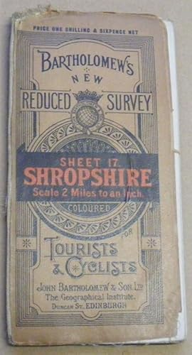
Bartholomew's 'Half Inch to Mile' Map of England & Wales, Sheet 17 Shropshire (cover has Bartholomew's New Reduced Survey for Tourists & Cyclists )
Idioma: Inglés
Publicado por John Bartholomew & Son, Edinburgh
Librería: Nigel Smith Books, Gunnislake, Reino Unido
Calificación del vendedor: 5 de 5 estrellas
Mapa
EUR 5,97
Envío por EUR 20,30
Se envía de Reino Unido a Estados Unidos de AmericaCantidad disponible: 1 disponibles
Añadir al carritoMap. Condición: Good. Folded map, dissected and mounted on cloth, in almost very good condition, a little foxed; card covers are worn, back cover loose. Date is c1911 (but probably not after). Has the CTC logo in the lower border, scale of miles as border.
-
![Imagen del vendedor de Bartholomew's 'Half Inch to Mile' Map of England & Wales, Sheet 18 Wilts & Berks (cover has Bartholomew's New Reduced Survey for Tourists & Cyclists ) [Wiltshire and Berkshire] a la venta por Nigel Smith Books](https://pictures.abebooks.com/inventory/md/md32371195531.jpg)
Bartholomew's 'Half Inch to Mile' Map of England & Wales, Sheet 18 Wilts & Berks (cover has Bartholomew's New Reduced Survey for Tourists & Cyclists ) [Wiltshire and Berkshire]
Idioma: Inglés
Publicado por John Bartholomew & Son, Edinburgh, 1911
Librería: Nigel Smith Books, Gunnislake, Reino Unido
Calificación del vendedor: 5 de 5 estrellas
Mapa
EUR 5,97
Envío por EUR 20,30
Se envía de Reino Unido a Estados Unidos de AmericaCantidad disponible: 1 disponibles
Añadir al carritoMap. Condición: Good. Folded map, paper, there are a couple of splits along a fold and two small holes where folds cross, the back of the sheet has a little foxing, but otherwise in very good condition. Card cover is tanned and worn. Date is c1911 (but probably not after). Has the CTC logo in the lower border.
-

Bartholomew's 'Half Inch to Mile' Map of England & Wales, Sheet 9 Sheffield (cover has Bartholomew's New Reduced Survey for Tourists & Cyclists )
Idioma: Inglés
Publicado por John Bartholomew & Son, Edinburgh, 1911
Librería: Nigel Smith Books, Gunnislake, Reino Unido
Calificación del vendedor: 5 de 5 estrellas
Mapa
EUR 5,97
Envío por EUR 20,30
Se envía de Reino Unido a Estados Unidos de AmericaCantidad disponible: 1 disponibles
Añadir al carritoMap. Condición: Fair. Folded map, paper, there are a number of short splits along the folds, particularly where folds cross, the map will need careful handling to avoid exacerbating these, but is otherwise in good condition. Card cover is tanned and worn. Date is c1911 (but probably not after). Has the CTC logo in the lower border.
-
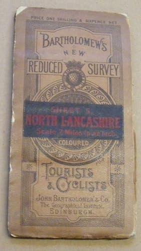
Bartholomew's 'Half-Inch to Mile' Map of England & Wales. Sheet 5. North Lancashire & Isle of Man. (Cover Title: Bartholomew's New Reduced Survey for Tourists & Cyclists)
Idioma: Inglés
Publicado por John Bartholomew & Son, Edinburgh
Librería: Nigel Smith Books, Gunnislake, Reino Unido
Calificación del vendedor: 5 de 5 estrellas
Mapa
EUR 5,97
Envío por EUR 20,30
Se envía de Reino Unido a Estados Unidos de AmericaCantidad disponible: 1 disponibles
Añadir al carritoMap. Condición: Good. Folded map, dissected and mounted on cloth, in almost very good condition, a little foxed; card covers are worn with small areas of loss to yapped cover. Scale of miles as border, has the CTC logo in the lower border. Probably c.1911.
-
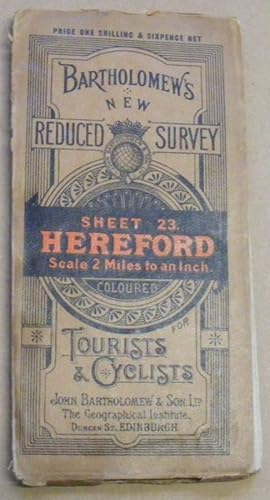
Bartholomew's 'Half Inch to Mile' Map of England & Wales, Sheet 23 Hereford (cover has Bartholomew's New Reduced Survey for Tourists & Cyclists )
Idioma: Inglés
Publicado por John Bartholomew & Son, Edinburgh
Librería: Nigel Smith Books, Gunnislake, Reino Unido
Calificación del vendedor: 5 de 5 estrellas
Mapa
EUR 5,97
Envío por EUR 20,30
Se envía de Reino Unido a Estados Unidos de AmericaCantidad disponible: 1 disponibles
Añadir al carritoMap. Condición: Good. Folded map, dissected and mounted on cloth, in almost very good condition, a little foxed; card covers are worn with some loss to yapped edges, front cover fold splitting at top. Date is c.1911 (but probably not after). Has the CTC logo in the lower border, scale of miles as border.
-

Bartholomew's 'Half Inch to Mile' Map of England & Wales, Sheet 34 Dorset (cover has Bartholomew's New Reduced Survey for Tourists & Cyclists )
Idioma: Inglés
Publicado por John Bartholomew & Son, Edinburgh, 1911
Librería: Nigel Smith Books, Gunnislake, Reino Unido
Calificación del vendedor: 5 de 5 estrellas
Mapa
EUR 5,97
Envío por EUR 20,30
Se envía de Reino Unido a Estados Unidos de AmericaCantidad disponible: 1 disponibles
Añadir al carritoMap. Condición: Fair. Folded map, mounted on cloth, there are a number of splits along folds and holes where folds cross, the whole map is very floppy and the linen is frayed at the edges, else it's in reasonably good condition. Card cover is tanned and worn and most of sheet label has been torn off. Date is c1911 (but probably not after). Has the CTC logo in the lower border, scale of miles as border.
-

Bartholomew's 'Half Inch to Mile' Map of England & Wales, Sheet 18 Birmingham District (cover has Bartholomew's New Reduced Survey for Tourists & Cyclists )
Idioma: Inglés
Publicado por John Bartholomew & Son, Edinburgh, 1911
Librería: Nigel Smith Books, Gunnislake, Reino Unido
Calificación del vendedor: 5 de 5 estrellas
Mapa
EUR 5,97
Envío por EUR 20,30
Se envía de Reino Unido a Estados Unidos de AmericaCantidad disponible: 1 disponibles
Añadir al carritoMap. Condición: Good. Folded map, paper, there are a couple of small holes where folds cross, the back of the sheet has marks and some foxing, and something drawn in blue, but otherwise in very good condition. Card cover is tanned and worn with a little loss to the yapped edges and some splitting to the spine. Date is c1911 (but probably not after). Has the CTC logo in the lower border.
-
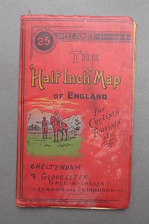
The Half Inch Map of England for Cyclists & Tourists etc - Sheet No 25 - Cheltenham & Gloucester - Cruchley's County Maps
Idioma: Inglés
Publicado por Gall & Inglis, London
Librería: C. Parritt, Derby, Reino Unido
Calificación del vendedor: 5 de 5 estrellas
Mapa
EUR 17,92
Envío por EUR 17,40
Se envía de Reino Unido a Estados Unidos de AmericaCantidad disponible: 1 disponibles
Añadir al carritoDecorative Cloth. Condición: Fair. No Jacket. Not dated, approx 1900. Decorative red cloth boards with a little rubbing/fraying to edges, some patchy fading, minor soiling. Lithographed paper map folds out to a size of 22''x27''. Map in good condition with a few small tears. Sheet number 25 of 42 covering the whole of England & Wales. This one covers Cheltenham and Gloucester. These maps were produced as leisure maps, mainly for cyclists - there is an image of a cyclist on the front board.
-
The Half Inch Map of England for Cyclists Tourists etc. Sheet Number 17, SOMERSET / SOUTH WALES.
Idioma: Inglés
Publicado por Gall & Inglis., London, England, 1900
Librería: Tony Hutchinson, Seale, Reino Unido
Calificación del vendedor: 5 de 5 estrellas
Mapa
EUR 16,13
Envío por EUR 11,02
Se envía de Reino Unido a Estados Unidos de AmericaCantidad disponible: 1 disponibles
Añadir al carritoSoft cover. Condición: Good. 26 x 22 inch, 36 section cloth backed folding map. Folds to 5.5 x 3 inch. Some age staining,2 small brownish stains in Bristol Channel, but no tears nor deliberate marks. Undated but probably about 1900, issued in conjunction with the 'Contour Road Books" which were first published about 1897.
-
The Half Inch Map of England for Cyclists Tourists etc. Sheet Number 19, HAMPSHIRE / BERKSHIRE.
Idioma: Inglés
Publicado por Gall & Inglis., London, England, 1900
Librería: Tony Hutchinson, Seale, Reino Unido
Calificación del vendedor: 5 de 5 estrellas
Mapa
EUR 17,33
Envío por EUR 11,02
Se envía de Reino Unido a Estados Unidos de AmericaCantidad disponible: 1 disponibles
Añadir al carritoSoft cover. Condición: Good. 26 x 22 inch, 36 section cloth backed folding map. Folds to 5.5 x 3 inch. Some light aging as expected but no tears nor deliberate marks. Undated but probably about 1900, issued in conjunction with the 'Contour Road Books" which were first published about 1897.
-
The Half Inch Map of England for Cyclists Tourists etc. Sheet Number 18, WILTSHIRE.
Idioma: Inglés
Publicado por Gall & Inglis., London, England, 1900
Librería: Tony Hutchinson, Seale, Reino Unido
Calificación del vendedor: 5 de 5 estrellas
Mapa
EUR 17,33
Envío por EUR 11,02
Se envía de Reino Unido a Estados Unidos de AmericaCantidad disponible: 1 disponibles
Añadir al carritoSoft cover. Condición: Good. 26 x 22 inch, 36 section cloth backed folding map. Folds to 5.5 x 3 inch. Some light aging as expected but no tears nor deliberate marks. Undated but probably about 1900, issued in conjunction with the 'Contour Road Books" which were first published about 1897.
-
The Half Inch Map of England for Cyclists Tourists etc. Sheet Number 1, CORNWALL.
Idioma: Inglés
Publicado por Gall & Inglis., London, England, 1900
Librería: Tony Hutchinson, Seale, Reino Unido
Calificación del vendedor: 5 de 5 estrellas
Mapa
EUR 17,33
Envío por EUR 11,02
Se envía de Reino Unido a Estados Unidos de AmericaCantidad disponible: 1 disponibles
Añadir al carritoSoft cover. Condición: Good. 26 x 22 inch, 36 section cloth backed folding map. Folds to 5.5 x 3 inch. Some light aging as expected but no tears nor deliberate marks. Undated but probably about 1900, issued in conjunction with the 'Contour Road Books" which were first published about 1897.
-
The Half Inch Map of England for Cyclists Tourists etc. Sheet Number 13, SUSSEX.
Idioma: Inglés
Publicado por Gall & Inglis., London, England, 1900
Librería: Tony Hutchinson, Seale, Reino Unido
Calificación del vendedor: 5 de 5 estrellas
Mapa
EUR 17,33
Envío por EUR 11,02
Se envía de Reino Unido a Estados Unidos de AmericaCantidad disponible: 1 disponibles
Añadir al carritoSoft cover. Condición: Good. 35 x 17 inch, 33 section cloth backed folding map. Folds to 5.5 x 3 inch. Some light aging as expected but no tears nor deliberate marks. Undated but probably about 1900, issued in conjunction with the 'Contour Road Books" which were first published about 1897.
-
The Half Inch Map of England for Cyclists Tourists etc. Sheet Number 10, DEVON / DORSET.
Idioma: Inglés
Publicado por Gall & Inglis., London, England, 1900
Librería: Tony Hutchinson, Seale, Reino Unido
Calificación del vendedor: 5 de 5 estrellas
Mapa
EUR 17,33
Envío por EUR 11,02
Se envía de Reino Unido a Estados Unidos de AmericaCantidad disponible: 1 disponibles
Añadir al carritoSoft cover. Condición: Good. 26 x 22 inch, 36 section cloth backed folding map. Folds to 5.5 x 3 inch. Some light aging as expected but no tears nor deliberate marks. Undated but probably about 1900, issued in conjunction with the 'Contour Road Books" which were first published about 1897.
-
The Half Inch Map of England for Cyclists Tourists etc. Sheet Number 21, KENT.
Idioma: Inglés
Publicado por Gall & Inglis., London, England, 1900
Librería: Tony Hutchinson, Seale, Reino Unido
Calificación del vendedor: 5 de 5 estrellas
Mapa
EUR 17,33
Envío por EUR 11,02
Se envía de Reino Unido a Estados Unidos de AmericaCantidad disponible: 1 disponibles
Añadir al carritoSoft cover. Condición: Good. 26 x 22 inch, 36 section cloth backed folding map. Folds to 5.5 x 3 inch. Some light aging as expected but no tears nor deliberate marks. Undated but probably about 1900, issued in conjunction with the 'Contour Road Books" which were first published about 1897.
-
The Half Inch Map of England for Cyclists Tourists etc. Sheet Number 9, DEVON.
Idioma: Inglés
Publicado por Gall & Inglis., London, England, 1900
Librería: Tony Hutchinson, Seale, Reino Unido
Calificación del vendedor: 5 de 5 estrellas
Mapa
EUR 17,33
Envío por EUR 11,02
Se envía de Reino Unido a Estados Unidos de AmericaCantidad disponible: 1 disponibles
Añadir al carritoSoft cover. Condición: Good. 26 x 22 inch, 36 section cloth backed folding map. Folds to 5.5 x 3 inch. Some light aging as expected but no tears nor deliberate marks. Undated but probably about 1900, issued in conjunction with the 'Contour Road Books" which were first published about 1897.
-

THE 'HALF INCH' MAP OF ENGLAND for Cyclists, Tourists. etc.
Publicado por c, 1910
Librería: AMBRA BOOKS (Aitchison & Cornish), Bristol, Reino Unido
Calificación del vendedor: 2 de 5 estrellas

Mapa
EUR 8,36
Envío por EUR 22,04
Se envía de Reino Unido a Estados Unidos de AmericaCantidad disponible: 1 disponibles
Añadir al carritoSheet 2, South Devon. Folding map printed in black and brown, linen- backed, folding into printed limp cloth wraps, 12mo. 1" repaired tear at edge. --- Please e-mail for one of my FREE CATALOGUES which include DEVON [ Manuscripts, Maps, Ephemera, Views, etc., etc. ] ---.
-
MAP: ORDNANCE SURVEY: HALF INCH TO ONE MILE FOR TOURISTS AND CYCLISTS: ENGLAND AND WALES: HEREFORD
Publicado por Bartholomew's, GB
Librería: Richard Sylvanus Williams (Est 1976), WINTERTON, Reino Unido
Calificación del vendedor: 5 de 5 estrellas
EUR 8,58
Envío por EUR 34,79
Se envía de Reino Unido a Estados Unidos de AmericaCantidad disponible: 1 disponibles
Añadir al carritoPaperback. Condición: G++. Cloth map (roughly) 750 x 550 mm. in card covers which folds to 190 x 100 mm. Not dated. Map is in good double plus condition with noticeable signs of wear and/or age.
-

The 'Half Inch' Map of England for Cyclists' Tourists etc. Sheet Number 13: Sussex
Publicado por Published by Gall & Inglis, London circa edition not stated. London circa 1910., 1910
Librería: Little Stour Books PBFA Member, Canterbury, Reino Unido
Miembro de asociación: PBFA
Calificación del vendedor: 5 de 5 estrellas
EUR 17,92
Envío por EUR 34,79
Se envía de Reino Unido a Estados Unidos de AmericaCantidad disponible: 1 disponibles
Añadir al carrito27'' x 21'' 36 section folding linen backed paper map. Roads coloured in orange. Two small tears to the folded creases down the top edge, light fraying to the front and back cover edges. Priced 1/- and 1/6 mounted on cloth. Member of the P.B.F.A. SUSSEX (Suth-Seaxe).
-

The 'Half Inch' Map of England and Wales for Cyclists' Tourists etc. Sheet Number 30 | Montgomeryshire and Herefordshire
Publicado por Published by Gall & Inglis, Edinburgh | 25 Paternoster Square, London circa edition not stated., 1910
Librería: Little Stour Books PBFA Member, Canterbury, Reino Unido
Miembro de asociación: PBFA
Calificación del vendedor: 5 de 5 estrellas
EUR 20,91
Envío por EUR 34,79
Se envía de Reino Unido a Estados Unidos de AmericaCantidad disponible: 1 disponibles
Añadir al carrito26½'' x 21½'' 36 section folding linen backed paper map. Roads coloured in orange. Priced 1/- with roads coloured and 1/6 mounted on cloth, ditto. Member of the P.B.F.A. CARTOGRAPHY, MAPS, PLANS.
-

The 'Half Inch' Map of England and Wales for Cyclists' Tourists etc. Sheet Number 17 | South Wales | Somerset
Publicado por Published by Gall & Inglis, Edinburgh | 25 Paternoster Square, London circa edition not stated., 1910
Librería: Little Stour Books PBFA Member, Canterbury, Reino Unido
Miembro de asociación: PBFA
Calificación del vendedor: 5 de 5 estrellas
EUR 20,91
Envío por EUR 34,79
Se envía de Reino Unido a Estados Unidos de AmericaCantidad disponible: 1 disponibles
Añadir al carrito26½'' x 21½'' 36 section folding linen backed paper map. Roads coloured in orange. Priced 1/- with roads coloured and 1/6 mounted on cloth, ditto. Member of the P.B.F.A. CARTOGRAPHY, MAPS, PLANS.
-

The 'Half Inch' Map of England and Wales for Cyclists' Tourists etc. Sheet Number 25 | Gloucestershire
Publicado por Published by Gall & Inglis, Edinburgh | 25 Paternoster Square, London circa edition not stated., 1910
Librería: Little Stour Books PBFA Member, Canterbury, Reino Unido
Miembro de asociación: PBFA
Calificación del vendedor: 5 de 5 estrellas
EUR 20,91
Envío por EUR 34,79
Se envía de Reino Unido a Estados Unidos de AmericaCantidad disponible: 1 disponibles
Añadir al carrito26½'' x 21½'' 36 section folding linen backed paper map. Roads coloured in orange. Priced 1/- with roads coloured and 1/6 mounted on cloth, ditto. Member of the P.B.F.A. CARTOGRAPHY, MAPS, PLANS.