Importe total (1 artículo artículos):
Destino del pedido:

coltons map virginia west (6 resultados)
Ir a los resultados principales
Filtros de búsqueda
Tipo de artículo
- Todos los tipos de productos
- Libros (4)
- Revistas y publicaciones (No hay ningún otro resultado que coincida con este filtro.)
- Cómics (No hay ningún otro resultado que coincida con este filtro.)
- Partituras (No hay ningún otro resultado que coincida con este filtro.)
- Arte, grabados y pósters (No hay ningún otro resultado que coincida con este filtro.)
- Fotografías (No hay ningún otro resultado que coincida con este filtro.)
- Mapas (2)
- Manuscritos y coleccionismo de papel (No hay ningún otro resultado que coincida con este filtro.)
Condición Más información
- Nuevo (No hay ningún otro resultado que coincida con este filtro.)
- Como nuevo, Excelente o Muy bueno (No hay ningún otro resultado que coincida con este filtro.)
- Bueno o Aceptable (2)
- Regular o Pobre (No hay ningún otro resultado que coincida con este filtro.)
- Tal como se indica (4)
Encuadernación
- Todas
- Tapa dura (4)
- Tapa blanda (No hay ningún otro resultado que coincida con este filtro.)
Más atributos
- Primera edición (2)
- Firmado (No hay ningún otro resultado que coincida con este filtro.)
- Sobrecubierta (No hay ningún otro resultado que coincida con este filtro.)
- Con imágenes (6)
- No impresión bajo demanda (6)
Idioma (2)
Precio
- Cualquier precio
- Menos de EUR 20 (No hay ningún otro resultado que coincida con este filtro.)
- EUR 20 a EUR 45 (No hay ningún otro resultado que coincida con este filtro.)
- Más de EUR 45
Gastos de envío gratis
- Envío gratis a Estados Unidos de America (No hay ningún otro resultado que coincida con este filtro.)
Ubicación del vendedor
Valoración de los vendedores
-
![Imagen del vendedor de Colton's Delaware, Maryland, Virginia and West Virginia. [map] a la venta por Kurt Gippert Bookseller (ABAA)](https://pictures.abebooks.com/inventory/md/md1192511770.jpg)
Colton's Delaware, Maryland, Virginia and West Virginia. [map]
Idioma: Inglés
Publicado por G. W. Colton, New York, 1888
Librería: Kurt Gippert Bookseller (ABAA), Chicago, IL, Estados Unidos de America
Miembro de asociación: ABAA ILAB MWABA
Calificación del vendedor: 5 de 5 estrellas

Mapa Original o primera edición
EUR 309,37
Envío por EUR 6,87
Se envía dentro de Estados Unidos de AmericaCantidad disponible: 1 disponibles
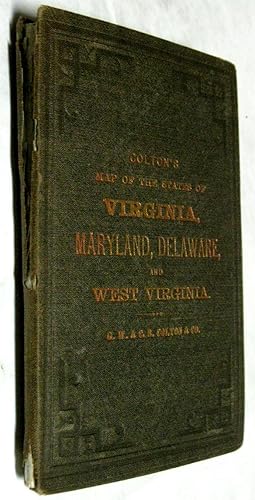
Añadir al carritoHardcover. Condición: Very good- condition. First thus edition. Folding map measures 18 x 27.5 inches, housed in the original cloth covers with moderate wear. Tiny breaks at a few folds. Small manuscript detail of the geology of the Blue Ridge Mountains affixed over one portion of the map. Bookplate on inside of front cover.
-
Colton's New Topographical Map of the States of VIRGINIA, MARYLAND, Delaware, and WEST VIRGINIA
Publicado por G. W. & C. B. Colton & Co., 182 Williams Street, New York, 1883
Librería: Ziern-Hanon Galleries, Frontenac, MO, Estados Unidos de America
Calificación del vendedor: 1 de 5 estrellas

EUR 525,93
Envío por EUR 4,72
Se envía dentro de Estados Unidos de AmericaCantidad disponible: 1 disponibles
Añadir al carritoFull Cloth. Condición: Good. Full black cloth with gilt lettering on front cover, stamped decorative border with wear through the spine which is splitting. Archive paper used to repair the spine and at the folds of the map. Overall a GOOD book. Size: 16mo - over 5¾" - 6¾" tall. Hardcover.
-

Colton's Map of the State of West Virginia & Portions of Adjoining States
Publicado por New York, New York, 1865
Librería: High Ridge Books, Inc. - ABAA, South Deerfield, MA, Estados Unidos de America
Miembro de asociación: ABAA ESA ILAB SNEAB
Calificación del vendedor: 5 de 5 estrellas
EUR 839,72
Envío por EUR 7,81
Se envía dentro de Estados Unidos de AmericaCantidad disponible: 1 disponibles
Añadir al carritoMap of West Virginia taken from Colton's war-era map of Virginia. Full color by county in West Virginia, uniform color in Virginia, uncolored outside. Includes Eastern Kentucky, western Maryland, much of Virginia. Original cloth, well rubbed at spine. Separations along some folds and at some fold junctions, with small loss from chipping in Augusta County. This is among the first separate maps of West Virginia after statehood in 1863.
-

Colton's New Topographical Map of the States of Virginia, West Virginia, Maryland & Delware and Portions of Other Adjoining States
Publicado por New York, New York, 1889
Librería: High Ridge Books, Inc. - ABAA, South Deerfield, MA, Estados Unidos de America
Miembro de asociación: ABAA ESA ILAB SNEAB
Calificación del vendedor: 5 de 5 estrellas
EUR 265,17
Envío por EUR 7,81
Se envía dentro de Estados Unidos de AmericaCantidad disponible: 1 disponibles
Añadir al carritoLacks folder. Late issue of this bright colorful map of Virginia and West Virginia, taken from a plate first used in the 1860's. Backed with linen, torn along several folds, smoke damaged at top right. Full color by county. Decorative border.
-
Colton's Map of Virginia & West Virginia
Publicado por G.W. & C.B. Colton, New York, 1870
Librería: Caroliniana, Aiken, SC, Estados Unidos de America
Calificación del vendedor: 5 de 5 estrellas
EUR 883,92
Envío por EUR 5,15
Se envía dentro de Estados Unidos de AmericaCantidad disponible: 1 disponibles
Añadir al carritoHand-colored lithograph map of Virginia and West (By God) Virginia, delineated by county, with insets of Richmond and Norfolk, Portsmouth, and Gosport. Richmond is identified as the capitol of Virginia, but no city is so designated in West Virginia, which did not vote to establish a permanent seat of government until 1877. The map is printed on a 16 ½" x 14: sheet of banknote paper and folds into brown cloth-covered boards with gilt titles. Light toning, with a few small stains, mostly to the left margin. Period previous owner's ink signature to an inner panel. The boards are edgeworn and showing in places.
-
Colton's New Topographical Map of the States of Virginia, West Virginia, Maryland, and Delaware and Portions of Other Adjoining States.
Año de publicación: 1871
Librería: Geographicus Rare Antique Maps, Brooklyn, NY, Estados Unidos de America
Miembro de asociación: ABAA ESA ILAB
Calificación del vendedor: 4 de 5 estrellas

Mapa Original o primera edición
EUR 841,49
Envío por EUR 14,59
Se envía dentro de Estados Unidos de AmericaCantidad disponible: 1 disponibles
Añadir al carrito1st Edition. Good. Wear and toning along original fold lines. Verso repairs to fold separations. Slight loss at some fold intersections. Light soiling. Size 30.75 x 45 Inches. This is an 1871 G. W. and C. B. Colton map of Virginia, West Virginia, Maryland, and Delaware, thus presenting the most active theater of the American Civil War (1861 - 1865). A Closer Look Coverage extends roughly from Knoxville to New York, and from New York to Raleigh, North Carolina. Cities and towns are identified throughout, and counties in Virginia, West Virginia, Maryland, and Delaware are shaded for differentiation. Washington D.C. is highlighted along the Potomac River between Virginia and Maryland. The region's iconic topography appears in pictorial fashion. Publication History and Census This map was created and published by G.W. and C.B. Colton in 1871. The first edition of 'Colton's New Topographical Map of the States of Virginia' was published in 1862 under the title 'Colton's New Topographical Map of the States of Virginia, Maryland, and Delaware, Showing also Eastern Tennessee and Parts of Other Adjoining States' by J. H. Colton. The next edition, dated 1863, labels West Virginia (which was admitted to the Union on June 20, 1863) and marks its borders, but the title does not change, which is also the case for the 1864 edition, the last edition published by J. H. Colton. The first edition to include West Virginia in the title was published in 1866 by G. W. and C.B. Colton under the title 'Colton's New Topographical Map of the States of Virginia, West Virginia, Maryland and Delaware, Showing Also Eastern Tennessee and Parts of Other Adjoining States.' G. W. and C. B. Colton continued publishing updated editions of this map until at least 1896. We note two cataloged examples of the present 1871 edition: New York Public Library and the Leventhal Map Center at the Boston Public Library. References: New York Public Library Map Div. 17-5438. Boston Public Library, Leventhal Map Center, G3880 1871.G19.