

Importe total (1 artículo artículos):
Destino del pedido:

bull combahee rivers (2 resultados)
Ir a los resultados principales
Filtros de búsqueda
Tipo de artículo
- Todos los tipos de productos
- Libros (1)
- Revistas y publicaciones (No hay ningún otro resultado que coincida con este filtro.)
- Cómics (No hay ningún otro resultado que coincida con este filtro.)
- Partituras (No hay ningún otro resultado que coincida con este filtro.)
- Arte, grabados y pósters (No hay ningún otro resultado que coincida con este filtro.)
- Fotografías (No hay ningún otro resultado que coincida con este filtro.)
- Mapas (1)
- Manuscritos y coleccionismo de papel (No hay ningún otro resultado que coincida con este filtro.)
Condición Más información
- Nuevo (No hay ningún otro resultado que coincida con este filtro.)
- Como nuevo, Excelente o Muy bueno (No hay ningún otro resultado que coincida con este filtro.)
- Bueno o Aceptable (1)
- Regular o Pobre (No hay ningún otro resultado que coincida con este filtro.)
- Tal como se indica (1)
Encuadernación
- Todas
- Tapa dura (No hay ningún otro resultado que coincida con este filtro.)
- Tapa blanda (No hay ningún otro resultado que coincida con este filtro.)
Más atributos
- Primera edición (No hay ningún otro resultado que coincida con este filtro.)
- Firmado (No hay ningún otro resultado que coincida con este filtro.)
- Sobrecubierta (No hay ningún otro resultado que coincida con este filtro.)
- Con imágenes (1)
- No impresión bajo demanda (2)
Idioma (1)
Precio
- Cualquier precio
- Menos de EUR 20 (No hay ningún otro resultado que coincida con este filtro.)
- EUR 20 a EUR 45 (No hay ningún otro resultado que coincida con este filtro.)
- Más de EUR 45
Gastos de envío gratis
- Envío gratis a Estados Unidos de America (No hay ningún otro resultado que coincida con este filtro.)
Ubicación del vendedor
Valoración de los vendedores
-

Entrance to BULL AND COMBAHEE RIVERS. South Carolina ( US Coast Survey)
Publicado por U.S. Coast Survey Office, (Wash. D.C.), 1871
Librería: Frey Fine Books, Rougemont, NC, Estados Unidos de America
Calificación del vendedor: 5 de 5 estrellas

EUR 177,03
Envío por EUR 5,97
Se envía dentro de Estados Unidos de AmericaCantidad disponible: 1 disponibles
Añadir al carritoMap. Condición: Very Good. Imperial Edition. Elephant Folio - over 15 - 23" tall. 1st edition, thus. 24" x17.5" . Hand colored. Very Good. Original folds visible. Very Light toning along folds. Margin intact, with small tears where the map was inserted into the atlas. Beautifully hand colored, a Very Good example. ***This map comes from the Report of the Superintendent of the U.S. Coast Survey for 1871. It contains recordings of river depth, tide tale, ocean depths, sailing direction. road names, towns, travelers stops, streams, necks, island and farm names.***.
-
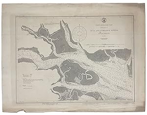
Bull and Combahee Rivers
Publicado por Published by the United States Coast and Geodetic Survey, Washington D.C., 1920
Librería: Donald A. Heald Rare Books (ABAA), New York, NY, Estados Unidos de America
Miembro de asociación: ABAA ILAB
Calificación del vendedor: 5 de 5 estrellas
Mapa
EUR 177,03
Envío por EUR 21,48
Se envía dentro de Estados Unidos de AmericaCantidad disponible: 1 disponibles
Añadir al carritoNautical chart, printed on heavy paper stock. Uncolored. A rare original coastal survey of the Bull and Combahee Rivers including St. Helena Island, St. Helena Sound, Coosaw River, Morgan River, and Hutchinson Islands. Established by President Thomas Jefferson in 1807 as the Survey of the Coast, the U.S. Coast and Geodetic Survey was the United States' first civilian scientific agency. This agency has followed its mission to survey the U.S. coastline, create nautical charts of the coast, and help increase maritime safety since its founding, and has often played fascinating roles in significant chapters of U.S. history. It served in all theaters of the Civil War in the service of the Union Army and Navy, pioneered acoustic exploration in the wake of the sinking of the Titanic, and during WWI it worked to detect enemy submarines. In addition, this agency worked to survey and produce detailed maps and renderings of the U.S. coast. These nautical survey maps (commonly referred to as "T-sheets") provide fascinating insights into the history of the United States coastline, which has and will continue to shift. These maps are the most important data source for understanding the physical and ecological characteristics of the U.S. shoreline. The present map is a highly detailed and accurate sea chart of St. Helena Sound, and an important historical view of the developing South Carolina.

