Importe total (1 artículo artículos):
Destino del pedido:

antique map asia original hand (10 resultados)
Comentarios
Ir a los resultados principales
Filtros de búsqueda
Tipo de artículo
- Todos los tipos de productos
- Libros (7)
- Revistas y publicaciones (No hay ningún otro resultado que coincida con este filtro.)
- Cómics (No hay ningún otro resultado que coincida con este filtro.)
- Partituras (No hay ningún otro resultado que coincida con este filtro.)
- Arte, grabados y pósters (No hay ningún otro resultado que coincida con este filtro.)
- Fotografías (No hay ningún otro resultado que coincida con este filtro.)
- Mapas (3)
- Manuscritos y coleccionismo de papel (No hay ningún otro resultado que coincida con este filtro.)
Condición Más información
- Nuevo (No hay ningún otro resultado que coincida con este filtro.)
- Como nuevo, Excelente o Muy bueno (No hay ningún otro resultado que coincida con este filtro.)
- Bueno o Aceptable (5)
- Regular o Pobre (No hay ningún otro resultado que coincida con este filtro.)
- Tal como se indica (5)
Encuadernación
- Todas
- Tapa dura (No hay ningún otro resultado que coincida con este filtro.)
- Tapa blanda (No hay ningún otro resultado que coincida con este filtro.)
Más atributos
- Primera edición (No hay ningún otro resultado que coincida con este filtro.)
- Firmado (1)
- Sobrecubierta (No hay ningún otro resultado que coincida con este filtro.)
- Con imágenes (5)
- No impresión bajo demanda (10)
Idioma (2)
Precio
- Cualquier precio
- Menos de EUR 20 (No hay ningún otro resultado que coincida con este filtro.)
- EUR 20 a EUR 45
- Más de EUR 45
Gastos de envío gratis
- Envío gratis a Espańa (No hay ningún otro resultado que coincida con este filtro.)
Ubicación del vendedor
Valoración de los vendedores
-

Russia, Asia - an Original Antique Hand Coloured Map
Publicado por Tallis, London, 1850
Idioma: Inglés
Librería: K Books Ltd ABA ILAB, York, YORKS, Reino Unido
Miembro de asociación: ABA ILAB PBFA
Calificación del vendedor: 5 de 5 estrellas

EUR 59,15
Convertir monedaEUR 10,16 gastos de envío desde Reino Unido a EspańaCantidad disponible: 1 disponibles
Ańadir al carritoNo Binding. Condición: Very Good. A fine original antique contemporary hand coloured map , mounted and ready to frame .Excellent condition printed by Tallis about the mid 19th century - vignettes.
-
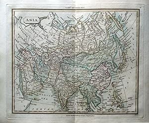
MAP OF ASIA - an Original Antique Hand Coloured Map
Ańo de publicación: 1840
Idioma: Inglés
Librería: K Books Ltd ABA ILAB, York, YORKS, Reino Unido
Miembro de asociación: ABA ILAB PBFA
Calificación del vendedor: 5 de 5 estrellas
EUR 47,32
Convertir monedaEUR 10,16 gastos de envío desde Reino Unido a EspańaCantidad disponible: 1 disponibles
Ańadir al carritoNo Binding. Condición: Very Good. A splendid map. Partially hand coloured - colouring not contemporary but delicately executed . Mounted - matted - and ready to frame . In very good condition. Printed circa 1840. Map of Asia, including Australia, well-defined.
-
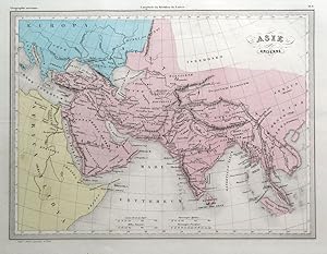
Antique Hand Coloured Map of Ukraine, Germany, Russia to Central Asia - an Original Antique Hand-Coloured Map of the Classical World
Ańo de publicación: 1790
Idioma: Inglés
Librería: K Books Ltd ABA ILAB, York, YORKS, Reino Unido
Miembro de asociación: ABA ILAB PBFA
Calificación del vendedor: 5 de 5 estrellas
EUR 47,32
Convertir monedaEUR 10,16 gastos de envío desde Reino Unido a EspańaCantidad disponible: 1 disponibles
Ańadir al carritoNo Binding. Condición: Very Good. Attractive Antique hand-coloured map of the classical world . Plate size approx. 10 x 8 inches 25 x 21 cms. Mounted and ready to frame, mount size approx. 12 x 10 inches, 30 x 25 cms, VERY GOOD, ca 1790. *Decorative and unusual - highly recommended.
-
Antique Hand Coloured Map of Asia Minor, Asia Cis Taurum - Detailed - an Original Antique Hand-Coloured Map of the Classical World
Ańo de publicación: 1790
Idioma: Inglés
Librería: K Books Ltd ABA ILAB, York, YORKS, Reino Unido
Miembro de asociación: ABA ILAB PBFA
Calificación del vendedor: 5 de 5 estrellas
EUR 47,32
Convertir monedaEUR 10,16 gastos de envío desde Reino Unido a EspańaCantidad disponible: 1 disponibles
Ańadir al carritoNo Binding. Condición: Very Good. Attractive Antique hand-coloured map of the classical world . Plate size approx. 10 x 8 inches 25 x 21 cms. Mounted and ready to frame, mount size approx. 12 x 10 inches, 30 x 25 cms, VERY GOOD, ca 1790. *Decorative and unusual - highly recommended.
-
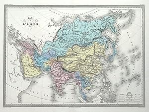
Antique Map ANCIENT ASIA, Original Malte Brun, hand coloured c1850
Librería: Lindisfarne Prints, Shrewsbury, SHROP, Reino Unido
Calificación del vendedor: 5 de 5 estrellas
Mapa
EUR 29,58
Convertir monedaEUR 8,61 gastos de envío desde Reino Unido a EspańaCantidad disponible: 1 disponibles
Ańadir al carritoAntique Map ASIE Ancienneby Conrade Malte BrunPublished by M.J.J.N Huot in "Atlas de la Geographie Universelle ou Description de Toutes Les Parties du Monde", Paris circa 1850A fine example of Malte-Brun's classical map of the continent of Asia.The level of detail can be seen in the close up images provided.Enhanced with original hand colour which remains bright and fresh. Fine condition other than a very light horizontal crease. Central fold as issued.Approx. 11" x 9" (290mm x 220mm) map area only, with good margins beyond.Please see also close up images.Conrad Malte-Brun ( 1755- 1826) was an important late 18th and early 19th century Danish / French cartographer and revolutionary. Along with colleague Edme Mentelle, Malte-Brun published his first cartographic work, the "GĂ ographie MathĂ matique, Physique et Politique de Toutes les parties du Monde" ( published between 1803 and 1807). He went on to found, "Les Annales des Voyages "(in 1807) and "Les Annales des Voyages, de la GĂ ographie et de l'Histoire" (in 1819). He also founded the Paris "SociĂ tĂ de GĂ ographie" . In time Malte-Brun became known as one of the finest French cartographers of his time. His son Victor Adolphe Malte-Brun (1816 - 1889) followed in his footsteps, republishing many of his father's original 18th century maps as well as producing numerous maps of his own. .A GENUINE ANTIQUE MAP GUARANTEED OVER 150 YEARS OLD FROM LINDISFARNE PRINTSNMJ518.
-
Antique Map ASIA Original Hand Coloured CONTINENT OF ASIA 1825
Librería: Lindisfarne Prints, Shrewsbury, SHROP, Reino Unido
Calificación del vendedor: 5 de 5 estrellas
Mapa
EUR 35,49
Convertir monedaEUR 8,61 gastos de envío desde Reino Unido a EspańaCantidad disponible: 1 disponibles
Ańadir al carritoAn antique map of ASIAAn attractive old map of the Continent of Asia in the early part of the 19th century.Engraved by James Tyrer for the Rev. T. Clark's " A New General School Atlas of Modern Geography" Published, London 1825 by John SouterWith outline hand colouring, centrefold as issued and blank verso. Fine unmarked condition , credited and dated within the plate. Measuring approx. 10" x 8" (260mm x 200mm) to the clearly defined platemark with margins beyond.Please view a further close up image. A GENUINE ANTIQUE MAP GUARANTEED OVER 180 YEARS OLD FROM LINDISFARNE PRINTS NMB515FREE UK SHIPPING INTERNATIONAL SHIPPINGTWO ITEMS COMBINED FOR SHIPPING THREE ITEMS OR MORE AND STANDARD SHIPPING IS FREE OF CHARGE WORLDWIDE.
-
Asia, from Accurate Survey By Emanuel Bowen (original Colouring , Margins, Ornate cartouche) - Splendid Antique Hand Coloured Detailed Map
Ańo de publicación: 1740
Idioma: Inglés
Librería: K Books Ltd ABA ILAB, York, YORKS, Reino Unido
Miembro de asociación: ABA ILAB PBFA
Calificación del vendedor: 5 de 5 estrellas
EUR 147,88
Convertir monedaEUR 10,16 gastos de envío desde Reino Unido a EspańaCantidad disponible: 1 disponibles
Ańadir al carritoNo Binding. Condición: Very Good. Antique hand-coloured map. Plate size approx. 18 x 13 inches, 45 x 37 cms. Mounted and ready to frame. VERY GOOD. *Decorative and unusual. circa 1740.
-
Antique Map ASIA, Original Malte Brun, hand coloured c1850
Librería: Lindisfarne Prints, Shrewsbury, SHROP, Reino Unido
Calificación del vendedor: 5 de 5 estrellas
Mapa
EUR 65,07
Convertir monedaEUR 8,61 gastos de envío desde Reino Unido a EspańaCantidad disponible: 1 disponibles
Ańadir al carritoAntique Map Carte de L'ASIEby Conrade Malte BrunPublished by M.J.J.N Huot in "Atlas de la Geographie Universelle ou Description de Toutes Les Parties du Monde", Paris circa 1850A fine example of Malte-Brun's map of the continent of Asia.The level of detail can be seen in the close up images provided.Enhanced with original hand colour which remains bright and fresh. Fine, clean condition. Central fold as issued.Approx. 16.5" x 11.5" (420mm x 310mm) map area only, with good margins beyond.Please see also close up images.Conrad Malte-Brun ( 1755- 1826) was an important late 18th and early 19th century Danish / French cartographer and revolutionary. Along with colleague Edme Mentelle, Malte-Brun published his first cartographic work, the "GĂ ographie MathĂ matique, Physique et Politique de Toutes les parties du Monde" ( published between 1803 and 1807). He went on to found, "Les Annales des Voyages "(in 1807) and "Les Annales des Voyages, de la GĂ ographie et de l'Histoire" (in 1819). He also founded the Paris "SociĂ tĂ de GĂ ographie" . In time Malte-Brun became known as one of the finest French cartographers of his time. His son Victor Adolphe Malte-Brun (1816 - 1889) followed in his footsteps, republishing many of his father's original 18th century maps as well as producing numerous maps of his own. .A GENUINE ANTIQUE MAP GUARANTEED OVER 150 YEARS OLD FROM LINDISFARNE PRINTSVNFU418.
-

1770 Original Antique Map "ASIA" by T KITCHIN Hand coloured - China Russia Japan
Librería: Antique Paper Company, ASHFORD, KENT, Reino Unido
Calificación del vendedor: 2 de 5 estrellas

Ejemplar firmado
EUR 147,88
Convertir monedaEUR 6,89 gastos de envío desde Reino Unido a EspańaCantidad disponible: 1 disponibles
Ańadir al carrito1770 Original Antique Map "ASIA" by T KITCHIN Hand coloured - China Russia Japan For more info please ask seller a question. Royal Mail 2nd Class - Ł0.00 Royal Mail 2nd Class Signed For - Ł4.50 Standard Int'l age - Ł4.00 Royal Mail International Signed - Ł8.00 No PICK UP OPTIONSorry, our items are NOT available for pick-up.PAYING VIA PAYPALWe accept on our all our items so you can shop with confidence.Simple choose the option when proceeding through the checkout.
-

1770 Original Antique Map "ASIA" by T KITCHIN Hand coloured - China Russia Japan
Librería: Antique Paper Company, ASHFORD, KENT, Reino Unido
Calificación del vendedor: 2 de 5 estrellas
EUR 147,88
Convertir monedaEUR 6,89 gastos de envío desde Reino Unido a EspańaCantidad disponible: 1 disponibles
Ańadir al carrito1770 Beautiful original antique map by Thomas Kitchin titled ASIA showing China, Japan, Russia, Philippines, Borneo, New Guinea, Persia, Iran. 25cm X 20.5cm with contemporary hand colouring. Excellent condition with some minor offsetting. Will look stunning once mounted and framed. All our items are original Antiques and as described.