Importe total (1 artículo artículos):
Destino del pedido:

admiralty chart (226 resultados)
Ir a los resultados principales
Filtros de búsqueda
Tipo de artículo
- Todos los tipos de productos
- Libros (123)
- Revistas y publicaciones (No hay ningún otro resultado que coincida con este filtro.)
- Cómics (No hay ningún otro resultado que coincida con este filtro.)
- Partituras (No hay ningún otro resultado que coincida con este filtro.)
- Arte, grabados y pósters (8)
- Fotografías (1)
- Mapas (94)
- Manuscritos y coleccionismo de papel (No hay ningún otro resultado que coincida con este filtro.)
Condición Más información
Encuadernación
Más atributos
Idioma (2)
Gastos de envío gratis
Ubicación del vendedor
Valoración de los vendedores
-
THE ADMIRALTY CHART: British Naval Hydrography in the Nineteenth Century
Idioma: Inglés
Publicado por American Elsevier Publishing Company, New York, NY, 1967
ISBN 10: 0370004795 ISBN 13: 9780370004792
Librería: Riverow Bookshop, Owego, NY, Estados Unidos de America
Miembro de asociación: ABAA ILAB
Calificación del vendedor: 5 de 5 estrellas

EUR 17,69
Envío por EUR 5,58
Se envía dentro de Estados Unidos de AmericaCantidad disponible: 1 disponibles
Añadir al carritoHardcover w/DJ. Condición: Good/Good. Frontispiece, Black and White Plates Ilustrador. New York, NY: American Elsevier Publishing Company. Good/Good. 1967. . Hardcover w/DJ. 8vo., 388pp., Shelf wear to dust cover, light foxing on flaps;original price intact; pages clean and unmarked .
-

Symbols and Abbreviations Used on Admiralty Charts, Chart 5011
Idioma: Inglés
Publicado por Hydrographic Department, 1979
Librería: Hellertown Books, Hellertown, PA, Estados Unidos de America
Calificación del vendedor: 5 de 5 estrellas
EUR 7,15
Envío por EUR 6,87
Se envía dentro de Estados Unidos de AmericaCantidad disponible: 1 disponibles
Añadir al carritounknown_binding. Condición: Good. No Jacket. Book Edition 4, October 1979. Softcover . Crease to lower right corner of rear cover.
-
Guide to the New Forest, with Southhampton, Salisbury, Romsey, Winchester, etc. Two Maps of the Forest, Admiralty Chart of the Solent, Plans of Southhampton, Winchester, Salisbury, etc. and a special Section for Small-Ship Owners. Sixty Illustrations. Third edition.
Idioma: Inglés
Publicado por London, Ward, Lock & Co.,1939., 1939
Librería: Antiquariat Heinz Tessin, Quickborn, Alemania
Calificación del vendedor: 5 de 5 estrellas
EUR 16,00
Envío por EUR 4,00
Se envía de Alemania a Estados Unidos de AmericaCantidad disponible: 1 disponibles
Añadir al carrito8°,XVI,88,84 Seiten, Originalleinenband. Es fehlen der Plan von Southhampton und die Admiralty Chart of the Solent. Beigeheftet: Zettel: The Publishers regret that, owing to Wartime difficulties, it is not at present possible to include the customary set of maps and plans in this Guide".
-

Symbols and Abbreviations used on Admiralty Charts. Chart 5011 (Int 1)-1991
Idioma: Inglés
Publicado por J.A.L. Myers, United Kingdom, 1995
Librería: Carmarthenshire Rare Books, Carmarthen, Reino Unido
Calificación del vendedor: 5 de 5 estrellas
EUR 10,73
Envío por EUR 20,84
Se envía de Reino Unido a Estados Unidos de AmericaCantidad disponible: 1 disponibles
Añadir al carritoSoft cover. Condición: Near Fine. Estado de la sobrecubierta: No Jacket Issued. 2nd Edition. paperback, illustrated, 75 pages, near fine. We are a real bookshop with real books situated in and shipping from the United Kingdom. Shelf B234.
-
![Imagen del vendedor de The Admiralty chart: British naval hydrography in the nineteenth century / [by] G. S. Ritchie a la venta por MW Books](https://pictures.abebooks.com/inventory/md/md32261050410.jpg)
The Admiralty chart: British naval hydrography in the nineteenth century / [by] G. S. Ritchie
Idioma: Inglés
Publicado por London ; Sydney [etc.] : Hollis & Carter, 1967
ISBN 10: 0370004795 ISBN 13: 9780370004792
Librería: MW Books, New York, NY, Estados Unidos de America
Calificación del vendedor: 5 de 5 estrellas
Original o primera edición
EUR 37,60
Gastos de envío gratis
Se envía dentro de Estados Unidos de AmericaCantidad disponible: 1 disponibles
Añadir al carritoFirst Edition. Fine cloth copy in an equally fine dust-wrapper. Particularly well-preserved overall; tight, bright, clean and especially sharp-cornered. Physical description; xi, 388 p. : front. (facsim.) 8 plates (incl. ports.) maps. ; 22 1/2 cm. Notes; Bibliography: p. [373]-379. Subjects; Great Britain Hydrographic Dept. Great Britain Hydrographic Department. Great Britain Navy History 19th century. Great Britain Hydrographic Office. Hydrographic surveying. Hydrographic surveying Great Britain History 19th century. 19th century. Great Britain Admiralty. Nautical charts History. 3 Kg.
-

Admiralty Chart: British Naval Hydrography in the 19th Century
Librería: WorldofBooks, Goring-By-Sea, WS, Reino Unido
Calificación del vendedor: 5 de 5 estrellas
EUR 31,28
Envío por EUR 6,48
Se envía de Reino Unido a Estados Unidos de AmericaCantidad disponible: 2 disponibles
Añadir al carritoHardback. Condición: Very Good. The book has been read, but is in excellent condition. Pages are intact and not marred by notes or highlighting. The spine remains undamaged.
-

Chart Symbols & Abbreviations: Symbols and Abbreviations used on British Admiralty Paper Charts
Librería: THE SAINT BOOKSTORE, Southport, Reino Unido
Calificación del vendedor: 5 de 5 estrellas
EUR 16,65
Envío por EUR 14,15
Se envía de Reino Unido a Estados Unidos de AmericaCantidad disponible: 10 disponibles
Añadir al carritoBook. Condición: New. New copy - Usually dispatched within 4 working days.
-

Symbols and Abbreviations Used On Admiralty Charts - Chart 5011 reprinted 1992
Idioma: Inglés
Publicado por Hydrographic Department, GB, 1992
Librería: Hanselled Books, Burntisland, FIFE, Reino Unido
Miembro de asociación: IOBA
Calificación del vendedor: 5 de 5 estrellas
EUR 23,85
Envío por EUR 19,69
Se envía de Reino Unido a Estados Unidos de AmericaCantidad disponible: 1 disponibles
Añadir al carritoSoft cover. Condición: Very Good. No Jacket. p/b 75 pages condition is very good.
-
![Imagen del vendedor de The Admiralty chart: British naval hydrography in the nineteenth century / [by] G. S. Ritchie a la venta por MW Books Ltd.](https://pictures.abebooks.com/inventory/md/md32244838239.jpg)
The Admiralty chart: British naval hydrography in the nineteenth century / [by] G. S. Ritchie
Idioma: Inglés
Publicado por London ; Sydney [etc.] : Hollis & Carter, 1967
ISBN 10: 0370004795 ISBN 13: 9780370004792
Librería: MW Books Ltd., Galway, Irlanda
Calificación del vendedor: 5 de 5 estrellas
Original o primera edición
EUR 30,00
Envío por EUR 13,95
Se envía de Irlanda a Estados Unidos de AmericaCantidad disponible: 1 disponibles
Añadir al carritoFirst Edition. Fine cloth copy in an equally fine dust-wrapper. Particularly well-preserved overall; tight, bright, clean and especially sharp-cornered. Physical description; xi, 388 p. : front. (facsim.) 8 plates (incl. ports.) maps. ; 22 1/2 cm. Notes; Bibliography: p. [373]-379. Subjects; Great Britain Hydrographic Dept. Great Britain Hydrographic Department. Great Britain Navy History 19th century. Great Britain Hydrographic Office. Hydrographic surveying. Hydrographic surveying Great Britain History 19th century. 19th century. Great Britain Admiralty. Nautical charts History. 1 Kg.
-
The Admiralty Chart - British Naval Hydrography in the Nineteenth Century
Librería: Wildside Books, Eastbourne, Reino Unido
Miembro de asociación: PBFA
Calificación del vendedor: 5 de 5 estrellas
EUR 33,40
Envío por EUR 13,90
Se envía de Reino Unido a Estados Unidos de AmericaCantidad disponible: 1 disponibles
Añadir al carritoHardcover. Condición: Very Good. Estado de la sobrecubierta: Very Good. 2nd Edition. 8vo, i-xiv, 444 pp, black and white frontispiece, 8 plates, 12 maps, some light marking to the closed fore edges but otherwise a very good to near fine copy in a similar dust wrapper. New edition of the book first published in 1967 with revisions and an Introduction by Andrew David.
-

West Coast (Admiralty Leisure Chart Plotters)
Idioma: Inglés
Publicado por United Kingdom Hydrographic Office, 2008
ISBN 10: 0707740630 ISBN 13: 9780707740638
Librería: Pigeonhouse Books, Dublin, Dublin, IE, Irlanda
Calificación del vendedor: 5 de 5 estrellas
EUR 19,99
Envío por EUR 27,40
Se envía de Irlanda a Estados Unidos de AmericaCantidad disponible: 1 disponibles
Añadir al carrito -
Nautical Chart Small Craft Edition Ile Vierge to Plateau Des Roches Douvres SC2668 book by Admiralty Publications
Idioma: Inglés
Publicado por Admiralty Publications
Librería: West Cove UK, Wellington, Reino Unido
Calificación del vendedor: 5 de 5 estrellas
EUR 19,03
Envío por EUR 30,05
Se envía de Reino Unido a Estados Unidos de AmericaCantidad disponible: 1 disponibles
Añadir al carritoSoftcover. Condición: Good. Immediate dispatch from Somerset. Chart in good condition condition. See images. About the book >.>.> Admiralty charts are nautical charts produced by the United Kingdom Hydrographic Office (UKHO), highly regarded worldwide for their accuracy and detail, and essential for safe maritime navigation. These charts provide comprehensive information, including depths and tidal information, details on navigational hazards such as rocks and wrecks, and aids to navigation like lighthouses, buoys, and beacons. They also depict coastal and underwater topography, showing the coastline and significant seabed features, as well as maritime boundaries and restricted areas, indicating international boundaries and shipping routes. Admiralty charts come in various scales to cater to different navigational needs, from large-scale charts for port entry and coastal navigation to smaller-scale charts for open ocean voyages. Regular updates ensure they reflect the latest hydrographic surveys and changes in maritime conditions. (LL).
-
Nautical Chart Small Craft Edition Anse De Kernic to Les Sept Iles SC3669 book by Admiralty Publications
Idioma: Inglés
Publicado por Admiralty Publications
Librería: West Cove UK, Wellington, Reino Unido
Calificación del vendedor: 5 de 5 estrellas
EUR 19,03
Envío por EUR 30,05
Se envía de Reino Unido a Estados Unidos de AmericaCantidad disponible: 1 disponibles
Añadir al carritoSoftcover. Condición: Good. Immediate dispatch from Somerset. Chart in good condition condition. See images. About the book >.>.> Admiralty charts are nautical charts produced by the United Kingdom Hydrographic Office (UKHO), highly regarded worldwide for their accuracy and detail, and essential for safe maritime navigation. These charts provide comprehensive information, including depths and tidal information, details on navigational hazards such as rocks and wrecks, and aids to navigation like lighthouses, buoys, and beacons. They also depict coastal and underwater topography, showing the coastline and significant seabed features, as well as maritime boundaries and restricted areas, indicating international boundaries and shipping routes. Admiralty charts come in various scales to cater to different navigational needs, from large-scale charts for port entry and coastal navigation to smaller-scale charts for open ocean voyages. Regular updates ensure they reflect the latest hydrographic surveys and changes in maritime conditions. (LL).
-
Nautical Chart Small Craft Edition Le Four to Anse De Kernic SC 3668 book by Admiralty Publications
Idioma: Inglés
Publicado por Admiralty Publications
Librería: West Cove UK, Wellington, Reino Unido
Calificación del vendedor: 5 de 5 estrellas
EUR 19,03
Envío por EUR 30,05
Se envía de Reino Unido a Estados Unidos de AmericaCantidad disponible: 1 disponibles
Añadir al carritoSoftcover. Condición: Good. Immediate dispatch from Somerset. Chart in good condition condition. See images. About the book >.>.> Admiralty charts are nautical charts produced by the United Kingdom Hydrographic Office (UKHO), highly regarded worldwide for their accuracy and detail, and essential for safe maritime navigation. These charts provide comprehensive information, including depths and tidal information, details on navigational hazards such as rocks and wrecks, and aids to navigation like lighthouses, buoys, and beacons. They also depict coastal and underwater topography, showing the coastline and significant seabed features, as well as maritime boundaries and restricted areas, indicating international boundaries and shipping routes. Admiralty charts come in various scales to cater to different navigational needs, from large-scale charts for port entry and coastal navigation to smaller-scale charts for open ocean voyages. Regular updates ensure they reflect the latest hydrographic surveys and changes in maritime conditions. (LL).
-
Nautical Chart Small Craft Edition Poole Bay SC2175 book by Admiralty Publications
Idioma: Inglés
Publicado por Admiralty Publications
Librería: West Cove UK, Wellington, Reino Unido
Calificación del vendedor: 5 de 5 estrellas
EUR 19,03
Envío por EUR 30,05
Se envía de Reino Unido a Estados Unidos de AmericaCantidad disponible: 1 disponibles
Añadir al carritoSoftcover. Condición: Good. Immediate dispatch from Somerset. Chart in good condition condition. See images. About the book >.>.> Admiralty charts are nautical charts produced by the United Kingdom Hydrographic Office (UKHO), highly regarded worldwide for their accuracy and detail, and essential for safe maritime navigation. These charts provide comprehensive information, including depths and tidal information, details on navigational hazards such as rocks and wrecks, and aids to navigation like lighthouses, buoys, and beacons. They also depict coastal and underwater topography, showing the coastline and significant seabed features, as well as maritime boundaries and restricted areas, indicating international boundaries and shipping routes. Admiralty charts come in various scales to cater to different navigational needs, from large-scale charts for port entry and coastal navigation to smaller-scale charts for open ocean voyages. Regular updates ensure they reflect the latest hydrographic surveys and changes in maritime conditions. (LL).
-
Nautical Chart Small Craft Edition Eddystone Rocks to Berry Head SC1613 book by Admiralty Publications
Idioma: Inglés
Publicado por Admiralty Publications
Librería: West Cove UK, Wellington, Reino Unido
Calificación del vendedor: 5 de 5 estrellas
EUR 19,03
Envío por EUR 30,05
Se envía de Reino Unido a Estados Unidos de AmericaCantidad disponible: 1 disponibles
Añadir al carritoSoftcover. Condición: Good. Immediate dispatch from Somerset. Chart in good condition condition. See images. About the book >.>.> Admiralty charts are nautical charts produced by the United Kingdom Hydrographic Office (UKHO), highly regarded worldwide for their accuracy and detail, and essential for safe maritime navigation. These charts provide comprehensive information, including depths and tidal information, details on navigational hazards such as rocks and wrecks, and aids to navigation like lighthouses, buoys, and beacons. They also depict coastal and underwater topography, showing the coastline and significant seabed features, as well as maritime boundaries and restricted areas, indicating international boundaries and shipping routes. Admiralty charts come in various scales to cater to different navigational needs, from large-scale charts for port entry and coastal navigation to smaller-scale charts for open ocean voyages. Regular updates ensure they reflect the latest hydrographic surveys and changes in maritime conditions. (LL).
-
The Admiralty Chart. British Naval Hydrography in the Nineteenth Century.
Publicado por American Elsevier Publishing Company, Inc. New York., 1967
Librería: Richard Peterson-Bookseller, Kingston, ON, Canada
Calificación del vendedor: 5 de 5 estrellas
Original o primera edición
EUR 17,69
Envío por EUR 19,38
Se envía de Canada a Estados Unidos de AmericaCantidad disponible: 1 disponibles
Añadir al carritoHardcover. Condición: Very Good. Estado de la sobrecubierta: Very Good. 1st Edition. Both the book and the dust jacket have very light wear on the edges. The contents are clean, bright & unmarked. One small tear on the top edge of the dust jacket spine. No chips. $15.00 on the flap.
-
Nautical Chart No. 2199: British Isles - North Channel, Northern Part. From Admiralty surveys to 1964. Additions and corrections to 1965. Scale 1:75,000.
Publicado por Admiralty, London, 1973
Librería: Bailgate Books Ltd, Doncaster, Reino Unido
Calificación del vendedor: 5 de 5 estrellas
Mapa
EUR 22,91
Envío por EUR 16,79
Se envía de Reino Unido a Estados Unidos de AmericaCantidad disponible: 1 disponibles
Añadir al carritoSoftcover. Condición: Very Good. Estado de la sobrecubierta: No Dust Jacket. Revised Edition. Nautical Chart No. 2199: British Isles - North Channel, Northern Part. From Admiralty surveys to 1964. Additions and corrections to 1965. Large corrections to 1968. Small Corrections to 1973. Scale 1:75,000. Clean coloured chart. Two vertical folds. Slight creasing on lower edge in margin. Slightly darkened and lightly marked on reverse. Slightly darkened along on front along main fold. Area covered: Antrim (part), Rathlin Island, Argyll (part), Sanda Island, Ayr (part), Wigtown, The Rhins (part), Elsa Craig, East and West Maiden, The Mull of Kintyre, Ballycastle, Runabay, Cushendun, Cushendall, Leswalt, Stranraer (part); North Channel, Entrance to Kilbrannan Sound, Entrance to the Firth of Clyde, Sanda Sound, Rathlin Sound, Church Bay, Red Bay, Ballantrae Bay, Loch Ryan, Size: 1130mm by 710mm. Item Type: Map. No dust jacket, as published. Single sheet map/chart which is suitable for framing and will be shipped rolled and in a cardboard tube. Quantity Available: 1. Shipped Weight: under 1 kg. Pictures of this item not already displayed here available upon request. Inventory No: 45516111122. All our books are sent by tracked mail.
-
THE ADMIRALTY CHART.: British Naval Hydrography in the Nineteenth Century. with an Introductory Essay by David A. .
Publicado por Edinburgh: The Pentland Press, 1995., 1995
Librería: SUBUN-SO BOOK STORE, ABAJ-ILAB, Tokyo, Japon
Miembro de asociación: ILAB
Calificación del vendedor: 4 de 5 estrellas

EUR 18,37
Envío por EUR 21,47
Se envía de Japon a Estados Unidos de AmericaCantidad disponible: 1 disponibles
Añadir al carritoxiv,444pp. with dust jacket. very good.
-
Admiralty Leisure Small Craft Chart SC 2220 1:36,000 Firth of Clyde-Pladda to Inchmarnock- Southern Sheet 1:36,000
Publicado por Admiralty Leisure Charts, 2006
Librería: Trumpington Fine Books Limited, Gilmilnscroft, Ayrshire, Scotland, Reino Unido
Calificación del vendedor: 4 de 5 estrellas
EUR 15,51
Envío por EUR 24,32
Se envía de Reino Unido a Estados Unidos de AmericaCantidad disponible: 1 disponibles
Añadir al carritoPaper Covers. Condición: Very Good. No Jacket. 8th Edition. Admiralty Leisure Small craft chart SC 2220 Scotland: Firth of Clyde - Pladda to Inchmarnock - Southern Sheet 1: 36,000. Also numbered 13826. 8th edition - 27th April 2006. In very good condition. A very good copy of a scarce sea chart. 'Leisure editions of Admiralty Charts are standard charts that have been adapted for the benefit of leisure craft users'. Comes without a slipcase.
-
The Admiralty Chart British Naval Hydrography in the Nineteenth Century
Publicado por New York: American Elsevier Publishing Company, 1967
Librería: Riverby Books, Fredericksburg, VA, Estados Unidos de America
Calificación del vendedor: 5 de 5 estrellas
Ejemplar firmado
EUR 35,39
Envío por EUR 5,97
Se envía dentro de Estados Unidos de AmericaCantidad disponible: 1 disponibles
Añadir al carritoHardcover. Condición: Good. Hardcover volume. 388 pages. Gray cloth boards with gold stamped lettering. Some rubbing, sunning to covers. Slightly shelf cocked but binding is tight and strong. Rubber stamp from the U.S. Naval Oceanographic Office on fore-edge. SIGNED by the author, with presentation, on title page. "For 'Tex' Treadwell, with many Thanks for your help and Friendship - Steve Ritchie.". Signed by Author(s).
-
The Admiralty Chart - British Naval Hydrography in the Nineteenth Century
Idioma: Inglés
Publicado por The Pentland Press, Bishop Auckland, 1995
ISBN 10: 1858212340 ISBN 13: 9781858212340
Librería: Wadard Books PBFA, Farningham, KENT, Reino Unido
Miembro de asociación: PBFA
Calificación del vendedor: 4 de 5 estrellas
Ejemplar firmado
EUR 41,75
Envío por EUR 24,32
Se envía de Reino Unido a Estados Unidos de AmericaCantidad disponible: 1 disponibles
Añadir al carritoHardcover. Condición: Very Good. Estado de la sobrecubierta: Very Good. 2nd Edition. Today British Admiralty charts are carried on board virtually every British and innumerable foreign vessels sailing in all parts of the world. The practice of supplying the Fleet and merchant marine with up to date charts produced under Admiralty auspices dates back to the early days of the nineteenth century. 444pp illustrated in black and white. Signed by the author twice, once to the title page and again to the front end paper. Signed by Author(s).
-
The Admiralty Chart: British Naval Hydrography in the Nineteenth Century
Publicado por Hollis and Carter, 1967
Librería: Anybook.com, Lincoln, Reino Unido
Calificación del vendedor: 5 de 5 estrellas
EUR 27,66
Envío por EUR 15,75
Se envía de Reino Unido a Estados Unidos de AmericaCantidad disponible: 1 disponibles
Añadir al carritoCondición: Good. This is an ex-library book and may have the usual library/used-book markings inside.This book has hardback covers. In good all round condition. Dust jacket in good condition. Please note the Image in this listing is a stock photo and may not match the covers of the actual item,700grams, ISBN:
-

The Georectification of the UKHO Admiralty Chart 5080 of Lough Derg
Idioma: Inglés
Publicado por VDM Verlag Dr. Mueller Aktiengesellschaft & Co. KG, 2014
ISBN 10: 3659554626 ISBN 13: 9783659554629
Librería: Books Puddle, New York, NY, Estados Unidos de America
Calificación del vendedor: 4 de 5 estrellas
EUR 64,82
Envío por EUR 3,43
Se envía dentro de Estados Unidos de AmericaCantidad disponible: 4 disponibles
Añadir al carritoCondición: New. pp. 112.
-
The Admiralty Chart: British Naval Hydrography in the 19th Century [Apr 01, 1967] Ritchie, G.S.
Librería: Captain John Smith's Books, MABLETHORPE, Reino Unido
Calificación del vendedor: 4 de 5 estrellas
Original o primera edición
EUR 27,17
Envío por EUR 42,85
Se envía de Reino Unido a Estados Unidos de AmericaCantidad disponible: 1 disponibles
Añadir al carritoUnknown binding. Condición: Fair. "Today British Admiralty charts are carried onboard virtually every British and innumerable foreign vessels sailing in all parts of the world. The practice of supplying the Fleet and the merchant marine with up-to-date charts produced under Admiralty auspices dates back to the heyday of the British East India Company in the eighteenth century. In this book Rear Admiral Ritchie describes just what thas lain behind the compilation of those charts - the organisation, the development of surveying techniques, the expeditions and above all the personalities."Ex military Library stock so expect to see light wear and possible markings and annotations in the text. Dust-jacket in good condition. Heavy sticker marking on protective film, but otherwise in tact and in good condition overall. Binder in good to very good condition. Edges clean and sharp. Boards robust. Hinge movement sound. Quick flickthrough of text shows no marks other than initial library stamp. Some minor yellowing. Overall good condition. 1967 first edition. We don't drop-ship and have items in stock immediately. Many thanks for looking and supporting independents.
-

Journal of the Printing Historical Society Number 25 1996 Articles include Chart Engraving at the Admiralty's Hydrographic Department 1951-1981 and Reading Mezzotints : Mr Constable's English Landscape
Publicado por Printing Historical Society, London, 1996
Librería: Provan Books, Glasgow, Reino Unido
Calificación del vendedor: 5 de 5 estrellas
EUR 5,96
Envío por EUR 28,95
Se envía de Reino Unido a Estados Unidos de AmericaCantidad disponible: 1 disponibles
Añadir al carritoSoft cover. Condición: Fine. Estado de la sobrecubierta: Near Fine. Large 8vo paperback, 86 pages, black and white illustrations, fine condition in card covers and near fine wrapper, top edge of wrapper creased.
-
Admiralty Chart: British Naval Hydrography in the 19th Century
Idioma: Inglés
Publicado por The Pentland Press, Edinburgh, 1995
ISBN 10: 1858212340 ISBN 13: 9781858212340
Librería: M & M Books, ATHENS, GA, Estados Unidos de America
Calificación del vendedor: 3 de 5 estrellas

EUR 70,78
Envío por EUR 4,29
Se envía dentro de Estados Unidos de AmericaCantidad disponible: 1 disponibles
Añadir al carritoHard Cover / Leather. Condición: Fine. Estado de la sobrecubierta: Fine (As New). 1995 Ed.
-
The Admiralty Chart; British naval hydrography in the nineteenth century
Idioma: Inglés
Publicado por The Pentland Press, Edinburgh, 1995
ISBN 10: 1858212340 ISBN 13: 9781858212340
Librería: BIBLIOPE by Calvello Books, Oakland, CA, Estados Unidos de America
Calificación del vendedor: 4 de 5 estrellas
Ejemplar firmado
EUR 71,66
Envío por EUR 4,29
Se envía dentro de Estados Unidos de AmericaCantidad disponible: 1 disponibles
Añadir al carritoHardcover. Condición: Near Fine. 2nd. Black cloth octavo with blue illustrated DJ; 444 pages; illustrations, maps; 21cm. Signed by author ll Contains maps and b/w illustrations. ll Written by Rear Admiral G.S. Ritchie, Hydrographer of the Navy 1966-1971 ll Introduction by Lieutnant Commander Andrew David, R.N. ll British Naval Hydrography. Slight soiling to DJ and to fore-edge and top edge, else a tight copy in near fine condition. in near fine dust-jacket.
-
The Admiralty Chart British Naval Hydrography in the Nineteenth Century
Publicado por American Elsevier Pub. Co., 1967
Librería: Last Exit Books, Charlottesville, VA, Estados Unidos de America
Calificación del vendedor: 4 de 5 estrellas
EUR 44,19
Envío por EUR 6,00
Se envía dentro de Estados Unidos de AmericaCantidad disponible: 1 disponibles
Añadir al carritoHardcover. Condición: Very Good. Hardcover. 8vo. Published by Hollis & Carter Ltd. , London, UK. 1967. Xi, 388 pgs. Illustrated. First Edition/First Printing. DJ has light shelf-wear present to the DJ extremities. Bound in cloth boards with titles present to the spine. Boards have light shelf-wear present to the extremities. No ownership marks present. Text is clean and free of marks. Binding tight and solid. Includes much of interest to the polar historian. Rear-Admiral George Stephen Ritchie CB DSC (30 October 1914 8 May 2012) was a British admiral noted for his cartographic and hydrographic work. ; 8vo 8" - 9" tall; 388 pages.
-
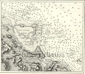
Holy Island or Lindisfarne showing water depths,from an Admiralty Chart,1881 1800s Antique Map
Publicado por Reclus
Librería: Artisans-lane Maps & Prints, Sidney, BC, Canada
Calificación del vendedor: 5 de 5 estrellas
Arte / Grabado / Póster
EUR 12,82
Envío por EUR 16,32
Se envía de Canada a Estados Unidos de AmericaCantidad disponible: 1 disponibles
Añadir al carritono binding. Condición: very good. A small tidal island located off the northeastern coast of England in Northumberland. Actual Map Image Size: 4 1/2 x 5 ins. Overall Size including text and borders : 10 1/2 x 7 Ins . CONDITION: This is a Wood Engraved Intext map with text on the back. Clear and sharp with beautiful detail. As scanned. NOTE THE FOLLOWING BEFORE YOU PURCHASE: This is a GENUINE ANTIQUE VINTAGE 1880s MAP. It is NOT a modern reproduction, ie. a laser scan, photocopy etc. It is the original from the antique or vintage atlas or book publication. This intext map was published on the date mentioned, or circa of the date mentioned at the top of the page. The map I have for sale, like many antique vintage prints and maps that you see online, originate from an antique vintage book or atlas publication. The publication may not always be known. If you have any questions, emails are welcome.


![Imagen del vendedor de The Admiralty Chart: British Naval Hydrography in the 19th Century [Apr 01, 1967] Ritchie, G.S. a la venta por Captain John Smith's Books](https://pictures.abebooks.com/inventory/md/md32379685654.jpg)