

Importe total (1 artículo artículos):
Destino del pedido:

1695 1st issue antique map (17 resultados)
Ir a los resultados principales
Filtros de búsqueda
Tipo de artículo
- Todos los tipos de productos
- Libros (No hay ningún otro resultado que coincida con este filtro.)
- Revistas y publicaciones (No hay ningún otro resultado que coincida con este filtro.)
- Cómics (No hay ningún otro resultado que coincida con este filtro.)
- Partituras (No hay ningún otro resultado que coincida con este filtro.)
- Arte, grabados y pósters (No hay ningún otro resultado que coincida con este filtro.)
- Fotografías (No hay ningún otro resultado que coincida con este filtro.)
- Mapas (17)
- Manuscritos y coleccionismo de papel (No hay ningún otro resultado que coincida con este filtro.)
Condición Más información
- Nuevo (No hay ningún otro resultado que coincida con este filtro.)
- Como nuevo, Excelente o Muy bueno (5)
- Bueno o Aceptable (No hay ningún otro resultado que coincida con este filtro.)
- Regular o Pobre (No hay ningún otro resultado que coincida con este filtro.)
- Tal como se indica (12)
Encuadernación
- Todas
- Tapa dura (No hay ningún otro resultado que coincida con este filtro.)
- Tapa blanda (No hay ningún otro resultado que coincida con este filtro.)
Más atributos
- Primera edición (1)
- Firmado (1)
- Sobrecubierta (No hay ningún otro resultado que coincida con este filtro.)
- Con imágenes (17)
- No impresión bajo demanda (17)
Idioma (1)
Precio
- Cualquier precio
- Menos de EUR 20 (No hay ningún otro resultado que coincida con este filtro.)
- EUR 20 a EUR 45
- Más de EUR 45
Gastos de envío gratis
- Envío gratis a Estados Unidos de America (No hay ningún otro resultado que coincida con este filtro.)
Ubicación del vendedor
Valoración de los vendedores
-

1695 HUNTINGDONSHIRE Original Antique Map 1st Issue by Robert Morden (SM4-32)
Librería: Antique Paper Company, ASHFORD, KENT, Reino Unido
Calificación del vendedor: 2 de 5 estrellas

Mapa
EUR 30,23
Envío por EUR 7,04
Se envía de Reino Unido a Estados Unidos de AmericaCantidad disponible: 1 disponibles
Añadir al carrito1695 HUNTINTONSHIRE Original antique map by Robert Morden. 1st Issue. Overall size approx 43cm x 37cm. Condition is good with central fold as issued.
-

1695 BEDFORDSHIRE Original Antique Map 1st Issue by Robert Morden (SM4-34)
Librería: Antique Paper Company, ASHFORD, KENT, Reino Unido
Calificación del vendedor: 2 de 5 estrellas
Mapa
EUR 42,32
Envío por EUR 7,04
Se envía de Reino Unido a Estados Unidos de AmericaCantidad disponible: 1 disponibles
Añadir al carrito1695 BEDFORDSHIRE Original antique map by Robert Morden. 1st Issue. Overall size approx 44cm x 37cm. Condition is excellentwith central fold as issued,.
-

1695 Antique 1st Issue Map of BUCKINGHAMSHIRE by Robert Morden (GSM38)
Librería: Antique Paper Company, ASHFORD, KENT, Reino Unido
Calificación del vendedor: 2 de 5 estrellas
Mapa
EUR 48,36
Envío por EUR 7,04
Se envía de Reino Unido a Estados Unidos de AmericaCantidad disponible: 1 disponibles
Añadir al carrito1695 - BUCKINGHAMSHIRE An original 1st Issue antique map of North Wales by Robert Morden.Robert Morden was an English publisher, bookseller, mapseller, cartographer, globe and instrument maker. He worked in London at the Atlas in New Cheapside and at the Atlas in Cornhill from 1675 to 1703. His output in cartographical works was quite large and varied. It included geographical playing cards, large scale maps in a number of sheets, the most important being a 12 sheet plan of London by William Morgan. He is probably best known for his series of county maps in Camdens Britannia. This work had last been published in 1637 and illustrated with county maps by William Hole and William Kip. The new edition was published in 1695 by Edmund Gibson, Bishop of Lincoln, printed by F. Collins for Abel Swalle at the West end of St. Pauls Church yard and for Awnsham and John Churchill at the Black Swan in Paternoster Row.Condition is good with central fold as issued. Size approx 44.5cm x 39cm including margins.
-

1695 RUTLAND Original Antique Map by Morden 1st Issue (LM30-29)
Librería: Antique Paper Company, ASHFORD, KENT, Reino Unido
Calificación del vendedor: 2 de 5 estrellas
Mapa
EUR 54,41
Envío por EUR 7,04
Se envía de Reino Unido a Estados Unidos de AmericaCantidad disponible: 1 disponibles
Añadir al carrito1695 COMITATUS ROTELANDIAE Tabula Nova Aucta. A fine antique map of RUTLAND by Robert Morden. 1st Issue. Size approx 42cm x 36cm. Condition is excellent with central fold as issued fine hand colour.
-

1695 LEICESTERSHIRE Original Antique Map 1st Issue by Robert Morden (SM4-31)
Librería: Antique Paper Company, ASHFORD, KENT, Reino Unido
Calificación del vendedor: 2 de 5 estrellas
Mapa
EUR 54,41
Envío por EUR 7,04
Se envía de Reino Unido a Estados Unidos de AmericaCantidad disponible: 1 disponibles
Añadir al carrito1695 LEICESTERSHIRE Original antique map by Robert Morden. 1st Issue. Overall size approx 43cm x 37cm. Condition is good with central fold as issued,.
-

1695 1st issue Antique Map MONMOUTH Monmouthshire Wales Robert Morden (GSM36)
Librería: Antique Paper Company, ASHFORD, KENT, Reino Unido
Calificación del vendedor: 2 de 5 estrellas
Mapa
EUR 48,36
Envío por EUR 7,04
Se envía de Reino Unido a Estados Unidos de AmericaCantidad disponible: 1 disponibles
Añadir al carritoNo Binding. Condición: Fine. No Jacket. 1695- THE COUNTY OF MONMOUTH An original 1st Issue antique map of Monmouthshire by Robert Morden.Robert Morden was an English publisher, bookseller, mapseller, cartographer, globe and instrument maker. He worked in London at the Atlas in New Cheapside and at the Atlas in Cornhill from 1675 to 1703. His output in cartographical works was quite large and varied. It included geographical playing cards, large scale maps in a number of sheets, the most important being a 12 sheet plan of London by William Morgan.He is probably best known for his series of county maps in Camdens Britannia. This work had last been published in 1637 and illustrated with county maps by William Hole and William Kip. The new edition was published in 1695 by Edmund Gibson, Bishop of Lincoln, printed by F. Collins for Abel Swalle at the West end of St. Pauls Church yard and for Awnsham and John Churchill at the Black Swan in Paternoster Row.Condition is very fine with central fold as issued. Size approx 44.5cm x 39cm including margins.Antique Paper Company are a long established family business selling original antique prints, maps engravings as well as many other paper antiques such as original vintage Decorative Posters, Ephemera, Stamps Postal History, Manuscripts, Antiquarian Books much more. We are always looking to buy and have up to andpound;500,000 in immediate funds available. We are looking for exceptional single items, better collections, original archives, Atlases, Libraries, accumulations etc and have previously purchased from Major Institutions, Libraries, Collectors, Solicitors many other sources. We are happy to travel almost anywhere in the world for the right opportunities. So please do get in touch if you are considering selling your Antique Paper collectables.
-

1695 BEDFORDSHIRE Original Antique Map 1st Issue by Robert Morden (LM30-28)
Librería: Antique Paper Company, ASHFORD, KENT, Reino Unido
Calificación del vendedor: 2 de 5 estrellas
Mapa
EUR 72,54
Envío por EUR 7,04
Se envía de Reino Unido a Estados Unidos de AmericaCantidad disponible: 1 disponibles
Añadir al carrito1695 BEDFORDSHIRE. A very fine example of this 1st Edition map of Bedfordshire by Robert Morden.Excellent condition with central fold as issued and fine hand colour. There are some light tone spots top the upper right cornerSize approx 45cm x 39cm including margins. Central fold as issued.Robert Morden (1650-1703)was an English publisher, bookseller, mapseller, cartographer, globe and instrument maker. He worked in London at the Atlas in New Cheapside and at the Atlas in Cornhill from 1675 to 1703. His output in cartographical works was quite large and varied. It included geographical playing cards, large scale maps in a number of sheets, the most important being a 12 sheet plan of London by William Morgan. He is probably best known for his series of county maps in Camdens Britannia. This work had last been published in 1637 and illustrated with county maps by William Hole and William Kip. The new edition was published in 1695 by Edmund Gibson, Bishop of Lincoln, printed by F. Collins for Abel Swalle at the West end of St. Pauls Church yard and for Awnsham and John Churchill at the Black Swan in Paternoster Row.
-

1695 BRITANNIA SAXONICA Saxon England Wales Antique Map 1st Issue Morden (LM30-27)
Librería: Antique Paper Company, ASHFORD, KENT, Reino Unido
Calificación del vendedor: 2 de 5 estrellas
Mapa
EUR 72,54
Envío por EUR 7,04
Se envía de Reino Unido a Estados Unidos de AmericaCantidad disponible: 1 disponibles
Añadir al carrito1695 BRITANNIA SAXONICA. Original antique map of Saxon England Wales by Robert Morden. 1st Issue. Overall size approx 43cm x 37cm. Condition is excellent with central fold as issued.
-

1695 LEICESTERSHIRE Original Antique Map 1st Issue by Robert Morden (LM30-30)
Librería: Antique Paper Company, ASHFORD, KENT, Reino Unido
Calificación del vendedor: 2 de 5 estrellas
Mapa
EUR 72,54
Envío por EUR 7,04
Se envía de Reino Unido a Estados Unidos de AmericaCantidad disponible: 1 disponibles
Añadir al carrito1695 LEICESTERSHIRE A fine antique map of Leicestershire by Robert Morden. Ist Issue. Size approx 44cm x 37cm. Condition is very fine with central fold as issued.
-

1695 Original Antique Map of HEREFORDSHIRE by Robert Morden 1st Issue
Librería: Antique Paper Company, ASHFORD, KENT, Reino Unido
Calificación del vendedor: 2 de 5 estrellas
Mapa
EUR 90,68
Envío por EUR 7,04
Se envía de Reino Unido a Estados Unidos de AmericaCantidad disponible: 1 disponibles
Añadir al carrito1695 HEREFORDSHIRE. Original antique of Herefordshire by Robert Morden. This example is from the 1st issue published in 1695. Overall size approx 40cm x 45cm. Condition is good with central vertical fold as issued.
-

1695 1st Issue NORTHAMPTONSHIRE original antique Map Robert Morden (LM32-55)
Librería: Antique Paper Company, ASHFORD, KENT, Reino Unido
Calificación del vendedor: 2 de 5 estrellas
Mapa
EUR 90,68
Envío por EUR 7,04
Se envía de Reino Unido a Estados Unidos de AmericaCantidad disponible: 1 disponibles
Añadir al carrito1695 NORTHAMPTONSHIRE.A fine example of this 1st Issue map of NORTHAMPTONSHIRE by Robert Morden. Excellent condition with central fold as issued and fine hand colour. Size approx 42cm x 37cm including margins. Central fold as issued. Condition is good with small piece of bottom centre margin missingRobert Morden (1650-1703) was an English publisher, bookseller, mapseller, cartographer, globe and instrument maker. He worked in London at the Atlas in New Cheapside and at the Atlas in Cornhill from 1675 to 1703. His output in cartographical works was quite large and varied. It included geographical playing cards, large scale maps in a number of sheets, the most important being a 12 sheet plan of London by William Morgan. He is probably best known for his series of county maps in Camdens Britannia. This work had last been published in 1637 and illustrated with county maps by William Hole and William Kip. The new edition was published in 1695 by Edmund Gibson, Bishop of Lincoln, printed by F. Collins for Abel Swalle at the West end of St. Pauls Church yard and for Awnsham and John Churchill at the Black Swan in Paternoster Row.
-

1695 THE EAST RIDING OF YORKSHIRE Antique Map by Morden 1st Issue (SM4-39)
Librería: Antique Paper Company, ASHFORD, KENT, Reino Unido
Calificación del vendedor: 2 de 5 estrellas
Mapa
EUR 108,81
Envío por EUR 7,04
Se envía de Reino Unido a Estados Unidos de AmericaCantidad disponible: 1 disponibles
Añadir al carrito1695 THE EAST RIDING OF YORKSHIRE by Robert Morden. A fine antique map of the East Riding of Yorkshire by Robert Morden. 1st Issue. Size approx 43cm x 38cm. Condition is excellent with central fold as issued fine hand colour.
-

1695 SOUTH WALES Original 1st Issue Antique Map by Robert Morden (LM33-23)
Librería: Antique Paper Company, ASHFORD, KENT, Reino Unido
Calificación del vendedor: 2 de 5 estrellas
Mapa
EUR 132,99
Envío por EUR 7,04
Se envía de Reino Unido a Estados Unidos de AmericaCantidad disponible: 1 disponibles
Añadir al carrito1695 - SOUTH WALES Original 1st issue antique map of the region of South Wales by Robert Morden. Covering the regions ofPembroke, Glamorgan, Carmarthen etc. Overall size approx 43cm x 38cm including margins. Condition is very fine with central fold as issued.
-
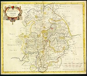
1695 Original Antique Map of WARWICKSHIRE Robert Morden Rare 1st Issue COLOUR
Librería: Antique Paper Company, ASHFORD, KENT, Reino Unido
Calificación del vendedor: 2 de 5 estrellas
Mapa Ejemplar firmado
EUR 102,77
Envío por EUR 7,04
Se envía de Reino Unido a Estados Unidos de AmericaCantidad disponible: 1 disponibles
Añadir al carritoNo Binding. Condición: Fine. No Jacket. 1695 Original Antique Map of WARWICKSHIRE Robert Morden Rare 1st Issue COLOUR For more info please ask seller a question. Royal Mail 2nd Class - £0.00 Royal Mail 2nd Class Signed For - £4.50 Standard Int'l age - £4.00 Royal Mail International Signed - £8.00 No PICK UP OPTIONSorry, our items are NOT available for pick-up.PAYING VIA PAYPALWe accept on our all our items so you can shop with confidence.Simple choose the option when proceeding through the checkout.
-

1695 Antique Map YORKSHIRE EAST RIDING Robert Morden RARE 1st Issue COLOUR
Librería: Antique Paper Company, ASHFORD, KENT, Reino Unido
Calificación del vendedor: 2 de 5 estrellas
Mapa
EUR 139,04
Envío por EUR 7,04
Se envía de Reino Unido a Estados Unidos de AmericaCantidad disponible: 1 disponibles
Añadir al carritoNo Binding. Condición: Fine. No Jacket. Listing Template 2018 Home About Us View Feedback Contact Us 1695 Antique Map YORKSHIRE EAST RIDING Robert Morden RARE 1st Issue COLOURDescription1695A 1st EditionOriginal Antique Map titled THE EAST RIDING OF YORKSHIREA fine and rare Copper Engraved original antique Map with decorative Cartouche and enhanced with later hand colouring. This example of from the very rare Gibson First Edition in 1695, significantly rarer than the 1722 and later editionsConditionOverall in excellent condition and central fold as issued. Overall size approx 50cm x 39cm with good large margins, perfect for mounting framing. View Our Categories Decorative Prints World Wide Maps Scotland Maps Architecture Design England Maps Royalty About UsWe specialise in selling all items that can be considered to be Antique Paper. * PRINTS * MAPS * HISTORICAL DOCUMENTS * POSTAL HISTORY * BOOKS * POSTERS * STAMPS * POSTCARDS * EPHEMERA And anything else that is considered Antique and made of Paper. ALL OF OUR ITEMS ARE ORIGINAL ANTIQUES - NOT MODERN COPIES. We are also very keen buyers of anything similar and especially after better collections, original archives, whole libraries and better single items and have and#163;250,000 in cash funds at anyone time to buy the right items. Contact UsIf you have any questions then please do not hesitate to contact us through the eBay messaging system. Feedback We will always help you to have a 100% positive happy buying experience. Contact us if you are unhappy about any aspect of your purchase from us. We only want five star feedback from you so buy with confidence.
-
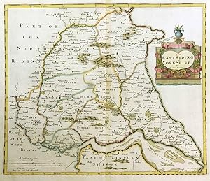
1695 Antique Map YORKSHIRE EAST RIDING Robert Morden RARE 1st Issue COLOUR
Librería: Antique Paper Company, ASHFORD, KENT, Reino Unido
Calificación del vendedor: 2 de 5 estrellas
Mapa Original o primera edición
EUR 139,04
Envío por EUR 7,04
Se envía de Reino Unido a Estados Unidos de AmericaCantidad disponible: 1 disponibles
Añadir al carritoNo Binding. Condición: Fine. No Jacket. 1695 A 1st Edition Original Antique Map titled THE EAST RIDING OF YORKSHIRE A fine and rare Copper Engraved original antique Map with decorative Cartouche and enhanced with later hand colouring. This exle of from the very rare Gibson First Edition in 1695, significantly rarer than the 1722 and later editions. Condition Overall in excellent condition and central fold as issued. Overall size approx 50cm x 39cm with good large margins, perfect for mounting & framing. WE ONLY SELL ORIGINAL ANTIQUE MAPS AND PRINTS AND NEVER SELL REPRODUCTIONS. All our items are original Antiques and as described.
-

1695 Antique Map of CHANNEL SMALLER ISLANDS Robert Morden 1st Issue COLOUR
Librería: Antique Paper Company, ASHFORD, KENT, Reino Unido
Calificación del vendedor: 2 de 5 estrellas
Mapa
EUR 211,58
Envío por EUR 7,04
Se envía de Reino Unido a Estados Unidos de AmericaCantidad disponible: 1 disponibles
Añadir al carritoNo Binding. Condición: Fine. No Jacket. Listing Template 2018 Home About Us View Feedback Contact Us 1695 Antique Map of CHANNEL SMALLER ISLANDS Robert Morden 1st Issue COLOURDescription1695A 1st EditionOriginal Antique Map titledTHE SMALLER ISLANDS IN THE BRITISH OCEANA fine and rare Copper Engraved original antique Map with decorative Cartouche and enhanced with later hand colouring. This example of from the very rare Gibson First Edition in 1695, significantly rarer than the 1722 and later editions.ConditionOverall in excellent condition and central fold as issued. Overall size approx 50cm x 39cm with good large margins, perfect for mounting framing.WE ONLY SELL ORIGINAL ANTIQUE MAPS AND PRINTS AND NEVER SELL REPRODUCTIONS.All our items are original Antiques and as described.We provide a No Quibble Money Back Guarantee View Our Categories Decorative Prints World Wide Maps Scotland Maps Architecture Design England Maps Royalty About UsWe specialise in selling all items that can be considered to be Antique Paper. * PRINTS * MAPS * HISTORICAL DOCUMENTS * POSTAL HISTORY * BOOKS * POSTERS * STAMPS * POSTCARDS * EPHEMERA And anything else that is considered Antique and made of Paper. ALL OF OUR ITEMS ARE ORIGINAL ANTIQUES - NOT MODERN COPIES. We are also very keen buyers of anything similar and especially after better collections, original archives, whole libraries and better single items and have and#163;250,000 in cash funds at anyone time to buy the right items. Contact UsIf you have any questions then please do not hesitate to contact us through the eBay messaging system. Feedback We will always help you to have a 100% positive happy buying experience. Contact us if you are unhappy about any aspect of your purchase from us. We only want five star feedback from you so buy with confidence.
