
Importe total (1 artículo artículos):
Destino del pedido:

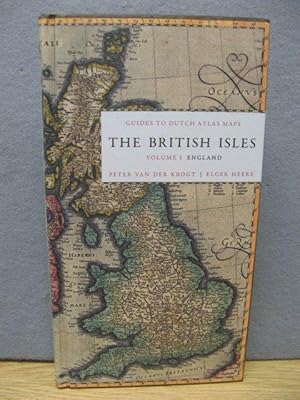
9789061943907 - GUIDES OF DUTCH ATLAS MAPS 1570-1662: England: 1 de VAN DER KROGT, P.; HEERE, ELGER (10 resultados)
Ir a los resultados principales
Filtros de búsqueda
Tipo de artículo
- Todos los tipos de productos
- Libros (10)
- Revistas y publicaciones (No hay ningún otro resultado que coincida con este filtro.)
- Cómics (No hay ningún otro resultado que coincida con este filtro.)
- Partituras (No hay ningún otro resultado que coincida con este filtro.)
- Arte, grabados y pósters (No hay ningún otro resultado que coincida con este filtro.)
- Fotografías (No hay ningún otro resultado que coincida con este filtro.)
- Mapas (No hay ningún otro resultado que coincida con este filtro.)
- Manuscritos y coleccionismo de papel (No hay ningún otro resultado que coincida con este filtro.)
Condición Más información
- Nuevo (3)
- Como nuevo, Excelente o Muy bueno (2)
- Bueno o Aceptable (1)
- Regular o Pobre (No hay ningún otro resultado que coincida con este filtro.)
- Tal como se indica (4)
Encuadernación
- Todas
- Tapa dura (10)
- Tapa blanda (No hay ningún otro resultado que coincida con este filtro.)
Más atributos
- Primera edición (1)
- Firmado (No hay ningún otro resultado que coincida con este filtro.)
- Sobrecubierta (No hay ningún otro resultado que coincida con este filtro.)
- Con imágenes (6)
- No impresión bajo demanda (10)
Idioma (1)
Precio
- Cualquier precio
- Menos de EUR 20 (No hay ningún otro resultado que coincida con este filtro.)
- EUR 20 a EUR 45
- Más de EUR 45
Gastos de envío gratis
- Envío gratis a Estados Unidos de America (No hay ningún otro resultado que coincida con este filtro.)
Ubicación del vendedor
Valoración de los vendedores
-
GUIDES TO DUTCH ATLAS MAPS: THE BRITISH ISLES, VOLUME 1: ENGLAND
Idioma: Inglés
Publicado por Oak Knoll Press and HES & DE GRAAF, New Castle and Houten, 2011
ISBN 10: 9061943906 ISBN 13: 9789061943907
Librería: Oak Knoll Books, ABAA, ILAB, NEW CASTLE, DE, Estados Unidos de America
Miembro de asociación: ABAA ILAB MBS
Calificación del vendedor: 5 de 5 estrellas

EUR 45,08
Envío por EUR 7,45
Se envía dentro de Estados Unidos de AmericaCantidad disponible: Más de 20 disponibles
Ańadir al carritoHardcover. 5 x 9.5 inches. Hardcover. 256 pages. This is the first in a series of sixteen reference guides designed for the historic and antique map collector, curator, or enthusiast. Between the sixteenth and eighteenth centuries, the Netherlands had a thriving map production and publishing industry, with figures like Johannes Blaeu and Abraham Ortelius leading the Dutch cartographic industry. The maps produced in these three centuries are now rare and highly sought after by a large community of collectors, map curators, dealers of antiquities, and enthusiasts. This series will provide short, clear, and academically valid information about all Dutch atlas maps regarding a certain country or area. Counties and regions to be examined include Scandinavia, Baltic/Russia, Germany, Austria/Hungary, France, Switzerland, England, Scotland, Wales, Ireland, Spain, Portugal, Italy, Greece, Asia, Africa, and America. Each part will detail the edition of the atlas(es) in which the maps have been incorporated, the year of publication, the known states, cartographic references, and remarks by the author. This first volume offers a descriptive catalogue of all the maps of England and English counties, published in Dutch atlases between 1570 and 1650. The catalogue of maps is preceded by a guide to the descriptions and a comprehensive list of the atlases cited. The map descriptions are given in a simplified ISBD format listing map number as it appears in the Atlantis Neerlandici, area description, title, translated title (usually from Latin to English), imprint, dimensions, notes (on the map, mapped area, the atlas in which the map first appeared, or the person to whom the map is dedicated), occurrence in atlases, and references to general carto-bibliographies or literature. Each entry is accompanied by a black-and-white map illustration. The book also contains biographies of Dutch atlas publishers including Abraham Ortelius, Gerard Mercator, Hondius & Janssonius, The Blaeus, and others. Available outside North America from HES & DE GRAAF.
-

Guides to Dutch Atlas Maps The British isles Vol 1: England
Librería: Houtman Boeken, Utrecht, Holanda
Calificación del vendedor: 5 de 5 estrellas
EUR 25,24
Envío por EUR 29,95
Se envía de Holanda a Estados Unidos de AmericaCantidad disponible: 1 disponibles
Ańadir al carritoCondición: fine. 2012, Hardcover, 256 blz.
-

The British Isles. Volume 1: England (Guides to Dutch Atlas Maps I)
Idioma: Inglés
Publicado por Houten, HES & De Graaf Publishers bv 2012, 2011
ISBN 10: 9061943906 ISBN 13: 9789061943907
Librería: Antiquariaat Schot, Hendrik-Ido-Ambacht, Holanda
Calificación del vendedor: 5 de 5 estrellas
EUR 32,20
Envío por EUR 25,00
Se envía de Holanda a Estados Unidos de AmericaCantidad disponible: 1 disponibles
Ańadir al carrito256 p. Hardcover (Very fine copy.).
-
The British Isles. Volume 1: England (Guides to Dutch Atlas Maps I)
Idioma: Inglés
Publicado por Houten, HES & De Graaf Publishers bv. 2011, 2011
ISBN 10: 9061943906 ISBN 13: 9789061943907
Librería: Antiquariaat Schot, Hendrik-Ido-Ambacht, Holanda
Calificación del vendedor: 5 de 5 estrellas
EUR 36,80
Envío por EUR 25,00
Se envía de Holanda a Estados Unidos de AmericaCantidad disponible: Más de 20 disponibles
Ańadir al carrito256 p. Hardcover (Very fine copy, like new. Still shrink-wrapped.).
-
Guides to Dutch Atlas Maps I - The British Isles, Vol. 1: England
Idioma: Inglés
Publicado por Hes & De Graaf, Netherlands, 2011
ISBN 10: 9061943906 ISBN 13: 9789061943907
Librería: PsychoBabel & Skoob Books, Didcot, Reino Unido
Calificación del vendedor: 5 de 5 estrellas
EUR 51,12
Envío por EUR 14,51
Se envía de Reino Unido a Estados Unidos de AmericaCantidad disponible: 1 disponibles
Ańadir al carritohardcover. Condición: Very Good. Estado de la sobrecubierta: No Dust Jacket. Hardcover (no jacket) in very good condition. A few scores and imperfections on page block. Text is clear throughout. TS. Used.
-

Guides to Dutch Atlas Maps The Britsh Isles Volume 1; England.
Idioma: Inglés
Publicado por Hes & de Graaf Publishers - Oak Knoll Press, 2011
ISBN 10: 9061943906 ISBN 13: 9789061943907
Librería: Emile Kerssemakers ILAB, Heerlen, Holanda
Miembro de asociación: ILAB NVVA
Calificación del vendedor: 5 de 5 estrellas
EUR 35,00
Envío por EUR 33,00
Se envía de Holanda a Estados Unidos de AmericaCantidad disponible: 1 disponibles
Ańadir al carrito2012, 255pp. Illustrated. Hardcover. 24,5x13,5cm. In very good condition.
-

The British Isles, Volume 1: England. Guide to Dutch Atlas Maps I.
Idioma: Inglés
Publicado por Hes & De Graaf Publishers; Oak Knoll Press, Houten (Netherlands) and New Castle (Delaware), 2012
ISBN 10: 9061943906 ISBN 13: 9789061943907
Librería: Ken Sanders Rare Books, ABAA, Salt Lake City, UT, Estados Unidos de America
Miembro de asociación: ABAA ILAB IOBA RMABA
Calificación del vendedor: 5 de 5 estrellas
Original o primera edición
EUR 67,68
Envío por EUR 6,57
Se envía dentro de Estados Unidos de AmericaCantidad disponible: 1 disponibles
Ańadir al carritoHardcover. Condición: As new. First edition. 255pp. Octavo [24.5 cm] Pictorial paper over boards. A pocket reference guide offering a descriptive catalogue of all the maps of England, and specific parts of the country, published in Dutch atlases between 1570 and 1650. Each map found in the atlases of Ortelius, Mercator-Hondius, Janssonius, and Blaeu is recorded.
-

The British Isles, Volume 1 (Guides to Dutch Atlas Maps)
Idioma: Inglés
Publicado por Brill & Hes & De Graaf, 2011
ISBN 10: 9061943906 ISBN 13: 9789061943907
Librería: Leopolis, Kraków, Polonia
Calificación del vendedor: 5 de 5 estrellas
EUR 57,50
Envío por EUR 65,00
Se envía de Polonia a Estados Unidos de AmericaCantidad disponible: 1 disponibles
Ańadir al carritoHardcover. Condición: New. 8vo (24 cm), 256 pp. Laminated boards. The series "Guides to Dutch Atlas Maps" is designed to provide clear, concise, and academically valid information about all Dutch atlas maps related to a particular country or area. Each volume focuses on the editions of the atlases in which the maps were included, the year of publication, the known states, cartographic references, and remarks by the author. This first volume offers a descriptive catalogue of all maps of England, as well as specific parts of the country, published in Dutch atlases between 1570 and 1650. It records all maps featured in the atlases of Ortelius, Mercator-Hondius, Janssonius, Blaeu, and their followers.
-
The British Isles Volume 1
Idioma: Inglés
Publicado por Brill | Hes & De Graaf, 2011
ISBN 10: 9061943906 ISBN 13: 9789061943907
Librería: Brook Bookstore, Milano, MI, Italia
Calificación del vendedor: 5 de 5 estrellas
EUR 102,07
Envío por EUR 27,99
Se envía de Italia a Estados Unidos de AmericaCantidad disponible: 8 disponibles
Ańadir al carritoCondición: new.
-
The British Isles, volume 1: England. Guides to Dutch Atlas Maps I
Idioma: Inglés
Publicado por Hes & De Graaf Publishers, 2011
ISBN 10: 9061943906 ISBN 13: 9789061943907
Librería: Revaluation Books, Exeter, Reino Unido
Calificación del vendedor: 5 de 5 estrellas
EUR 153,94
Envío por EUR 11,61
Se envía de Reino Unido a Estados Unidos de AmericaCantidad disponible: 1 disponibles
Ańadir al carritoHardcover. Condición: Brand New. 1st edition. 256 pages. 9.69x5.43x0.87 inches. In Stock.
