
Importe total (1 artículo artículos):
Destino del pedido:

9781566955409 - PYRENEES/ANDORRA 1/275.000: Adventure Maps: 3308 (ADVENTURE MAP - 1/275.000) de Nat Geo Maps (15 resultados)
Ir a los resultados principales
Filtros de búsqueda
Tipo de artículo
- Todos los tipos de productos
- Libros (13)
- Revistas y publicaciones (No hay ningún otro resultado que coincida con este filtro.)
- Cómics (No hay ningún otro resultado que coincida con este filtro.)
- Partituras (No hay ningún otro resultado que coincida con este filtro.)
- Arte, grabados y pósters (No hay ningún otro resultado que coincida con este filtro.)
- Fotografías (No hay ningún otro resultado que coincida con este filtro.)
- Mapas (2)
- Manuscritos y coleccionismo de papel (No hay ningún otro resultado que coincida con este filtro.)
Condición Más información
- Nuevo (14)
- Como nuevo, Excelente o Muy bueno (1)
- Bueno o Aceptable (No hay ningún otro resultado que coincida con este filtro.)
- Regular o Pobre (No hay ningún otro resultado que coincida con este filtro.)
- Tal como se indica (No hay ningún otro resultado que coincida con este filtro.)
Encuadernación
- Todas
- Tapa dura (No hay ningún otro resultado que coincida con este filtro.)
- Tapa blanda (No hay ningún otro resultado que coincida con este filtro.)
Más atributos
- Primera edición (No hay ningún otro resultado que coincida con este filtro.)
- Firmado (No hay ningún otro resultado que coincida con este filtro.)
- Sobrecubierta (No hay ningún otro resultado que coincida con este filtro.)
- Con imágenes (6)
- No impresión bajo demanda (15)
Idioma (1)
Precio
- Cualquier precio
- Menos de EUR 20
- EUR 20 a EUR 45
- Más de EUR 45 (No hay ningún otro resultado que coincida con este filtro.)
Gastos de envío gratis
Ubicación del vendedor
Valoración de los vendedores
-
Pyrenees Andorra Adventure Travel Map: France, Spain (Sheet Map, Folded)
Idioma: Inglés
Publicado por National Geographic Maps 7/11/2011, 2011
ISBN 10: 1566955408 ISBN 13: 9781566955409
Librería: BargainBookStores, Grand Rapids, MI, Estados Unidos de America
Calificación del vendedor: 5 de 5 estrellas

EUR 13,00
Gastos de envío gratis
Se envía dentro de Estados Unidos de AmericaCantidad disponible: 2 disponibles
Ańadir al carritoSheet Map, Folded. Condición: New. Pyrenees Andorra Adventure Travel Map: France, Spain. Book.
-

Pyrenees and Andorra (National Geographic Adventure Map)
Idioma: Inglés
Publicado por National Geographic Maps, 2022
ISBN 10: 1566955408 ISBN 13: 9781566955409
Librería: Lakeside Books, Benton Harbor, MI, Estados Unidos de America
Calificación del vendedor: 5 de 5 estrellas
EUR 9,75
Envío por EUR 3,48
Se envía dentro de Estados Unidos de AmericaCantidad disponible: 3 disponibles
Ańadir al carritoCondición: New. Brand New! Not Overstocks or Low Quality Book Club Editions! Direct From the Publisher! We're not a giant, faceless warehouse organization! We're a small town bookstore that loves books and loves it's customers! Buy from Lakeside Books!
-

Pyrenees and Andorra Map
Idioma: Inglés
Publicado por National Geographic Maps, US, 2011
ISBN 10: 1566955408 ISBN 13: 9781566955409
Librería: Rarewaves USA, OSWEGO, IL, Estados Unidos de America
Calificación del vendedor: 5 de 5 estrellas
EUR 13,37
Gastos de envío gratis
Se envía dentro de Estados Unidos de AmericaCantidad disponible: 3 disponibles
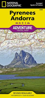
Ańadir al carritoMap. Condición: New. . Waterproof . Tear-Resistant . Travel MapNational Geographic's Pyrenees and Andorra Adventure Map provides global travelers with the perfect combination of detail and perspective in a highly functional travel tool. This map includes the locations of cities and towns with a user-friendly index, plus a clearly marked road network complete with distances and designations for roads and highways. Beaches and yachting harbors dot Spain and France's Mediterranean coastlines while the location of golf courses, camping sites, waterfalls, caves, and ski areas make it easy to enjoy the region's abundant outdoor activities. National parks, World Heritage sites, scenic viewpoints, antiquity sites, museums, and more are included, making it invaluable to travelers hoping to experience all the history, art, and culture the region has to offer.The front side of the print map shows the country of Andorra and the eastern half of the Pyrenees including the cities of Narbonne, Carcassone, Pamiers, St-Gaudens, St-Girons, Perpignan in France, and Balaguer, Manresa, and Figueres in Spain. The reverse side of the map stretches from the city of Biarritz on the Bay of Biscay eastward to include Pamplona and Huesca, Spain, and Pau, Tarbes, and the famed pilgrimage site of Lourdes, France. Popular for alpine skiing and mountaineering, the Pyrenees are a scenic mountain range which form a natural boundary between Spain and France. Stages of two of cycling's epic grand tours - the Tour de France and the Vuelta a Espańa - traverse the Pyrenees and three long-distance footpaths run the length of the mountain range. Nestled in the center of the Pyrenees is the ruggedly beautiful Andorra, the sixth smallest country in Europe which is roughly two and a half times the size of Washington, D.C. Its picturesque mountain vistas and easy charm have made Andorra a favorite destination for savvy travelers. Every Adventure Map is printed on durable synthetic paper, making them waterproof, tear-resistant and tough - capable of withstanding the rigors of international travel.
-
Pyrenees and Andorra Map (National Geographic Adventure Map, 3308)
Idioma: Inglés
Publicado por Natl Geographic Society Maps, 2022
ISBN 10: 1566955408 ISBN 13: 9781566955409
Librería: California Books, Miami, FL, Estados Unidos de America
Calificación del vendedor: 4 de 5 estrellas

EUR 14,38
Gastos de envío gratis
Se envía dentro de Estados Unidos de AmericaCantidad disponible: 7 disponibles
Ańadir al carritoCondición: New.
-
Pyrenees and Andorra Map
Idioma: Inglés
Publicado por National Geographic Maps, 2011
ISBN 10: 1566955408 ISBN 13: 9781566955409
Librería: PBShop.store US, Wood Dale, IL, Estados Unidos de America
Calificación del vendedor: 5 de 5 estrellas
EUR 21,97
Gastos de envío gratis
Se envía dentro de Estados Unidos de AmericaCantidad disponible: 15 disponibles
Ańadir al carritoUNK. Condición: New. New Book. Shipped from UK. Established seller since 2000.
-
Pyrenees and Andorra Map
Idioma: Inglés
Publicado por National Geographic Maps, 2011
ISBN 10: 1566955408 ISBN 13: 9781566955409
Librería: PBShop.store UK, Fairford, GLOS, Reino Unido
Calificación del vendedor: 5 de 5 estrellas
EUR 17,93
Envío por EUR 3,79
Se envía de Reino Unido a Estados Unidos de AmericaCantidad disponible: 15 disponibles
Ańadir al carritoUNK. Condición: New. New Book. Shipped from UK. Established seller since 2000.
-
Pyrenees and Andorra Map (Folded)
Idioma: Inglés
Publicado por National Geographic Maps, Evergreen, 2011
ISBN 10: 1566955408 ISBN 13: 9781566955409
Librería: Grand Eagle Retail, Bensenville, IL, Estados Unidos de America
Calificación del vendedor: 5 de 5 estrellas
EUR 22,24
Gastos de envío gratis
Se envía dentro de Estados Unidos de AmericaCantidad disponible: 1 disponibles
Ańadir al carritoFolded. Condición: new. Folded. AdventureMaps provide global travellers with the perfect combination of detail and perspective, highlighting hundreds of points of interest and the diverse and unique destinations within the country. Each map is printed on durable synthetic paper, making them waterproof and tear-resistant. They also include the locations of cities and towns with a user-friendly index, plus a clearly marked road network complete with distances and designations for major highways, main roads and tracks and trails for those seeking to explore more remote regions. Shipping may be from multiple locations in the US or from the UK, depending on stock availability.
-
National Geographic Pyrenees Andorra : Europe/Spain & France: Adventure Travel Map
Idioma: Inglés
Publicado por National Geographic Maps, 2011
ISBN 10: 1566955408 ISBN 13: 9781566955409
Librería: Revaluation Books, Exeter, Reino Unido
Calificación del vendedor: 5 de 5 estrellas
Mapa
EUR 13,42
Envío por EUR 11,52
Se envía de Reino Unido a Estados Unidos de AmericaCantidad disponible: 2 disponibles
Ańadir al carritoSheet map. Condición: Brand New. map edition. 2 pages. 0.25x9.25x4.25 inches. In Stock.
-
Pyrenees and Andorra (National Geographic Adventure Map (3308))
Idioma: Inglés
Publicado por National Geographic Maps, 2019
ISBN 10: 1566955408 ISBN 13: 9781566955409
Librería: Russell Books, Victoria, BC, Canada
Calificación del vendedor: 5 de 5 estrellas
EUR 10,75
Envío por EUR 17,45
Se envía de Canada a Estados Unidos de AmericaCantidad disponible: 7 disponibles
Ańadir al carritoMap. Condición: New. Special order direct from the distributor.
-
Pyrenees And Andorra: Travel Maps International Adventure Map
Idioma: Inglés
Publicado por National Geographic Maps, 2022
ISBN 10: 1566955408 ISBN 13: 9781566955409
Librería: THE SAINT BOOKSTORE, Southport, Reino Unido
Calificación del vendedor: 5 de 5 estrellas
EUR 17,57
Envío por EUR 13,80
Se envía de Reino Unido a Estados Unidos de AmericaCantidad disponible: 5 disponibles
Ańadir al carritoSheet map, folded. Condición: New. New copy - Usually dispatched within 4 working days.
-
PYRENEES ANDORRA 3308
Librería: Libreria della Natura, Milano, MI, Italia
Calificación del vendedor: 5 de 5 estrellas
EUR 11,95
Envío por EUR 36,00
Se envía de Italia a Estados Unidos de AmericaCantidad disponible: 1 disponibles
Ańadir al carritoLEGATURA EDITORIALE. Condición: NUOVO.
-

Pyrenees and Andorra Map
Idioma: Inglés
Publicado por National Geographic Maps, US, 2011
ISBN 10: 1566955408 ISBN 13: 9781566955409
Librería: Rarewaves USA United, OSWEGO, IL, Estados Unidos de America
Calificación del vendedor: 5 de 5 estrellas
EUR 17,56
Envío por EUR 43,64
Se envía dentro de Estados Unidos de AmericaCantidad disponible: 3 disponibles
Ańadir al carritoMap. Condición: New. . Waterproof . Tear-Resistant . Travel MapNational Geographic's Pyrenees and Andorra Adventure Map provides global travelers with the perfect combination of detail and perspective in a highly functional travel tool. This map includes the locations of cities and towns with a user-friendly index, plus a clearly marked road network complete with distances and designations for roads and highways. Beaches and yachting harbors dot Spain and France's Mediterranean coastlines while the location of golf courses, camping sites, waterfalls, caves, and ski areas make it easy to enjoy the region's abundant outdoor activities. National parks, World Heritage sites, scenic viewpoints, antiquity sites, museums, and more are included, making it invaluable to travelers hoping to experience all the history, art, and culture the region has to offer.The front side of the print map shows the country of Andorra and the eastern half of the Pyrenees including the cities of Narbonne, Carcassone, Pamiers, St-Gaudens, St-Girons, Perpignan in France, and Balaguer, Manresa, and Figueres in Spain. The reverse side of the map stretches from the city of Biarritz on the Bay of Biscay eastward to include Pamplona and Huesca, Spain, and Pau, Tarbes, and the famed pilgrimage site of Lourdes, France. Popular for alpine skiing and mountaineering, the Pyrenees are a scenic mountain range which form a natural boundary between Spain and France. Stages of two of cycling's epic grand tours - the Tour de France and the Vuelta a Espańa - traverse the Pyrenees and three long-distance footpaths run the length of the mountain range. Nestled in the center of the Pyrenees is the ruggedly beautiful Andorra, the sixth smallest country in Europe which is roughly two and a half times the size of Washington, D.C. Its picturesque mountain vistas and easy charm have made Andorra a favorite destination for savvy travelers. Every Adventure Map is printed on durable synthetic paper, making them waterproof, tear-resistant and tough - capable of withstanding the rigors of international travel.
-
Pyrenees Andorra Adventure Travel Map: France, Spain
Idioma: Inglés
Publicado por National Geographic Maps, 2013
ISBN 10: 1566955408 ISBN 13: 9781566955409
Librería: moluna, Greven, Alemania
Calificación del vendedor: 5 de 5 estrellas
EUR 14,14
Envío por EUR 48,99
Se envía de Alemania a Estados Unidos de AmericaCantidad disponible: 5 disponibles
Ańadir al carritoCondición: New. wasser- und reissfest Sehenswuerdigkeiten mit Naturschutzgebieten und historischen AttraktionenAdventureMaps provide global travellers with the perfect combination of detail and perspective, highlighting hundreds of points of interest and the diverse an.
-

Pyrenees and Andorra Map (Folded)
Idioma: Inglés
Publicado por National Geographic Maps, Evergreen, 2011
ISBN 10: 1566955408 ISBN 13: 9781566955409
Librería: AussieBookSeller, Truganina, VIC, Australia
Calificación del vendedor: 5 de 5 estrellas
EUR 39,45
Envío por EUR 32,29
Se envía de Australia a Estados Unidos de AmericaCantidad disponible: 1 disponibles
Ańadir al carritoFolded. Condición: new. Folded. AdventureMaps provide global travellers with the perfect combination of detail and perspective, highlighting hundreds of points of interest and the diverse and unique destinations within the country. Each map is printed on durable synthetic paper, making them waterproof and tear-resistant. They also include the locations of cities and towns with a user-friendly index, plus a clearly marked road network complete with distances and designations for major highways, main roads and tracks and trails for those seeking to explore more remote regions. Shipping may be from our Sydney, NSW warehouse or from our UK or US warehouse, depending on stock availability.
-

Pyrenäen und Andorra: NATIONAL GEOGRAPHIC Adventure Maps: Protected Areas, Points of Interest, Detailed Road Network and Town Location Index : Protected Areas, Points of Interest, Detailed Road Network and Town Location Index
Idioma: Inglés
Publicado por National Geographic Maps, 2011
ISBN 10: 1566955408 ISBN 13: 9781566955409
Librería: AHA-BUCH GmbH, Einbeck, Alemania
Calificación del vendedor: 5 de 5 estrellas
Mapa
EUR 15,68
Envío por EUR 60,48
Se envía de Alemania a Estados Unidos de AmericaCantidad disponible: 1 disponibles
Ańadir al carritomap. Condición: Sehr gut. Gebraucht - Sehr gut SG - leichte Beschädigungen oder Verschmutzungen, ungelesenes Mängelexemplar, gestempelt - AdventureMaps provide global travellers with the perfect combination of detail and perspective, highlighting hundreds of points of interest and the diverse and unique destinations within the country. Each map is printed on durable synthetic paper, making them waterproof and tear-resistant. They also include the locations of cities and towns with a user-friendly index, plus a clearly marked road network complete with distances and designations for major highways, main roads and tracks and trails for those seeking to explore more remote regions.